Stormwater Basin Tour w/ NJWSA!
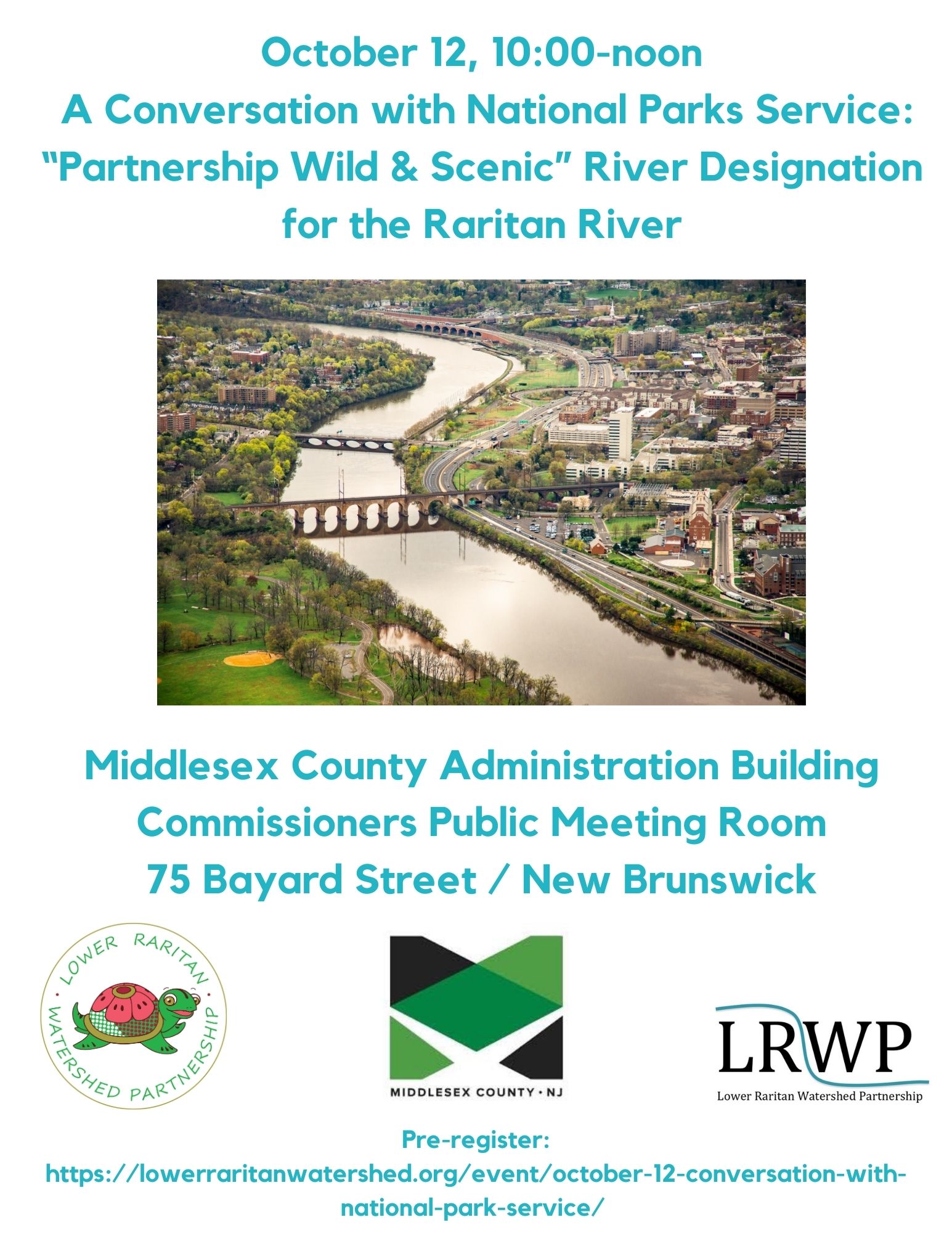
On Thursday October 12 the Lower Raritan Watershed Partnership will host Paul Kenney from NPS to talk about Partnership Wild & Scenic designation for the Raritan River. Please join us for this discussion from 10am to noon at the Middlesex County Administration Building, in the first floor Commissioner’s Meeting Room (75 Bayard Street / New Brunswick).
Pre-registration required for parking validation.
About Partnership Wild & Scenic Rivers Designation:
Congress has specified in some Wild and Scenic River designations, that rivers are to be administered by the Secretary of the Interior through the National Parks Service in partnership with local governments, councils, watershed groups and non-governmental organizations, generally through the use of cooperative agreements. In these ‘Partnership’ Wild and Scenic Rivers communities protect their own outstanding rivers and river-related resources through a collaborative approach.
Partnership Wild and Scenic Rivers are a unique category of designated rivers managed through long-term partnerships between the National Park Service and community, local, regional, and state stakeholders.
Editor’s note: The LRWP views engagement in the arts and humanities as integral to the work of effective science communication. In the article below long time partner coLAB Arts Director of Education John P. Keller articulates aspects of our ongoing collaborative inquiry into these processes, reflects on the importance of reciprocal relationships between art and science, and poses challenging questions to guide us in further discovery and expression.
Article and photos by coLAB Arts Director of Education John P. Keller
…the most extraordinary work happening today is work that considers: How does the creative studio space expand research? And how does scientific inquiry make art better?
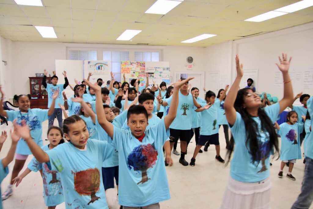
On a hot and humid August afternoon in the coLAB Arts educational studio, Teaching Artist Jasmine Carmichael was giving final rehearsal instructions to 60 summer institute students: “We are going to start from the top, if something is a little off just keep going and trust the ensemble, and remember… you are water.”
Students were “knee deep” in the process of devising a dance piece reflecting their knowledge of water flows through ensemble based movement. Thanks to the Lower Raritan Watershed Partnership and Rock Dance Collective, these students married an emerging science-based understanding of the natural world with an arts-based embodiment of the human experience. In other words, they were using both their brains and their bodies to more deeply connect with the concept of water and our relationship to it.
“…remember… you are water.”
Leonardo DaVinci would not have understood the concept of a division between scientific reasoning and creative expression. The observation of water speed, velocity, and turbidity would have been interwoven with the processes of creating sketches with shading, patterning, and composition. Hypothesis would have not been possible without imagination. Good storytelling would not have been possible without data. Human truth would not be transferable from one person to another without reflecting objective scientific realities framed in metaphor. Yet somehow over the course of the centuries and the development of institutions we think of scientific reasoning and creative expression as two very different pursuits, dividing both their physical proximity (the studio vs. the lab) and their emotional (literal vs. figurative or fact vs. fiction).
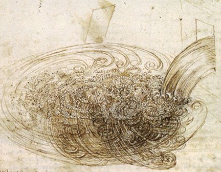
Leonardo DaVinci Water Study
c. 1508-9. Wikimedia Commons
There are of course exceptions that live outside the sometimes restrictive academic divisions. In fact most methodology-based artists and most humanist-scientists already understand the mutual benefit. So why aren’t our institutions designed to enable better collaboration? What would such a redesign of the creative and scientific process look like? What could this redesign of process mean for the tackling of climate change? The Artists and Scientists mentioned above might articulate two main areas of mutual benefit, that of interchangeable: 1) Research and 2) Expression. In my own education growing up, whether it was explicit or inferred, I always thought the idea of research belonged squarely to the scientist. Articulation on the other hand belonged to the studio artist. However, the most extraordinary work happening today is work that considers: How does the creative studio space expand research? And how do analytic metrics make art better?
In preparing for the October 8th Watershed Run Off – a dance performance of stormwater flows to demonstrate how waters become polluted — the partnership of Rock Dance Collective, the Lower Raritan Watershed Partnership and and others started with creative word play as a way to investigate the cultural connection with water. Building on this they layered data, metrics, observation and hypothesis in the studio to create an embodied expression. Lower Raritan Watershed Partnership is putting artists out into the field, taking advantage of new ways of seeing, and feeling, to influence scientific methods. Other local entities like the Rutgers University School of Environmental and Biological Sciences and Mason Gross School of the Arts are also developing nascent partnerships to create new interdisciplinary methodologies and curricula, actively reimagining the dividing lines of the academy.
Over the next year coLAB Arts and Lower Raritan Watershed Partnership will continue putting artists and science educators in rooms (and floodplains!) together to expand the work of each. And we aim to support deeper inquiry and conversation within our communities. Consider our October 8 “Watershed Run Off” as the first of many opportunities for all members of the watershed to directly nurture and experience the evolving field of art and science collaboration. Join us!

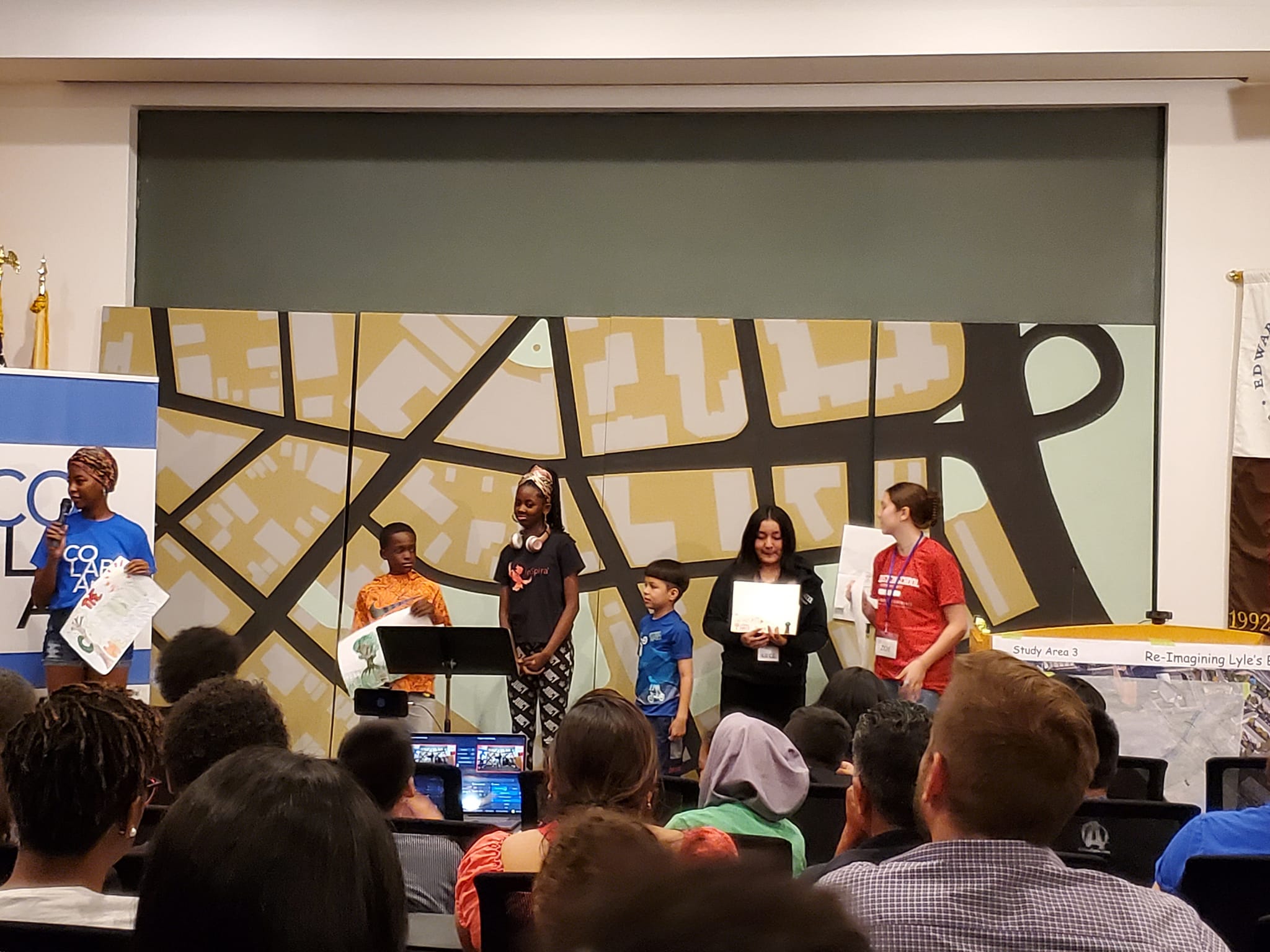
Jasmine Carmichael (far left) leads Summer Institute students in explaining how they created the large map (behind them) of New Brunswick streets and “hidden” streams.
Join the LRWP and Rock Dance Collective in New Brunswick at noon on Sunday October 8 for a performance of stormwater flows, demonstrating how rivers become polluted.
Register here to become part of the demonstration of stormwater “RUN OFF” as we walk from Feaster Park to Boyd Park. All those who join us as “run off” receive a free tee-shirt! OR join us in Boyd Park as an audience member for a dance performance.
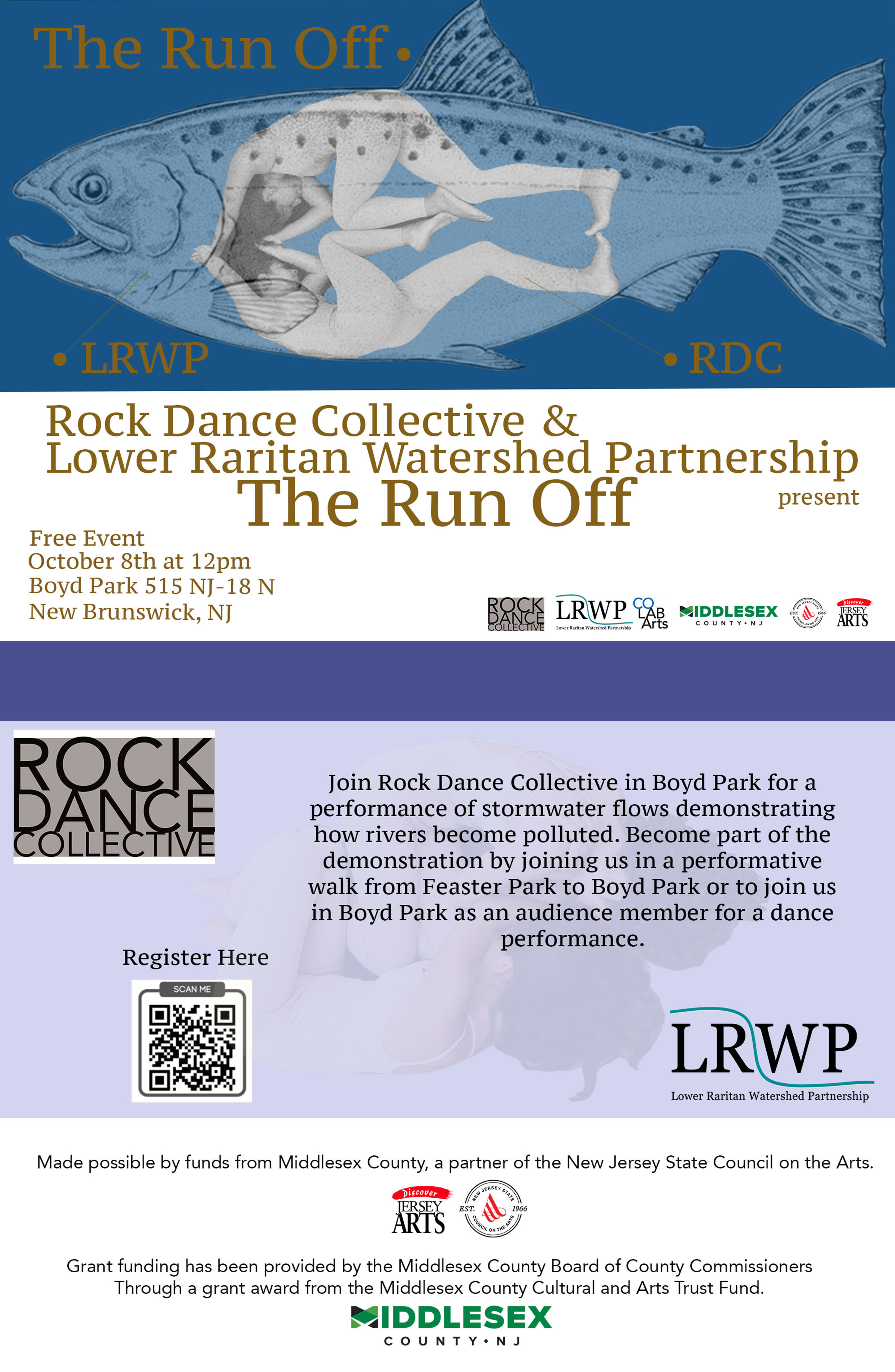
Click here to be taken to the registration page.
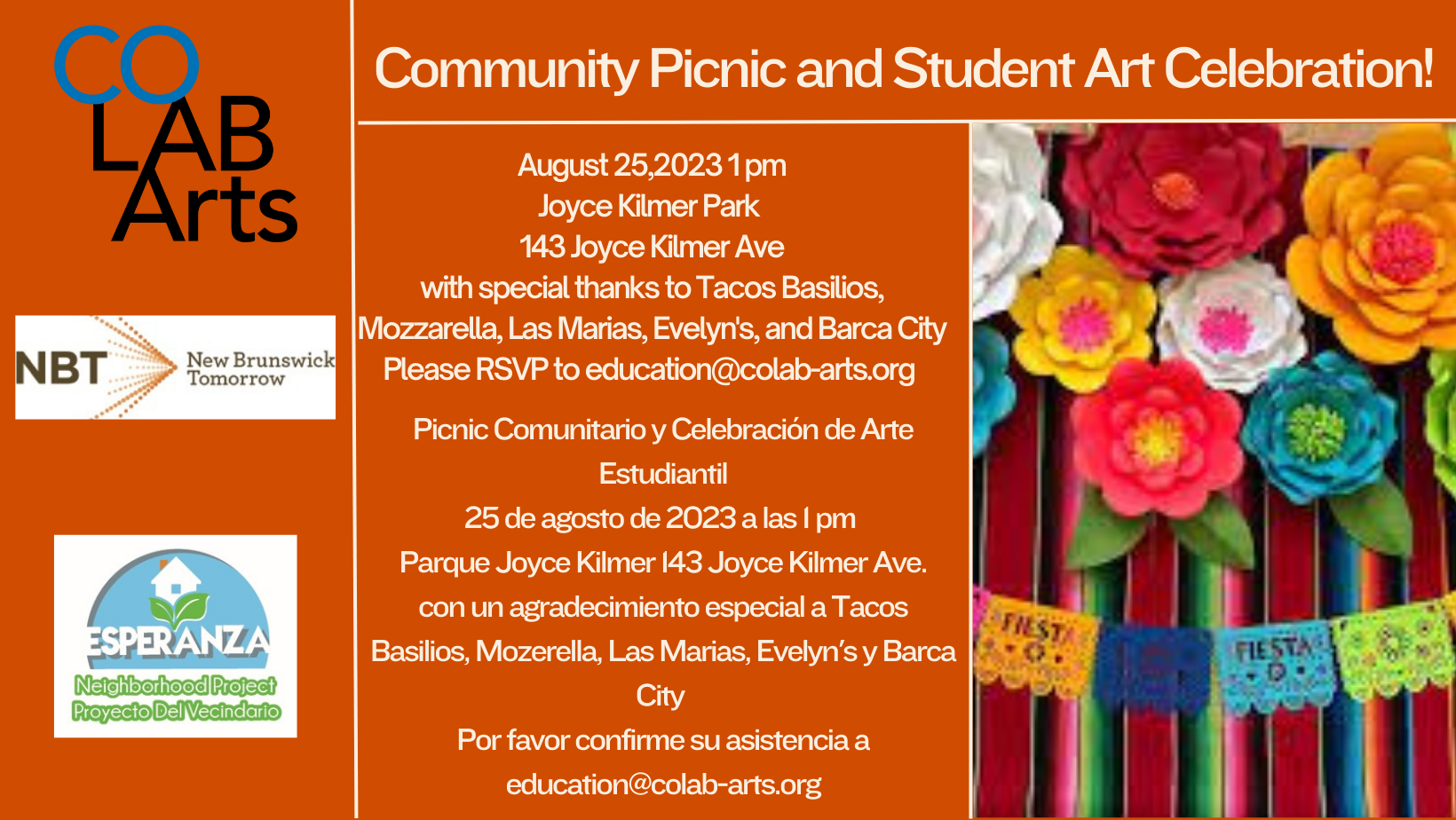
With thanks to our wonderful coLAB Arts partners for making magic on the theme of #hiddenstreams and watershed health. For six weeks in Summer 2023 we are working with coLAB Arts to lead area youth in creatively imagining resilient futures for our central NJ landscape.
Weeks 4-6 final presentation will be held Friday August 25, 1pm in New Brunswick’s Joyce Kilmer Park.
The Lower Raritan Watershed Partnership is pleased to present our 2022 Annual Report! With special thanks to Rutgers Raritan Scholar Chris McLaughlin for his assistance in developing this document during Spring semester 2023.
Swimming or other forms of contact with contaminated water can cause gastrointestinal illness as well as respiratory disease, ear and eye infection, and skin rash. Each year, there are an estimated 57 million cases of illness in the U.S. resulting from swimming in oceans, lakes, rivers and ponds. The vast majority of these illnesses go unreported.
Contaminated water can also trigger health warnings or closures that interfere with our ability to enjoy public bathing beaches. Around the country, for those public bathing beaches that are part of the Environmental Protection Agency’s Beach Advisory and Closing On-line Notification (BEACON) Program, there were more than 8,700 health warnings or closures in 2022.
Significant sources of pathogen pollution that can make swimmers, fishers, boaters, jet-skiers or others sick include stormwater runoff, sewage overflows and in some places, manure from livestock.
Two trends have increased the pollution risk in New Jersey from these sources:
Congress took a big step to reduce the threat of pathogens pollution by passing the Infrastructure Investment and Jobs Act (otherwise known as the bipartisan infrastructure law) in 2021. The law not only directly provides $11.7 billion for sewage and stormwater projects but also authorizes an additional $14.65 billion for that purpose. (The EPA estimates the actual need for wastewater infrastructure at $271 billion.)
However, there is much more we can do to protect and improve water quality in our waterways. Local, state and federal governments should:
PLEASE JOIN US!! We are very excited. hope to see you there! (Pre-registration requested)