Since Summer 2019 the Lower Raritan Watershed Partnership and Rutgers Cooperative Extension of Middlesex County have conducted pathogens monitoring for Fecal Coliform and Enterococcus at six non-swimming public beach access sites along the Lower Raritan during the warmer months.
In this video, filmed as part of a public outreach session on 3.24.2022, we present a summary of data and findings for 2019-2021 monitoring, including analysis results of genetic source. We also share information about our monitoring plans for Summer 2022, including our partnership with the EPA.
The New Jersey State Department of Environmental Protection (NJDEP) is currently conducting the 2022 Clean Watersheds Needs Survey (or CWNS). The LRWP encourages all Lower Raritan communities to participate so as to collect information about wastewater infrastructure, stormwater – grey and green infrastructure, and non-point source pollution control projects, including the needs for decentralized wastewater (or septic) systems.
The U.S. Environmental Protection Agency (USEPA), in partnership with the State of New Jersey and other states, surveys communities every four years to identify any water quality or public health-based capital needs (up to 20 years) and costs in your community. The results are published in a Report to Congress, and it is used by Congress and state legislatures in their budgeting efforts.
The CWNS data are also used to help measure environmental progress, contribute to academic research, provide information to the public, and help local and state governments implement water quality programs. This data can influence the allocation of SRF funds and future special federal grants or funding programs. The CWNS is your best opportunity to let our decision-makers better understand the financial challenges you face in implementing your wastewater, stormwater management, and NPS pollution control programs.
To participate in the survey, first identify any water quality or public health-based capital needs (up to 20 years) and costs in your community that were not funded by January 1, 2022. Then, submit these community needs by completing the online survey form and uploading any supporting documentation describing your community’s new needs and costs.
CWNS online webpage registration and login instructions:
2) For your initial usage, please click on the “Click here to Register” button.
3) After your registration is complete, enter your e-mail and click “Log-In.”
4) A confirmation e-mail will be sent to you with a link that takes you to the needs survey page showing thelist of all your surveys.
5) To create a new survey, click the “Start New Survey” button.
6) You must submit any open survey before you may create another.
Please submit the survey with your community needs and supporting documents by May 31, 2022.
If you have any questions about the CWNS or need assistance in filling out the form, NJDEP will provide technical support. If you have identified your needs but lack the supporting cost documentation, NJDEP staff can provide alternative means of documenting these costs or assist you by using a cost estimation tool. Please contact Ketan Patel or Kyle Carlson at 609-292-3114 or e-mail at NJCWNS22@dep.nj.gov.
On March 21 we welcome the first day of Spring in the northern hemisphere. Most of us learn in elementary school that as the Earth rotates on its axis, the tilt of rotation brings the northern and southern poles either closer to or farther from the sun. In the farther position each hemisphere experiences less daylight, and the days are cooler. In the closer position – hello Spring! hello Summer! – more concentrated sunlight results in warmer days and longer periods of daylight.
Our relationship to the sun also affects the night sky, and the visible constellations are seasonal and change throughout the year. If you make a habit of looking at the sky every morning just before sunrise or every night right after sunset, you will start to notice how a few new stars emerge in the east each day. Since the sun and stars move at different rates, the change you observe is what is revealed with a gradual tilt of the earth’s axis at approximately one degree per day.
One thing that doesn’t change while the earth moves on it’s axis is the latitude, or north–south position, of specific points or locations on the Earth’s surface. New Jersey’s Liberty Science Center explains: “The key factor determining which stars we can see on a certain night is our latitude. Latitude is how far we are north or south of the equator.”
Our Raritan Watershed is 40 degrees north of the equator. Other 40th latitude cities include Menorca, Sardinia, Beijing, Humboldt County, Boulder and, closer to home, Philadelphia. Per the 1894 Kansas-Nebraska Act, the 40th parallel north also forms the boundary between the states of Kansas and Nebraska. Anyone at the 40th parallel looking up at the night sky at the same time of night will see the same stars that we do in our Lower Raritan.
As fascinating as looking at the night sky is as a way to track seasonal change, of course there are other ways to use our position in space to perceive the passage of time. Instead of looking up at the stars at night we can observe the change in shadows on our landscape. As the Earth rotates towards the sun, the sun gets closer to the zenith, or its directly overhead position. This affects the cast of shadows on the landscape around us.
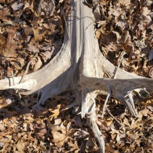
Use Spring Equinox to start investigating the interplay of sun and shadow on the landscape.
Photo taken in Rutgers EcoPreserve at approximately 2pm February 20, 2022.
The photographer Henri Cartier-Bresson wrote “To take photographs means… putting one’s head, one’s eye and one’s heart on the same axis.”
The sun rising during the spring and summer months in our sky means that heat and light reach our surface at a steeper angle. The result: noon on a summer day (the sun’s highest position) casts almost no shadows. Similarly, in the winter, the angle of the sun drops lower casting less concentrated heat and longer shadows. Just as the sun’s proximity to earth directly affects the Earth’s surface temperature, the angle of the sun also dictates the length of shadows. Areas closer to the equator experience much less of this phenomena because their relationship to the sun’s position is much more consistent year round.
Starting Monday, March 21 – the first day of Spring – we will start a three month daily “meditation” on the intersection of shadows, space and time. Will you join us? All you need is a willingness to commit to visiting a site in your neighborhood landscape every day at the same time, and an interest in tracking a shadow in your neighborhood to mark the climb of the sun. We welcome you to share your observations!
Here’s how: Choose an open area with plenty of direct sunlight, then pick an object that casts a distinct shadow. At the same time each day between the March 21 Spring Equinox and the June 21 Summer Solstice visit the object and measure the length of its shadow. Over time you should see the shadow shrink slowly. After the first month, make an estimate of how long you think the shadow will be at the end of your observations. And consider this: the days get longer, our shadows get shorter, but the sun doesn’t change size or temperature during the seasons, it is only our position that changes.
On February 24, 2022 the Lower Raritan Watershed Partnership, Princeton Hydro and Middlesex County Office of Planning hosted a Virtual Outreach Session to share concept plan development for the restoration of a 165-acre coastal eco-park along the South River in New Jersey.
During this webinar project partners discuss ecosystem restoration; contextualize the site and its historic and current conditions; provide drone images of the site; and discuss proposed public access opportunities, recreational priorities, ecological enhancement (including identifying optimal nest platform locations for Osprey, Bald Eagles, and Peregrine Falcons), and more.
This project is supported through a $249,639 in National Fish and Wildlife Foundation grant to:
“Conduct an ecosystem restoration site assessment and design for 165 acres of tidal marshes and transitional forest in New Jersey’s Raritan River Watershed. Project will result in an engineering plan with a permit-ready design to reduce coastal inundation and erosion along about 2.5 miles of shoreline for neighboring flood-prone communities and enhance breeding and foraging habitat for 10 state-listed threatened and endangered avian species.”