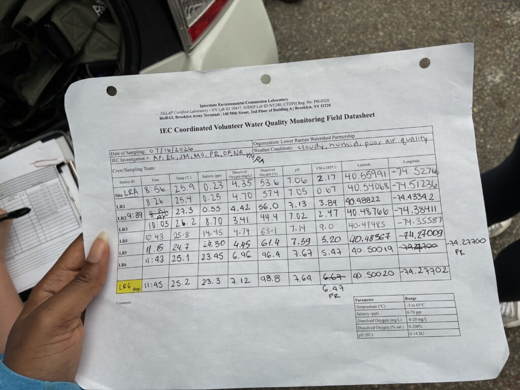
We started and ended monitoring session today with cloudy skies and cool temperatures. While it rained before and after the session, we stayed dry thanks to some excellent timing.
All our parameters seemed to be in a good range; however, we expected the enterococci and fecal matter levels to be on the higher end due to the precipitation we experienced in the past 48 hours.
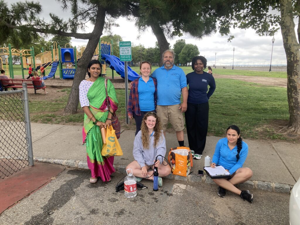
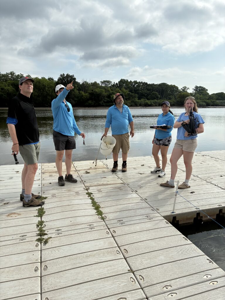
Photo by Endurance Laryea.
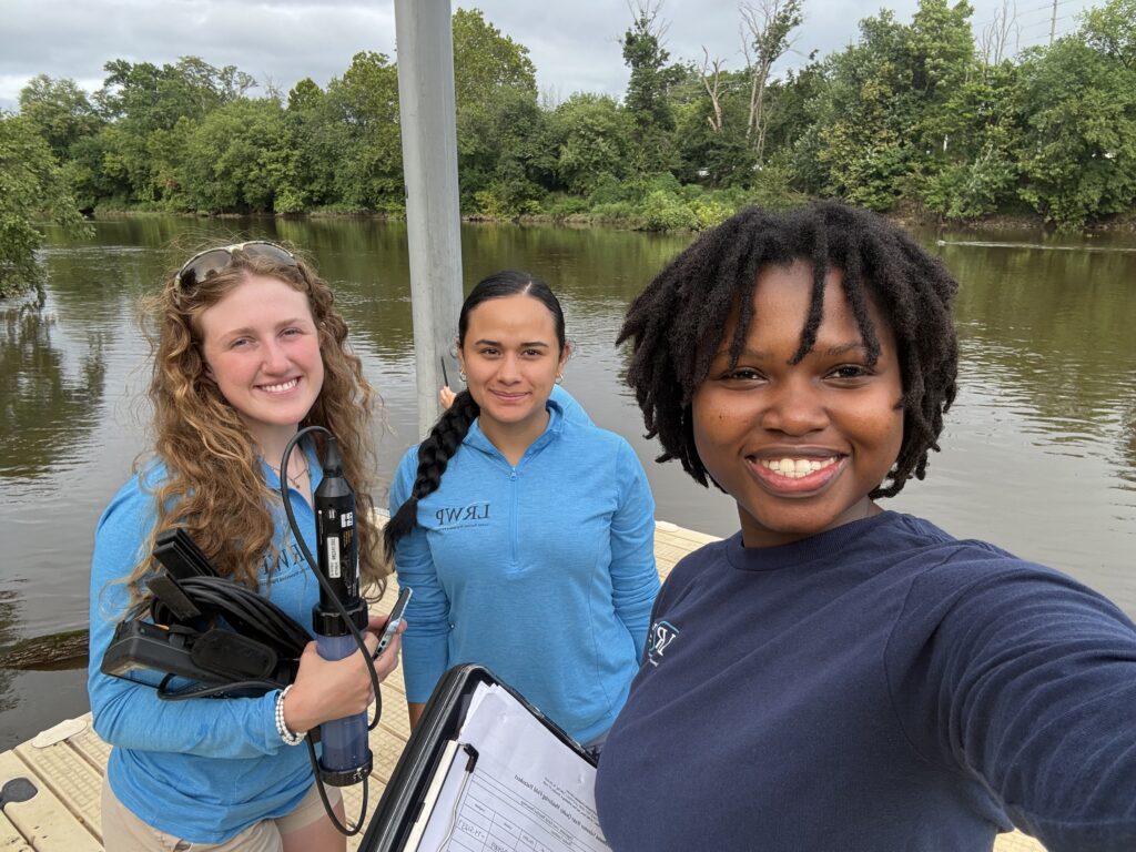
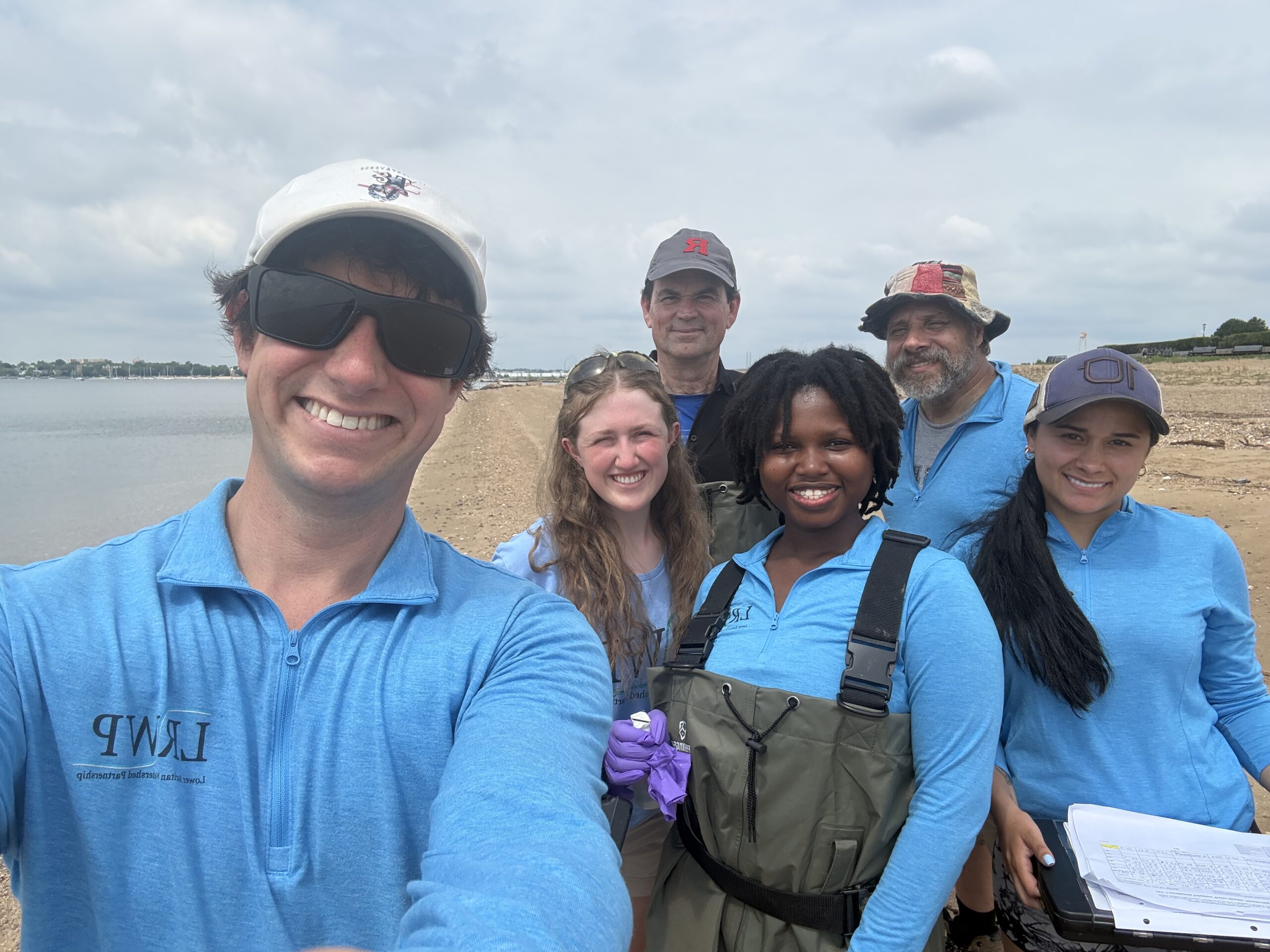
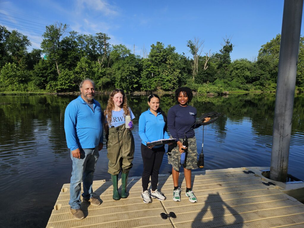
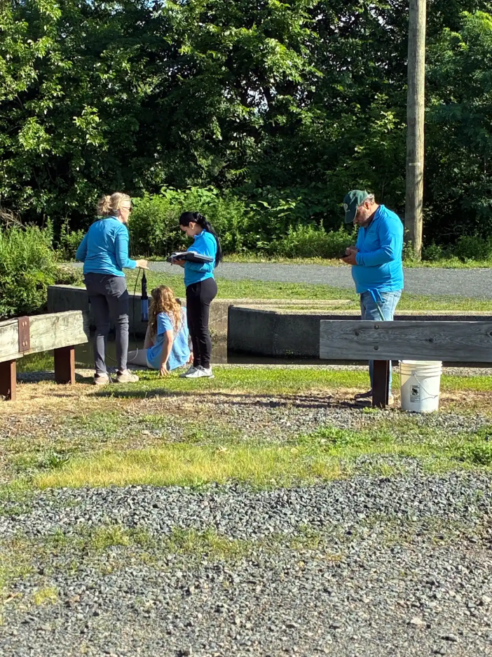
The team today! Lakshmi, Olesya, Endurance, Ashley, Paula and John (taking photo).
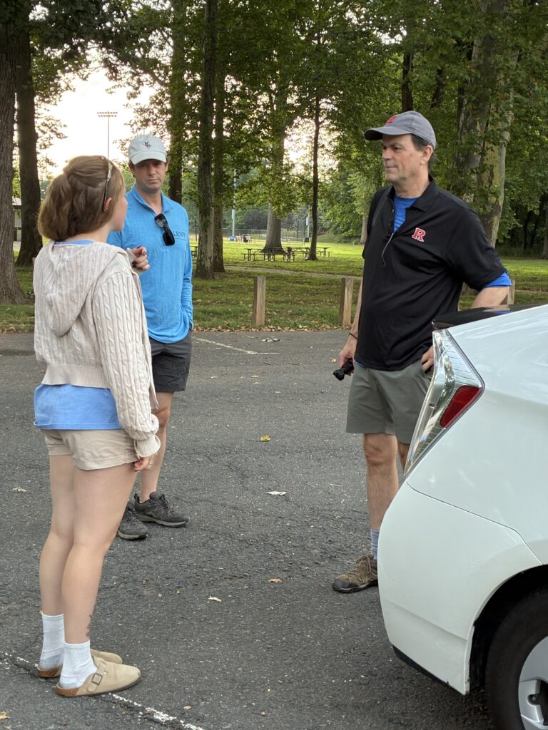
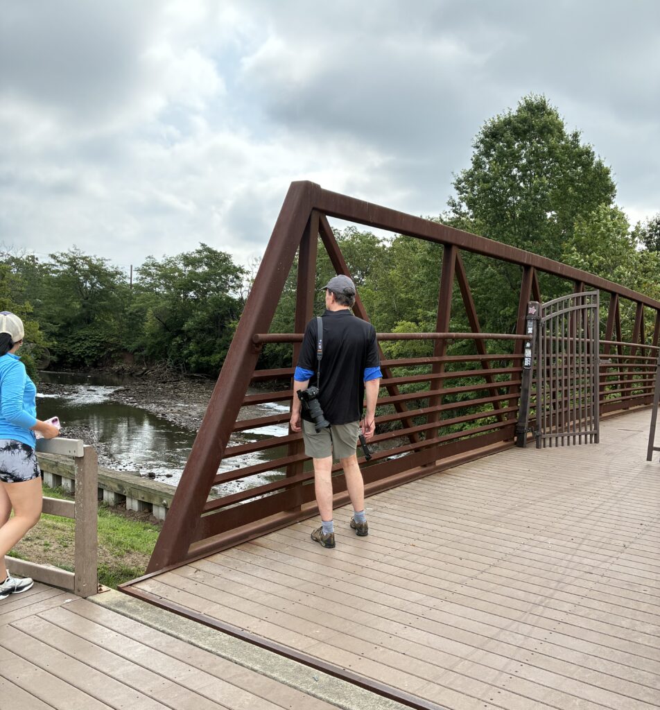
We were joined by Lakshmi at Edison where John pointed out some important features of the landscape around the river and explain the goals and activities of the LRWP Pathogens Monitoring sessions this summer.
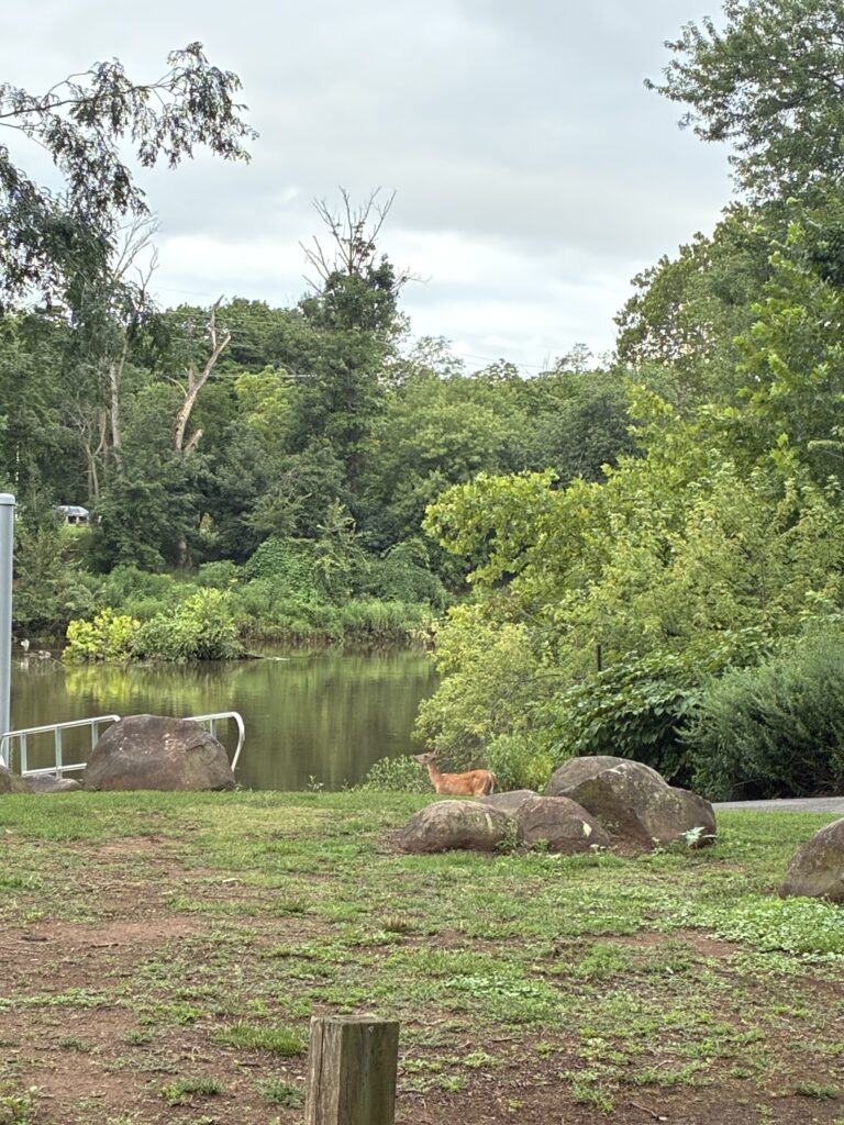
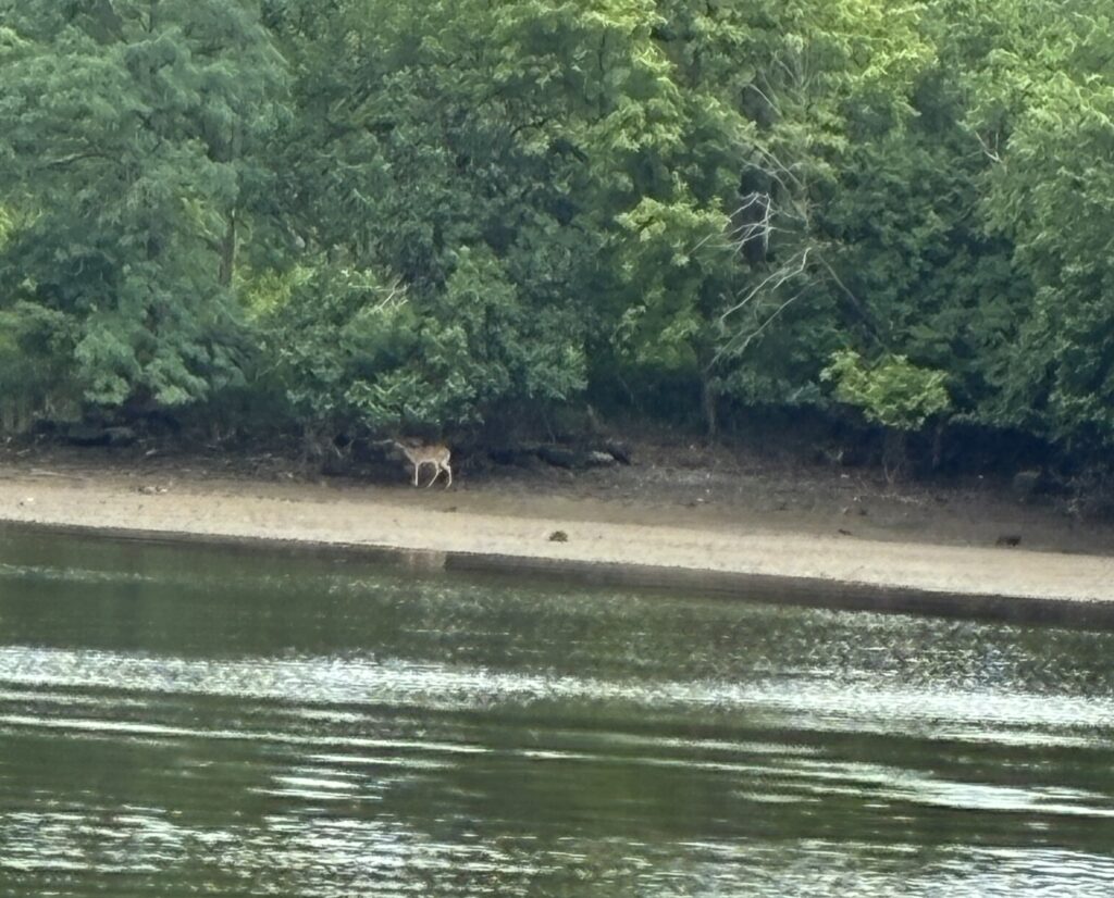
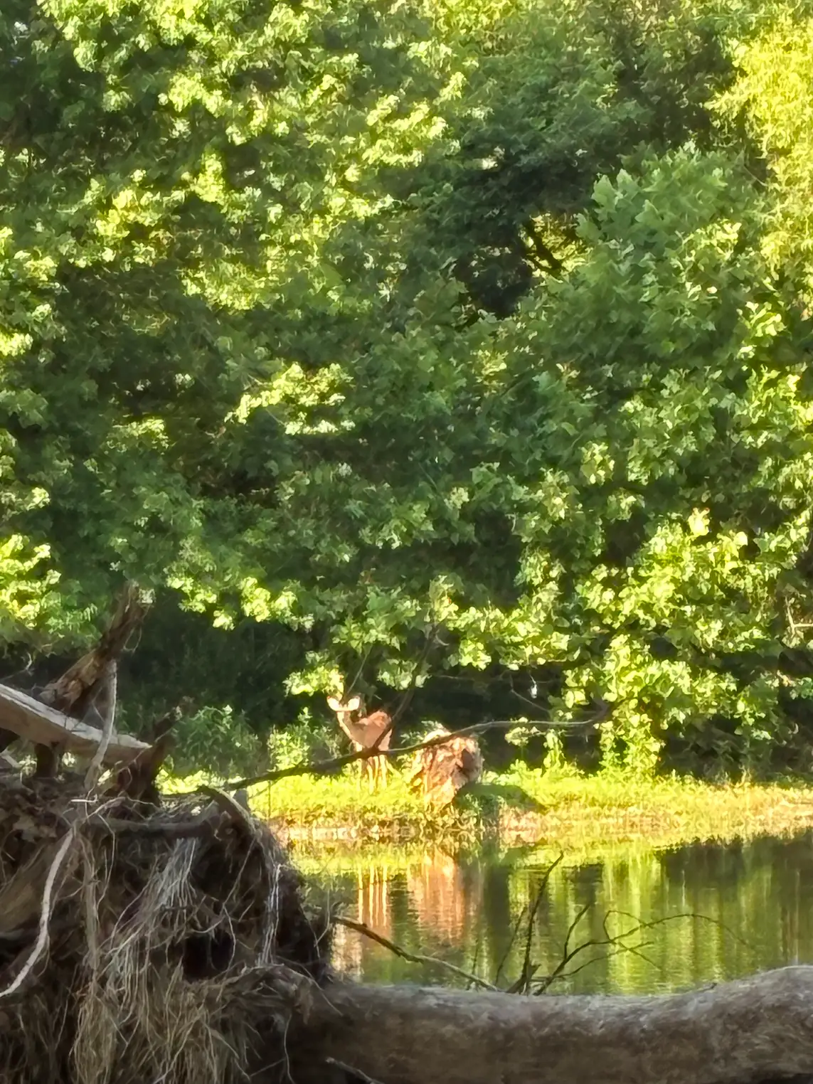
This deer was seen wandering about in circles at Riverside Park, Piscataway when we got there this morning. It seemed to have lost its way–maybe strayed from its herd? Photo by Endurance Laryea.
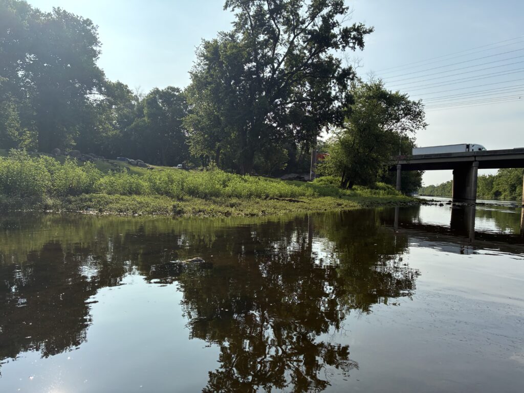
High tide and stormwater led to high water levels at all seven sites.
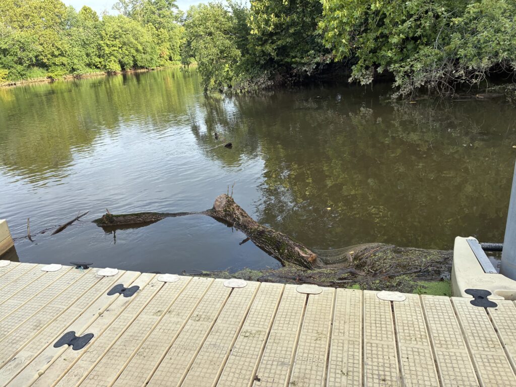
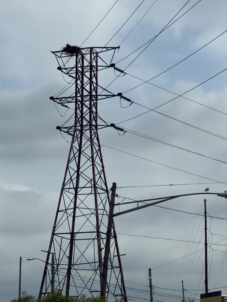
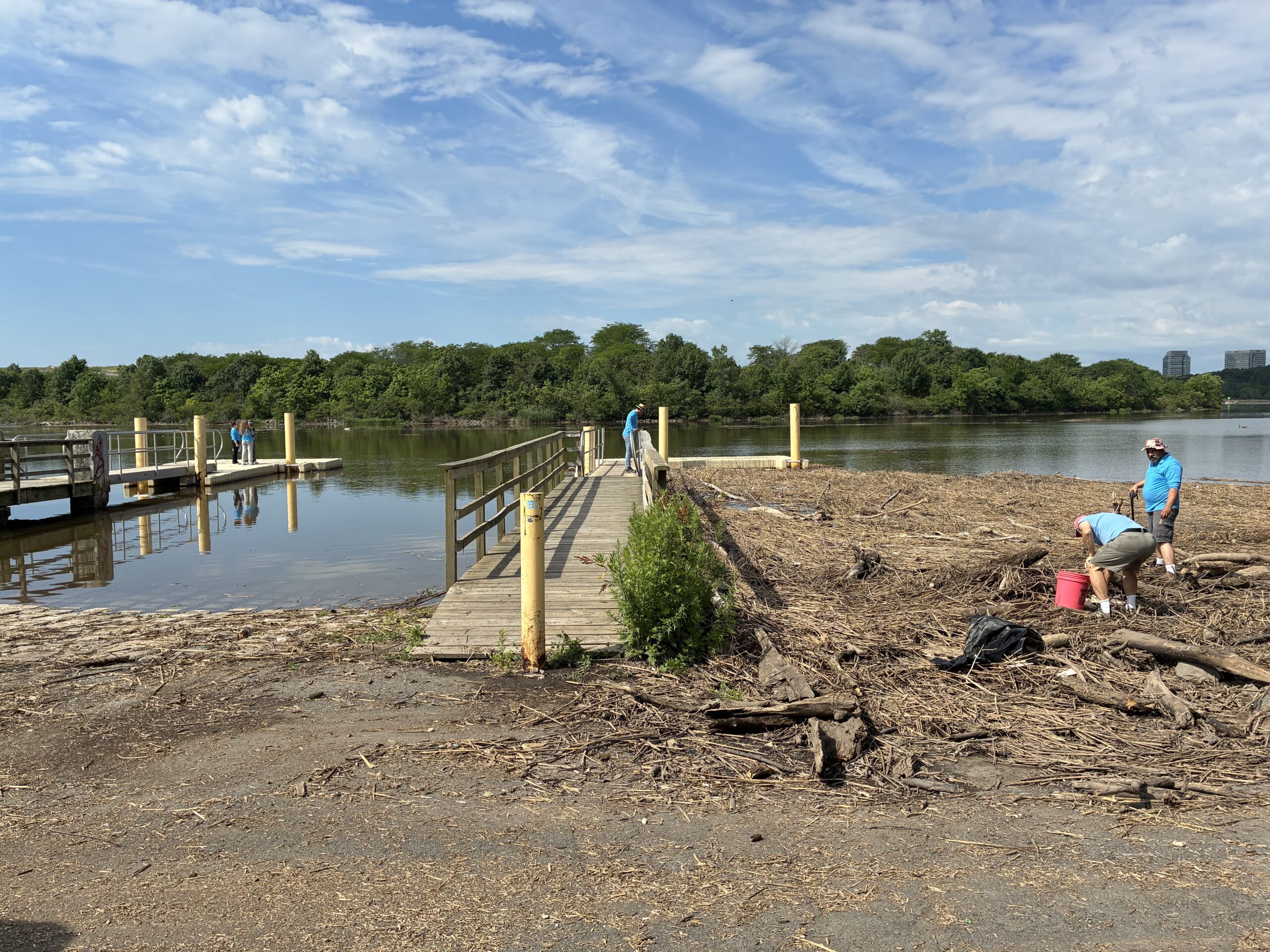
An ash tree trunk floating near the dock. Several ash trees have died and fallen off near the river at Riverside Park, and this may have been washed in by the storm in the last couple of days. The LRWP team is currently working to try to restore trees in the riparian zone. Photo by Endurance Laryea.
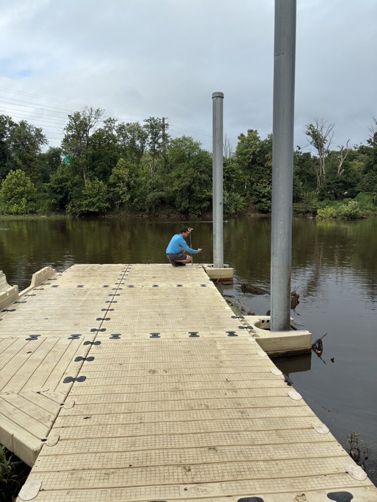
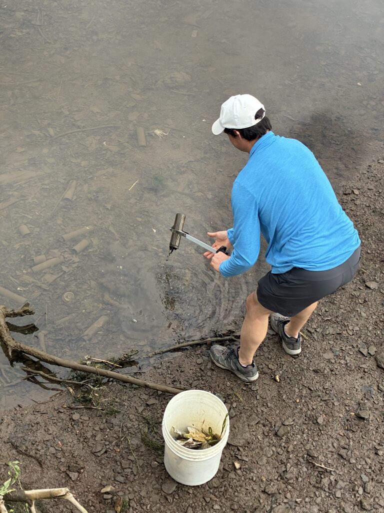
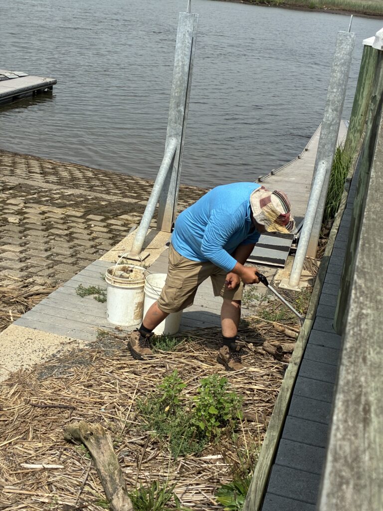
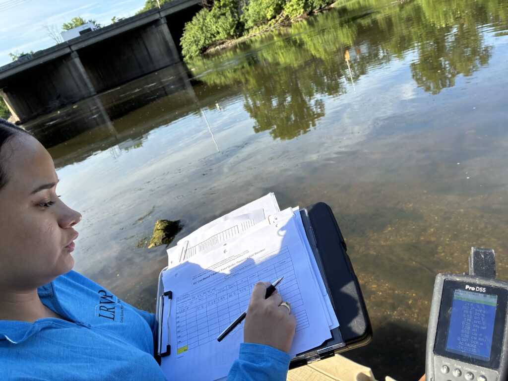
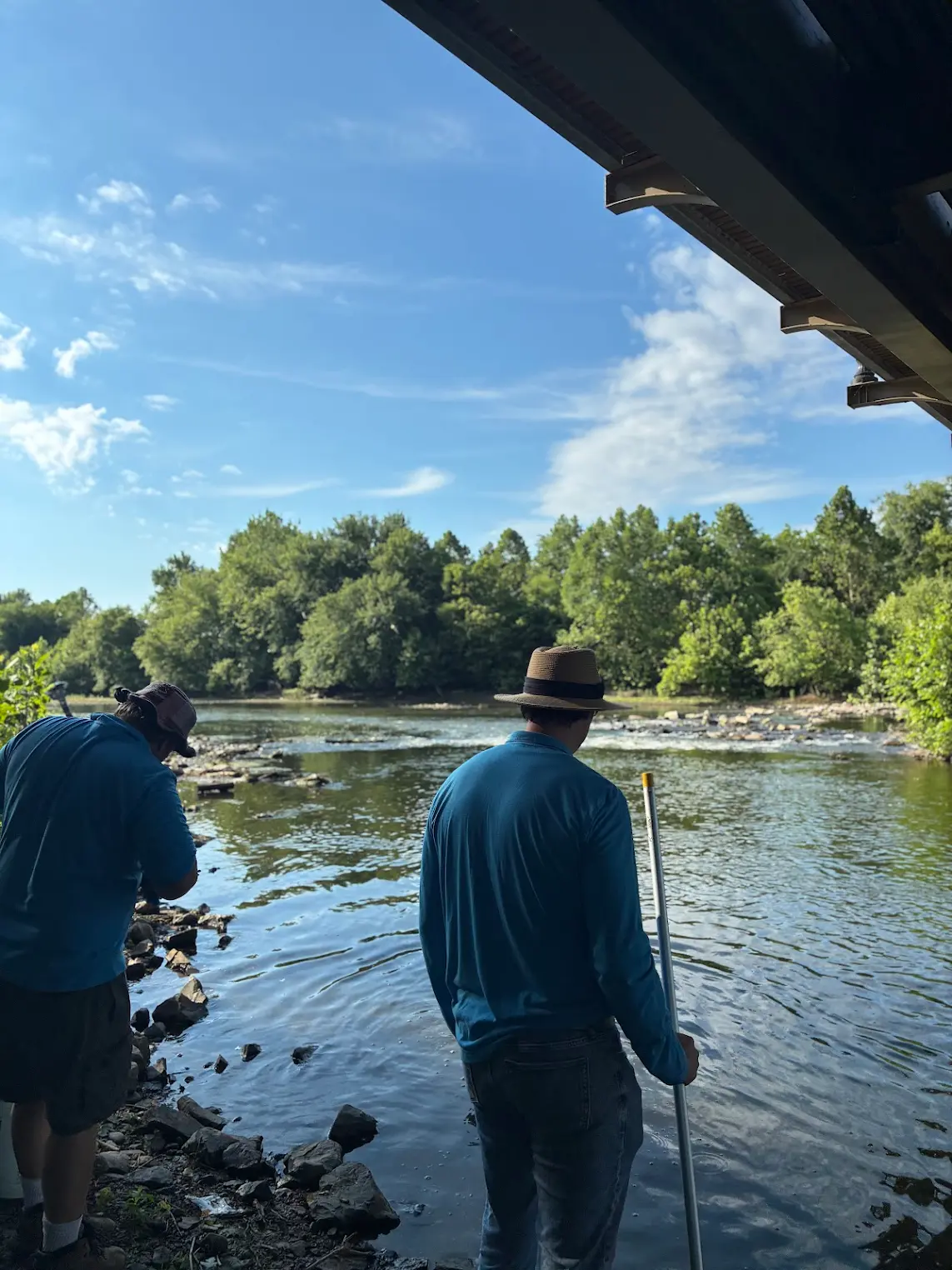
John made some height demarcations on one of the poles to make it easier to see changes in river depth. Photo by Endurance Laryea.
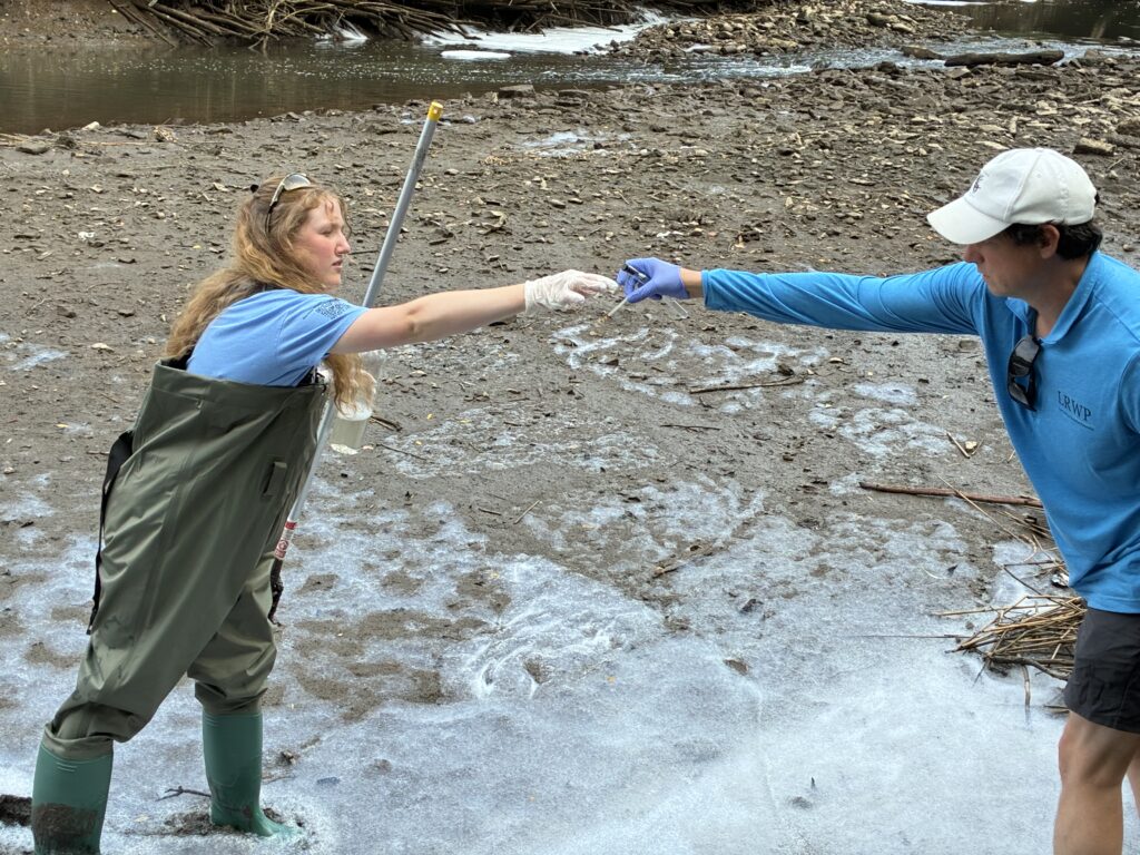
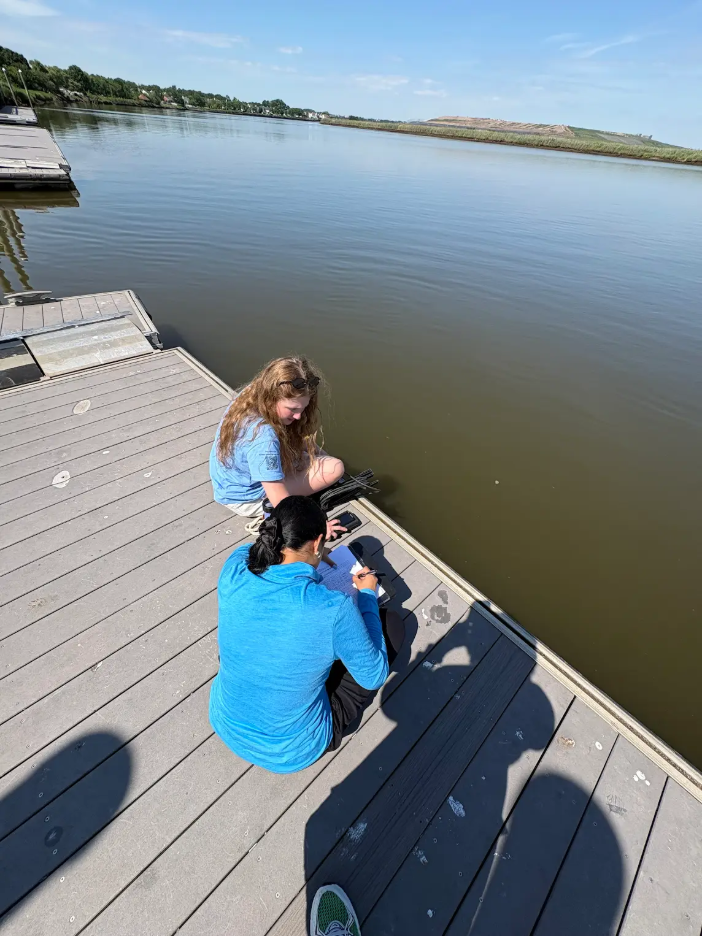
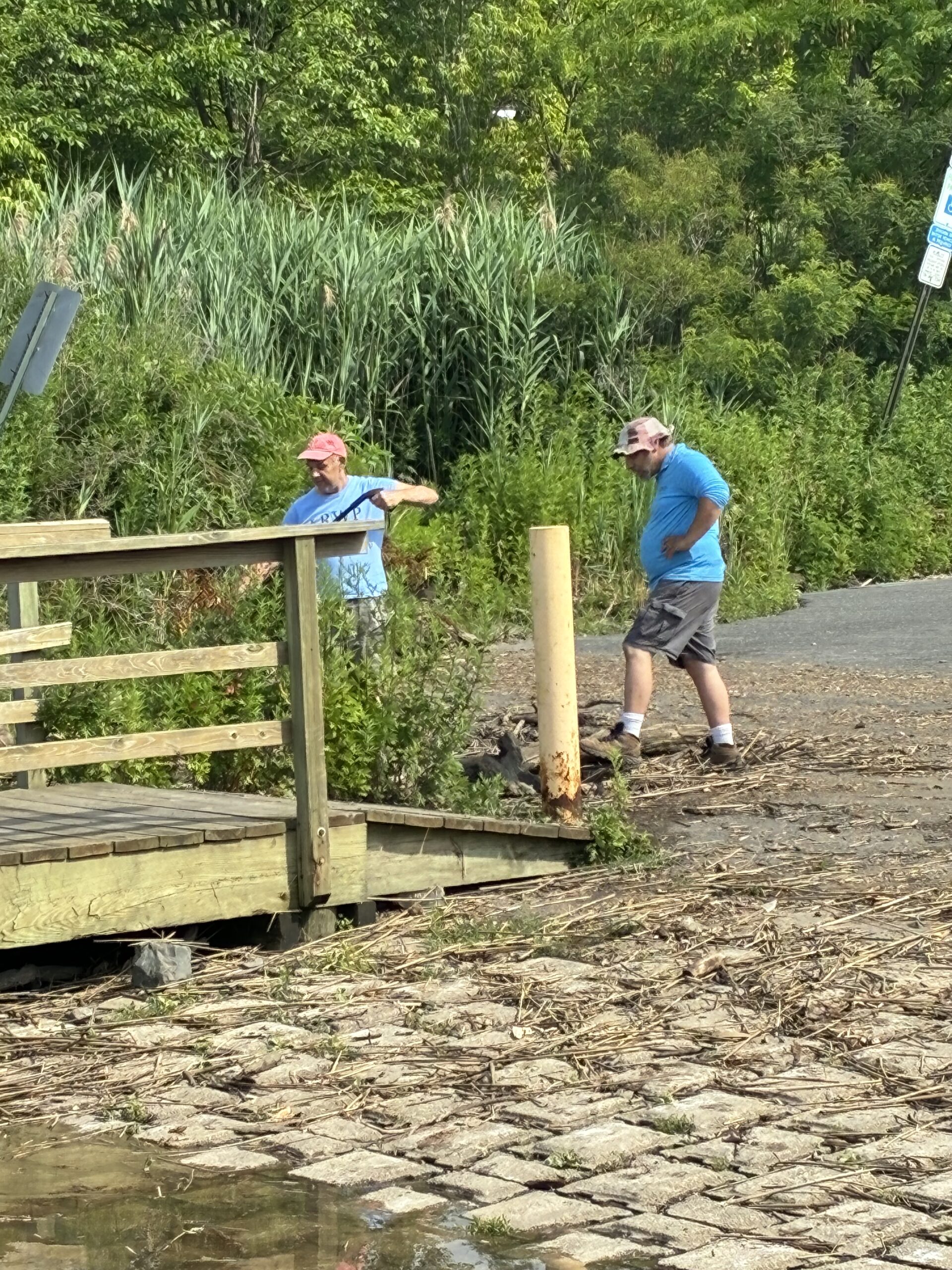
Ashley, Paula and Endurance pose for a photo after taking samples and hydrological measurements at riverside Park. John can be spotted in the background measuring the river depth and making demarcations on the pole. Photo by Endurance Laryea.
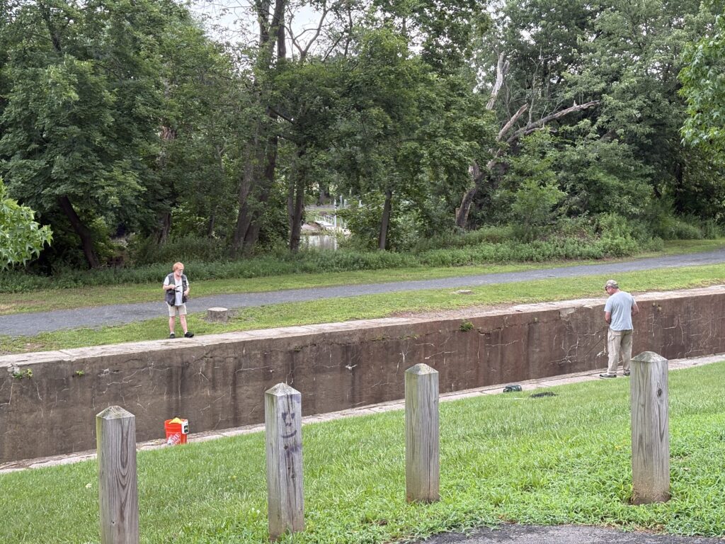
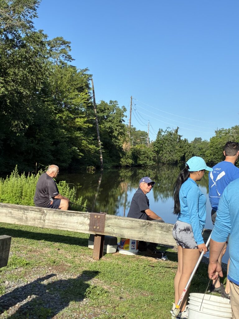
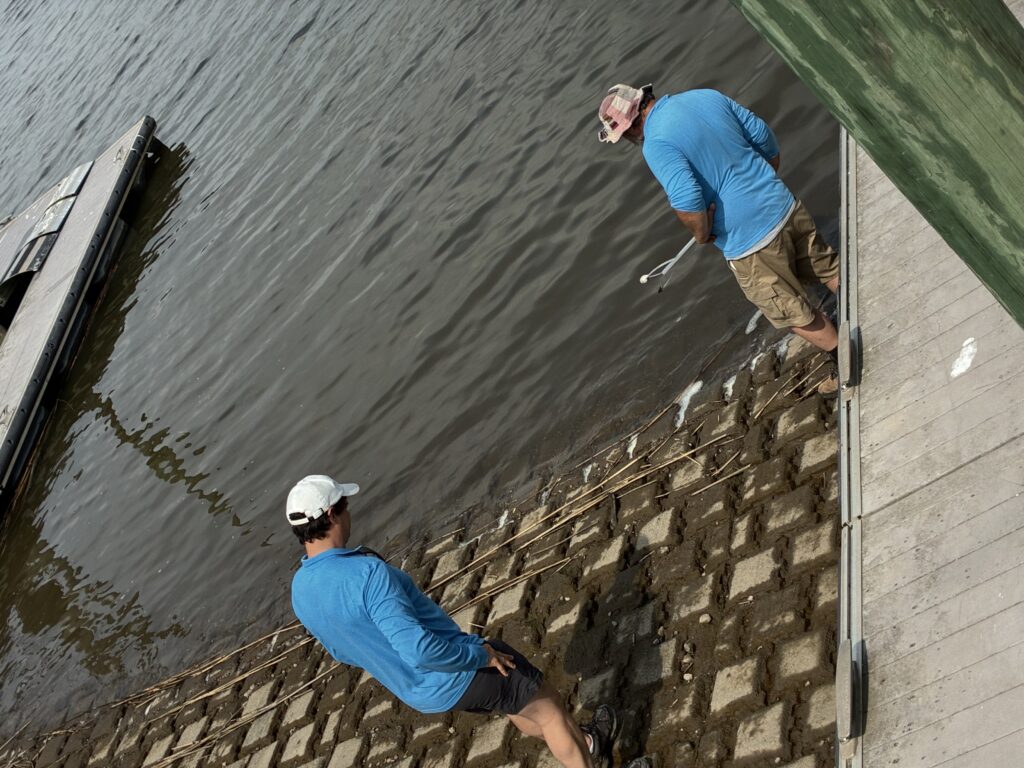
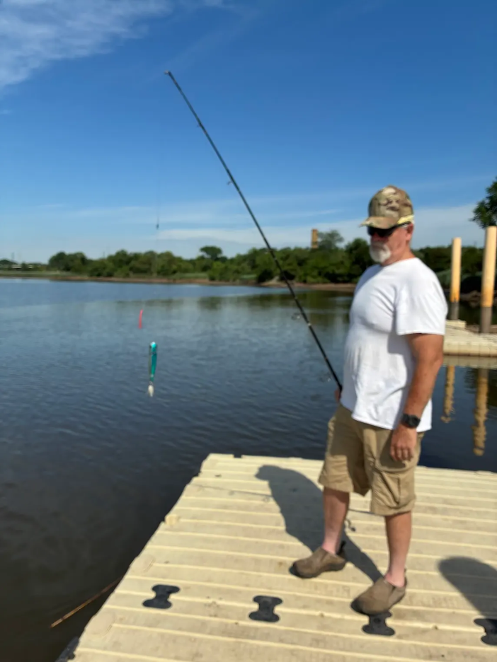
Two fishermen spotted at the Five-Mile Lock, Easton Avenue. At the time we came for monitoring and sampling, they had not had any luck. Hopefully they did after we had left. Photo by Ashley Fritz.
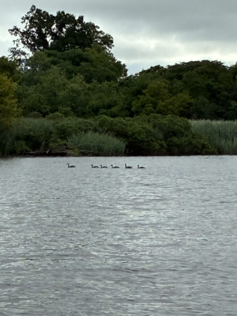
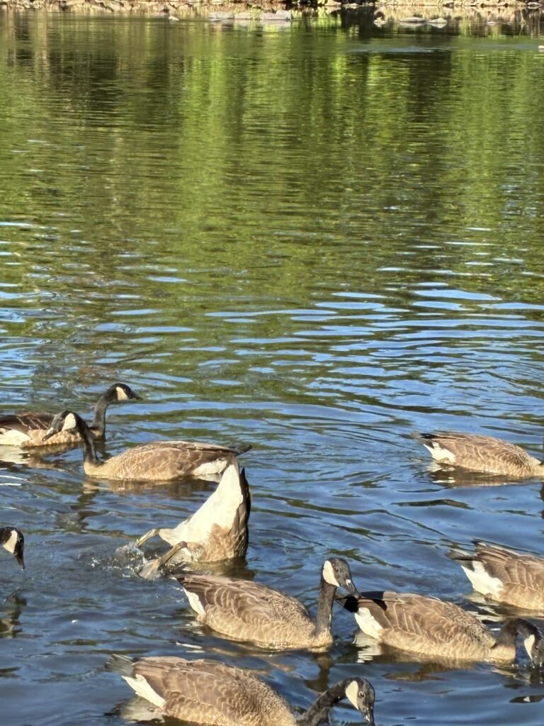
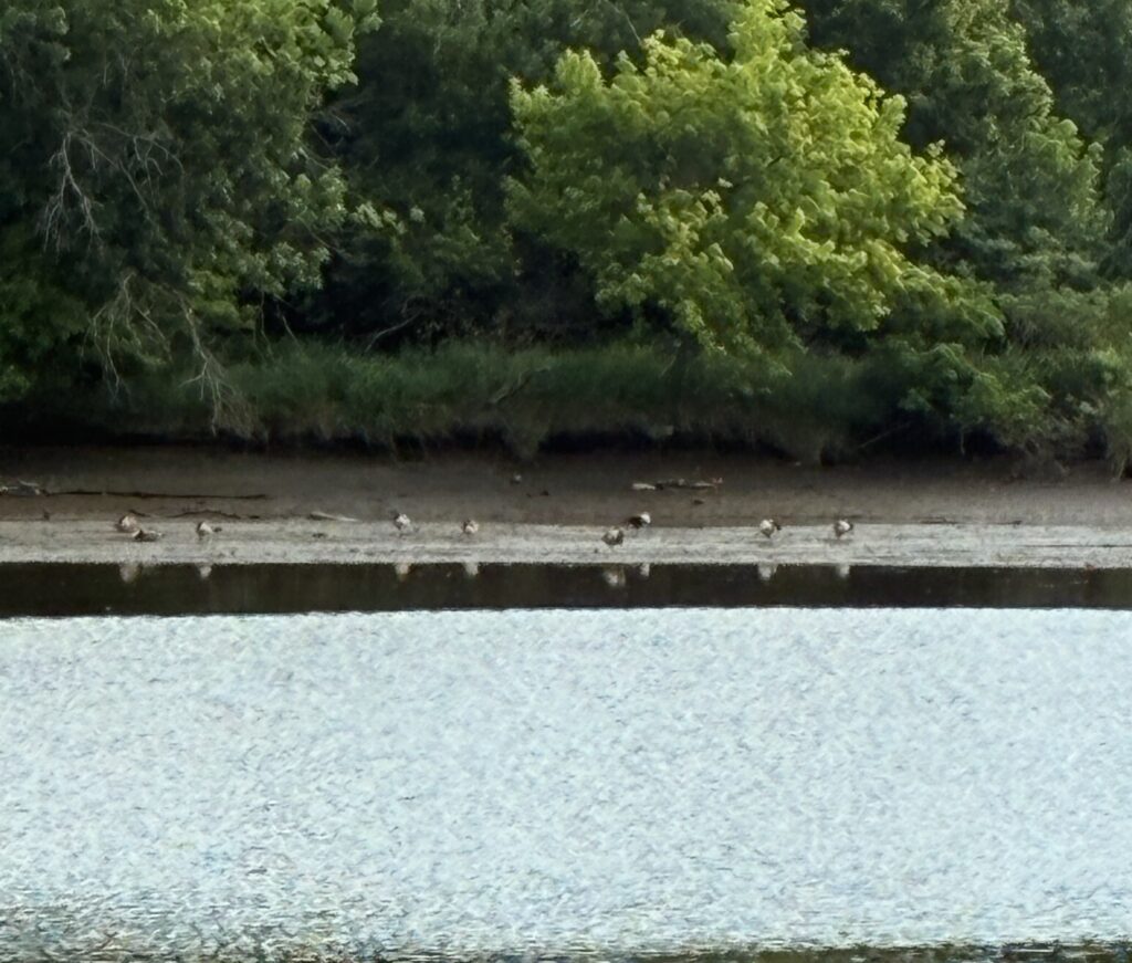
Ever wondered why ducks or geese move in a straight line on water? They remind me of elementary school kids being led by their teachers on a field trip. No teacher wants to get back to school only to realize that they lost a kid! It is a similar concept with these birds; however, another theory is that they do this to conserve their energy. The leader duck creates a ‘momentum’ ahead that the ones trailing behind paddle on. Less tiredness, less slacking!
Canada geese swimming in a straight line at Rutgers Boathouse, New Brunswick. Photo by Endurance Laryea.
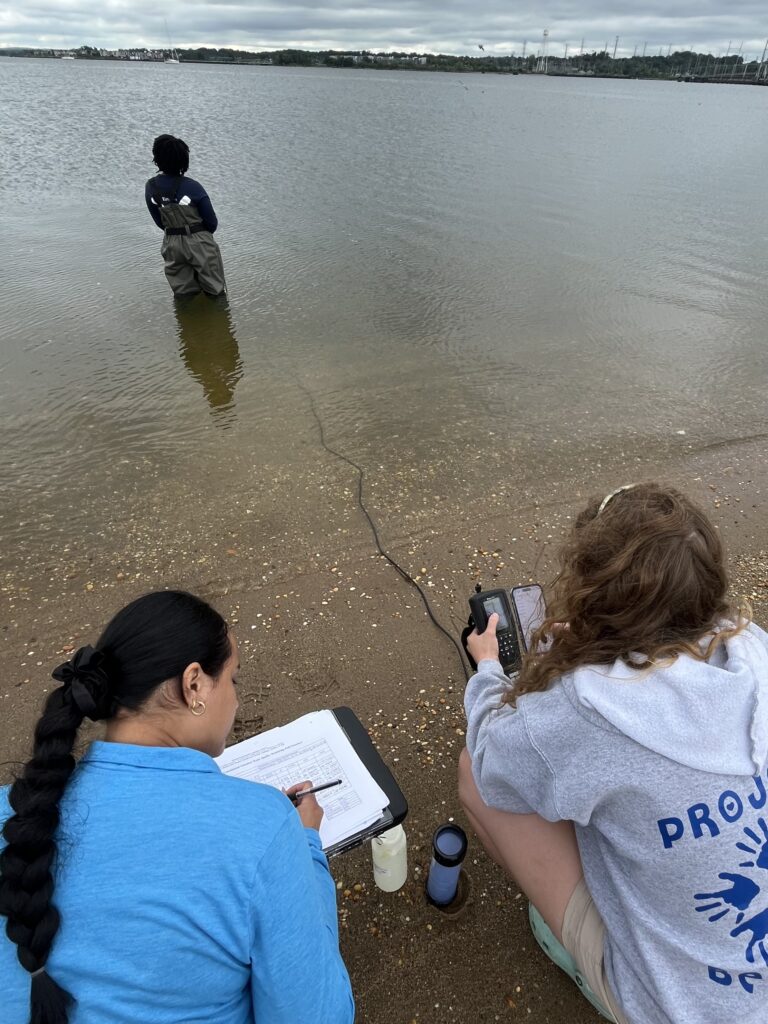
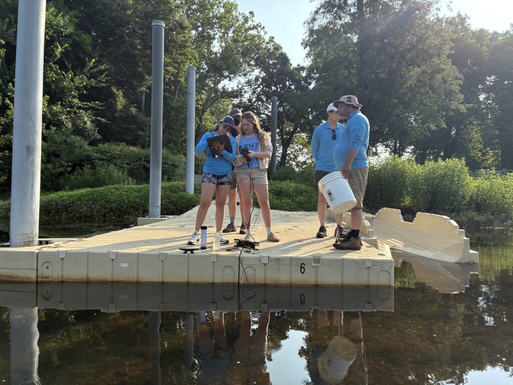
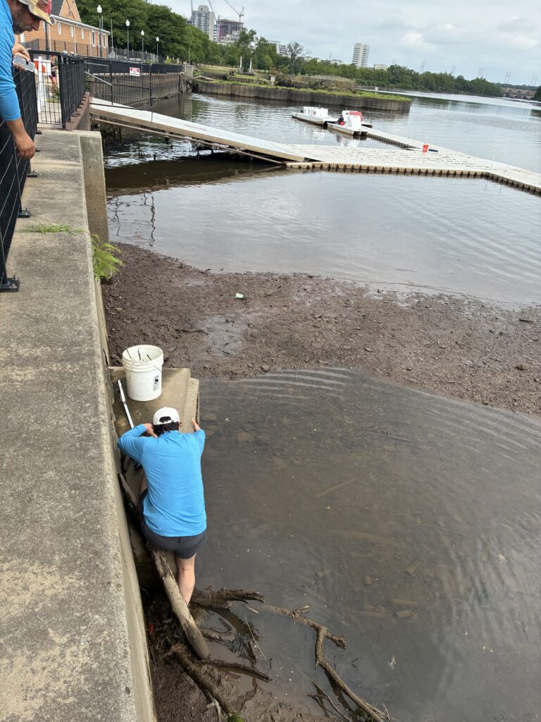
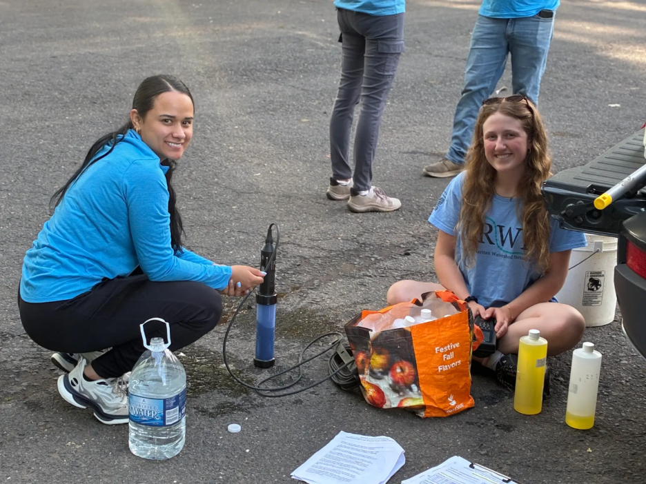
Paula and Ashley recording hydrological parameters at Rutgers Boathouse. Photo by Olesya Nabokova.
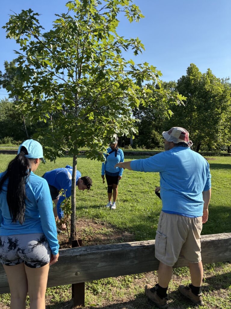
The honey locust trees pruned by Mike and John at Rutgers Boathouse have been fairing really well in the past couple of weeks. Thanks to the stewards at the Rutgers Boathouse who have been maintaining them and making they are not mowed down when cutting the grass.
Mike making sure the tree guards are sturdy. Photo by Endurance Laryea.
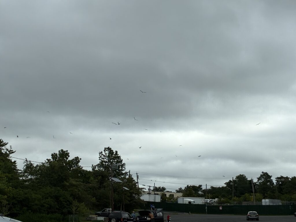
Seagulls flying frantically at Edison Boat Launch as the clouds get thicker and darker. Photo by Endurance Laryea.
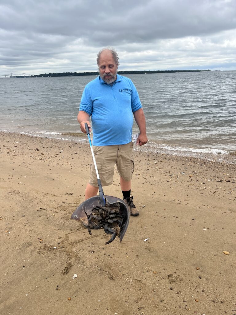
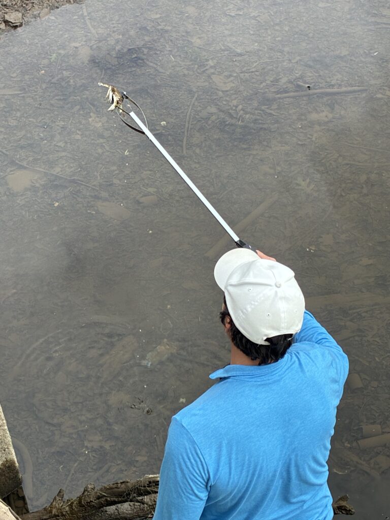
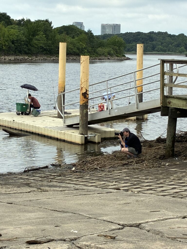
Man crabbing during high tide at Edison. Photo by Endurance Laryea.
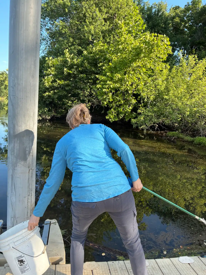
Olesya and Mike on Trash duty.Photo by Endurance Laryea.
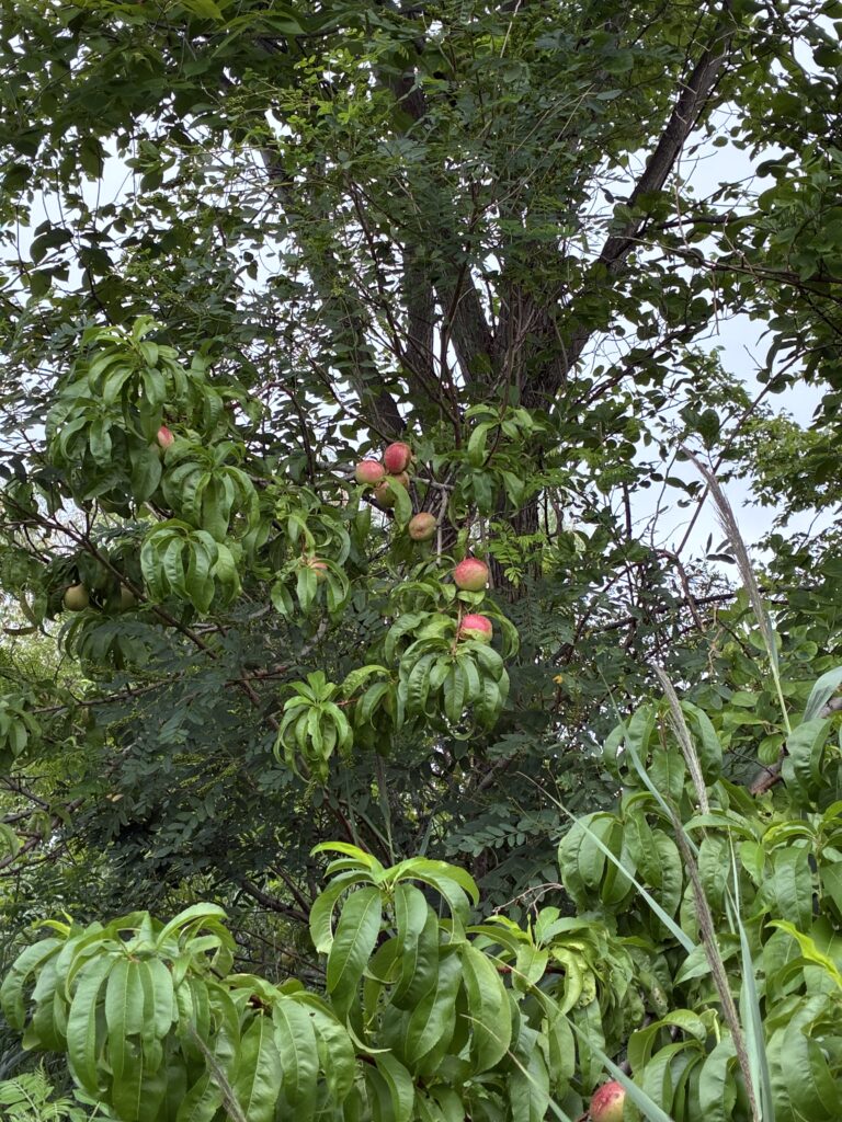
John spotted this apple tree with its fruits almost ready to harvest. Apple flowers start to bloom in the spring. By early summer, pollination takes place and the fruits start to develop. Pollination is the beginning of the reproductive process in plants. It is followed by fertilization which is when the fruit start to develop. By late summer to early fall, the apples are ripe and ready to be harvested. Photo by Endurance Laryea
High tide in Sayreville too. Photo by Ashley Fritz.
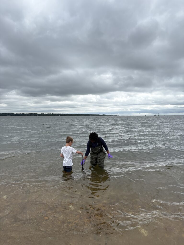
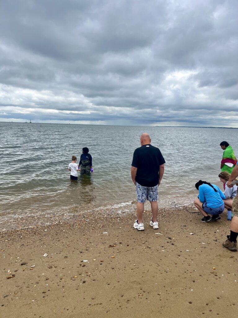
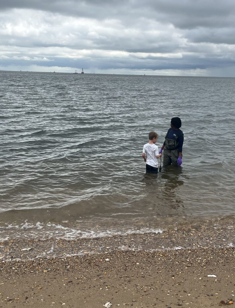
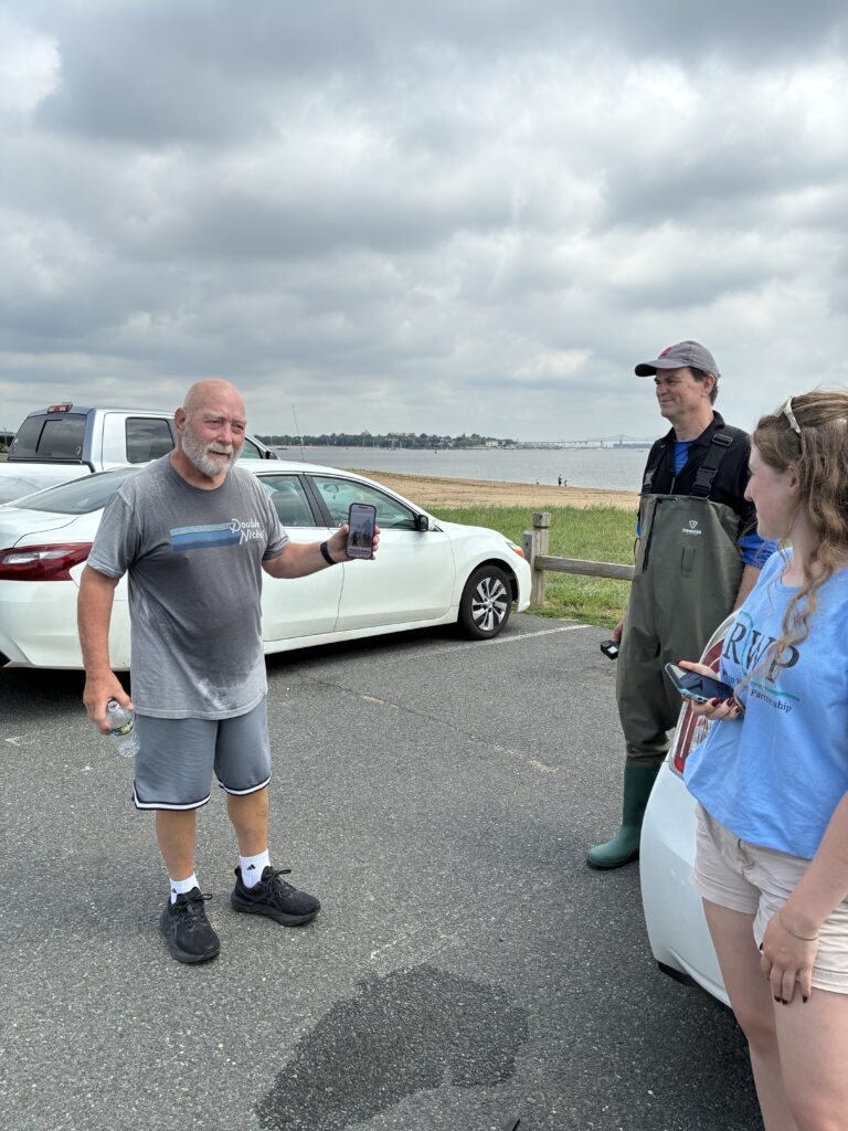
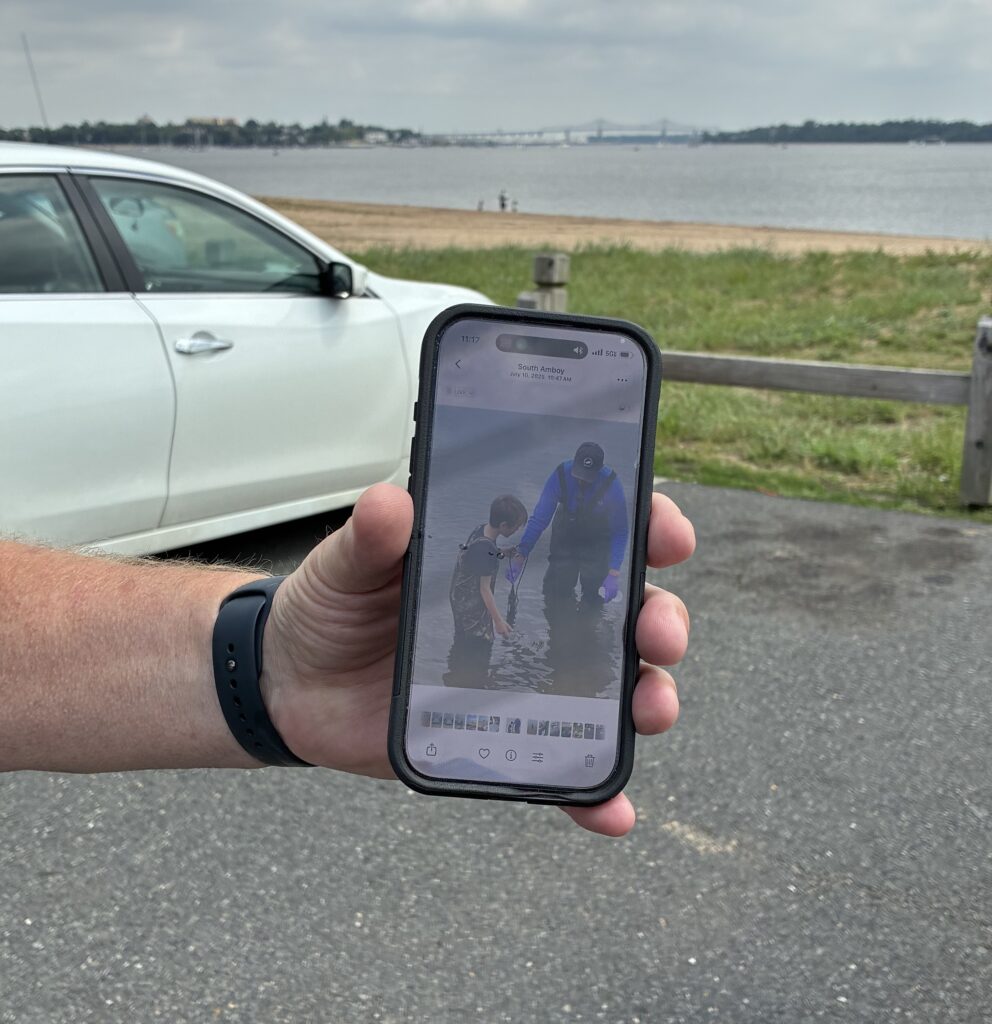
Remember the grandfather who reminded us of his grandson a couple of weeks ago at Waterfront Park, South Amboy? He came with his grandson, Gavin, to sample with us today at this site! Gavin has grown so much within the year that he outgrew his waders, so he had to go in with his swim shorts. We were excited that he was able to join us today! Photo by Ashley Fritz.
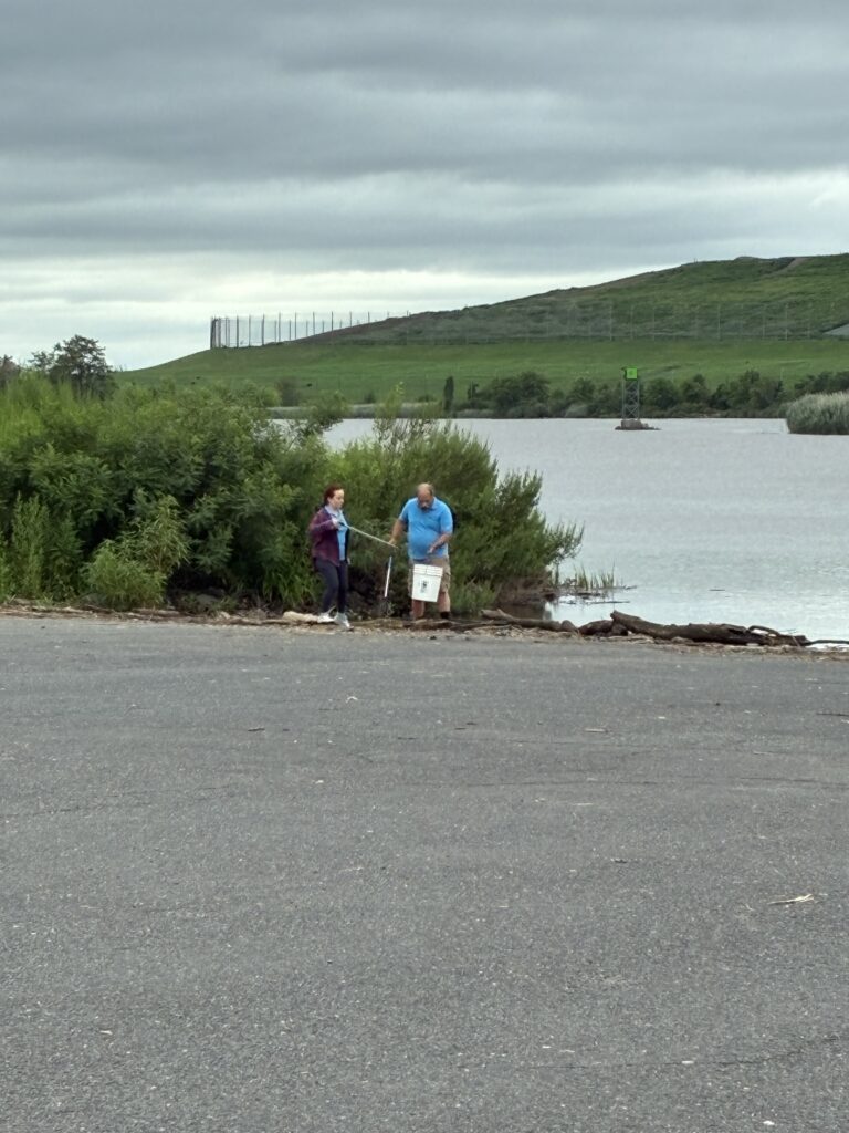
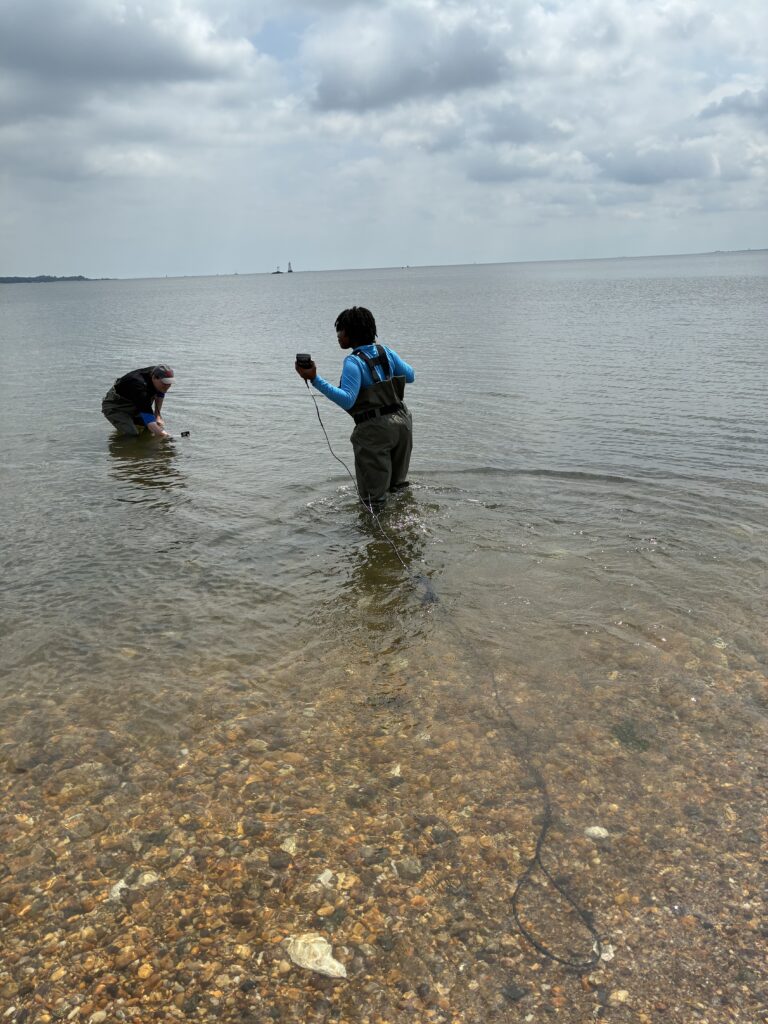
Gavin’s grandfather looks on while he and Endurance hold the sonde in the river and Paula and Ashley record the measurements. Photo by John Meyer.
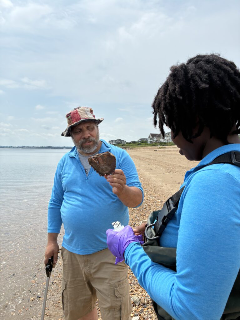
Mike holds up a half of a dead horseshoe crab. Photo by Olesya Nobokova.
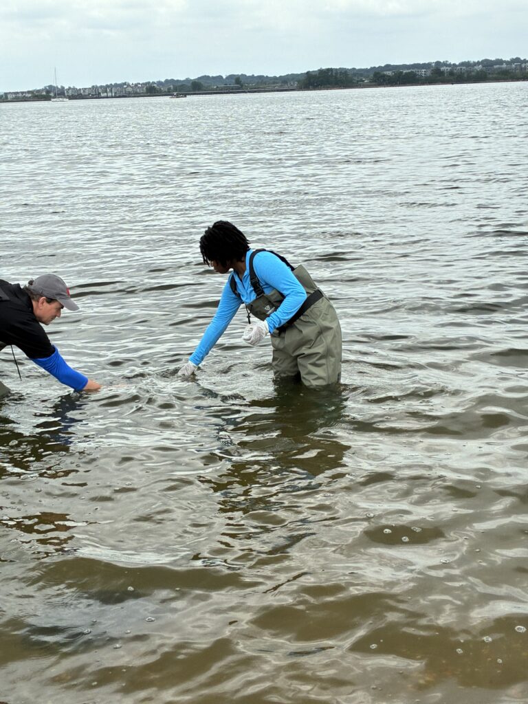
Paula, Ashley and Endurance on sampling duties in Perth Amboy. Photo by Olesya Nobokova.
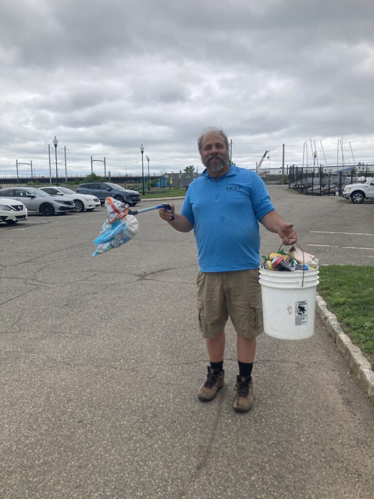
Mike holds up a baby diaper with his trash picker in one hand and 5-gallon bucket full of trash in the other at Perth Amboy. A poor sight to see! Photo by John Meyer.
Photo by Endurance Laryea.
Enjoy your weekend and remember to be safe if you decide to spend your time on the river this weekend!
By Endurance Laryea, LRWP Summer Research Intern and J.M. Meyer.
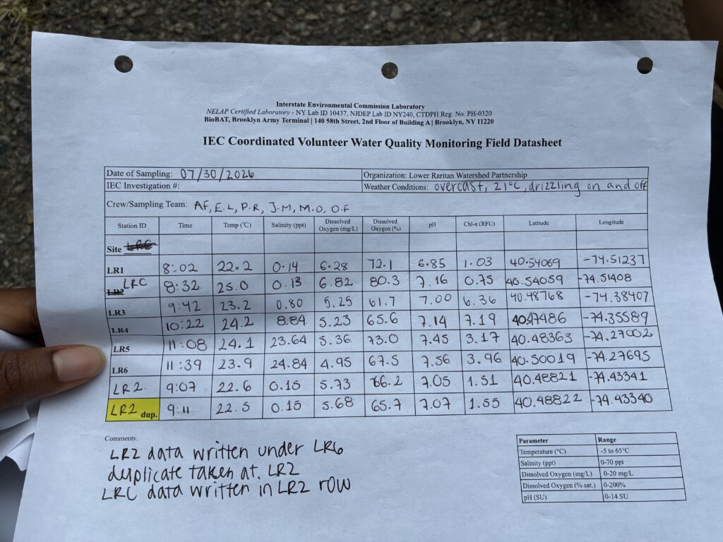
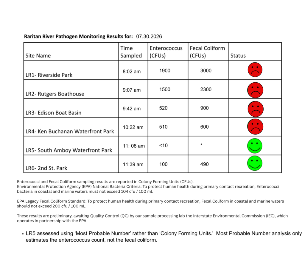
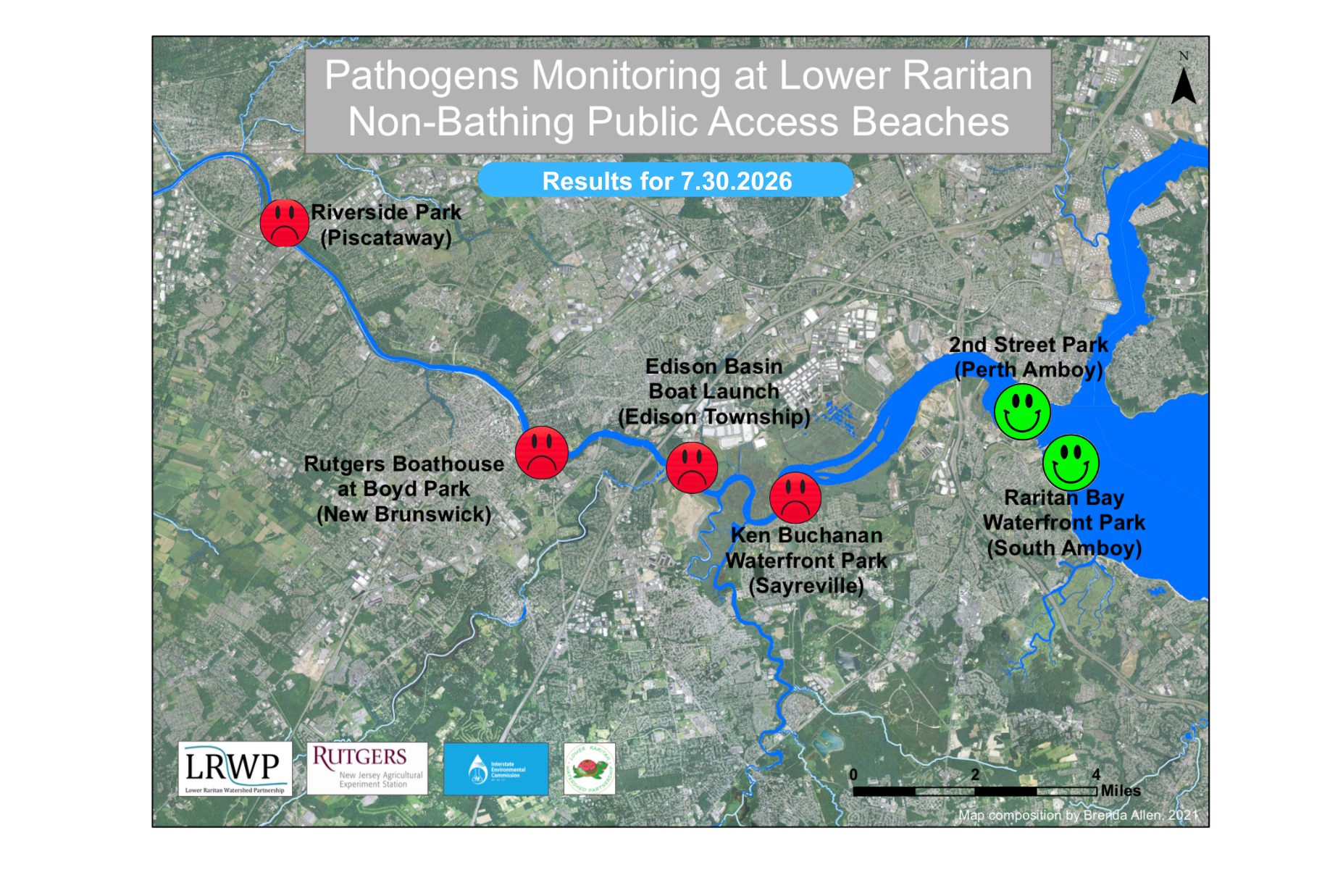
The final pathogen monitoring session of the month took place on Thursday, July 30th. Each week during the summer, from May to October, the Lower Raritan Watershed Partnership and Rutgers Cooperative Extension of Middlesex County run a volunteer-based monitoring program along the Raritan River. We collect water quality samples at six non-bathing public access beach sites, provide our samples to the Interstate Environmental Commission for analysis in their laboratory, and report the results to the public. Our mission is to share this data with the community and partners to ensure the safe use of the Raritan River for all.
Our lab results for water quality samples taken on Thursday, July 30th, 2026, show Enterococcus bacteria levels exceeding the EPA federal water quality standard of 104 cfu/100mL at four of our regular monitoring sites this week. The problem sites are indicated by the red frown on the map and chart and include Riverside Park (Piscataway), Rutgers Boathouse (New Brunswick), Edison Boat Basin (Edison), Ken Buchanan Waterfront Park (Sayreville).
This was the worst result since May 21st, and the high failure rate is largely attributable to the rainfall we received in the previous 24 hours.
Green smiles on the chart and map indicate the sites with bacteria levels safe for recreation and include the following: 2nd Street Park (Perth Amboy), and South Amboy Waterfront Park.
We tested just after high tide on Thursday; if not for the tidal flush of Raritan Bay, Perth Amboy would have also likely failed to meet the EPA standard for safe primary contact.
Pathogens/Enterococci levels are used as indicators of the possible presence of disease-causing bacteria in recreational waters. Such pathogens may pose health risks to people coming in primary contact with the water (touching) through recreational activities like fishing, kayaking or swimming in a water body. Possible sources of bacteria include Combined Sewer Overflows (CSOs), improperly functioning wastewater treatment plants, stormwater runoff, leaking septic systems, animal carcasses, pet waste, wildlife waste, and runoff from manure storage areas.
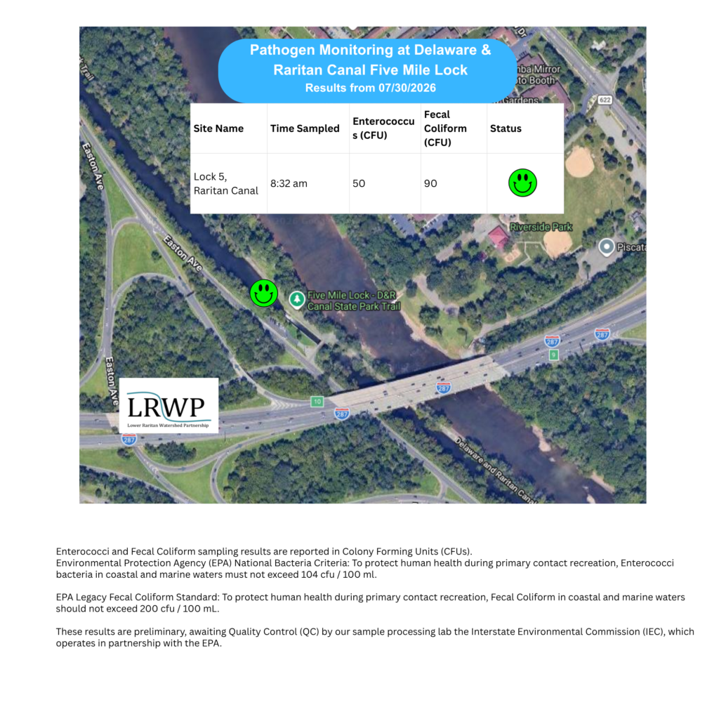
In order to better understand why Riverside Park, Piscataway has been our worst performing site over the past six years, we have started sampling further upstream. On July 30thj, we sampled the canal at Five Mile Lock, Easton Avenue, a third time since we started pathogens monitoring this season. The lab analysis produced 50 enterococci cfu per 100mL which passes the EPA federal water quality standard of 104 cfu/100mL. Again, this site passed the test, as it has every week that we’ve tested it.
Our goal in reporting these results is to give residents a better understanding of the potential health risks related to primary contact during water-based recreation. If you are planning on recreating on the Raritan this weekend, make sure to stay safe and wash up after any activities!
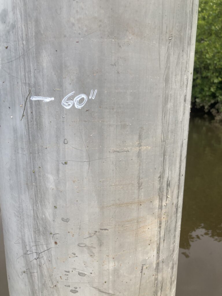
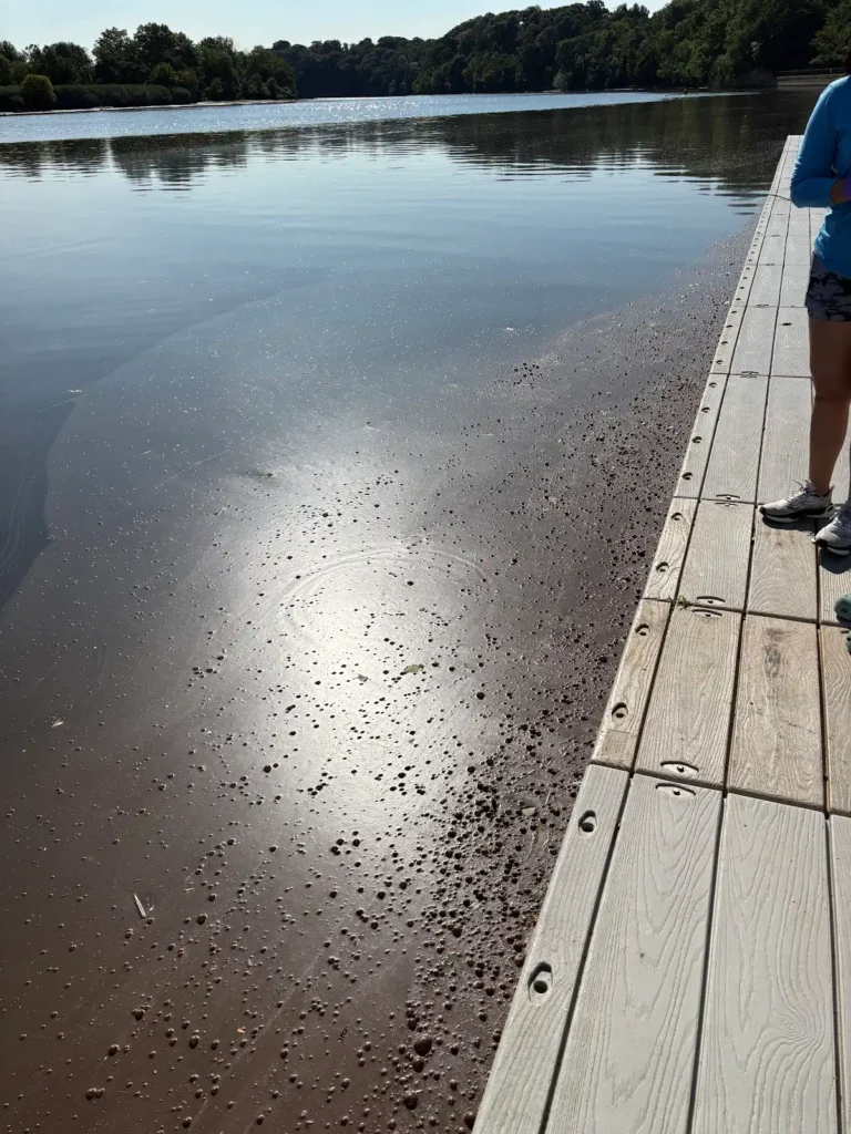
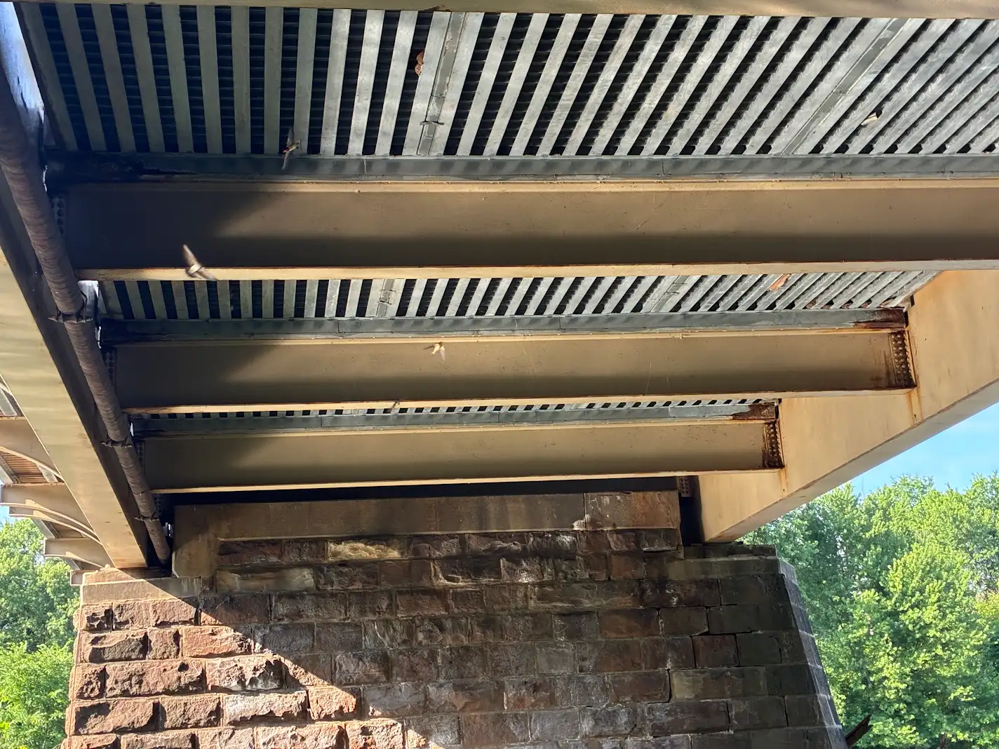
The lines of sediment across this Piscataway pier reached about 55 inches above the floor of the river bed, underscoring the dynamic power of watersheds during rainstorms. Last week, the river at this spot was only 8 inches deep, and it was only 19 inches deep at the time of testing. — Photo by J.M. Meyer.
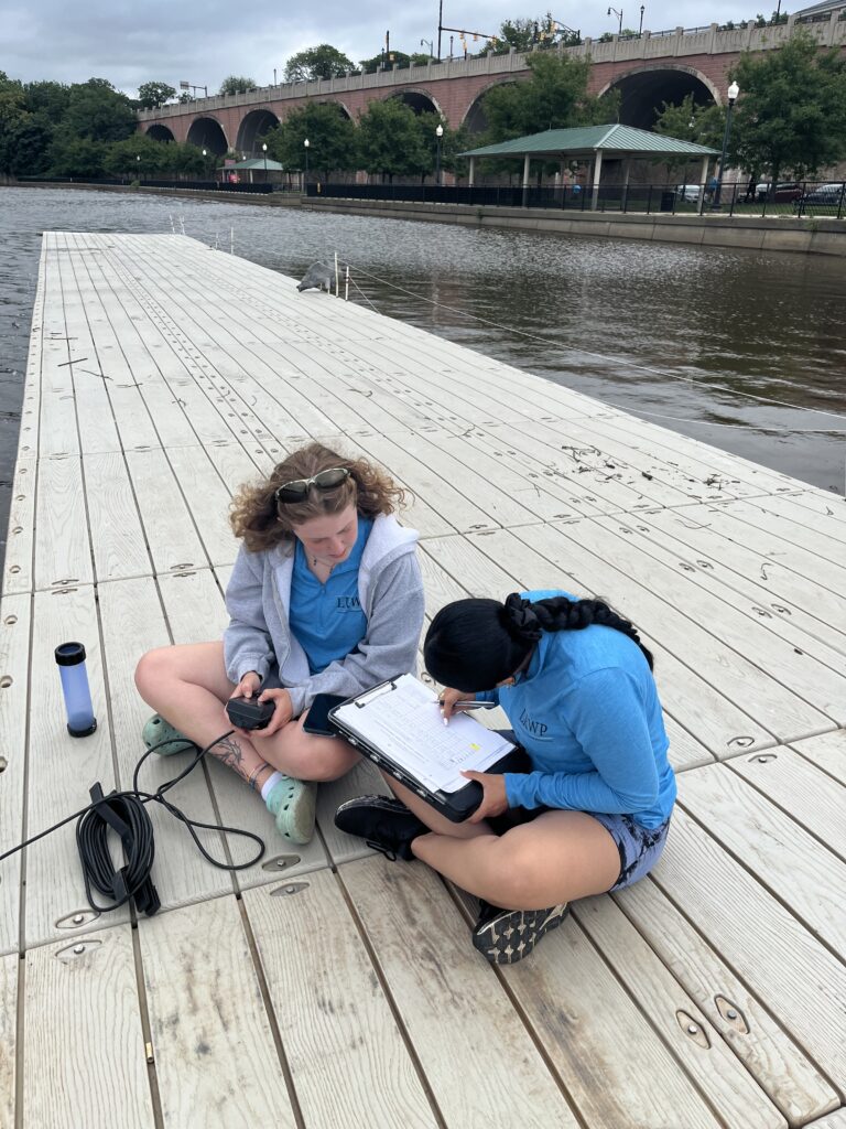
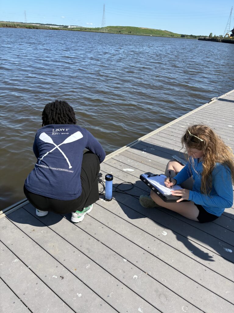
Ashley and Paula record data from the sonde at high tide at Rutgers Boat House, New Brunswick. — Photo by Olyesa Nabokova.
For the second year in a row, South Amboy grandfather brought his grandson to South Amboy specifically to learn from our water monitoring team.– Photo by Olyesa Nabokova.
We collected eight gallons of trash off the beach in Perth Amboy. Much of the material, unfortunately, was sanitary products flushed from the sewage. We also found a diaper tucked among the rocks. Perth Amboy: don’t be like that. — Photo by J.M. Meyer.
This small honey locust shrub could grow into a good sized tree after just a couple of years if human left it alone.
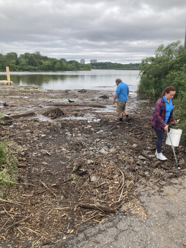
Mike and Olyesa clean trash from the drift wood and mud lodged into the upstream side of Edison Boat Basin.
By Endurance Laryea, LRWP Summer Research Intern and J.M. Meyer.
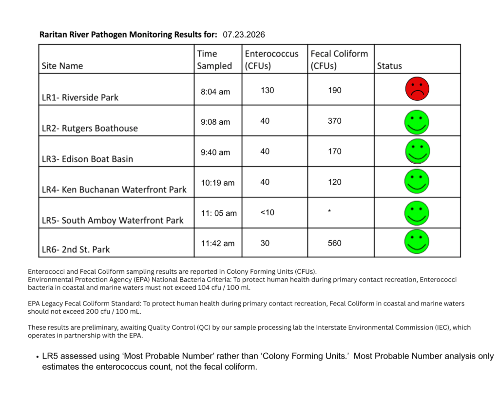
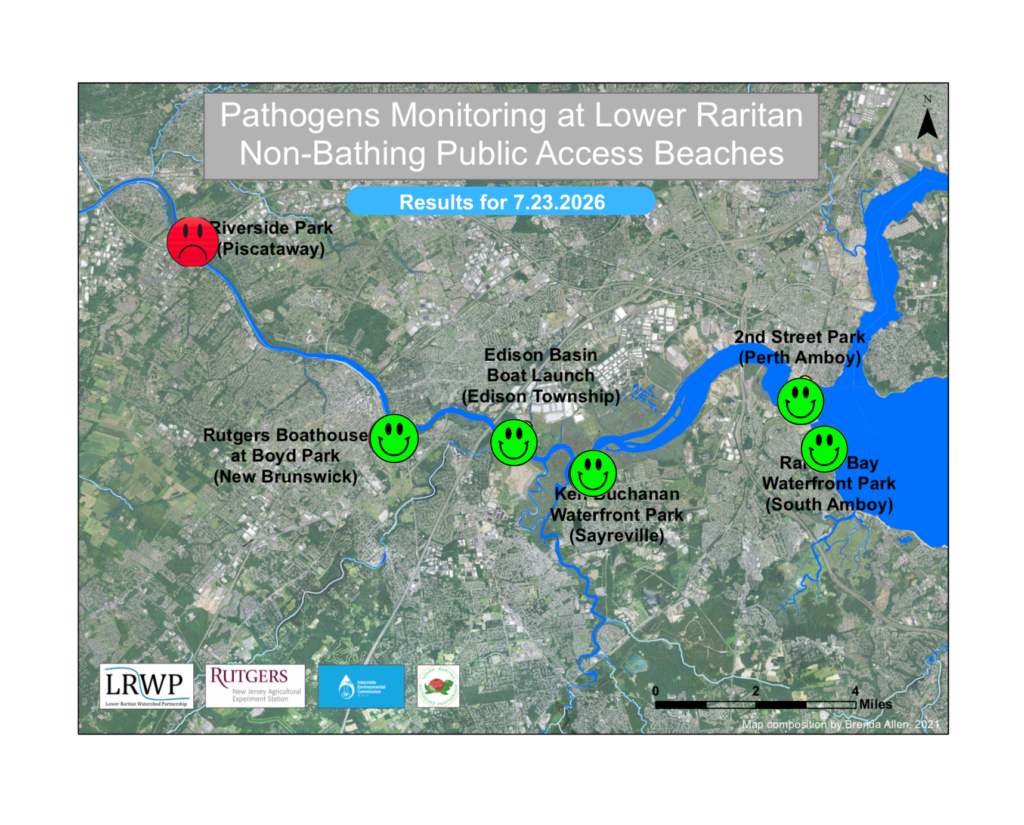
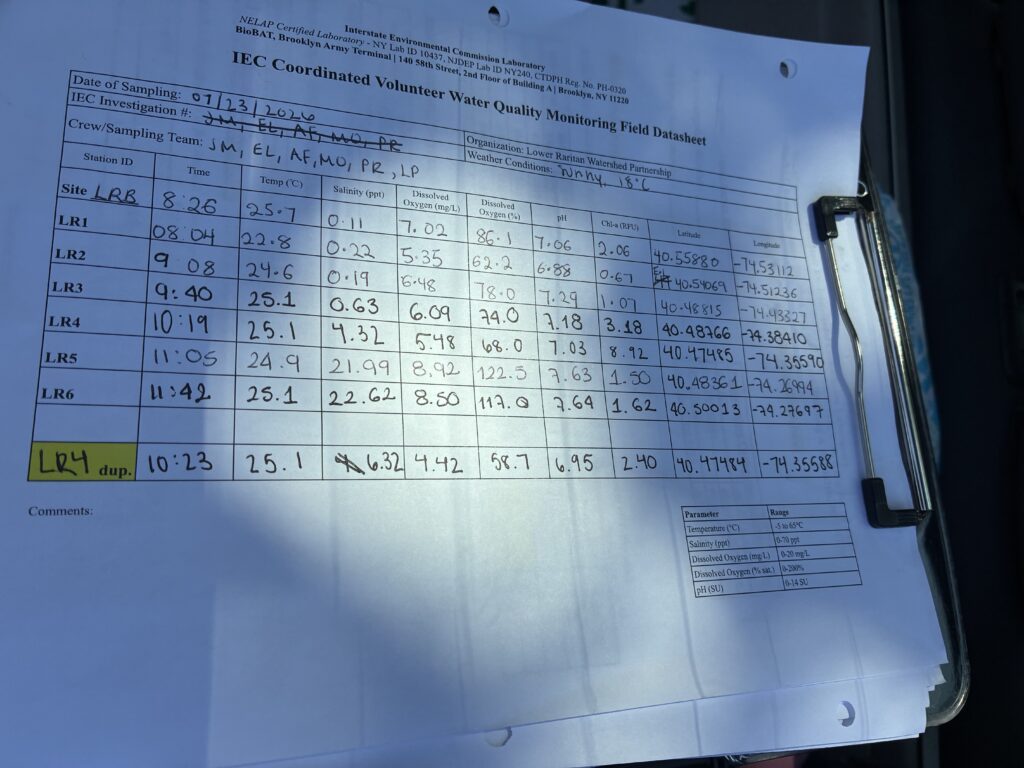
The fourth pathogen monitoring session of the month took place on Thursday, July 23rd. Each week during the summer, from May to October, the Lower Raritan Watershed Partnership and Rutgers Cooperative Extension of Middlesex County run a volunteer-based monitoring program along the Raritan River. We collect water quality samples at six non-bathing public access beach sites, provide our samples to the Interstate Environmental Commission for analysis in their laboratory, and report the results to the public. Our mission is to share this data with the community and partners to ensure the safe use of the Raritan River for all.
Our lab results for water quality samples taken on Thursday, July 23rd, 2026, show Enterococcus bacteria levels exceeding the EPA federal water quality standard of 104 cfu/100mL at one of our regular monitoring sites this week. The problem sites are indicated by the red frown on the map and chart and include Riverside Park (Piscataway). Green smiles on the chart and map indicate the sites with bacteria levels safe for recreation and include the following: Rutgers Boathouse (New Brunswick), Edison Boat Basin (Edison), Ken Buchanan Waterfront Park (Sayreville), 2nd Street Park (Perth Amboy), and South Amboy Waterfront Park.
Pathogens/Enterococci levels are used as indicators of the possible presence of disease-causing bacteria in recreational waters. Such pathogens may pose health risks to people coming in primary contact with the water (touching) through recreational activities like fishing, kayaking or swimming in a water body. Possible sources of bacteria include Combined Sewer Overflows (CSOs), improperly functioning wastewater treatment plants, stormwater runoff, leaking septic systems, animal carcasses, pet waste, wildlife waste, and runoff from manure storage areas.
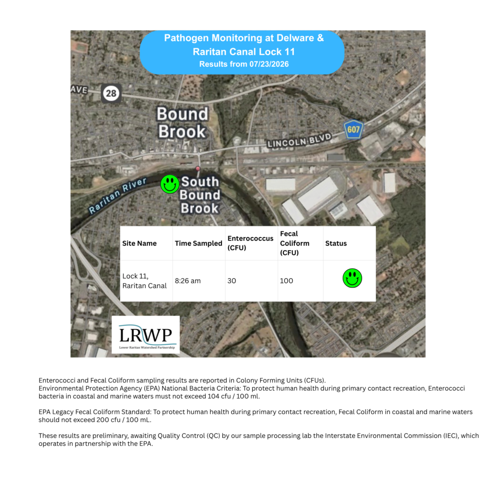
In order to better understand why Riverside Park, Piscataway has been our worst performing site over the past six years, we have started sampling further upstream. On July 23rd, we sampled the canal at Lock 11, South Bound Brook, a third time since we started pathogens monitoring this season. The lab analysis produced 30 enterococci cfu per 100mL which passes the EPA federal water quality standard of 104 cfu/100mL. Again, this site passed the test, as it has every week that we’ve tested it.
Our goal in reporting these results is to give residents a better understanding of the potential health risks related to primary contact during water-based recreation. If you are planning on recreating on the Raritan this weekend, make sure to stay safe and wash up after any activities!
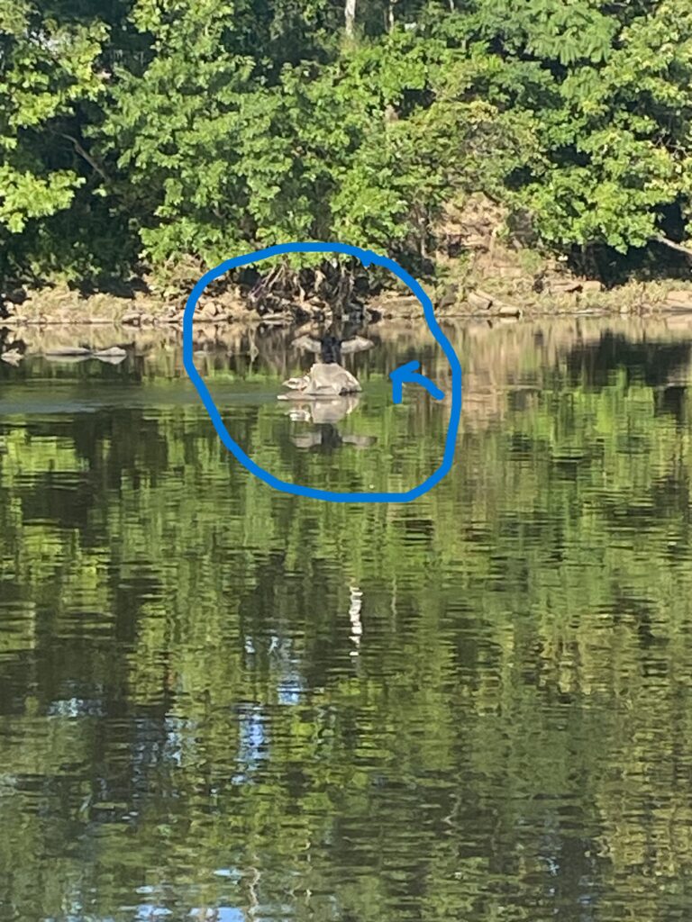
We were greeted by two birds this morning. One with its wings outstretched on a rock in the middle of the river and a smaller bird with orange feet and crest on a smaller rock beside it. Birds may stretch their wings for various reasons like temperature regulation, blood circulation, drying of their feathers or even a territorial sign. Not sure which this one was doing though. From where we stood, we were not able identify what kind of birds they were. Photo by Mike Orsini.
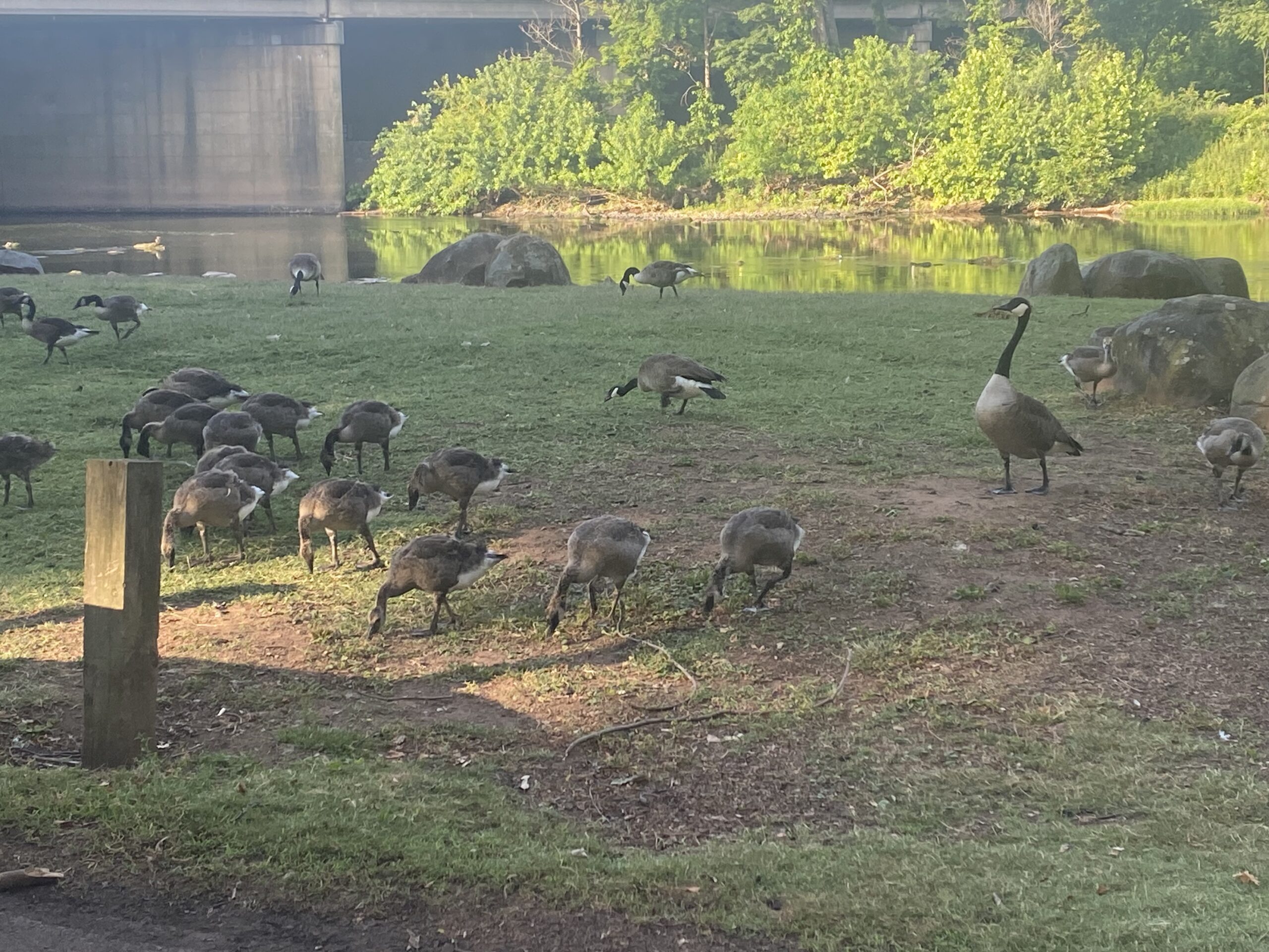
Who knew Canadian geese were into gymnastics? Here is a goose doing a handstand–or in this case, ‘beakstand’–to feed. We did not see them catch any fish, but they fed on some waterweeds while we were there. Photo by Endurance Laryea.
A public notice has been put up at Five Mile Lock, South Bound Brook, New Jersey to warn the community on usage of the D&R canal water. At the moment, there are no fishing or water consumption restrictions, however, there are warnings on the usage of the water for plant irrigation purposes. The canal has been treated with Sonar Genesis, an aquatic herbicide that is sprayed on the surface of the water to impede the photosynthetic processes of water weeds. The purpose of that was to control the growth of Hydrilla in the canal. Hydrilla is an invasive species. As discussed in last week’s post, invasive species are harmful to the ecosystems in which they are non-native hence, the need for management.
Photo by Mike Orsini.
“Where are the fishes”, two fishermen inquired at Five Mile Lock, South Bound Brook , New Jersey. We have not spotted any fish at this site since we started monitoring this season and this was the first time seeing any fishing activity going on here. Photo by Endurance Laryea.
Photo by Endurance Laryea.
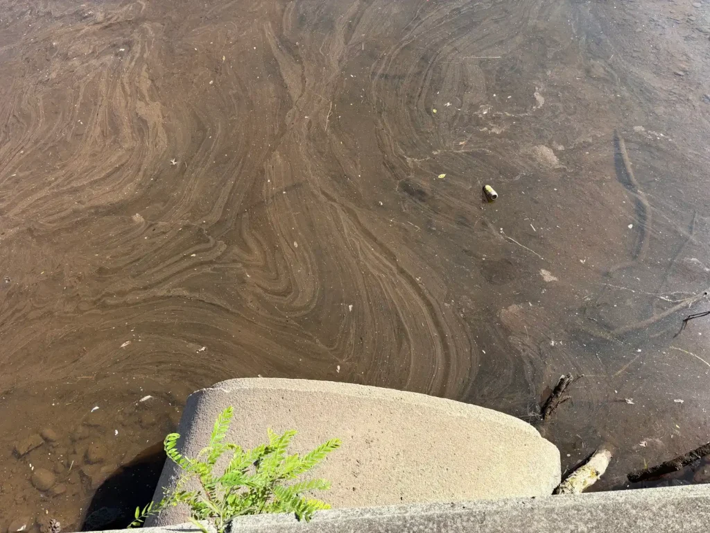
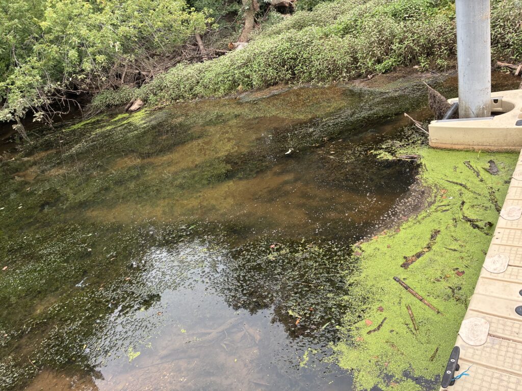
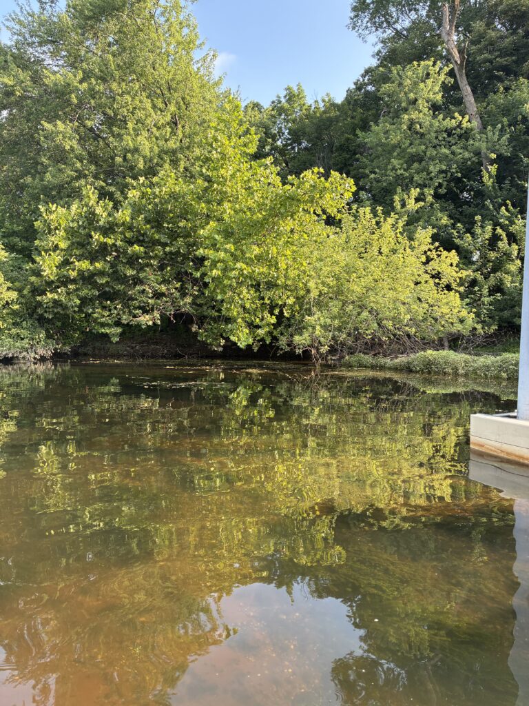
At Rutgers Boat House, New Brunswick, what looked like a biofilm was all over the surface of the water surrounding the dock. It appeared to be coming out of the outfall–possibly, organic matter being washed into the river. Think of a biofilm as a community of bacteria. They form when bacteria attach itself to a surface (In this case, the water surface), produce a glue-like substance called Extracellular Polymeric Substances (EPS) to help them stick to each other and the surface of attachment better, then reproduce forming a slimy layer of film on the surface of attchment. Biofilms can be found in various places, dranaige pipes, water storage tanks, down your kitchen drain, and even your teeth!
Photos by Paula Rubio.
Photo by Ashley Fritz.
John taking out plastic from the water at Edison Boat Launch. Photo by Ashley Fritz.
Ashley, John and Endurance on sampling and sonde measurement duties. Photos by Paula Rubio.
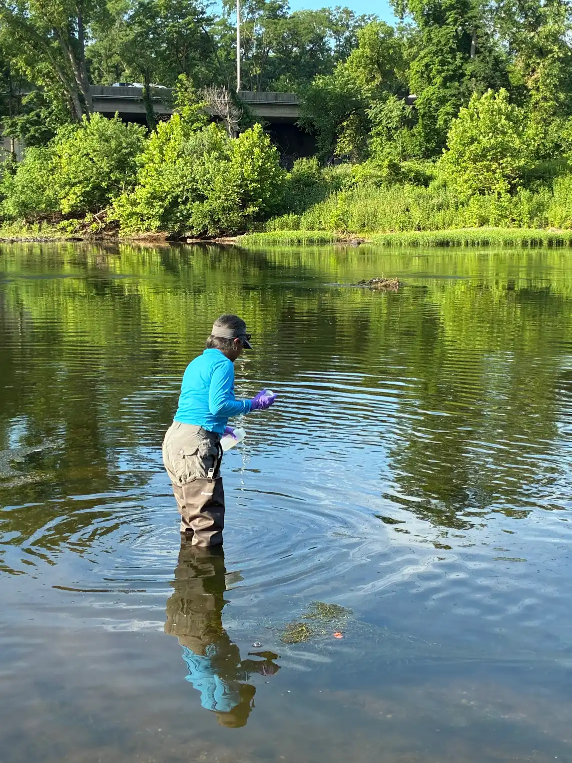
Endurance on sampling duty at South Amboy. Photo by John Meyer.
A massive algal bloom at Perth Amboy. The water was greenish and murky unlike the clear color it has had for the past couple of weeks. Photo by Endurance Laryea.
Photo by Endurance Laryea.
Thankfully, oxygen levels rose back to normal, and we did not experience the fish dead we feared!
By Endurance Laryea, LRWP Summer Research Intern and J.M. Meyer.
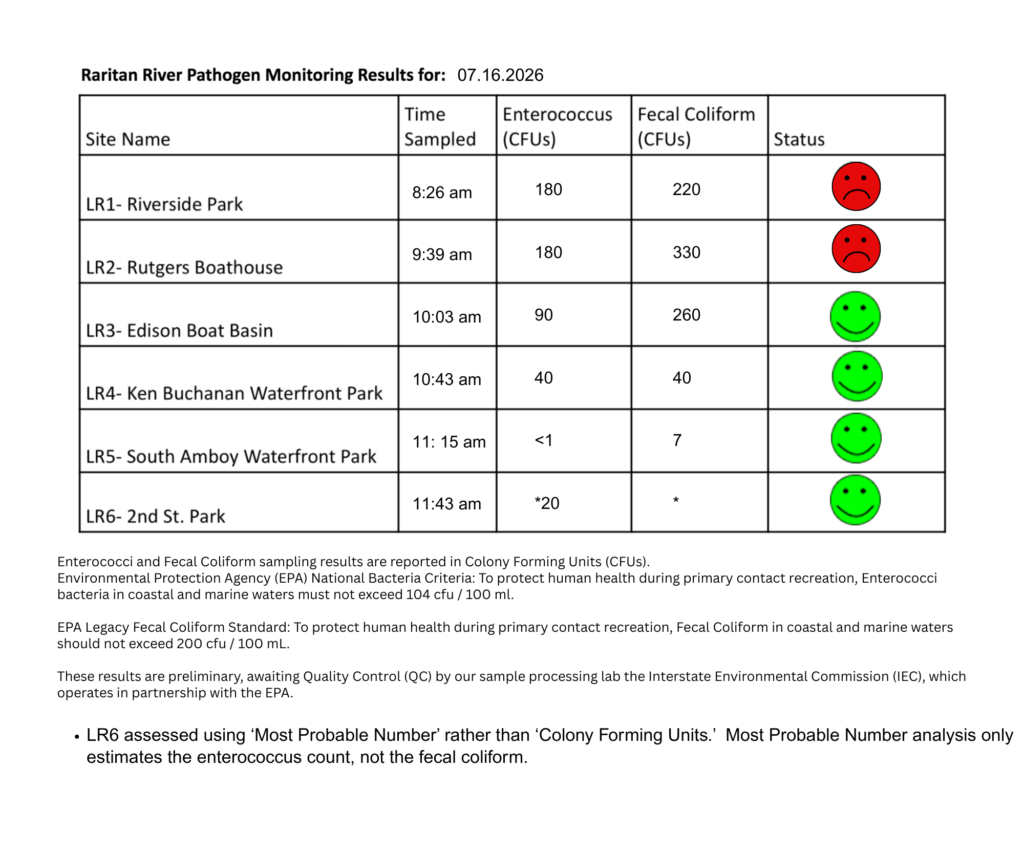
The third pathogen monitoring session of the month took place on Thursday, July 16th. Each week during the summer, from May to October, the Lower Raritan Watershed Partnership and Rutgers Cooperative Extension of Middlesex County run a volunteer-based monitoring program along the Raritan River. We collect water quality samples at six non-bathing public access beach sites, provide our samples to the Interstate Environmental Commission for analysis in their laboratory, and report the results to the public. Our mission is to share this data with the community and partners to ensure the safe use of the Raritan River for all.
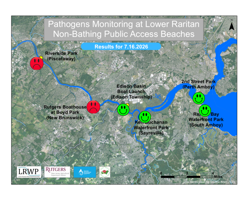
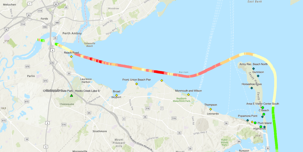
Our lab results for water quality samples taken on Thursday, July 16th, 2026, show Enterococcus bacteria levels exceeding the EPA federal water quality standard of 104 cfu/100mL at two of our regular monitoring sites this week. The problem sites are indicated by the red frown on the map and chart and include Riverside Park (Piscataway), and Rutgers Boathouse (New Brunswick). Green smiles on the chart and map indicate the sites with bacteria levels safe for recreation and include the following: 2nd Street Park (Perth Amboy), and South Amboy Waterfront Park.
Pathogens/Enterococci levels are used as indicators of the possible presence of disease-causing bacteria in recreational waters. Such pathogens may pose health risks to people coming in primary contact with the water (touching) through recreational activities like fishing, kayaking or swimming in a water body. Possible sources of bacteria include Combined Sewer Overflows (CSOs), improperly functioning wastewater treatment plants, stormwater runoff, leaking septic systems, animal carcasses, pet waste, wildlife waste, and runoff from manure storage areas.
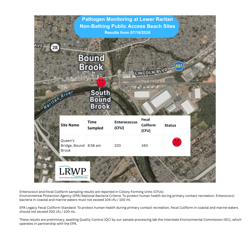
In order to better understand why Riverside Park, Piscataway has been our worst performing site over the past six years, we have started sampling further upstream. On July 16th, we sampled the Queen’s Bridge, Bound Brook site a third time since we started pathogens monitoring this season. The lab analysis produced 220 enterococci cfu per 100mL which crashes into the EPA federal water quality standard of 104 cfu/100mL. Again, this site failed the test, as it has every week that we’ve tested it. In contrast, the D&R canal has passed all six of its tests.
Our goal in reporting these results is to give residents a better understanding of the potential health risks related to primary contact during water-based recreation. If you are planning on recreating on the Raritan this weekend, make sure to stay safe and wash up after any activities!
Nilesh, one of our key Sewa International volunteers at last year’s Green Brook project, is working with Olyessa and other team members to plan a riparian restoration effort in Piscataway! In the above photo, Nilesh receives feedback on his proposal from Mike and Ruby.
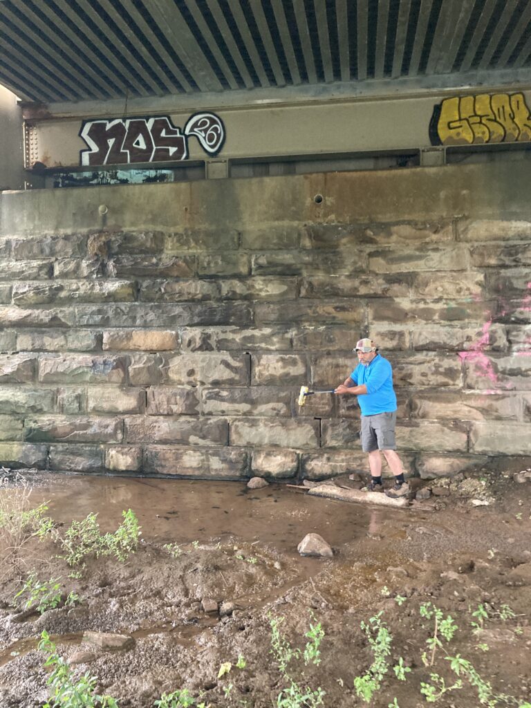
In this photo, Mike is cleaning litter out of a backwater pool, an important part of the Riparian Zone. This backwater is particularly interesting because it is situated beneath a bridge.
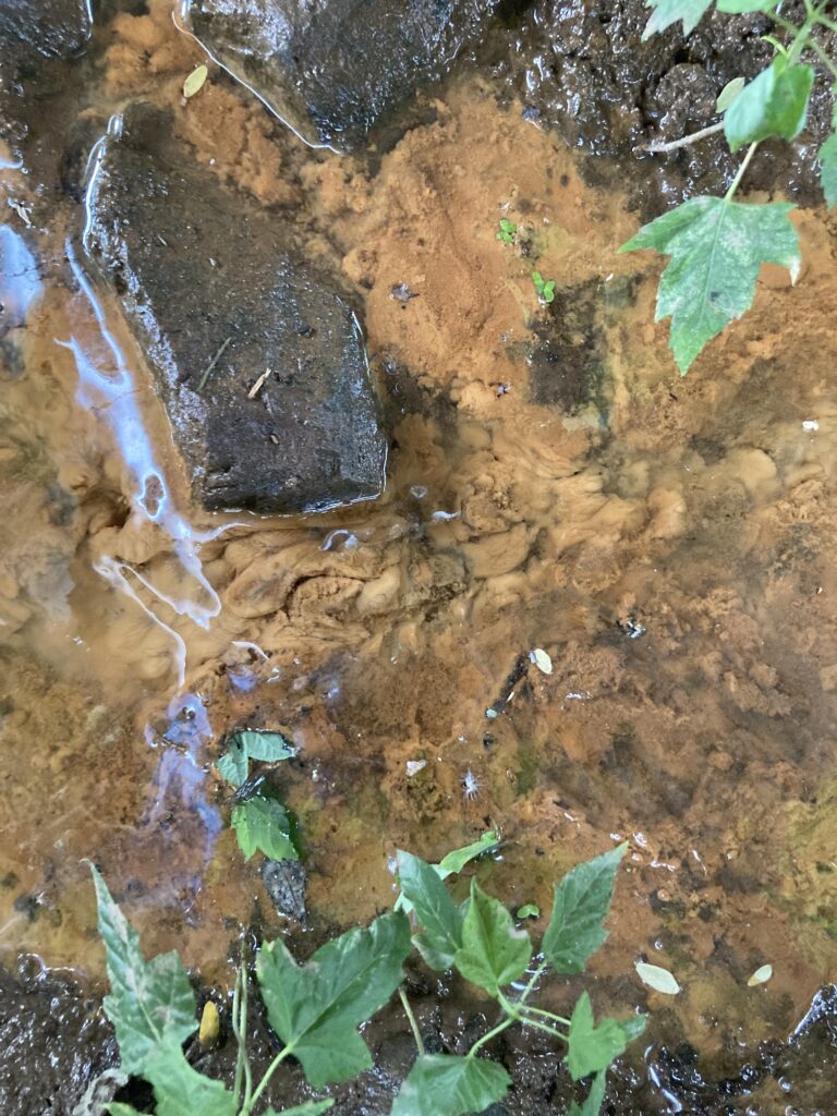
Have you ever noticed reddish, slimy water seeping out of the shale layers in western Middlesex County? You might have seen iron-rich bacteria! These tiny creatures are microorganisms that get energy by oxidizing dissolved ferrous iron (Fe²⁺) into ferric iron (Fe³⁺), which creates rust-like, reddish-brown, slimy deposits in water and soil. These bacteria are common in iron-rich groundwater, streams, and wells, and while generally not harmful to humans, they can cause foul odors, staining, and pipe blockages. Ancient peoples used these invisible critters to gather iron which could then be processed into a crude iron ore.
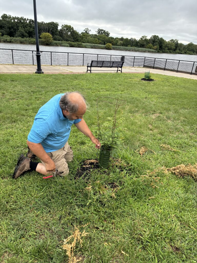
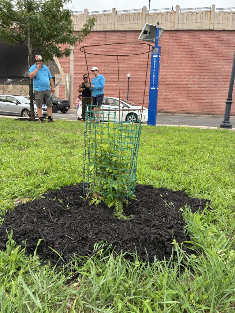
Mike, Eddy, and John installed new guards around the recovering honey locust trees.Photos by Endurance Laryea.
Thanks to the wonderful folks at New Brunswick Parks, we met with the lead steward of Boyd Park, Eddy, to discuss strategies for growing more shade trees in New Brunswick. Boyd Park is a huge tract of land separated from New Brunswick by state route 18; despite limited walking paths between New Brunswick and Boyd Park, the city currently struggles to maintain the park with extremely limited resources. The LRWP is currently lobbying the D&R canal to stretch an additional three miles to encompass the historic downstream Raritan lock. This would enable the D&R State Park, one of New Jersey’s greatest treasures, to reach our diverse, community-oriented citizens in eastern New Brunswick.
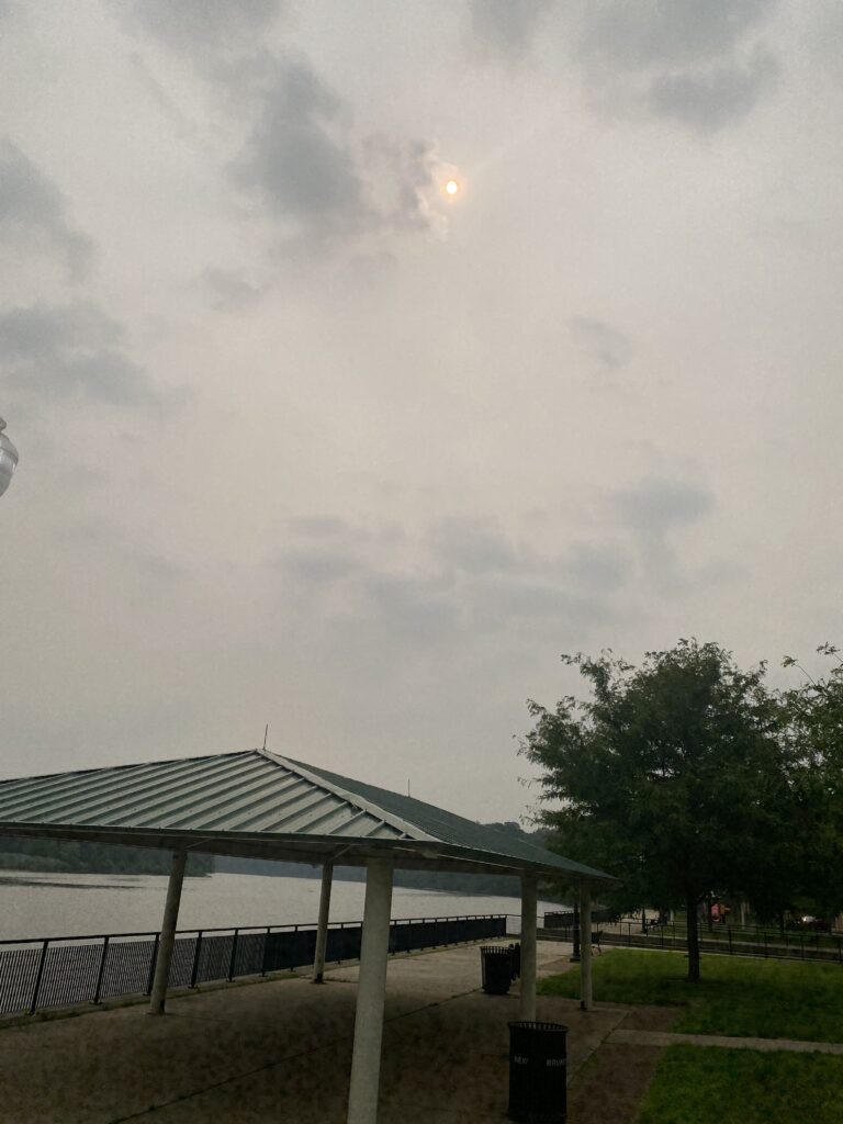
In the above photo from Mike Orsini, we can see the thick blanket of wildfire smog that smothered much of the mid-Atlantic this week. Breathing in fine particulate matter is associated with a myriad of health problems, including dementia. Please consider breaking out those pandemic-era n95 masks before going outdoors.
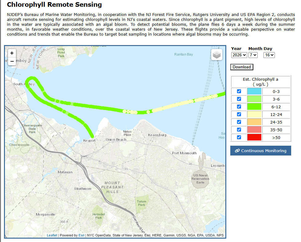
As the summer progresses, it is not unusual for chlorophyll counts to explode and for oxygen levels to drop. In Middlesex County, it is still common practice to fertilize parks and gardens, even in the riparian zone. By this time in the summer, the fertilizer has washed into the Raritan and out into Raritan Bay, where it feeds numerous aquatic plants; when those plants die, the bacteria that feed on the dead plants rapidly consume much of the oxygen in the water. The state’s ariel monitoring of Raritan Bay shows increasing evidence of chlorophyll.
Remote sensing map of Raritan Bay from NJDEP on July 15th, 2026, the day prior to our water monitoring. The red color indicated an estimated level of chlorophyll greater than 50 micrograms per centimeter — that is extremely high!
Remote sensing of Raritan Bay on July 16th, 2026 — the day of our sampling.
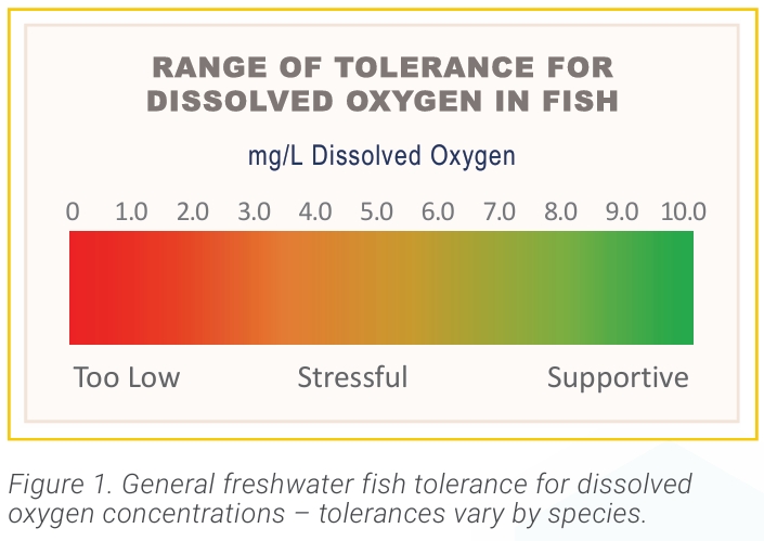
At the time of sampling, dissolved oxygen (DO) levels were below average at all of our sites except Perth Amboy. Dissolved oxygen is important for aquatic life. The lower the DO level the more stressful it is for fishes. On the other hand, higher DO levels support spawning, growth and activity of the fishes.
All the sites visited this week, except Perth Amboy, experienced low levels of oxygen in the ‘stressful’ range according to the EPA. If the oxygen levels do not increase in the next 48 to 72 hours, we may see our first fish die off of the season.
It is important to note that dissolved oxygen levels change throughout the day and waterbody, hence, the values we took at the time of sampling may not reflect the overall levels of the water at the sites.
Algal bloom and duckweed growth sighted on the tidal flats of Piscataway. An indication of low oxygen levels and possible high phosphorous levels.Photo by Endurance Laryea.
Did you know that goslings can grow as big as the parent geese in 8-12 weeks? We can no longer tell the difference between the goslings we saw when we started monitoring this season. Photo by Endurance Laryea.
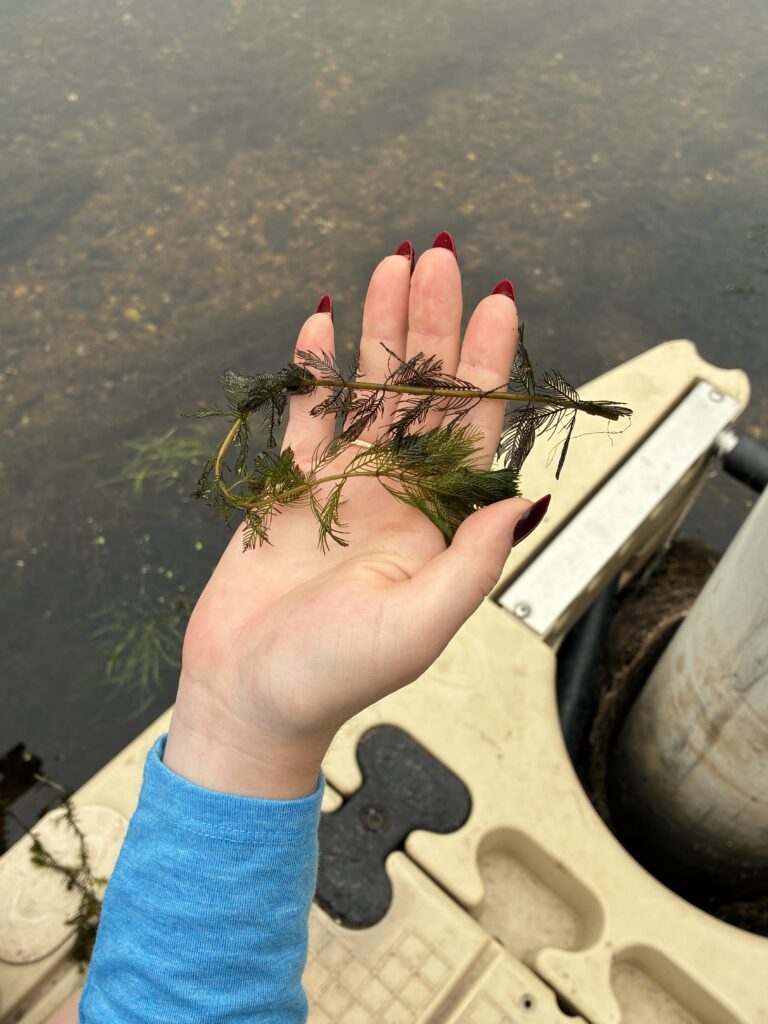
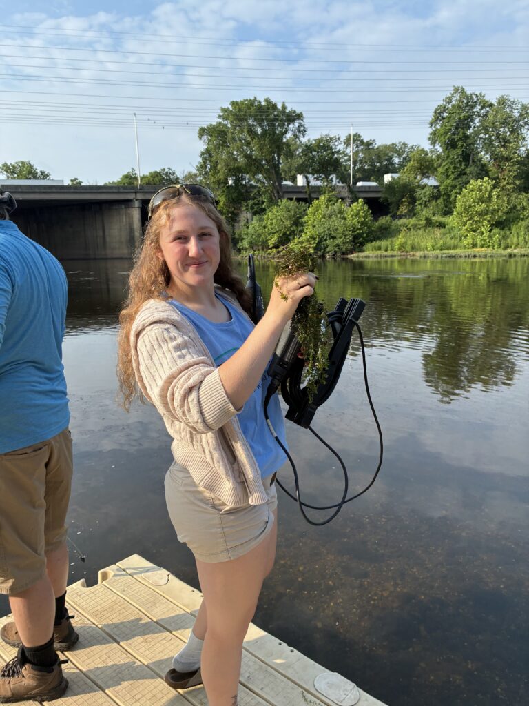
Ashley holds up a Eurasian Watermilfoil plant, an invasive species in large parts of the United States but native to Europe, Asia and North Africa. Photo by Endurance Laryea.
Invasive species are organisms that are not native to a particular ecosystem but can reproduce very quickly and out compete native organisms. The issue with this is that it erases the biodiversity in the ecosystem. Why is biodiversity important? In simple terms, different species in the ecosystem play different and important roles. If all other species were wiped out by one species, the system becomes imbalanced, and the equilibrium that holds the ecosystem together may crash. Though non-native plants may play a similar role in an ecosystem to native plants, they may
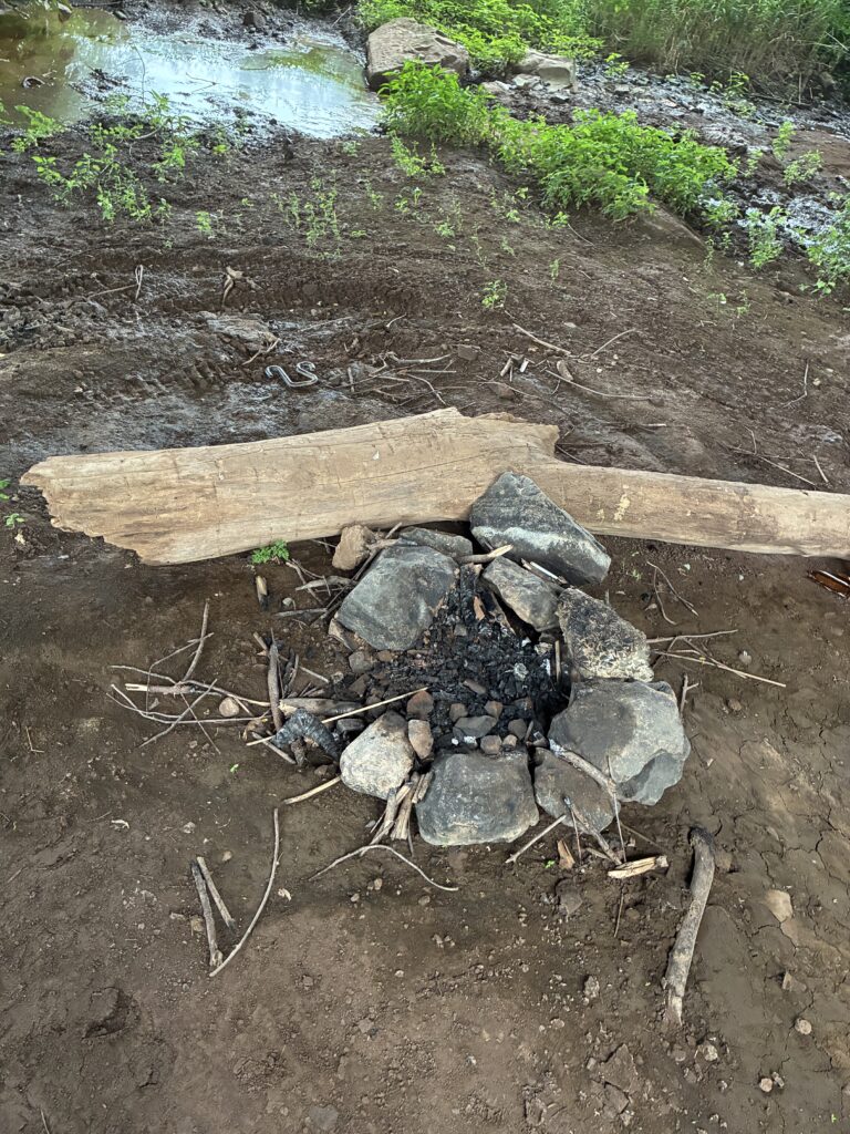
Mike was impressed with the neatness of this campfire ring under Queens Bridge! Photo by Endurance Laryea.
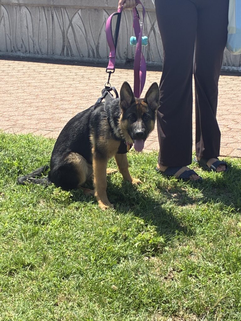
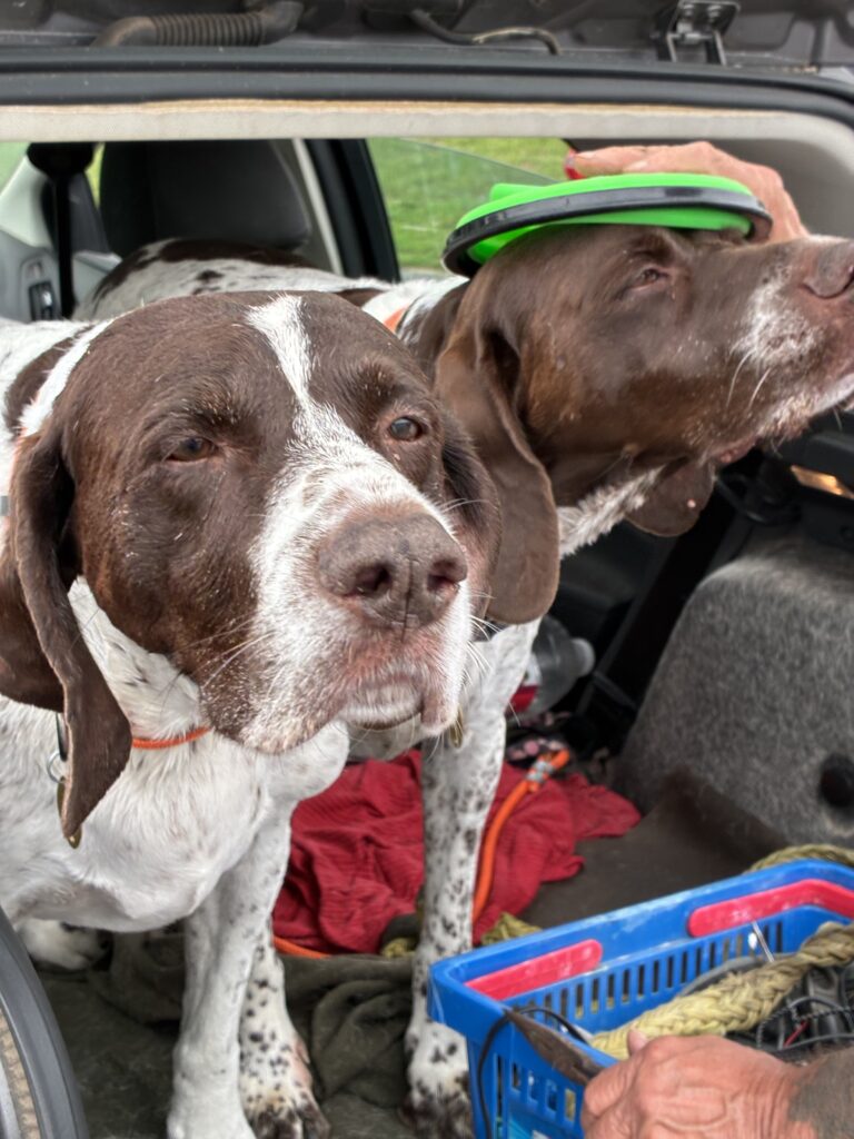
Melting hearts is what they do: Meet Bow and Junior, brothers who captured the hearts of the team at Edison. Photo by Endurance Laryea.
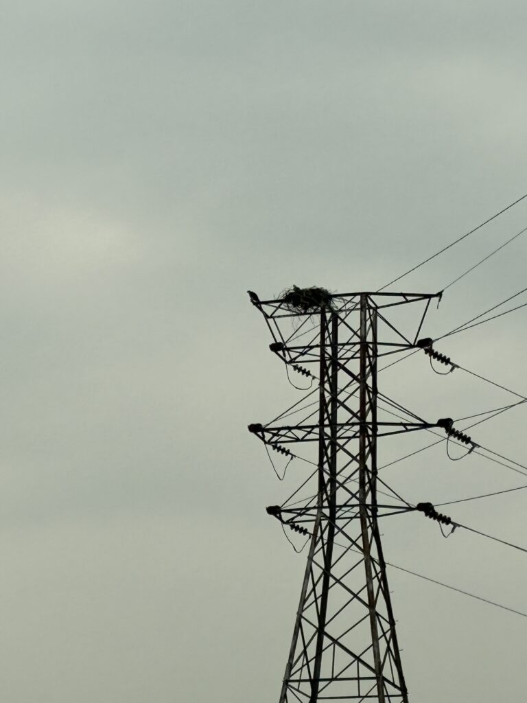
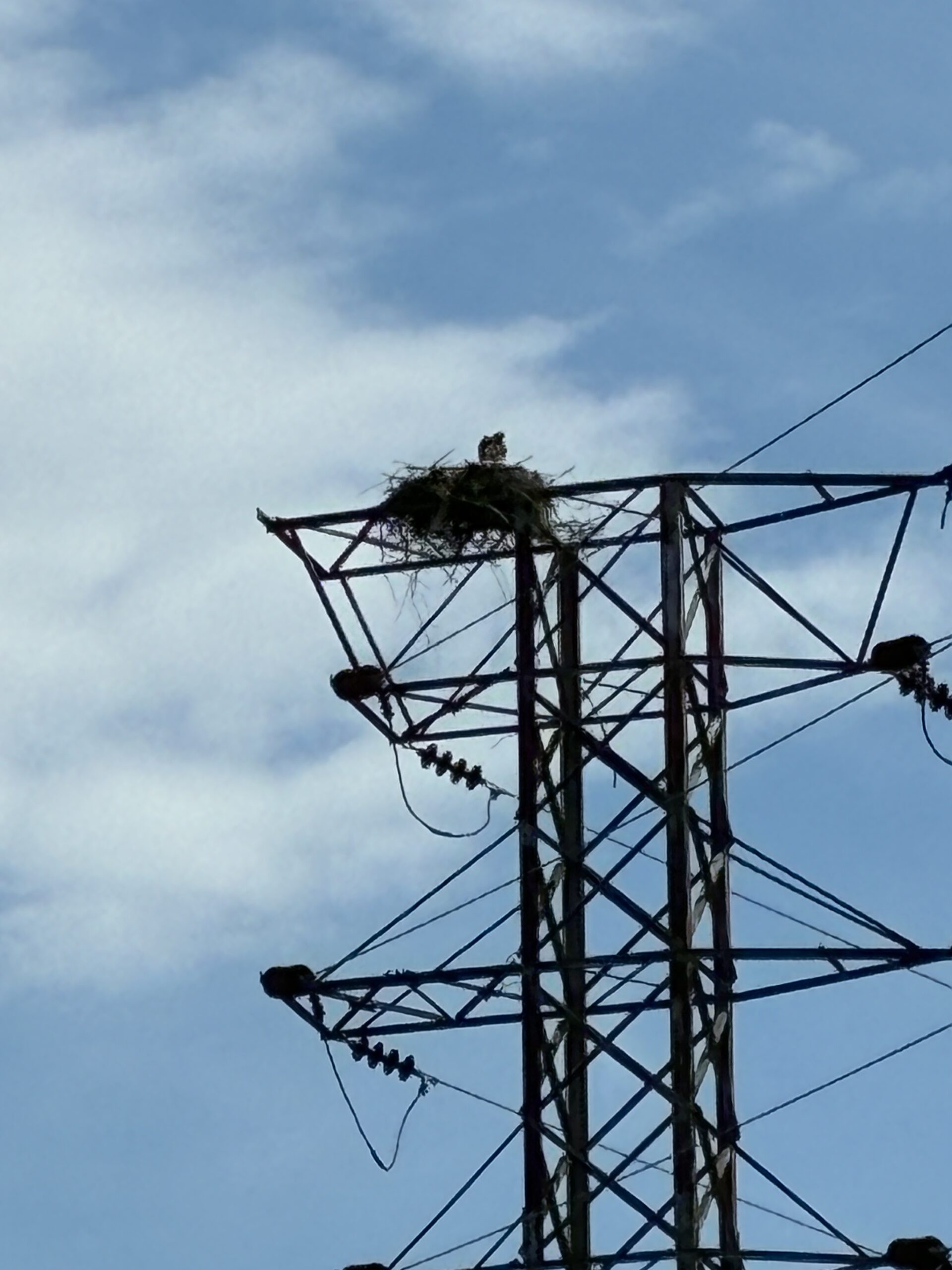
Baby ospreys at Sayreville confirmed! We couldn’t tell how many though. Photo by Endurance Laryea.
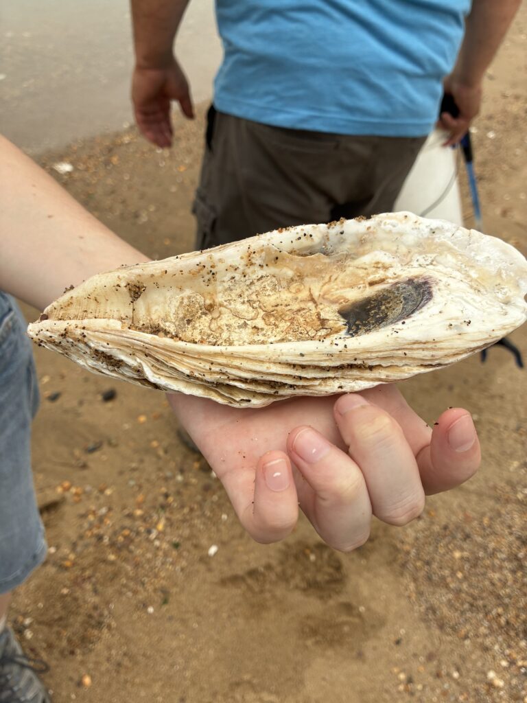
South Amboy is always giving us souvenirs. Today’s was a shell of an oyster, maybe? Photo by Endurance Laryea.
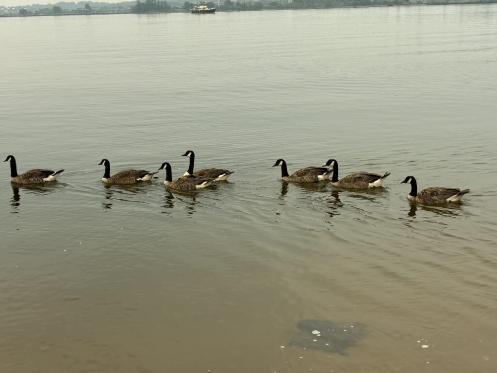
Last but not least, geese were sighted for the first time at Perth Amboy. Photo by Endurance Laryea.
The geese understand the importance of water monitoring, so they politely made way for our team. — Photo by J.M. Meyer.
The session came to an end on a happy note and Ruby, from the Interstate of Environmental Commission (IEC) picked up the samples to take to the lab in Brooklyn. Ruby joined the team today to audit the sampling and monitoring session. Photo by Endurance Laryea.
By Endurance Laryea, LRWP Summer Research Intern and J.M. Meyer.
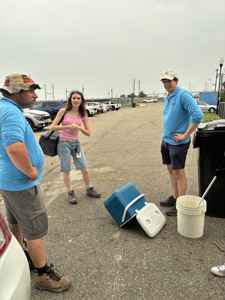
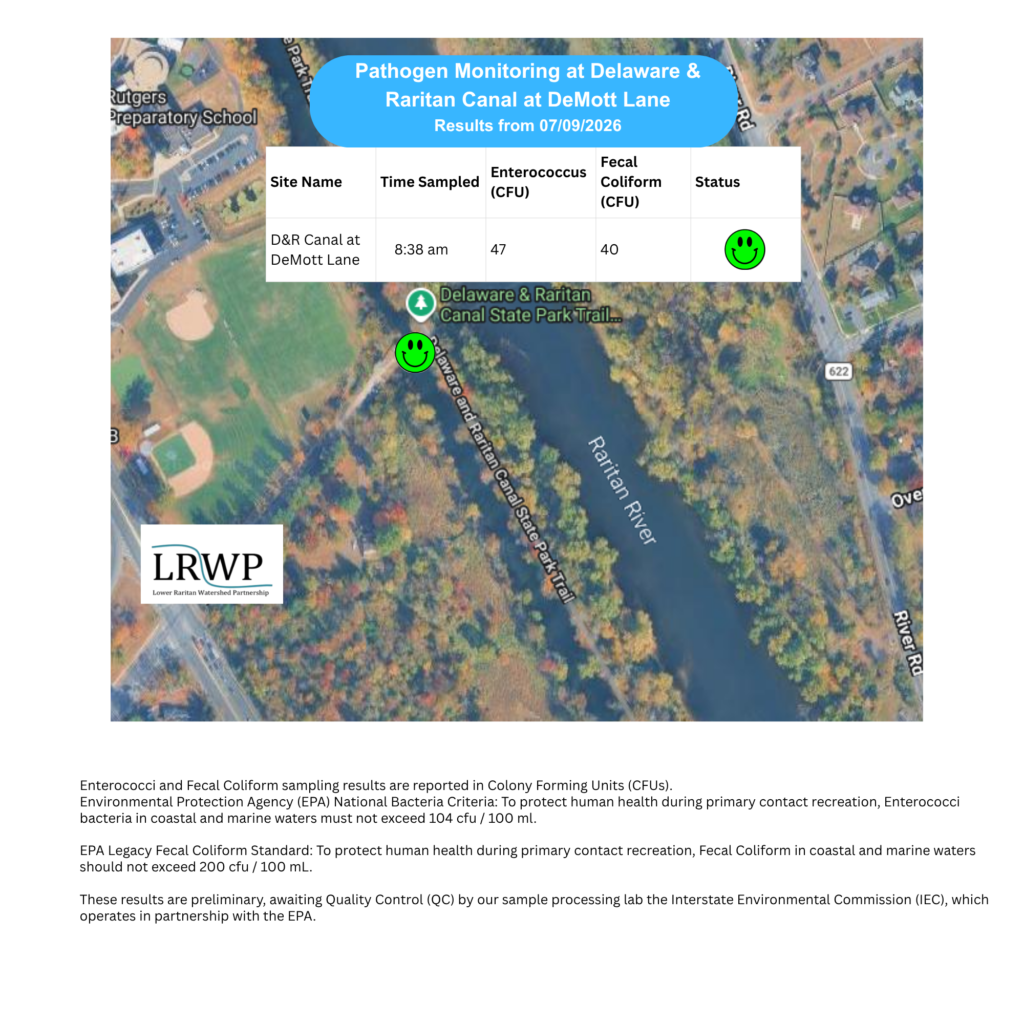
The second pathogen monitoring session of the month took place on Thursday, July 9th. Each week during the summer, from May to October, the Lower Raritan Watershed Partnership and Rutgers Cooperative Extension of Middlesex County run a volunteer-based monitoring program along the Raritan River. We collect water quality samples at six non-bathing public access beach sites, provide our samples to the Interstate Environmental Commission for analysis in their laboratory, and report the results to the public. Our mission is to share this data with the community and partners to ensure the safe use of the Raritan River for all.
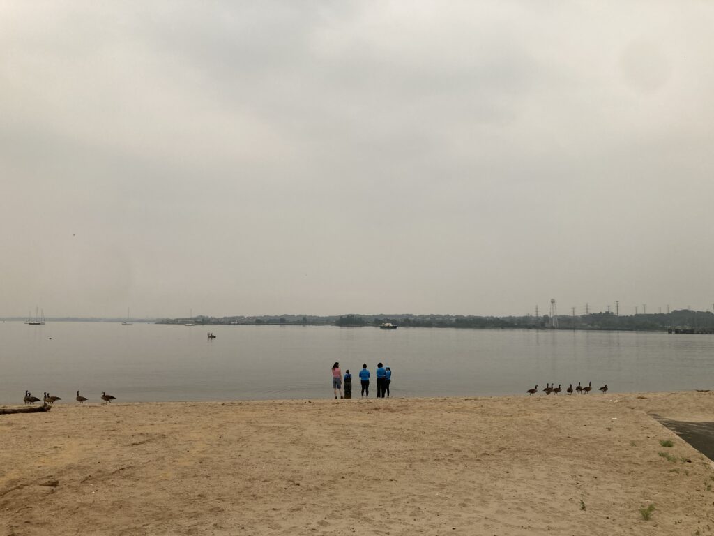
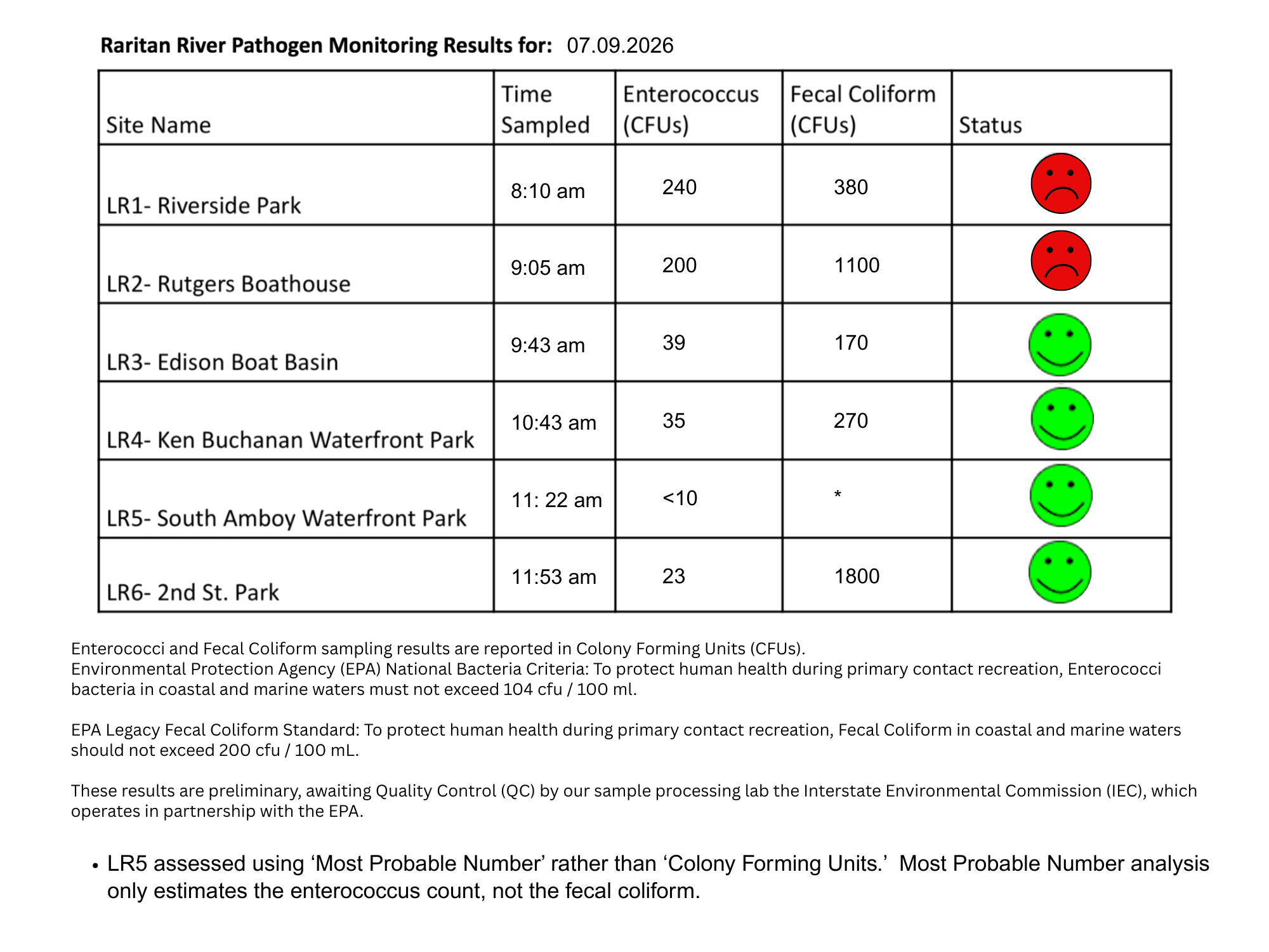
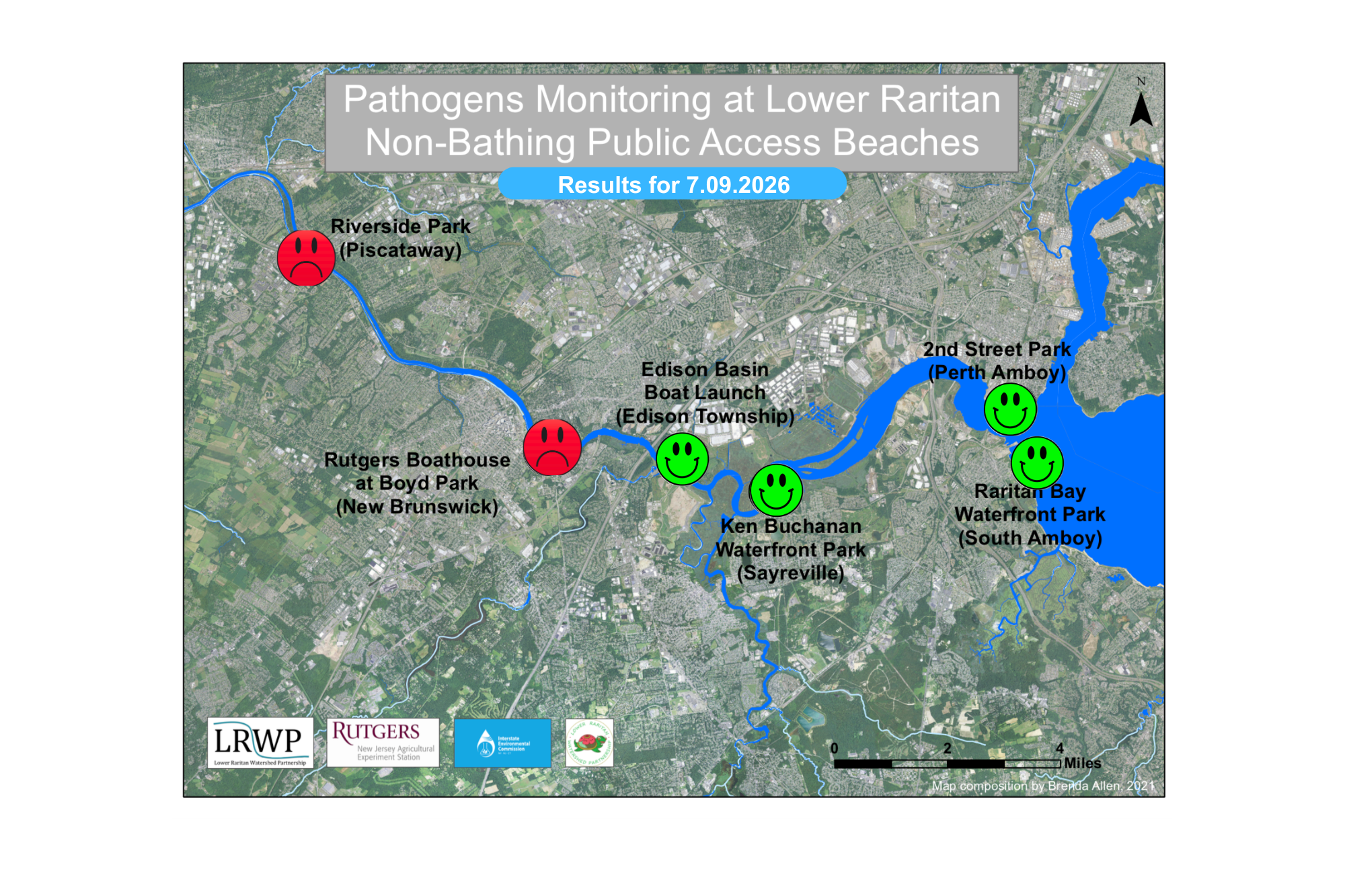
Our lab results for water quality samples taken on Thursday, July 9th, 2026, show Enterococcus bacteria levels exceeding the EPA federal water quality standard of 104 cfu/100mL at twoof our monitoring sites this week. The problem site is indicated by the red frown on the map and chart: Riverside Park (Piscataway) and Rutgers Boathouse (New Brunswick). Green smiles on the chart and map indicate the sites with bacteria levels safe for recreation and include the following: Edison Boat Basin (Edison), Ken Buchanan Waterfront Park (Sayreville)2nd Street Park (Perth Amboy).
Pathogens/Enterococci levels are used as indicators of the possible presence of disease-causing bacteria in recreational waters. Such pathogens may pose health risks to people coming in primary contact with the water (touching) through recreational activities like fishing, kayaking or swimming in a water body. Possible sources of bacteria include Combined Sewer Overflows (CSOs), improperly functioning wastewater treatment plants, stormwater runoff, leaking septic systems, animal carcasses, pet waste, wildlife waste, and runoff from manure storage areas.
In order to better understand why Riverside Park, Piscataway has been our worst performing site over the past six years, we have started sampling further upstream. On July 7th, we sampled the DeMott Lane D&R Canal site a second time since we started pathogens monitoring this season. The lab analysis produced 47 enterococci colony per 100mL passing the EPA federal water quality standard of 104 cfu/100mL. It also passed the test during our first month of monitoring.
Our goal in reporting these results is to give residents a better understanding of the potential health risks related to primary contact during water-based recreation. If you are planning on recreating on the Raritan this weekend, make sure to stay safe and wash up after any activities!
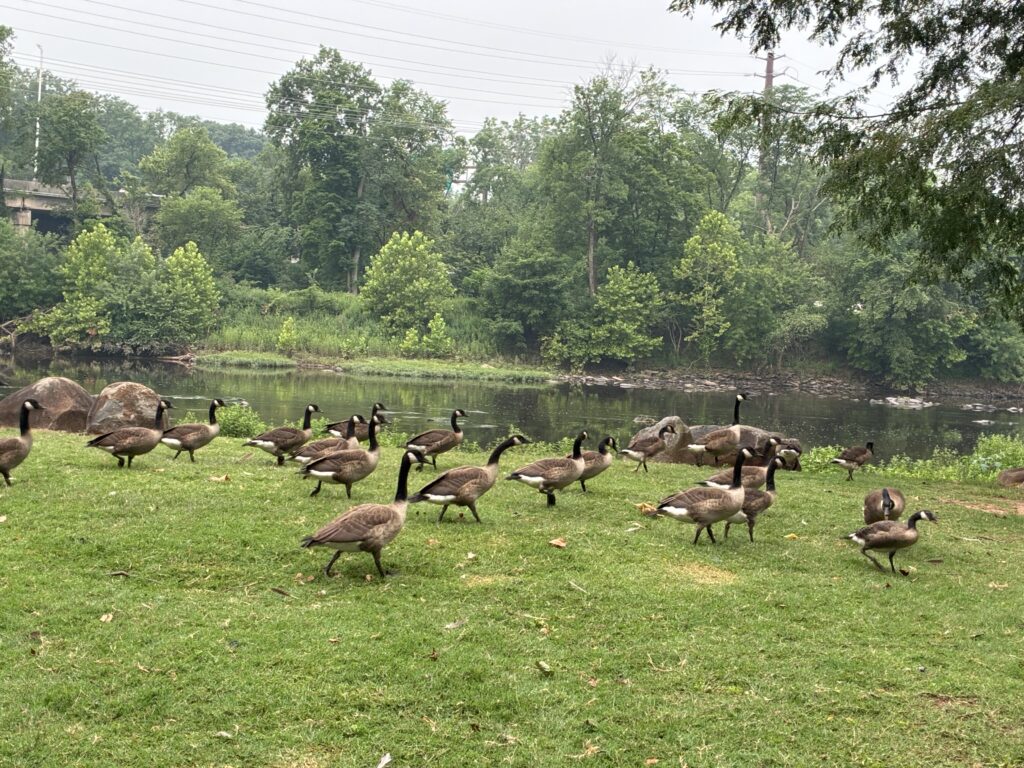
With no ‘goose chasing’ vehicles in sight, the Canada geese lounge in the summer shade at Riverside Park. Photo by Michael Orsini.
Thanks to the low tide, Dr. John found numerous ofrenda votive candles at the mouth of the Rutgers Boathouse Culvert. — Photo by Michael Orsini.
A close up of the votive candles. Photo by Michael Orsini.
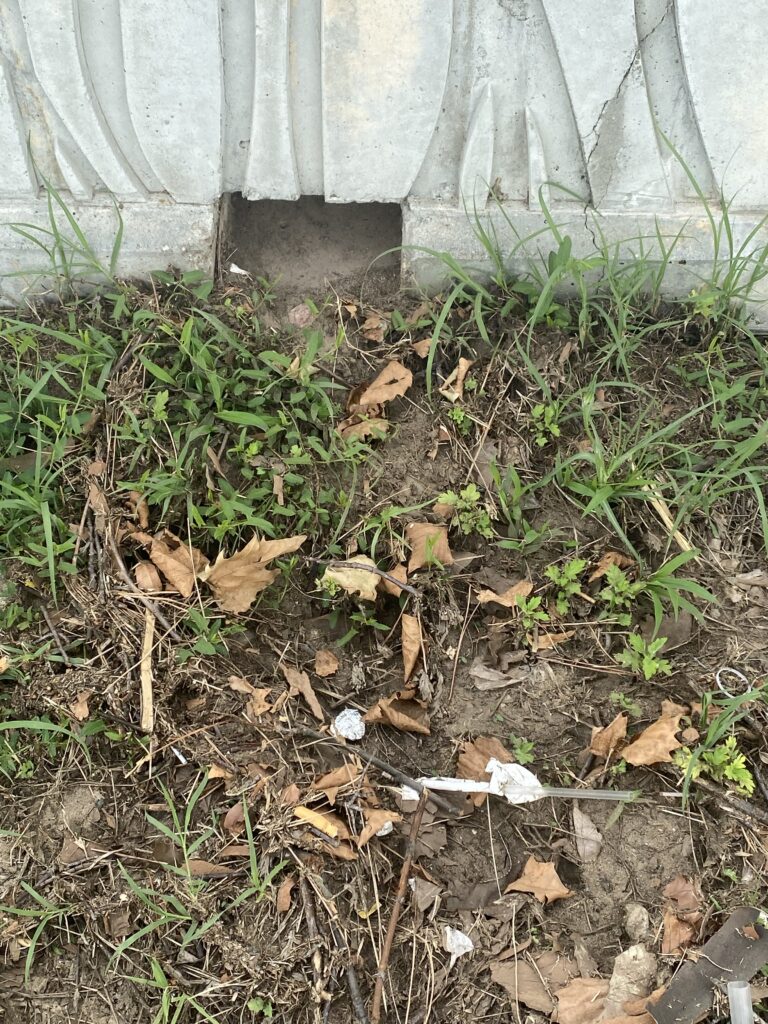
The Perth Amboy beach wall has numerous drainage openings to allow water to runoff onto the beach. Unfortunately, scores of cigarette butts and candy wrappers hitch a ride through the small portal. Please properly dispose of your trash! — Photo by Michael Orsini.
From fallen trees to mysterious bubbles, the LRWP team had quite an adventure during today’s monitoring session and we had John Munson, a video producer for Rutgers Today join us in our escapades as well!
The team today!
John, Endurance, Ashley, Paula, Mike and John from Rutgers Today pose for a group photo at the Waterfront Park in South Amboy. Photo by Endurance Laryea.
Today, John, the video director for Rutgers Today, the official daily news source for Rutgers University, joined the monitoring session to film a feature highlighting the work we do.
Ashley introducing herself to John- Photo by Endurance Laryea.
Starting off in Piscataway, we encountered a Raritan River flushed with precipitation from the past week. The water level was enough to submerge the elodea and algae that is usually sighted on the stream bank.
Tidal flats completely covered by high tide- Photo by Endurance Laryea.
Last week, Olesya was able to pick up trash here. Today you could not walk here without protective boots.
Ashley holds up an elodea plant. Photo by Endurance Laryea.
Ashley and Paula record hydrological measurements. Photo by Endurance Laryea.
We cannot forget about the goslings who are now as big as the parent geese now!Photo by Endurance Laryea.
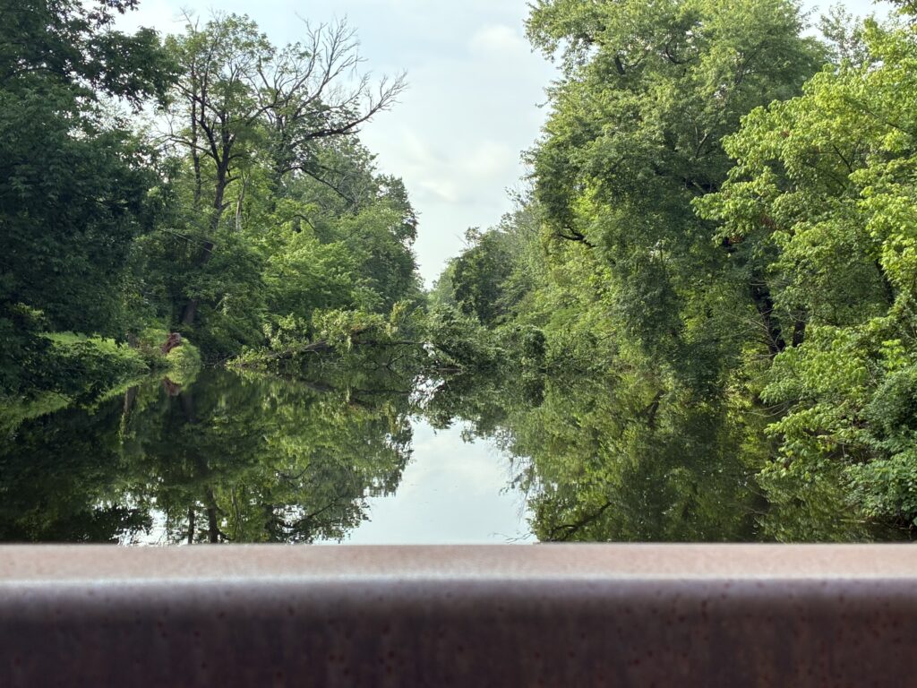
The next site was the Delaware & Raritan Canal; one of the four new sites added to the monitoring sites this summer. It was our second time sampling this summer. Unfortunately, we were met with the sight of a fallen tree across the canal. I spoke of how beautiful this site was when we first visited. It still is, however, this fallen tree reminds us of how inevitable change is in nature.
A tree fallen across the D&R Canal. The photo was taken facing downstream of the canal. Photo by Endurance Laryea.
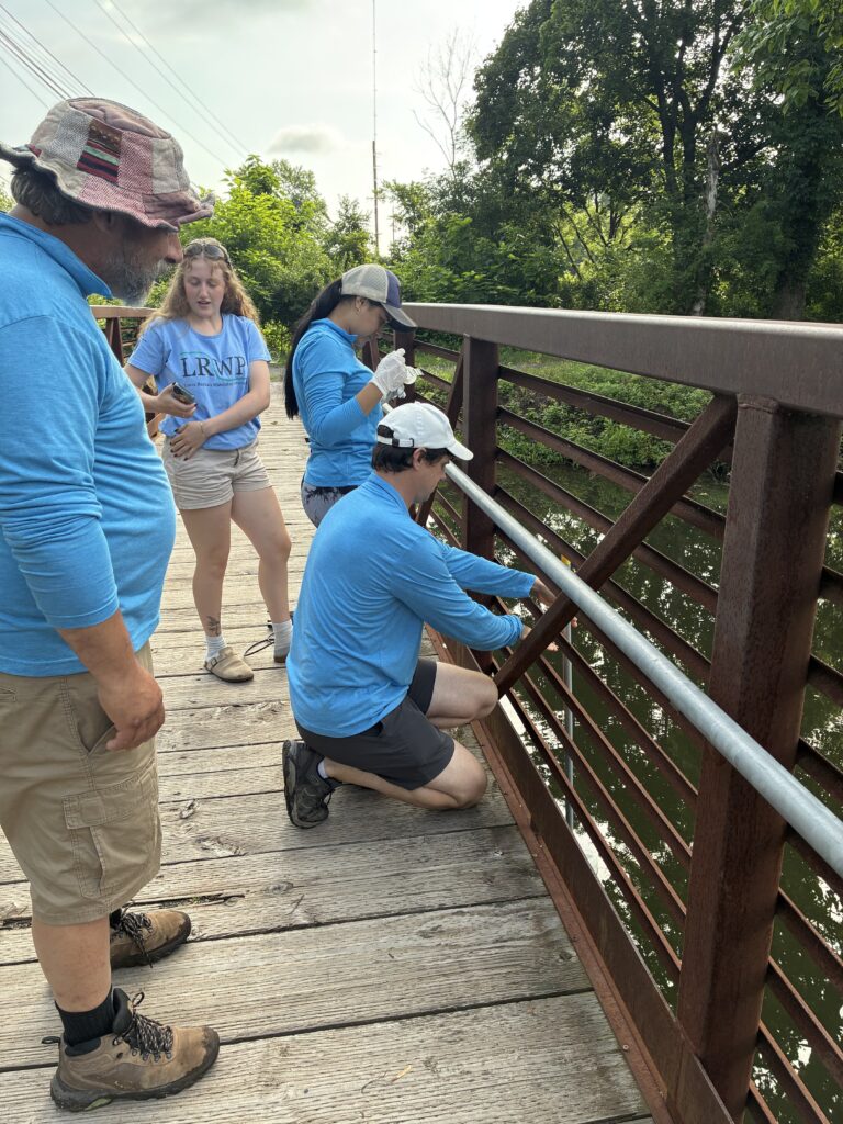
John and Paula handling the skillful maneuvering required to collect the sample from the canal bridge. Photo by Endurance Laryea.
Extremely low tides at Rutgers Boathouse today!
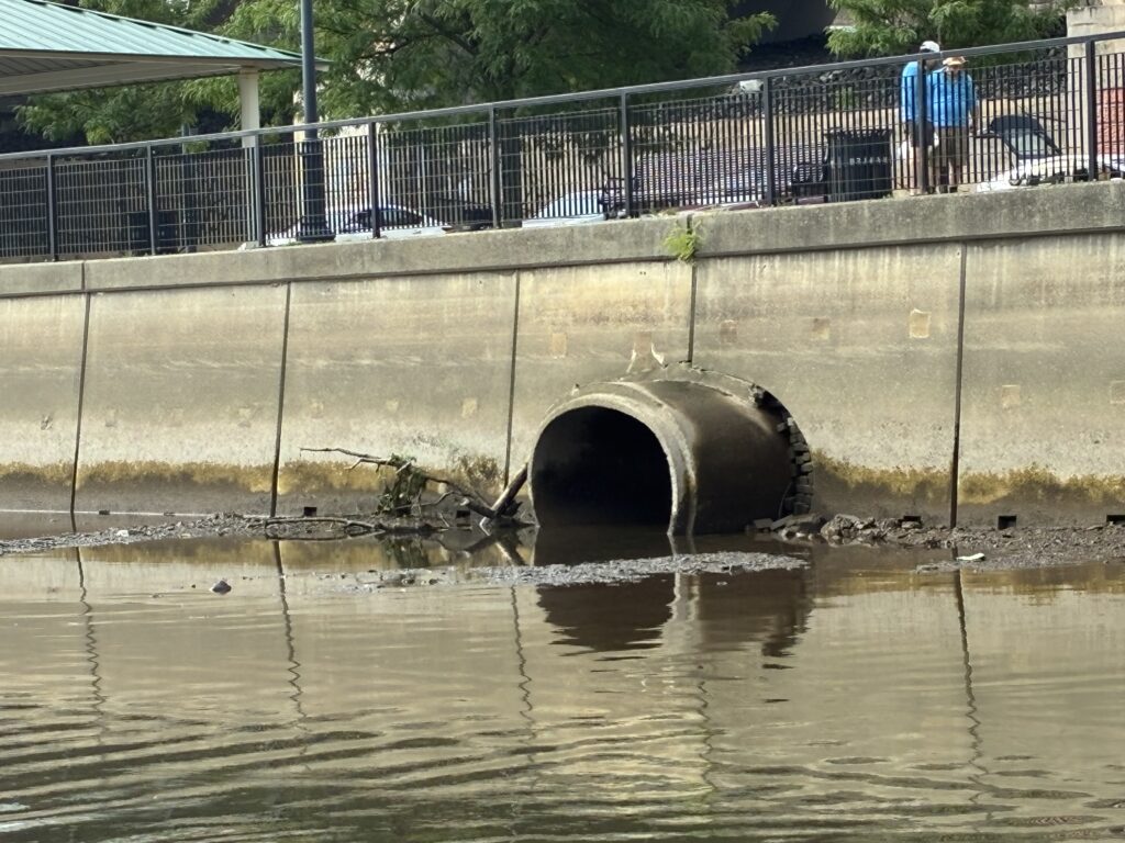
The outfall pipe at Rutgers Boathouse completely exposed. Photo by Endurance Laryea.
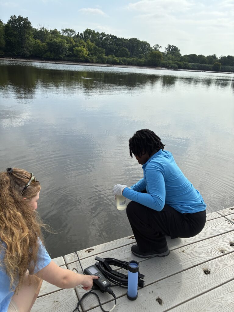
Endurance takes the sample while Ashley records measurements. Photo by Paula Rubio.
John shows the team where the drains connect to the outfall. Photo by Endurance Laryea.
Some geese and deer were spotted here too.
Photos by Endurance Laryea and Paula Rubio.
What seemed to be used votive candle containers were spotted at the mouth of the outfall pipe. John jumped down to identify and retrieve as much as he could–a bold move worthy of its own theme music.
“John displayed amazing dexterity and catlike reflexes to retrieve and identify candles”–funny remark from Mike on John’s daring move. Photo by Endurance Laryea.
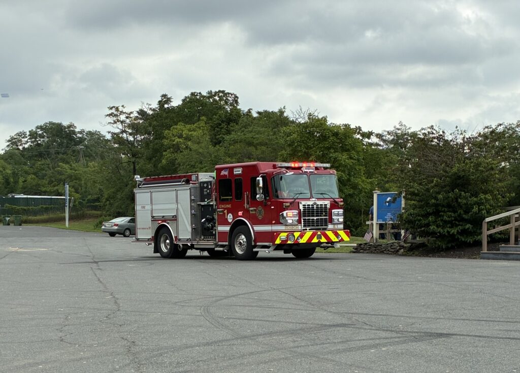
Mystery foam at Edison today!
We came to meet the Fire Truck parked at the Edison Boat Basin parking lot, close to the bridge across Mill Brook stream–a stream that flows into the Lower Raritan. Upon further inquiry by John and Mike, they were told that a fisherman had called the fire department concerning a questionable amount of foam in the Mill Brook stream.
Photos By Endurance Laryea.
On the theme of courageous moments today, the LRWP team offered to take a sample and get it tested if possible. Braving numerous potential hazards, Mike and I accompanied Ashley with John, the video director, in tow to collect a sample of the foam and water in a bottle since we did not have an extra sample bottle.
John later joined Ashley in the stream to test for the pH of the bubbles. Photos by Endurance Laryea.
On the brighter side at the dock of the boat basin, two men were spotted crabbing while we collected our sample sampled and recorded our measurements.
John, the video director, takes photos while two men crab at the dock. Photo by Endurance Laryea.
Our next site, Sayreville…
We think the baby ospreys have hatched! Can you tell in the photo? Photo by Endurance Laryea.
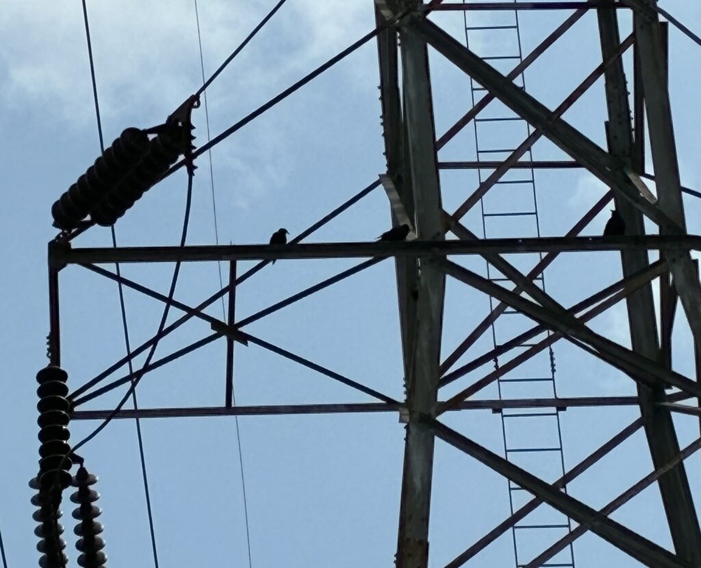
The cutest crows I have ever seen. Photo by Endurance Laryea.
Photo by Endurance Laryea.
(What was Dr. John Doing)
“Once you see it, you can’t leave it!”-Mike. Trust Mike to go into any corner to pick up trash so long as his eyes sights it!
Mike on trash pick-up duty in Sayreville. Photo by Endurance Laryea.
John and Mike inspecting foam that was suspected to be detergent used to wash off the boat docks at Sayreville. Photo by Endurance Laryea.
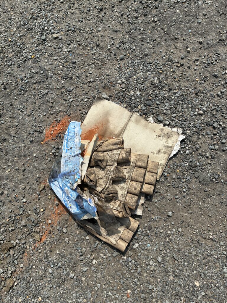
This was the second used firework packaging we came across today. I’m sensing a strong July 4th energy. Photo by Endurance Laryea.
Like a reward, after the mysterious events the preceded this morning, we were taken down a sweet memory lane at Waterfront Park, South Amboy by a man who recognized the LRWP team. During one of the monitoring sessions last year, his grandson had fun joining John into the river to collect a sample in his adorable waders. It was such a wholesome moment!
Photos by Endurance Laryea.
John, the video director, films as I go in to take measurements at South Amboy. Photo by Endurance Laryea.
Mike has a souvenir for John –the shell of a horseshoe crab.
Last site–Perth Amboy!
More films at Perth Amboy. Photo by Endurance Laryea.
John shares LRWP postcards with locals. The dog seems to capture his attention. Photo by Endurance Laryea.
It’s a wrap at Perth Amboy minutes before the sky opens its flood gate. Alexa from the Interstate of Environmental Commission (IEC) comes to pick up our samples and provide us with more sampling bottles, calibrating buffers and gloves sufficient for the next couple of weeks.
Photos by Endurance Laryea.
An adventurous monitoring session as usual. Hope you can join us one of these days of monitoring. Stay dry and cool!
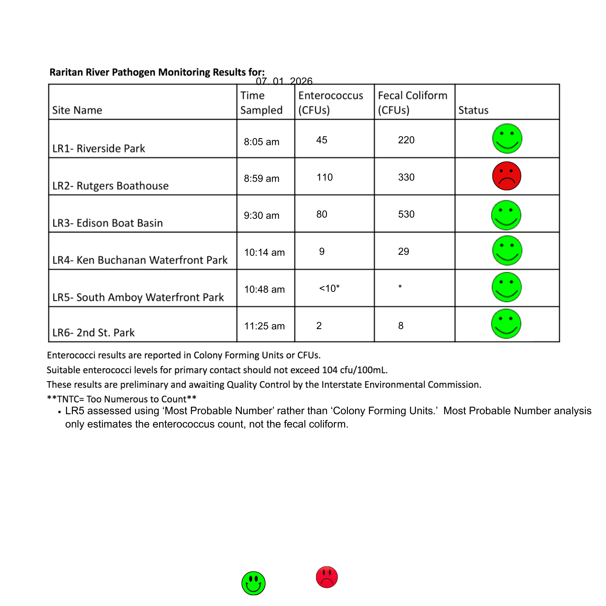
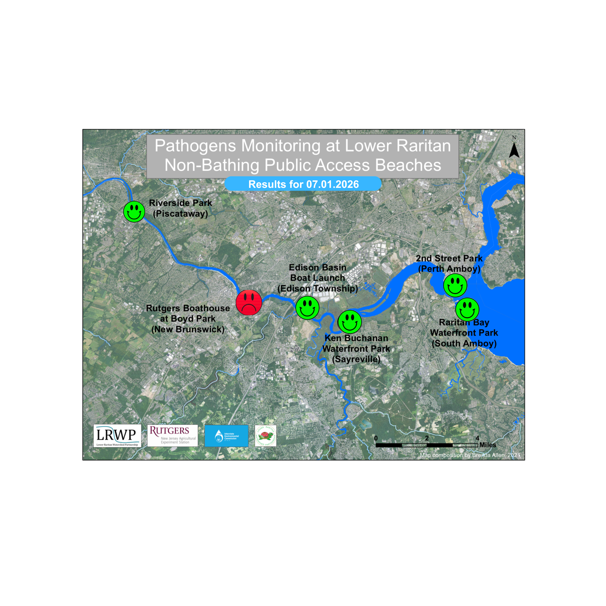
The first pathogen monitoring session of the month took place on Thursday, July 1st. Each week during the summer, from May to October, the Lower Raritan Watershed Partnership and Rutgers Cooperative Extension of Middlesex County run a volunteer-based monitoring program along the Raritan River. We collect water quality samples at six non-bathing public access beach sites, provide our samples to the Interstate Environmental Commission for analysis in their laboratory, and report the results to the public. Our mission is to share this data with the community and partners to ensure the safe use of the Raritan river for all.
Our lab results for water quality samples taken on Thursday, July 1st, 2026 show Enterococcus bacteria levels exceeding the EPA federal water quality standard of 104 cfu/100mL at one of our monitoring sites this week. Problem sites are indicated by red frowns on the map and chart: Rutgers Boathouse (New Brunswick). Green smiles on the chart and map indicate the sites with bacteria levels safe for recreation, and include the following: Riverside Park (Piscataway), Edison Boat Basin (Edison), Ken Buchanan Waterfront Park (Sayreville), Raritan Bay Waterfront Park (South Amboy), 2nd Street Park (Perth Amboy). For South Amboy, we were unable to analyze enough fluid to complete the membrane filtration process required to measure Colony Forming Units. We have therefore marked that site with an asterisk. Statistical analysis of the sample produced a ‘Most Probable Number’ of 63 enterococci per 100 mL, and we were unable to assess fecal coliform.
Typically, whenever Rutgers Boathouse fails the pathogens test, we see the upstream site (Riverside Park) fail too. This makes the July 1st results somewhat surprising! Our team did notice that on July 1st there was an unusual amount of bird waste on the dock at Rutgers Boathouse, and this may have contributed to the site’s failure.
Pathogens/Enterococci levels are used as indicators of the possible presence of disease-causing bacteria in recreational waters. Such pathogens may pose health risks to people coming in primary contact with the water (touching) through recreational activities like fishing, kayaking or swimming in a water body. Possible sources of bacteria include Combined Sewer Overflows (CSOs), improperly functioning wastewater treatment plants, stormwater runoff, leaking septic systems, animal carcasses, pet waste, wildlife waste, and runoff from manure storage areas.
In order to better understand why Riverside Park, Piscataway is our worst performing site over the past six years, we have started sampling further upstream, as well as in the historic Delaware & Raritan Canal. On July 1st, we sampled Five Mile Lock in Somerset County, which is in the canal just across from Riverside Park. The lab analysis produced an estimate of 58 enterococci ‘colony forming units’ per 100 mL, and 60 fecal. We find it interesting that all of our canal sites have had less entero and fecal than the adjacent river. The waters in the canal appear relatively stagnant and we expected worse results than we see.
Our goal in reporting these results is to give residents a better understanding of the potential health risks related to primary contact during water-based recreation. If you are planning on recreating on the Raritan this weekend, make sure to stay safe and wash up after any activities!
By Endurance Laryea, LRWP Summer Research Intern and J.M. Meyer.
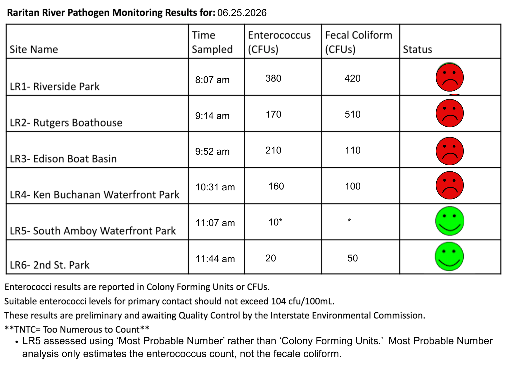
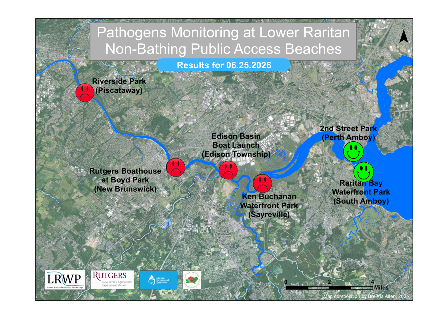
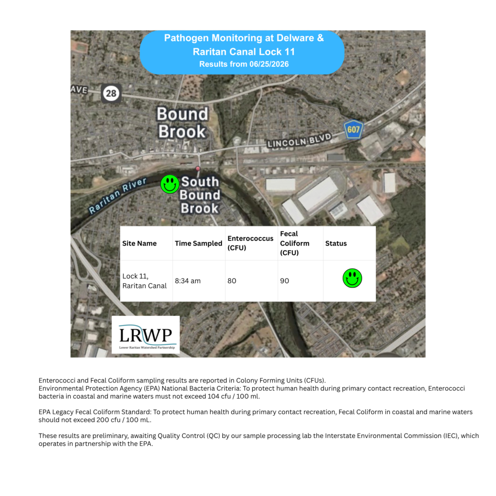
The last pathogen monitoring session of the month took place on Thursday, June 25th. Each week during the summer, from May to October, the Lower Raritan Watershed Partnership and Rutgers Cooperative Extension of Middlesex County run a volunteer-based monitoring program along the Raritan River. We collect water quality samples at six non-bathing public access beach sites, provide our samples to the Interstate Environmental Commission for analysis in their laboratory, and report the results to the public. Our mission is to share this data with the community and partners to ensure the safe use of the Raritan River for all.
Our lab results for water quality samples taken on Thursday, June 25th, 2026, show Enterococcus bacteria levels exceeding the EPA federal water quality standard of 104 cfu/100mL atone of our monitoring sites this week. The problem site is indicated by the red frown on the map and chart: Riverside Park (Piscataway), Rutgers Boathouse (New Brunswick), Edison Boat Basin (Edison), Ken Buchanan Waterfront Park (Sayreville). Rutgers. Green smiles on the chart and map indicate the sites with bacteria levels safe for recreation and include the following: 2nd Street Park (Perth Amboy), and South Amboy Waterfront Park.
Pathogens/Enterococci levels are used as indicators of the possible presence of disease-causing bacteria in recreational waters. Such pathogens may pose health risks to people coming in primary contact with the water (touching) through recreational activities like fishing, kayaking or swimming in a water body. Possible sources of bacteria include Combined Sewer Overflows (CSOs), improperly functioning wastewater treatment plants, stormwater runoff, leaking septic systems, animal carcasses, pet waste, wildlife waste, and runoff from manure storage areas.
In order to better understand why Riverside Park, Piscataway has been our worst performing site over the past six years, we have started sampling further upstream. On June 25th, we sampled the Lock site a second time since we started pathogens monitoring this season. The lab analysis produced 80 enterococci cfu per 100mL which flies beneath the EPA federal water quality standard of 104 cfu/100mL. Once again, the D&R Canal has proved cleaner than the site at Riverside Park, Piscataway.
Our goal in reporting these results is to give residents a better understanding of the potential health risks related to primary contact during water-based recreation. If you are planning on recreating on the Raritan this weekend, make sure to stay safe and wash up after any activities!
On a clear and sunny morning, the team set out today for the fourth monitoring session of the month. Most of the sites were serene with little activity. A beautiful reminder that rest is part of nature.
The team, today! Mike, Ashley, Paula, Endurance and Heather (taking the photo)- Photo by Heather Fenyk.
With beautiful smiles, Paula and Ashley pause quickly for a moment from calibrating the sonde to pose for a quick photo. Photo by Endurance Laryea.
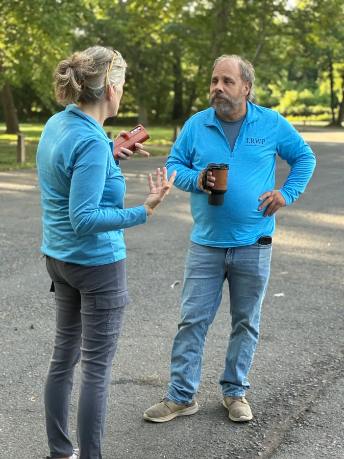
Mike and Heather had an intriguing conversation about landscape development—discussing ways in which the environment around the river sites we visit can be improved to help water safety.
Launching the day’s sampling at our first site, Riverside Park, is Ashley taking the sample. Photo by Endurance Laryea.
Paula records the values of pH, salinity, chlorophyll RFU, oxygen saturation, temperature amongst others from the sonde. Photo by Endurance Laryea.
Heather on trash pickup duty at Riverside Park. Photo by Endurance Laryea.
We visited Lock 11 for the second time. It is amongst the four new sites we are investigating this summer, and it passed the EPA safety level for enterococcus CFU on our last visit, and it passed again this time with a value of 80 CFU, below the safety level of 105 CFU.
Heather, Ashley, and Paula take measurements from the canal at Lock 11 while Mike completes the visual assessment form. Photo by Endurance Laryea.
Photo by Paula Rubio.
Of all the sites, New Brunswick was our busiest site today.
At Rutgers Boat House, two fawns and a doe were spotted on the other side. We thought they were the cutest things we saw today! Photo taken by Ashley Fritz.
That’s Asley’s favorite bird, the Great Blue Heron! Photo by Ashley Fritz.
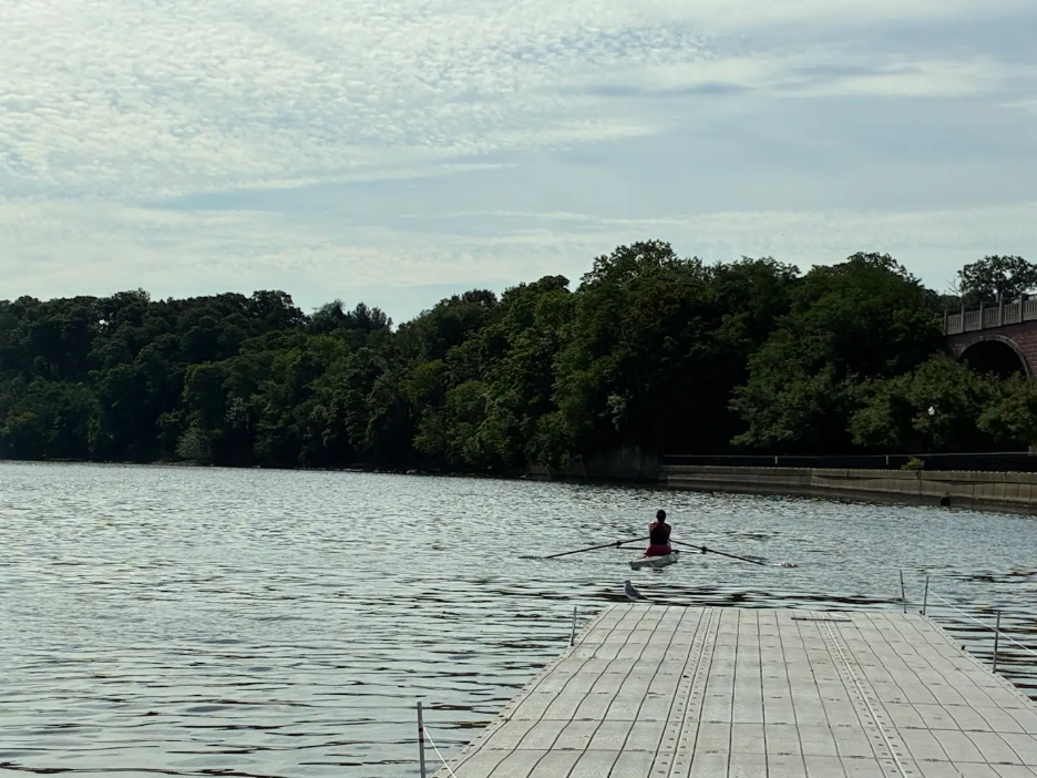
Today is not the first time seeing this Rutgers rower and her coach. But today, the team had the opportunity to explain what the Lower Raritan Watershed Partnership and its team does.
Photo by Ashley Fritz.
Grass being cut from the vegetation near the boat house floating near the dock. Photo by Endurance Laryea.
Heather was so excited about Paula’s nails matching LRWP’s colors that she had to take a picture! Photo by Heather Fenyk.
Not much was happening at Edison Boat Launch today, but we did speak to this nice fisherman with his line and hook and bait. He had not caught any fish at the time of our conversation and reasoned that it may be due to low tides. He was the only one at the boat launch by the time we were done and leaving. Photo by Endurance Laryea.
Ashley and Paula recording values at Sayreville. Photo by Endurance Laryea.
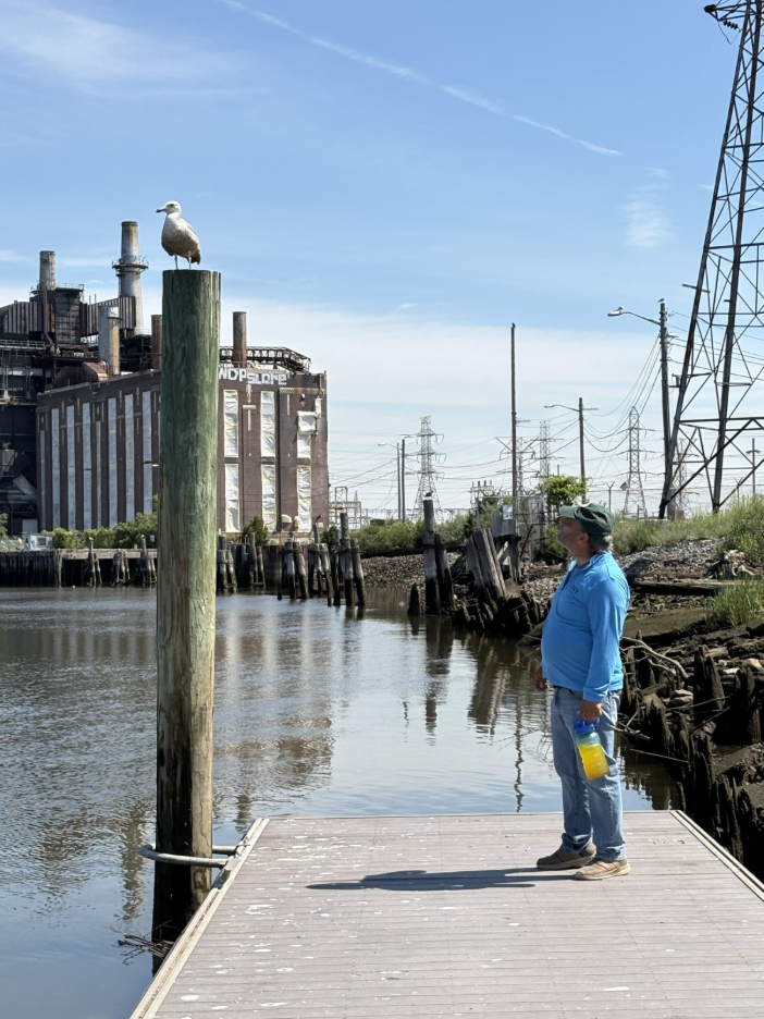
Taken aback by the presence of the seagull on the pole, after he has stood by the pole for a while without noticing it, Mike expresses his surprise to the seagull as though it can understand him. A funny encounter that I had to capture. Photo by Endurance Laryea.
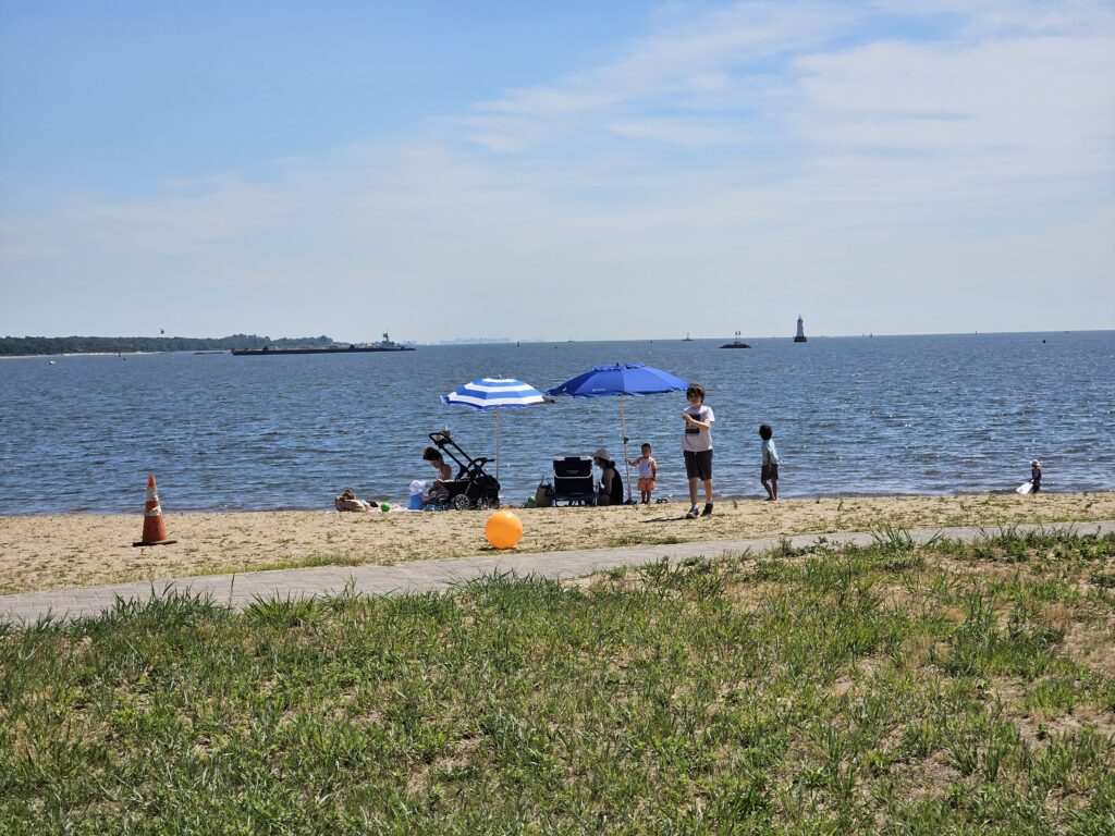
A family spotted picnicking at Waterfront Park, South Amboy. Photo by Heather Fenyk.
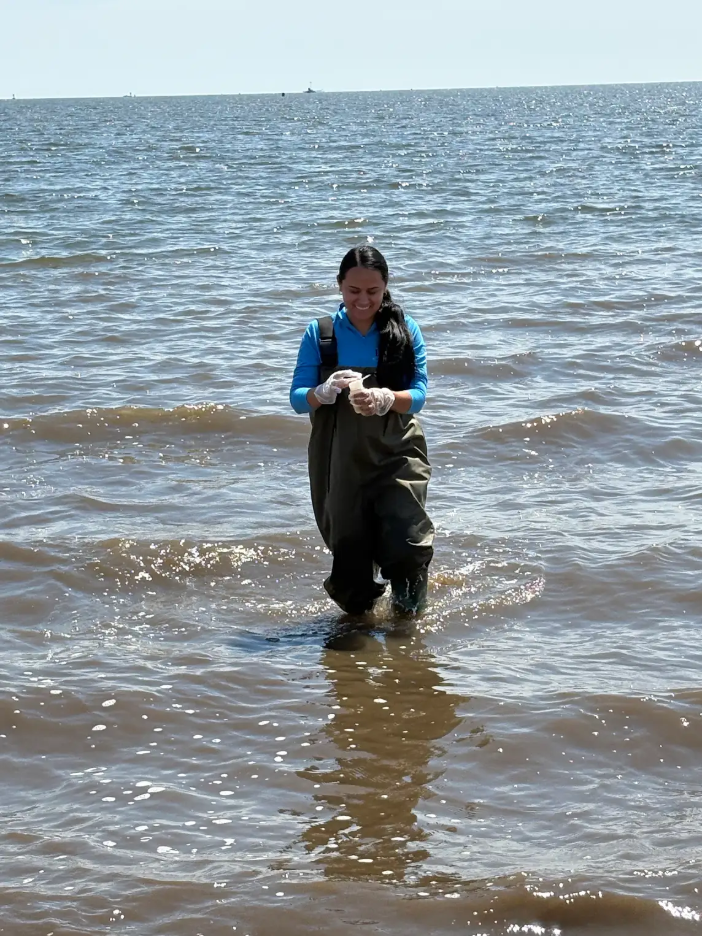
Paula on sampling duty at South Amboy. Photo by Endurance.
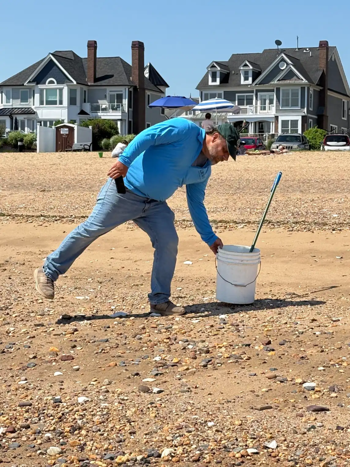
Mikeon trash pickup duty. Photo by Endurance Laryea.
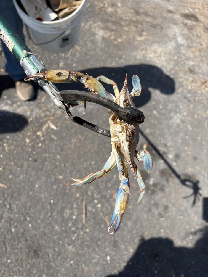
A dead blue crab on the shore at Waterfront Park, South Amboy.
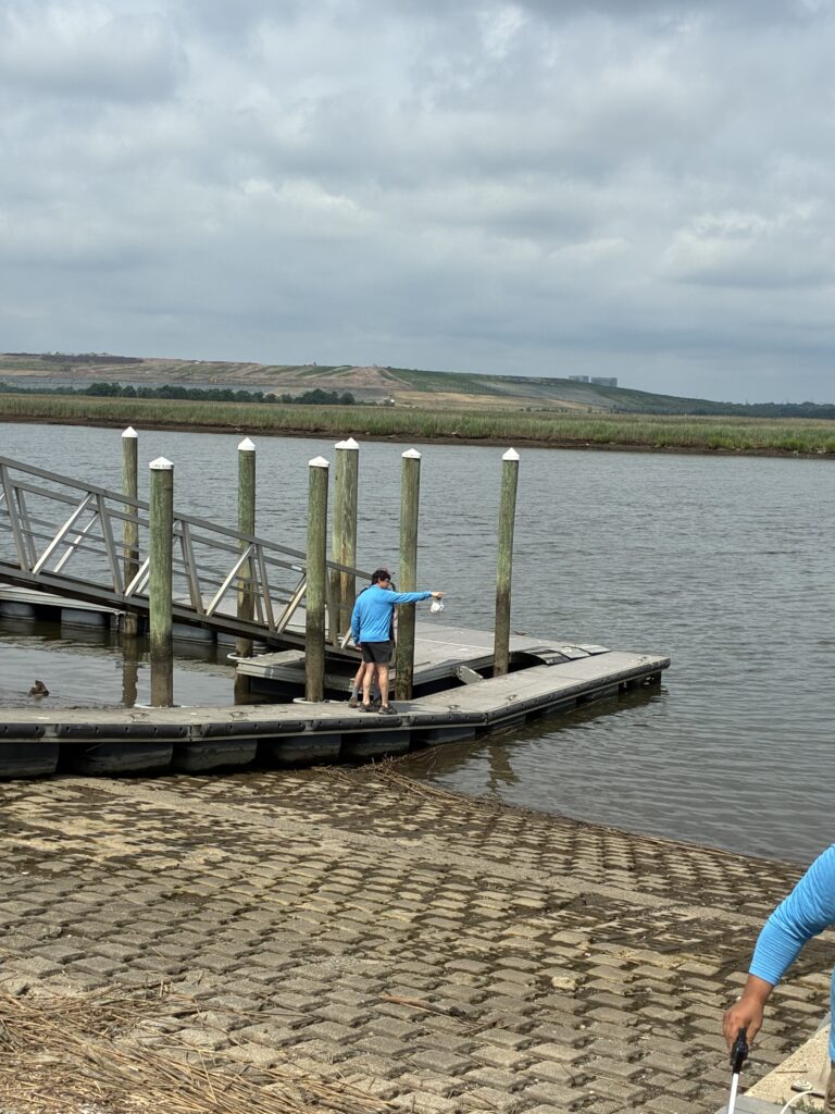
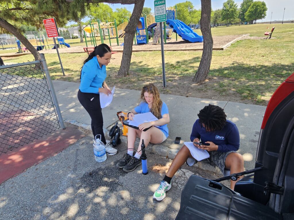
Our monitoring session was wrapped up at 2nd Street Park, Perth Amboy. The last sample bottle of the day was added to the cooler. We proceeded with the post-sampling calibration of the sonde as we waited for Alexa, a representative from the Interstate Environmental Commission (IEC), to pick up our samples and send them to the lab for testing.
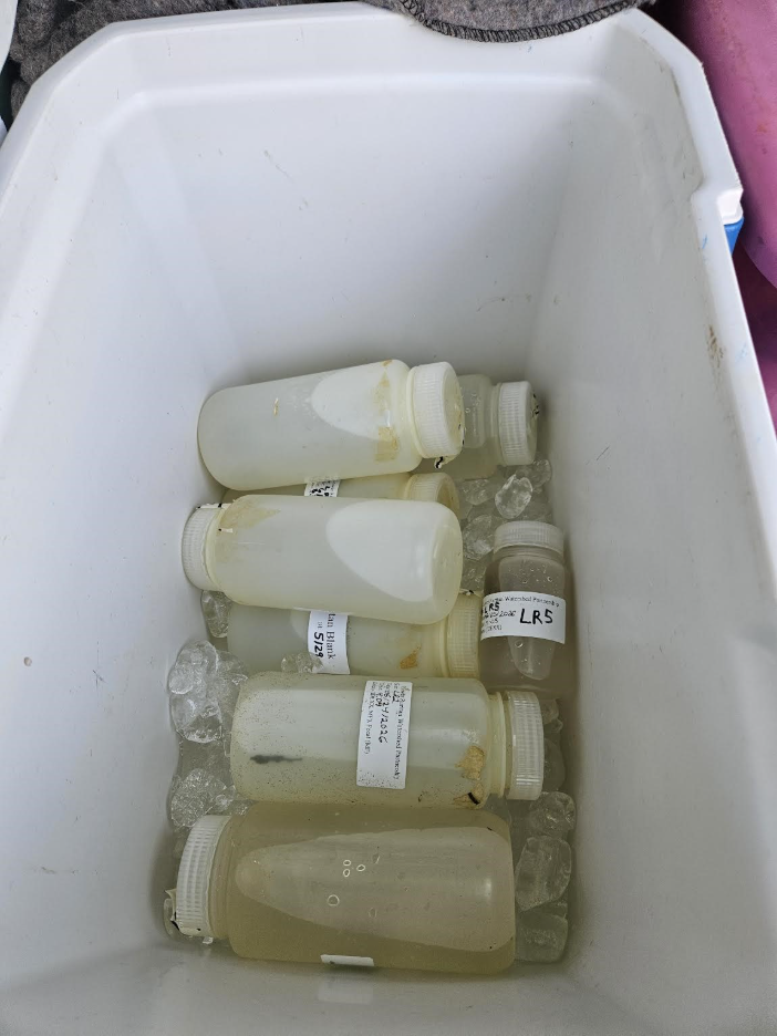
Samples from all seven sites visited today and a blank sample. The blank sample is a sample of pure water which is placed together with the samples in the cooler and used as a reference for comparison during testing—it serves as a control. Photo by Heather Fenyk.
Paula, Ashley, and Endurance handling post-sampling calibration and visual habit evaluation. Photo by Heather Fenyk.
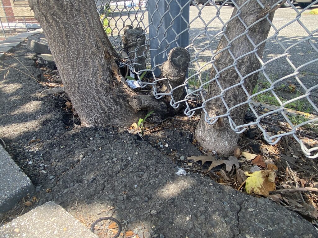
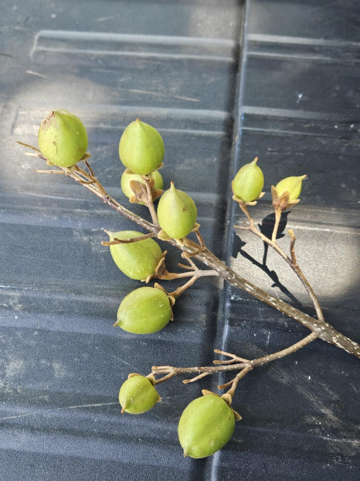
We ended the session today with a lesson on resilience from this tree. The tree grows through the chain link fence of a parking lot in the elementary school at Perth Amboy. Regardless of its compromising habitat, the tree is keeps thriving and bearing fruits!
By Endurance Laryea, LRWP Summer Research Intern and J.M. Meyer.
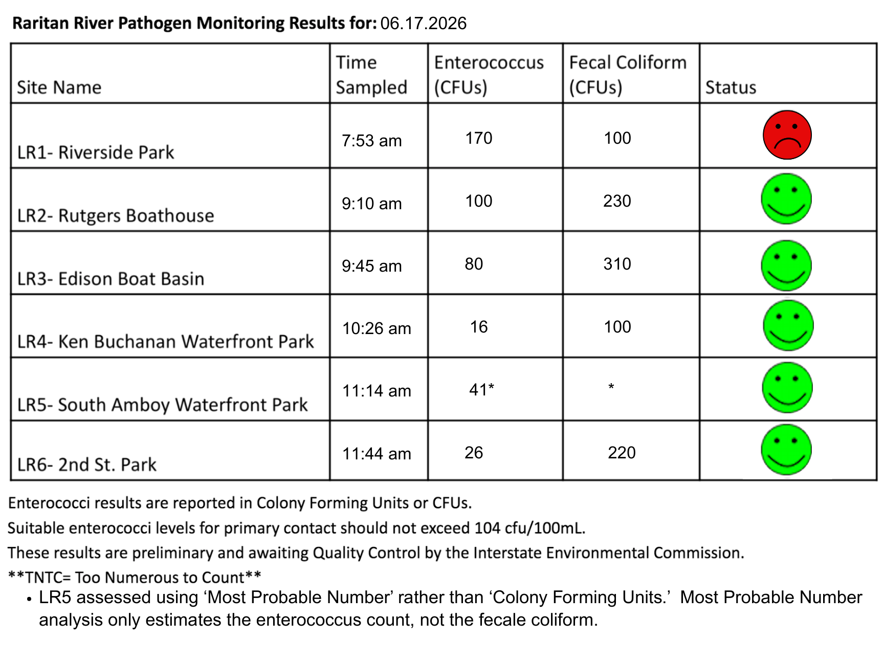
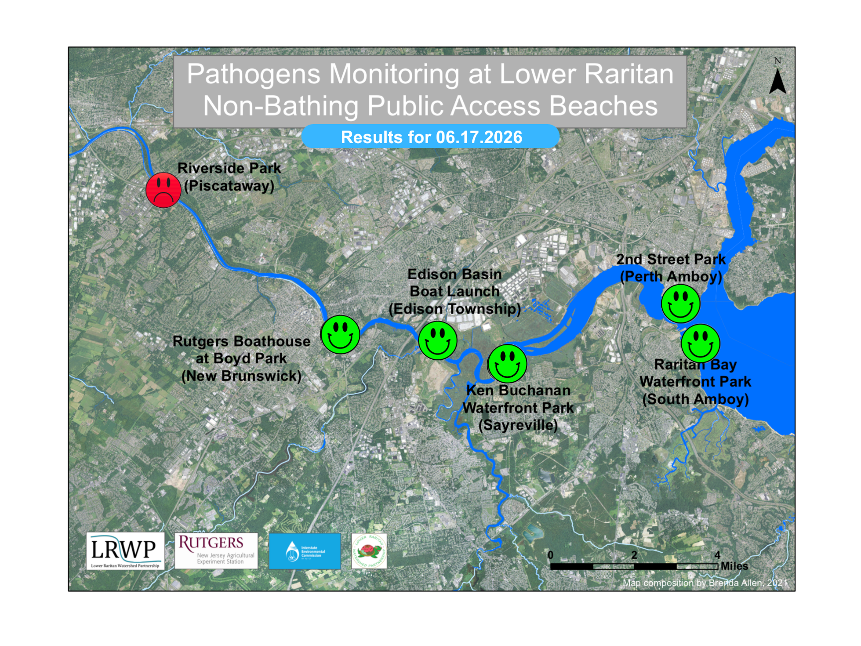
The second pathogen monitoring session of the month took place on Thursday, June 17th. Each week during the summer, from May to October, the Lower Raritan Watershed Partnership and Rutgers Cooperative Extension of Middlesex County run a volunteer-based monitoring program along the Raritan River. We collect water quality samples at six non-bathing public access beach sites, provide our samples to the Interstate Environmental Commission for analysis in their laboratory, and report the results to the public. Our mission is to share this data with the community and partners to ensure the safe use of the Raritan River for all.
Our lab results for water quality samples taken on Thursday, June 17th, 2026, show Enterococcus bacteria levels exceeding the EPA federal water quality standard of 104 cfu/100mL at one of our monitoring sites this week. The problem site is indicated by the red frown on the map and chart: Riverside Park (Piscataway). Green smiles on the chart and map indicate the sites with bacteria levels safe for recreation and include the following: Rutgers Boathouse (New Brunswick), Edison Boat Basin (Edison), Ken Buchanan Waterfront Park (Sayreville)2nd Street Park (Perth Amboy).
Pathogens/Enterococci levels are used as indicators of the possible presence of disease-causing bacteria in recreational waters. Such pathogens may pose health risks to people coming in primary contact with the water (touching) through recreational activities like fishing, kayaking or swimming in a water body. Possible sources of bacteria include Combined Sewer Overflows (CSOs), improperly functioning wastewater treatment plants, stormwater runoff, leaking septic systems, animal carcasses, pet waste, wildlife waste, and runoff from manure storage areas.
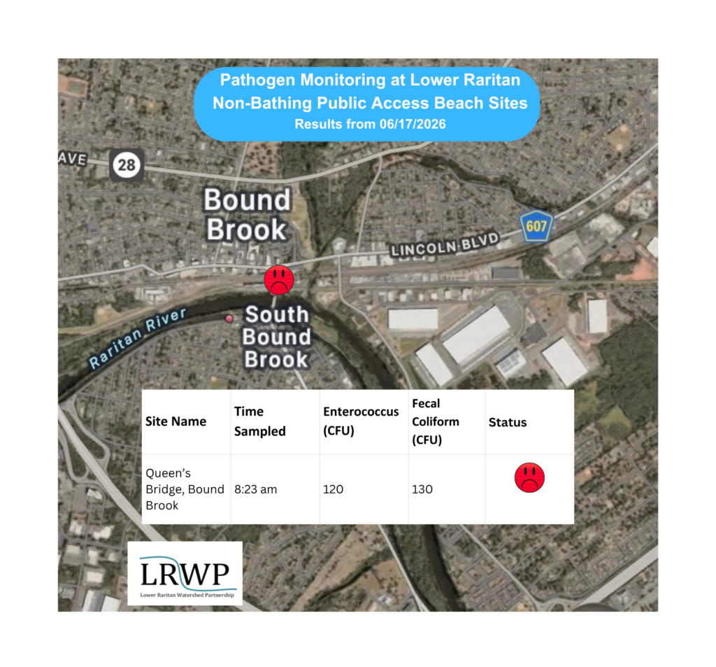
In order to better understand why Riverside Park, Piscataway has been our worst performing site over the past six years, we have started sampling further upstream. On June 17th, we sampled The Queens Bridge Recreational Access/Kayak Launch site a second time since we started pathogens monitoring this season. The lab analysis produced 120 enterococci cfu per 100mL exceeding the EPA federal water quality standard of 104 cfu/100mL. It also failed the test during our first week of monitoring; it was an especially rainy week, and our sample scored a most-probable-number of 2909 entero per 100 mL! Gross! Yet that same rainy week Riverside Park registered a score of more than 6,000 colony forming units per 100 mL.
Perhaps in dry weather we might suggest that upstream flow accounts for most of the bacteria numbers in Riverside Park, but that in wet weather there are many other sources of pollutants. These are interesting if preliminary results.
Our goal in reporting these results is to give residents a better understanding of the potential health risks related to primary contact during water-based recreation. If you are planning on recreating on the Raritan this weekend, make sure to stay safe and wash up after any activities!
This morning’s weather was just perfect for all the exciting adventures we were going to embark on. It was a clear and sunny morning with temperatures in the 70’s.
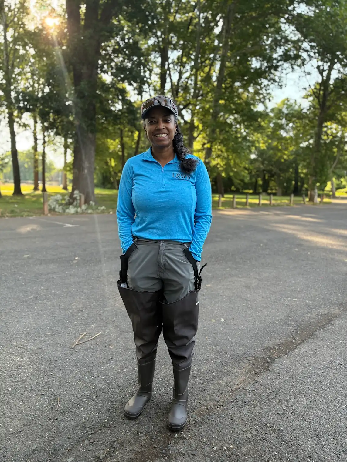
Ready to kick off June 17th’s pathogens monitoring session, Lydia came prepared and excited in her hip waders! Photo by Endurance Laryea.
Our friends at Riverside Park were seen going about their day peacefully. Can you guess why? No Geese chasers to rattle their morning! I am not sure if the Geese Chasers ever came today but for the entire duration of our pathogens monitoring at this site, we did not see the geese and goslings fleeing into the river at the sight of a Geese Chaser car. We were surprised to see how big the goslings have become since we last saw them. Almost the same size as their parents-incredible! Photo by Mike Orsini.
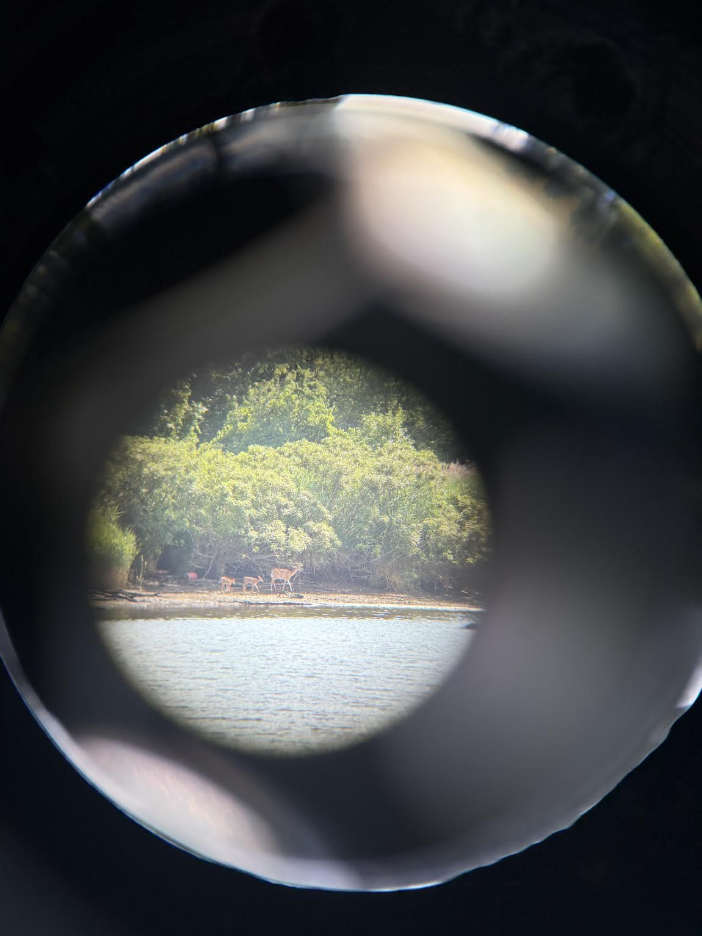
Four deer spotted dashing across the park at Riverside Park. Photo by Endurance Laryea.
Lydia taking a sample at Riverside Park. Photo by Endurance Laryea.
Our second site today was The Queens Bridge Recreational Access/Kayak Launch site. It is one of our four new sites this season and today was the second visit. So much was going in this one site that we would have spent the whole morning exploring it if care was not taken! John and Mike talked about the trees; Lydia, some other plants like lady’s thumb and poison ivy; and Art about the birds. Their enthusiasm for what they knew was so contagious that it made me excited even if I did not know what they were talking about.
Mike and John sampling duties at Queens Bridge. Photo by Endurance Laryea.
Barn swallows spotted under the bridge at Queens Bridge. Art explained that they got their names because of their habit of building nests in barns, sheds and similar man-made structures. John noted that they were not present the last time they visited this site in the first week of pathogens monitoring. Photo by Endurance Laryea.
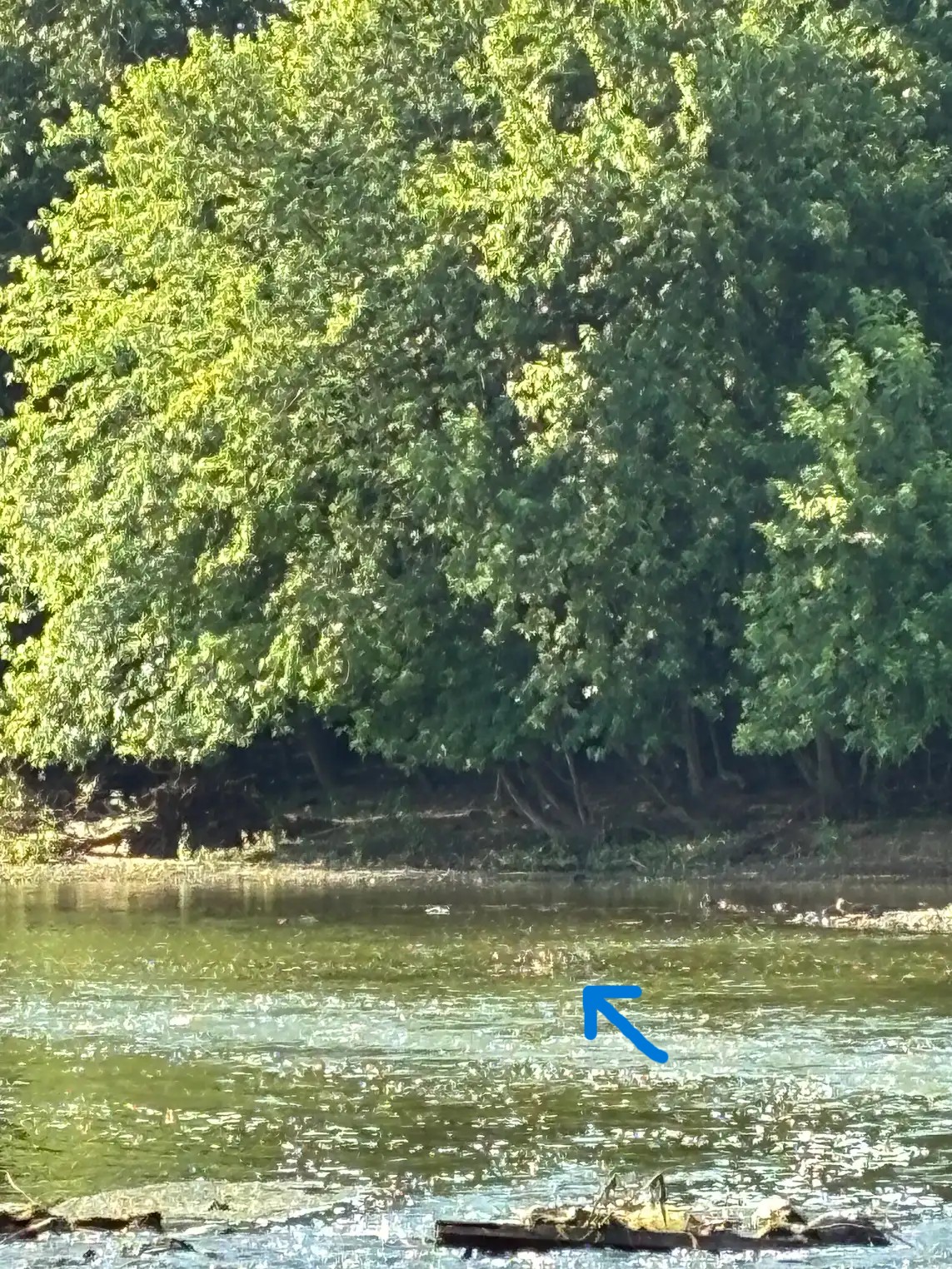
A deer sighted across the river from us. Photo by Endurance Laryea.
We also saw a flotilla of goslings paddling across the river without a parent goose. Photo by Endurance Laryea
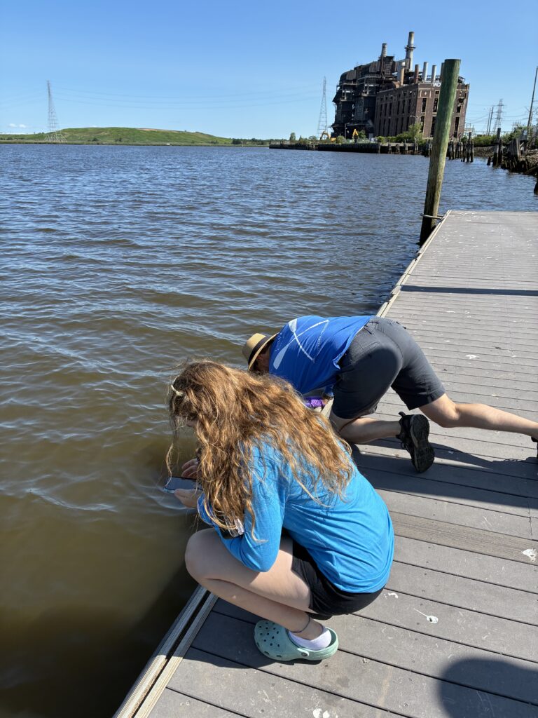
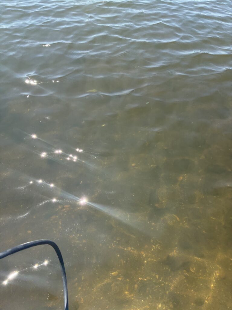
At Rutgers Boathouse today, we noticed high tide. And for the second time, we saw the minnows. It seems to me that they are observed when there is high tide because we did not see them last week when there was low tide.
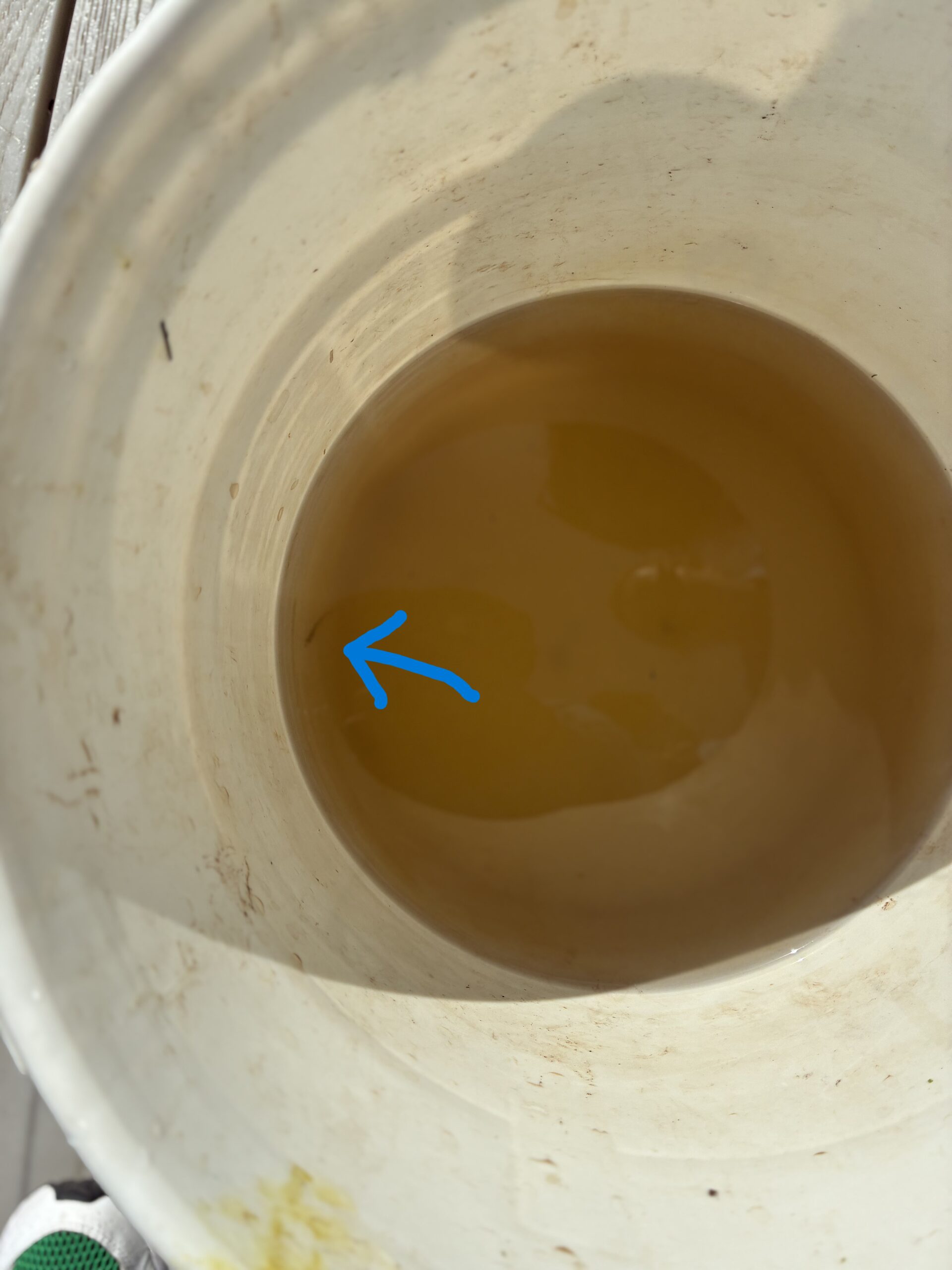
In our grand effort to capture them in a bucket so that we get a better view of them, we only caught one-barely noticeable- out of the thousands we saw. They are incredibly sensitive to disturbances. Photo by Endurance Laryea.
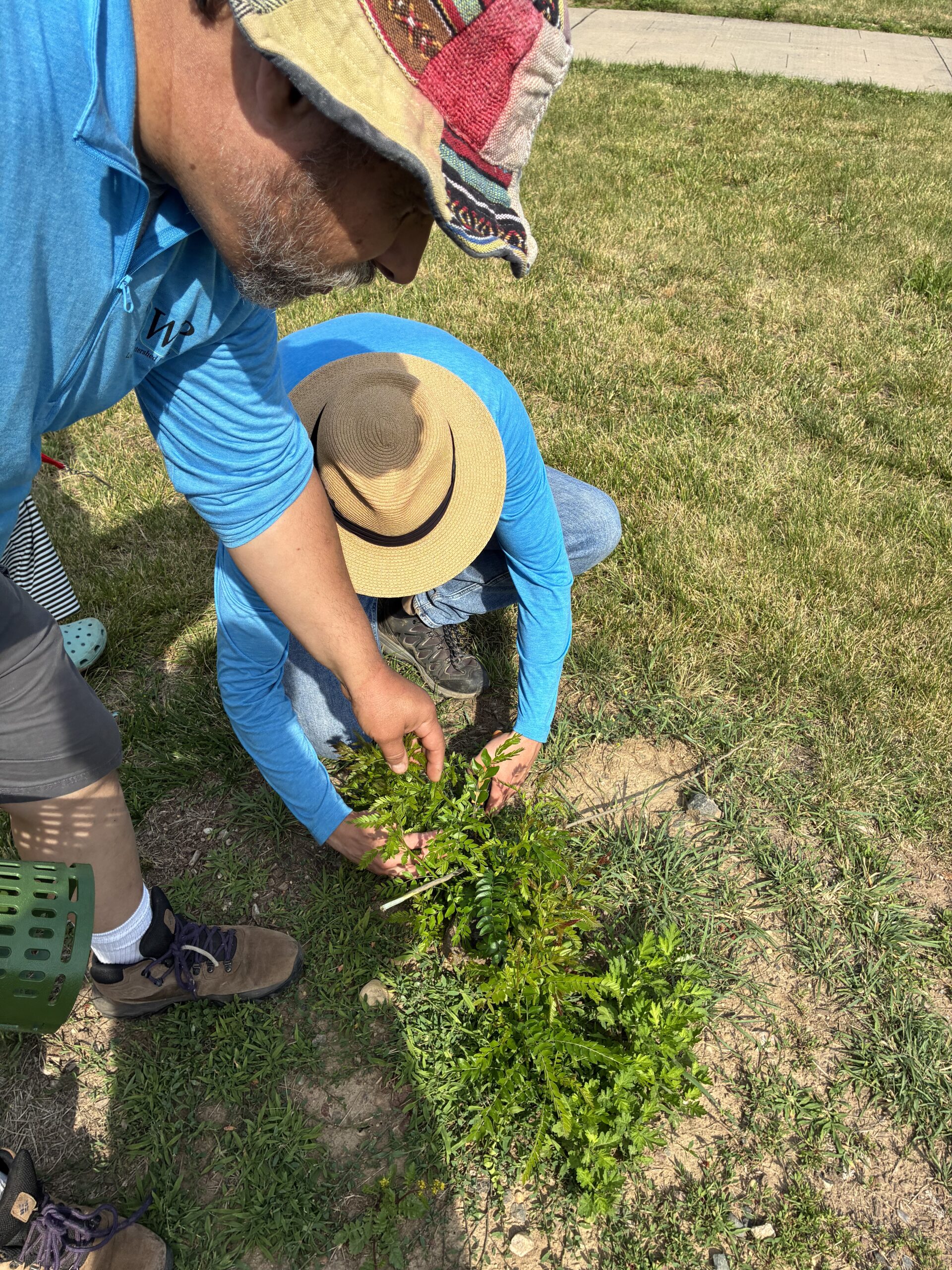
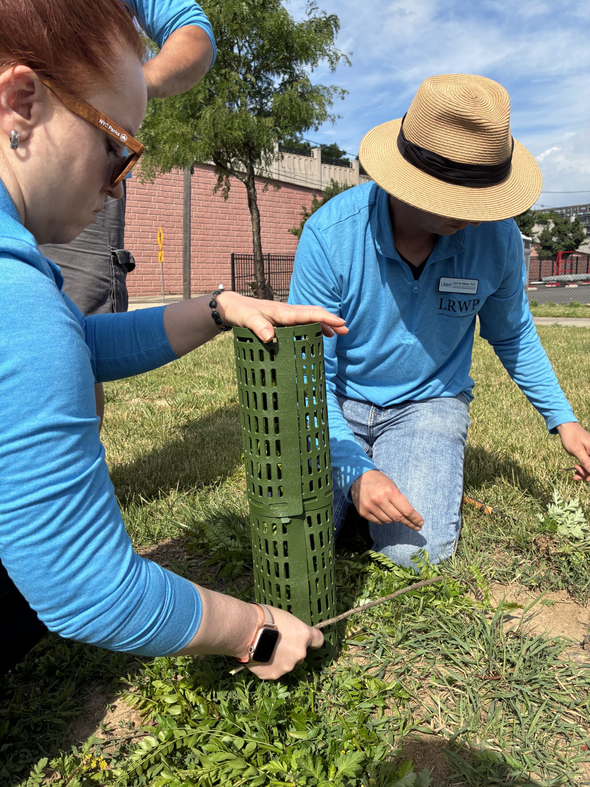
There are a few honey locust stumps that have started to grow little sprouts at the New Brunswick site. John and Mike have chosen one to put a guard around and see how it fares for the week. The smaller branches were pruned, and the guard was put around the tallest branch to enable it grow as a ‘leader’ without significant competition from rival sprouts.
Mike and John pruning the little branches of the honey locust stump. Photo by Endurance Laryea.
Olesya and John stabilizing the guard with twigs. Photo by Endurance Laryea.
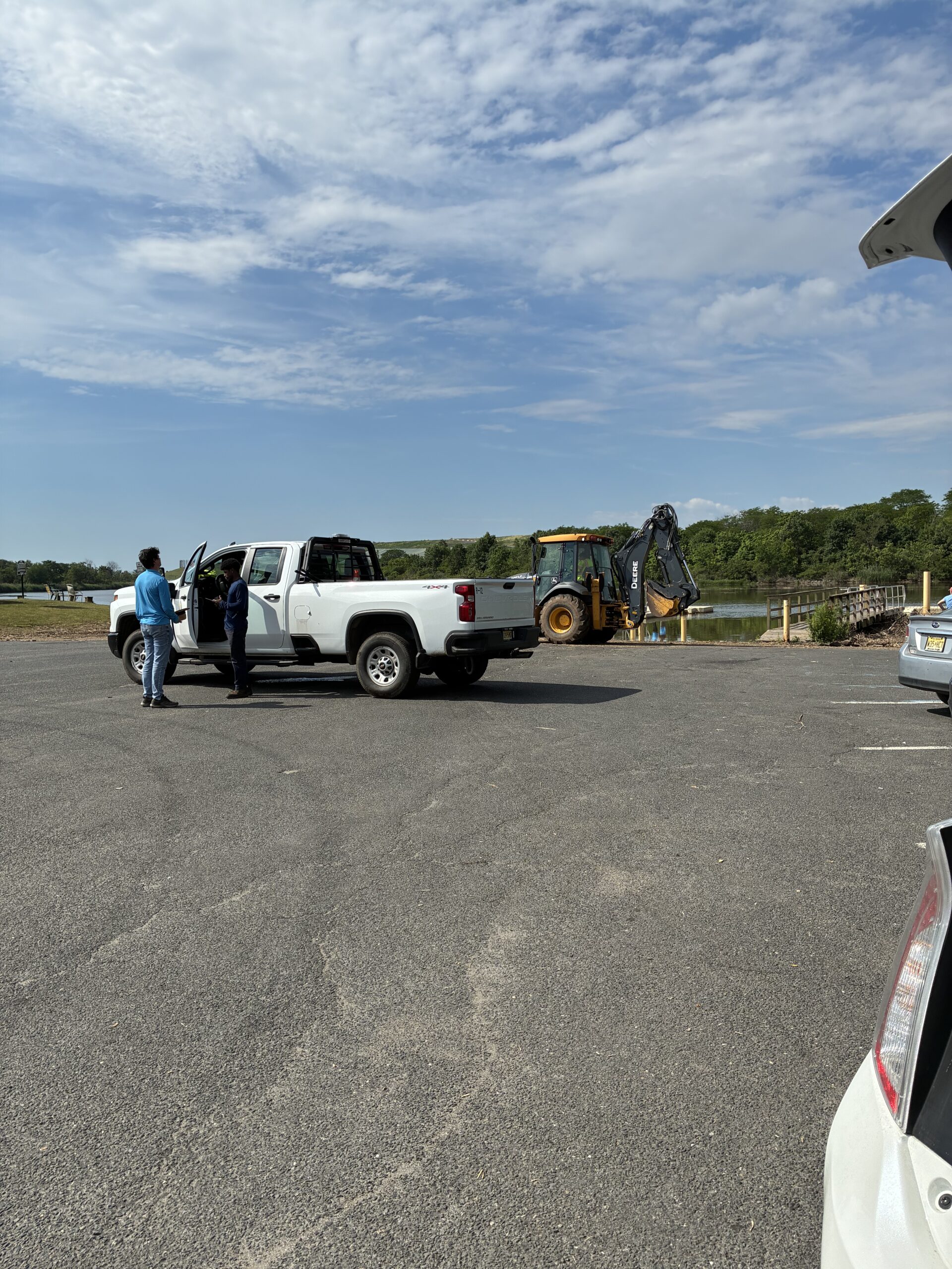
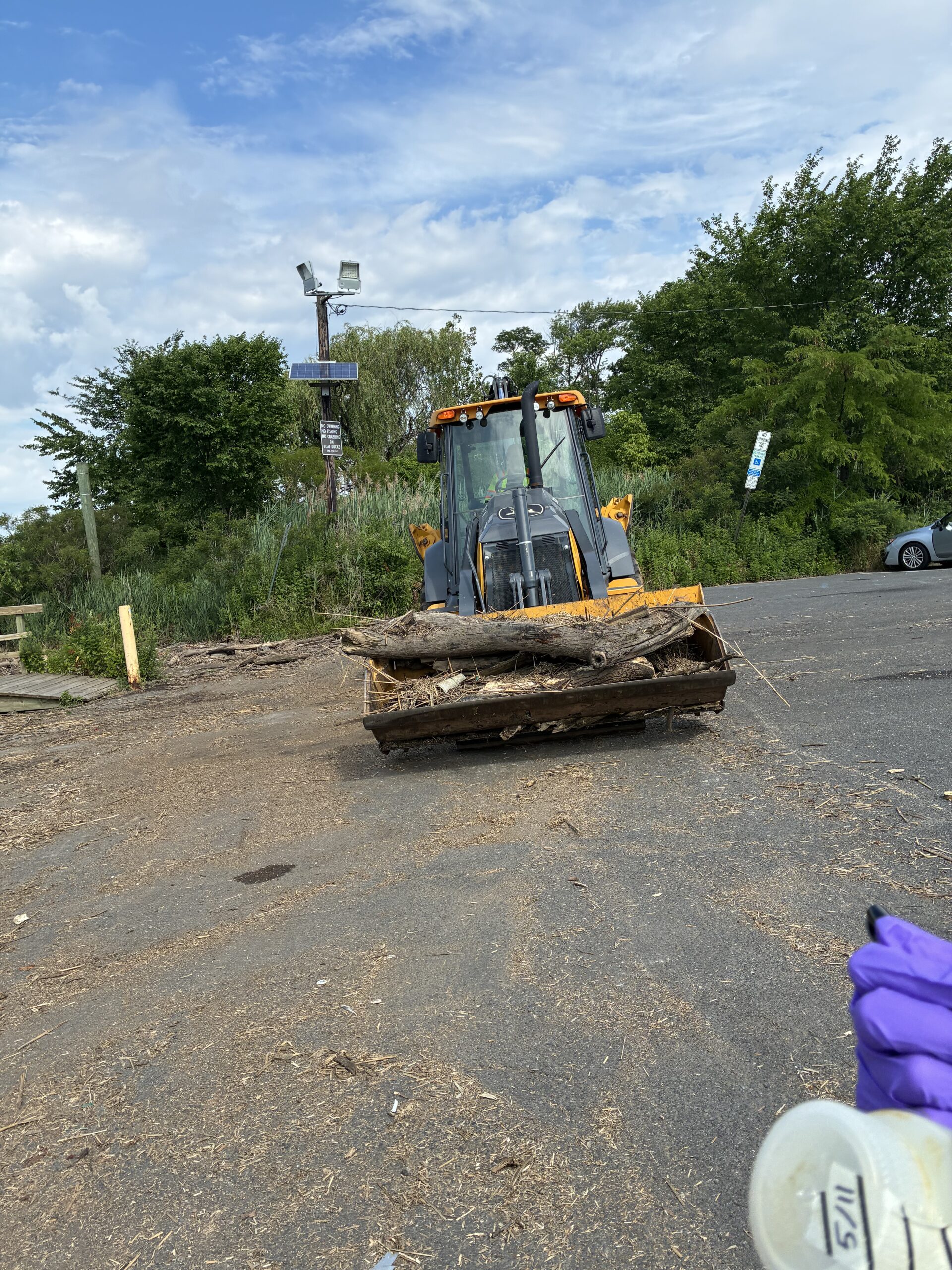
Clean up at Edison Boat Launch today!
After John inquired about what they were doing, the public service workers explained that they were cleaning up the debris between the two docks on the river to allow easy access by boats and kayaks.
A backhoe loader used in the debris clean up. Photo by Endurance Laryea
Every time we visit this site, we try our best to pick up trash caught up in the debris. It is so much that we only do what time allows. It would be lovely if everyone who visits picks up a few pieces of garbage-with proper protective wear, of course 🙂
Art and Mike on trash duty. Photo by Endurance Laryea.
Not much activity other than our familiar friends were spotted at Sayreville — several seagulls, but only one osprey in the nest, instead of the mated pair we saw last week.
Photos by Endurance Laryea.
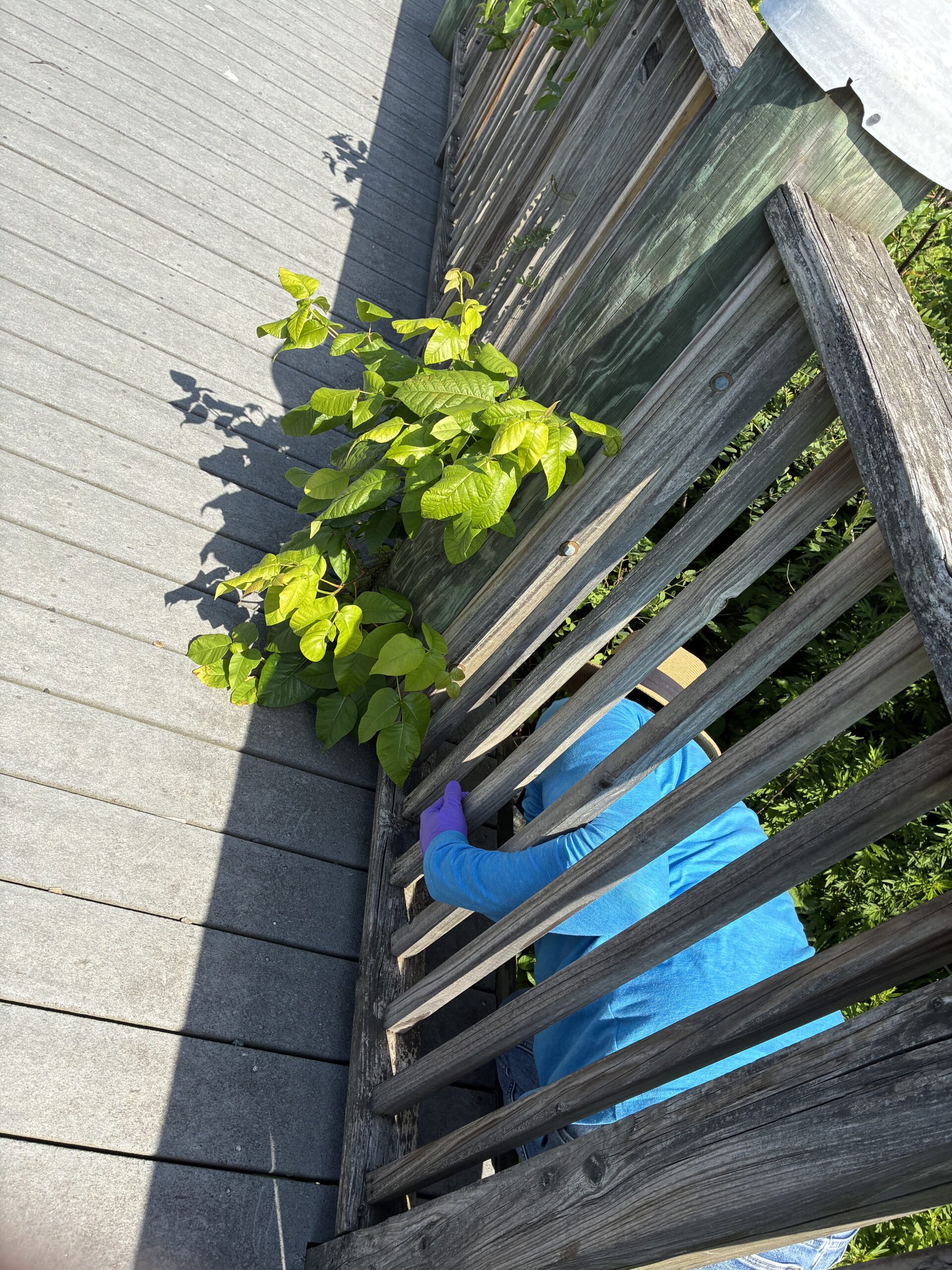
John cutting the roots of a Poison Ivy plant that has grown through the dock railings. With the number of Poison Ivy plants pointed out today, I am certain that I will be able to spot them in the future–hopefully. Photo by Endurance Laryea.
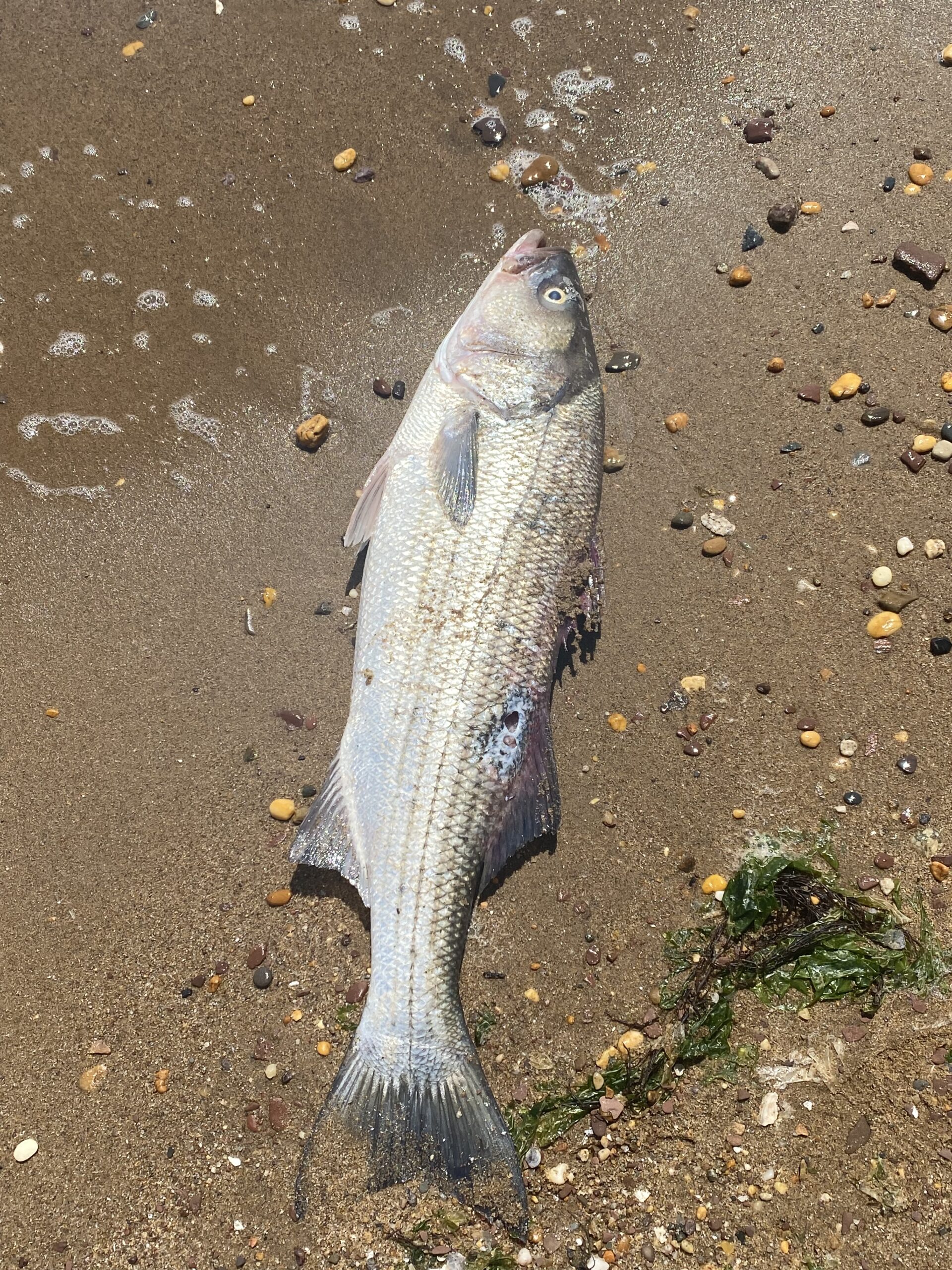
If you have been following our blog posts this summer, you may have read that it striped bass season. In our second week, we saw what seemed to be the gills of a striped bass on the shore of the Raritan Bay Waterfront Park in South Amboy. Today, we saw a dead striped bass on the shore with a decaying hole close to the second dorsal fin. It could have been washed to the shore a few minutes or hours before we got there because it did not give off a decaying odor and it looked pretty fresh.
A dead striped bass at the shore on Raritan Bay Waterfront Park, South Amboy. Photo by Art Allgauera.
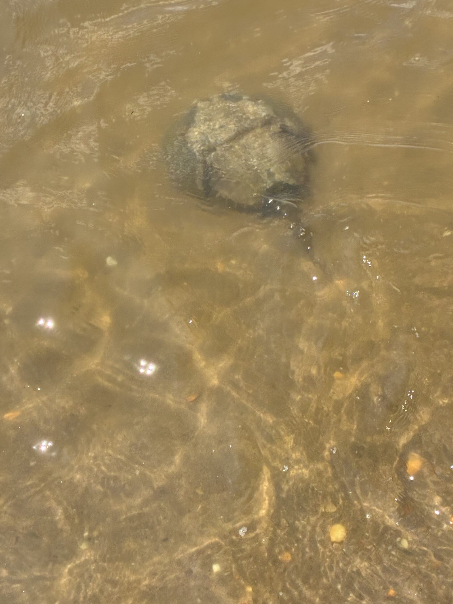
It is also horseshoe crab mating season. I felt something tap the boots of my waders in Perth Amboy while collecting the last sample of the day. I looked down to see a curious horseshoe crab coming towards my boots a second time. They are not dangerous so try not to panic the next time you encounter them 🙂
As I looked down to figure out what tapped my boots, I also noticed a cluster of minnows circling around me. Photos by Endurance Laryea.