Article by Joe Mish. Aerial images taken on flight provided by Lighthawk compliments of No Water No Life
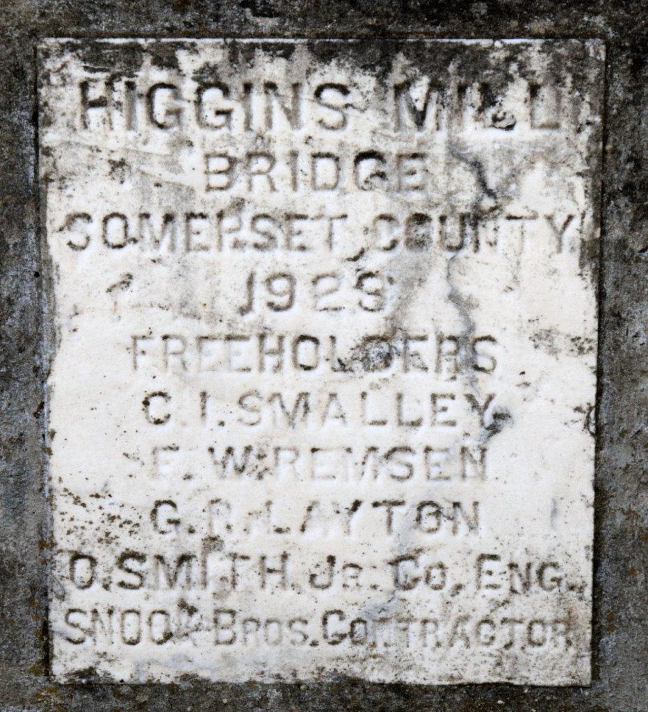
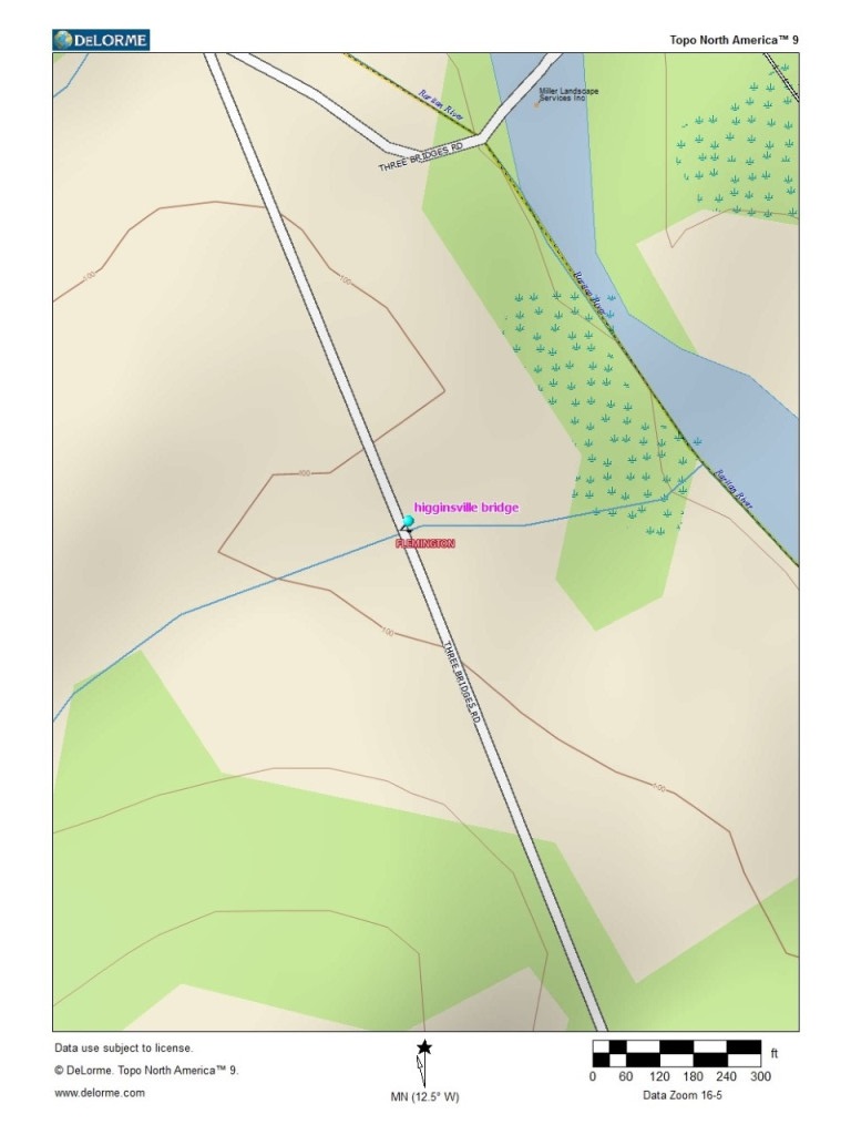
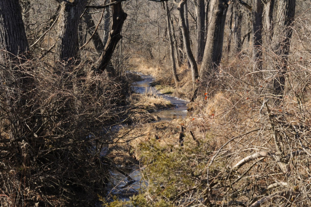
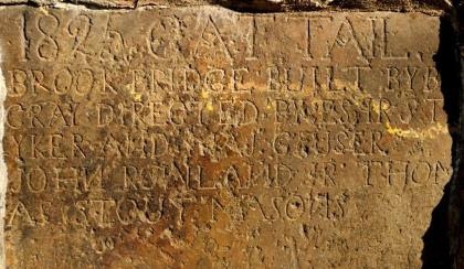
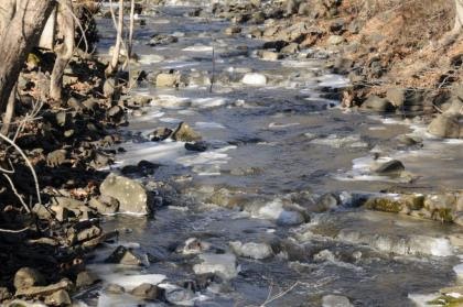
A plaque, inset in a concrete bridge constructed in 1923, spans the nameless stream, which now appears on the map as a thin blue line.The last image shows the stream as it exists today, just before it empties into the South Branch of the Raritan.
If all the water that ever flowed from the Raritan river drainage could be measured, its contribution to the depth of the ocean would be impressive. Think of that watershed as a collection agency for the world’s oceans.
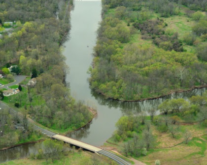
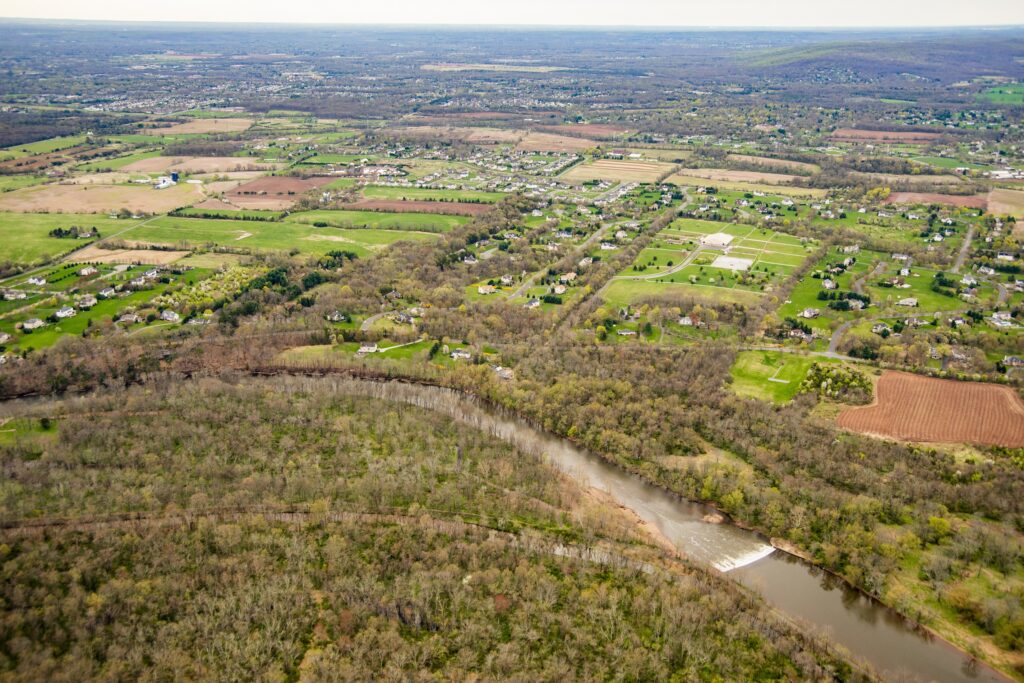
The South Branch flows into the confluence from the right, the North Branch from the left. They combine to form the Raritan River. This natural formation was an important landmark to the Lenape Tribe, which referred to this place as Tucca-Ramma-Hacking, “the meeting place of waters.”
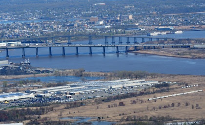
An aerial view of the Raritan River clearly shows its two main branches, the South Branch and the North Branch. From the perspective of the confluence, its two main branches get their name, despite both arising north of their meeting place. The confluence marks the beginning of the Raritan River.
A closer look reveals the larger tributaries which feed the main branches; Rockaway creek, Black river/Lamington River and the Neshanic River, all of which are clearly noted on maps.
No less important are the numerous smaller brooks and creeks whose contributions are significant and whose names may appear only on old maps or engraved on marble plaques set in structures that bridge their banks. Peter’s brook, Chambers brook, Pleasant Run, Prescott Brook, Assicong Creek, Minneakoning Creek, Holland Brook and the First, Second and Third Neshanic Rivers, are identified on some maps though only Holland Brook has one sign along its nine mile winding course. Hoopstick and Bushkill are lesser known streams, within plain view, that bear no identifying signage and are often represented as nameless blue lines.
There are dozens more minor streams whose names appear nowhere except in obscure archives. Each one eventually feeds not the Raritan or its two main branches above the confluence. Knowing someone’s name is a sign of respect.
Calling someone by the wrong name can be embarrassing. However, the signs that misidentify the North Branch of the Raritan River as the Raritan River proper, have failed to embarrass those responsible for posting such signs.
Many smaller seeps and springs whose names have been lost to the ages add to the accumulated flow. Driving along the Lamington River for instance, there are endless watery traces arising from springs within the woods that empty into larger tributaries. Many are just moist creases worn through the soil over time, which collect rainwater and snowmelt to supplement the downstream daily flow.
Maps show endless springs, which make the cartographers final draft as thin blue lines. Often a network of converging shorter lines, each with a defined beginning, join to form larger streams like Pleasant Run and Holland brook.
Obscure water sources fascinate me simply because their anonymity and remote locations arouse my curiosity about the natural communities that might exist in such rarely visited places. Their presence represents a convergence of habitat types that attract birds and wildlife. Though they bear no labels to honor their faithful contribution to the next blue line and ultimate confluence, their importance must not be overlooked.
Many springs which appeared on old maps, no longer exist, eliminated by construction of sewer lines or otherwise diverted or filled in. As maps are revised and generations fade, these streams exist only in a cartographer’s archive.
My appreciation for these disappearing thin blue lines was heightened when I recently discovered that as a kid I walked over Slingtail brook every day on the way to school. At some point this little stream which bore a name, was diverted through a sewer line under the pavement. More amazing, even older residents had no memory of that stream, its presence and name lost to the ages. I did find a reference to Slingtail Brook in the Woodbridge, New Jersey newspaper archives dated 1939. The property through which a portion of the stream flowed was up for sale. A clause by the seller stipulated the brook not be diverted or covered over.
“Conveyance will be made subject to the following condition: That the course of Slingtail Brook as now existent, be not changed or diverted from its course or that said stream and flow of water therein be not blockaded, dammed or otherwise restricted.
Take further notice that the Township ………… “
Fords Beacon, May 12, 1939”
Somewhere in time the requirement that Slingtail remain unmolested, was lost to progress and legal wrangling. Such is the fate of so many smaller streams, especially when their names only exist in oral history and no signage marks there presence.
One small trickle of a stream that has miraculously retained its nature and name, is Cattail Brook.
Cattail brook arises from a convergence of network of bubbling springs, supplemented by runoff from rain and snowfall. It begins as hardly more than a trickle, directed by gravity, from the south facing ridge of the heavily wooded Sourland Mountains, near East Amwell, NJ. Cattail brook gives birth to Rock Brook, a tumultuous and moody stream that joins the more sedate Bedens Brook on its way to the Millstone River. The Millstone joins with the Raritan River to make its final contribution to the earth’s deep blue oceans.
Rock Brook derives its character from the influence of gravity and its bed of stone, which can change its mood from this idyllic mountain brook into a raging torrent
An extended winter freeze, preserving snow from a previous storm beyond its expected stay, was interrupted by a thaw and heavy rain. The melting snow joined the torrential downpour as it flowed over frozen ground to collect in every shallow crease leading to the river. The water’s velocity was enhanced by the decreasing gradient of deep well worn pathways etched into the earth.
The banks of successfully larger streams barely contained the accumulation of water delivered from the network of anonymous thin blue lines. Acting as a single entity, the collection agency, if you will, of the Raritan River drainage, faithfully delivered its contribution of sweet water to the world’s salty oceans.
The Raritan River becomes the Raritan Bay downstream of the New Jersey Garden State Parkway Bridge. With a poetic flourish, the salt water bay and lower Raritan River are stained blue, saturated with the blue ink used to represent the thousands of nameless pale blue lines drawn on maps of the extensive Raritan River watershed.
Author Joe Mish has been running wild in New Jersey since childhood when he found ways to escape his mother’s watchful eyes. He continues to trek the swamps, rivers and thickets seeking to share, with the residents and visitors, all of the state’s natural beauty hidden within full view. To read more of his writing and view more of his gorgeous photographs visit Winter Bear Rising, his wordpress blog. Joe’s series “Nature on the Raritan, Hidden in Plain View” runs monthly as part of the LRWP “Voices of the Watershed” series. Writing and photos used with permission from the author.
Photos and article by LRWP Board President Heather Fenyk
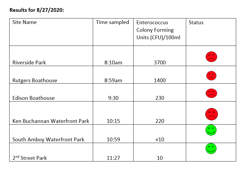
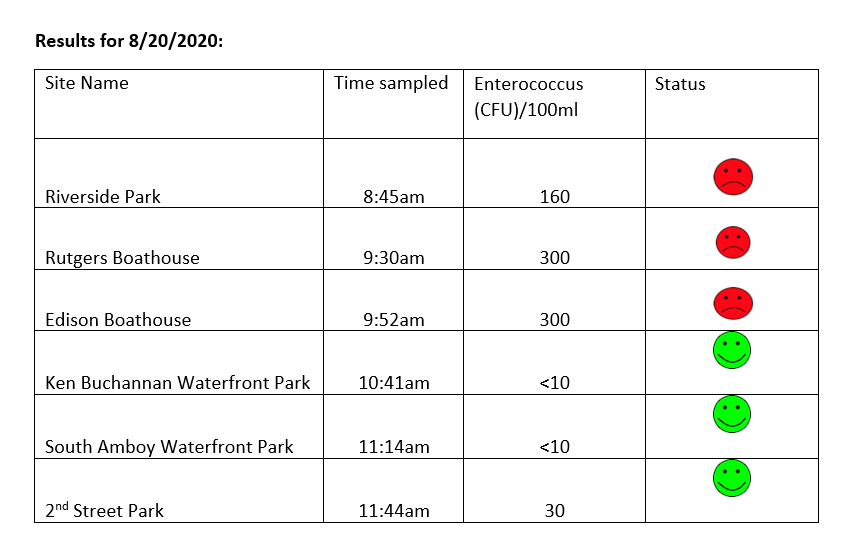
The LRWP and EARTH Center of Middlesex County monitor for Fecal Coliform and Enterococcus at six non-swimming public beach access sites along the Lower Raritan during the warmer summer months. Fecal Coliform and Enterococcus are indicators of disease-causing bacteria in our waterways.
The EPA recommends that a single Enterococcus sample be less than 110 Colony Forming Units (CFU)/100mL for primary contact. Enterococci levels are used as indicators of the possible presence of disease-causing bacteria in recreational waters. Such pathogens may pose health risks to people fishing and swimming in a water body. Sources of bacteria include Combined Sewer Overflows (CSOs), improperly functioning wastewater treatment plants, stormwater runoff, leaking septic systems, animal carcasses, and runoff from manure storage areas. Enterococci levels are often high after heavy or consistent rainfall.
This week our South Amboy and Perth Amboy sites look great. Things are not so great at our Piscataway, New Brunswick, Edison and Sayreville sites – Enterococcus CFUs are quite high. Please note that these results for August 20, 2020 are preliminary and awaiting Quality Control.
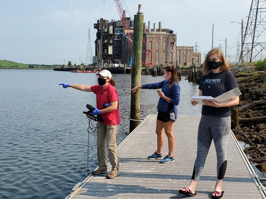
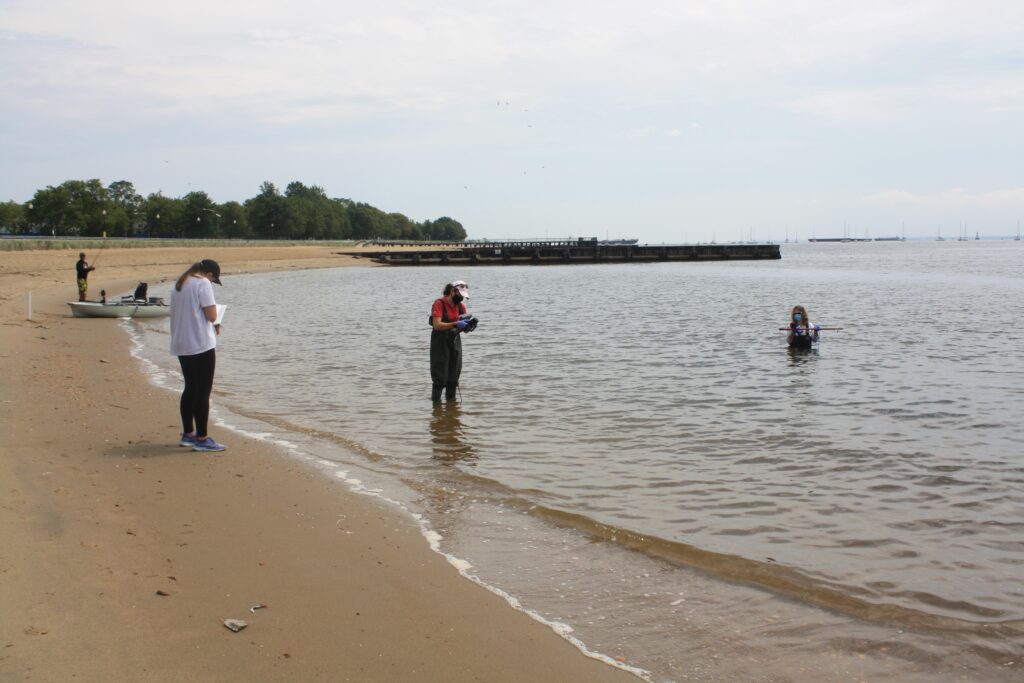
Field Notes
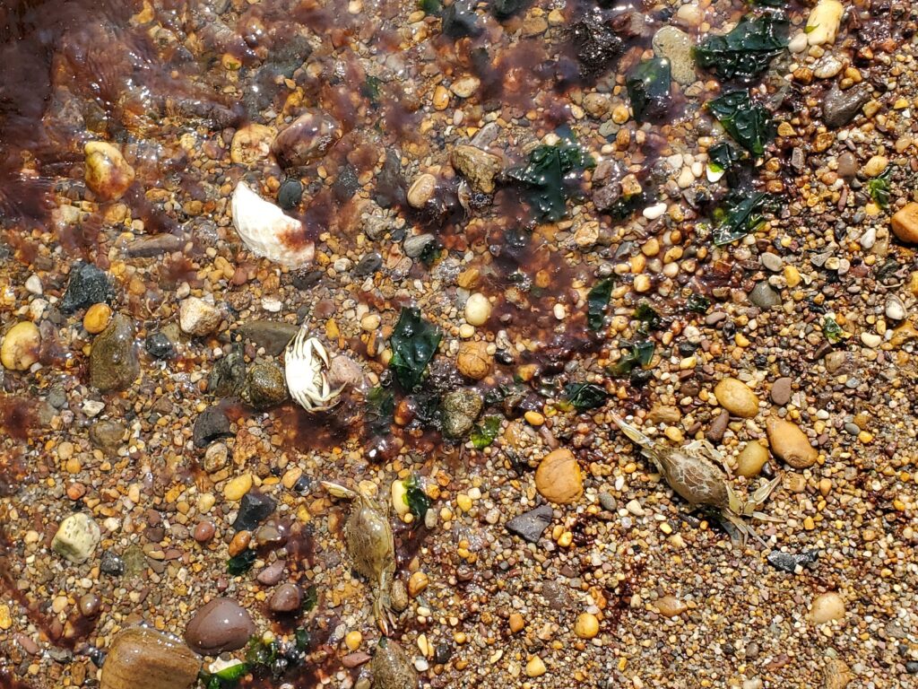
Warm and muggy day for pathogens sampling. LOTS of bunker at the Edison Boat Basin and Sayreville Ken Buchanan Boat launch sites. Red tide and dead crabs in South Amboy. Special thanks to Maya for all her help monitoring this summer – today was her last day in the field before she heads back to school.
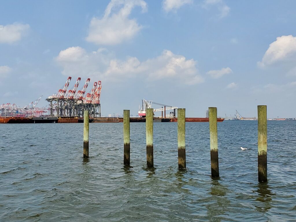
Look! Bunker/Menhaden! We saw lots of these guys at both our Sayreville (pictured) and Edison sites.Dead crabs and red tide at the South Amboy beachThis week we dropped our samples off in Bayonne at a monitoring site for the Hackensack Riverkeeper – they have great views of Elizabeth, NJ’s working port!
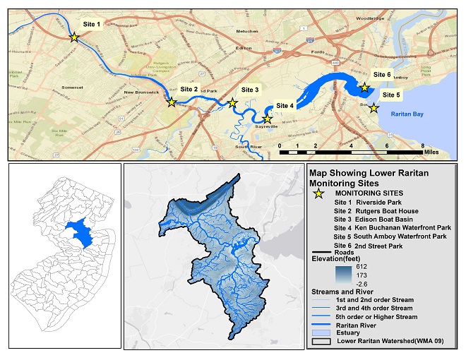
Summer 2020 Raritan Monitoring Sites
The New Jersey state Department of Environmental Protection and Middlesex County Health Departments typically monitor at sanctioned public swimming beach sites. They do not monitor the water quality for pathogens at public access non-swimming beach sites along the Raritan, despite regular use of these areas for primary contact (fishing and swimming) by members of our urban communities.
The LRWP works with in partnership with the Interstate Environmental Commission for lab analysis of our samples. We have a Quality Assurance Protocol Plan (QAPP) approved by the federal Environmental Protection Agency. We work to report our results as soon as lab analysis is completed.
Interview by Emily Koai, LRWP Spring 2020 Raritan Scholar
Nandini Checko was born in India and moved to the United States at a young age. She earned her bachelors and masters degrees at Rutgers and Columbia Universities respectively. When her children started school, she began her journey in local volunteering in schools and townships within Somerset County. She has helped with a multitude of initiatives in an effort to improve local sustainability. Through her work with LRWP and ANJEC, she hopes for improved civic engagement in communities and a more profound understanding of our interconnectedness with nature.
EK: Could you tell us a little about yourself and your background?
NC: Unlike many of my colleagues, I don’t have an environmental science background. I have a bachelor’s degree from Rutgers School of Business, and a master’s degree from Columbia in Organizational Development. My degree in organizational development has helped frame the work that I do because it takes a holistic approach to managing change — the people, systems, process and technology. It’s a highly collaborative approach to help move a project along and to help folks really co-create their future.
EK: What led you to your focus in plastics then?
NC: It started with my organization that I work for right now, which is the Association of New Jersey Environmental Commissions (ANJEC)— a statewide, non-profit environmental group that helps New Jersey environmental commissions, individuals, local and state agencies preserve natural resources and promote sustainable communities. We just celebrated 50 years of environmental excellence. We are a small but mighty group! My boss came to me maybe about 4 years ago and said EPA Region 2 is doing a roll out of a program called Trash Free Waters – zero waste loading of trash into our waterways, and at that time, Region 2 (NJ, NY, PR, US Virgin Islands, & eight Indian Nations) was led by Judith Enck. She’s an absolute visionary, a total leader, similar to Heather—very inspiring and amazing woman.
ANJEC started dipping their toes in and asked “What would that really look like in New Jersey?” When we dug into that question, we found our way to the problem of people pollution. The nine million of us that live in New Jersey—we’re all polluting in our own little way. So much waste entering our natural eco-systems. And when you dig down into that waste (especially litter), then you’re looking at plastics, and when you go a little further into plastics, you realize the majority of it is single-use, once and done.
That really motivated us to take this and move this agenda item forward. It aligns very well with our mission of supporting the local environment and I had a lot of support to advance reducing single-use plastics from my boss, Jennifer Coffey (ANJEC Executive Director) – an inspirational leader that gives the staff a lot of leeway.
EK: Did you have any passion projects in your career that led you to where you are today?
NC: I lived in India during my formative years and was always really connected to the environment. I’m very sensitive about waste– whether it’s litter or food waste, just waste in general, it bothers me deeply because it’s such a pull on the Earth’s resources.
We recycle at home, and when my son started elementary school, I figured the school was doing the same. And then he came home a few weeks in and said that they don’t recycle in school. I looked into it and, sure enough, they weren’t recycling. That started me on the path of local volunteering. I started the Green Design Group and we created sustainable efforts within the community and put forth a lot of the initiatives in schools and the township. And through that effort, I also started the Green Classroom Committee. As a parent volunteer, I worked with the superintendent, the facilities manager, business administrator, students and teachers to help educate and implement a variety of programs from anti-idling, removing Styrofoam lunch trays, and energy efficiency programs.
When you think about what gets people activated, it’s about what they can see, touch and feel in their own lives. When you see the woods in your town on fire, you’re going to get involved and ask: Why is that on fire? How can I help? For me, it was my kids. I was recycling at home and they come back from school and say they’re not recycling there. That’s when I got curious. Children are key to helping adults get involved in civic engagement.
EK: On a wider scale, what roles do you think municipalities have in progressing the work we are doing as an organization?
NC: I think they play a massive role. Municipalities are key players in advancing LRWP’s mission of improving water quality and the health of the ecosystem of the Raritan River. Given NJ’s home rule structure, local governance is essential to making water stewardship and advocacy a priority.
EK: What kind of opportunities do you think there are for partnership between the LRWP and the ANJEC?
NC: “Water is life, and we have a moral obligation to protect it for all its inhabitants now and in the future.” This quote from Candy Ashmun, ANJEC Co-founder, highlights the synergy between our two groups. Environmental commissions play a pretty unique role in municipalities. Most local planning happens within the boundaries of the town and in site development, it’s just by block and lot numbers. You’re not looking to see how it’s all connected. Water, land, animals have no boundaries. And environmental commissioners, when they take that bigger regional look, they’re looking at the watershed. Through my role at ANJEC, I would like to introduce more municipal officials to LRWP and help advance our mutual goals.
EK: What would you like to communicate to today’s society about watersheds and the environment?
Watersheds play a really key role in all our lives. We have to support reducing the amount of pollution that enters the watersheds and people need to better understand where their water comes from and where it goes.
Article by John Jengo. Aerial photos by Alison M. Jones with NoWaterNoLife – photos were captured during a LightHawk, Inc. flight
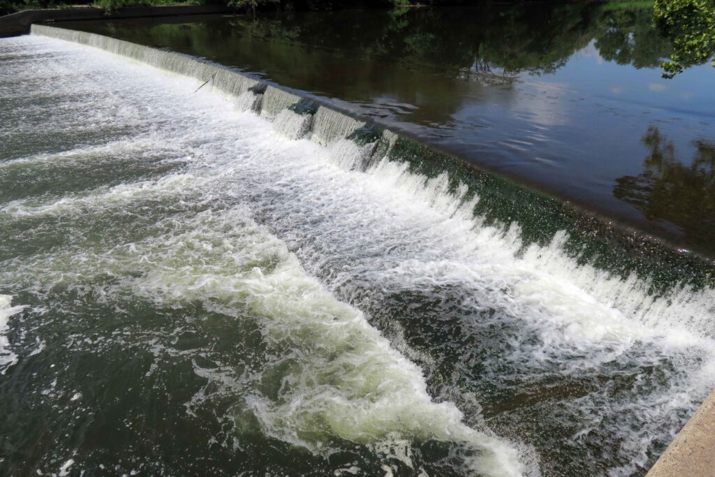
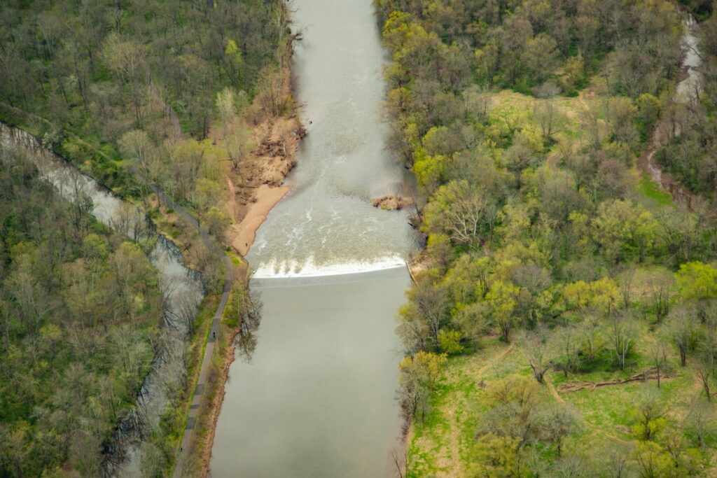
The 230-foot-wide Headgates Dam, located between Hillsborough and Duke Island Park in Bridgewater, NJ is the last dam on the Raritan River before the confluence of its North and South Branches.
Headgates Dam, Duke Island Park, Raritan Water Power Canal looking south past the Raritan River towards Princeton and Sourland Mountains Photo courtesy Alison M. Jones with NoWaterNoLife – photo taken during a LightHawk, Inc. flight
The original Headgates Dam (what you see today is a 1959 reconstruction) was built in 1842 in conjunction with the Raritan Water Power Canal as an entrepreneurial venture in order to sell commercial lots in the town of Raritan three miles east to industries requiring water power. At its height, there was a gristmill, a machine shop and foundry, a screw factory, a paint works, flour mills, the Somerville Water Company, and most famous of all, the Raritan Woolen Mills, all using water flowing down the Canal.
Headgates Dam, 8.20.2019. Courtesy John Jengo.
I believe that the term “Headgates” referred to both the dam itself and a gate structure that was formerly located at the head of the Canal where it adjoined the Raritan River. Many people have noticed the three curious bumps along the eastern half of the dam, and I postulate that these features indicate the location of a stop log guide frame that allowed a set of stop logs (rudimentary gates) to be raised or lowered to control the level of the water impounded behind the dam. Conceivably, these “gates” could be opened during the spring migration to allow migratory fish to pass upriver, and if the gates were operated in this manner, this would not be the only instance of fish passage structures being incorporated into 18th and 19th century dams. One can wonder why such multi-use, holistic thinking was forgotten when all these dams were rebuilt in the 20th century. It should be noted that the term “Headgates” also applied to large Gate House structure equipped with six timber lift gates (which was unfortunately demolished in the 1960s) that was formerly located at the head of the Canal that controlled the flow of water into the Raritan Water Power Canal.
Headgates Dam Photo courtesy Alison M. Jones with NoWaterNoLife – photo taken during a LightHawk, Inc. flight
J.B. Duke’s acquisition in 1897 of the Somerset Lighting Company/Raritan Water Power Company (the brick “powerhouse” building which survives just east of the Wrought Iron Bridge Company double intersection truss bridge, commonly referred to as the Nevius Street Bridge,) was initiated because Mr. Duke wanted both hydropower and a reliable water supply from the Canal for his expansive estate (Duke Farms), including its renowned network of lakes and fountains. To resolve the problem of the turbid Canal waters clogging the delicate fountain waterworks, Mr. Duke had a large-scale filtration facility constructed circa 1907 (the stone “castle” building just west of the Nevius Street Bridge) so that only exceptionally clear water would be discharged from the fountains. I postulate that Duke Farms ceased using Canal waters around 1974 because the flow of water had diminished, its quality had declined, and the maintenance of the filtration system became too onerous. It was at this time that Duke Farms converted the Nevius Street Dam (the dam that was located just upstream of the Nevius Street Bridge that was built for aesthetic and recreational purposes by Mr. Duke in 1901) for the estate water supply until 2013 when that dam was removed as part of the Raritan River Fish Passage Initiative and groundwater supply wells were installed to provide water for the Duke Farms lake system.
Since 2008, I have conducted research and studies to assess the feasibility of removing the Headgates Dam, but there are several complex and costly technical issues that remain to be resolved. Firstly, there is a community-essential sanitary sewer line that is located just upstream of the dam that has to be relocated before the dam is removed (part of the sewer line protrudes above the river bed so if the dam were to be removed, the sewer would be exposed to the rivers’ most turbulent flow, which is not permitted by State regulations). Secondly, the Raritan Water Power Canal is listed on the New Jersey and National Registers of Historic Places, and in the absence of the dam, it would be largely dewatered so plans are being developed to provide an alternative source of water for the Canal. Should financial resources be identified to implement these aforementioned remedies, the removal of the Headgates Dam could proceed in a manner similar to that of the Robert Street Dam (removed in 2012), which was reconstructed in 1964 using the same design specifications. The removal of the Headgates Dam would free the entire 30-mile length of the main stem of the Raritan River for migratory fish passage, in addition to opening up the lower reaches of both the South and North Branches of the Raritan.
Headgates Dam Photo courtesy Alison M. Jones with NoWaterNoLife – photo taken during a LightHawk, Inc. flight
John W. Jengo, PG, LSRP is a licensed Professional Geologist in several Northeastern and Southeastern states and a Licensed Site Remediation Professional in New Jersey. John works as a Principal Hydrogeologist in an environmental consulting firm in southeastern Pennsylvania. He has degrees in geology from Rutgers University (1980) and the University of Delaware (1982). Over the last 30 years, he has conducted the characterization and remediation of large, complex contaminated industrial sites throughout New Jersey, Pennsylvania, and Delaware. He played a key role in Natural Resource Damage (NRD) assessments that led to groundbreaking legal settlements to remove numerous low head dams on the Raritan and Millstone Rivers to restore historically significant migratory fish spawning runs. As technical project manager, he planned, permitted, and successfully managed the removal of the Calco Dam, the Robert Street Dam, and the Nevius Street Dam between 2008-2013, and the removal of the Weston Mill Dam on the Millstone River in 2017, along with leading the archaeological investigation of the former Weston Mill in the Borough of Manville and Franklin Township.
Photos and article by LRWP Board President Heather Fenyk
The LRWP and EARTH Center of Middlesex County monitors for Fecal Coliform and Enterococcus at six non-swimming public beach access sites along the Lower Raritan during the warmer summer months. Fecal Coliform and Enterococcus are indicators of disease-causing bacteria in our waterways.
The EPA recommends that a single Enterococcus sample be less than 110 Colony Forming Units (CFU)/100mL for primary contact. Enterococci levels are used as indicators of the possible presence of disease-causing bacteria in recreational waters. Such pathogens may pose health risks to people fishing and swimming in a water body. Sources of bacteria include Combined Sewer Overflows (CSOs), improperly functioning wastewater treatment plants, stormwater runoff, leaking septic systems, animal carcasses, and runoff from manure storage areas. Enterococci levels are often high after heavy or consistent rainfall.
Briefly, our Sayreville, South Amboy and Perth Amboy sites are looking good this week! Please note that these results for August 20, 2020 are preliminary and awaiting Quality Control.
Field Notes
Yesterday was an exquisite day for sampling the Raritan!
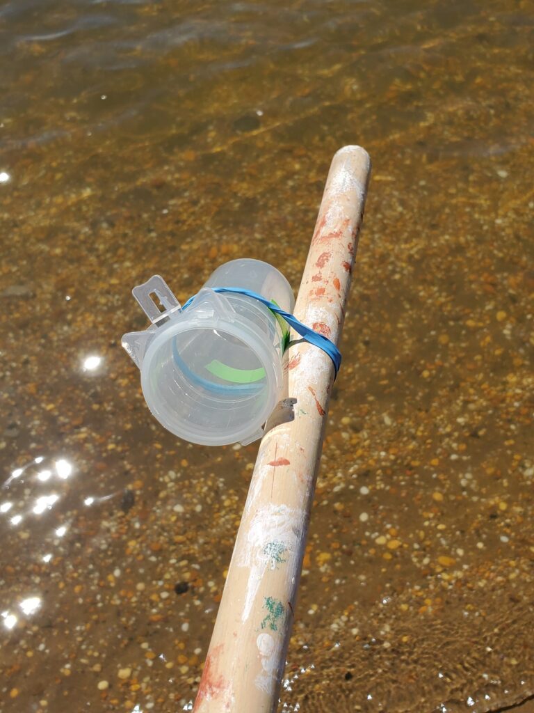
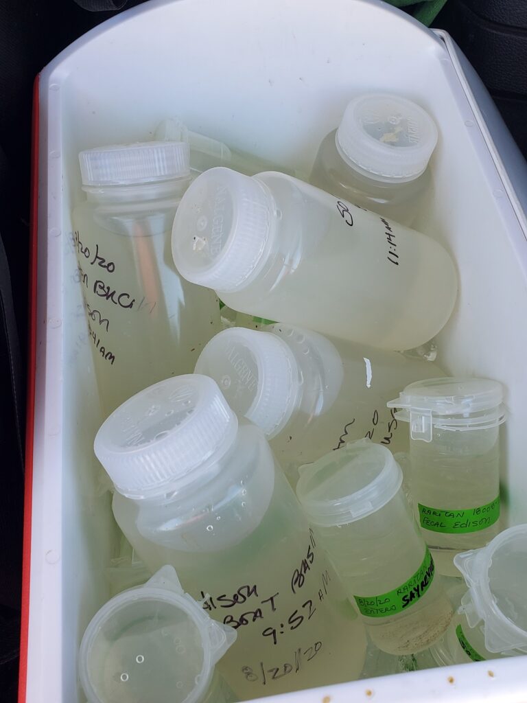
Clear and gorgeous waters, and the re-purposing of a broom handle into our snazzy new sampling stick.Thanks to Maya and NJ Watershed Ambassador Heather Miara for lending a hand in the field.Thanks also to IEC’s wonderful Jessica Bonamusa for meeting us in the Elizabeth IKEA parking lot for the sample handoff.This week we kick off our genetic source trackdown analysis – the larger sample bottle in the mix of pathogens sample bottles will go to a Rutgers lab for filtering and analysis. We’re looking forward to more definitively pinning our pathogens problems on human, beast or fowl.
Summer 2020 Lower Raritan Monitoring Sites
The New Jersey state Department of Environmental Protection and Middlesex County Health Departments typically monitor at sanctioned public swimming beach sites. They do not monitor the water quality for pathogens at public access non-swimming beach sites along the Raritan, despite regular use of these areas for primary contact (fishing and swimming) by members of our urban communities.
The LRWP works with in partnership with the Interstate Environmental Commission for lab analysis of our samples. We have a Quality Assurance Protocol Plan (QAPP) approved by the federal Environmental Protection Agency. We work to report our results as soon as lab analysis is completed.
The LRWP and EARTH Center of Middlesex County monitors for Fecal Coliform and Enterococcus at six non-swimming public beach access sites along the Lower Raritan during the warmer summer months. Fecal Coliform and Enterococcus are indicators of disease-causing bacteria in our waterways.
The EPA recommends that a single Enterococcus sample be less than 110 Colony Forming Units (CFU)/100mL for primary contact. Enterococci levels are used as indicators of the possible presence of disease-causing bacteria in recreational waters. Such pathogens may pose health risks to people fishing and swimming in a water body. Sources of bacteria include Combined Sewer Overflows (CSOs), improperly functioning wastewater treatment plants, stormwater runoff, leaking septic systems, animal carcasses, and runoff from manure storage areas. Enterococci levels are often high after heavy or consistent rainfall.
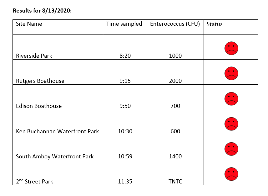
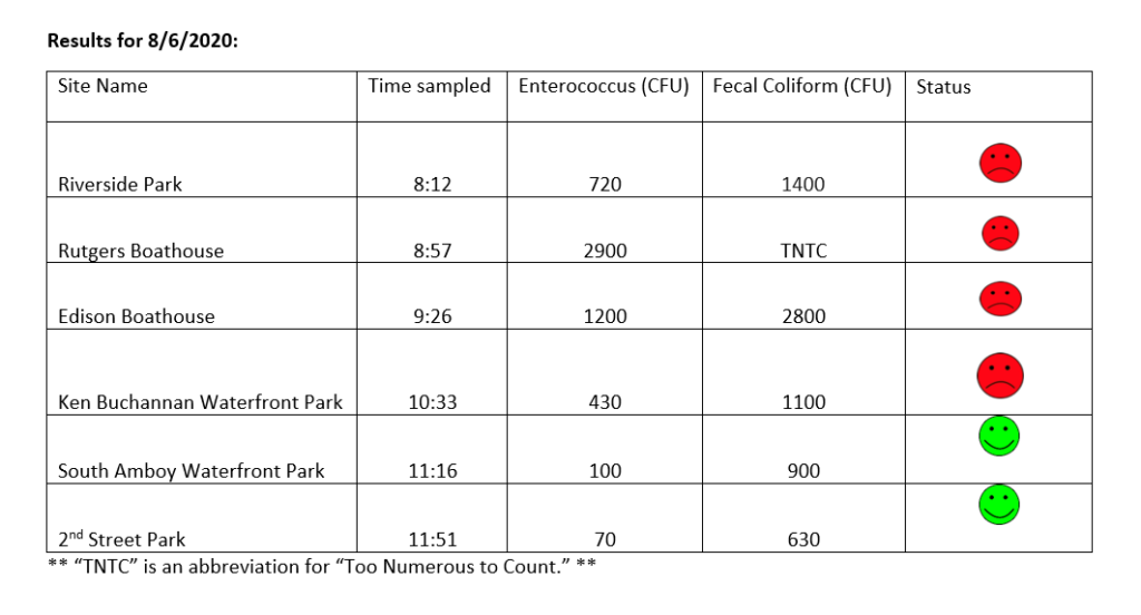
“TNTC” is an abbreviation for “Too Numerous To Count.”
Please note that these results for August 13, 2020 are preliminary and awaiting Quality Control:
Photos and notes from 8.13.2020 Monitoring
Lots of rainfall this week meant high pathogens counts at our sites. This week we monitored in the rain! Thanks to Michele Bakacs for the photos.
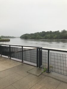
View of Raritan River from Rutgers Class of 1914 Boathouse
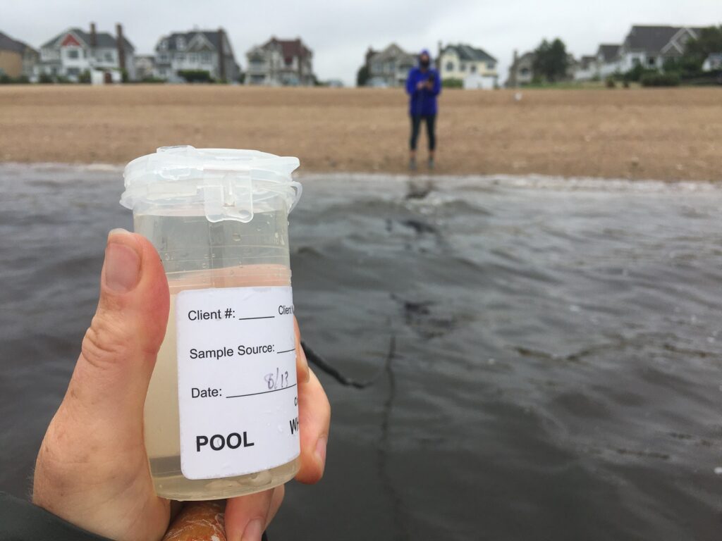
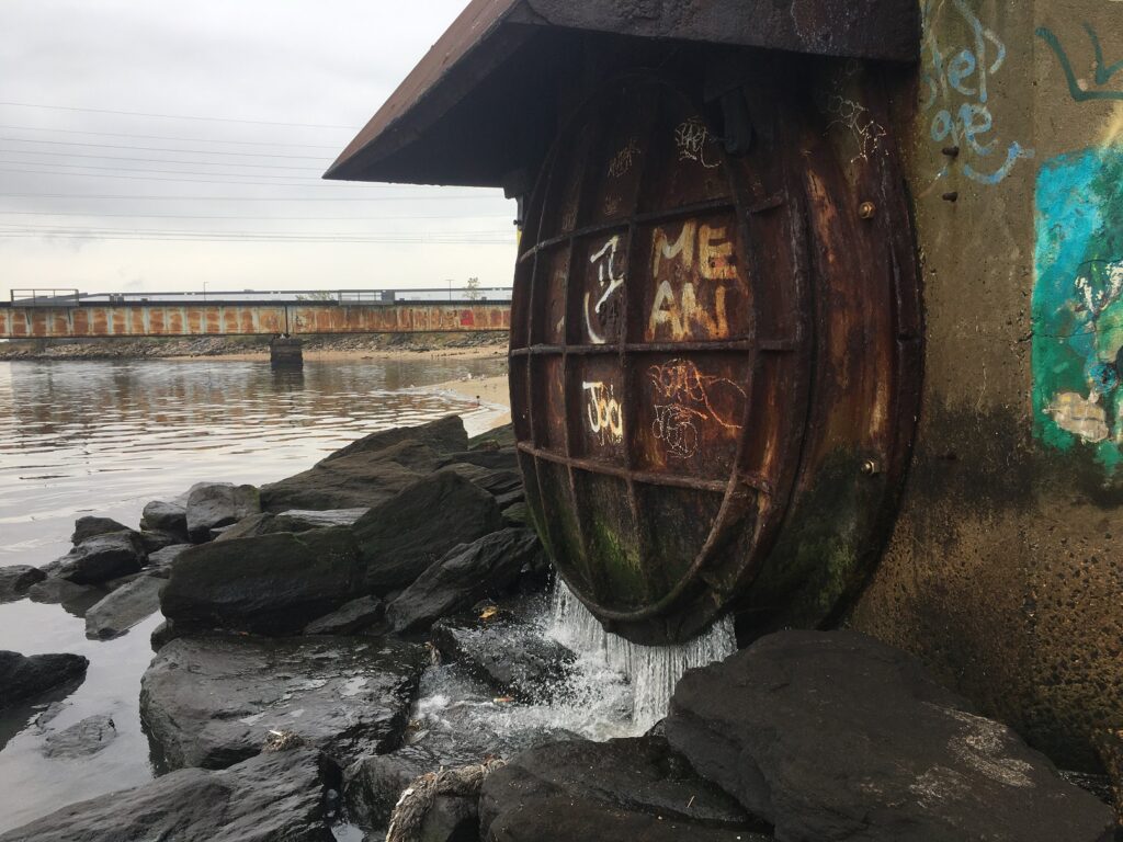
Sample catching at South AmboyActive CSO discharge, Perth Amboy
The New Jersey state Department of Environmental Protection and Middlesex County Health Departments typically monitor at sanctioned public swimming beach sites. They do not monitor the water quality for pathogens at public access non-swimming beach sites along the Raritan, despite regular use of these areas for primary contact (fishing and swimming) by members of our urban communities.
The LRWP works with in partnership with the Interstate Environmental Commission for lab analysis of our samples. We have a Quality Assurance Protocol Plan (QAPP) approved by the federal Environmental Protection Agency. We work to report our results as soon as lab analysis is completed.
The LRWP and EARTH Center of Middlesex County monitors for Fecal Coliform and Enterococcus at six non-swimming public beach access sites along the Lower Raritan during the warmer summer months. Fecal Coliform and Enterococcus are indicators of disease-causing bacteria in our waterways.
The EPA recommends that a single Enterococcus sample be less than 110 Colony Forming Units (CFU)/100mL for primary contact. Enterococci levels are used as indicators of the possible presence of disease-causing bacteria in recreational waters. Such pathogens may pose health risks to people fishing and swimming in a water body. Sources of bacteria include Combined Sewer Overflows (CSOs), improperly functioning wastewater treatment plants, stormwater runoff, leaking septic systems, animal carcasses, and runoff from manure storage areas. Enterococci levels are often high after heavy or consistent rainfall.
Please note that these results for August 6, 2020 are preliminary and awaiting Quality Control:
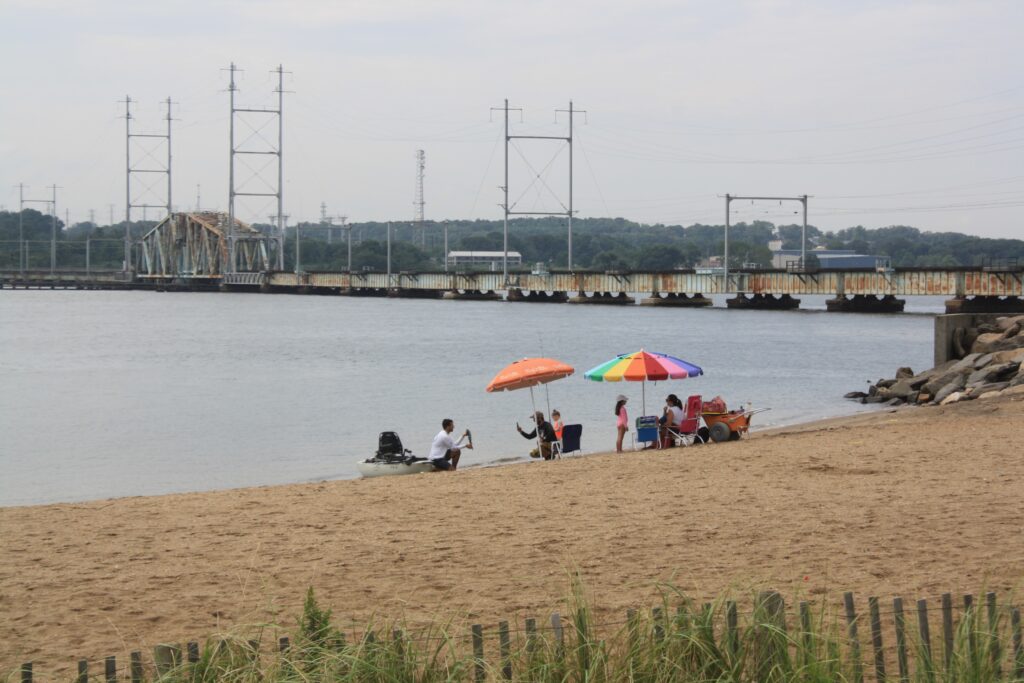
Field observations for 8.6.2020
Waters were running high and fast during monitoring, due in part to remnant stormwater flow from Tropical Storm Isiasis which started its destruction in New Jersey on August 4, knocking out power for 1.4 million state residents. Isiais pummeled the Lower Raritan as well, and the River looked like chocolate milk at our Piscataway, New Brunswick and Edison sites. We observed a fair amount of flotsam in the water, and a few islands of accumulating logs and trash.
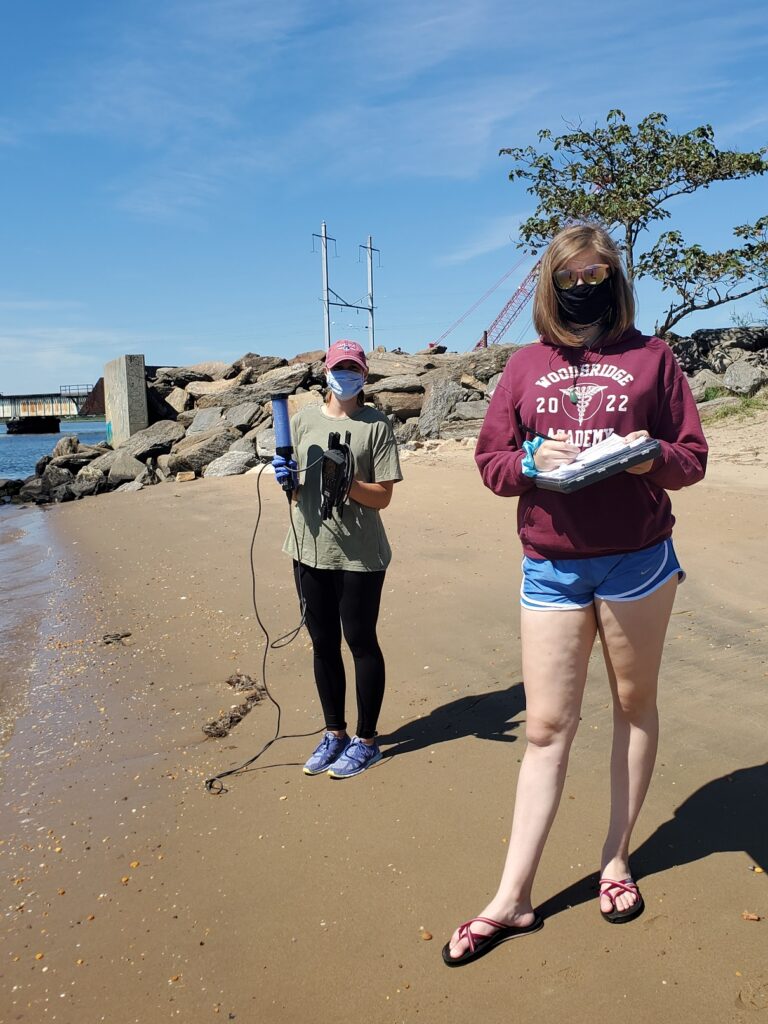
Our monitoring crew, with fisherfolk in the background (photo: Renee Skelton)In Perth Amboy, folks were out on the beach picnicking and fishing, despite active discharge from the Combined Sewer Overflow just 20 feet away. (photo: Renee Skelton)
The New Jersey state Department of Environmental Protection and Middlesex County Health Departments typically monitor at sanctioned public swimming beach sites. They do not monitor the water quality for pathogens at public access non-swimming beach sites along the Raritan, despite regular use of these areas for primary contact (fishing and swimming) by members of our urban communities.
The LRWP works with in partnership with the Interstate Environmental Commission for lab analysis of our samples. We have a Quality Assurance Protocol Plan (QAPP) approved by the federal Environmental Protection Agency. We work to report our results as soon as lab analysis is completed.