In today’s digital age it is more important than ever to preserve places where children can run, play, and experience nature. A referendum measure on the Nov 5 ballot for New Brunswick residents – for the New Brunswick Open Space Trust Fund – allows residents to vote to preserve open space so as to improve our system of parks, trails, and natural areas in New Brunswick and throughout the watershed.
If approved by the voters, the Open Space Trust Fund would establish a levy on homeowners, costing the average homeowner $27 per year.
Here’s How the Open Space Trust Fund would be Used
• Improving the water quality of rivers and streams;
• Protecting the Raritan River;
• Providing clean, safe parks;
• Providing accessible parks; and
• Repairing and improving existing parks.
Accountability Measures to Ensure Funds are Properly Spent
• Moneys raised for the Open Space Trust Fund would only be used open space projects and nothing else.
• Expenditures from the Open Space Trust Fund would be subject to a public audit every year.
• There would be full public disclosure and review of all expenditures.
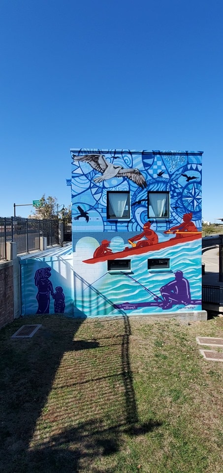
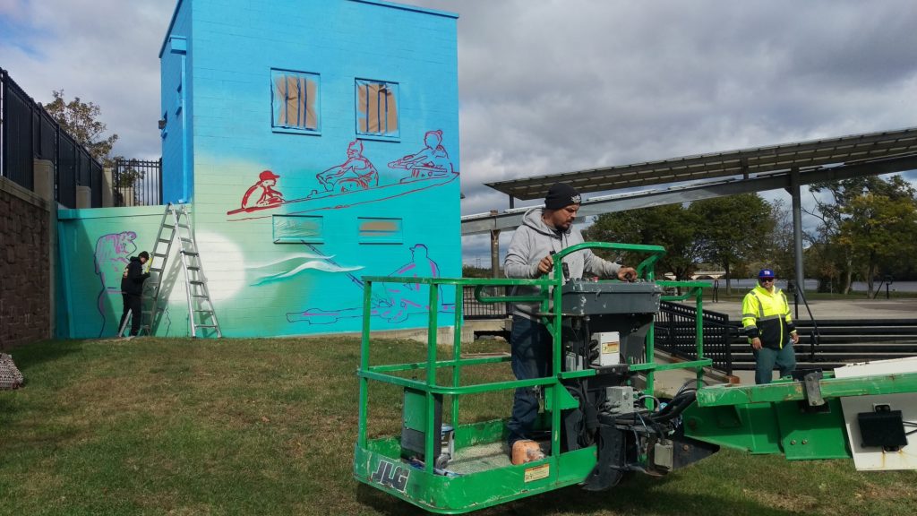
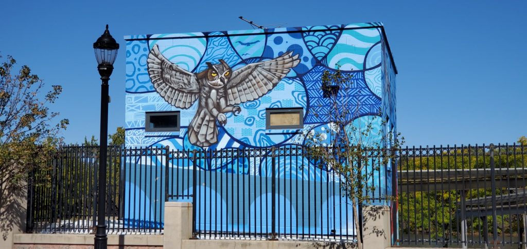
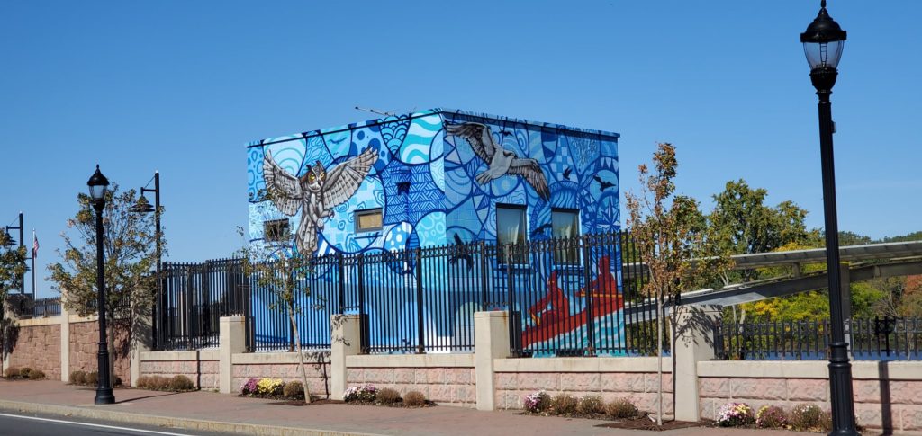
“Raritan River Ways” was created by Leon Rainbow in New Brunswick, in Elmer B. Boyd Park overlooking the amphitheater entrance and Route 18. The mural was created as a commission from the New Brunswick City Government’s response to coLAB Arts’ oral histories collected from individuals who have been boating, fishing, and stewarding the Raritan River for decades.
Route 18 has disconnected New Brunswick from its waterway since the 1950s. Given the high visibility of this mural, we view #RaritanRiverWays is a form of wayfinding for the New Brunswick community and others to reconnect with the Raritan River. We see it as a reminder that we should all #lookfortheriver
Special Thanks to Leon, and to his assistants Radek and John Everyman for this beautiful gift for the City.
Thanks also to Michael Tublin, Keith Jones II, Daniel Swern and John P Keller for all your hard work to make this project possible!
The Nature Conservancy, Sustainable Jersey and The Watershed Institute are again offering “Roots for Rivers” reforestation grants, available now through Friday, December 13th, 2019 for spring 2020 tree planting projects.
The Roots for Rivers Reforestation mini grant program uses the Conservancy’s lessons learned and expertise, coupled with financial incentives, to inspire communities and help catalyze restoration efforts across New Jersey to restore our watersheds through planting native trees and shrubs in degraded floodplain areas and help us to achieve a goal of planting 100,000 trees throughout our state’s floodplains by 2020. To date, over 83,000 materials have been planted (and protected) throughout New Jersey’s floodplains.
As we travel through our communities, few of us think about the hidden world of streams and rivers that once flowed across the landscape. In the face of climate change and increased precipitation, real life has shown us that stormwater runoff and flooding have intensified. #lookfortheriver is an outreach campaign to engage New Jersey residents in examining changes made to our urban streams and hydrology over time.
Seven years ago my family was without power and heat following Superstorm Sandy. We spent days off from school and work, charging phones in a local fire station, shopping at A&P in the dark, and mopping up our flooded basement apartment. We mourned with our next door neighbor who lost a brother to generator-related carbon monoxide poisoning, and with a colleague who lost a neighbor when the storm’s vicious winds downed a tree.
Today we stop to remember. As we do, we think about those for whom Hurricane-related devastation is fresh. The Bahamas is still assessing damage from Hurricane Dorian. Puerto Rico is still recovering from Hurricane Maria. And just last month Tropical Storm Imelda dumped 43 inches on the Houston, Texas region, causing wide scale flooding, a near repeat of the intense rainfall seen during Hurricane Harvey in 2017.
Imelda and Harvey in particular have brought attention to the likelihood that global climate change will increase the frequency of powerful hurricanes and other storms, and not just in Texas. The northeast has already experienced a 71% increase between 1958 and 2012 in rainfall from intense storms. If the amount of rain that saturated Houston during Harvey or Imelda hit Raritan Bay, our Lower Raritan Watershed riverine communities, including Perth Amboy, South Amboy, Sayreville and South River, would be completely inundated through a combination of storm surge and overland stormwater flow. Although rainfall amounts akin to Harvey are unlikely in our region, we know we must adapt to a wetter, stormier reality.
Intense rainfall is especially devastating in heavily urbanized areas that are characterized by impervious cover, and by streams that are completely culverted, buried, or otherwise covered up. The impact of “hiding” so many of streams causes serious problems. Communities are alienated from their waterways and historic ecologies, habitats are degraded, water quality is compromised, and stormwater runoff and flooding intensify. In the context of intensified precipitation, healthy, open streams play an important role in stormwater management. Open streams slow and control stormwater surge, and stormwater gets absorbed and gradually released by soil and plants.
On this seventh anniversary of Hurricane Sandy the Lower Raritan Watershed Partnership (LRWP) is rolling out #lookfortheriver, a new campaign designed to inspire care for neglected waterways – our lost or forgotten streams – in the context of climate change, intensified urban flooding and sea level rise. We see #lookfortheriver as a way to build social resilience, and to empower communities, particularly folks in harms way with respect to flooding, to value and restore freshwater ecosystems and the environment as community care and resilience.
#lookfortheriver is a way for ordinary citizens to learn how to adapt and prepare for a wetter, stormier future. It involves training in how to read a topographic map, identify watersheds, and understand basic hydrology. It is designed to support residents and communities as they explore their own local landscapes, and to open up discussion about historic patterns of land management and how we might do better.
The LRWP will be gradually building a portfolio of #lookfortheriver offerings. To start, in 2020 eligible entities like libraries, historical societies, museums, civic associations, public agencies, senior centers, and other community groups throughout the state of New Jersey can host a #lookfortheriver outreach session through the New Jersey Council for the Humanities (NJCH) Public Scholars Project.
We are excited about this new initiative, and hope you will join us as we look to the future and #lookfortheriver.
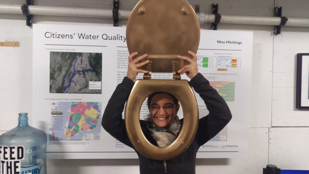
Last week our River was “honored” for having the worst performing waters in terms of bacteria levels of any of the civic science monitoring projects in the NY-NJ Harbor Estuary. Yes, the Raritan River received the 2019 “Golden Toilet” award from NYC’s The River Project.
Click here to see entire season’s results for all 70+ sites, displayed week by week. Click on the map icons here to see results for specific sites.
IEC Environmental Analyst Jessica Bonamusa models the 2019 “Golden Toilet” award
While facing ignominy is not our preferred approach to public engagement, we do hope this helps bring attention and resources to clean up our River. There is nowhere to go but up.
We and our EARTH Center of Middlesex County partners have a lot of work to do in terms of data analysis, but expect more detailed reporting out in the coming weeks.
It is because of the commitment and dedication of our volunteer monitors that we have the data to start pinpointing, and addressing, problems and sources of pollution. A huge THANKS to them for helping us build this program and clean up our Raritan. And a special thanks to the Interstate Environmental Pollution Control Commission for lab analysis.
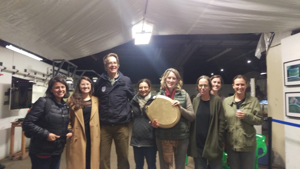
The River Project’s annual awards night, LRWP’s Heather Fenyk receiving the “Golden Toilet” on behalf of the Raritan River
THANK YOU to all the volunteers who joined the LRWP on a beautiful fall day to make a difference! With HUGE thanks to them and our Central Jersey Stream Team and Middlesex County Parks partners, this was a pretty amazing clean-up. Took advantage of a super low tide to scavenge the Raritan River floodplain like crazy, hauling 57 tires and two dumpsters worth of muddy trash up to the Donaldson Park basketball courts before the tide changed. Then we had to take the tires to the boat launch, wash them, and load them onto a truck for disposal.
The large letters written in white chalk on the old concrete dam simply said, “good bye dam”. That sentiment was accompanied by other names and sketches, not unlike a farewell card signed for a departing fellow co-worker.
The dam on the Lamington River at Burnt Mills was scheduled for removal after several iterations of mills beginning in early colonial times circa 1754.
Dams and mills came and went on New Jersey rivers and streams. Some destroyed by floods, fire or angry upstream neighbors deprived of migrating fish. British troops did their part and burned the mill on the Lamington, in Bromley, which was henceforth named Burnt Mill. These days the dams are being removed by private organizations and groups in cooperation with the National Fish and Wildlife Service. These organizations are dedicated to the restoration of rivers and the downstream benefits to native wildlife and soil stability.
Hundreds of dams across the country have been removed or are being scheduled for removal. The results are, for the most part, shockingly positive. From California to Maine, stories of returning fisheries, reduction in sediment accumulation, reduced flooding and a greater diversity of wildlife have been documented.
Every dam is its own story, its significance dependent on location. Downstream of the Lamington, on the lower Raritan, removal of dams allowed the upstream travel of anadromous fish.
In colonial times, netting alewives and shad as far upstream as Raritan, generated a profitable commercial fishery. Mills and dams put an end to that business.
Most early mills were situated on feeder streams to avoid seasonal floods and raging current. The Lamington dam was perfectly situated in that regard.
Mature trees lined the banks to stabilize the soil and as a result the stream bed suffered minimal erosion during seasonal flooding. Runoff was minimal due to the surrounding land being unsuitable for farming. Even today as development has exploded, the stream bed of the upper Lamington and Rockaway is mostly sand and gravel. The difference is striking when compared to the nearby lower South Branch which suffers from erosion and a build up of silt.
This image above the Burnt Mills dam captures the character of the Lamington and South Rockaway. Mature trees lock in the soil and a heavy canopy shades the shallow water.
The low concrete dam across the Lamington had been breeched in the early 1950s and misdirected the streamflow into the opposite shore causing severe erosion. An aerial view comparing the intact structure in 1953, to breeched version in 1956, shows the progress of the resulting erosion. An aerial view as seen today, compared to 1956, is even more dramatic.
The image on the top shows the intact dam in 1953. The image on the bottom shows the impact of erosion caused by the breeched dam in three years time in 1956.
The Lamington is the recipient of water released from Cushetunk Lake and Round Valley reservoir via South Rockaway creek as well as runoff from extensive upstream development. The added flow into the lower Lamington has hastened its meandering as directed by impervious shale cliffs and the concrete dam. Concrete walls designed to prevent erosion, speed the streamflow otherwise slowed by natural shorelines. Concrete walls line an upstream golf course, and another wall lines an outside curve along the road about a half-mile above the dam. During times of planned water release and seasonal storms, the water volume and speed create a high-pressure nozzle at the point of the breeched dam. The sum of upstream water, that makes up the Lamington, flows around a sharp bend a few hundred yards above the dam, careens off the high straight wall of red shale, slams into a concrete barrier perpendicular to its flow, then left, into a bank of unstable soil.
Free flowing rivers exhibit pure energy and it is energy and movement that define life. Science aside, it is the magic of perpetual motion and endless flow that we embrace. Flowing water is a magic carpet which requires no effort to travel, whether it be by vessel or imagination.
Any interruption of the energized free flow is representative of progressive pathology and an existential threat. The ‘damnation’ of rivers and streams represent stasis, blockages and clots; their removal, a life saving intervention.
So it was, the landmark Burnt Mill dam came down. Mixed feelings for those whose youthful memories were cast into the concrete substructure. The sight of the dam served as a reminder of an idyllic time and sunny days. A momentary retreat from the harsh reality that, on occasion, bites us all, was erased.
The removal was well planned and orchestrated as opposed to a charge of dynamite and a call of, ‘fire in the hole.’
The course of the river needed to be shifted and so large boulders were placed strategically to form the foundation of a left bank to replace that which was lost.
A 323 Caterpillar excavator fitted with tracks, moved into the river above the dam and began to scoop river bed gravel to line the upstream side of the length of the concrete dam. Apparently, this prevented water from flooding the work area during removal. Boulders in place, a second 323 Cat positioned on the downstream side, fitted with a ram driven spike, began to break up the concrete starting at the midstream end, working toward the right shore. It appeared the first foot and a half was easily penetrated. The second and third pass strained the hydraulic ram, the concrete’s resistance futile. After each session with the spike, the front-end loader scooped up the rubble and dumped it in-line with the boulders to form a new shoreline. The effort continued and half the dam was broken up and redistributed in about four hours. https://vimeo.com/367086739
Before and after images show the progress of the removal. Images 3 and 8 are the same view. Images 1 and 7 represent the same view. This work took place over three days.
Work continues as the removal of the dam was the first step in restoring the Lamington to its original course, pre-1754.
A new generation will know a different river, just as the last generation knew only a river interrupted by a dam.
Author Joe Mish has been running wild in New Jersey since childhood when he found ways to escape his mother’s watchful eyes. He continues to trek the swamps, rivers and thickets seeking to share, with the residents and visitors, all of the state’s natural beauty hidden within full view. To read more of his writing and view more of his gorgeous photographs visit Winter Bear Rising, his wordpress blog. Joe’s series “Nature on the Raritan, Hidden in Plain View” runs monthly as part of the LRWP “Voices of the Watershed” series. Writing and photos used with permission from the author. Contact jjmish57@msn.com. See more articles and photos at winterbearrising.wordpress.com.
The LRWP submitted the letter below in response to NJDEP request for public comment on the proposed 2016 303(d) List of Water Quality Limited Waters, including the Lower Raritan, South River and Lawrence Brook Watersheds (WMA9). This “Integrated Report” is prepared pursuant to Section 305(b) of the Federal Clean Water Act to meet requirements to biennially prepare and submit to the USEPA a reporting addressing the overall water quality of the State’s waters, including support of designated uses.
October 16, 2019
TO: Jack Pflaumer, Environmental Scientist 1 / New Jersey Department of Environmental Protection
RE: DRAFT 2016 New Jersey Integrated Water Quality Assessment Report for the Raritan Water Region
Dear Mr. Pflaumer –
The Lower Raritan Watershed Partnership (LRWP) is New
Jersey’s newest watershed association, representing the state’s Lower Raritan
Watershed. Partners include county, municipal and academic entities, as well as
community garden, environmental, fishing, boating, student, business, service
and other community interests. Our mission is to restore, enhance, and
conserve, the natural resources of New Jersey Watershed Management Area 9 through
science-based stewardship, education and innovation.
The LRWP appreciates the NJDEP’s
basin-wide approach to pollutant modeling in the 2016 Integrated Report for the
Raritan Water Region, and likewise appreciates the attention it gives to
upstream impacts which affect the entire Raritan Basin. However, we feel the
NJDEP approach falls short in significant ways. We have a number of specific concerns:
NJDEP fails to include Watershed Management Areas
7 and 9 in the 2016 Total Maximum Daily Load Report addressing Total
Phosphorus, Dissolved Oxygen, pH and Total Suspended Solids impairments.
We understand that the 2016 TMDL Report is a study of non-tidal waters. However, no justification for focusing solely on non-tidal waters at the exclusion of WMA9 and WMA7 – a significant portion of the Raritan Basin – is provided. Furthermore, aside from brief mention of the need for watershed based plans (pp 64-65) there is no indication in the 2016 Integrated Report of when TP, DO, pH and TSS pollutant reduction planning will begin for the tidal and adjacent watershed areas of the Raritan Basin, or how this might proceed
2.The 2016 Integrated Report presents an inadequate assessment of pathogens (enterococcus) in our Lower Raritan waters.
In fact, we do not see evidence in the report or appendices that the Lower Raritan River waters have ever been formally monitored for enterococcus. Without adequate analysis and reporting of pathogens in the SE1 waters of the estuary, including the inland portion of the Raritan River, the quality of the state’s waters is overstated on page 29 of the report: “A net zero change in Enterococcus listings reflects the continued excellent recreational water quality in New Jersey’s ocean waters, as well as stable conditions in the bays and estuaries.”
3. Page 32 of the 2016 Integrated Report fails to include Monmouth County as a constituent of the Raritan Water Region.
It is critical that NJDEP includes all portions of the
Raritan Basin, including the tidal and associated watershed areas of WMA9 and
WMA7, in comprehensive water quality planning. Failure to include areas of WMA9
and WMA7 in water quality analyses, in TMDL development for pollutants like TP,
DO, pH and TSS and enterococcus, and in watershed based planning efforts,
significantly compromises water protection in areas where the majority of the Basin’s
population reside.
Failure of NJDEP to include all portions of the Raritan
Basin in these analysis and planning activities has repercussions. Federal funding
for conservation and restoration of our waterways and watersheds is prioritized
based on planning and implementation of projects that address water quality
impairment through implementation of NPS pollution controls, including those
specifically identified in approved TMDL implementation. NJDEP’s failure to
ensure that areas like WMA9 and WMA7 that do not have TMDLs or watershed based
plans puts these areas at tremendous disadvantage in seeking federal funds to
protect our local waters and watersheds.
The LRWP requests a meeting with NJDEP to discuss the above, and to develop a strategic plan for prioritized approaches for pollutant management in the tidal portions and other overlooked areas of the Raritan Basin. Please contact me at your earliest convenience.
Sincerely,
Heather Fenyk, Ph.D., AICP/PP
President and Founder, Lower Raritan Watershed Partnership
It’s a wrap! Our 20 week summer monitoring program closes out on a high note – our best results all summer!! HUGE THANKS to the wonderful volunteers who gave generously of their time to get water quality data out there for public use. Thanks also to our amazing EARTH Center of Middlesex County and Rutgers partners, and the Interstate Environmental Commission for running labs.
Raritan River Enterococci results for 10.10.19. Results reported in Colony Forming Units or CFUs. Suitable levels for enterococci should not exceed 104cfu/100mL. Please note: results are preliminary and awaiting Quality Control.
Raritan River pathogens (enterococci) report for October 2, 2019. Results are reported in Colony Forming Units or cfus. Suitable levels for enterococci should not exceed 104cfu/100mL. Please note these results are preliminary and awaiting quality control.