PFAS (per- and polyfluoroalkyl substances) are synthetic chemicals used since the 1940s in nonstick cookware, stain- and water-resistant fabrics, food packaging, cosmetics and firefighting foam. They’re called “forever chemicals” because they barely break down. Released from factories, sewage plants, landfills, sludge-fertilized fields and firefighting sites, they build up in our rivers, sediments, fish and bodies. Long-term exposure to some PFAS is linked to certain cancers, immune suppression and reproductive and developmental harm.
Environment New Jersey and NJPIRG’s new report, Forever Chemicals in America’s Rivers and Lakes, found PFAS at 83% of more than 1,600 surface-water sites tested nationwide from 2022 to 2024, and at 91% of the 86 sites tested in New Jersey, including every Raritan watershed location in the data. Yet none of those sites is in the Lower Raritan, and New Jersey still has no surface water quality standards for PFAS. That matters because these rivers supply our drinking water and are where our neighbors fish, paddle and play.
That’s why LRWP joined Environment New Jersey and NJPIRG on the banks of the Raritan on October 14, 2026 to bring attention to the release of the Forever Chemicals Report. LRWP Executive Director Heather Fenyk’s remarks follow:
The LRWP is pleased to support this work to bring attention to the widespread nature of PFAS and the need for state action to reduce PFAS in both surface and groundwater.
Good afternoon, and welcome to the banks of the Raritan River! I’m Heather Fenyk, Executive Director of the Lower Raritan Watershed Partnership.
We’re standing in the Lower Raritan Watershed. This is the downstream, most urban and most tidal part of the Raritan Basin, where the river meets the tide and flows on to Perth Amboy and Raritan Bay.
This is a special river, and a hard-working one. Generations of industry along this tidal reach left a legacy we still live with. Mercury, PCBs, arsenic, chromium, lead and copper remain in our sediments and our fish. That’s why people who fish here still have to think twice about what they bring home, and why recovery takes decades.
And the next legacy pollutant is already in the water. PFAS, the forever chemicals, don’t break down. New Jersey was a national leader on PFAS in drinking water. But we still have no surface water quality standards for PFAS in the rivers that feed our taps and that people fish and paddle in. More broadly, our surface water standards for toxic pollutants need to catch up with the science.
So I want to thank Environment New Jersey and the NJPIRG students for this report, Forever Chemicals in America’s Rivers and Lakes. They found PFAS at 83 percent of the more than 1,600 waterways tested nationwide from 2022 to 2024, with 114 different PFAS compounds detected. They’ve made an invisible problem visible.
Here’s what struck me most. Of those 1,600 sites, not one is in the Lower Raritan watershed. Not the river behind me, not the South River, not Lawrence Brook. No data is not clean water. It’s a blind spot.
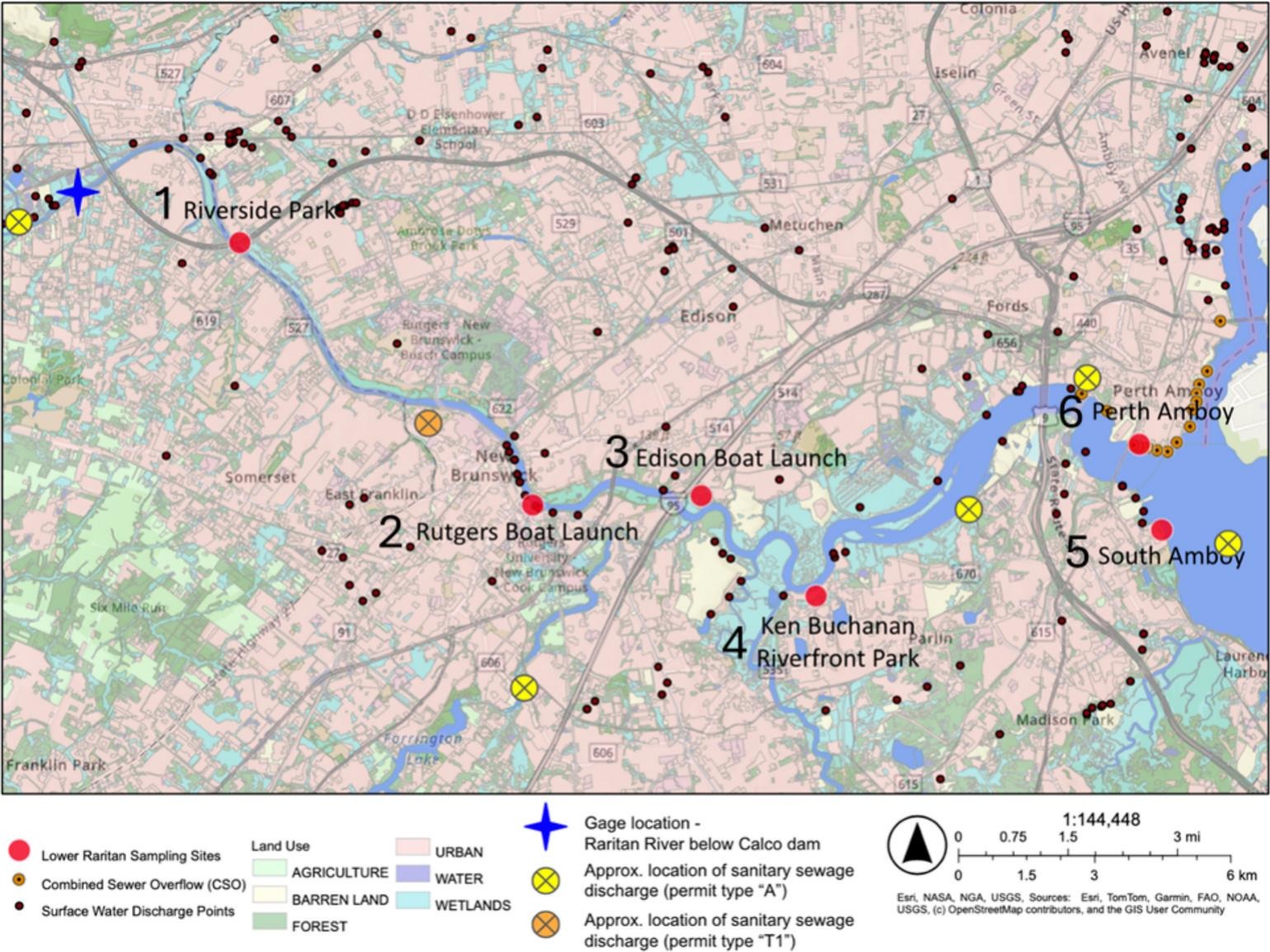
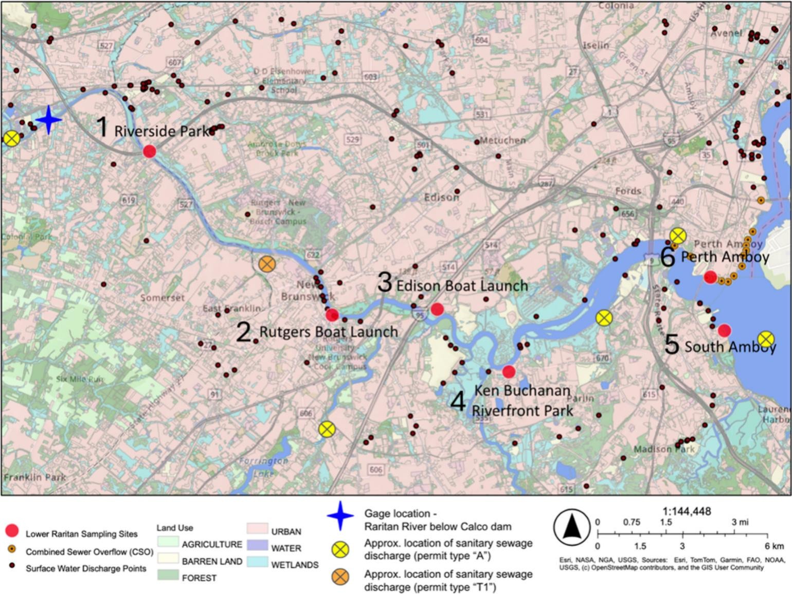
At LRWP, we believe you can’t fix what you don’t measure. Since 2019, our volunteers and partners have tested this river for bacteria every week at six sites along the tidal Raritan. We work under an EPA-approved quality assurance plan, and we post the results publicly.
That data anchors our new strategy to speed up cleanup plans, called TMDLs, for the Lower Raritan. Those plans set pollution budgets, and today the tidal Raritan from New Brunswick to Perth Amboy has almost none. We want to expand what we measure, including toxic contaminants like PFAS, and we’re launching a technical advisory committee to help do it.
But volunteers can’t set standards. That’s the State’s job.
So today I’m calling on Governor Sherrill’s office to move forward NJDEP’s proposed amendments to the Surface Water Quality Standards, setting criteria for PFAS and 94 other toxic contaminants. Standards are what make a pollutant count. They’re how a waterway gets listed as impaired, how permits set limits, and how cleanup plans get written. Standards are where cleanup begins.
And to members of the Senate Budget and Appropriations Committee: please advance S4468 and fund the monitoring, in our rivers and our private wells, that tells us where these chemicals are.
The Raritan has come back before, and it can again. Let’s not hand the next generation a new legacy pollutant. Thank you!
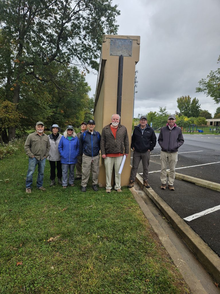
On Sunday, October 4, 2026, the Lower Raritan Watershed Partnership (LRWP), the Middlesex Borough Environmental Commission and members of the public gathered for a guided walk touring the newly constructed U.S. Army Corps of Engineers (USACE) flood control infrastructure in Middlesex Borough, NJ.
Standing near the newly installed flood gates and massive concrete flood walls, participants examined the intersection of legacy infrastructure, historical stream pathways, and modern stormwater engineering.
The outing provided an opportunity to contrast the borough’s heritage hydrology, how water historically flowed through local streams, wetlands, and natural floodplains, with the present-day realities of altered stream channels, localized flooding, and large-scale structural intervention.
The new flood gates and flood walls in Middlesex Borough represent key segments of the broader Green Brook Flood Risk Management Project. Managed by the USACE New York District in partnership with the New Jersey Department of Environmental Protection (NJDEP), this multi-decade, basin-wide effort covers a 150-square-mile drainage area spanning Somerset, Middlesex, and Union counties. Local oversight and advocacy are spearheaded by the Green Brook Flood Control Commission (GBFCC).
Historic Flooding Context in the Lower Raritan
The Green Brook basin has a long, documented history of devastating floods. The confluence of the Green Brook and the Bound Brook and the Raritan River forms a hydraulic bottleneck during extreme rain events. Notable severe flood events include:
August 1971 (Tropical Storm Doria): Caused widespread inundation, prompting initial severe calls for regional basin-wide flood mitigation.
September 1999 (Hurricane Floyd): Standardized the benchmark for modern flood danger in the basin, submerging downtown business districts and residential neighborhoods under several feet of floodwater.
April 2007 (Nor’easter) & August 2011 (Hurricane Irene): Re-emphasized the area’s ongoing vulnerability, breaching non-protected bank sections and delaying local economic recovery.
September 2021 (Tropical Storm Ida): Flash flooding rapidly overwhelmed stormwater networks and historical tributary pathways, underlining the increasing frequency of high-intensity precipitation events.
A Watershed Perspective: Habitat Connectivity & Stream Health
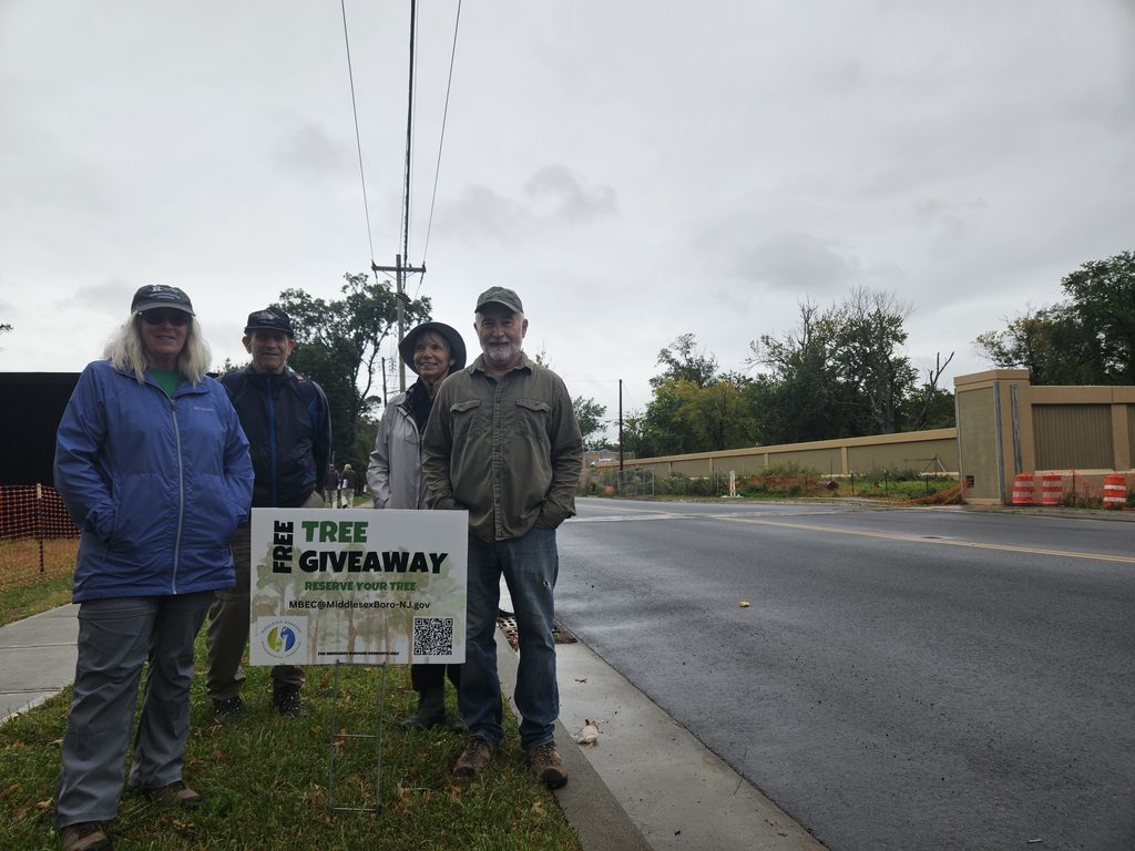
Constructing miles of reinforced concrete floodwalls and levees required clear-cutting thousands of mature trees along the riparian corridor. In 2024 the Middlesex Borough Environmental Commission initiated a mini “tree farm” and free tree giveaway program to support Borough residents in replacing trees on their own property.
From a watershed health standpoint, this loss carries immediate and long-term consequences. While concrete flood walls, levees, and closing gates offer protection for human structures, viewing these interventions through a watershed lens reveals significant ecological trade-offs:
Stream Health & Hydrologic Channelization: Hard infrastructure constrains streams to fixed paths, accelerating water velocity during high-flow events and preventing streams from dissipating energy naturally across floodplains.
Habitat Connectivity: Flood walls act as physical barriers for terrestrial and amphibious wildlife, cutting off riparian corridors necessary for foraging and breeding. Furthermore, culverts and gates can alter aquatic passage for migratory fish species.
Downstream Flooding Dynamics: Holding water back or channeling it more rapidly through one stretch of a stream can shift water volume downstream faster. Unless carefully balanced by upstream wetland retention (such as regional wetland mitigation projects), structural flood walls risk transferring peak volume challenges to downstream communities along the Raritan.
Non-Structural Floodplain Management
The New Jersey Department of Environmental Protection’s Blue Acres Program offers a non-structural alternative to flood walls by purchasing flood-prone homes from willing sellers at fair market value. The acquired land is demolished and permanently preserved as open space, restoring the natural floodplain sponge and permanently removing residents from harm’s way.
For properties that remain within flood zones, FEMA released the fourth edition of its technical guidance, Retrofitting Flood-Prone Residential Structures (FEMA P-259), in July 2026, replacing the prior 2012 edition. This updated manual provides engineers, architects, and homeowners with modernized standards for elevating foundations, dry/wet floodproofing, elevating utilities, and installing flood vents to protect homes while complementing regional flood defense infrastructure.
Essay and photos by Joe Mish unless otherwise noted
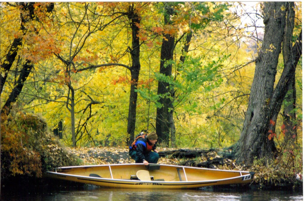
A yellow, curled autumn leaf or a Kevlar canoe; both are more than capable of transporting a traveler and their imagination through the autumn scenery along the South Branch of the Raritan and reveal a glimpse of the hidden, natural world. Photo by Lindsay May Mish
The trim yellow canoe quietly slipped through the standing leaf littered water with each stroke of the paddle. Eventually, the leaves would accumulate on the bow to create a gurgling sound and slow forward progress. A quick backstroke and turn of the bow cleared the leaves at the expense of energy exerted and time.
Autumn had arrived and the interchangeable term, fall, took on a practical meaning as the air was aflutter with falling leaves that carpeted the water’s surface.
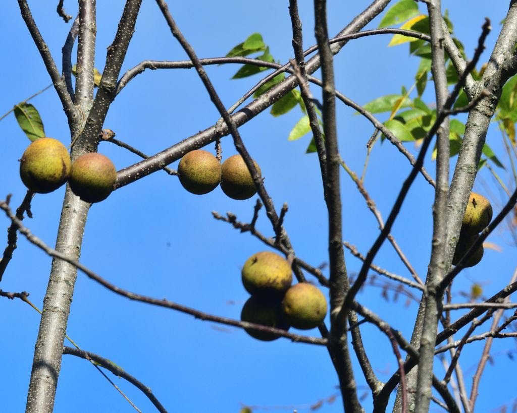
Leaves were not the only thing suddenly falling to earth. During an early morning paddle when all was silent and calm, a nearby, unexpected loud splash, sent shockwaves through my body. It sounded as if someone threw a rock in my direction with mal intent. In reality, it was a black walnut falling into the water. The large green billiard ball sized walnut enclosed husk is quite a formidable bludgeon, whose striking force is magnified when it hits the water.
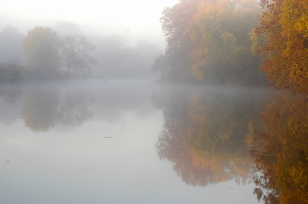
Peak autumn color is often enhanced by a pre-dawn gold infused mist covering the river when early October teases with the cold nights and warm sunny days. Drifting quietly downstream into the mist feels as if riding the current into the primordial past when the earth was just being formed. An alarmed great blue heron completes the experience as it reflects its paradactyl ancestry in size and form.
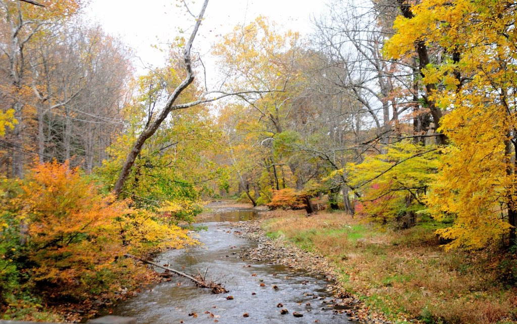
Some of the best fall scenery is along the rivers and canals where calm water mirrors the golden foliage and extends linearly to a vanishing point or disappears beyond a curve. This draws you deeper into the scene to a place where imagination, memories and time mingle with autumnal color. A place where the traveler will lose their way and wander aimlessly without the need to reach a destination.
The rays of the midday sun are captured by the water arguing with the rocks and stones of the exposed riverbed and turned into bright sparkling diamonds; a perfect complement to the blaze of fall foliage which lines the river’s banks. The white faceted diamonds lay like a necklace against the sky-blue décolletage reflected in the smooth water above and downstream of the turbulence.
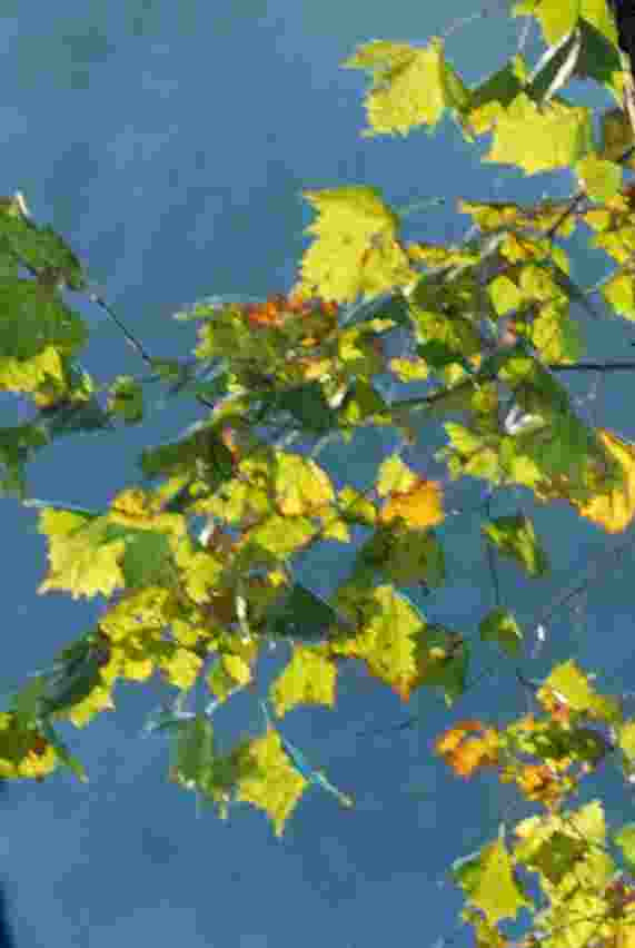
Sitting at the river’s edge watching fallen leaves float by, it is impossible to not imagine yourself aboard a curled yellow leaf traveling on the energy of the current and at the whim of an errant breeze. Through no effort of your own, you travel as an observer on a downriver cruise, unburdened by schedule or destination. It is as if you parted your conscious mind from reality, to set your imagination free. You look down to see the shadow of your leaf racing along the stony riverbed. Then spin around at the edge of an eddy and pass over a bed of long lime green grass swaying seductively in the current. Riding a smooth wave over a submerged rock, the sky appears for an instant. Pure white fluffy clouds parade against an azure, blue sky which disappears and reappears in the openings within the green and golden-brown foliage of a sycamore tree.
Each fallen leaf is a post-it-note created by autumn and distributed far and wide by the river’s current. Each colorful courier declares a friendly reminder of the inevitable change of seasons.
The autumn is truly a time of wonder, as daylight dims and shadows lengthen, while leaves magically turn brilliant colors. Like an emergency generator being triggered when the lights go out, the fall colors appear and flash a visual warning that winter’s icy emissary will arrive before the celestial clock officially declares winter’s arrival.
The seasons are tracked to the second by the predictable positions of the stars and planets. The stability of their celestial dance amid the chaos of the heavens is beyond comprehension, as the fall color is a reminder that our existence is at the mercy of the stars. A single scarlet leaf pasted to the sidewalk after a rain validates our heavenly origins.
October is the last comfort station before the final trek through the darkest days, as we stumble along to find the light switch on the first day of winter. The energy of brilliant fall color restores the spirit when the lights go out and power us through to the birth of light in December, when the shrinking light begins to grow.
Joe Mish has always lived in sight of New Jersey’s Raritan River. His early years were spent roaming clay banks, streams, tidal creeks and swamps of the Lower Raritan near Crab Island. Now living upstream on the Raritan’s South Branch, he photographs New Jersey’s natural treasures hidden in plain view, sharing them in his column “Along the South Branch” in The Branchburg News, on his own blog page, and via the Lower Raritan River Partnership’s website. Many of his photos appear in Judy Auer Shaw’s The Raritan River: Our Landscape, Our Legacy. Joe also has images published in Northeast Sporting Journal, Maine Outdoors and History of Willowood. A graduate of Rutgers Cook College, Joe is a regular on Super Aging Today radio program as a nature photojournalist. Retired from Johnson and Johnson where he worked in Clinical Research and Pharmacology, Joe paddles local rivers throughout the year to see what surprises nature has to offer when no one else is looking.
Written by Olesya Nabokova, Rutgers Environmental Steward Program Participant
Thursday mornings begin early for the pathogen monitoring team. By 7:30 a.m., we are already at Riverside Park — the first of six sampling sites. These mornings are usually remarkably beautiful, filled with early sunlight, the quiet murmur of the river, crisp air, and the warm and inspiring atmosphere created by a group of enthusiastic people.
Art, Ashley, Endurance, Olesya, and Mike at Riverside Park, Piscataway.
All of them come from very different backgrounds, including LRWP representatives, Rutgers students, and simply concerned and engaged members of the community, but we are all driven by a common purpose. And this blend of people is easily the most inspiring part of the experience.
I first learned about LRWP pathogens monitoring while enrolled in the Rutgers Environmental Steward (RES) program. As an ecologist, I wanted to understand the environmental characteristics of the region my family had just moved to, and find ways to contribute to addressing its environmental challenges. RES provides exactly that opportunity: it empowers volunteers with the knowledge and tools to tackle pressing environmental issues across New Jersey. Through expert-led training and hands-on learning, Stewards discover how to promote sustainable climate solutions and drive meaningful change, both in their personal lives and within their communities.
To graduate, every Steward completes a certification project addressing a specific environmental issue in their community. You can design your own project with support from a coordinator or choose an existing initiative from a host organization. I was particularly drawn to LRWP pathogens monitoring of the Lower Raritan River.
At first glance, this work may sound like simply collecting water samples. In reality, it goes much deeper. Only volunteers who have completed the required training and hands-on practice are permitted to collect samples and conduct field measurements of water-quality parameters such as pH, dissolved oxygen, algal pigments, salinity, and temperature. Standardized procedures are carefully followed, and monitoring equipment is thoroughly calibrated.
Susana and Olesya record measurements from the YSI Sonde, including temperature, pH, and salinity.
In addition to water-quality measurements, the team conducts a Visual Habitat Assessment, documenting conditions such as weather and tide at the time of sampling, water color and odor, human activities, animals present in the waterbody, and other observations. While on-site, we also remove trash from the shoreline and the water.
But one of the most critical parts of our work is community outreach. We chat with passersby about what we are doing and why this data matters. We show them where to find our weekly results online, helping the public make informed, safe decisions about swimming, kayaking, or boating at different spots along the river.
Mike searches for plastic trash amid the debris deposited at Edison Boat Basin.
Throughout every stage of this work, I am constantly inspired by my teammates. They are ready to collect samples in pouring rain or under the blazing sun. They remove dozens of gallons of trash from the shoreline.
They have an impressive knowledge of the local flora, fauna, and environmental and historical features of the region. And they are generous in sharing that knowledge with others. Perhaps what inspires me most is that the team does not simply observe the problems we encounter – it takes action. For instance, when signs of a possible leak or overflow from a combined sewer system (including a characteristic odor and large amounts of discarded baby wipes along the shoreline) were noticed, LRWP representatives followed up with local authorities to report the issue. On another occasion, when we found trees along the riverbank that had been damaged during lawn mowing, the team carefully tended them over the following few weeks and helped protect regrowth from further harm.
After coordinating with Eddy, the Boyd Park maintenance lead in New Brunswick, the team installed a series of tree guards around a series of honey locusts. The trees grew four feet in one season. Mature trees reduce the strain on storm water systems and protect the ground from excessive solar heat.
It is largely thanks to people like these – caring, dedicated, and deeply committed to their community – that this experience has been so meaningful to me. I am especially grateful to Heather Fenyk, LRWP’s Executive Director, for her leadership and guidance; to Dr. John Meyer for the thoughtful way he organizes each sampling session, generously shares his knowledge, and navigates all unexpected situations with remarkable patience and tact; and to my RES coordinator, Michele Bakacs, for introducing me to this opportunity. For me, this is exactly what environmental stewardship looks like in practice: science, community, and a genuine commitment to the place we all share.
Olesya and Mike display seven gallons of trash recovered from Sayreville.
Endurance is a senior at Rutgers University, The State University of New Jersey—New Brunswick, majoring in Cell Biology and Neuroscience. This summer, she wanted to be involved in public service and community engagement which led her to apply for the 2026 Rutgers Scarlet Service Internship Program. Even though she did not know which organization she would end up interning with, she knew she wanted to do something that would require her to apply the knowledge she acquired in her coursework out on the field. After a rigorous interview process with five non-profit organizations, she matched with the Lower Raritan Watershed Partnership!
With the LRWP she serves as a Pathogens Monitoring and Communications Intern, where she works with volunteers to collect hydrological samples and record hydrological field data. Under the supervision of Dr. John Meyer, Endurance is also in charge of writing weekly blog posts that include results from the Interstate Environmental Commission (IEC) lab analysis of the water samples and a narrative of the pathogens monitoring sessions. Additionally, she works together with the LRWP team and its volunteers of diverse backgrounds in coming up with possible solutions to tackle water quality and environmental safety issues to improve the health of the communities that surround the Lower Raritan.
We asked Endurance what she has learned through her internship:
“I have developed strong communication across lingual bridges, refined written and spoken science communication and have strengthened leadership, organizations and teamwork skills!”
Endurance shared that she is passionate about medicine and using scientific insights to enhance community wellbeing and says her work with LRWP has offered an early, hands-on glimpse into what community-engaged science looks like in practice.
You can read Endurance’s journal entries about her pathogens monitoring experiences here:
Here at the Lower Raritan Watershed Partnership (LRWP), we believe that a healthy Raritan River and Lower Raritan Watershed is possible, restored and sustained through collaboration, participatory science, and stewardship.
Our work connects the dots between individual action and collective impact, realizing healthy ecological connections on the path to a healthy watershed. As a growing 501(c)(3) nonprofit with a slate of new programs coming on line in 2026, the LRWP is looking for Board Members and Technical Advisory Committee Members to join us in this shared work. While we are open to contributions from individuals with expertise of all kinds, we are also seeking individuals with experience in fundraising.
Please see our Board Member/Technical Advisory Committee Member Application Package (below).
The Board of Directors (“Board”) of LRWP is a working and governing board and is responsible for oversight of the strategic, financial, operational, and policy decisions for the organization. At present, the Board manages the administration of policy and practice as well as operations. Membership of the Board should represent leaders who demonstrate significant commitment and passion for the organization’s mission, strategic planning, and organizational success. Reporting to the Board Chair, Board Members typically serve three-year terms and make a meaningful financial commitment to the organization on an annual basis.
About the Technical Advisory Committee
Our Technical Advisory Committee meets 2-3x a year, providing “on call” expertise and often serving on behalf of the LRWP as liaison or representative with other organizations, committees or boards. The Technical Advisory Committee members report to the Chair of the LRWP Organizational Support Committee. Membership of the Technical Advisory Committee should represent field experts or community leaders whose knowledge and work dovetails in significant way with the LRWP’s initiatives. Technical Advisory Committee Members typically serve three-year terms and are expected to participate in key annual organizational events (TAC meetings, the LRWP Annual Meeting, etc).
LRWP is proud to welcome Heather Fenyk as our first-ever Executive Director. As the organization continues to grow in scope and impact, this new chapter reflects both momentum and intention. I spoke with Heather about stepping into this role and her vision for the watershed’s future.
NC: Congratulations on becoming LRWP’s first Executive Director! What does this moment mean for the organization? HF: Thank you — it’s truly an honor. This role represents an evolution for LRWP. For years, we’ve accomplished so much as an all-volunteer organization. Moving to a structure with dedicated staff signals that we’re ready to deepen and expand our impact. It doesn’t change who we are at our core — we remain rooted in partnership and volunteer energy — but it allows us to be more strategic, responsive, and consistent in our work across the watershed.
NC: What are your priorities as you step into this position? HF: Along with strengthening our internal processes, building systems, and continuing our fundraising efforts, I want to focus on cultivating a true “watershed ethic.” That means helping people understand how data connects to policy and how policy connects to lived experience.
We need stronger vertical integration — from scientific monitoring to municipal decision-making. For example, pathogen monitoring data should inform MS4 planning and then ultimately support stormwater utilities. Hyper-local data needs to translate into concrete examples communities can act on.
We must think regionally and at the county level. Watershed-scale planning and implementation allow us to address flooding, wildfire risk, land management, and ecological restoration as interconnected systems rather than isolated issues.
NC: LRWP was recently awarded the DEP’s Extreme Weather Resiliency Grant — our largest grant to date. What does this project represent? HF: This grant is both a milestone and a responsibility. We will be developing an Extreme Weather Resilience Plan focused on remediated and contaminated sites in Middlesex County, selecting ten priority sites — five impacted by flooding and five affected by wildfires — and conducting comprehensive vulnerability assessments.
This project embodies our watershed approach. Extreme weather doesn’t respect municipal boundaries, and neither do environmental risks related to pollutant flows. By examining these sites through a resilience lens, we can help municipalities better understand vulnerabilities and integrate those findings into planning and implementation. It’s about preparing for the future with science-based, regionally informed solutions.
NC: LRWP has grown significantly over the past decade. How do you see your role building on that momentum? HF: LRWP has earned tremendous credibility. People recognize it as a trusted voice for the watershed. My role is to build on that trust — strengthening our educational programming, supporting thoughtful advocacy, and helping translate big-picture watershed issues into meaningful local action. Residents need to see how what happens in their town connects to the health of the entire watershed system.
NC: Partnership has always been central to LRWP’s identity. How will that continue? HF: Partnership is everything! I see LRWP as both a convener and a collaborator. Whether we’re working with elected officials, environmental commissions, schools, or community groups, our approach is rooted in shared purpose. We want to create opportunities for people to talk to each other — not at each other — and to build solutions grounded in respect, data, and common goals.
NC: What do you see as your goals as Board President? DT: LRWP is, at its heart, a volunteer board. That shapes how I see this role. My primary goal is to support the work of our subcommittees and make sure they have what they need to thrive. If I can help remove administrative hurdles and keep us organized and focused, that’s a win. I also see my role as offering strong support to Heather Fenyk as she steps into her new position as Executive Director. Leadership works best when it’s collaborative, and I’m committed to making sure she has the partnership she needs.
NC: How has LRWP grown over the past ten years? DT: We’ve grown from being a volunteer group to becoming THE volunteer group — “the Voice of the Watershed”. That reputation has been earned through consistency and credibility. Today, people are listening. Municipal leaders, residents, and partners recognize LRWP as a trusted resource. We’ve also become more strategic in our advocacy. For example, in 2020 we joined East Brunswick Township in litigation to protect a highly environmentally sensitive area from development. Actions like that aren’t taken lightly — they’re part of a broader effort to influence policy and strengthen protections across the watershed. We want our work to lead to systemic change.
NC: LRWP remains a relatively small organization, even as we welcome our first compensated Executive Director. How can we best serve the 50 municipalities within the watershed? DT: Capacity is still a challenge. We can’t be everywhere at once, but we can model what partnership looks like. That means building strong relationships with local governments, community organizations, educators, and residents. Our strength has always been collaboration. If we continue to connect people, share resources, and amplify good work, we can have an impact far beyond our size.
NC: What advice would you give to someone who wants to better appreciate the Lower Raritan Watershed? DT: Slow down. Pay attention. Listen carefully to what’s around you — the water, the landscape, the human communities. Ask questions and stay curious. The watershed isn’t just a physical place; it’s a living system we’re part of with a rich history and ever changing landscape. The more we practice that kind of attentive appreciation, the more motivated we become to protect it.
NC: Why should someone consider volunteering as an LRWP Board member?DT: Serving on the LRWP Board is a meaningful way to extend your commitment to your community, the environment and LRWP. It’s an opportunity to step back and look at the entire watershed — beyond municipal boundaries — and help shape its future. We welcome people who bring professional expertise, lived experience, and passion to the table. If you care about the Lower Raritan and want to make a tangible difference, we are actively looking for new board members to join us.
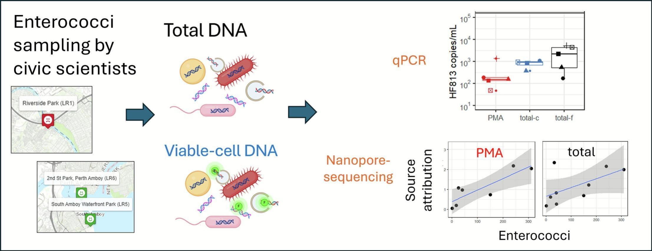
With huge thanks to our partners including Rutgers Cooperative Extension of Middlesex County, the Fahrenfeld Lab at Rutgers – The State University of New Jersey, and NJ Sea Grant, the LRWP is pleased to share that findings based on our Summer Raritan River civic science pathogens monitoring and data gathering efforts were published by Elsevier in Science of the Total Environment:
Ehasz, G., Almosd, L., Ahamed, P., Bakacs, M., Fenyk, H., Fahrenfeld, N.L. 2026. Comparison of propidium monoazide and total-DNA based qPCR and long-read sequencing for microbial source tracking in an estuarine river. Science of the Total Environment. 1013, 181271. 10.1016/j.scitotenv.2025.181271
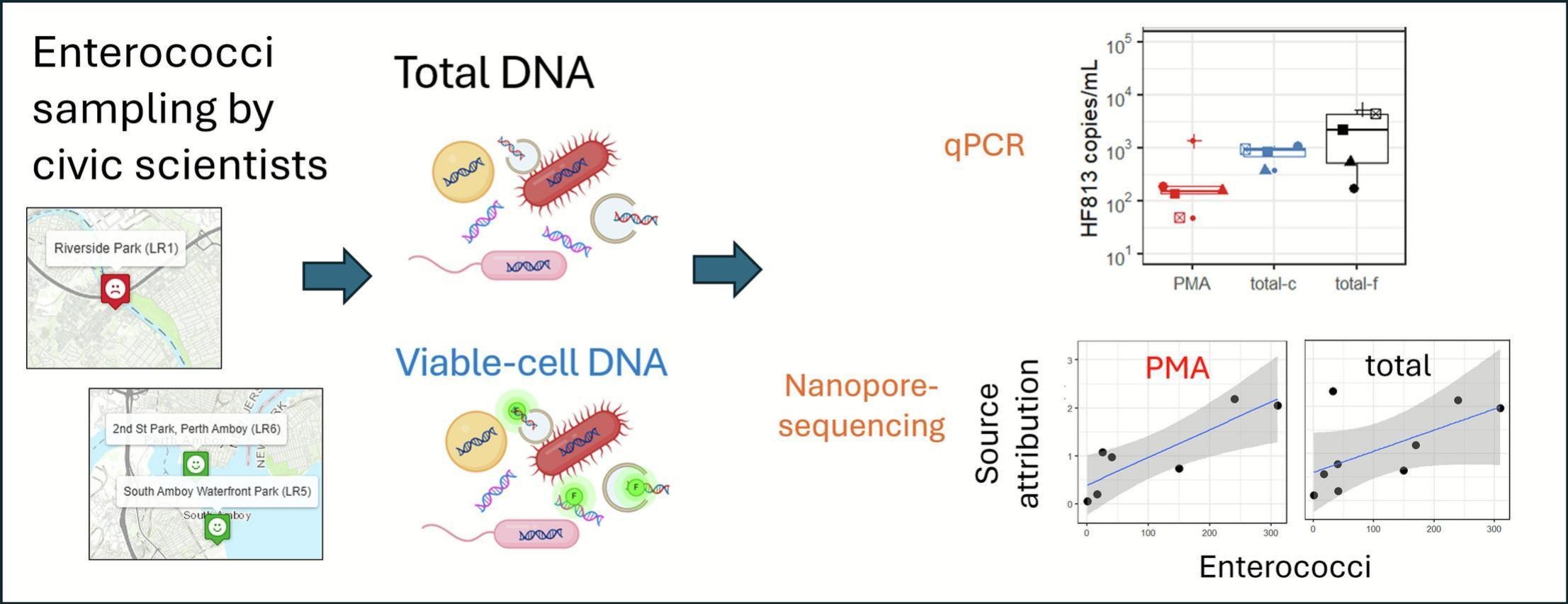
Recap: Fecal pollution is a common cause of water pollution and improved microbial source tracking techniques are needed. A NJ Sea Grant funded team from Rutgers, Middlesex County Extension, and the Lower Raritan Watershed Partnership conducted microbial monitoring on the Lower Raritan River. Total-DNA and viable-cell DNA techniques were compared.
Results: Using viable-cell DNA rather than total DNA resulted in better correlations between fecal pollution and source measurements. The techniques demonstrated in the Lower Raritan can be applied in any watershed with fecal pollution issues and may improve results.
With huge thanks to partners including Rutgers Cooperative Extension of Middlesex County, the Fahrenfeld Lab at Rutgers – The State University of New Jersey, and NJ Sea Grant, the LRWP is pleased to share that findings based on our Summer Raritan River civic science pathogens monitoring and data gathering efforts were published by Elsevier in Science of the Total Environment:
Ehasz, G., Almosd, L., Ahamed, P., Bakacs, M., Fenyk, H., Fahrenfeld, N.L. 2026. Comparison of propidium monoazide and total-DNA based qPCR and long-read sequencing for microbial source tracking in an estuarine river. Science of the Total Environment. 1013, 181271. 10.1016/j.scitotenv.2025.181271
Recap: Fecal pollution from humans and birds was identified using DNA-based techniques in the Lower Raritan. Fecal pollution is a common cause of beach and shellfish harvest closures and microbial source tracking can help identify the source of this pollution. A NJ Sea Grant funded team from Rutgers, Middlesex County Extension, and the Lower Raritan Watershed Partnership conducted microbial monitoring on the Lower Raritan River. Multiple techniques for fecal source tracking were tested and compared.
Results: Microbial pollution in the Lower Raritan was linked to both human and bird sources using both qPCR and microbiome-based techniques that focus on living cells rather than total DNA. Results were shared with local utilities and governmental agencies who can find solutions for these pollution sources. The techniques demonstrated in the Lower Raritan can be applied in any watershed with fecal pollution issues.