The first pathogen monitoring session of the month took place on Thursday, October 8th. Each week during the summer, from May to October, the Lower Raritan Watershed Partnership and Rutgers Cooperative Extension of Middlesex County run a volunteer-based monitoring program along the Raritan River. We collect water quality samples at six non-bathing public access beach sites, provide our samples to the Interstate Environmental Commission for analysis in their laboratory, and report the results to the public. Our mission is to share this data with the community and partners to ensure the safe use of the Raritan River for all.
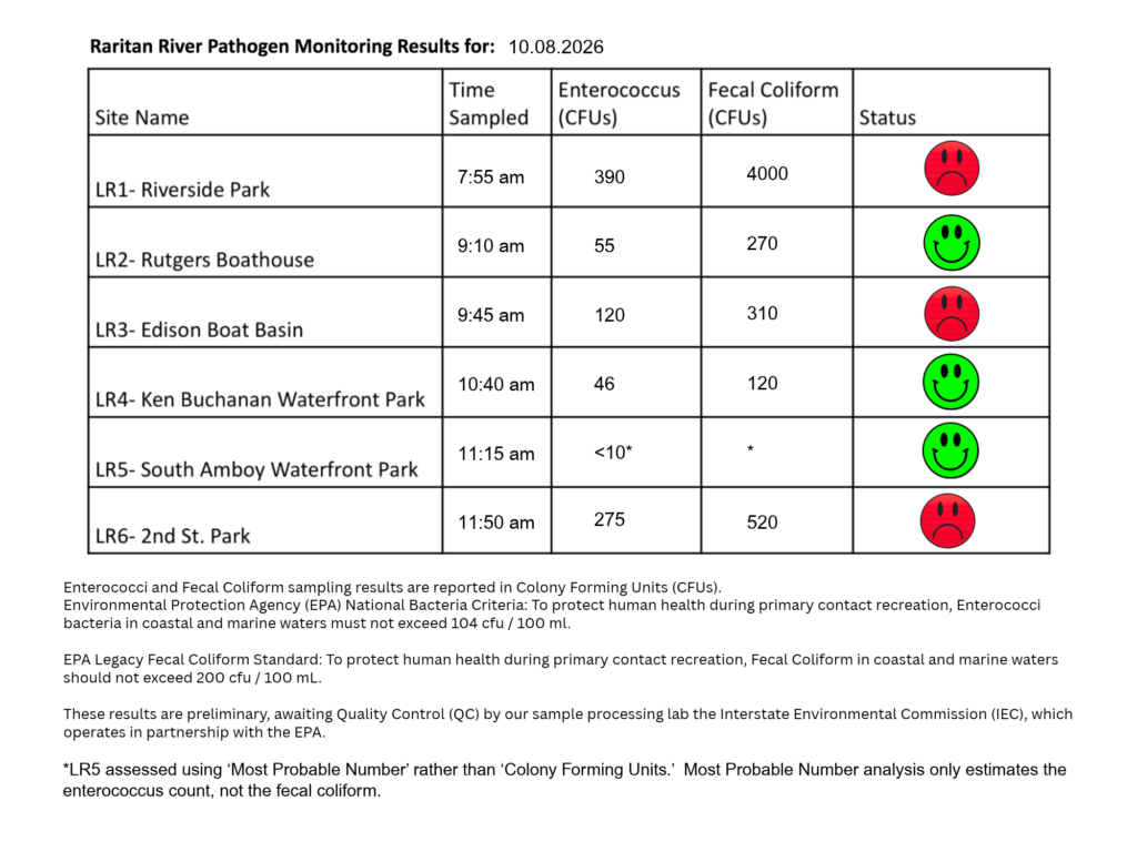
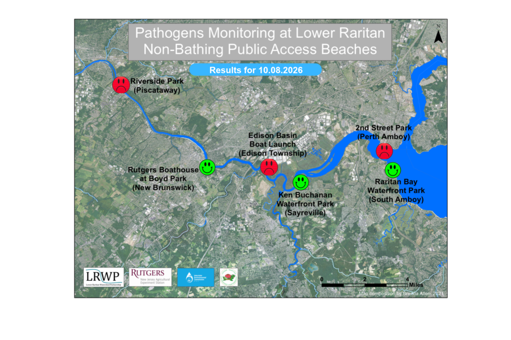
Our lab results for water quality samples taken on Thursday, October 8th, 2026, show Enterococcus bacteria levels exceeding the EPA federal water quality standard of 104 cfu/100mL at three of our regular monitoring sites this week. The problem sites are indicated by the red frown on the map and chart and include Riverside Park (Piscataway), Edison Boat Basin (Edison), and Second Street Park (Perth Amboy).
Green smiles on the chart and map indicate the sites with bacteria levels safe for recreation and include the following: Rutgers Boat Basin (New Brunswick),Ken Buchanan Waterfront Park (Sayreville), and Raritan Bay Waterfront Park (South Amboy).
A note of caution: New Brunswick and Sayreville remain above the legacy EPA standard for Fecal Colony-Forming Units. Wash your hands, and cook your fish.
Pathogens/Enterococci levels are used as indicators of the possible presence of disease-causing bacteria in recreational waters. Such pathogens may pose health risks to people coming in primary contact with the water (touching) through recreational activities like fishing, kayaking or swimming in a water body. Possible sources of bacteria include Combined Sewer Overflows (CSOs), improperly functioning wastewater treatment plants, stormwater runoff, leaking septic systems, animal carcasses, pet waste, wildlife waste, and runoff from manure storage areas.
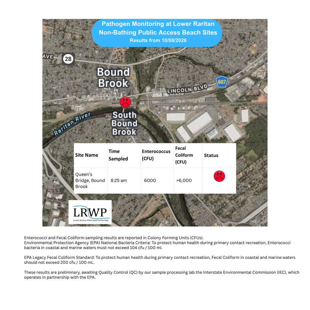
In order to better understand why Riverside Park, Piscataway has been our worst performing site over the past six years, we have started sampling at new sites in the vicinity. On October 8th, we sampled the Queen’s Bridge for a sixth time since we started pathogens monitoring this season. The lab analysis produced 6,000 enterococci cfu per 100mL which is well above the EPA federal water quality standard of 104 cfu/100mL!
Our goal in reporting these results is to give residents a better understanding of the potential health risks related to primary contact during water-based recreation. If you are planning on recreating on the Raritan this weekend, make sure to stay safe and wash up after any activities!
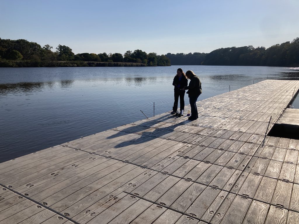
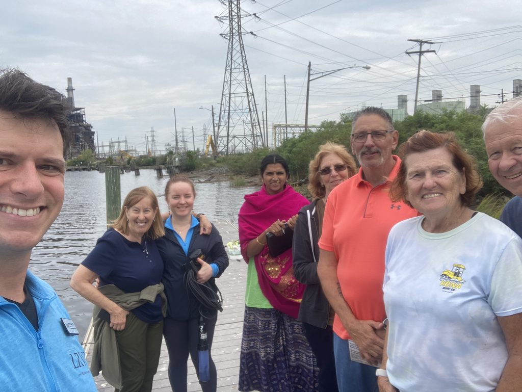
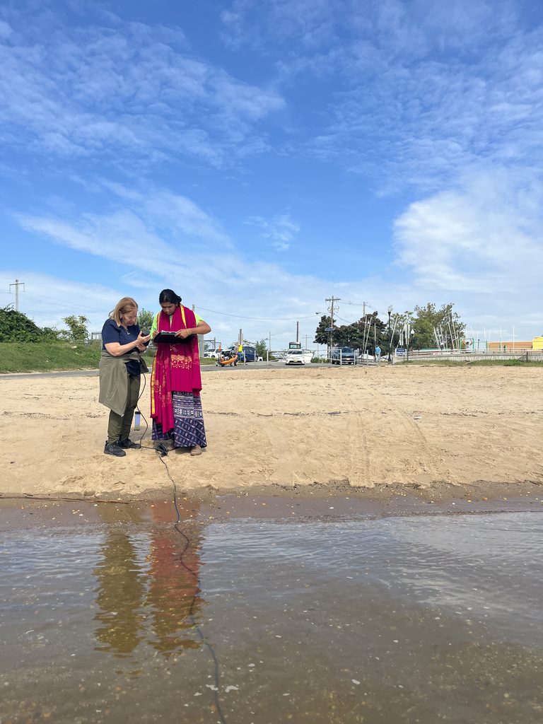
Olesya and Doreen sample the water at Rutgers Boat House for the final time of the season.
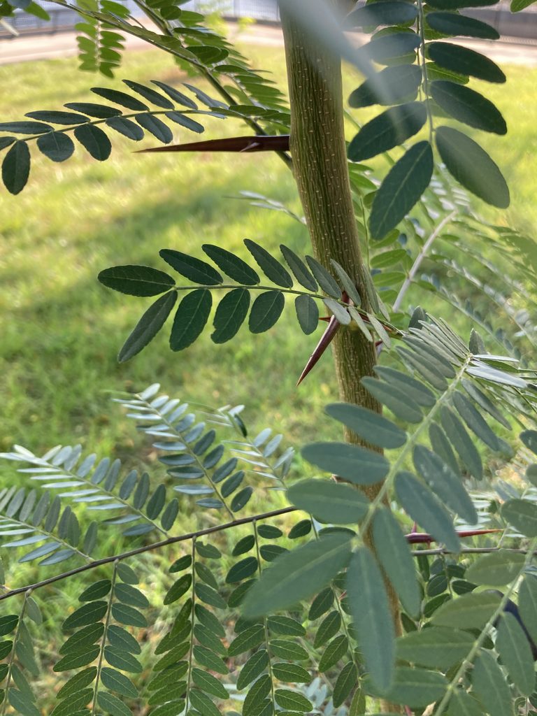
The honey locust trees in New Brunswick continue to put out new leaves each week. Each compound leaf on a honey locust is paired with sharp tri-tongued thorns.
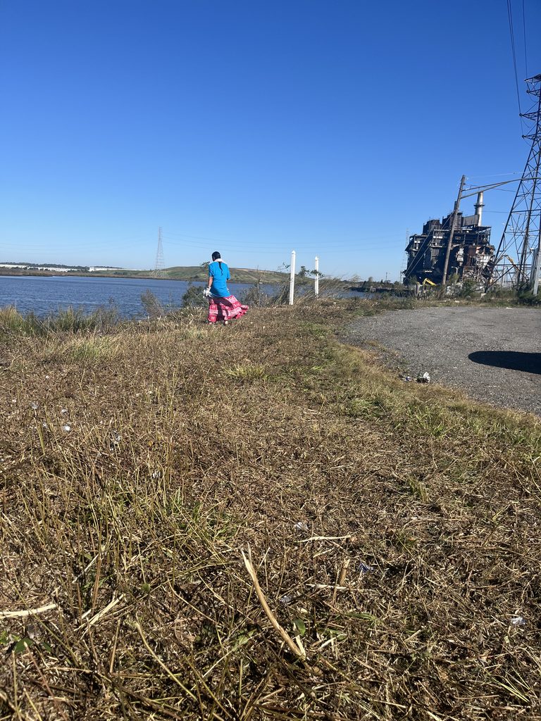
Lakshmi searches for trash among the recently mown riparian zone in Sayreville. The vegetation forms an important buffer between the water and the land. It’s especially effective at trapping plastic and preventing it from washing into the water.
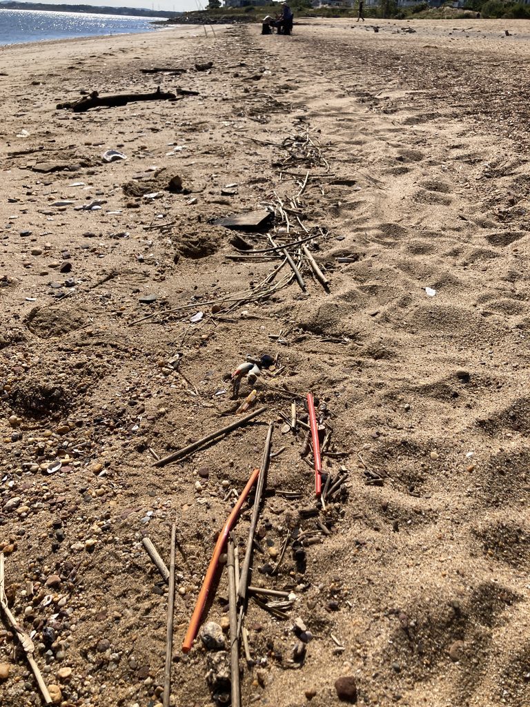
The receding tide always leaves a line of plastic straws and woody debris on the shore at South Amboy.
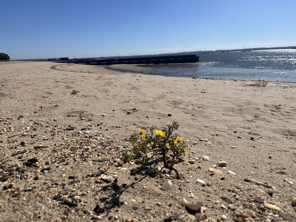
A lonely camphorweed grows along the shore in Perth Amboy, New Jersey. The flower and leaves produce a sharp, resinous scent. –Photo by Olesya Nabokova.
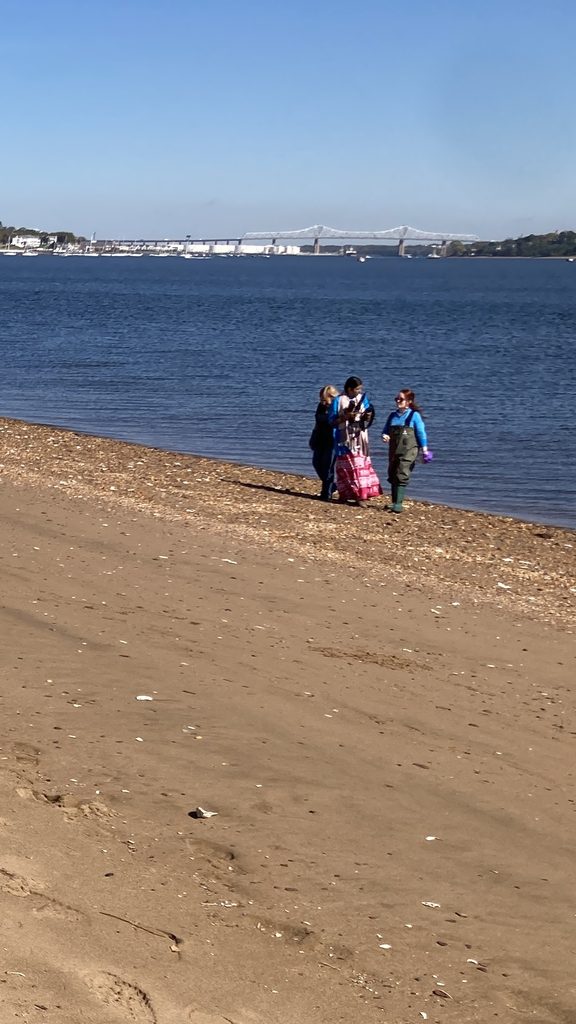
Doreen, Lakshmi, and Olesya leave the shoreline of Raritan Bay after sampling in South Amboy.
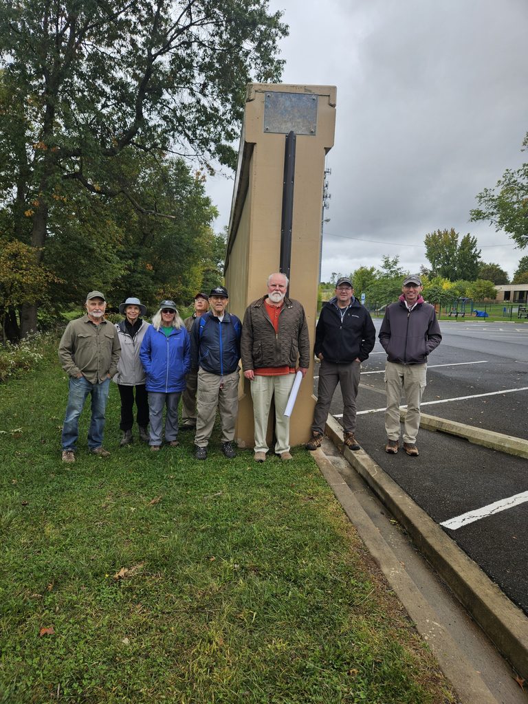
On Sunday, October 4, 2026, the Lower Raritan Watershed Partnership (LRWP), the Middlesex Borough Environmental Commission and members of the public gathered for a guided walk touring the newly constructed U.S. Army Corps of Engineers (USACE) flood control infrastructure in Middlesex Borough, NJ.
Standing near the newly installed flood gates and massive concrete flood walls, participants examined the intersection of legacy infrastructure, historical stream pathways, and modern stormwater engineering.
The outing provided an opportunity to contrast the borough’s heritage hydrology, how water historically flowed through local streams, wetlands, and natural floodplains, with the present-day realities of altered stream channels, localized flooding, and large-scale structural intervention.
The new flood gates and flood walls in Middlesex Borough represent key segments of the broader Green Brook Flood Risk Management Project. Managed by the USACE New York District in partnership with the New Jersey Department of Environmental Protection (NJDEP), this multi-decade, basin-wide effort covers a 150-square-mile drainage area spanning Somerset, Middlesex, and Union counties. Local oversight and advocacy are spearheaded by the Green Brook Flood Control Commission (GBFCC).
Historic Flooding Context in the Lower Raritan
The Green Brook basin has a long, documented history of devastating floods. The confluence of the Green Brook and the Bound Brook and the Raritan River forms a hydraulic bottleneck during extreme rain events. Notable severe flood events include:
August 1971 (Tropical Storm Doria): Caused widespread inundation, prompting initial severe calls for regional basin-wide flood mitigation.
September 1999 (Hurricane Floyd): Standardized the benchmark for modern flood danger in the basin, submerging downtown business districts and residential neighborhoods under several feet of floodwater.
April 2007 (Nor’easter) & August 2011 (Hurricane Irene): Re-emphasized the area’s ongoing vulnerability, breaching non-protected bank sections and delaying local economic recovery.
September 2021 (Tropical Storm Ida): Flash flooding rapidly overwhelmed stormwater networks and historical tributary pathways, underlining the increasing frequency of high-intensity precipitation events.
A Watershed Perspective: Habitat Connectivity & Stream Health
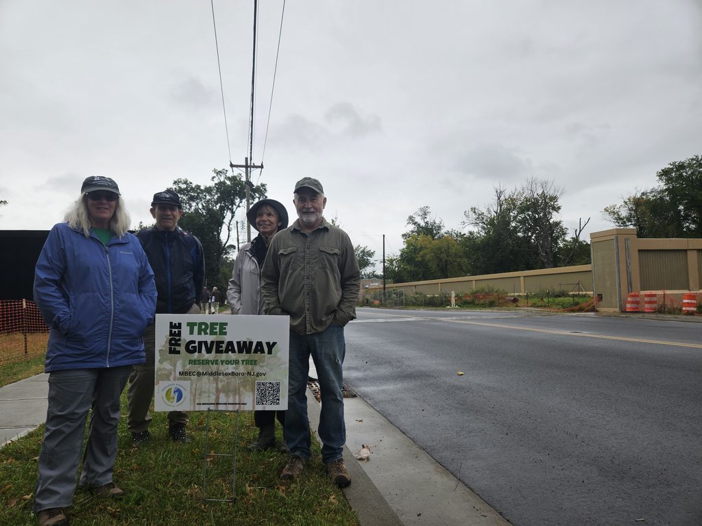
Constructing miles of reinforced concrete floodwalls and levees required clear-cutting thousands of mature trees along the riparian corridor. In 2024 the Middlesex Borough Environmental Commission initiated a mini “tree farm” and free tree giveaway program to support Borough residents in replacing trees on their own property.
From a watershed health standpoint, this loss carries immediate and long-term consequences. While concrete flood walls, levees, and closing gates offer protection for human structures, viewing these interventions through a watershed lens reveals significant ecological trade-offs:
Stream Health & Hydrologic Channelization: Hard infrastructure constrains streams to fixed paths, accelerating water velocity during high-flow events and preventing streams from dissipating energy naturally across floodplains.
Habitat Connectivity: Flood walls act as physical barriers for terrestrial and amphibious wildlife, cutting off riparian corridors necessary for foraging and breeding. Furthermore, culverts and gates can alter aquatic passage for migratory fish species.
Downstream Flooding Dynamics: Holding water back or channeling it more rapidly through one stretch of a stream can shift water volume downstream faster. Unless carefully balanced by upstream wetland retention (such as regional wetland mitigation projects), structural flood walls risk transferring peak volume challenges to downstream communities along the Raritan.
Non-Structural Floodplain Management
The New Jersey Department of Environmental Protection’s Blue Acres Program offers a non-structural alternative to flood walls by purchasing flood-prone homes from willing sellers at fair market value. The acquired land is demolished and permanently preserved as open space, restoring the natural floodplain sponge and permanently removing residents from harm’s way.
For properties that remain within flood zones, FEMA released the fourth edition of its technical guidance, Retrofitting Flood-Prone Residential Structures (FEMA P-259), in July 2026, replacing the prior 2012 edition. This updated manual provides engineers, architects, and homeowners with modernized standards for elevating foundations, dry/wet floodproofing, elevating utilities, and installing flood vents to protect homes while complementing regional flood defense infrastructure.
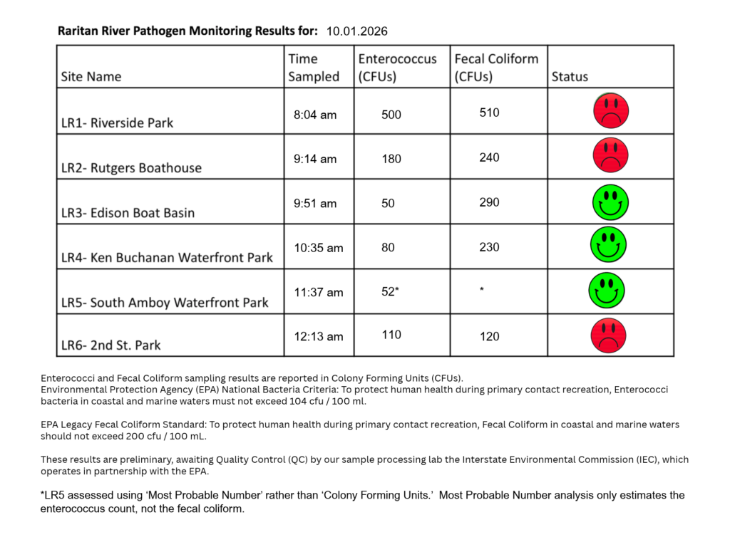
The first pathogen monitoring session of the month took place on Thursday, October 1st. Each week during the summer, from May to October, the Lower Raritan Watershed Partnership and Rutgers Cooperative Extension of Middlesex County run a volunteer-based monitoring program along the Raritan River. We collect water quality samples at six non-bathing public access beach sites, provide our samples to the Interstate Environmental Commission for analysis in their laboratory, and report the results to the public. Our mission is to share this data with the community and partners to ensure the safe use of the Raritan River for all.
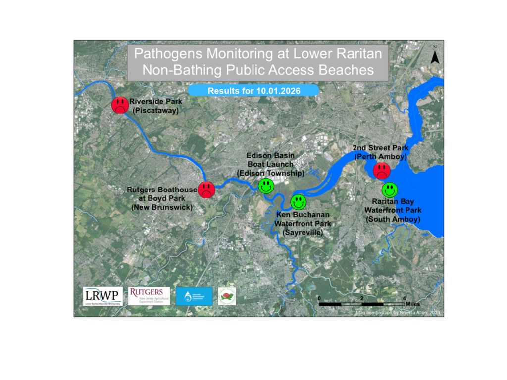
Our lab results for water quality samples taken on Thursday, October 1st, 2026, show Enterococcus bacteria levels exceeding the EPA federal water quality standard of 104 cfu/100mL at three of our regular monitoring sites this week. The problem sites are indicated by the red frown on the map and chart and include Riverside Park (Piscataway), Rutgers Boat House (New Brunswick), and Second Street Park (Perth Amboy).
Green smiles on the chart and map indicate the sites with bacteria levels safe for recreation and include the following: Edison Boat Basin (Edison),Ken Buchanan Waterfront Park (Sayreville), and Raritan Bay Waterfront Park (South Amboy).
A note of caution: in the wake of the nor’easter, none of the sites met the legacy EPA standard for Fecal Colony-Forming Units. Wash your hands, and cook your fish.
Pathogens/Enterococci levels are used as indicators of the possible presence of disease-causing bacteria in recreational waters. Such pathogens may pose health risks to people coming in primary contact with the water (touching) through recreational activities like fishing, kayaking or swimming in a water body. Possible sources of bacteria include Combined Sewer Overflows (CSOs), improperly functioning wastewater treatment plants, stormwater runoff, leaking septic systems, animal carcasses, pet waste, wildlife waste, and runoff from manure storage areas.
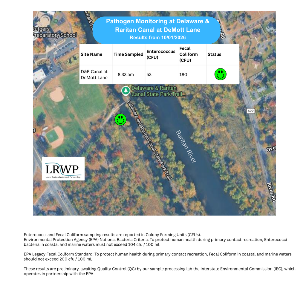
In order to better understand why Riverside Park, Piscataway has been our worst performing site over the past six years, we have started sampling at new sites in the vicinity. On October 1st, we sampled the Delaware & Raritan Canal at DeMott lane for a fifth time since we started pathogens monitoring this season. The lab analysis produced 53 enterococci cfu per 100mL which satisfies the EPA federal water quality standard of 104 cfu/100mL.
Our goal in reporting these results is to give residents a better understanding of the potential health risks related to primary contact during water-based recreation. If you are planning on recreating on the Raritan this weekend, make sure to stay safe and wash up after any activities!
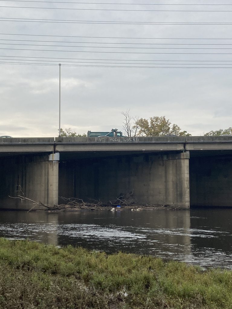
A plastic blue and white ice chest has joined the debris along I 287 in Piscataway. During rain events, the debris rises and falls with the water, and bashes against the concrete. This causes scouring on the piers. An LRWP volunteer contacted the New Jersey Department of Transportation about the issue.
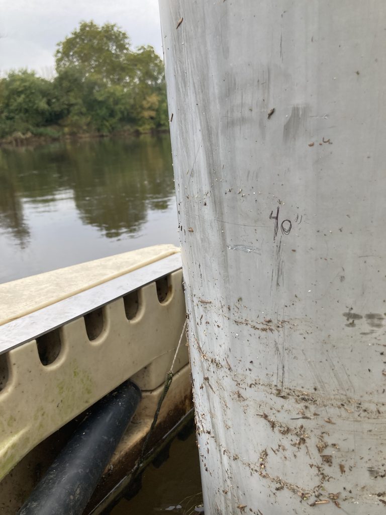
In dry conditions, the river at the Piscataway Riverside Park boat dock is only about ten inches deep. During the nor’easter, the debris line tells us river rose at least another twenty-five inches.
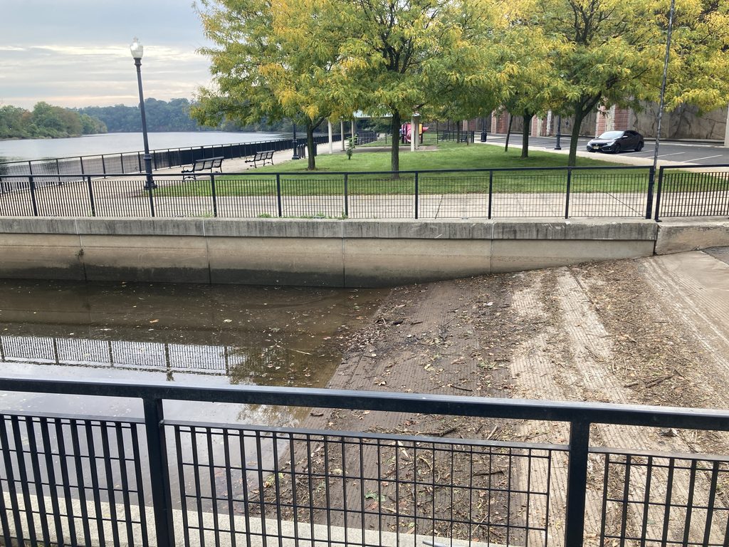
As one would expect, the nor’easter combined with the harvest moon to drive the river over the banks of Boyd Park. New Brunswick Parks did an impressive job cleaning up the park in the wake of the storm — and they even cleaned out the boat ramp!
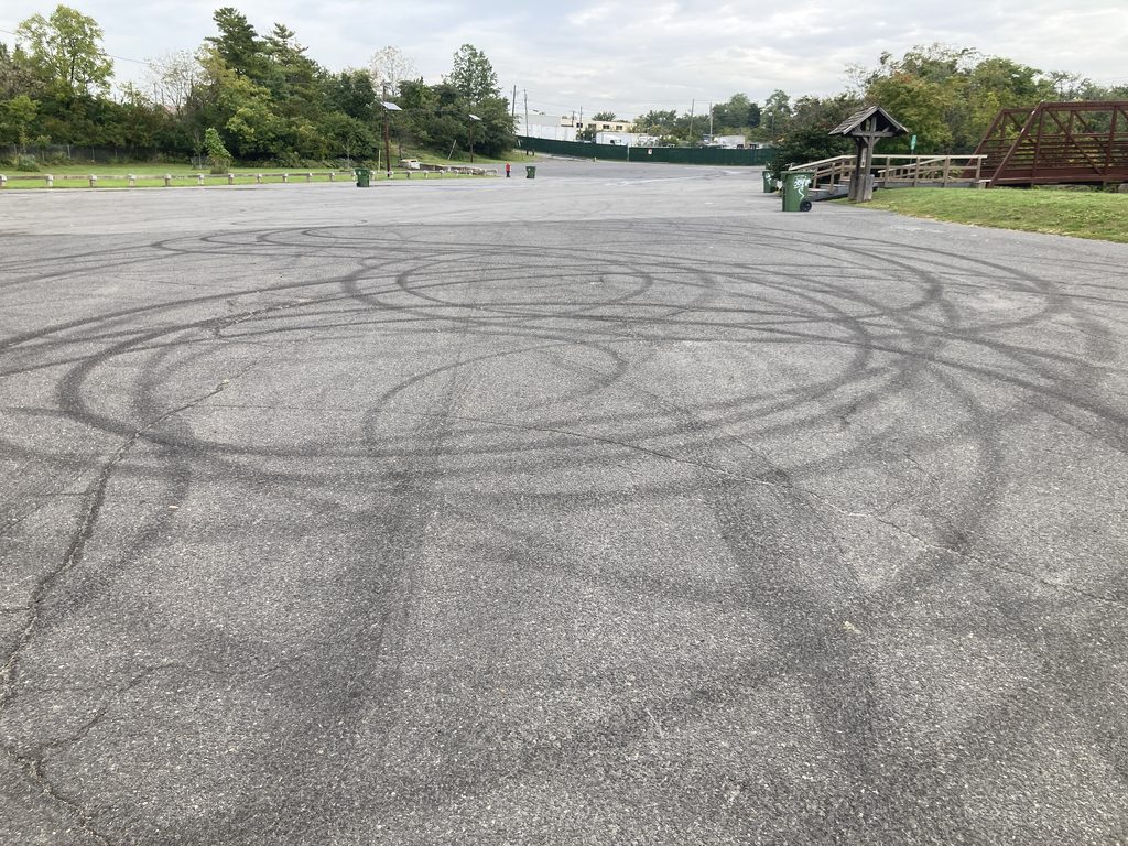
A reckless driver lined up the trash cans at Edison boat basin and then knock them over with his car. Thank you to the local fishermen, DPW workers, and LRWP volunteers who cleaned up the mess.
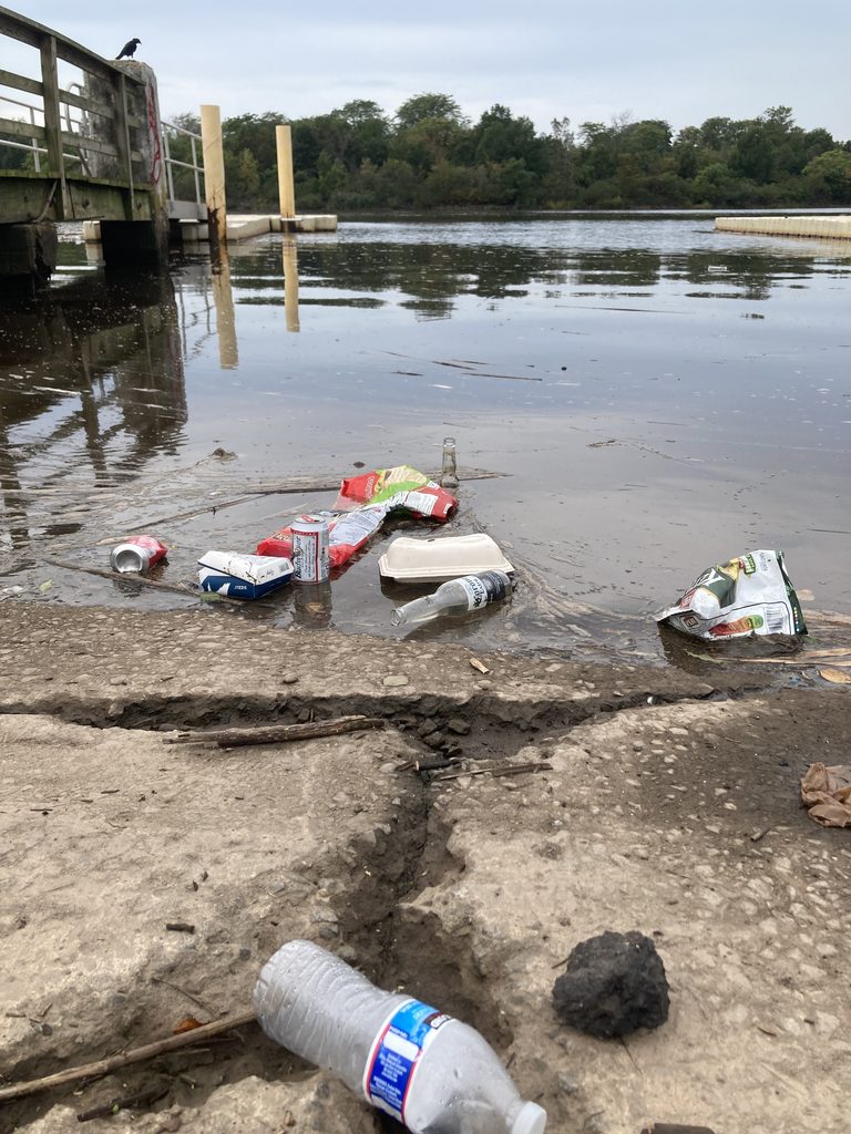
Some of the spilled trash at Edison Boat Basin.
One of our standout collaborators is Elyse Barone, the recycling and clean communities coordinator in Sayreville. Thanks to her leadership our water monitoring team briefed the co-chairs of the environmental commission and the director of public works on the water quality of the Raritan River in Sayreville. We appreciate everything they have done to reduce stormwater pollution in the watershed!
Doreen and Lakshmi record data from the YSI sonde while sampling in South Amboy. — Photo by Olesya Nabokova.
Essay and photos by Joe Mish unless otherwise noted
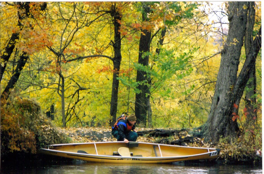
A yellow, curled autumn leaf or a Kevlar canoe; both are more than capable of transporting a traveler and their imagination through the autumn scenery along the South Branch of the Raritan and reveal a glimpse of the hidden, natural world. Photo by Lindsay May Mish
The trim yellow canoe quietly slipped through the standing leaf littered water with each stroke of the paddle. Eventually, the leaves would accumulate on the bow to create a gurgling sound and slow forward progress. A quick backstroke and turn of the bow cleared the leaves at the expense of energy exerted and time.
Autumn had arrived and the interchangeable term, fall, took on a practical meaning as the air was aflutter with falling leaves that carpeted the water’s surface.
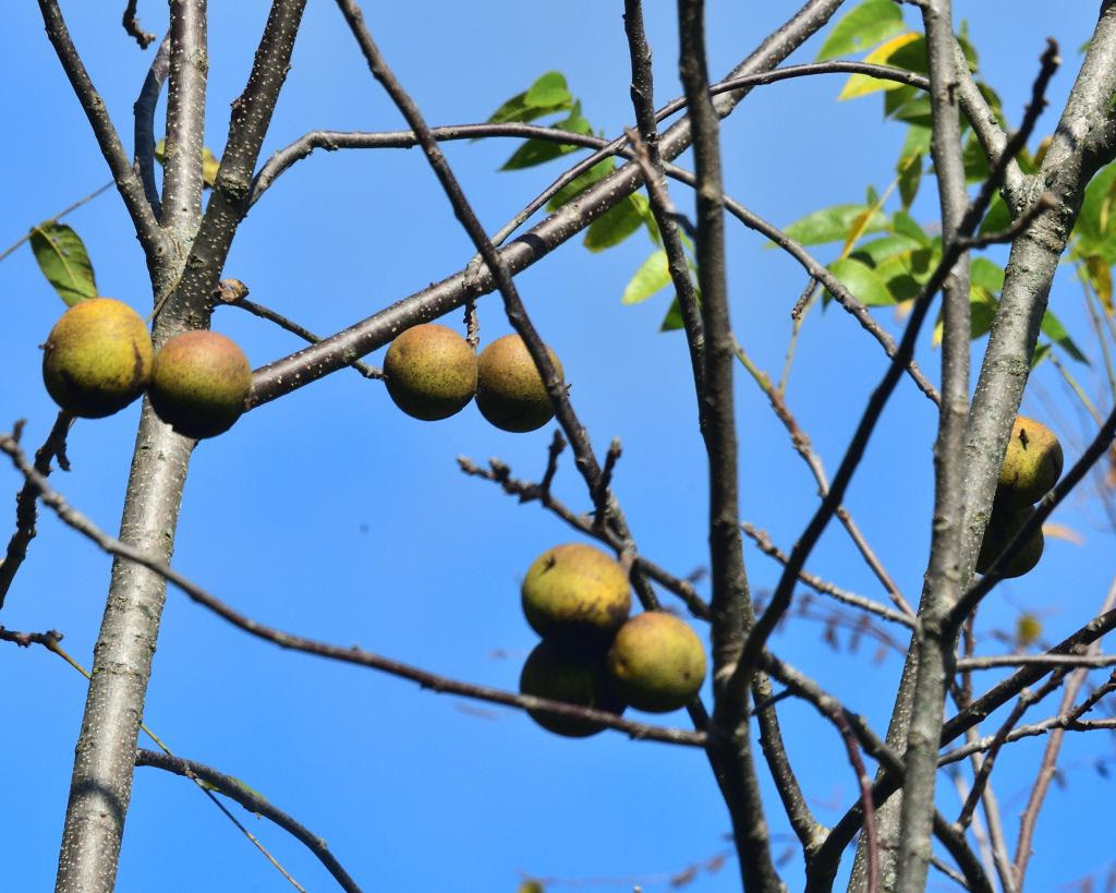
Leaves were not the only thing suddenly falling to earth. During an early morning paddle when all was silent and calm, a nearby, unexpected loud splash, sent shockwaves through my body. It sounded as if someone threw a rock in my direction with mal intent. In reality, it was a black walnut falling into the water. The large green billiard ball sized walnut enclosed husk is quite a formidable bludgeon, whose striking force is magnified when it hits the water.
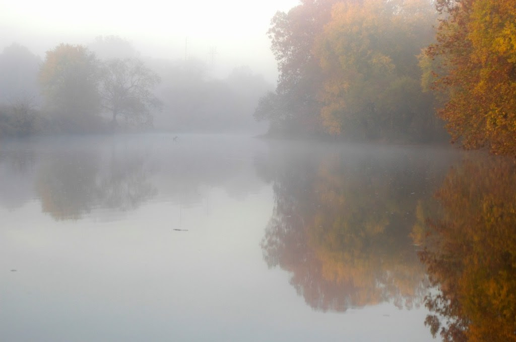
Peak autumn color is often enhanced by a pre-dawn gold infused mist covering the river when early October teases with the cold nights and warm sunny days. Drifting quietly downstream into the mist feels as if riding the current into the primordial past when the earth was just being formed. An alarmed great blue heron completes the experience as it reflects its paradactyl ancestry in size and form.
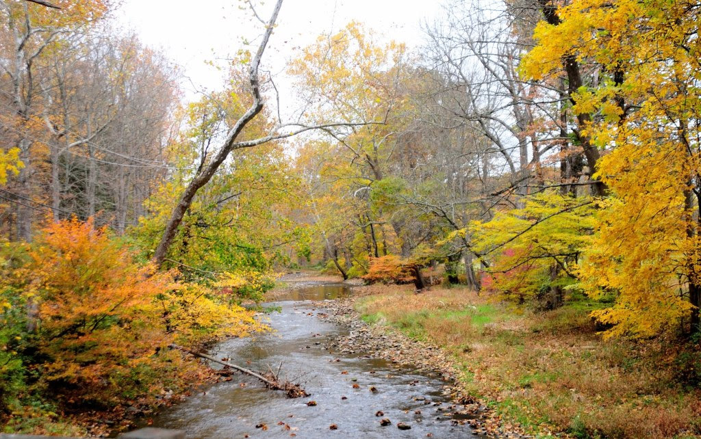
Some of the best fall scenery is along the rivers and canals where calm water mirrors the golden foliage and extends linearly to a vanishing point or disappears beyond a curve. This draws you deeper into the scene to a place where imagination, memories and time mingle with autumnal color. A place where the traveler will lose their way and wander aimlessly without the need to reach a destination.
The rays of the midday sun are captured by the water arguing with the rocks and stones of the exposed riverbed and turned into bright sparkling diamonds; a perfect complement to the blaze of fall foliage which lines the river’s banks. The white faceted diamonds lay like a necklace against the sky-blue décolletage reflected in the smooth water above and downstream of the turbulence.
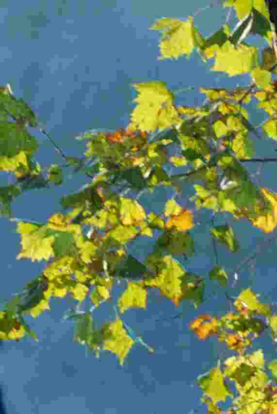
Sitting at the river’s edge watching fallen leaves float by, it is impossible to not imagine yourself aboard a curled yellow leaf traveling on the energy of the current and at the whim of an errant breeze. Through no effort of your own, you travel as an observer on a downriver cruise, unburdened by schedule or destination. It is as if you parted your conscious mind from reality, to set your imagination free. You look down to see the shadow of your leaf racing along the stony riverbed. Then spin around at the edge of an eddy and pass over a bed of long lime green grass swaying seductively in the current. Riding a smooth wave over a submerged rock, the sky appears for an instant. Pure white fluffy clouds parade against an azure, blue sky which disappears and reappears in the openings within the green and golden-brown foliage of a sycamore tree.
Each fallen leaf is a post-it-note created by autumn and distributed far and wide by the river’s current. Each colorful courier declares a friendly reminder of the inevitable change of seasons.
The autumn is truly a time of wonder, as daylight dims and shadows lengthen, while leaves magically turn brilliant colors. Like an emergency generator being triggered when the lights go out, the fall colors appear and flash a visual warning that winter’s icy emissary will arrive before the celestial clock officially declares winter’s arrival.
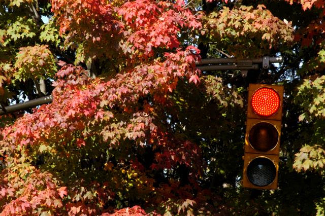
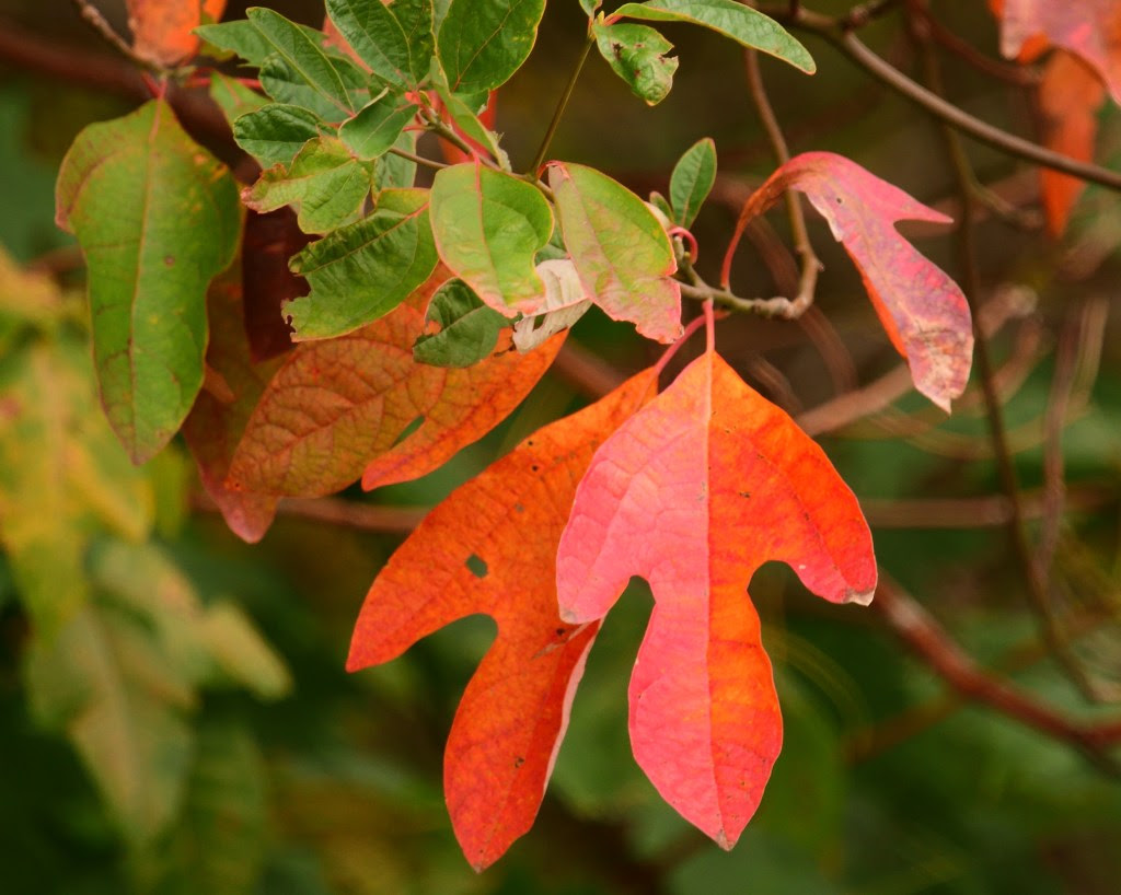
The seasons are tracked to the second by the predictable positions of the stars and planets. The stability of their celestial dance amid the chaos of the heavens is beyond comprehension, as the fall color is a reminder that our existence is at the mercy of the stars. A single scarlet leaf pasted to the sidewalk after a rain validates our heavenly origins.
October is the last comfort station before the final trek through the darkest days, as we stumble along to find the light switch on the first day of winter. The energy of brilliant fall color restores the spirit when the lights go out and power us through to the birth of light in December, when the shrinking light begins to grow.
Joe Mish has always lived in sight of New Jersey’s Raritan River. His early years were spent roaming clay banks, streams, tidal creeks and swamps of the Lower Raritan near Crab Island. Now living upstream on the Raritan’s South Branch, he photographs New Jersey’s natural treasures hidden in plain view, sharing them in his column “Along the South Branch” in The Branchburg News, on his own blog page, and via the Lower Raritan River Partnership’s website. Many of his photos appear in Judy Auer Shaw’s The Raritan River: Our Landscape, Our Legacy. Joe also has images published in Northeast Sporting Journal, Maine Outdoors and History of Willowood. A graduate of Rutgers Cook College, Joe is a regular on Super Aging Today radio program as a nature photojournalist. Retired from Johnson and Johnson where he worked in Clinical Research and Pharmacology, Joe paddles local rivers throughout the year to see what surprises nature has to offer when no one else is looking.