By LRWP Monitoring Outreach Coordinator Jocelyn Palomino
Every Thursday from May to October, the Lower Raritan Watershed Partnership and Rutgers Cooperative Extension of Middlesex County run a volunteer-based monitoring program along the Raritan river. During the summer, we collect water quality samples at six non-bathing public access beach sites, provide our samples to the Interstate Environmental Commission for analysis in their laboratory and report the results to the public on Friday afternoons. Our mission is to share this data with the community and partners to ensure the safe use of the Raritan river for all.
Our lab results for water quality samples taken on Thursday August 22, 2024 show Enterococcus bacteria levels exceeding the EPA federal water quality standard of 104 cfu/100mL at only ONE of our monitoring sites this week. Problem sites are indicated by red frowns on the map and chart which includes: Riverside Park (Piscataway). Green smiles on the chart and map indicate the sites with bacteria levels safe for recreation, which include: Rutgers Boathouse (New Brunswick), Edison Boat Basin and Ken Buchanan Waterfront Park (Edison), South Amboy Waterfront Park (South Amboy) and 2nd Street Park (Perth Amboy).
Pathogens/Enterococci levels are used as indicators of the possible presence of disease-causing bacteriain recreational waters. Such pathogens may pose health risks to people coming in primary contact with the water (touching) through recreational activities like fishing, kayaking or swimming in a water body. Possible sources of bacteria include stormwater runoff, Combined Sewer Overflows (CSOs), improperly functioning wastewater treatment plants, leaking septic systems, animal carcasses, and runoff from manure storage areas.
Our goal in reporting these results is to give residents a better understanding of the potential health risks related to primary contact during water-based recreation. If you recreate on the Raritan this weekend, be sure to take all safety precautions into consideration and wash up after any water-based activities!
Caught a glimpse of the enlarged moon during pre-calibration on early Thursday morning, after this Monday’s Supermoon that will occur again in mid-September, Photo Credit: Jocelyn Palomino
We spotted lots of folks out recreating at each of our sites, as well as an abundance of wildlife this week. Can you spot the heron hiding by the D&R canal at the Rutgers Boathouse?Photo Credit: Jocelyn Palomino
Half of the flock flew away as the team approached the docks, but the other half stayed to watch us collect water samples on the messy docks of LR4- Ken Buchanan Waterfront. Photo Credit: Jocelyn Palomino
Beautiful weather this weekend to enjoy the outdoors before the summer comes to an end- use and share our data to help plan your weekend activities on the Raritan!! Photo Credit: Jocelyn Palomino
Huge thanks to our volunteers for joining us in the field this week: Irene Riegner, Nibav Velan and Frank Dahl!Photo Credit: Jocelyn Palomino(left) and Frank Dahl (right)
The green mittens are going fast, we expect a shipment of red mittens to arrive shortly, well before cold weather sets in. Sassafras trees have three variations of leaf shape, one reminiscent of a mitten. When the red mittens are on display, Autumn has arrived.
August foliage provides the canvas upon which September begins to smudge and splash bright colors across the landscape. These scattered traces of color are the threads from which the blanket of full fall brilliance is woven.
As the earth squints at the sun, the decreasing daylength triggers a seasonal response, marked by visual changes in leaf color. The bold statement of color, expanding daily, by the hand of an unseen artist, fires the imagination of the human mind to dwell in a borderless realm of magic and possibility.
In the time before science, the wonders of the natural world were rationalized by myth, to satisfy the overpowering human curiosity, which demanded explanation. In a way, the periodic appearance of leaf color was a teaching aid to foster human survival by articulating the most critical elements of adaptation, creativity, and imagination.
The world that surrounds us is the catalyst for all we create, innovation is the product of imagination. Inspiration may be found in the least probable places, where the path of a fallen leaf on the driveway, leads directly to the starlit heavens and their impact on the earth and all living things.
I enjoy taking a paleo perspective to view nature and try to share the experience and emotion of my kindred paleo counterparts. Standing in their moccasins, I would come to realize a repetitive pattern exists which provides predictability, a key to survival and a reference point upon which to stack temporary facts. The appearance of color precedes the arrival of cold weather, a reminder to be prepared for snow and cold. See the colors of the sunset and rise, appear on the leaves. The overflowing colors are spattered across the landscape as the sun crashes into or escapes from the earth, to allow the colors of the sky to be held in your hand.
Summer has a home in September, so the transition to autumn is quite subtle, though hints of color stand out like small islands in the sea of green. While some specific trees and shrubs turn off the green, early in September, random species will always showcase a wink of color.
Black walnut trees are the first to turn yellow and shed leaves. They appear abandoned and leafless, while nearby trees are still veiled in green. The ground beneath the trees covered in a thick layer of yellow leaves, and laden with walnuts encased in thick green husks appear as if set on a yellow tablecloth for distribution and consumption by the local gray squirrels.
Staghorn sumac surrenders its green but retains its gold and red leaflets as adornments to compliment its dark brown hairy seed clusters. Many are already marked by white-tail deer bucks, scraping the velvet from their antlers.
Sassafras trees appear adorned in yellow or red, some leaves, in the shape of colorful mittens, as if displayed on a rack for sale.
American sycamore leaves are light green and edged with a golden brown as they begin to change in late summer. Their height and crown easily seen, especially when growing in groves along a watercourse is an obvious sign of changing seasons.
Native dogwood trees in late summer are adorned with faded reddish-purple leaves and bright red gleaming berries, which stand in contrast to each other and make this small understory tree, a fall treat to behold.
Black gum trees, found along the upper South Branch, are first in flight in their beech, birch, maple neighborhood association, as their obovate leaves, egg shaped with the broad end toward the tip, turn a rich salmon color and actually look like old fashioned Christmas lights.
Still, it is the random splash of color that catches the eye long before the great parade of fall color arrives. A single leaf of pumpkin orange appears among the dark green crown of an oak tree, as if signaling for rescue, afloat on an expanse of green ocean, five thousand feet below a search plane.
Unable to keep a secret, or simply out of step with the fall choreography, these colorful precursors are the sparks that light the autumn fire.
Author Joe Mish has been running wild in New Jersey since childhood when he found ways to escape his mother’s watchful eyes. He continues to trek the swamps, rivers and thickets seeking to share, with the residents and visitors, all of the state’s natural beauty hidden within full view. To read more of his writing and view more of his gorgeous photographs visit Winter Bear Rising, his wordpress blog. Joe’s series “Nature on the Raritan, Hidden in Plain View” runs monthly as part of the LRWP “Voices of the Watershed” series. Writing and photos used with permission from the author.
The LRWP is opposed to conversion of Thomas A. Edison Park from free public land to fee-based access, and has serious concerns regarding the environmental impact of the proposed project (see our comments below). We encourage watershed residents to review and comment on the Environmental Assessment submitted by Middlesex County to the National Park Service regarding the County’s plan to turn Thomas A. Edison Park into a Destination Athletic Complex with 14 artificial turf fields. You will find the Environmental Assessment and details to provide comment here. The comment period ends on September 3, 2024.
TO: Diane Keith, NER Program Manager / National Park Service / Federal Lands to Parks / c/o 54 Portsmouth St. / Concord, NH 03301
RE: Thomas A. Edison Park Environmental Assessment
On behalf of the Lower Raritan Watershed Partnership (LRWP), I am writing to express objection to Middlesex County’s proposed change of the purpose and use of acreage within Thomas A. Edison Park in Edison Township. The LRWP has reviewed the Environmental Assessment for this project, and remains concerned by the plans to: 1) convert significant contiguous woodland acreage to active park facilities, which will have the effect of further compromising habitat connectivity for wetlands species in a fringe ecosystem area; and 2) replace current woodland and natural grass acreage with artificial/synthetic turf, which will have the effect of eliminating important ecosystem services of filtering stormwater runoff and moderating temperatures provided by these landscapes. Clearly both woodland conversion and installation of synthetic turf will also have the result of exacerbating climate change and pollutant flows in the watershed.
Below we provide more detail on our concerns related to this project:
Failure to account for flood risk
Current flood models suggest that significant portions of the area of concern will be under water in the future. Development of these lands, especially using synthetic turf, will significantly compromise passive floodwater containment in an already flood-prone area of the Lower Raritan Watershed.
Synthetic Turf Sheds Microplastics, PFAS, and Other Chemicals
Like all plastic materials, synthetic turf doesn’t last forever—instead, it breaks up and sheds massive amounts of tiny plastic particles into the environment and our bodies. A 2018 report by the European Commission showed that athletic fields composed of synthetic turf shed an annual average of 18,000-70,000 tons of microplastics each year into surrounding air, soils, and waters. This includes huge quantities of crumb rubber, which leaches toxic lead, PFAS, phthalates, and other dangerous chemicals. People and other animals who walk and play on synthetic turf absorb plastic particles and their toxins through the skin, inhalation, and ingestion.
Synthetic Turf Wastes and Contaminates Water
Synthetic turf still requires regular watering, especially on hot days where it can heat up to 40-70 times hotter than the surrounding air—getting even hotter than asphalt. This is because unlike real organic, cooling, and oxygenating grass, synthetic turf is heat absorbent. The temperatures of plastic grass can get so hot it has been known to cause contact injuries called “turf burn.” Heated synthetic turf has also been found to release toxic gases, including carcinogenic benzene and formaldehyde. In addition, materials experts report major drainage issues linked to plastic grass. These issues worsen droughts by preventing groundwater—which many people depend on for drinking—from naturally recharging. When rain falls onto synthetic turf, research shows it absorbs chemicals and runs off—typically entering stormwater systems that drain to large water bodies, in this case the proximate Raritan River and the NY/NJ Harbor Estuary. Also of concern is the increased temperature of the stormwater runoff as it flows into the Raritan.
Increase in Impervious Cover
The conversion of forested habitat to plastic turf and parking lots will increase impervious cover, compromising any attempts to meet federal MS4 requirements let alone advance stormwater management best practices. As we face increasing risks and uncertainties of climate change we should, as a basic practice, never convert parkland to parking lots or synthetic surfaces.
Exacerbates Inequities of Access to Recreational Spaces
The Federal Government deeded Thomas Edison Park to Middlesex County to be used as a free park in perpetuity. Conversion of these free public lands to fee-based access violates the original intent of the deed, and the public interest. Furthermore, the County proposal is for expansion of park amenities in an already well-resourced portion of Middlesex County. The County clearly has not taken transportation equity or other equity concerns into consideration with respect to improving equitable recreational access to County system parks for low socio-economic status communities and for communities with limited access to transportation to park networks.
The LRWP respectfully requests that the National Park Service deny approval to Middlesex County for the proposed changes to Thomas Edison Park.
Almost two-thirds of New Jersey’s coastline, including all of the tidally influenced portion of the Raritan River, is at high or very high risk to coastal erosion. New Jersey Department of Environmental Protection (NJDEP) has developed a set of amendments, part of NJ Protecting Against Climate Threats (NJPACT) Resilient Environments and Landscape (REAL), to address these risks.
The LRWP supports NJDEP’s efforts to modernize resource protections to better support New Jersey communities like ours in building resilience to sea-level rise, extreme weather, chronic flooding, and other impacts of our changing climate. We encourage our Lower Raritan communities to support NJPACT. The NJPACT rule proposal, along with additional details regarding the public hearings and public comment, are provided on the Department’s NJREAL website https://dep.nj.gov/njreal/.
The New Jersey Protecting Against Climate Threats (NJPACT) Resilient Environments And Landscape (REAL) is part Governor Phil Murphy’s Executive Order 100 (Jan. 2020) that includes amendments to existing land resource protection rules designed to bolster resilience to the unavoidable impacts of climate change.The proposed rules address sea-level rise, coastal storm surge, flooding, and stormwater management concerns while improving water quality, protecting natural resources, and streamlining permitting processes that will expedite resilient investments in New Jersey’s communities and economy.
There will be three public hearings concerning the proposal as follows:
IN PERSON: September 5, 2024, 6:00 P.M., at Ocean County College, Gateway Lecture Hall #104 (Bldg. #101), College Drive, Toms River, NJ 08754;
VIRTUAL: September 12, 2024, 2:00 P.M. September 19, 2024, 10:00 A.M.
By LRWP Monitoring Outreach Coordinator Jocelyn Palomino
Every Thursday from May to October, the Lower Raritan Watershed Partnership and Rutgers Cooperative Extension of Middlesex County run a volunteer-based monitoring program along the Raritan river. During the summer, we collect water quality samples at six non-bathing public access beach sites, provide our samples to the Interstate Environmental Commission for analysis in their laboratory and report the results to the public on Friday afternoons. Our mission is to share this data with the community and partners to ensure the safe use of the Raritan river for all.
Our lab results for water quality samples taken on Thursday August 15, 2024 show Enterococcus bacteria levels exceeding the EPA federal water quality standard of 104 cfu/100mL at TWO of our monitoring sites. Problem sites are indicated by red frowns on the map and chart which includes: Riverside Park (Piscataway) and 2nd Street Park (Perth Amboy). Green smiles on the chart and map indicate the sites with bacteria levels safe for recreation, which include: Rutgers Boathouse (New Brunswick), Edison Boat Basin and Ken Buchanan Waterfront Park (Edison), and South Amboy Waterfront Park (South Amboy).
Pathogens/Enterococci levels are used as indicators of the possible presence of disease-causing bacteriain recreational waters. Such pathogens may pose health risks to people coming in primary contact with the water (touching) through recreational activities like fishing, kayaking or swimming in a water body. Possible sources of bacteria include stormwater runoff, Combined Sewer Overflows (CSOs), improperly functioning wastewater treatment plants, leaking septic systems, animal carcasses, and runoff from manure storage areas.
Our goal in reporting these results is to give residents a better understanding of the potential health risks related to primary contact during water-based recreation. If you plan on recreating on the Raritan, be sure to take all safety precautions by washing up after any activities!
Our Thursday mornings begin with volunteers helping Program Coordinator Jocelyn Palomino with the pre-calibration of our equipment, while the rest of the team gears up for sampling. Photo Credit: Frank Dahl
Leave it to Rose to capture close-up shots like this that allow us to see nature in all its beauty! Photo Credit: Rose Lawless
Frank Dahl was in charge of managing the YSI this week, Shely Dash got to borrow his binoculars to catch a good look at some herons at the Edison Boat Basin. Photo Credit: Rose Lawless
Messy docks at LR4, I wonder who the culprits could have been… Photo Credit: Rose Lawless
Our AMAZING team of volunteers collecting water samples, cleaning up the shore and sharing our data with local residents while at LR5- South Amboy Waterfront Beach, Photo Credit: Rose Lawless
During low tide, we noticed very murky and grey water at LR6-2nd. Street Park with a large amount of scum built up on the rocks, despite the dry weather in recent days. Photo Credit: Rose Lawless
By LRWP Monitoring Outreach Coordinator Jocelyn Palomino
Every Thursday from May to October, the Lower Raritan Watershed Partnership and Rutgers Cooperative Extension of Middlesex County run a volunteer-based monitoring program along the Raritan river. During the summer, we collect water quality samples at six non-bathing public access beach sites, provide our samples to the Interstate Environmental Commission for analysis in their laboratory and report the results to the public on Friday afternoons. Our mission is to share this data with the community and partners to ensure the safe use of the Raritan river for all.
After receiving such heavy rainfall this week due to Tropical Storm Debby, our lab results for water quality samples taken on Thursday August 08, 2024 show Enterococcus bacteria levels exceeding the EPA federal water quality standard of 104 cfu/100mL at all SIX of our monitoring sites. Problem sites are indicated by red frowns on the map and chart which includes: Riverside Park (Piscataway), Rutgers Boathouse (New Brunswick), Edison Boat Basin and Ken Buchanan Waterfront Park (Edison), South Amboy Waterfront Park (South Amboy) and 2nd Street Park (Perth Amboy). Green smiles on the chart and map would normally indicate the sites with bacteria levels safe for recreation, which does not include any sites this week.
Pathogens/Enterococci levels are used as indicators of the possible presence of disease-causing bacteriain recreational waters. Such pathogens may pose health risks to people coming in primary contact with the water (touching) through recreational activities like fishing, kayaking or swimming in a water body. Possible sources of bacteria include stormwater runoff, Combined Sewer Overflows (CSOs), improperly functioning wastewater treatment plants, leaking septic systems, animal carcasses, and runoff from manure storage areas.
Our goal in reporting these results is to give residents a better understanding of the potential health risks related to primary contact during water-based recreation. If you plan on recreating on the Raritan, be sure to take all safety precautions by washing up after any activities!
A dark morning filled with strong winds and plenty of rain to make water quality monitoring an adventure!! Photo Credit: Jocelyn Palomino (left) and Irene Riegner (right)
Loads of debris/trash washed up by the docks of the Edison Boat Basin. You can see how all the stormwater runoff washed from the parking lot makes its path to the river! Photo Credit: Jocelyn Palomino
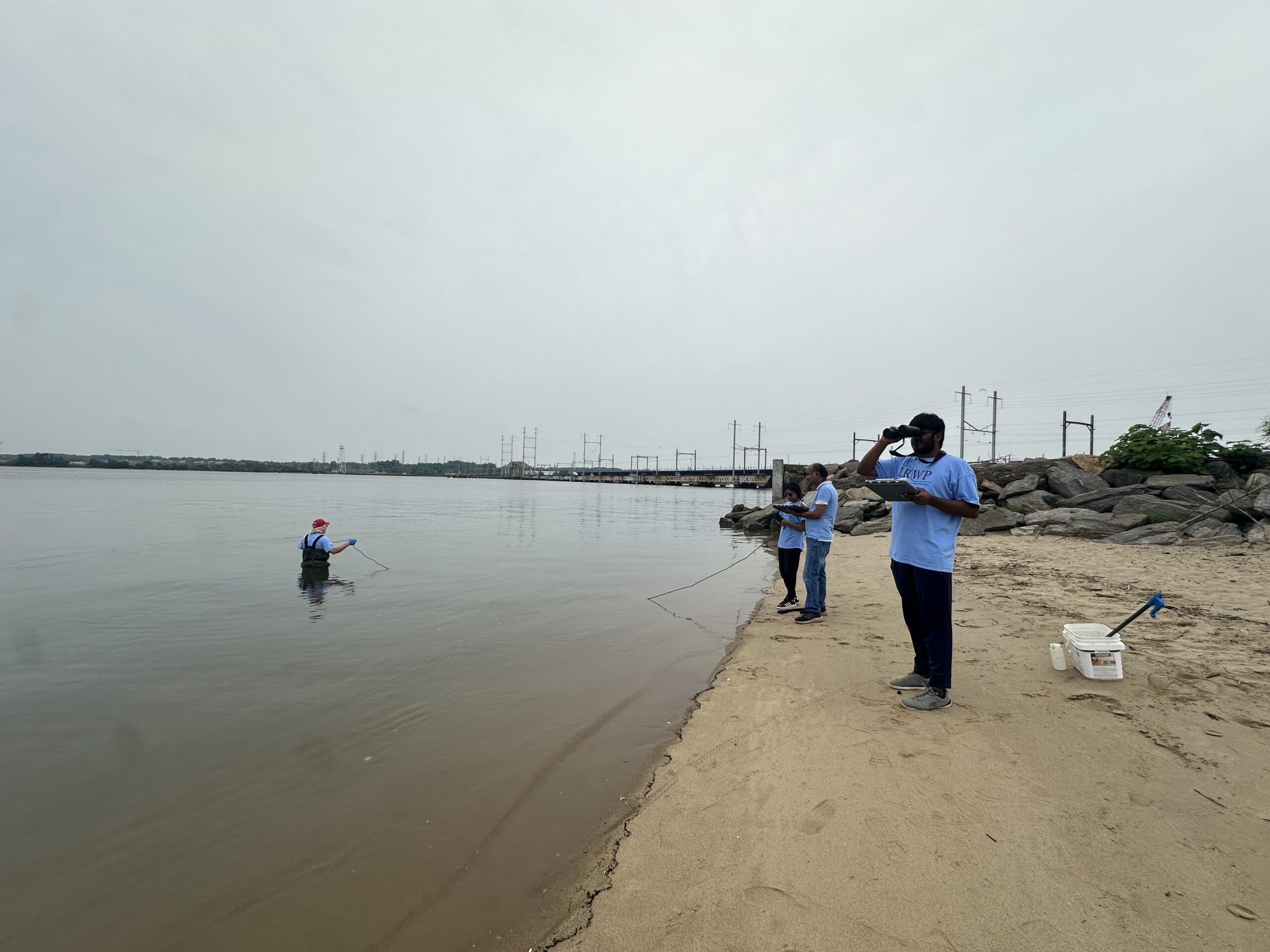
While one of our volunteers wades into the river to collect our weekly sample, the rest of the team stays ashore to record the data relayed by the YSI, which indicates the real-time levels of Dissolved Oxygen, pH, salinity and more. Photo Credit: Jocelyn Palomino (left) and Irene Riegner (right)
HUGE THANKS to Nibav Velan and Irene Riegner for their contributions this week and for enduring the conditions of Tropical Storm Debby!Photo Credit: Jocelyn Palomino (left) and Irene Riegner (right)
By LRWP Monitoring Outreach Coordinator Jocelyn Palomino
Every Thursday from May to October, the Lower Raritan Watershed Partnership and Rutgers Cooperative Extension of Middlesex County run a volunteer-based monitoring program along the Raritan river. During the summer, we collect water quality samples at six non-bathing public access beach sites, provide our samples to the Interstate Environmental Commission for analysis in their laboratory and report the results to the public on Friday afternoons. Our mission is to share this data with the community and partners to ensure the safe use of the Raritan river for all.
Our lab results for water quality samples taken on Thursday August 01, 2024 show Enterococcus bacteria levels exceeding the EPA federal water quality standard of 104 cfu/100mL at only ONE of our monitoring sites this week. Problem sites are indicated by red frowns on the map and chart which includes: 2nd Street Park (Perth Amboy). Green smiles on the chart and map indicate the sites with bacteria levels safe for recreation, and include the following: Riverside Park (Piscataway), Rutgers Boathouse (New Brunswick), Edison Boat Basin and Ken Buchanan Waterfront Park (Edison), South Amboy Waterfront Park (South Amboy).
Pathogens/Enterococci levels are used as indicators of the possible presence of disease-causing bacteriain recreational waters. Such pathogens may pose health risks to people coming in primary contact with the water (touching) through recreational activities like fishing, kayaking or swimming in a water body. Possible sources of bacteria include Combined Sewer Overflows (CSOs), improperly functioning wastewater treatment plants, stormwater runoff, leaking septic systems, animal carcasses, and runoff from manure storage areas.
Our goal in reporting these results is to give residents a better understanding of the potential health risks related to primary contact during water-based recreation. If you are planning on recreating on the Raritan this weekend, stay safe by properly washing up after any activities!
Clear and sunny skies on Thursday morning helped us collect our samples smoothly before the heat caught up to us!Photo Credit: Jocelyn Palomino
Water quality at LR3- Edison Boat Basin was noticeably greasy and scummy this week, Photo Credit: Jocelyn Palomino
We did not observe much recreational or wildlife activity at our sites this Thursday, but we can always count on the seagulls and ducklings that greet us on the Ken Buchanan docks! Photo Credit: Jocelyn Palomino
Heavy discharge coming from the Combined Sewer Overflow (CSO) located right by the shore at Perth Amboy’s 2nd Street Park… the water quality was murky with an overwhelming smell of sewage and is our only site that exceeds the federal standard this week. Photo Credit: Jocelyn Palomino
BIG thanks again to our volunteers this week for helping us collect informational data for the community: Nibav Velan, Sanil Nambiar and Thulasi Nambiar!!
By LRWP Monitoring Outreach Coordinator Jocelyn Palomino
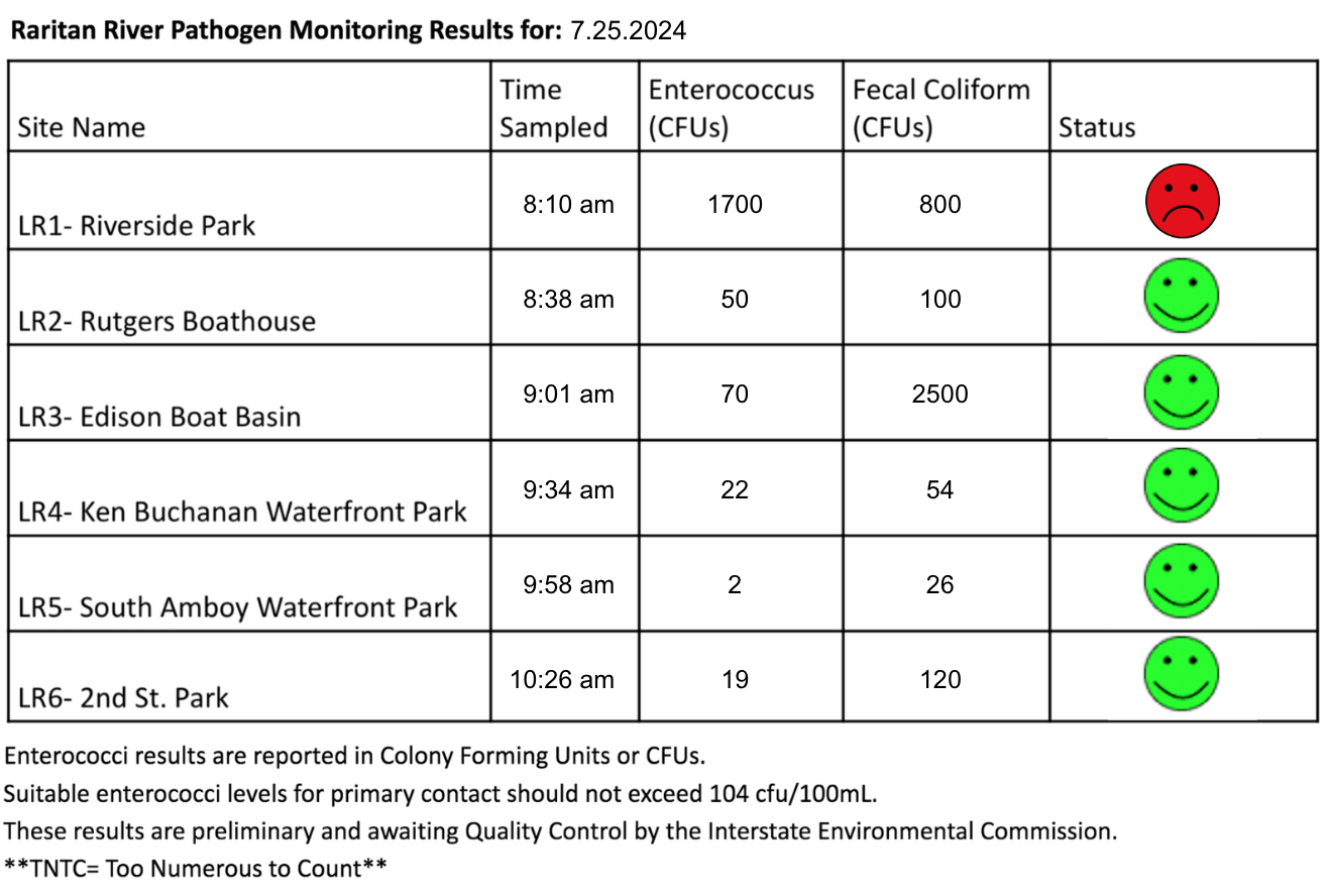
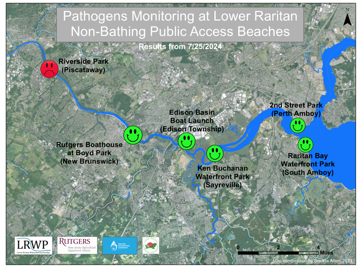
Every Thursday from May to October, the Lower Raritan Watershed Partnership and Rutgers Cooperative Extension of Middlesex County run a volunteer-based monitoring program along the Raritan River. During the summer, we collect water quality samples at six non-bathing public access beach sites, provide our samples to the Interstate Environmental Commission for analysis in their laboratory and report the results to the public on Friday afternoons. Our mission is to share this data with the community and partners to ensure the safe use of the Raritan river for all.
Our lab results for water quality samples taken on Thursday July 25, 2024 show Enterococcus bacteria levels exceeding the EPA federal water quality standard of 104 cfu/100mL at only ONE of our monitoring sites this week. Problem sites are indicated by red frowns on the map and chart which includes: Riverside Park (Piscataway). Green smiles on the chart and map indicate the sites with bacteria levels safe for recreation, and include the following: Rutgers Boathouse (New Brunswick), Edison Boat Basin and Ken Buchanan Waterfront Park (Edison), South Amboy Waterfront Park (South Amboy) and 2nd Street Park (Perth Amboy).
Pathogens/Enterococci levels are used as indicators of the possible presence of disease-causing bacteriain recreational waters. Such pathogens may pose health risks to people coming in primary contact with the water (touching) through recreational activities like fishing, kayaking or swimming in a water body. Possible sources of bacteria include Combined Sewer Overflows (CSOs), improperly functioning wastewater treatment plants, stormwater runoff, leaking septic systems, animal carcasses, and runoff from manure storage areas.
Our goal in reporting these results is to give residents a better understanding of the potential health risks related to primary contact during water-based recreation. If you are planning on recreating on the Raritan this weekend, stay safe by properly washing up after any activities!
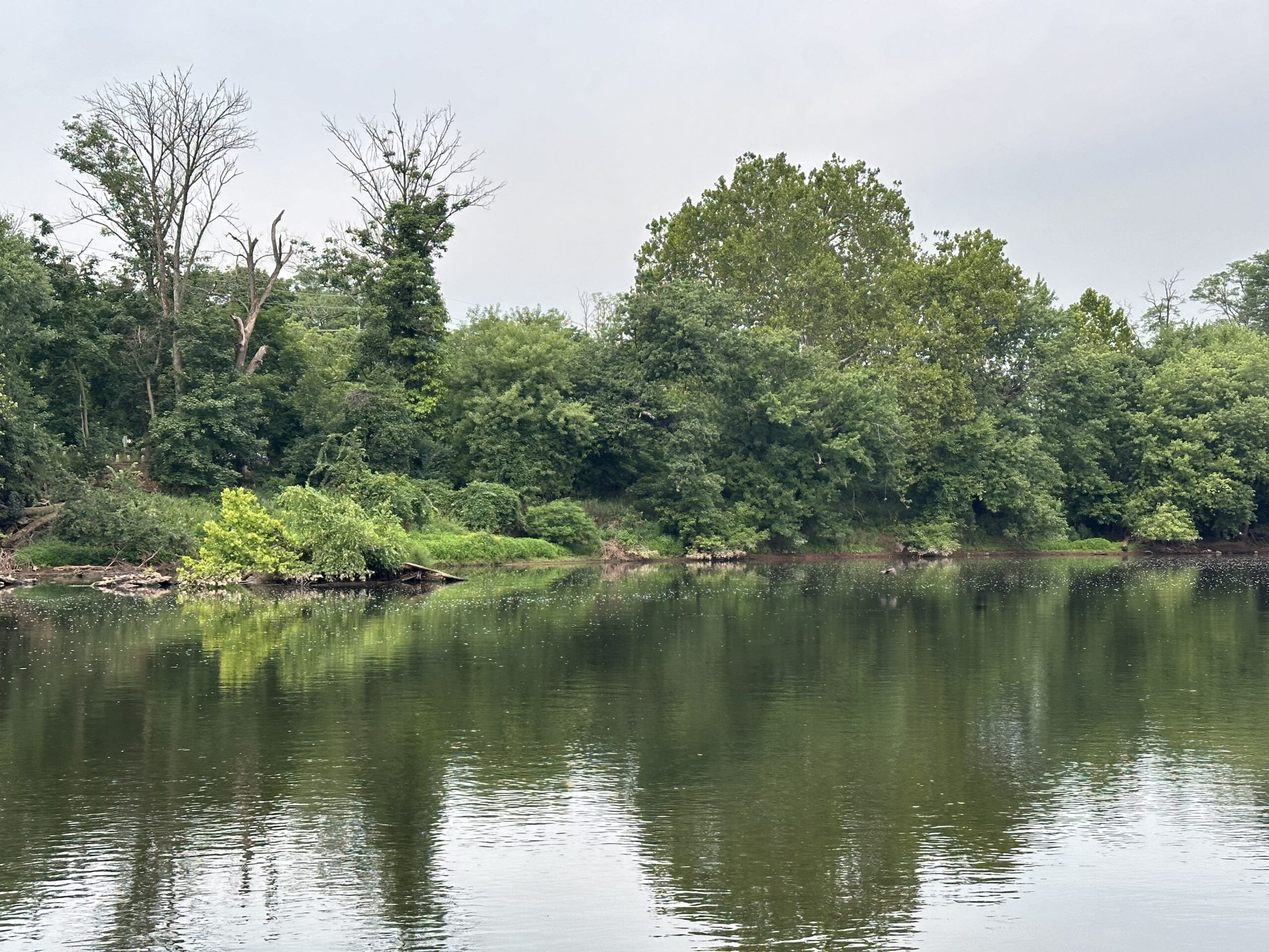
Turbid and scummy waters at LR1- Riverside Park this Thursday morning, pathogen results showed high Enterococcus levels only for this site. Photo Credit: Jocelyn Palomino
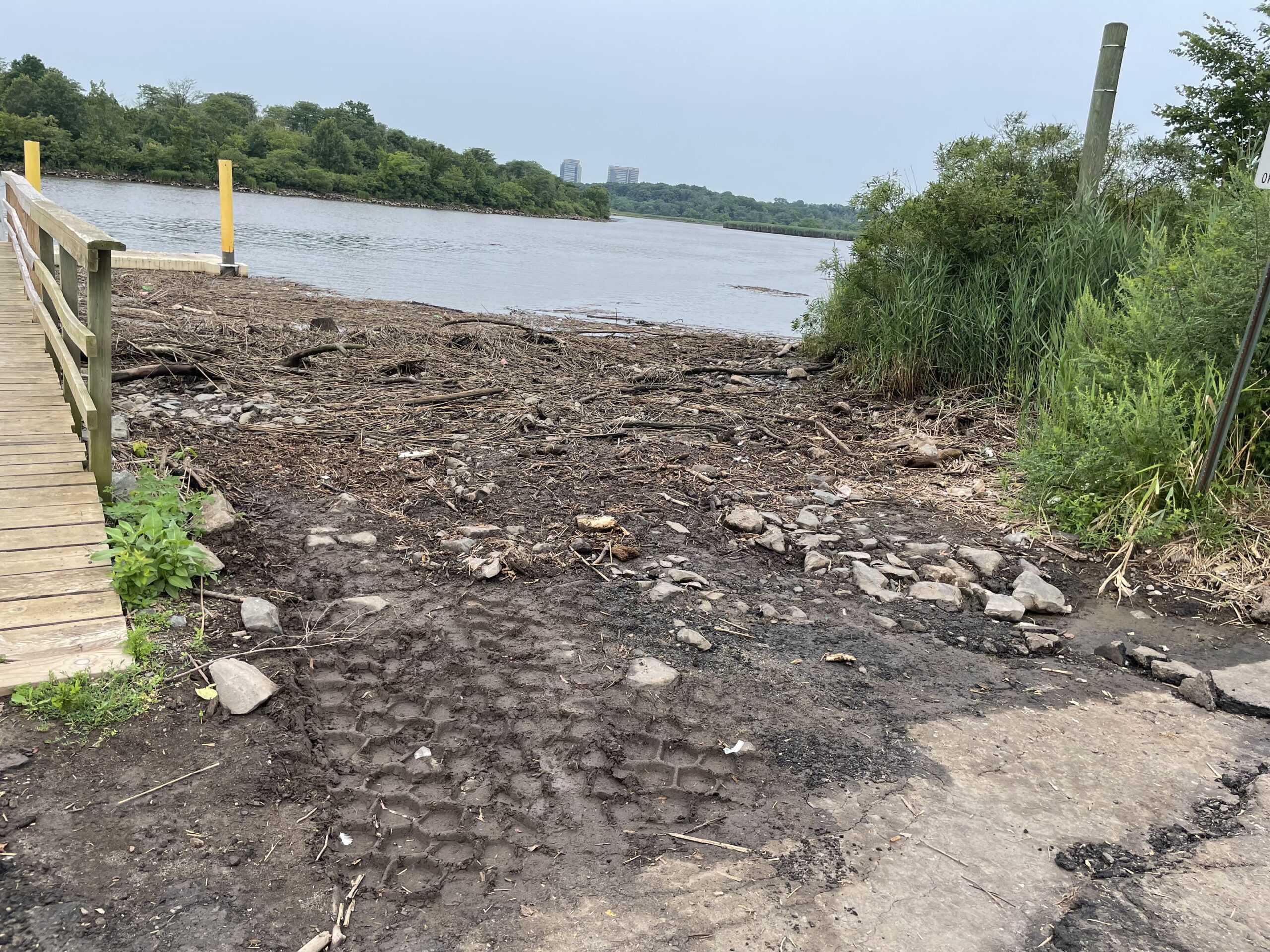
A tremendous amount of debris washed up at the Edison boat launch, Photo Credit: Frank Dahl
SEWA volunteers have worked closely with the LRWP over the last couple weeks on the Pathogens Monitoring Team, they are becoming excellent water quality professionals!Photo Credit: Jocelyn Palomino
Overcast and gloomy skies on Thursday morning, however, no precipitation was recorded 24 to 48 hours prior to monitoring. Photo Credit: Jocelyn Palomino
Special thanks to our monitoring team of volunteers who joined us this week: Frank Dahl, Thulasi Nambiar, Sanil Nambiar and Nibav Velan!Photo Credit: Jocelyn Palomino
By LRWP Monitoring Outreach Coordinator Jocelyn Palomino
Every Thursday from May to October, the Lower Raritan Watershed Partnership and Rutgers Cooperative Extension of Middlesex County run a volunteer-based monitoring program along the Raritan River. During the summer, we collect water quality samples at six non-bathing public access beach sites, provide our samples to the Interstate Environmental Commission for analysis in their laboratory and report the results to the public on Friday afternoons. Our mission is to share this data with the community and partners to ensure the safe use of the Raritan river for all.
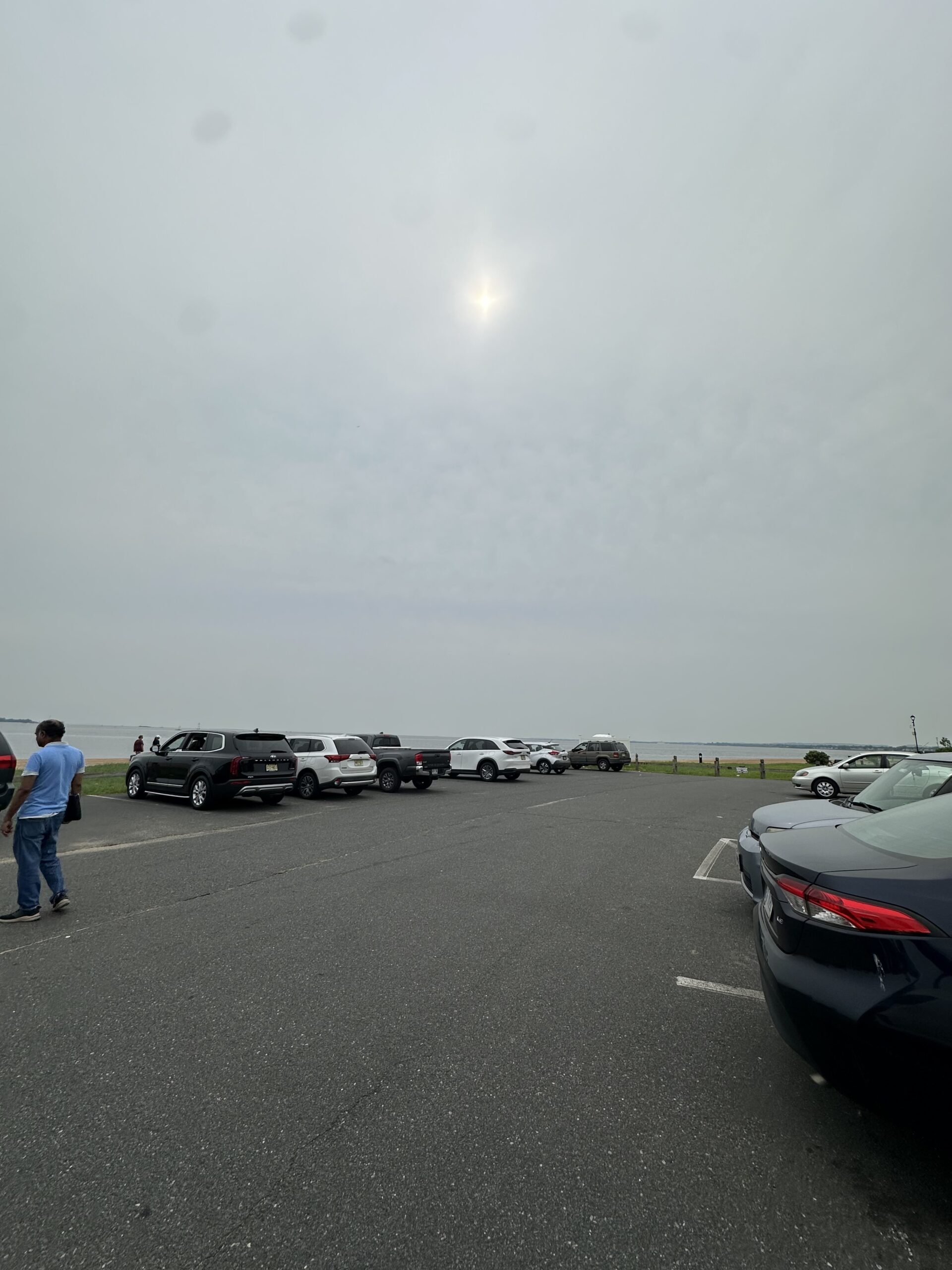
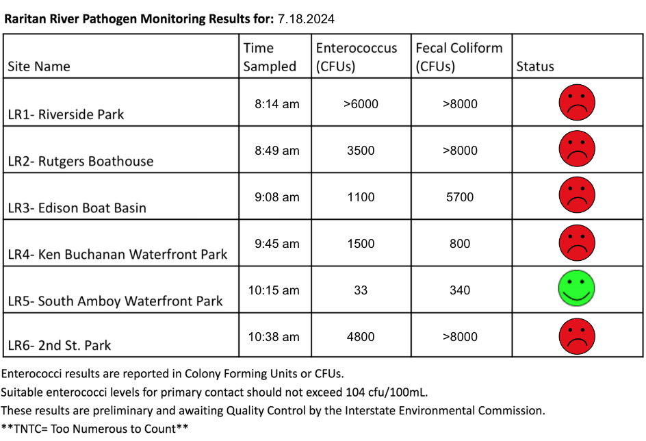
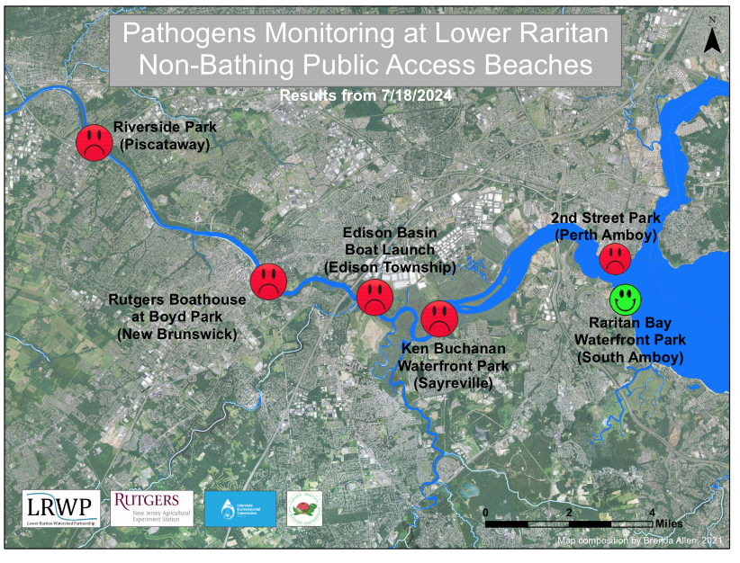
After multiple days of precipitation and thunderstorms, our lab results for water quality samples taken on Thursday July 18, 2024 show Enterococcus bacteria levels exceeding the EPA federal water quality standard of 104 cfu/100mL at FIVE of our monitoring sites this week. Problem sites are indicated by red frowns on the map and chart which includes: Riverside Park (Piscataway), Rutgers Boathouse (New Brunswick), Edison Boat Basin and Ken Buchanan Waterfront Park (Edison), and 2nd Street Park (Perth Amboy). Green smiles on the chart and map indicate the sites with bacteria levels safe for recreation, and include the following: South Amboy Waterfront Park (South Amboy).
Pathogens/Enterococci levels are used as indicators of the possible presence of disease-causing bacteriain recreational waters. Such pathogens may pose health risks to people coming in primary contact with the water (touching) through recreational activities like fishing, kayaking or swimming in a water body. Possible sources of bacteria include Combined Sewer Overflows (CSOs), improperly functioning wastewater treatment plants, stormwater runoff, leaking septic systems, animal carcasses, and runoff from manure storage areas.
Our goal in reporting these results is to give residents a better understanding of the potential health risks related to primary contact during water-based recreation. If you are planning on recreating on the Raritan this weekend, stay safe by properly washing up after any activities!
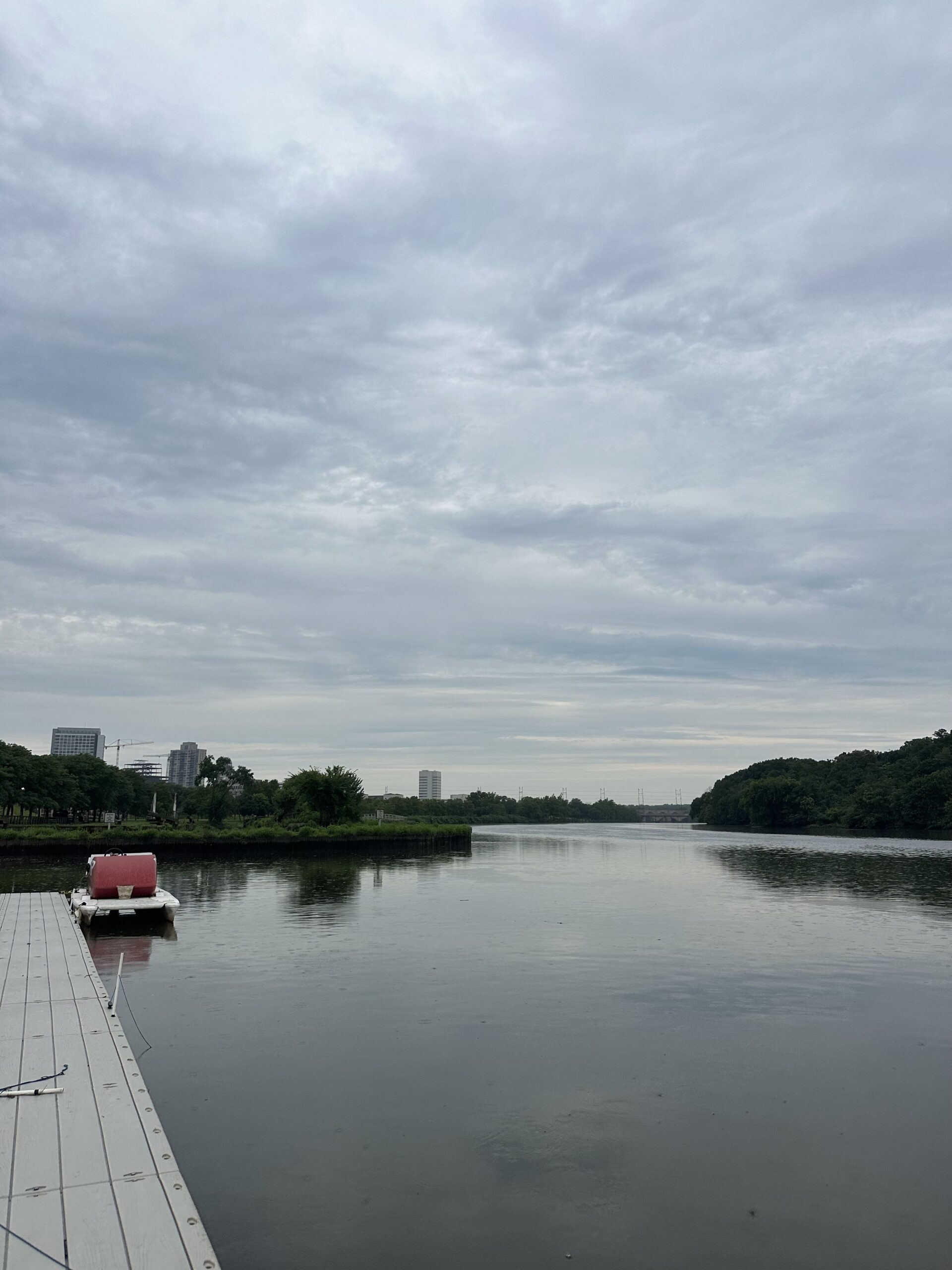
Cloudy skies and light rain over the Rutgers boat docks during our monitoring session this week, Photo Credit: Jocelyn Palomino
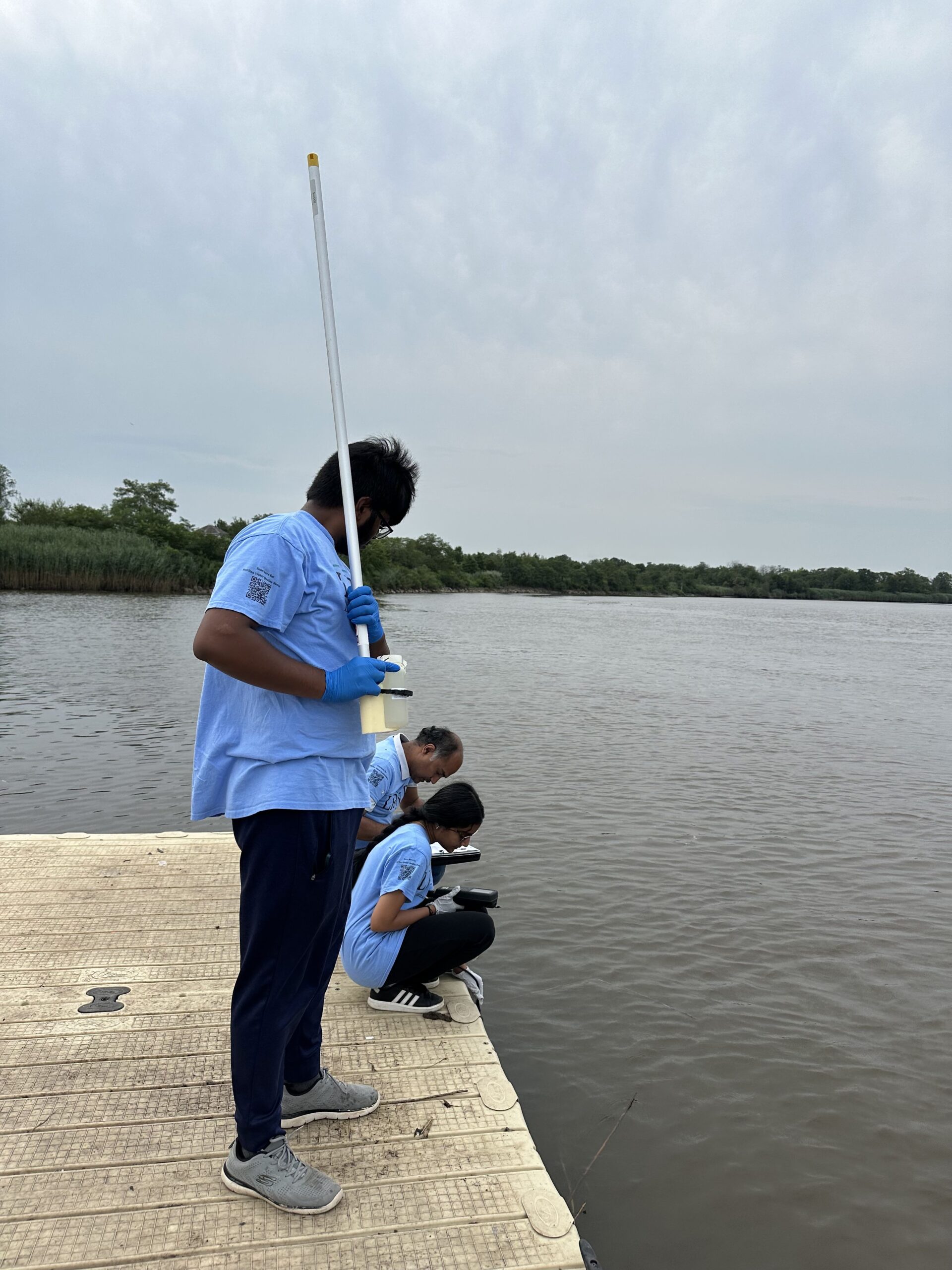
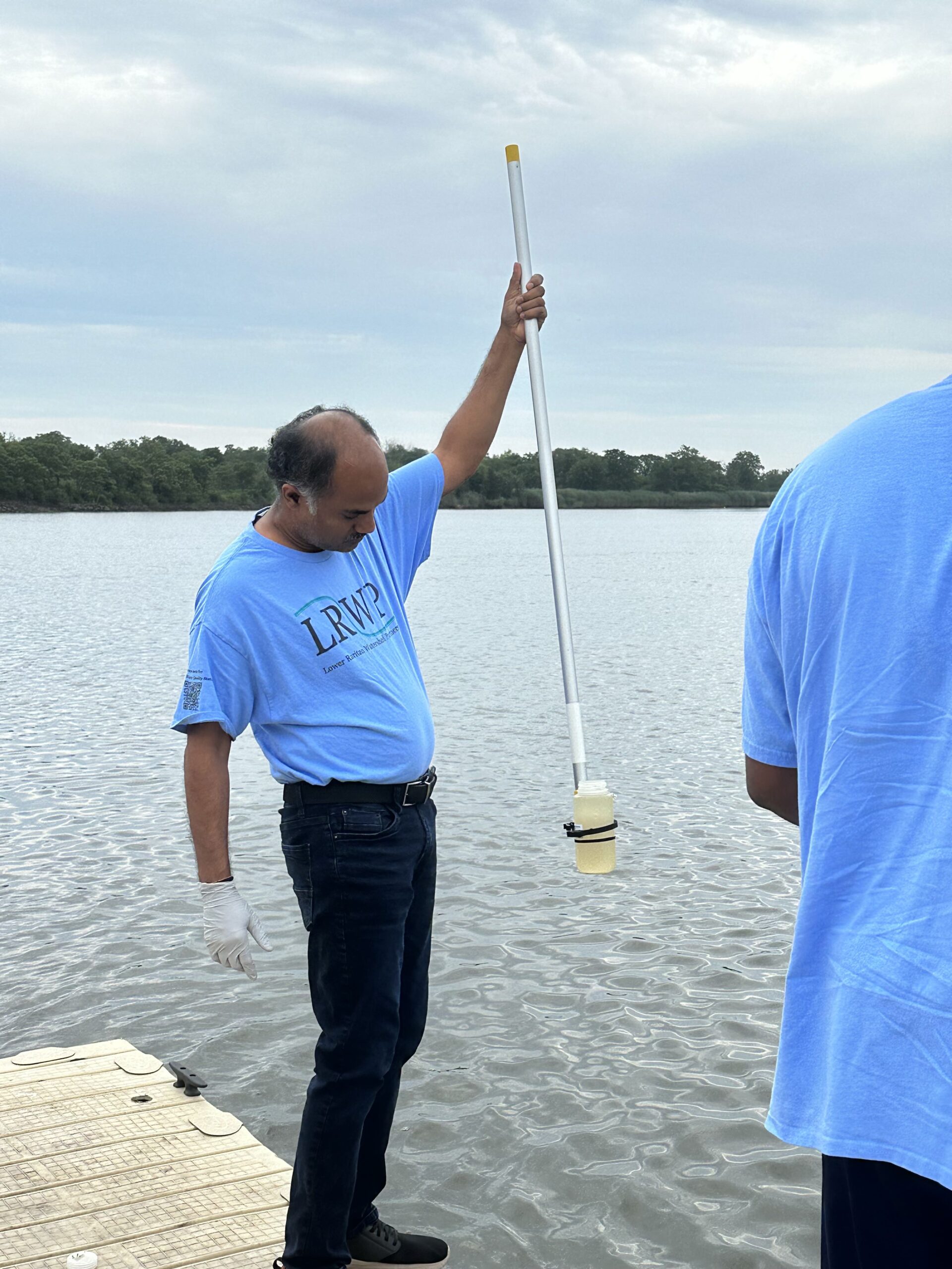
Sanil Nambiar collected our samples for the week with our new and improved sampling stick that we use to retrieve our bottles, Photo Credit: Jocelyn Palomino
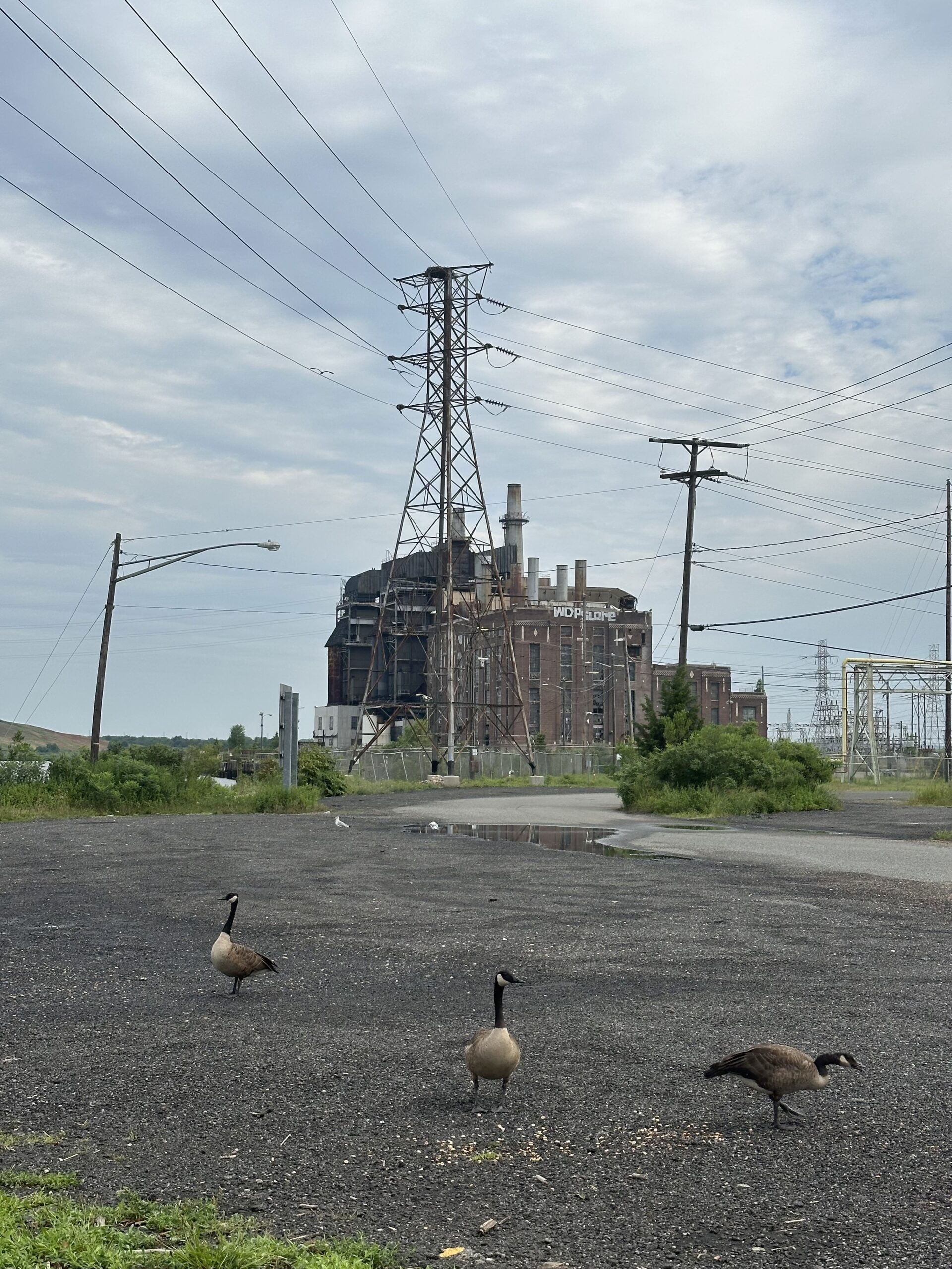
Canadian geese were present at all of our monitoring sites Thursday morning, which was noted in our visual habitat assessment as it may have contributed to some of the fecal matter in our samples, Photo Credit: Jocelyn Palomino
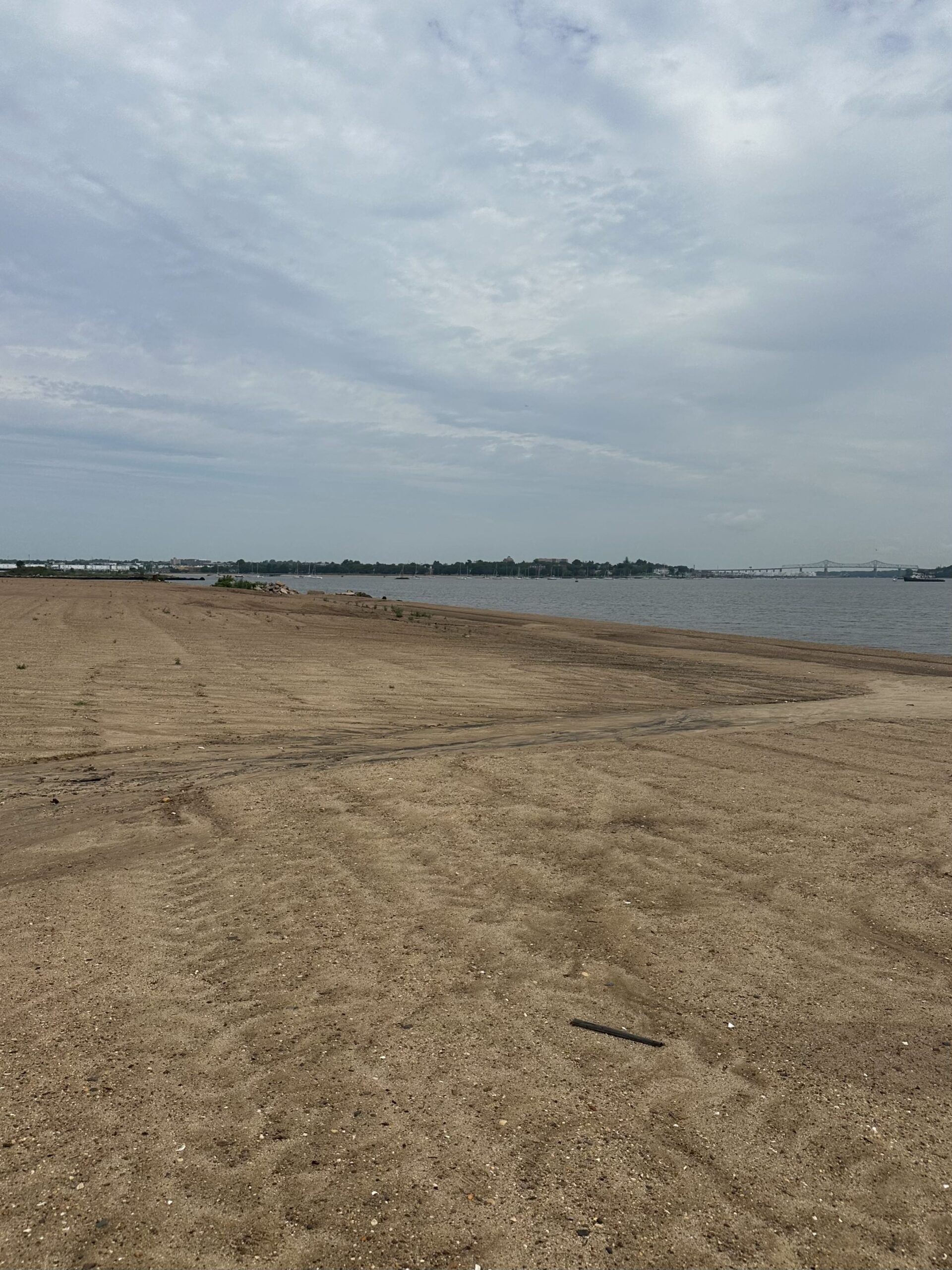
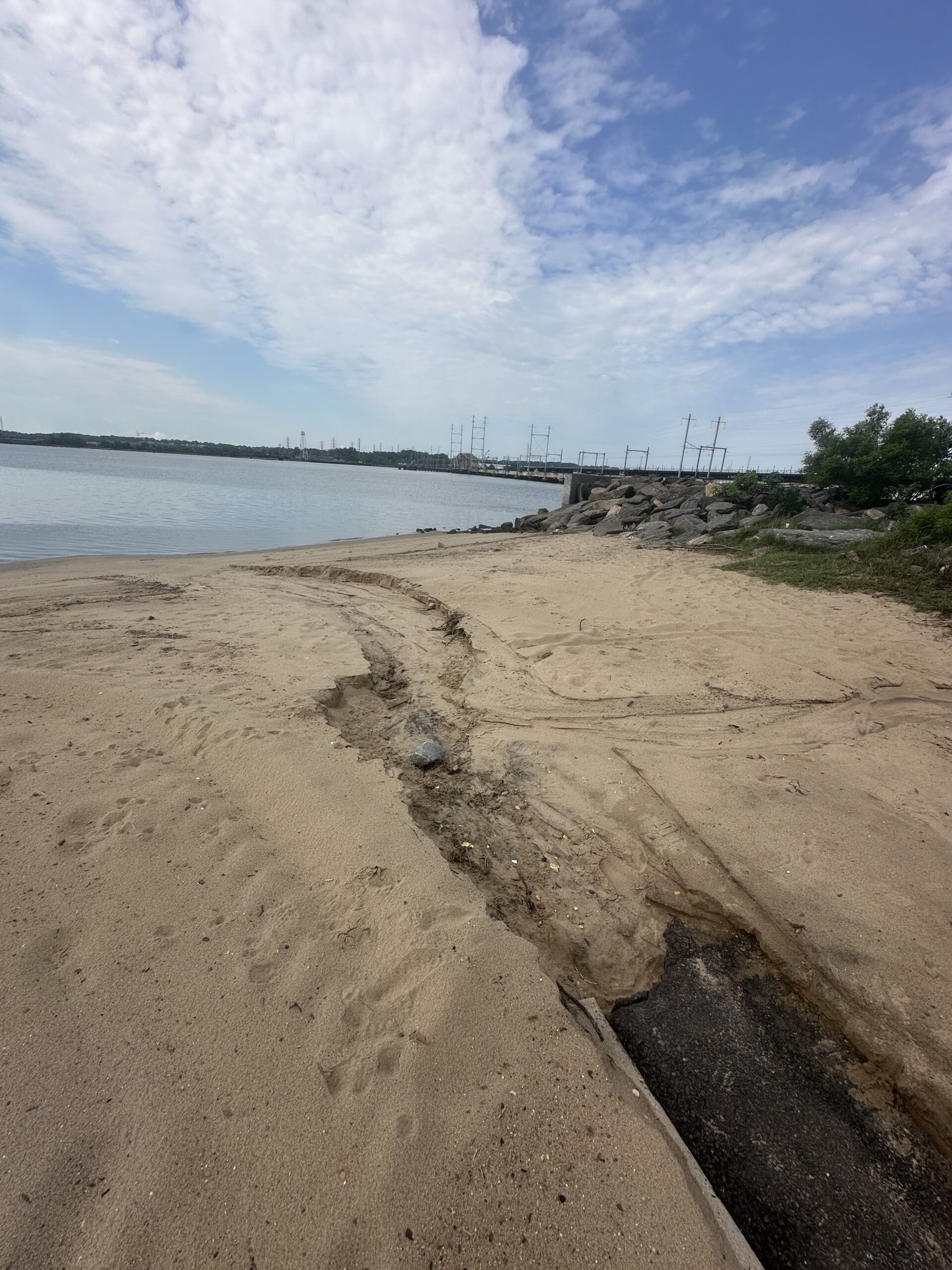
With such heavy precipitation on Wednesday night, the stormwater runoff left trails on the sand of its path leading right into the water at LR5 and LR6, Photo Credit: Jocelyn Palomino
Nibav helping Thulasi gear up before wading into our last site of the day, Perth Amboy’s 2nd. Street Park! Photo Credit: Jocelyn Palomino
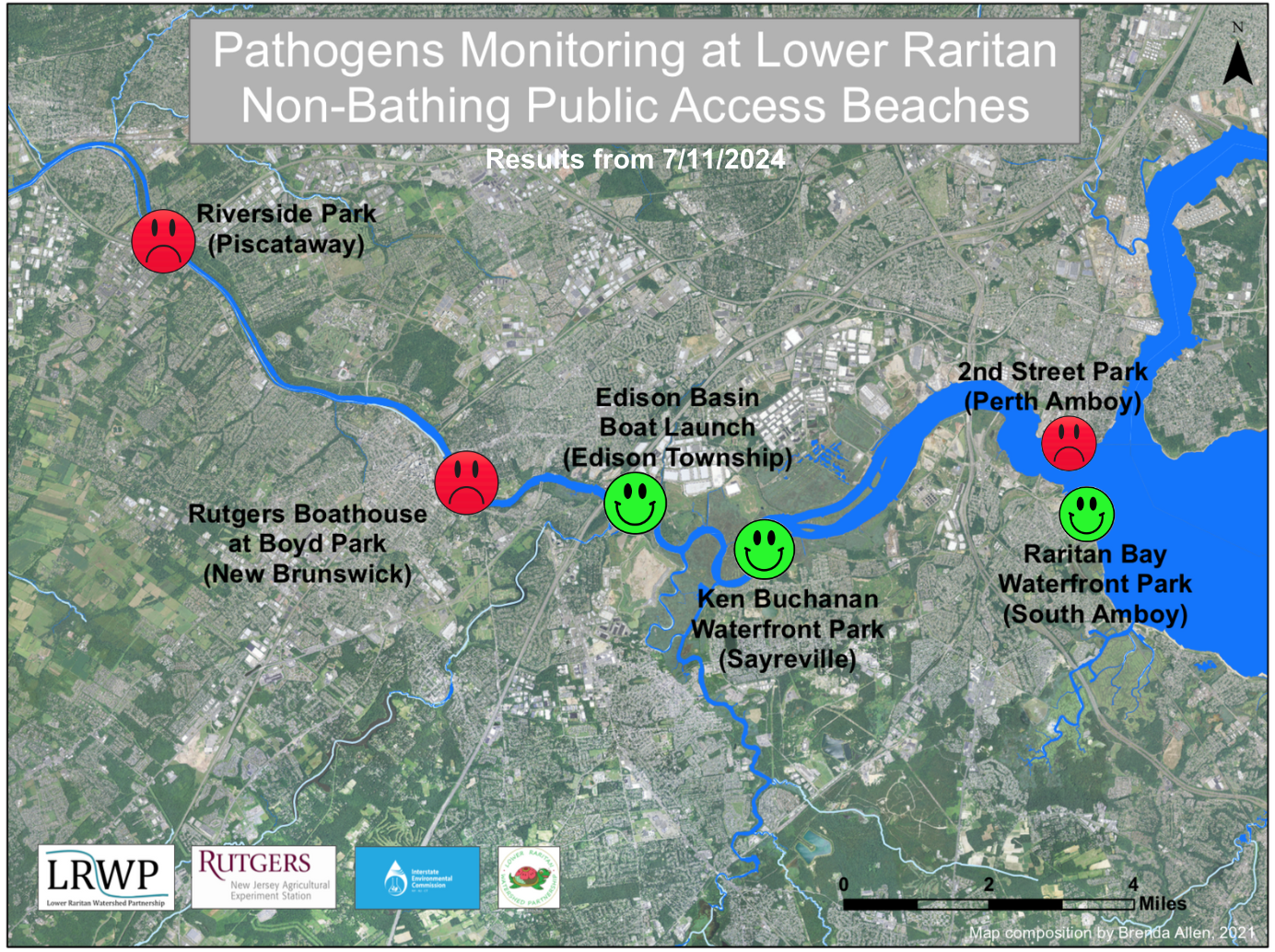
By LRWP Monitoring Outreach Coordinator Jocelyn Palomino
Every Thursday from May to October, the Lower Raritan Watershed Partnership and Rutgers Cooperative Extension of Middlesex County run a volunteer-based monitoring program along the Raritan River. During the summer, we collect water quality samples at six non-bathing public access beach sites, provide our samples to the Interstate Environmental Commission for analysis in their laboratory and report the results to the public on Friday afternoons. Our mission is to share this data with the community and partners to ensure the safe use of the Raritan river for all.
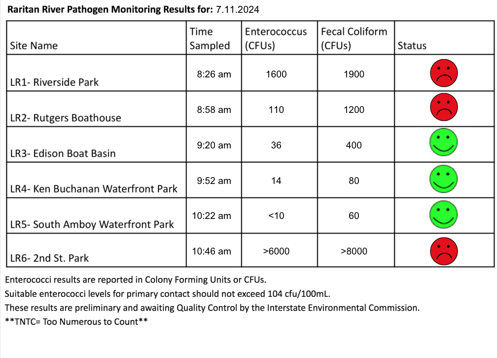
Our lab results for water quality samples taken on Thursday July 11, 2024 show Enterococcus bacteria levels exceeding the EPA federal water quality standard of 104 cfu/100mL at THREE of our monitoring sites this week. Problem sites are indicated by red frowns on the map and chart which includes: Riverside Park (Piscataway), Rutgers Boathouse (New Brunswick), and 2nd Street Park (Perth Amboy). Green smiles on the chart and map indicate the sites with bacteria levels safe for recreation, and include the following: Edison Boat Basin, Ken Buchanan Waterfront Park (Edison) and the South Amboy Waterfront Park (South Amboy).
Pathogens/Enterococci levels are used as indicators of the possible presence of disease-causing bacteriain recreational waters. Such pathogens may pose health risks to people coming in primary contact with the water (touching) through recreational activities like fishing, kayaking or swimming in a water body. Possible sources of bacteria include Combined Sewer Overflows (CSOs), improperly functioning wastewater treatment plants, stormwater runoff, leaking septic systems, animal carcasses, and runoff from manure storage areas.
Our goal in reporting these results is to give residents a better understanding of the potential health risks related to primary contact during water-based recreation. If you are planning on recreating on the Raritan this weekend, make sure to stay safe and wash up after any activities!
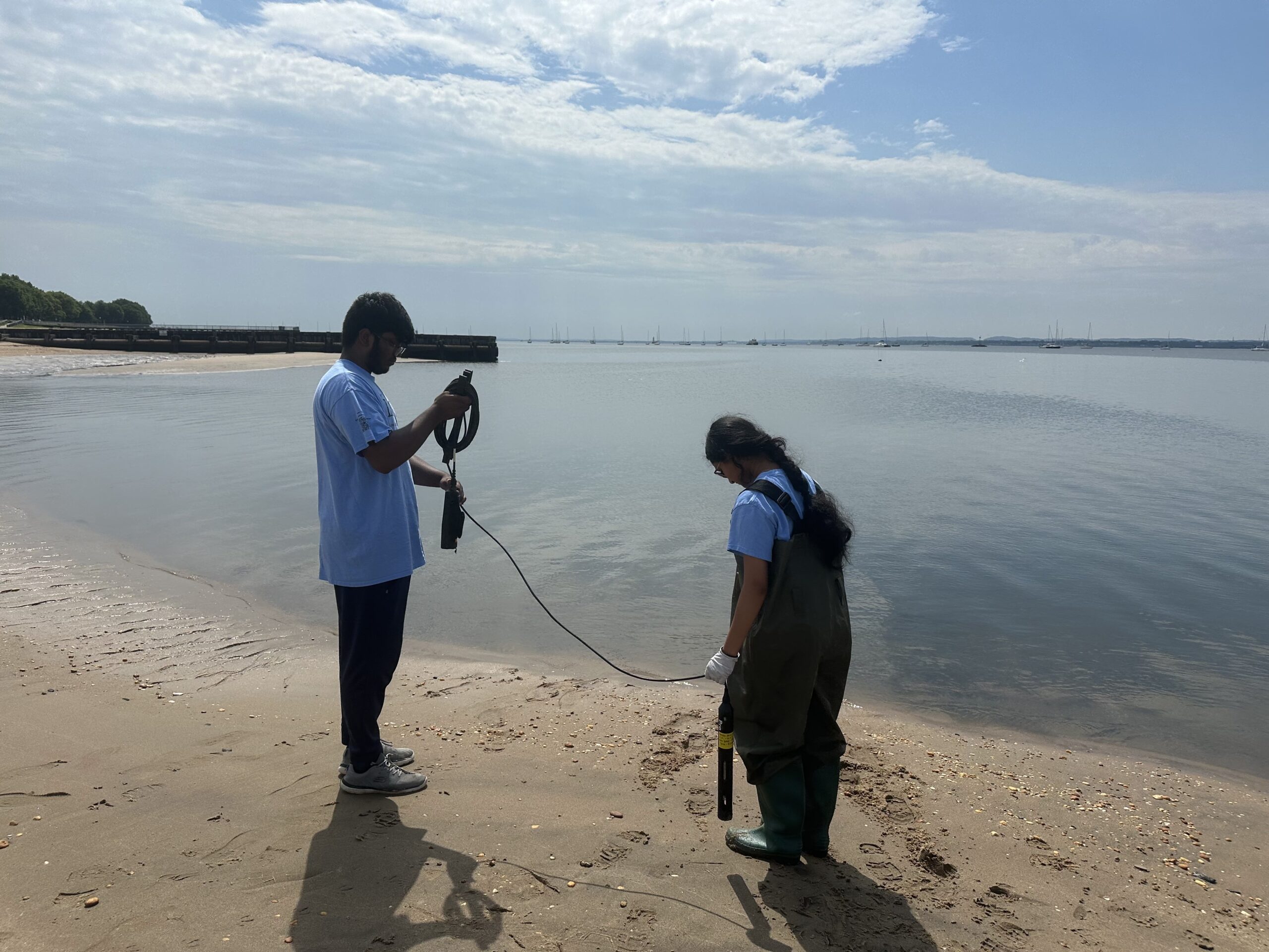
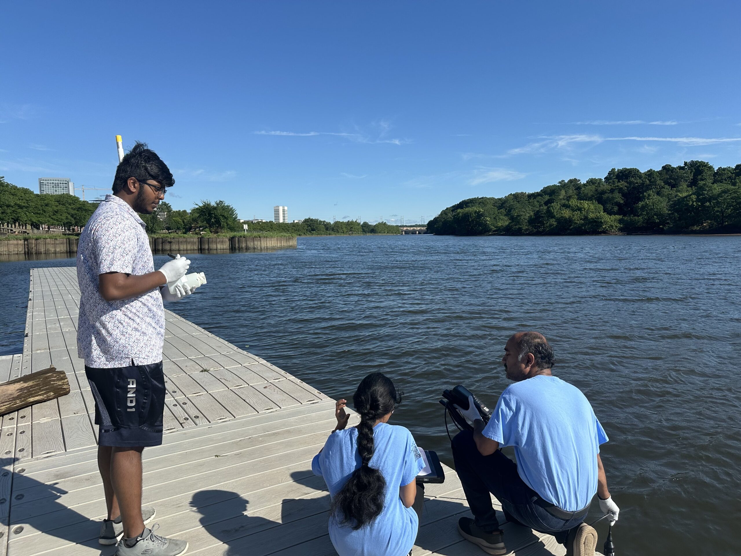
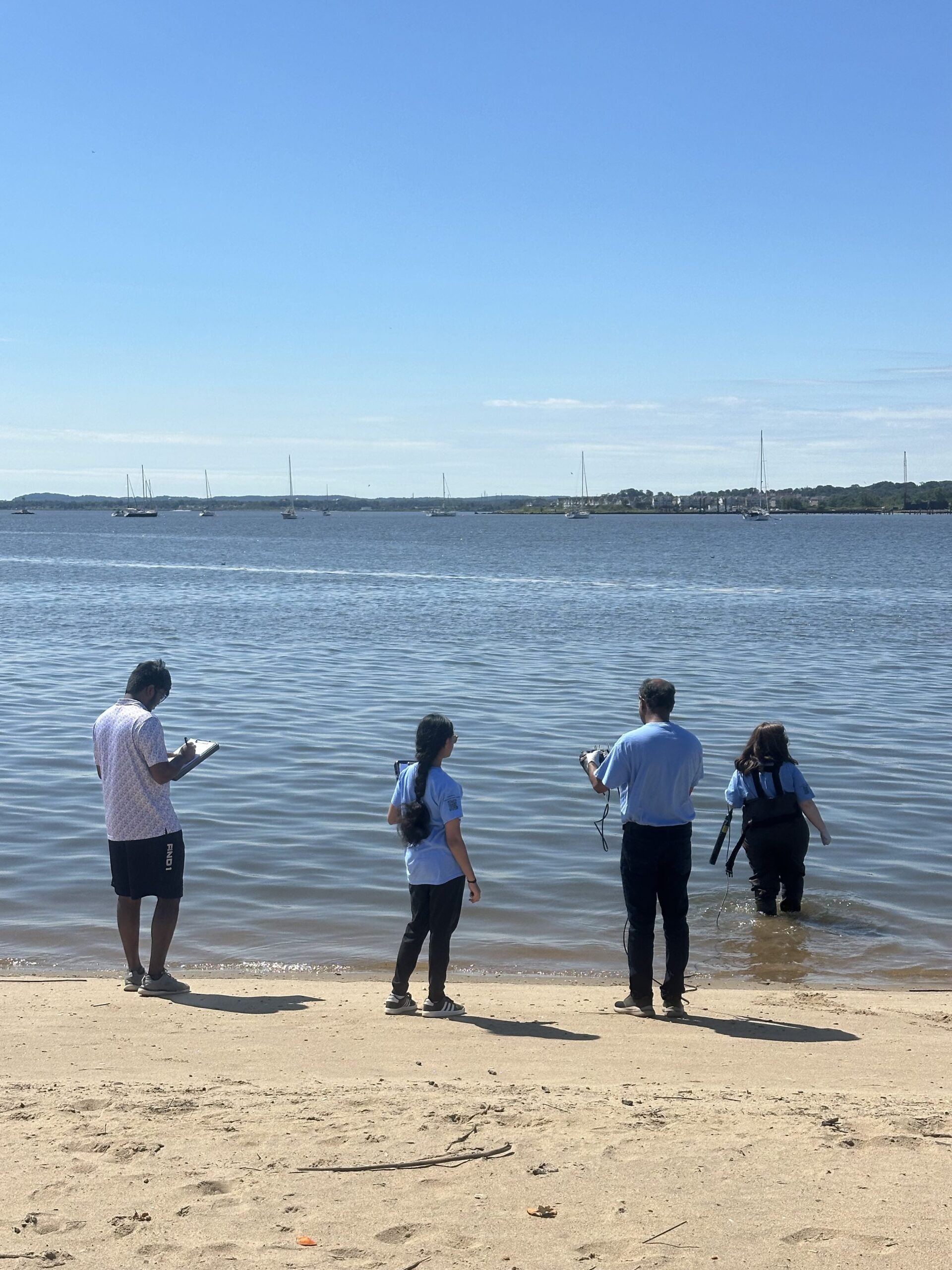
VolunteersNibav, Thulasi and Sanil collecting data from each other while on the docks at the Rutgers Boathouse, Photo Credit: Jocelyn Palomino
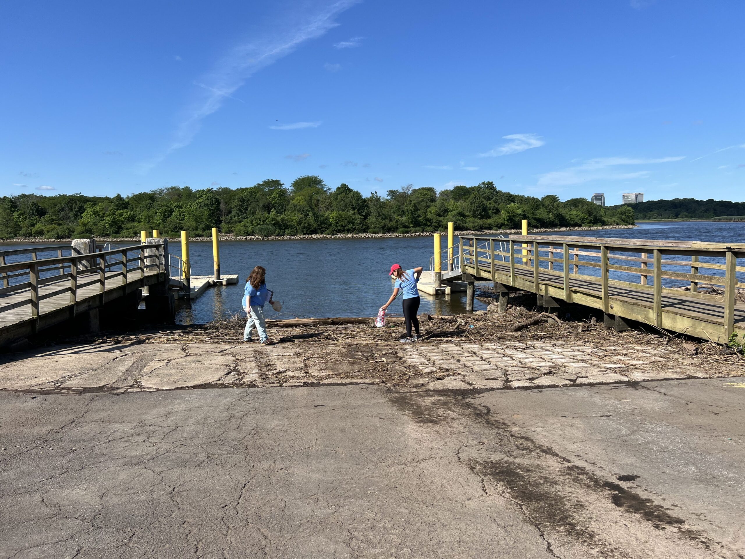
Before heading to the next site, Sofi and Jocelyn picked-up trash that had been washed up at the Edison Boat Basin, Photo Credit: Sanil Nambiar
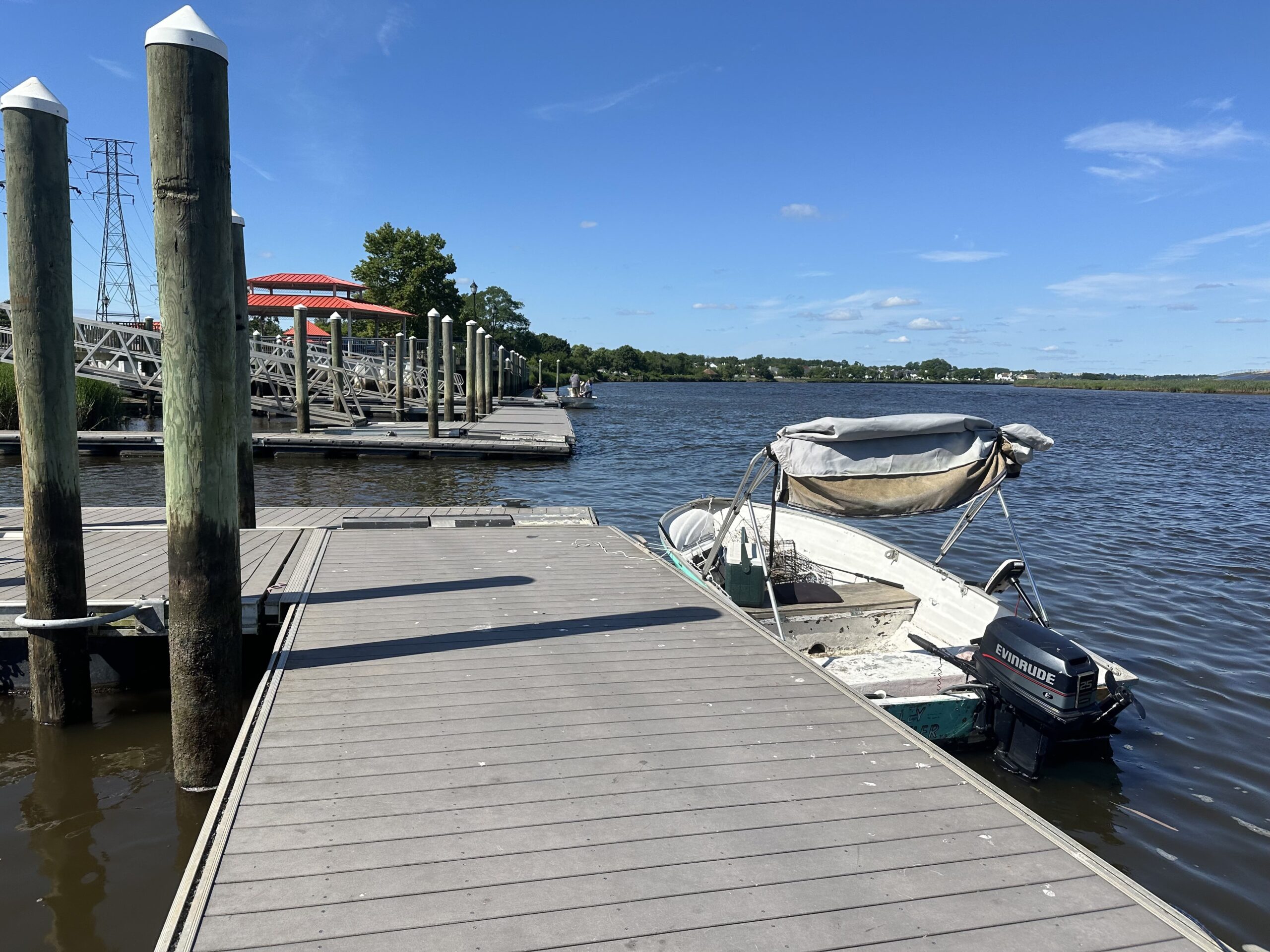
Plenty of boating activity at our monitoring sites along the Raritan this Thursday, please be sure to properly wash-up after all water-related activities for safety! Photo Credit: Jocelyn Palomino
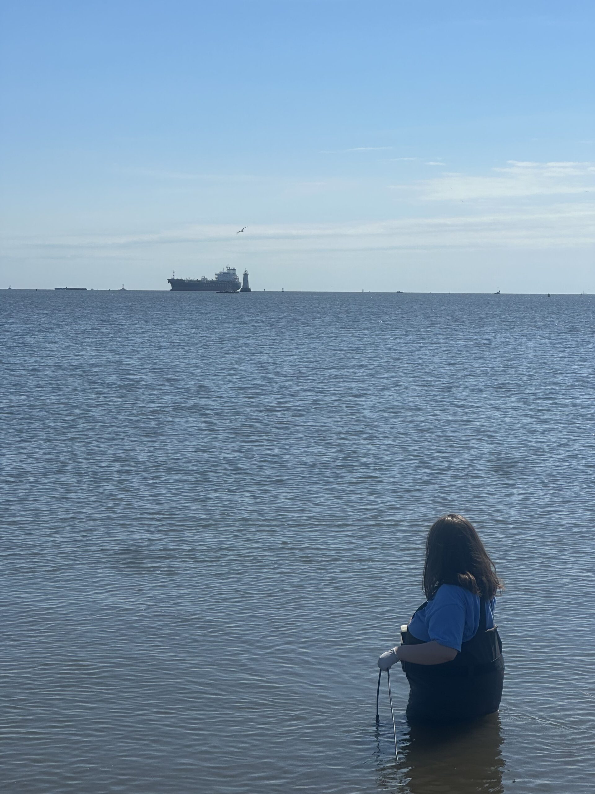
While at the South Amboy Waterfront, we observed a large cargo ship out in the distance right behind the lighthouse- Sofi was able to get a pretty good view since she volunteered to wade in. Looking good out there Sofi! Photo Credit: Jocelyn Palomino
MANY THANKS to the volunteers who joined us this week: Nibav Velan, Thulasi Nambiar, Sanil Nambiar, and Sofi Grossman! Photo Credit: Jocelyn Palomino