Article and photos by Joe Mish
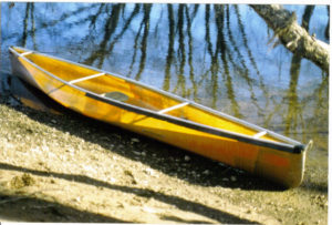
My South Branch office is made of kevlar and weighs 52#, well lit with natural light and leaves no trace. A perfect vehicle for discovering New Jersey’s natural treasure hidden in plain view.
Every once in a while, it is useful to check your back trail to validate your current course. For the last few years I have been attending the Rutgers sponsored, ‘Annual Sustainable Raritan River Conference’ and was introduced to the people and effort dedicated to improve the water and land that make up the Raritan River basin.
It was strange at first to hear someone else talk about my river. There was a moment of concern, a tinge of jealousy, that my ownership of the river was being usurped by strangers, some not even native to New Jersey. I soon realized I was among kindred spirits. It was like meeting long lost relatives….. whose company you sincerely enjoyed. Each member contributed a critical piece of the puzzle, whether a citizen, volunteer or a degreed scientist, each perspective complimented the other, and occasionally there was the discovery of a piece no one knew was missing. The symposium took the threads of individual effort and wove them into a whole cloth.
I was pleasantly surprised, the focus of the conference dovetailed perfectly into my goals and objectives. It also prompted me to revisit what I hope to accomplish with my images and words, given the current status of New Jersey’s relationship with its natural treasures.
Today New Jersey enjoys a natural inheritance that is the sum of the legacy left by generations of agrarian, industrial and residential development. Sacrificed in the name of progress, our natural and wild treasures are reputed to have been diminished to a vanishing point in the wake of the great human juggernaut. However, despite New Jersey’s recurring reputation as the most densely populated state in the union, wildlife is found to proliferate along its river corridors, highways, woods and fields. Much of this wildlife existed before the establishment of farms, whose disappearance falsely signals the surrender to unabated construction and development. The farms and cows are actually late-arriving interlopers, highly visible and used as a convenient but inaccurate measure of our intrinsic wild and natural resources. It is the presence or absence of cows that form the basis for politically subjective land use decisions.
Even the most ardent nature-oriented residents are often oblivious to the richness and distribution of this state’s natural treasures. Regional areas, reputed as nature destinations, add to obscure our natural treasures as their existence implies an absence of nature except where designated. Combine this with the perspective of the nature-neutral and nature-oblivious residents and it is understandable how the nature sterilized image of New Jersey arises from within and grows with distance to earn a national and global reputation as “the ghost of nature past”.
Against this background my photographic intentions range from historic documentation of ephemeral wild moments to portraiture revealing the energy and dignity of the creatures that covertly exist among us. What the camera misses the words capture, what the camera sees the words enhance.
The articles are a blend of literary flourish embedded with scientific information as much for entertainment as to arouse curiosity. I wish to create a gravitational pull of curiosity that draws the reader to seek deeper knowledge. Hopefully some youngster will be intrigued enough to pursue more detailed information and perhaps launch a career in science.
One reason New Jersey’s natural treasures remain hidden in plain view is because of prejudice and limited expectation. The best way to remedy this, is to change the lens through which our natural world is viewed. I do this by presenting stories and information from unique perspectives, along with images of wildlife most have never seen and many more don’t believe exist so close to home.
When I consider my place in the effort to restore the rivers, I see me operating on the interface between art and science. I walk that line to help transition attitudes and open eyes to a new reality fostered by creativity and imagination.
Rutgers fish camera at Island Weir Dam on the Raritan River is now online.
http://raritanfishcam.weebly.com
Author Joe Mish has been running wild in New Jersey since childhood when he found ways to escape his mother’s watchful eyes. He continues to trek the swamps, rivers and thickets seeking to share, with the residents and visitors, all of the state’s natural beauty hidden within full view. To read more of his writing and view more of his gorgeous photographs visit Winter Bear Rising, his wordpress blog. Joe’s series “Nature on the Raritan, Hidden in Plain View” runs monthly as part of the LRWP “Voices of the Watershed” series. Writing and photos used with permission from the author.
Margo Persin, Rutgers Environmental Steward
Editor’s Note: In 2018 Margo Persin joined the Rutgers Environmental Steward program for training in the important environmental issues affecting New Jersey. Program participants are trained to tackle local environmental problems through a service project. As part of Margo’s service project she chose to conduct assessments of a local stream for a year, and to provide the data she gathered to the Lower Raritan Watershed Partnership (LRWP). Margo keeps a journal of her experiences, excerpts of which are included in the LRWP’s “Voices of the Watershed” column.
Location: Willow Dr. Middlesex, NJ 08846, USA
Latitude: 40:566552
Longitude: -74.510890
Prologue
In working on my project, I plan to provide a detailed chronological report of the specified site over a period of one complete annual cycle. Secondly, I will take photos to document any changes – or lack of changes – with the passing of seasons, and to bear witness to human intervention, whether it be positive or negative. For example, has any work been done previously to prevent erosion of the stream? Or, what are the effects of littering/ dumping in regard to stream health? I am looking forward to being an active observer of the ‘big picture’ as well as the minutiae of this specific site. Because I am a life-long gardener, it is patently obvious that my garden ‘talks to me’ – I learned that from my Mom. One needs to learn to observe and interpret the sometimes subtle and sometimes obvious messages that nature sends out. For example, a plant may not be partial to a planting site and thus sends out runners or shoots to a more appropriate placement and then a new plant pops up in the more favored location. Needs more sun? Wants higher or direr ground? Example: day lilies don’t like to be in the vicinity of lilies-of-the-valley and they also don’t tolerate any mulch…. With this in mind, I want to to enter into that active ‘observing/listening’ relationship with a stream habitat, which will be slightly different from one with a suburban garden. But I suspect that some (many?) of the same or similar skills will apply.
And third, I want to create a written narrative of my relationship with the site, which I hope will be a meditation on the ‘how’ and ‘why’ of a more intimate connection with the wild part of nature that surrounds us. How can we become more active and aware observers and listeners, in order to be able to honor the wildness in nature? And how can we utilize that in order to attain a closer, more authentic and honorable connection between earth and human, to acknowledge that wild part that connects rather than separates us?
A bit of a delayed and bumpy start ….
Given that I wanted to do a stream assessment, the first order of business was to get some training in that field of endeavor. To that end, I participated in a Visual Habitat Assessment training program offered by the Lower Raritan Watershed Partnership that took place on 21 May 2017 at the Lawrence Brook. It was led by Heather Fenyk and those of us in the group learned how to assess stream quality utilizing a very helpful and specific set of guidelines that include water conditions, stream measurements, and stream characteristics. In addition, we also were introduced to ‘high gradient monitoring’ that has as its focus such parameters as embeddedness, sediment deposition, channel flow, velocity/depth, channel alteration, bank stability, etc. My mind’s eye was awakened to the plethora of detail that could so easily be passed over, if one’s full attention to detail is not called into service. It was a wonderful learning opportunity and I was so glad that the opportunity had been afforded to me to learn in this very supportive and educational context. It is my opinion that we learned from the group leader, from the assistants and from nature itself. It was an experience that has stayed with me – I was so impressed by how the gifts of science and observation we who inhabit that green planet that we call home can both inhabit and commune with earth, water, sun, and sky. We need to be silent, to look, to listen, to be, and to be at ease so that the earth’s signals can fill us with wonder.
My next step was to find out exactly where the stream was located, obviously. But this task proved much, much harder to achieve than would be expected. After contacting several people over a period of several months, the site coordinates were eventually sent to me by Mr. Robert Hughes, the Watershed Ambassador WMA 9, on 30 October 2017. Progress!
The third step was to do a reconnoitering mission to the site – more about that in a moment – and finally, to arrange for an ‘official first visit’, in the company of another environmental enthusiast, so that the first official set of measurements could be taken. It was strongly suggested by both Michele Bakacs and Heather, with an eye toward safety, to develop and utilize a team approach for site visits. Two people had been recommended to me who might be willing to visit the site with me; I contacted these two people and because of timing, only one was able to co-ordinate with me for the site visit. That first official visit took place on 2 December 2017, with Carolyn F as the second member of the site visit team. So begins the project – it will continue over the course of an entire year, from December to December, so as to be able to capture the feel of the site and to develop a relationship with nature’s rhythm at this particular site. Wish me luck.
Preliminary visit
Prior to the official start of my project, I wanted to locate the site on my own and to reconnoiter it from a very practical perspective: aside from the spatial co-ordinates, what was the easiest, safest, most direct route to the site? Is parking available? How safe/reachable is the site from a public safety perspective? Is the site easily accessible via vehicle? On foot? Are there walking trails? Are they cleared / easy to negotiate? Are there other accommodations? Is the site under the care of any public entity? Are there man-made structures in the vicinity? If so, what purpose do they serve?
25 November 2017
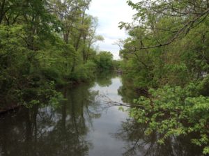
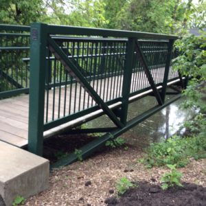
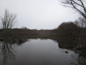
My first unaccompanied visit to the site was purely for reconnoitering. The part that I visited is easily accessible from Rte. 28 in Middlesex and there is a small parking lot available that fronts the Ambrose Brook. (It turns out that I was not quite at the coordinate site, but within walking distance of the GPS coordinates. More about that later.) While seated in my vehicle I waited for a few moments to get my bearings: there are paths that lead in both directions, one that parallels Rte. 28 and another that cuts back into a residential area. Part of the path is paved, then gives way to some well-trodden dirt walkways that follows the contours of the stream as it meanders its way through the suburban area. There is a small park with a pavilion, a suspended observation / fishing deck that is handicapped accessible, and a portable potty adjacent to the parking lot. Farther down, barely visible from the road, is a lovely foot bridge that crosses the stream from the small park area to a rather dense suburban area. The bridge is made of metal, quite sturdy, and provides a beautiful vista in both directions of the stream.
Exiting my vehicle, I walked farther down along the part parallel to Rte. 28 and observed a small but lovely waterfall that allows for the swelling of the brook during times of heavy rain. There are two drains, presumably for rain run-off, that deposit water into the brook. One is a cement structure with a grate that protrudes from under Rte. 28 and the other is a slightly battered metal pipe that extends from underground over the brook. During that first visit, neither drain had any appreciable amount of water to contribute to the brook water capacity. In regard to vegetation, being that it is winter, the ground is frozen hard but the water from the brook is not frozen. The grass is brown and dormant, fallen leaves are all around and the trees are bare, sleeping as they should on this cold winter day. Few birds made their presence known and the only sounds were those of the quietly gurgling brook versus the distant hum of the traffic less than one block away.
A lovely memory and observation came to me from the past. One of my acquaintances from years past is a lovely Native American woman; if I remember correctly, she is of the Cree tribe. In speaking of the turning of the seasons, she noted that within Native American culture, in her tribe in particular, winter is of great value because it gives members of the tribe both the time and the space for storytelling, for being with family and tribe members in close proximity, for listening and learning, for observing, for working on and teaching traditional crafts to the younger generation, for making music and singing, for the passing down of valued and cherished information such as family and tribal history, tribal traditions, myths and legends, for sharing the lessons that are needed to pass from one stage of life to another, for maintaining a way of life. She also emphasized that winter is so important to nature because it is a time of somnolent rest, a time to retreat inward, to focus on the completion of one cycle before embarking on the renewal of spring and the start of yet another growing season. As I wandered the bank of the Ambrose Brook on that cold and quiet winter day, I pondered the lessons that await me in this project. The air was cold and I felt a quiet sense of contentment and anticipation, a turning inward that my friend had indicated that is one of the gifts of the winter season. What other gifts would nature bestow upon me if I could just be still, wait, observe, and listen?
2 December 2017
Ready, set, go! This was a cold and brisk, partly cloudy, not unpleasant day for the very first ‘official visit’ to the site; I was accompanied by Carolyn F, a valued member of the assessment workshop whose name had been suggested to me by Heather of the LRWP. We communicated several times via e-mail and then met on this Saturday in order to put into practice the skills and formula that we had learned back in May. It turns out that this environmental buddy had a bit more on the ball than I did, for she pointed out to me that the actual site of the GPS coordinates was a bit farther removed from the one that I had scoped out on Rte. 28. After texting back and forth, we finally met at the appointed date and time at the GPS location; both of us came prepared, she more than I. Her waders served her very well, given that we did a practice run of habitat assessment using the study sheets provided at the workshop. We did a quick reconnaissance of the site via the latitude and longitude numbers, which is located in a residential neighborhood a bit farther removed – about two blocks or so – from Rte. 28, close to a modest children’s playground. We walked the site, she took some photos, then we decided to head for the other section closer to Rte. 28 in order to try our hand at working through the assessment sheets as a practice run.
Using all the equipment and measurement tools provided by the Lower Raritan Watershed Partnership – metal ruler, flag markers, floating rubber duck, thermostat – we happily set to work on the task, starting with the ‘general sheet’, then working through ‘water conditions’, and ‘stream measurements’ (width, depth, velocity). Sounds fairly straightforward, right? Well, what slowed the process at this point was that the measurements are required to be taken using the metric system and not the standard American system of inches, feet and yards, including centigrade versus Fahrenheit readings. Arghhhhhhhh…… Needless to say, the conversions slowed us down just a bit but Carolyn’s phone (with calculator) turned out to be a most vital component of our visit. We did some of the calculations on the spot and then later at home I checked our numbers and completed the conversions. Our tasks included wading into the stream – her waders and my duck boots came in very handy considering the distance and depth – and I appreciated very much having a buddy to ‘compare notes’ to take all the measurements and come to a shared decision in regard to stream characteristics and visual assessment of gradient factors such as epifaunal substrate, embeddedness, sediment deposition, channel flow, frequency of ripples, and the rest of the categories. We measured out our required distance – 50 meters in either direction – placed the flag markers, then got to work.
The task was engrossing and the suburban context faded into the background as we assiduously worked our way through the assessment. Even though the natural habitat was in full winter mode, I became aware of the subtle shadings of sound, color, texture, movement and stillness. For example, the floating rubber duck signaled the literal ebb and flow of the stream with its bobbing and stalling as it responded to the currents and cross-currents of the slowly moving water. At times it got caught in a pocket of calm, and then with a bit of encouragement from us, rejoined the water’s energy to make it to the final point of our measures. In observing the little rubber duck’s movement, its vibrant yellow color so visible to our human eyes, it became for me a bit of a metaphor, in that it was floating on the surface of the all-encompassing stream, seemingly unaware of its insignificance vis-à-vis the natural world. We humans ‘float on the surface’, unaware of our insignificance over time in regard to the pulsing of the planet beneath our feet. Alas, our interventions often are negative, considering how overpopulation, pollution, and other forms of contamination interfere with this pulsing, as our lovely green planet hurls itself through the universe, the planet itself insignificant in the greatness of space.
Carolyn and I utilized our time well: we were at the site for approximately two and a half hours, taking measurements, comparing our individual observations, appreciating the subtleties of the winter landscape. And just one more observation. We both noted that the area was relatively clean of human garbage, trash, and other forms of detritus, which was a pleasant surprise for me. Given the site’s proximity to the road, the parking lot and rather dense housing, I honestly had expected there to be a stronger and more visible human footprint in the form of various forms of waste – trash, paper, cans, bottles, old tires. But the area is fairly clean! At the end, my environmental buddy suggested that a visit for the purpose of kayaking might be a doable undertaking at some future time in the warmer months, in order to explore the area upstream of the given site. That idea will be placed on the list of possibilities for another day. With that we each went our separate ways. It was good to be heading home, with the heat flowing in the cab of my vehicle.
30 December 2017
“The best laid plans….” Now that this project had finally launched, I was anxious to establish a steady rhythm in regard to my site visits. And in addition, there was contact with another environmental enthusiast, who signaled a sincere willingness to serve as my exploration buddy. Susan E. had volunteered to accompany me on further adventures; she is perfectly qualified and suited for the task, having developed an environmental project of her own, which in truth, was the inspiration for my own. We decided that an end-of-the-year visit would be an appropriate means to both close out one cycle and look forward to another, Janus like, in anticipation of a yet another change of season. Alas, the plans fell through because I came down with a virus and was out of commission for the good part of a month. So… on to the New Year and the start of another cycle.
21 January 2018
In the company of Susan E., we headed to the site on a cold, clear and sunny day. We parked at the lot in close proximity to the brook, then on foot wandered back to where the GPS coordinates are located. Our meandering took us farther upstream than I had previously visited. The footing was firm in places and quite soggy in others, and we noted the dormant vegetation, including a healthy crop of brambles that very effectively caught at our clothing. Ugh. We noted the places where the waters had left a mark on the land within an overflow plain, evident in the swirling, matted down grass and the markings on the shrubs and trees that line the banks of the brook. Susan pointed out several places of evident erosion in the banks of the opposite side of the stream and noted the layering of sediment – different colors and textures — that gave evidence of the changing composition of the earth’s layering. Many are the varieties of trees that line the banks, whose root systems benefit from the generous supply of water. [ Note to self: try to identify the flora on the banks of the stream. Are these specimens native to the area? Or have they been added to enhance the landscape from a human perspective?]
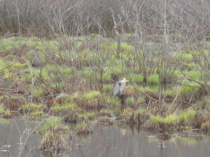
We made our way to the lovely footbridge, a steel structure that provides an excellent vantage point to look in both directions, both up and down stream. Some fauna were present, a few ducks and geese on the surface of the water as well as a some fish that lazily lolled in the current below. I was struck by the sense of solitude and peace of this beautiful place, in spite of the proximity of suburban life so close. We continued on the bridge to the other side, then made our way carefully along the opposite bank. The footing became quite muddy and unstable but the view from this far side of the stream offered the opportunity to reclaim a perspective based on a more unenhanced version of the site, one not as manufactured by human intervention. Nice!
Our visit included stopping for Susan to take some photos, then we crossed back to the parking lot and took our leave.
21 March 2018
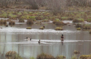
As predicted by the US Weather Service, it has been a cold and long winter, followed by a cold and wet spring. I stopped by the Ambrose Brook today in the hopes of spying a bit of change, whether in the early budding of trees, the minute sprouting of grass, a return of more birds with their flutters and chirping. Any harbingers of spring? No such luck, not yet. However, this visit provided me with another opportunity. It was a cold and mostly cloudy day that served for me to stand in quiet solitary contemplation on the observation platform. Not to be deterred, I chose to focus attention on a small island that is at the center of the brook and attempt to take note of the visual minutiae that delineate the island’s subtle shadings. The colors are primarily brown and green, with varying shades of tan and grey. Black lurks in the shadows and slivers of flickering sunlight shoot arrow-like through the trees, shrubs and brambles. Wind ruffles some fallen leaves that cling to roots and branches, decaying evidence of a season long past. Some ducks paddle quietly along the perimeter of the island and barely take note of my presence. Perhaps they have become inured to human presence in general or through experience have learned that the imposing, vertical mammals do not have the habit of crossing the water barrier between solid ground and the little island to their backs. They occasionally glanced in my direction and then continued on with their creek cruising. Not a bad life, given that their feathers and a layer of winter fat provide ample protection from the water and wind.
My observation also took in the water level, higher than in previous visits, presumably from early spring melting and run-off. The brook water was a muddy brown and lapped at the edges of the island; there was some bank vegetation that was partially submerged and partially above water level. As with the previous visit a bit upstream, trees on the island threw off roots, some as thick as the fists of a prize fighter, to sustain their height. There was no indication as yet of buds forming on the trees, none that I could see from the distance, standing on the observation platform. The quiet of this visit on this end-of-winter day comforted me, offered a soothing message of tranquility, endurance and the abiding wisdom of nature’s continuing cycles.
10 May 2018
Spring has finally arrived at Ambrose Brook, there are many indications that the season has turned in alignment with the earth’s rotation and tilt. I visited the site at around 10:30 am and stayed for about one and a half hours. My time was spent in observation and contemplation of the natural environment as well as the effects of human intervention. For starters, the leaves are starting to appear on all the trees – finally – the grass is starting to appear less stubbly. As a result of the burgeoning leaf cover, the ability to see across the brook will be quickly diminishing in the coming weeks, I surmise. The water in the creek seems to be moving at a bit faster pace, probably because of the amount of rain that has been falling in the last week or so. I walked for approximately a quarter of a mile in each direction from the parking area off of Rt. 28 in order to determine what changes, if any, had occurred because of the winter weather.
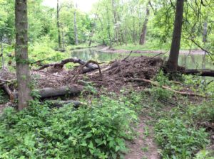
What I observed in the area closest to the segment identification by latitude and longitude was some washing up and / or tree fall from winter storms. Some of the fallen timber had been ‘cut down to size’ by someone wielding a chain saw, most probably a worker from the local DPW; the logs and branches were piled up on the left bank to a height of approximately three and one half feet. This pile of wood and leafy debris may prove enticing to some small furry creatures in the future for a lovely, cool, and protected nesting or burrowing place, if it is left as it is. I was able to get around the pile and continue my observation but the brambles have started to fill in and the slog got a bit more difficult. It was evident from where I was walking on the bank that there is a type of flood plain for the creek; the flow exceeds the bank where the creek takes a meandering turn toward the left. The footing became quite muddy and the brown grass left over from the fall manifested the effects of flowing water – lovely swirls and whorls that give the impression of a lazy aquatic ballet performed upon the welcoming earth with the literal ebb and flow of the creek’s capricious visits during the winter months.
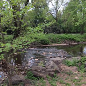
The brook’s water has now receded from the flood plain and is within a channel that has definitive banks, although the height of the banks varies at different points on my observation path. Taking a turn in the opposite direction from the parking area, parallel to Rt. 28, the view is idyllic – a meandering brook with a few surface ripples that give off a low and pleasing hum, an overhang of greening trees, grass appealing to the eye and calling for the tread of bare feet, a small waterfall, and some waterfowl – Canadian geese and a few mallard ducks who were more than willing to share the space and beauty of the moment, either the ones who were on the banks of the creek or those who were enjoying the cool embrace of the creek’s sultry flow. In spite of the minimal traffic noise emanating from Rt. 28, this was place and moment that could be described as a feast for the senses. The gift of sight that captures the nuance of color and form, that of hearing, the sound of birds and brook, that of touch, that encourages physical discourse with so many material forms as well as the ephemeral contact of wind on my face. And the olfactory experience is not to be denied, in the sweet reminder of flowering trees and bushes that contrasts with the musty and not-to-be-denied odor of the languorous creek within its uneven banks. And the experience of taste? I was not expecting to add that to the list, but a bug unceremoniously entered my mouth and with an unanticipated crunch, the bitterness of the insect’s demise forged its way into my consciousness. Ugh. So much for poetic contemplation of this idyllic scenario.
In regard to human intervention, in addition to the chainsawed fallen timber, there was evidence of tidying up in the recently mowed grass along the banks, mulch piled and spread along the public walkways, and a cheerful DPW worker raking some leaves. There was some human traffic; two men were fishing off of two different piers with hand rails – handy for resting their fishing poles –, and a young mother ambled briskly with her toddler son who had no interest in staying in the stroller but rather preferred to trot along beside her.
The visit was enjoyable, refreshing, renewing. Some ideas for further exploration are to identify the trees and shrubs in the area, to focus on bird species that are present, and perform another official habitat assessment of the creek utilizing the format provided by the Lower Raritan Watershed Partnership. And the possibility of a kayaking expedition offers yet another challenge. Onward!
About Margo Persin: I am a retired Rutgers professor who needed a project. I took the Environmental Stewards course offered through Rutgers and was inspired to get back in touch with this beautiful green planet that we all call home via a focus on water. I grew up on the Lake Erie shore, the northeast Ohio coastline, so the pull to return to a partnership with water was a logical and autobiographical one for me. Also, during my years as a professor, I spent several years in Mexico and was able to observe firsthand the devastating and catastrophic effects of no access to potable water. Water means healthy communities, healthy crops, healthy kids. Water is life.
Article and photos by Joe Mish
The powerful watery hand of the river reaches up in a wild mood to toss its dance partner skyward.
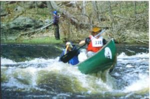
A canoeist might think of the river as a dance partner whose energy flow and mood sets the tone for the style of dance to be performed. A waltz, a tango or lambada are all on the river’s dance card to be enjoyed or sat out. Any paddler who wishes to partner with the river and enjoy the wide variety of watery tunes must have practiced moves, familiarity with boat and paddle and an ability to read the subtle nuance of wave patterns reflecting the structure of the hidden riverbed.
While high water and low water dances may be thoroughly enjoyed, I originally coined the term ‘river dance’ to describe the convoluted navigation required to follow the low water flow typically occurring on the South Branch during the summer.
Each year, winter ice and downed trees reshape the river bed to form new shoals, islands and channels which leave the scars and wrinkles that figure so prominently when water levels drop in the summer.
Low water and limited paddler skill do not preclude a float trip down the river as a grounded boat may be dragged across exposed shoals and shallows to deeper water.
Plodding along does not equate to river dancing but it gets the job done.
The joy of river dancing comes into play when the paddler, perhaps in a solo canoe, seeks out cuts and channels that hold just enough water to support the boat. Following the deepest water when the riverbed becomes a player in the band may mean tracing a convoluted course from one side of the river to the other. This shallow water navigation strategy is directly applicable to high, fast water flowing through boulder strewn stretches of river. Both situations require reading the wave patterns to determine the best path beyond the next immediate move.
One fast water section where I launch always has sufficient water from bank to bank for about a hundred yards. During lower water levels the left side and most of the middle of the riverbed is almost exposed and not navigable except for a narrow cut quite close to river right. As is often the case, a direct downstream approach to the deep water cut is not possible because the water directly above the cut is too shallow or has a downed tree blocking that approach. As the situation and solution is obvious from a long distance upstream there is time to gradually approach the passage at a forty-five degree angle and then straighten the boat with a quick draw to follow perfectly in the strong deep current.
Further downstream near a bend in the river, a long treeless island appears, the right side of which is navigable in a channel that runs along the opposite bank. As the channel nears the end of the island, it flattens out and disappears. The water then seeks to run at an angle across the raised center section of the riverbed. The riverbed here appears to have a profile of a typical crowned roadway and the main channel reappears to run just along the tip of the island. Crossing the riverbed from one channel to the other requires a good look at the wave patterns. If you know nothing, then just observe the differences in the wave patterns. In very shallow water they are almost indistinguishable but with practice differences will become apparent. Generally, flatter waves reflect deeper water. Or simply put, the less busy the surface of the water appears, the further above the riverbed it is. Don’t be surprised sometimes to find the water too shallow despite choosing the most favorable pathway. Crossing an ultra shallow channel as described, may require the paddler to shift their weight forward to create an absolute neutral balance in the boat to avoid a fore or aft drag. Shifting paddler weight to one side in a typical shallow V-shaped hull will often decrease the depth the hull protrudes into the water and might make the difference between stepping out and dragging the boat or barely floating by with some slight scraping.
One of the most useful skills a paddler can acquire is the ability to ferry. A ferry is a method which allows cross stream travel in swift water with minimal paddler effort.
I usually stop to do a ferry whenever fast water presents itself just because it is so much fun and feels like magic. A ferry is based on the premise that a canoe becomes invisible to the current when perfectly aligned with the water flow. A canoe can be paddled upstream and held in position without any downstream travel when the hull is parallel to the water flow. Eventually when the hull begins to angle across the current the boat will be washed downstream. The speed with which the boat is carried downstream depends on the angle of the boat to the water flow. The greater the hull angle, the greater the surface area the current has to push against. A ferry is possible when the boat is angled into the current and that angle held steady by the paddler. Very fast water requires a shallow angle to be held, the slower the water speed the greater the angle needed to perform a ferry.
Often the current speed changes as you cross the river and the boat’s position must be adjusted appropriately. The magic occurs when you realize the boat, held at the proper angle, begins to cross the current from one side to the other without any downstream travel!
A ferry can be accomplished with the bow upstream or downstream. Simply angle the upstream end of the boat in the direction of the shore you wish to reach. In very fast water you might suddenly find yourself at the precipice of a ledge with no chance of safe passage. Not to worry. Straighten the hull with any and all paddle strokes that might be applicable, hold the boat steady. Choose your angle and be amazed as your boat becomes a magic carpet to drift you above the ledge, perpendicular to the current, and on to a safe passage or convenient eddy.
Do not despair when summer water levels fall and most folks abandon the thought of paddling the local rivers. Armed with patience and agility you might try to dance with the river on her terms.
Author Joe Mish has been running wild in New Jersey since childhood when he found ways to escape his mother’s watchful eyes. He continues to trek the swamps, rivers and thickets seeking to share, with the residents and visitors, all of the state’s natural beauty hidden within full view. To read more of his writing and view more of his gorgeous photographs visit Winter Bear Rising, his wordpress blog. Joe’s series “Nature on the Raritan, Hidden in Plain View” runs monthly as part of the LRWP “Voices of the Watershed” series. Writing and photos used with permission from the author.
Article and photos by Joe Sapia
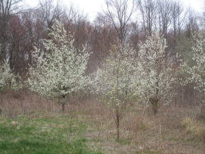
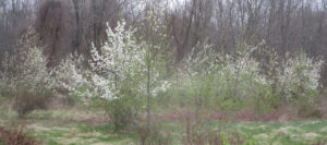
Callery pear trees taking over a field in Monroe, Middlesex County.
CALLERY PEAR TREES: Have you noticed the trees of blooming white flowers in abundance during your travels? Pretty? As we drive by them, yes. But take a closer look, these non-native, but once popular ornamentals, have large thorns, have week branches, and grow thickly. This thick growth prohibits beneficial native plant life from growing. Calleries cross-pollinate easily and produce small pears, which birds eat and, then, poop seeds through the countryside — resulting in more calleries. Enjoy the view and learn from them — that is probably the only good I can say about them.
Callery pear trees along Route 130 in East Windsor, Mercer County.
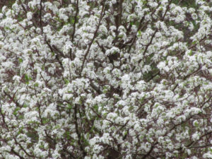
A closeup of callery pears in Monroe, Middlesex County.
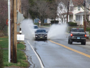
HEAVY RAIN…: The Jersey Midlands got clobbered with rain on the Sunday-Monday overnight and Monday, April 15-16 and 16. The National Weather Service reports the following rainfall totals in Midlands counties, although these reported records may not be complete records:
Burlington: 1.94 inches at Joint Base McGuire Dix Lakehurst to 2.50 at Southampton.
Hunterdon: 2.34 at Lebanon to 2.51 at Readington.
Mercer: 2.33 at Trenton-Mercer Airport.
Middlesex: No reading available.
Monmouth: 3.17 at Wayside.
Ocean: No reading available.
Somerset: 2.20 at Middlebush to 2.83 in the Hillsborough area.
Bucks County, Pennsylvania: 2.85 at Doylestown Airport.
Flooding at Saw Mill Brook in Helmetta, Middlesex County.
…AND WIND: On Monday, April 16, besides getting hit hard by rain, the Jersey Midlands got pretty good winds. According to the nj.com website, strong winds were recorded at:
Monmouth County: 47 miles per hour at Sea Girt.
Ocean County: 51 miles per hour at Tuckerton and Joint Base McGuire Dix Lakehurst.
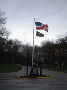
The wind whips these flags at Thompson Park on the boundary of Jamesburg and Monroe in Middlesex County on Monday, April 16.

“Jamesburg Lake” (properly Lake Manalapan) at Thompson Park on the boundary of Jamesburg and Monroe, Middlesex County, is wind-driven Monday, April 16.
GROUNDHOG IN THE WATER: I do not think of ground hogs, “Marmota monax,” and water going together. But I spooked one near Manalapan Brook. A hole dug under a tree was flooded, but the ground hog fled me, into the flooded hole. At 61-years-old, all my life in these Pine Barrens around Helmetta, I still learn.
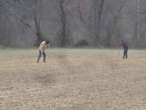
Two women searching for American Indian artifacts in a farm field on the Cranbury-Plainsboro boundary, Middlesex County.
SNOW: I received a report of snow falling Tuesday, April 17, in the Cranbury-Plainsboro area of Middlesex County. Since the winter of 1995-1996, this would be the latest snowfall I am aware of in South Middlesex County. Previously, I knew of April 16 in 2007. This season, I recorded 42.5 inches at my home in Monroe, Middlesex County; Normal, based at New Brunswick about 7.5 miles away, would be about 26 inches. Basically, half of this season’s snow did not fall until March 2 or later.
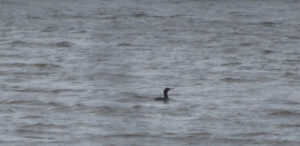
A double-crested cormorant, “Phalacrocorax auritus,” on “Jamesburg Lake” (properly Lake Manalapan) on the boundary of Jamesburg and Monroe, Middlesex County.
SHAD RUN: I ran into Don Kamienski, a field editor for The Fisherman magazine, at this year’s Outdoors Writer’s Workshop, sponsored by the state Division of Fish and Wildlife. Don, who lives along the Delaware River in Burlington County, told me the shad were already running up the river. The annual Shad Fest in Lambertville, Hunterdon County, is Saturday and Sunday, April 28 and 29. More information is available at http://www.shadfest.com.

Shad Fest, 2011 — Various festival posters and one of the artists involved.
BEWARE THE LANDSCAPER: As it warms and we get into our yards and gardens, beware of hiring landscapers or gardeners. Have some reasonable faith in them. For example, I see way too much “volcano” mulching, rather than the proper “doughnut” mulching. The buildup of volcano mulching invites fungus into the mulch and disease into the tree. (Why mulch at all?) Also, I see white rock circles around trees; It just heats up the tree. Another recent sighting was a lawn treatment of topsoil on top of old lawn, then a seeding on top of the topsoil; One, it is the wrong time of year to properly plant a lawn and, two, why not remove the old lawn and aerate? Also, topsoil is not regulated, so try to make sure you know what you are getting.
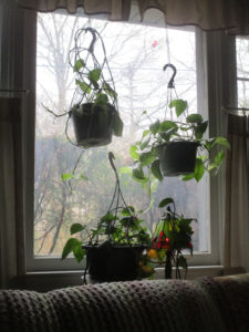
Houseplants in the living room window in my house in Monroe, Middlesex County. A cardinal, “Cardinalis cardinalis,” perched in a tree outside the window.
GOLDFINCHES, SKUNK CABBAGE, ETC.: Another sign of spring is the yellowing of male eastern goldfinches, “Spinus tristis.” “Spring males are brilliant yellow and shiny black with a bit of white,” according to Cornell University’s All About Birds website. “Females and all winter birds are more dull, but identifiable by their conical bill; pointed, notched tail; wingbars; and lack of streaking. …The brightening yellow of male goldfinches each spring is one welcome mark of approaching warm months.” This species is the New Jersey state bird. And skunk cabbage, “Symplocarpus foetidus,” is greening up in wetlands.
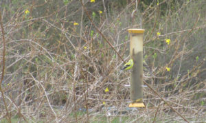
Two eastern goldfinches, the colorful male on the left and the duller female on the right, on my backyard finch feeder in Monroe, Middlesex County.
Skunk cabbage in the Millstone River floodplain on the boundary of Cranbury and Plainsboro, Middlesex County.
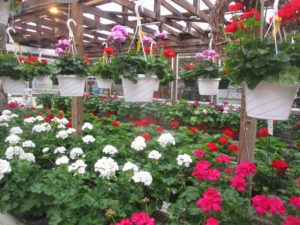
TONY’S MARKET: For the first time this season, I visited one of my favorite places, Tony’s Farm and Garden Center in Robbinsville, Mercer County. At Tony’s, I usually buy house plants — On this trip, I picked up a wandering Jew and a fuschia — house plant supplies, tomato plants, seeds, and perhaps other odds and ends. I have been a Tony’s customer for 25 or so years. Also, a trip to Tony’s includes me walking through the greenhouses, shooting photographs. Many thanks to the Ciaccio family. I normally deal with Tony, a third generation of the family. (My other two regular nursery stops are Krygier’s in South Brunswick, Middlesex County, and Ferris Farms Garden Center in East Brunswick, Middlesex County. All three are courteous and very helpful.)

Blooming flowers at Tony’s Farm and Garden Center in Robbinsville, Mercer County.
DRIVE-BY NATURALIST: I was driving to a Monmouth County section of the state’s Assunpink Wildlife Managment Area to attend the annual Outdoor Writer’s Workshop, sponsored by the state Division of Fish and Wildlife. While driving on Route 539 in East Windsor, Mercer County, a male northern harrier, “Circus hudsonius,” flew only a few feet off the ground and only a few feet in front of my Jeep, crossing my path from left to right. This sleek hawk is one of my favorite birds of prey. To see one close-up, if only only a glimpse, is a sight. Because it was a quick-happening event, I was unable to photograph the harrier.
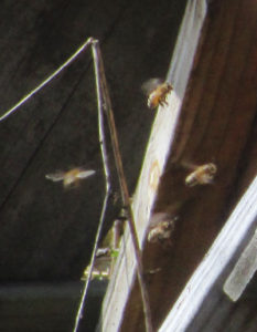
Pollinators, honeybees on the Kiesler farm along the boundary of Cranbury and Plainsboro, Middlesex County.
OUTDOOR WRITER’S WORKSHOP: As a journalist, I have been attending the state Outdoor Writer’s Workshop, sponsored by the New Jersey Division of Fish and Wildlife, on and off for about 30 years. I am a little off my turf because it is basically attended by hunting and fishing writers, rather than naturalists such as me, but the talks are informative. This year, I was able to catch the welcome by Larry Herrighty, director of Fish and Wildlife; Paulette Nelson, assistant director, on “Recovering America’s Wildlife Act,”; Ross Shramko’s “Results of the Strocked Trout Movement Study in Flat Brook”; and Sharon Petzinger’s “Songbird Response to Forest Management in Northwestern New Jersey.” Many thanks to Al Ivany, chief of Fish and Wildlife’s Office of Wildlife Education and Information, for inviting me every year. The lunch, catered by Mastoris Diner-Restaurant, one of my old hangouts in Bordentown Township, Burlington County, is a treat. (Disclosure: Beginning a few months ago, I became a Fish and Wildlife volunteer, primarily keeping tabs on the Upper Millstone River bald eagle, “Haliaeetus leucocephalus,” nest on the boundary of Mercer and Middlesex counties.)
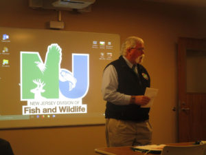
Larry Herrighty, director of the state Division of Fish and Wildlife, welcome attendees to the 2018 Outdoor Writer’s Workshop.
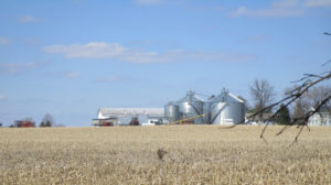
A vanishing scene of farmland, here on the Cranbury-Plainsboro boundary of Middlesex County.
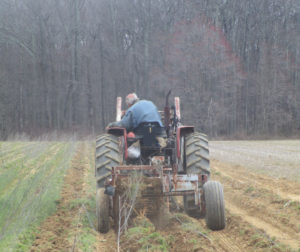
VOICES FROM AFIELD, FRANK ULATOWSKI: Frank Ulatowski, an outdoorsman-friend from Manalapan-Englishtown, Monmouth County, is looking to get rid of circa late 1930s-early 1940s Allis Chalmers tractor. In its deteriorated condition, it probably would be best used for parts. Frank is reachable at Frank’s Auto Repairs in Manalapan-Englishtown, telephone 732-446-7616.
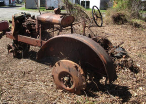
The circa late 1930s-early 19402 Allis Chalmers tractor in Manalapan-Englishtown, Monmouth County.
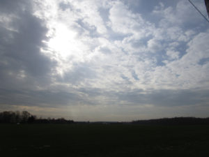
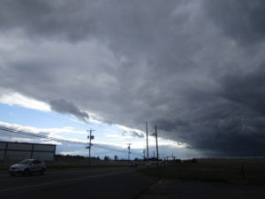
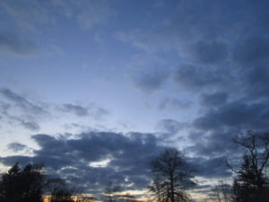
SKY PHOTOS: This week’s sky photos are from the areas of Helmetta, Monroe, Cranbury, Plainsboro, South Brunswick, and East Brunswick in Middlesex County; Upper Freehold in Monmouth County; and East Windsor and West Windsor in Mercer County.
A night view from my backyard in Monroe, Middlesex County.
The Kiesler farm on the boundary of Cranbury and Plainsboro in Middlesex County and East Windsor, Mercer County.
The Kiesler farm looking toward the Cranbury, Middlesex County, side.
The Kiesler farm on the boundary of Cranbury and Plainsboro, Middlesex County, looking toward Grover’s Mill, Mercer County.
Along the Millstone River on the boundary of Plainsboro and Cranbury on the Middlesex County side and East Windsor and West Windsor on the Mercer County side.
From my backyard in Monroe, Middlesex County.
Sky over the cuesta geologic formation in Upper Freehold, Monmouth County.
South Brunswick Middlesex County.
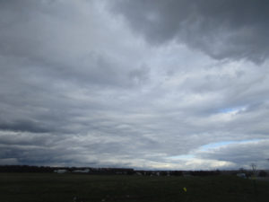
South Brunswick, Middlesex County.
Over a swamp hardwood forest on the boundary of Helmetta and East Brunswick, Middlesex County, in the Pine Barrens around Helmetta.
SUNRISE AND SUNSET: For the week of Sunday, April 22, to Saturday, April 28, the sun will rise about 6:10 to 6 a.m. and set about 7:45 to 7:50 p.m. For the week of Sunday, April 29, to Saturday, May 5, the sun will rise about 6 to 5:50 a.m. and set about 7:50 to 7:55 p.m.
NIGHT SKY: The next full moon is April 29, the Sprouting Grass Full Moon.
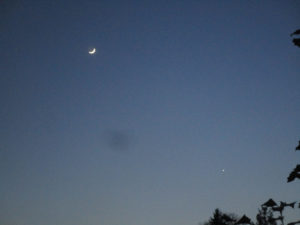
The crescent moon and the planet Venus, from my backyard in Monroe, Middlesex County.
ATLANTIC OCEAN TEMPERATURE: The Atlantic Ocean temperature off New Jersey was about 51 degrees.
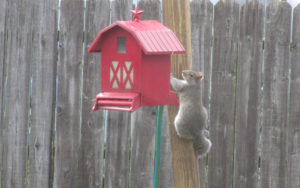
A squirrel, “Sciurus carolinesis,” at my backyard bird feeder in Monroe, Middlesex County.
WEATHER: The National Weather Service office serving the Jersey Midlands is at https://www.weather.gov/phi/.
UPCOMING:
April 28, Saturday, 10 a.m. to 4 p.m., Middlesex County, New Brunswick: Rutgers University Ag Field Day, Cook Campus, Route 1 and Ryders Lane. More information is available at website http://agfieldday.rutgers.edu.
April 28 and 29, Saturday and Sunday, Hunterdon County, Lambertville: Shad Fest event of environmentalism, entertainment, food, crafts. More information is available at http://www.shadfest.com.
Inside the greenhouse at Tony’s Farm and Garden Center in Robbinsville, Mercer County.
REDUCING MY CARBON FOOTPRINT: As I awoke one morning, I listened to a radio broadcast about reducing one’s carbon footprint. I thought, Where am I failing to be an environmentalist? My answer is I drive too much, probably in the 20,000 miles-per-year range. I should work on this. Well, a few hours later, my Jeep was in the shop again for an ongoing clutch-dashboard area problem. Several weeks ago, I had no Jeep for 10 days — and survived quite well, walking and bicycling. So, here we go again. Fortunately, this is my slow time of year for work and with the little work I have this time of year, I can survive without a motor vehicle — I hope. Which leads me to a related story…
…BICYCLING: Without my Jeep, I bicycled from my Monroe house, through Helmetta, to Spotswood, all in Middlesex County, for breakfast. On my way back, I stopped at Timmy Mechkowski’s farmette in Helmetta. Timmy has a woodcutting operation there and I needed one log for the woodstove Timmy gave me. I grabbed the wood, tied it to rack of my second-hand, but lovingly trusty, circa 1980 Schwinn Collegiate coaster bicycle. Chris, the pizza delivery woman, saw my parked bicycle with the firewood and thought, Who would do something like this? Then, she saw it was my bike and she added, Now, it makes sense. I am like the “Log Lady” on the old Twin Peaks television show…

My coaster bicycle hauling firewood.
BURNING THE LOG: After watching on television my Toronto Maple Leafs beat the Boston Bruins is a National Hockey League playoff game, I went to my woodstove in my garden and threw in the log. I figured I would hang out under the stars on a cool night with a warm woodstove. Well, I gave up that idea when I realized I was smoking out the neighborhood. I guess the log was too wet. So, I watered down the fire and called it a night.
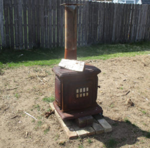
The woodstove in my garden with the log on top.
Joe Sapia, 61, is a lifelong resident of Monroe — in South Middlesex County, where his maternal family settled more than 100 years ago. He is a Pine Barrens naturalist and an organic gardener of vegetables and fruit, along with zinnias and roses. He loves the Delaware River north of Trenton and Piedmont, too.
He draws inspiration on the Pine Barrens around Helmetta from his mother, Sophie Onda Sapia, who lived her whole life in these Pines, and his Polish-immigrant grandmother, Annie Poznanski Onda.
He gardens the same backyard plot as did his Grandma Annie and Italian-American father, Joe Sr. Both are inspirations for his food gardening. Ma inspires his rose gardening.
Joe is a semi-retired print journalist of almost 40 years. His work also is at @JosephSapia on Twitter.com, along with The Jersey Midlands page on Facebook.com on the Jersey Midlands page.
Copyright 2018 by Joseph Sapia
Article and photos by Joe Sapia
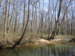
Matchaponix Brook near Englishtown Market in Manalapan, Monmouth County. This section of the brook is both diamond and rough — a beautiful natural world fighting the nonpoint-source pollution along Route 527. Brook in the foreground, swamp hardwood forest in the near background, and in the left of the far background, pitch pine trees of the Spotswood Outlier, disconnected from the main section of the Pine Barrens to the south.
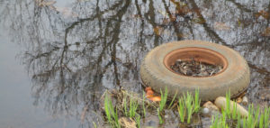
MATCHAPONIX BROOK AT ROUTE 527: I am 61-years-old and have been crossing Matchaponix Brook at Englishtown Market in Manalapan, Monmouth County, since as far back as I can remember. Yet I never gave much thought to the natural world here — until Englishtown outdoorsman Gary Forman relayed information to me through our mutual friend, outdoorsman Frank Ulatowski. This is the beginning of Matchaponix Brook, formed by the joining of Weamaconk Creek and McGellairds Brook. When I stopped by this week, I was amazed. Step only a few feet away from busy Route 527 and one is in a beautiful natural world of brook; swamp hardwood forest; a lodge of beaver, “Castor canadensis”; mallards, “Anas platyrhynchos”; great blue heron, “Ardea herodias”; and the telltale pitch pine, “Pinus rigida,” of the Pine Barrens because this is part of the Pines’s disconnected Spotswood Outlier. Probably plenty more that I did not notice. Unfortunately, I did notice the nonpoint-source pollution — garbage gathering in Matchaponix Brook. Take away this garbage and the busyness of Route 527 and I was in a wonderful natural world. Again, we should keep our eyes open because the natural world is around us, even if we taint it.
A great blue heron on Matchaponix Brook in Manalapan, Monmouth County.
AS BEAUTIFUL AS MATCHAPONIX BROOK IS AT ROUTE 527…: Nonpoint-source pollution — basically debris, such as litter or materials blown offsite, with no specific origin — is a major problem in our world. Simply look at litter along a road or, in this case, gathered in Matchaponix Brook at Route 527 in Manalapan, Monmouth County. Generally, the source of this garbage appears to be debris that drains into the brook and Route 527 littering.
Garbage in Matchaponix Brook at Route 527 in Manalapan, Monmouth County.
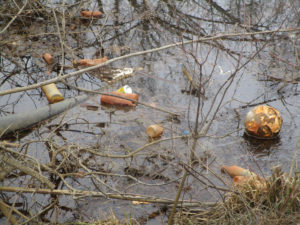
Garbage in Matchaponix Brook at Route 527 in Manalapan, Monmouth County.
MATCHAPONIX BROOK: In the Englishtown area of Monmouth County, Weamaconk Creek and McGellairds Brook join to form Matchaponix Brook. The brook then flows for about 5 miles, as the crow flies, to the north and merges with Manalapan Brook to form the South River on the boundary of Monroe, Spotswood, and Old Bridge in Middlesex County. “Matchaponix” is a Lenni Lenape Indian word for “land of bad bread,” or land where corn does not grow well. I speculate this name comes from the Matchaponix Brook area being in the Spotswood Outlier of the Pine Barrens, or an area of sandy soil not conducive to growing corn or other conventional crops. (Conversely, “Manalapan” means “land of good bread.” Manalapan Brook begins and runs for miles in a non-Pine Barrens area, or an area of darker, gravelly soil that is good for growing corn.)
Mallards on Matchaponix Brook in Manalapan, Monmouth County.
SPRING SPRINGING: People are fishing. Listen in the early morning and you will likely hear birds singing. Look at a woods and you likely will see the red buds of trees. Flowers are blooming in gardens. Nature is coming alive with spring.
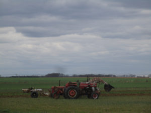
Warren Kiesler churns up horseradish plants on his farm in Cranbury, Middlesex County. To the right of the tractor in the background, notice the tree budding.
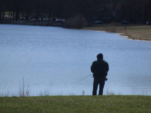
An angler at “Jamesburg Lake’ (properly “Lake Manalapan”) on the boundary of Jamesburg and Monroe, Middlesex County.
ROBINS IN THE YARD: With the coming of spring-like weather, it means the likelihood of seeing robins, “Turdus migratorius,” in our yards. I have noticed more of them around my yard in Monroe, Middlesex County. This week, I watched a robin pull a worm from my garden. “Although robins are considered harbingers of spring, many American Robins spend the whole winter in their breeding range,” according to Cornell University’s All About Birds website. “But because they spend more time roosting in trees and less time in your yard, you’re much less likely to see them.” As the weather warms and nature comes alive, they move to yards because of the availability of such things as worms. “American Robins are common sights on lawns across North America, where you often see them tugging earthworms out of the ground,” according to the Cornell website.
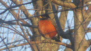
A robin in the shrubs of my front yard in Monroe, Middlesex County.
HORSERADISH FARMING: With the collapse of newspapers and, in turn, the collapse of my approximately 35 years as a reporter – basically from 21-years-old when I got my journalism degree to 55-years-old – I am always looking for work. Over those 5-plus years, I have been a part-time staff writer on a weekly paper, freelance writer, writing teacher, security guard. Security guarding, which I did during my college years and resumed these years later, now takes me from a Central Jersey professional park to the perimeter around foreign cargo ships where Maryland’s Patapsco River meets Chesapeake Bay. As I like to say, I have the best syntax at the Baltimore docks and am the only employee of Rutgers University’s Plangere Writing Center that wears a hard hat on his other job. This week, at 61-years-old, add laborer at the Kiesler horseradish farm to my resume.
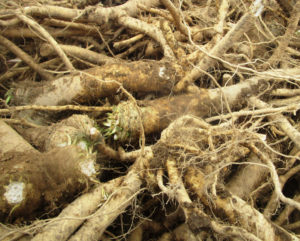
Harvested horseradish on Kiesler farm in Cranbury, Middlesex County.
SNOWBIRDS GOING, GOING…: When will “snowbirds” — juncos, “Junco hyemalis” — be gone for the season? Based on field notes I have kept over the years, they should be leaving Monroe, Middlesex County, any day now to about April 25 or so. They will head to high ground, as close as North Jersey or Pennsylvania or as far as Canada. Then, I will see them again around the yard about mid-October to early November.
Manalapan Brook in the section of Monroe between Helmetta and Jamesburg, Middlesex County.
IN MY GARDEN: I finished the planting of the early spring crop — Kaleidoscope Blend Carrots, Touchon Heirloom Carrots, Bloomsdale Long-Standing Heirloom Spinach, Early Wonder Heirloom Beets, and Salad Bowl Lettuce, all Burpee products.
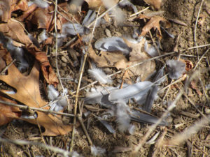
I found this in my garden. Something got this bird, the remains possible those of a mockingbird, “Mimus polyglottos.”
YARDWORK: I tackled the first yardwork of the season, working the front yard. I trimmed trees and prepared soil to plant zinnia and warm-season vegetables. The latter is a continuation of my plan to make my one-quarter-acre yard as productive as possible. With that idea, I am trying to minimize a generally unproductive lawn as much as possible.
PRINCETON ENVIRONMENTAL FILM FESTIVAL: I attended the annual Princeton Envirionmental Film Festival, seeing part of the “Evolution of Organic” movie and the entire “Seed to Seed” movie, both about organic farming. I also got to see the talk of Dr. Joe Heckman — organic farmer, a member of the board of directors of Northeast Organic Farming Association of New Jersey, and Rutgers University soil scientist — after the showing of the “Evolution of Organic” and got to socialize with Joe. (Joe and his wife, Joyce Goletz Heckman, own Neshanic Pastures farm in East Amwell, Hunterdon County. Joyce and I are childhood friends from Monroe, Middlesex County.)
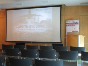
Awaiting a movie at the Princeton Environmental Film Festival.

Dr. Joe Heckman, who spoke on organic farming at the Princeton Environmental Film Festival. Joe is an organic farmer, a member of the board of directors of Northeast Organic Farming Association of New Jersey, and Rutgers University soil scientist.
UPPER MILLSTONE RIVER EAGLES: We are pretty sure the nest of bald eagles, “Haliaeetus leucocephalus,” on the Upper Millstone River on the boundary of Mercer and Middlesex counties, has one eaglet in it. The baby should fledge in early to mid-May or the early end to early June on the far end. Then, the family should stay together in the area. After fledging, the young eagle or eagles should stay in the area until about early September to early December. (The bald eagle remains in New Jersey an “endangered” breeder – that is, in immediate jeopardy as a breeder – and “threatened” in general – that is, in danger of becoming “endangered” if conditions deteriorate.)
An adult bald eagle landing on the Upper Millstone River nest.
GARDEN WRITING: A great pleasure of mine is to be back at the Princeton Adult School this semester, again teaching non-fiction writing. In the past, I have taught the essay and the vignette. This semester, the course is called “Garden Writing,” but is really about gardens, the outdoors, or nature. Because of its title, the course has drawn a class of passionate gardeners. This passion inspires wonderful stories. Just this week, I have read papers about dandelions, beginning spring plantings indoors, tomatoes and their guests of the hornworm and Braconid wasp. The dozen or so in this class make it a joy to teach.
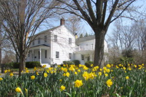
THINGS THAT DO NOT BELONG: Just because something is outdoorsy does not mean it belongs everywhere in the outdoors world. On the Millstone River on the boundary of East Windsor, Mercer County, and Cranbury, Middlesex County, I noticed ornamental daffodils growing in the river floodplain. I suspect these were purposely planted or they grew from waste soil. They looked pretty along the river, but they are a non-natives that do not belong there.
These daffodils look pretty blooming along the Millstone River on the boundary of Cranbury, Middlesex County, and East Windsor, Mercer County. But they are ornamentals that do not belong in the wild.
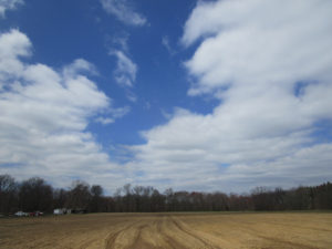
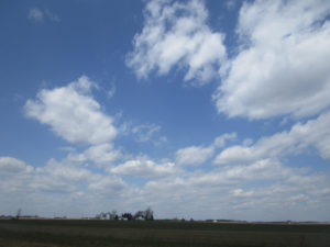
SKY PHOTOS: This week’s sky photos are from Monroe, Cranbury and Plainsboro, all in Middlesex County.
Sky above farmland in Monroe, Middlesex County.
Sky above farmland in Cranbury, Middlesex County.
Above my backyard in Monroe, Middlesex County.
Above farmland on the Cranbury-Plainsboro boundary, Middlesex County.
SUNRISE AND SUNSET: For the week of Sunday, April 15, to Saturday, April 21, the sun will rise about 6:20 to 6:10 a.m. and set about 7:35 to 7:45 p.m.
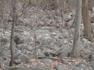
A Piedmont boulder field on the Princeton Ridge in Princeton, Mercer County. Notice the lichen growing on the rocks. Lichen is a sign of fresh air.
MOON: The next full moon is April 29, the Sprouting Grass Full Moon.
ATLANTIC OCEAN TEMPERATURE: The Atlantic Ocean temperature off New Jersey was about 46 to 52 degrees.
WEATHER: The National Weather Service office serving the Jersey Midlands is at https://www.weather.gov/phi/.
UPCOMING:
April 21, Saturday, 11 a.m. to 2 p.m., Burlington County, Southampton: The Pinelands Preservation Alliance’s 13th Annual Native Plant Sale, Alliance headquarters, 17 Pemberton Road (Route 616). More information is available from the alliance, telephone 609-859-8860 or website http://www.pinelandsalliance.org.
April 28, Saturday, 10 a.m. to 4 p.m., Middlesex County, New Brunswick: Rutgers University Ag Field Day, Cook Campus, Route 1 and Ryders Lane. More information is available at website http://agfieldday.rutgers.edu.
April 28 and 29, Saturday and Sunday, Hunterdon County, Lambertville: Shad Fest event of environmentalism, entertainment, food, crafts. More information is available at http://www.shadfest.com.
Daffodils in bloom in Cranbury, Middlesex County.
Joe Sapia, 61, is a lifelong resident of Monroe — in South Middlesex County, where his maternal family settled more than 100 years ago. He is a Pine Barrens naturalist and an organic gardener of vegetables and fruit, along with zinnias and roses. He loves the Delaware River north of Trenton and Piedmont, too.
He draws inspiration on the Pine Barrens around Helmetta from his mother, Sophie Onda Sapia, who lived her whole life in these Pines, and his Polish-immigrant grandmother, Annie Poznanski Onda.
He gardens the same backyard plot as did his Grandma Annie and Italian-American father, Joe Sr. Both are inspirations for his food gardening. Ma inspires his rose gardening.
Joe is a semi-retired print journalist of almost 40 years. His work also is at @JosephSapia on Twitter.com, along with The Jersey Midlands page on Facebook.com on the Jersey Midlands page.
Copyright 2018 by Joseph Sapia
Article and photos by Joe Mish
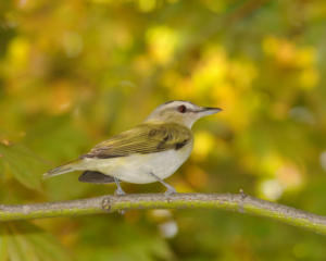
A red eyed vireo briefly descends from the treetops to provide a fleeting glimpse of one of the most common, yet rarely seen birds, east of the Mississippi.
March is the last piece of evidence needed to prove winter has gone by. No matter the weather March brings, her legacy of cold and snow, as the step child of winter, is invalidated by “the first day of spring” conspicuously stamped twenty-one days into the month on just about every calendar printed.
Further visual proof needed to allay the fear that winter is here to stay, are the strands of migratory birds that precede peak migration in the next couple of months. Perfectly positioned between two rivers that lead to the sea and link to the main Atlantic flyway, Branchburg comes alive with colorful winged migrants. Some birds are just passing through while others stay to establish breeding territories.
You don’t really need to be a graduate ornithologist with the ability to differentiate a magnolia warbler from a black throated warbler to enjoy all the feathered gems that pass our way in spring.
During a recent snowfall the view of several brilliant red, resident cardinals, dodging among the tight branches of a nearby holly tree resplendent in dark green leaves and an overabundance of red berries was a sight to behold. The gently falling snow turned the scene into a living Christmas card.
Bird seed scattered on the ground immediately near the back glass sliding door was being appreciated by a flock of brave juncos. The scene was calm and predictable with an occasional song sparrow darting across the stage. Suddenly, standing on the ground next to the glass was what appeared to be a Parula warbler. I ran for the camera to no avail as the little bird disappeared quicker than a shooting star. It didn’t seem plausible that a warbler would be in this area so early but there it was. Looking through the, ‘guide to field identification, Birds of North America’, I reviewed the dazzling array of warblers each differentiated by plumage unique to adult and juvenile, male and female with a cautionary note on hybrid warblers and seasonal plumage. I guess it was a male Parula warbler.
The conflict of identification versus the excitement at seeing a strange colorful bird lingered for a moment until I realized it was the sight of the bird that provided the magic.
Knowledge of the scientific classification was irrelevant to the enjoyment of simply noticing something that appeared to be different and gave pause to a moment of thoughtfulness or beauty.
As an example, you might gaze upon a stunning portrait of another person or a dreamy sunset and immediately be drawn in even though you have no idea of the person’s name or the location of the sunset.
Beauty is its own reward and needs no further qualification.
Birds are creatures which reflect the colors that dripped from God’s palette of infinite hues used to paint the portrait of life. One could argue ‘colors’ have wings to spread nature’s beauty far and wide and taken together they are called, ‘birds’.
Soon the area will be crowded with migrating birds, the most colorful of which are the warblers. A walk along the river flyways while scanning the treetops will reveal small flocks of birds that look like no other you have ever seen. The bright plumed breeding males will be the first to arrive as they travel in the safety of numbers. It is hard to imagine that these diminutive delicate appearing birds migrate yearly to Central America, Mexico and the West Indies from New Jersey and points north. After arriving in breeding areas, the males separate to set up mating territories defended by trilling songs sung loud and often.
The colorful and numerous male warblers representing several species are spectacular to observe in their diversity of color swatches, masks, vests, necklaces and caps. Each color pattern represents a different species despite similar size and intermingling of flocks.
Even the most ‘nature oblivious’ and ‘nature neutral’ observers may have their heads compulsively turned by the accidental appearance of a flash of tropical color among the local treetops.
Perhaps a seed of curiosity may be sown, nurtured and cultivated from a brief encounter with a spring warbler. That dangling thread of gangly curiosity left by a Magnolia warbler or Yellowthroat can easily draw the observer into the world of nature to wander and wonder at the infinite complexities that bind all living things. To believe beauty is only skin deep and fleeting is to ignore the power, depth and satisfaction the beauty of nature has to offer. Asking nothing in return, not even requiring that you can differentiate a Rufous sided towhee from a Cape May warbler, beauty exists only to be appreciated.
Author Joe Mish has been running wild in New Jersey since childhood when he found ways to escape his mother’s watchful eyes. He continues to trek the swamps, rivers and thickets seeking to share, with the residents and visitors, all of the state’s natural beauty hidden within full view. To read more of his writing and view more of his gorgeous photographs visit Winter Bear Rising, his wordpress blog. Joe’s series “Nature on the Raritan, Hidden in Plain View” runs monthly as part of the LRWP “Voices of the Watershed” series. Writing and photos used with permission from the author.
Article and photos by Joe Mish
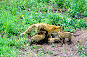
Eager and hungry fox pups survived the mercurial spring floods to feed voraciously on mom in the bright sunlight of a late April morning.
April is the quintessential month of spring, the first month to start with a vowel after a bleak winter of hard consonant constructed months. The name April is probably derived from the Latin infinitive, aperere, ‘to open’, but that consideration is at the risk of offending the claims of the goddess of love, Aphrodite, and Apollo the son of Zeus, their namesake month.
I see April as a grand series of ever changing dance steps performed in tune to the great celestial choreography of the planets and stars. One planetary misstep and the world comes crashing down. It is, however, a play without flaw that brings the predictability of the seasons and the impish April to improvise her set of daily surprises that precede the full bloom of May.
April is a charming minx with dancing green eyes whose mercurial ways give false hope to early gardeners as she whirls in the white robes of a sudden snow squall. Days of bright sunshine are mixed with bone chilling moist air, frosts and gentle rain or hailstorms of biblical proportion. These are the veils April sheds as she improvises dance steps to tease and mislead, all the while faithfully delivering the solemn promise of May.
Edwin Way Teale, a noted author and naturalist claims that, “spring approaches from the south at fifteen miles a day”. If you were to drive from New Jersey to Maine in mid April, you could actually see spring approach.
Travelling north, you go back in time to see spring begin.
As you drive through New Jersey, forsythia planted along road medians would be in full yellow bloom as tree buds give birth to pale green leaves.
The crowns of naturalized red maple dominated hardwoods would have shed their maroon veil to now wear a haze of light green unfurling leaves that will continue to darken as they mature
Oak dominated hillsides and lowlands scattered with black gum, hard maple, beech, ash and sycamore appear as colorful as autumn with interlacing crowns covered in non reflective red, yellow, pink and salmon hued emerging leaves.
The color and blooms slowly fade as you travel north. The further you travel in one day, the more the landscape appears as if drawn on individual sheets of paper flicked by hand to appear as if moving. The individual frames of the ‘movie’ become alive and reveal the living, leading edge of the manifestations of spring.
The return journey south allows you to enjoy the second coming of spring and the insight that comes with a second chance.
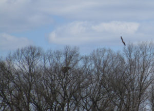
Along the South Branch, a Great Horned Owl has been nurturing a clutch of eggs that will produce at least one full sized, flightless owlet to stand constantly alert for parental food deliveries in mid April.
During two trips down the South Branch in February and March, a female red fox ran along the river bank to expose herself as if to draw me away from her riverside den. She would run along the bare vertical bank then walk out onto a gravel bar, sit down and watch me approach. When I got too close she would run off and wait further downstream. At one point she ran across a sand bar that was flanked by a pair of mallards standing on the bare ground and a great blue heron posed in foot deep water. All three birds stood perfectly still as the fox ran between them. Neither the ducks nor the heron made any move to escape as if they knew the fox was not a threat that day.
I can only hope the fox waited until April to have her pups in light of the flood that came in late March. Perhaps April will reveal a gentle rain that favors the survival of not only the fox pups, but the bank swallows, flycatchers, muskrat and turkeys that might have dens or nests close to the riverbank and flood plain.
It is amazing how migration, breeding, births and nurturing coincide with seasonal events as if truly participating in a dance whose every step is critical to survival.
We have evolved physiologically to fit into a small, ‘temporary’ niche circling in an eddy on the river of change. If the changes take place faster than we can evolve, we go away.
Despite the vagaries of April’s whim, she shows the world an emergence of life that has learned her fickle ways and dances in step to lovingly embrace such a wild partner.
Author Joe Mish has been running wild in New Jersey since childhood when he found ways to escape his mother’s watchful eyes. He continues to trek the swamps, rivers and thickets seeking to share, with the residents and visitors, all of the state’s natural beauty hidden within full view. To read more of his writing and view more of his gorgeous photographs visit Winter Bear Rising, his wordpress blog. Joe’s series “Nature on the Raritan, Hidden in Plain View” runs monthly as part of the LRWP “Voices of the Watershed” series. Writing and photos used with permission from the author.
Article and photos by Joe Sapia
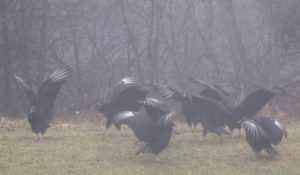
The dance of the black vultures, “Coragyps atratus,” in a professional park in Plainsboro, Middlesex County. These vultures were near a deer carcass, so they could have been spreading their wings to rid them of any bacteria picked up while feeding on the dead body. Or it could be a simple drying of the wings, although the day was foggy.
BLACK VULTURES, UP FROM THE SOUTH: As I have mentioned in the past, I do not recall seeing a black vulture, “Coragyps atratus,” until about the middle 1990s. They are more of a southeastern United States species. Now, I see them frequently in the Jersey Midlands. The species “has expanded range northward in the northeast, but has declined in parts of southeast,” according to the National Audubon Society’s website. “Loss of good nest sites in large tree hollows may be one cause.”
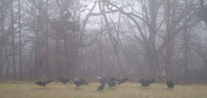
Black vultures on a foggy day in a professional park in Plainsboro, Middlesex County.
BLACK VULTURES ON A CARCASS: In a professional park in Plainsboro, Middlesex County, lie a well-picked-over carcass of a deer, “Odocoileus virginianus,” presumably the victim of motor vehicle accident. It was not picked-over enough for black vultures, “Coragyps atratus,” to be uninterested. There were about 10 on or near the carcass. Black vultures feed on “mostly carrion,” according to the National Audubon Society website. The species “feeds on carcasses of dead animals of all sizes.” And from Cornell University’s All About Birds website, “Turkey vultures (“Cathartes aura”) have an excellent sense of smell, but black vultures aren’t nearly as accomplished sniffers. To find food they soar high in the sky and keep an eye on the lower-soaring turkey vultures. When a turkey vulture’s nose detects the delicious aroma of decaying flesh and descends on a carcass, the black vulture follows close behind. One on one at a carcass, black vultures lose out to the slightly larger turkey vulture. But flocks of black vultures can quickly take over a carcass and drive the more solitary turkey vultures away.” I saw no turkey vultures at the carcass.
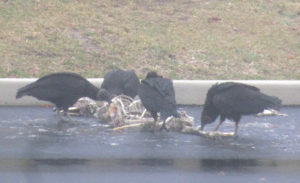
Black vultures on a deer carcass in a professional park in Plainsboro, Middlesex County.
DEER DAMAGE: Damage from browsing deer, “”Odocoileus virginianus,” is quite apparent, if you know what to look for. Look where ornamentals are planted. If you see arbor vitae with a thin bottom and a tipped top, kind of like an arrow pointed upward, you are probably looking at deer damage — the bottom being what is easily reachable to the deer, the top being harder to reach or out of reach.

Deer damage on these evergreen ornamental trees on a foggy day in a professional park in Plainsboro, Middlesex County.
MULCHING TREES: The concept of mulching a tree is to retain water to the root area while the tree is getting established. Well, if you are going to mulch, please do it correctly. That is, think “doughnut,” not “volcano.” Regarding the proper way, build a “doughnut” outside of the trunk — the hole around the trunk, the ring not touching any trunk or roots. Run the rim out to the end of the root ball or to the end of the tree canopy. The mulch should be only 2- to 3-inches deep. (Regarding a volcano, its massive depth could introduce and hold contaminants, while its touching the tree could introduce contaminants to the tree itself. Also, why mulch an established tree? Aesthetics — and property owners love aesthetics. Sorry, but I view that as image over substance.
Volcanoes, the wrong way to mulch a tree. Here in a professional park in Plainsboro, Middlesex County.
THE DRIVE-BY NATURALIST: A doctor’s appointment in this Plainsboro, Middlesex County, professional park got me a lot of material for this writing. So, as I keep reminding, be prepared. There is a lot of nature around us. As much as I preach about keeping an eye out for things happening in the natural world, I missed a rare photograph — a flying adult bald eagle, “Haliaeetus leucocephalus,” and an Air Force jet circling Joint Base McGuire-Dix-Lakehurst. Per my duties as a state Division of Fish and Wildlife volunteer, I was observing the Upper Millstone River eagle nest on the boundary of Mercer and Middlesex counties, including shooting photographs. An adult eagle left the nest and was circling the area, flying farther and farther south from the nest — in the direction of the military base. At the same time, the Air Force cargo plane was circling the base. There they were, two flying symbols of American freedom in one frame. Well, nowadays, I have only a point-and-shoot camera. Instead of focusing on the eagle and plane in the background, the camera focused on the tree branches in the foreground. So, the eagle and plane are a blur. My fault. Despite the capture-the-moment shot, I should have made sure the camera was properly focused.
A missed photograph opportunity of two flying symbols of American freedom — a bald eagle circling in front of the Upper Millstone River nest and a plane circling Joint Base McGuire-Dix-Lakehurst.
UPPER MILLSTONE RIVER EAGLES: The bald eagles, “Haliaeetus leucocephalus,” on the Upper Millstone River nest on the boundary of Mercer and Middlesex counties seem to have been attending to their young for weeks. So, the baby or babies — it is unknown if there is one baby or more in the nest — should fledge in early to mid-May on the early end to early June on the far end. Then, the family should stay together in the area. After fledging, the young eagle or eagles should stay in the area until about early September to early December. (The bald eagle remains in New Jersey an “endangered” breeder – that is, in immediate jeopardy as a breeder – and “threatened” in general – that is, in danger of becoming “endangered” if conditions deteriorate.)
An adult bald eagle flies into the Upper Millstone River nest, left, on the boundary of Mercer and Middlesex counties.
SNOWFALL THIS WEEK: This week at my house in Monroe, Middlesex County, snow fell Monday, April 2 — and estimated 2 inches. Also on April 2, I noticed the first forsythia blooming this season in Mercer County (Hightstown and East Windsor) and Middlesex County (Cranbury and South Brunswick).
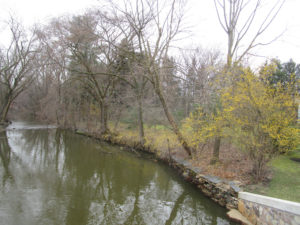
Forsythia blooming along Cranbury Brook in Cranbury, Middlesex County.
SNOWFALL TO DATE: With the Monday, April 2, snowfall of about 2 inches at my house in Monroe, Middlesex County, the seasonal snowfall total is 42.5 inches. What a late snow period — prior to March 2, 21.5 inches fell; from March 2 to April 2, 21 inches fell. (The seasonal average at New Brunswick, about 7.5 miles away, is about 26 inches.)

A tranquil Brainerd Lake (informally “Cranbury Lake”) in Cranbury, Middlesex County, on the day it last snowed, Monday, April 2. It was a wet snow of about 2 inches and melted very quickly — before this photograph was taken in the afternoon.
SNOWFALL, I TOLD YOU SO: I keep noting we can get snowfall until about April 15. This year, it is proving true. Based on my record-keeping, since the winter of 1995-1995, the latest snowfall accumulation in Monroe, Middlesex County, was 3.5 inches in 1996, April 9-10, and the latest snowfall without accumulation was in 2007, April 16.
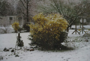
From the Joey Archives: 1996, April 9, Tuesday — Snow on blooming forsythia in Hamilton Square, Mercer County.
SUNRISE AND SUNSET: For the week of Sunday, April 8, Sunday, to Saturday, April 14, the sun will rise from about 6:30 to 6:20 a.m. and set about 7:30 to 7:35 p.m. For the week of Sunday, April 15, to Saturday, April 21, the sun will rise about 6:20 to 6:10 a.m. and set about 7:35 to 7:45 p.m.

Sky photo, No. 1: My backyard in Monroe, Middlesex County.
ATLANTIC OCEAN TEMPERATURE: The Atlantic Ocean temperature off New Jersey was about 45 degrees.
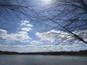
Sky photo, No. 2: “Jamesburg Lake” (properly “Lake Manalapan”) in Thompson Park on the Jamesburg-Monroe boundary of Middlesex County.
WEATHER: The National Weather Service office serving the Jersey Midlands is at https://www.weather.gov/phi/.
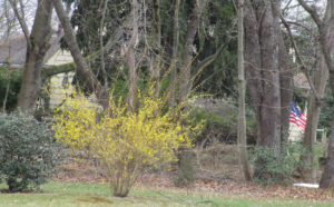
Forsythia blooming in a front yard of a house in East Windsor, Mercer County.
UPCOMING:
April 9 to 15, Monday to Sunday, Mercer County: The annual Princeton Environmental Film Festival, website https://www.princetonlibrary.org/peff/.
April 11, Wednesday, 9 a.m. to 3:30 p.m., Somerset County, Hillsborough: The 10th Annual New Jersey Invasive Species Strike Team Conference, Duke Farms, Route 206. More information is available from the Friends of Hopewell Valley Open Space, email
April 14, Saturday, 9:30 a.m. signup, 10 a.m. to 1 p.m., Middlesex County, East Brunswick: The 15th Annual Farrington Lake Cleanup, Bicentennial Park, Riva Avenue and Hardenburg Lane. (Rain date, April 15, Sunday, 1 to 4 p.m.). More information is available from Michael Shakarjian at telephone 732-828-3275, Alan Godber at 732-846-4476, website http://www.lbwp.org, or email contact@lbwp.org.
April 21, Saturday, 11 a.m. to 2 p.m., Burlington County, Southampton: The Pinelands Preservation Alliance’s 13th Annual Native Plant Sale, Alliance headquarters, 17 Pemberton Road (Route 616). More information is available from the alliance, telephone 609-859-8860 or website http://www.pinelandsalliance.org.
April 28, Saturday, 10 a.m. to 4 p.m., Middlesex County, New Brunswick: Rutgers University Ag Field Day, Cook Campus, Route 1 and Ryders Lane. More information is available at website http://agfieldday.rutgers.edu.
April 28 and 29, Saturday and Sunday, Hunterdon County, Lambertville: Shad Fest event of environmentalism, entertainment, food, crafts. More information is available at http://www.shadfest.com.
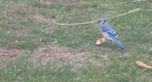
Now, this is a Jersey blue jay, a blue jay, “Cyanocitta cristata,” that eats pizza. In my backyard in Monroe, Middlesex County.
Joe Sapia, 61, is a lifelong resident of Monroe — in South Middlesex County, where his maternal family settled more than 100 years ago. He is a Pine Barrens naturalist and an organic gardener of vegetables and fruit, along with zinnias and roses. He loves the Delaware River north of Trenton and Piedmont, too.
He draws inspiration on the Pine Barrens around Helmetta from his mother, Sophie Onda Sapia, who lived her whole life in these Pines, and his Polish-immigrant grandmother, Annie Poznanski Onda.
He gardens the same backyard plot as did his Grandma Annie and Italian-American father, Joe Sr. Both are inspirations for his food gardening. Ma inspires his rose gardening.
Joe is a semi-retired print journalist of almost 40 years. His work also is at @JosephSapia on Twitter.com, along with The Jersey Midlands page on Facebook.com on the Jersey Midlands page.
Copyright 2018 by Joseph Sapia
Article and photos by Joe Sapia
Gulls flying above a dune along the Atlantic Ocean at Spring Lake, Monmouth County.
DRIVE-BY NATURALIST: As I was driving along a road in Monroe, Middlesex County, I looked at farmland and saw two birds — a red-tailed hawk, “Buteo jamaicensis,”on a dead animal, the other, a turkey vulture, “Cathartes aura,” standing aside. When the red-tail left, the turkey vulture began feasting on the dead animal, while another turkey vulture flew in. It appears the turkey vultures were not messing with a red-tail.
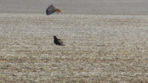
Photo 1: A turkey vulture, bottom, awaits its turn on a dead animal, to the right of the vulture, as a red-tail hawk got done eating and flies away. Moral of this story: Do not mess with a red-tail.
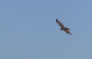
Photo 2: The red-tail flies off.
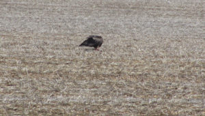
Photo 3: The turkey vulture gets its turn on the dead animal.

Photo 4: Another turkey vulture flies in.
HOLLYWOOD AND THE RED-TAILED HAWK: “The Red-tailed Hawk has a thrilling, raspy scream that sounds exactly like a raptor should sound,” according to Cornell University’s All About Birds website. “At least, that’s what Hollywood directors seem to think. Whenever a hawk or eagle appears onscreen, no matter what species, the shrill cry on the soundtrack is almost always a Red-tailed Hawk.” The site adds, “This is probably the most common hawk in North America. If you’ve got sharp eyes, you’ll see several individuals on almost any long car ride, anywhere.”

A red-tailed hawk flies over field and farmland on the boundary of Monroe and Cranbury in Middlesex County.
SNOW: From the snowfall of Tuesday to Thursday, March 20 to 22, the National Weather Service is reporting the following totals by county. They are broken down, here, by the low number of inches to the high number, but they may not reflect complete totals from around each county:
Burlington County: 7.3 inches in Cinnaminson to 11.9 inches in Mount Holly.
Hunterdon County: 6.7 in Wertsville to 14 in the Byram area.
Mercer County: 6 in the Princeton area to 9.1 in the Hightstown area.
Middlesex County: 5 in south Old Bridge to 12.5 at Cheesequake. (I recorded about 11 inches in the part of Monroe between Helmetta and Jamesburg.)
Monmouth County: 8.5 in Keyport to 13 in Lincroft.
Ocean County: 5.8 in the Lakehurst area to 15 in Lacey.
Somerset County: 5.6 in Watchung to 8.5 in the Bedminster area.
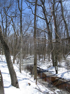
Turtle Creek on the Helmetta-Monroe boundary in Middlesex County after the Tuesday to Thursday, March 20 to 22, snowfall.
SNOWFALL TO DATE: At my house in Monroe, Middlesex County, the season’s snowfall to date has been 40.5 inches. Normal at New Brunswick, Middlesex County, or about 7.5 miles away, is about 26 inches. We are well past normal, with about three weeks of snow season to go. Interestingly, nearly half the snowfall, or 19 inches, has been in the last three weeks — of March!
Joey’s house in Monroe, Middlesex County, in the snow.
CLIMATE CHANGE AND THE WEATHER: Jennifer Francis, a research professor at Rutgers Univeristy, talks about climate change’s impact on weather, http://www.philly.com/philly/opinion/commentary/climate-change-noreaster-spring-snow-opinion-20180322.html.

The Wednesday, March 21, nor’easter party at the Hightstown Diner, Mercer County.
GARDEN WRITING: The “Garden Writing” course I am teaching in the Princeton Adult School began this week. So, I have spent some time reading student papers, covering such topics as farm life in Delaware, Hunterdon County; orchids; Grandma’s pansies; and a lemon tree. All the papers have been enjoyable reads by area writers.
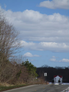
A farm scene in the Applegarth section of Monroe, Middlesex County.
MY GARDEN, NO. 1, PLANTING: The back portion of my backyard has as far back as I can remember in my 61 years been called “The Garden,” where my father, Joe Sr., and Grandma Annie Poznanski Onda grew vegetables and fruit. I still garden it, that patch being about 15 feet in depth and 75 feet in width, or a little more than 1,100 square feet. Before this week’s snow, I plowed up The Garden. Some look to St. Patrick’s Day, March 17, to plant peas and I had my Burpee Sugar Snap Peas in hand, but I viewed St. Paddy’s Day as too early. Instead, I was looking to plant the peas in early April. Finally, on Saturday, March 24, I broke down and planted two rows, or about 30 feet, of the Burpee Sugar Snap Peas. I also planted a row, or about 15 feet, of Burpee heirloom Touchon Carrot, because I had some old seeds around.
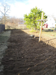
“The Garden” plowed up in my backyard in Monroe, Middlesex County.
MY GARDEN, NO. 2, ORDERING SEEDS: I ordered the rest of my early garden seeds, along with the summer garden stuff, all from Burpee. The early stuff: heirloom Touchon Carrot, Kaleidoscope Blend Carrot, Salad Bowl Lettuce, Early Wonder Beet, and heirloom Bloomsdale Long Standing Spinach. The summer seeds: Red Currant cherry tomatoes, heirloom Rutgers Tomato, Silver Queen Hybrid Corn, Straight Eight Organic Cucumber, heirloom Big Mama Lima Bean, and heirloom Hales Best Jumbo Cantaloupe. Also for the summer season, I bought various varieties of Burpee zinnia for fresh cuts and to attract pollinators — Envy, Candy Cane Mix, Old Mexico, Forecast, and Raspberry Lemonade Mix.
MY GARDEN, NO. 3, ZINNIA: Last year was the first year I grew zinnia. I bought them to attract pollinators, which they did — especially various species of butterfly. And I always had fresh cuts. Zinnia, too, are easy to grow. Also nice about zinnia is it being an annual, so I am not introducing an invasive non-native plant. I fell in love with zinnia. This year, I plan on putting the seeds of various varieties in a jar, shaking the jar, and planting the seeds in a big mix. So far, I plan these Burpee varieties — Envy, Candy Cane Mix, Old Mexico, Forecast, Raspberry Lemonade Mix, Cut and Come Again, Giant Flowered, and Big Tetra. If I need more, I will buy more. If I have too much seed, I will save the extra or take the view, “You cannot have too much zinnia seed.”
ELSEWHERE IN THE YARD: Ma (Sophie Onda Sapia) died at 81-years-old in 1995. But her flowers still grow in the front yard.
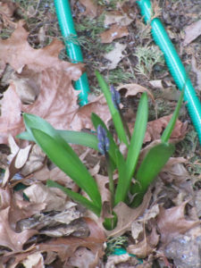
Ma’s flowers in the front yard of my home in Monroe, Middlesex County.
FULL MOON: The next full moon is Saturday, March 31, the second full moon of March. The first one was March 1.
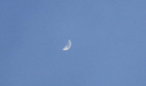
A half-moon with clouds passing in front of it, as viewed from my backyard in Monroe, Middlesex County.
SUNRISE AND SUNSET: For the week of Sunday, March 25, to Saturday, March 31, the sun will rise from about 6:55 to 6:45 a.m. and set about 7:15 to 7:20 p.m. For the week of Sunday, April 1, to Saturday, April 7, the sun will rise about 6:40 to 6:30 a.m. and set 7:20 to 7:30 p.m.
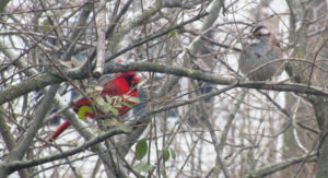
A cardinal, “Cardinalis cardinalis,” and a white-throated sparrow, “Zonotrichia albicollis,” in my sideyard in Monroe, Middlesex County.
ATLANTIC OCEAN TEMPERATURE: The Atlantic Ocean temperature off New Jersey is about 40 degrees.
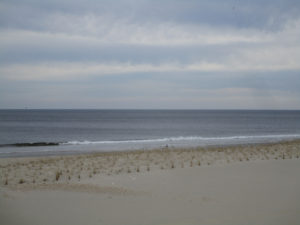
A calm, flat Atlantic Ocean at Sea Girt, Monmouth County.
WEATHER: The National Weather Service office serving the Jersey Midlands is at https://www.weather.gov/phi/.
A HAWK?: Have you ever heard a blue jay cry like a hawk? “The blue jay frequently mimics the calls of hawks, especially the red-shouldered hawk” according to Cornell University’s All About Birds website. “These calls may provide information to other jays that a hawk is around, or may be used to deceive other species into believing a hawk is present.”
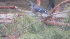
A blue jay, “Cyanocitta cristata,” helping itself to sunflower seeds in the backyard of my Monroe, Middlesex County, home.
SKY PHOTOS: This week’s sky photographs are from Monroe and Cranbury in Middlesex County.
The Wyckoff’s Mills section of Monroe, Middlesex County.

The Wyckoff’s Mills section of Monroe, Middlesex County.
The sky over farmland in Cranbury, Middlesex County.

A dusk view from my backyard in Monroe, Middlesex County.
HEARINGS ON GAS PIPELINE EXPANSION: The Federal Energy Regulatory Commission (FERC) has schedule hearings on the “draft environmental impact statement” for the Northeast Supply Enhancement project’s natural gas pipeline expansion through the Jersey Midlands. Hearings are scheduled for:
April 25, Wednesday, 5 to 9 p.m., in Middlesex County, Old Bridge, at the George Bush Senior Center.
April 26, Thursday, 5 to 9 p.m., in Brooklyn, New York, at the Best Western Gregory Hotel.
May 2, Wednesday, 5 to 9 p.m., in Somerset County, Franklin, at the Franklin Township Community Center.
May 3, Thursday, 5 to 9 p.m., in Quarryville, Pennsylvania, at Solanco High School.
April 7, Saturday, 8 a.m.: New Jersey’s trout fishing season formally opens.
April 9 to 15, Monday to Sunday, Mercer County: The annual Princeton Environmental Film Festival, https://www.princetonlibrary.org/peff/.
In my front yard in Monroe, Middlesex County, the Wednesday-Thursday, March 21-22, nor’easter ends. This photograph reminds me of “Scout Vespers,” a song we sang at Boy Scout Troop 81 meetings, “Softly falls the light of day as our campfire fades away….”
Joe Sapia, 61, is a lifelong resident of Monroe — in South Middlesex County, where his maternal family settled more than 100 years ago. He is a Pine Barrens naturalist and an organic gardener of vegetables and fruit, along with zinnias and roses. He loves the Delaware River north of Trenton and Piedmont, too.
He draws inspiration on the Pine Barrens around Helmetta from his mother, Sophie Onda Sapia, who lived her whole life in these Pines, and his Polish-immigrant grandmother, Annie Poznanski Onda.
He gardens the same backyard plot as did his Grandma Annie and Italian-American father, Joe Sr. Both are inspirations for his food gardening. Ma inspires his rose gardening.
Joe is a semi-retired print journalist of almost 40 years. His work also is at @JosephSapia on Twitter.com, along with Facebook.com on the Jersey Midlands page.
Copyright 2018 by Joseph Sapia
Article and photos by Joe Mish

The sea run shad, striped bass and herring that gather at the mouth of the Raritan River attract animals high on the food chain such as this harbor seal. Whales and dolphin have also been sighted over the last few years not in small part from the contribution of the Raritan River and its sweet water branches.
The spring-fed north and south branches of the Raritan River join in a marriage of sweet water at their confluence, on an endless journey to the sea. Each hidden spring and brook along the way, contributes its own genetic identity, mixed in a final blend at the mouth of the Raritan River.
Where the fresh water meets the salty sea, the ebb and flow of tides stir the brine into fresh water to create a stable buffer zone of brackish water.
These back bays and estuaries formed at the mouths of rivers are a perfect place for young of the year striped bass to gain in size before going offshore to migrate. American, hickory, gizzard shad, river herring, such as blueback herring and alewives also gather here and search for ancient breeding grounds located far upriver.
In the time before dams, sea run fish migrated far upstream into the north and south branch. Fishing was a robust industry in early colonial times where the seasonal migration of herring and shad was a profitable business.
The construction of dams to power mills along the river put a halt to upstream commercial fishing. The mills and dams were not welcomed by colonists who made a living from the seasonal fisheries. One account tells of early settlers in the mid 1700s, unhappy with a mill dam just below Bound Brook, making nightly raids to dismantle the dam and allow shad to continue their upstream migration.
Fast forward to today, the river still flows to the sea and the shad and herring gather to swim upstream.
In 1985 pregnant shad from the Delaware River were transplanted to the South Branch as part of a program to restore a shad migration along with planned dam removals.
Dams that have blocked migrating fish have recently been removed. The Calco dam near the former Calco Chemical Company built around 1938, cleared the way for migrating fish to reach the confluence of the Millstone and Raritan where a flood control dam was built. Known as the Island Farm weir, completed in 1995, it includes a viewing window and fish ladder to allow the dam to be bypassed by fish travelling upstream.
As part of the shad restoration project, volunteers working with Rutgers scientists tag shad and herring in an ongoing effort to gauge the success of the fish ladder and restoration efforts. Preliminary findings can be accessed at, http://raritan.rutgers.edu/wp-content/uploads/2015/10/NJDEP-2013-American-shad-restoration-in-the-raritan-river.pdf
A live underwater camera is placed at the dam each year after threat of ice has past. The camera is now operated by Rutgers University and may be seen online at http://raritanfishcam.weebly.com/fish-guide.html and at http://raritan.rutgers.edu/resources/fish-cam/
Aside from the Calco dam, three of five dams upstream of the Island Farm Weir, two dams on the Raritan, the Nevius street and Robert street dam and one on the Millstone have been removed. All in anticipation that the head dam at Dukes Island Park and the low dam at Rockafellows Mills on the South Branch will eventually be deconstructed.
See the above link for the video of the Nevius street dam removal. Go to MENU, open videos/multimedia to see Nevius street dam deconstructed.
See this link for a look at the Duke’s Island dam today; https://vimeo.com/259404286
The dream to restore our rivers and fisheries to their unmolested glory is well on the way to reality. Bald eagles now nest along the Raritan and its branches, soon to be joined by spawning shad and herring.
The vision of a pristine river valley, interrupted by 300 years of abuse and neglect is slowly emerging from the river mist as a magical apparition. The magic supplied by the hard work of Rutgers scientists and dedicated volunteers who echo the words of Rutgers president Thomas, who served in 1930, “Save the Raritan”.
As an aside to this article, I will share a sobering and emotional experience involving the Island Weir Dam that took place in 1995. The intent is to emphasize the importance of safety while paddling in general and especially when near dams or in cold water.
See page three of this link for a description of what happened that day: http://www.wrightwater.com/assets/25-public-safety-at-low-head-dams.pdf
I was paddling on the Delaware and Raritan Canal which parallels the Millstone River about two miles from where the dam is located at the confluence of the Millstone and Raritan rivers. This was a training session for a cold water canoe race that takes place each April in Maine. I am an experienced paddler, familiar with cold water immersion and so was wearing a wet suit with a dry top and pants along with a life jacket/pfd while on the calm water in the canal.
As I neared the end of my trip at the Manville causeway, several police cars slowly drove by and turned around as if searching for something. Sirens were wailing and more police and rescue vehicles were seen and the road blocked off. First thought was the body of a woman who was reported to have ended her life in the Millstone a week before was found.
As it turned out a kayaker and two companions in a canoe decided to run the dam. According to my recollection of the news article; the canoe made it through first, while the kayaker who followed, failed to clear the dam and was stuck in the hydraulic.
According to the news article, ‘the experienced paddlers’ wore no thermal protection or pfds when they ran the dangerous dam. It was reported that the canoers paddled back to help their companion and they capsized in the hydraulic. Once you cross that line which marks the downstream flow from the water cycling upstream, you will be pulled into the hydraulic.
The kayaker and one of the men in the canoe were washed out of the turbulent water but the other was lost, his body never recovered.
A hydraulic occurs when the weight of falling water creates a hole which is then filled by downstream water being pulled upstream in an endless re-circulating current parallel to the dam. Low head dams may be altered to prevent or mitigate a hydraulic.
There is a point of no return where you can actually see a line that separates the water flowing downstream from the water flowing back upstream to power the hydraulic.
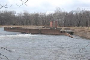
Island Weir Dam at the confluence of the millstone and Raritan River. You can see the horizontal shelves that are the fish ladder in the center and the subsequent stepped redesign to mitigate the dangerous hydraulic.
There have been several more drownings involving dams on the Raritan and its branches. I recall another at the Headgate, which is the dam created by the Duke estate below the confluence of the North and South branches. The paddler went over and was lost in the hydraulic below.
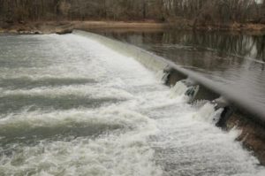
This is the headgate dam at Dukes Island Park. Created to collect river water via the Dukes canal to power the estates and supply water to the series of ponds built at decreasing elevations to allow the water to return to the river by gravity.
No warning signs are posted to alert paddlers to the danger ahead. On the downstream face of the dam is a warning to keep off.
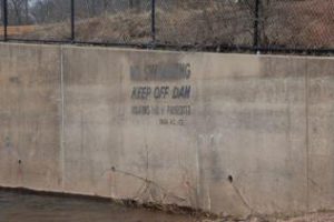
Too little too late warning.
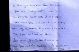
Paddling on the South Branch from Rockafellow’s mill rd, just below the low head dam that forms Red Rock Lake, this note was placed on my windshield. Though I was no where near the dam, contrary to what the note states, the message was at once heart breaking and shown here, now serves as a warning to all; beware of the dangers of low head dams.

This sign is placed about 5 football fields above the dam at red rock lake on the South Branch. It’s placement a puzzlement that mitigates its message.
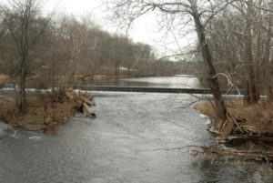
Dam at Red Rock Lake.
Though rivers like the South Branch and North Branch are reputed to be no more dangerous than a swimming pool, tragedy can strike when least expected. Strainers, trees that fall into the river blocking passage, can snag and capsize a boat and entangle the paddler in its branches under pressure of a fast current. Low head dams can drown a paddler by immersion or entanglement on debris as the paddler is unable to wash out of the turbulent recycling water. Search on line to get an idea of how widespread is the danger of obscure low head dams and loss of life across the country.
Paddling when river temperatures are well below normal body temperature requires thermal protection no matter the air temperature. Wearing a pfd alone will not be enough to survive if your body temperature drops before you can be rescued or self rescue. Such was the case of a paddler on Round Valley reservoir a few years ago.
Typically water temp during the winter and early spring on the South Branch is 41 degrees. More than enough to cause a spasm to block your ability to breathe even before hypothermia sets in. See this link for a detailed explanation of the effects of cold water immersion. Remember, ‘cold water’ does not have to be that cold.
http://www.coldwatersafety.org/ColdShock.html
Overturning in fast water, a boat can instantly fill with a hundred gallons of water. Each gallon weighing 8 pounds, can pin or crush a paddler between the canoe and any obstruction. Such was the case on a locally sponsored canoe trip in shallow water on a beautiful day on the South Branch. One paddler was trapped under the canoe in a strainer. Eventually he popped out from under the boat, shaken but safe. The canoe was stuck fast in the strainer, filled with hundreds of pounds of water. Never be downstream of a capsized canoe.
Tragedy can occur on the calmest day under brilliant blue skies, always wear a pfd and be alert to potential dangers, especially dams.
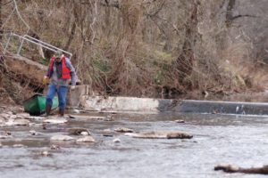
Low head dam across the North Branch just above rt 202 makes a difficult passage during low water portage and a dangerous hydraulic during high water.
Author Joe Mish has been running wild in New Jersey since childhood when he found ways to escape his mother’s watchful eyes. He continues to trek the swamps, rivers and thickets seeking to share, with the residents and visitors, all of the state’s natural beauty hidden within full view. To read more of his writing and view more of his gorgeous photographs visit Winter Bear Rising, his wordpress blog. Joe’s series “Nature on the Raritan, Hidden in Plain View” runs monthly as part of the LRWP “Voices of the Watershed” series. Writing and photos used with permission from the author.