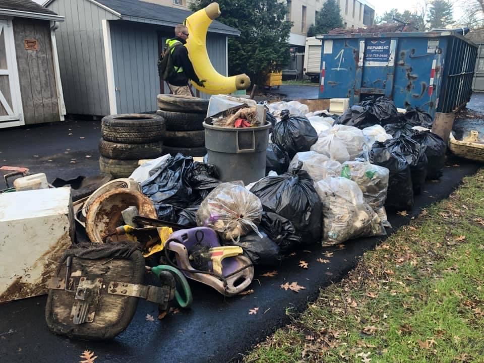
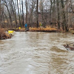
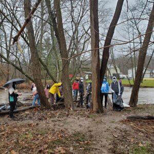
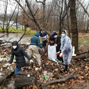
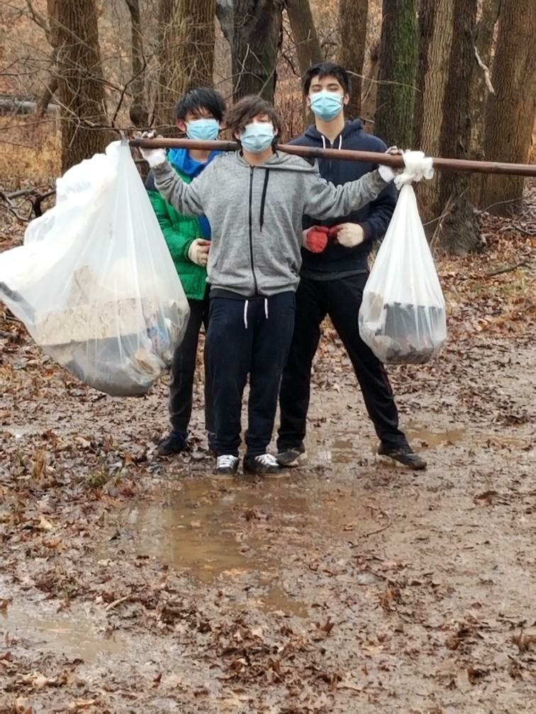
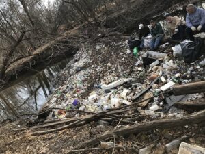
HUGE THANKS to the 60+ intrepid souls who joined the Lower Raritan Watershed Partnership and Central Jersey Stream Team out on the Green Brook floodplain for our last clean-up of the year. It was a cold, windy, rainy, mucky start to the day – really only the cold abated by the time we wrapped up.
With appreciation to Green Brook Township, Green Brook Regional Centre, GreenBrook Lions, Sewa Central Jersey, Mr. Kevin Ellis’ Middle School Science class, our Hackensack Riverkeeper friends and all the wonderful volunteers for giving of their time to clean up our watershed!
A crazy amount of trash was collected including a mini fridge, large screen TV, a big inflatable banana and so much more. See below for a few photos from the day. See you in 2021!!
LRWP board member Anton Getz and CJST board member Jens Riedel spot an inflatable banana on the Green Brook
Green Brook Middle School science teacher Kevin Ellis and his students
Central Jersey Sewa volunteer fill dozens of bags with plastic bottles
A healthy stream is a complex place. Vegetation grows along its banks, shading the stream and filtering pollutants before they enter the waters. Wildlife find shelter and food near and in its waters. And within the stream itself are fish, insects, and other organisms with specific needs for oxygen, food, and shelter. Certain land uses affect habitat quality and stream health. A stream corridor functions holistically, and any changes to a part may affect the entire habitat.
A habitat assessment is a summary of different characteristics of a stream segment that help us better understand the health of our area streams. When we understand issues that affect our streams, we can do a better job of protecting them.
Please join the LRWP and Americorps Watershed Ambassador Caitlin DiCara on Monday November 30 for a two-hour FREE virtual Stream Habitat Assessment training.
This training will detail the “how-tos” of assessing the health of our local streams in preparation for Spring 2021 monitoring.
We will also provide general overview of our adopt-a-stream and stream monitoring program, and answer participant questions about these program and program requirements.
This FREE training will run from 5:30-7:30 PM from the comfort of your own home. Registration required.
We look forward to seeing you on November 30!
Heather Fenyk
Jon Dugan
Caitlin DiCara, NJ Watershed Ambassador Program
For more information, contact Heather Fenyk: hfenyk@lowerraritanwatershed.org OR #908.349.0281
A healthy stream is a complex place. Vegetation grows along its banks, shading the stream and filtering pollutants before they enter the waters. Wildlife find shelter and food near and in its waters. And within the stream itself are fish, insects, and other organisms with specific needs for oxygen, food, and shelter. Certain land uses affect habitat quality and stream health. A stream corridor functions holistically, and any changes to a part may affect the entire habitat.
A habitat assessment is a summary of different characteristics of a stream segment that help us better understand the health of our area streams. When we understand issues that affect our streams, we can do a better job of protecting them.
Please join the LRWP and Americorps Watershed Ambassador Caitlin DiCara on Monday November 30 for a two-hour FREE virtual Stream Habitat Assessment training.
This training will detail the “how-tos” of assessing the health of our local streams in preparation for Spring 2021 monitoring.
We will also provide general overview of our adopt-a-stream and stream monitoring program, and answer participant questions about these program and program requirements.
This FREE training will run from 9–11 AM from the comfort of your own home. Registration required.
We look forward to seeing you on November 30!
Heather Fenyk
Jon Dugan
Caitlin DiCara, NJ Watershed Ambassador Program
For more information, contact Heather Fenyk: hfenyk@lowerraritanwatershed.org OR #908.349.0281
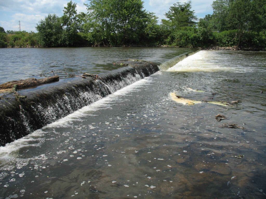
Calco Dam, positioned at Raritan River Mile (RM) 20.9, was located in Bridgewater and Franklin Townships, Somerset County, New Jersey just upriver from the Borough of Bound Brook. Calco Dam, technically a low-head loss dispersant weir, was constructed in 1938 by the Calco Chemical Company, Inc. as part of the effluent conveyance system for a synthetic dyestuff manufacturing operation that had been established at this location in 1915. To direct effluent flow to Calco Dam, a diversion structure was built on a natural stream (Cuckels Brook) 800 feet north of the dam, and as part of the diversion construction, a canal was dug from that structure to Calco Dam; a screening structure was installed at the end of the canal to prevent debris from flowing into the dispersant pipe inside the dam. The center dispersant weir section of Calco Dam was 123 feet long and was composed of a 36-inch-diameter effluent tile pipe encased in concrete, which had on its downstream side a total of 41 8-inch-diameter outlets spaced three feet apart. The weir structure was connected to the river banks by approximately 50- to 55-foot-long solid concrete abutments, making Calco Dam a run-of-the-river structure. According to the original design drawings, Calco Dam varied in width between 21.25-23 feet and it had a structural height of approximately seven feet. There was an 18-inch-thick, 12-foot-wide concrete apron extending downstream from the dam crest, ending in an apron toe section extending 3 feet below the river bed.
Calco Dam Before Removal
When the Somerset Raritan Valley Sewerage Authority (SRVSA) purchased the manufacturing site’s wastewater treatment plant operations in 1985, ownership of Calco Dam also transferred to SRVSA because the dam was an integral part of the facility wastewater effluent discharge system. Although SRVSA was utilizing Calco Dam for discharging treated municipal effluent into the Raritan River when I approached them in 2008 about removing the dam, they were already in the process of designing and permitting an alternative effluent discharge route and outfall to the Raritan River, which would allow Calco Dam to be abandoned and removed. SRVSA immediately recognized the value of eliminating the potential liability of a dam and they became the model of a cooperative dam owner in the subsequent contractual negotiations to grant us permission to remove Calco Dam.
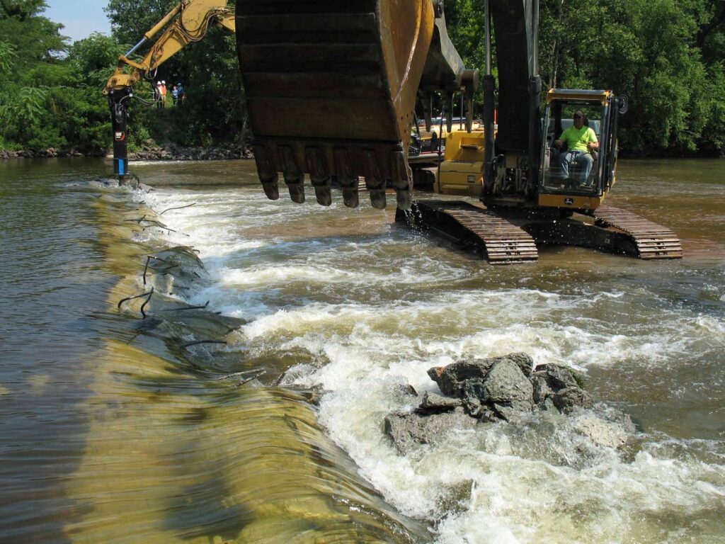
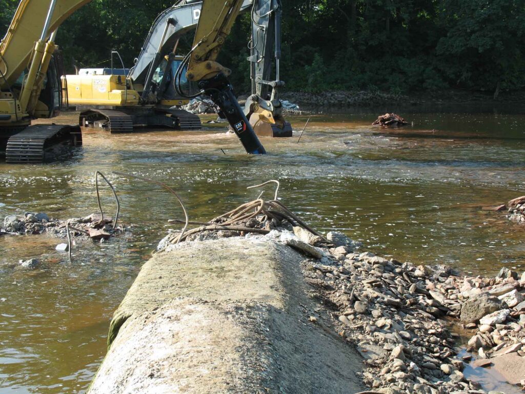
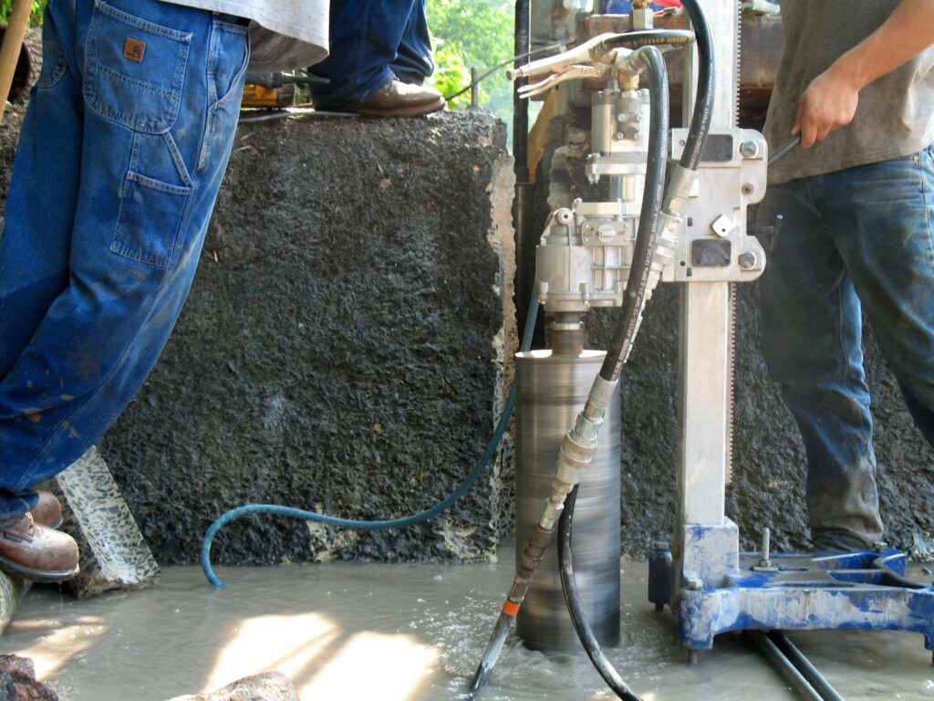
The Calco Dam removal was successfully accomplished between July 18 and August 1, 2011, but the removal had an unique engineering component. In planning the dam removal, I ascertained that the southernmost end of the dam had been incorporated into and under the towpath berm of the historic Delaware and Raritan (D&R) Canal, although a fair portion of this dam section had been subsequently exposed by scour eddies caused by water flowing over the dam. The effect of any further excavation on the stability of the D&R Canal towpath berm was considered too risky to implement so a decision was to made to leave that southernmost section of the dam intact and rebury the section that had become exposed from the river’s scouring action. To isolate this dam section from the remainder of the structure that was to be removed required that a methodology be devised to cut through the entire dam structure with a minimal amount of disturbance to the towpath berm (the dam was much too thick to be saw cut). Taking advantage of the same scour pool that had dangerously eroded into the base of the towpath berm, we built a temporary coffer dam around this section of the dam, dewatered it, and proceeded to drill and extract dozens of overlapping 6.5-inch diameter concrete cores across the width of the dam in the process known as “stitch coring.” Once the isolation of this section of the dam was completed, we imported tons of properly-sized rock riprap and rebuilt the base of the D&R Canal towpath berm back into its original configuration with the southernmost dam fragment now serving as a stable foundation for the reconstruction. Success of this restoration was tested just a few weeks later during back-to-back record flooding events from Hurricane Irene and Tropical Storm Lee when this section of the repaired D&R Canal towpath berm held firm while other sections along the D&R Canal route suffered washouts and breaches.
Calco Dam During Initial BreachingCalco Dam During Final BreachingCalco Dam Stitch Coring
The number of returning migratory fish in the Raritan River the following spring heralded the remarkable and rapid recovery of the Raritan River at the Calco Dam location. Based on observations at the upstream Island Farm Weir (IFW) fish ladder viewing window in the first spring migration season (March-May 2012) following the dam removal, the number of American shad migrating upstream increased 500% and the total number of fish passing through the IFW fish ladder increased by 200%. This essentially instantaneous result propelled the planning of the next two dam removals, which were accomplished in just the next two years (Robert Street Dam in 2012 and the Nevius Street Dam in 2013), and this succession of three dam removals in just three years is considered to be one of the most ambitious river restoration efforts that have implemented to date.
Calco Dam After Removal
John W. Jengo, PG, LSRP is a licensed Professional Geologist in several Northeastern and Southeastern states and a Licensed Site Remediation Professional in New Jersey. John works as a Principal Hydrogeologist in an environmental consulting firm in southeastern Pennsylvania. He has degrees in geology from Rutgers University (1980) and the University of Delaware (1982). Over the last 30 years, he has conducted the characterization and remediation of large, complex contaminated industrial sites throughout New Jersey, Pennsylvania, and Delaware. He played a key role in Natural Resource Damage (NRD) assessments that led to groundbreaking legal settlements to remove numerous low head dams on the Raritan and Millstone Rivers to restore historically significant migratory fish spawning runs. As technical project manager, he planned, permitted, and successfully managed the removal of the Calco Dam, the Robert Street Dam, and the Nevius Street Dam between 2008-2013, and the removal of the Weston Mill Dam on the Millstone River in 2017, along with leading the archaeological investigation of the former Weston Mill in the Borough of Manville and Franklin Township.
~SAVE THE DATE~ Join the Lower Raritan Watershed Partnership, Central Jersey Stream Team and friends for a clean-up of the Green Brook!
WHAT: a clean-up of the Green Brook on Saturday December 5 from 10AM to 1PM
WHERE: Green Brook Regional Center, 275 Greenbrook Rd, Green Brook Township, NJ 08812
This Event is Co-coordinated by the Lower Raritan Watershed Partnership and Central Jersey Stream Team. With special thanks to the Green Brook Department of Public Works for cartage and supplies.
Please wear closed toe shoes and clothes you are willing to get dirty and wet. Gloves and bags will be provided.
*** For more information contact Heather hfenyk@lowerraritanwatershed.org or Jens jens.riedel@cjstreamteam.org ***
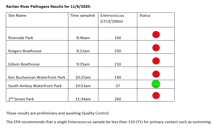
Yesterday was the last day of pathogens monitoring for 2020. Despite COVID-related challenges and the general difficulties of juggling an all volunteer program, we met EPA requirements for quality data and built a great data set. HUGE THANKS to our partners: Rutgers Cooperative Extension of Middlesex County and the Interstate Environmental Commission. And much gratitude to all our wonderful volunteer monitors! We couldn’t do it without you!
Below are our pathogens results for 11.5.2020, followed by field notes for the day.
The LRWP and Rutgers Cooperative Extension of Middlesex County monitor for Fecal Coliform and Enterococcus at six non-swimming public beach access sites along the Lower Raritan during the warmer summer months. Fecal Coliform and Enterococcus are indicators of disease-causing bacteria in our waterways.
The EPA recommends that a single Enterococcus sample be less than 110 Colony Forming Units (CFU)/100mL for primary contact. Enterococci levels are used as indicators of the possible presence of disease-causing bacteria in recreational waters. Such pathogens may pose health risks to people fishing and swimming in a water body. Sources of bacteria include Combined Sewer Overflows (CSOs), improperly functioning wastewater treatment plants, stormwater runoff, leaking septic systems, animal carcasses, and runoff from manure storage areas. Enterococci levels are often high after heavy or consistent rainfall.
Field notes for November 5, 2020
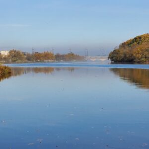
Another foggy start to the morning. Both our Riverside Park (Piscataway) and New Brunswick Boat House sites were gorgeous under a shroud of mist.
Looking toward Albany Street Bridge from the Rutgers Class of 1914 Boathouse
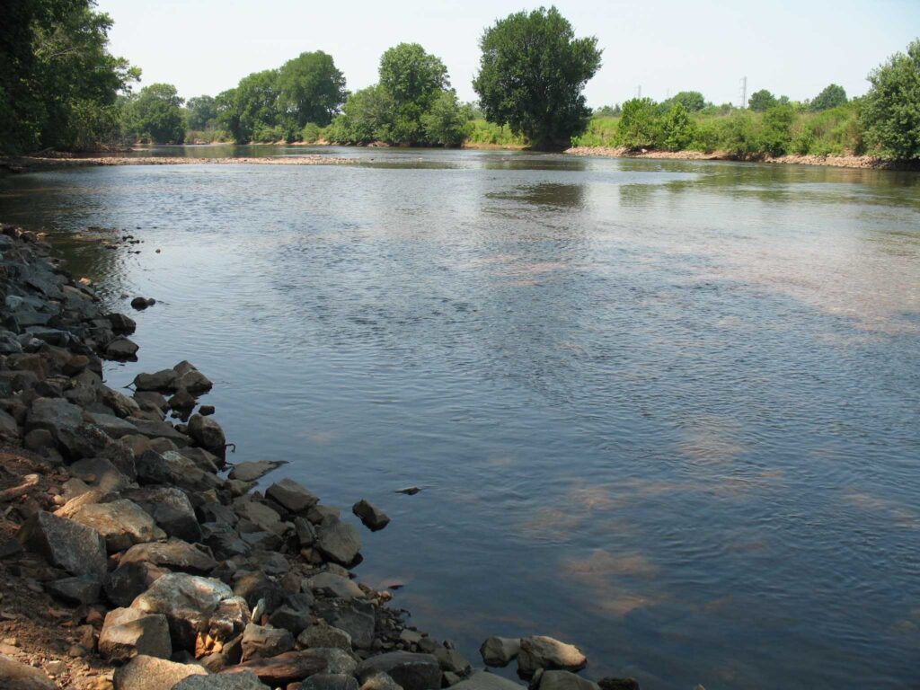
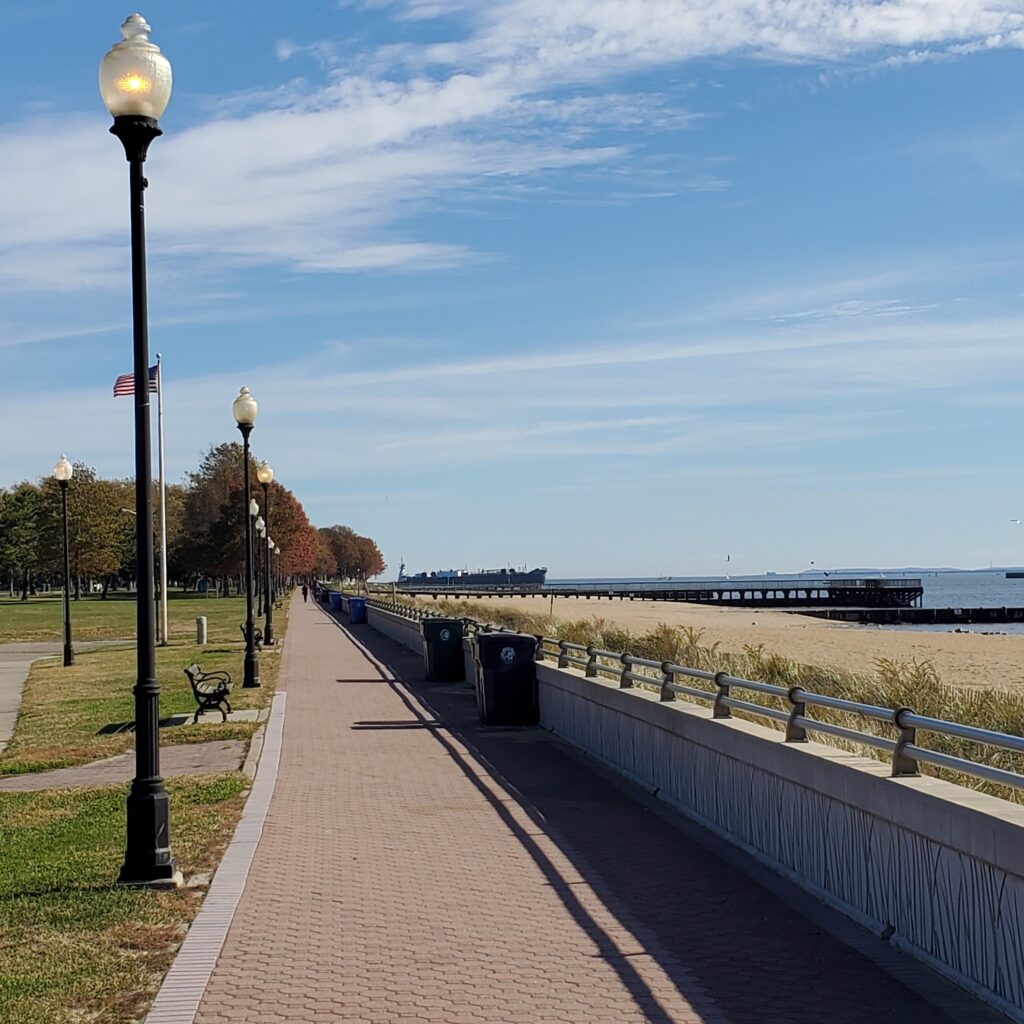
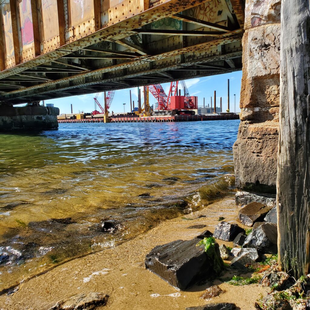
The views from our monitoring site in Perth Amboy are dramatic. To the left you look out to Raritan Bay and sailboats and huge ships heading into New York Harbor. To the right you look upstream, at the mouth of the Raritan, where the new “River Draw” train bridge is under construction.
Looking toward construction of the new train bridge from under the old “River Draw”
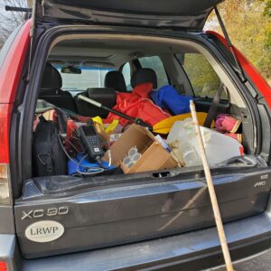
So long, see you next year!
While it is sad to end the sampling season, we will be happy to empty our trunk of monitoring supplies
The LRWP and Rutgers Cooperative Extension of Middlesex County monitor for Fecal Coliform and Enterococcus at six non-swimming public beach access sites along the Lower Raritan during the warmer summer months. Fecal Coliform and Enterococcus are indicators of disease-causing bacteria in our waterways.
The EPA recommends that a single Enterococcus sample be less than 110 Colony Forming Units (CFU)/100mL for primary contact. Enterococci levels are used as indicators of the possible presence of disease-causing bacteria in recreational waters. Such pathogens may pose health risks to people fishing and swimming in a water body. Sources of bacteria include Combined Sewer Overflows (CSOs), improperly functioning wastewater treatment plants, stormwater runoff, leaking septic systems, animal carcasses, and runoff from manure storage areas. Enterococci levels are often high after heavy or consistent rainfall.
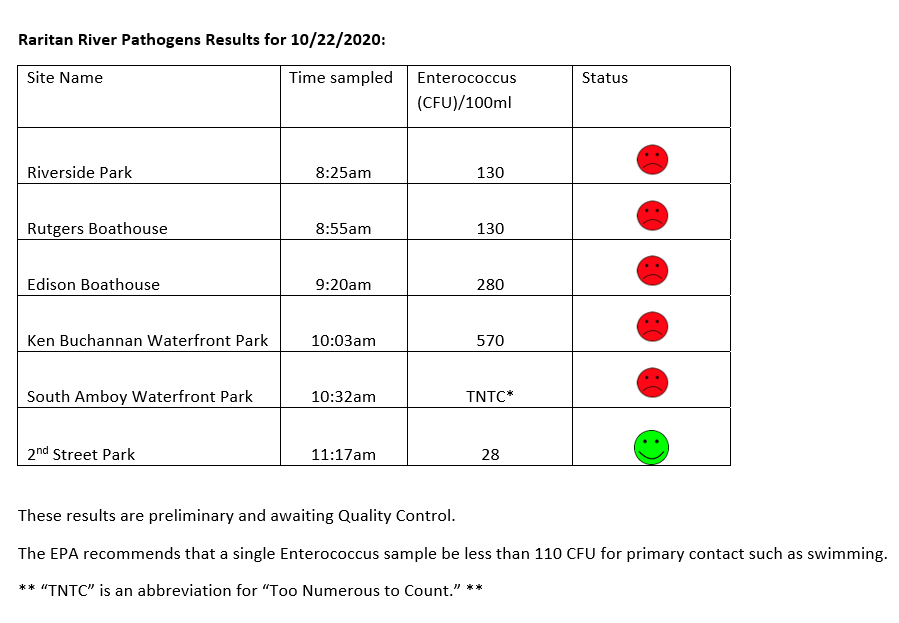
Below are our pathogens results for October 22, 2020.
Field notes for October 22, 2020
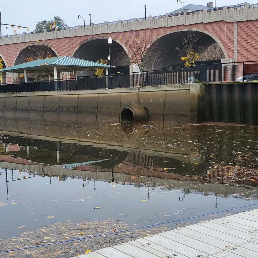
Fog blanketed much of the East Coast through the morning, and hung heavy over the Raritan until burning off around noon. Called “advection fog,” the mist forms when warm, moist air passes over a cool surface. Advection describes the movement of fluid, in this case the fluid is wind. When the moist, warm air made contact with the cooler surface air, water vapor condensed to create fog.
A blanket of fog hovered over our monitoring sites, including Riverside Park in Piscataway
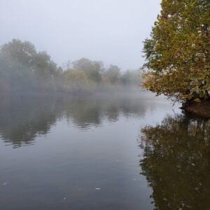
Ever wonder how all the rain that falls onto a highway is “disappears” for a safe driving experience? It is transferred via stormwater infrastructure — that is, pipes or channels — to and “outfall” at which the stormwater enters receiving waters (rivers, streams, or creeks). This outfall at New Brunswick’s Boyd Park conveys rainwater from Route 18 (above the arches) into the Raritan River at the Rutgers Class of 1918 Boathouse.
A stormwater outfall conveying water off of Route 18 into the Raritan River at Rutgers Boathouse.
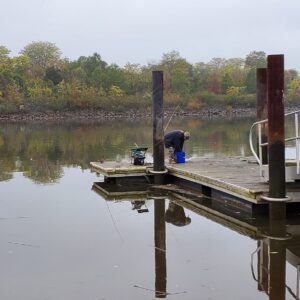
Our fisher friends in Edison didn’t seem to mind the fog. They told us they had just caught and released a 26-inch striper the night before.
The LRWP and Rutgers Cooperative Extension of Middlesex County monitor for Fecal Coliform and Enterococcus at six non-swimming public beach access sites along the Lower Raritan during the warmer summer months. Fecal Coliform and Enterococcus are indicators of disease-causing bacteria in our waterways.
The EPA recommends that a single Enterococcus sample be less than 110 Colony Forming Units (CFU)/100mL for primary contact. Enterococci levels are used as indicators of the possible presence of disease-causing bacteria in recreational waters. Such pathogens may pose health risks to people fishing and swimming in a water body. Sources of bacteria include Combined Sewer Overflows (CSOs), improperly functioning wastewater treatment plants, stormwater runoff, leaking septic systems, animal carcasses, and runoff from manure storage areas. Enterococci levels are often high after heavy or consistent rainfall.
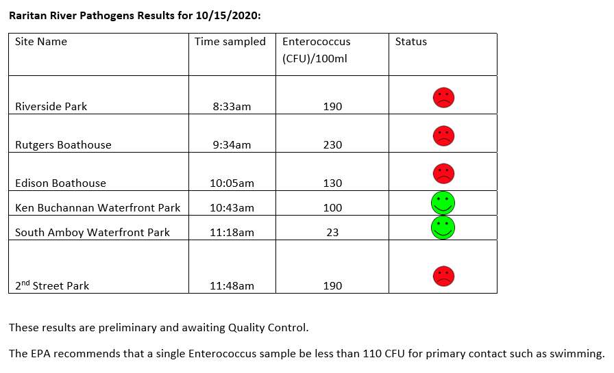
Below are our pathogens results for October 15, 2020.
Field notes for 10.15.2020
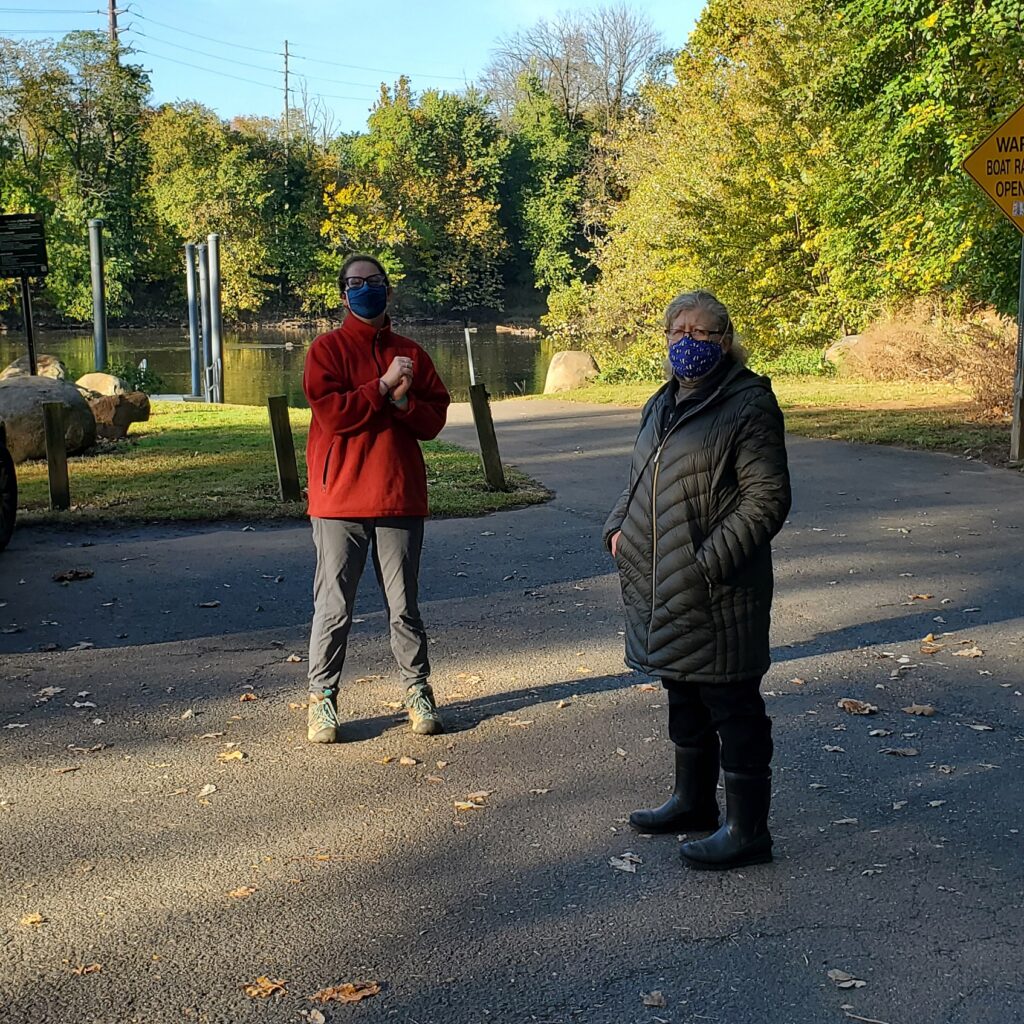
What a beautiful day for monitoring! Americorps Watershed Ambassador Caitlin DiCara helped us out with monitoring. We were also joined at our Piscataway and New Brunswick sites by our Windows of Understanding 2021 artist Marcia Shiffman. Marcia’s work for 2021 will focus on communicating the “hidden” social justice issue of inequitable access to nature.
Caitlin DiCara and Marcia Shiffman at our Riverside Park (Piscataway) site
We talked with Marcia and Caitlin about social barriers and physical obstacles to enjoyment of blue or green spaces or parks. In preparation for our listening session on Social Justice and Access to Nature, we identified a number of barriers to accessing nature. All of the below we observe as issues at non-bathing public access beach pathogens monitoring sites. These include:
-Difficulty in accessing green/blue or park space because of landscape design
-Difficulty in accessing green/blue or park space because of cost
-Not feeling welcome in a natural blue/green space or park because of economic status, or ethnic or cultural difference
-Cultural and/or language restriction present other barriers to enjoyment of time in natural spaces
-Bullying behaviors or material obstacles limit enjoyment of time in natural spaces for persons with disabilities
-Fear, anxiety, or feelings of helplessness in the face of crime limits time in natural spaces
What obstacles or barriers have we missed?
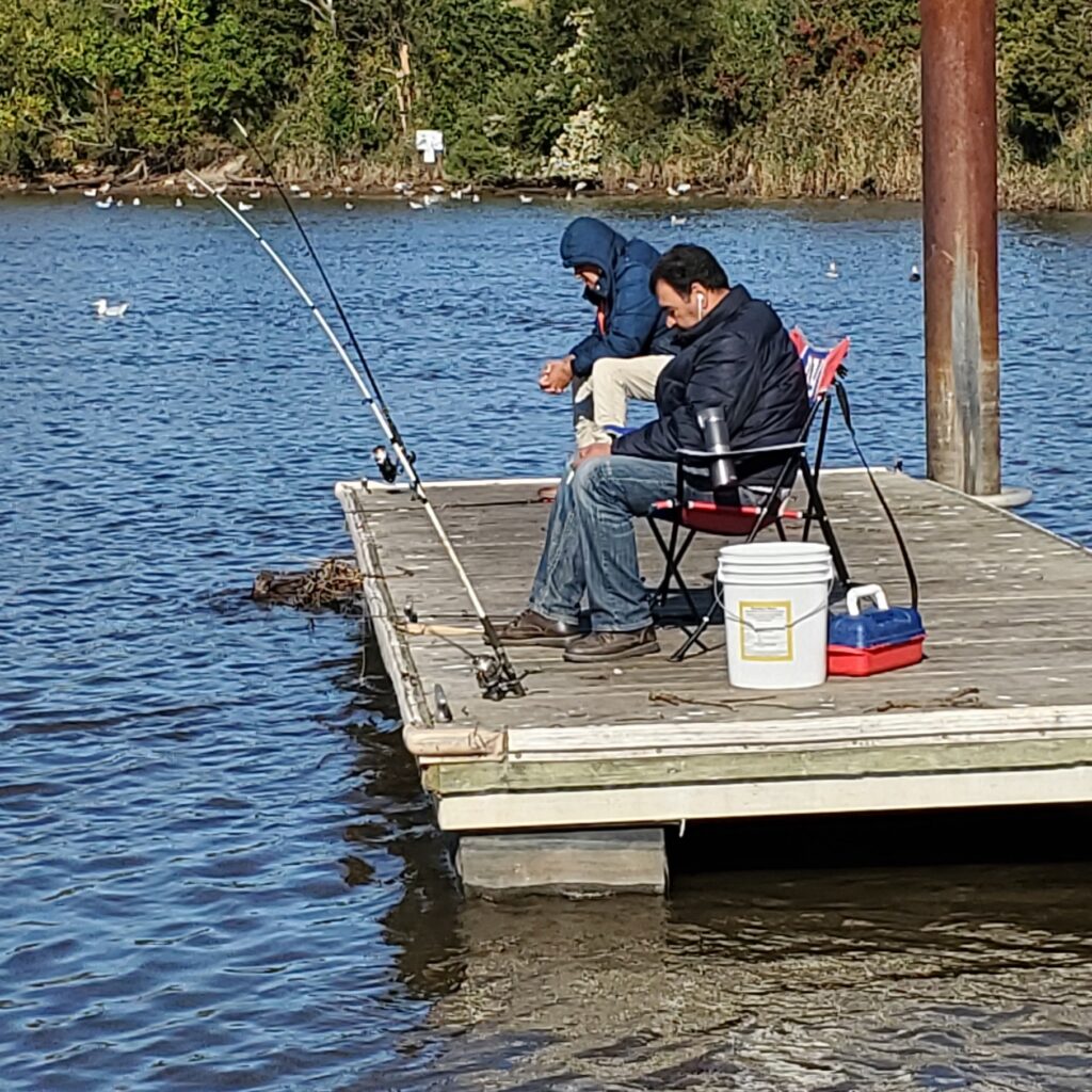
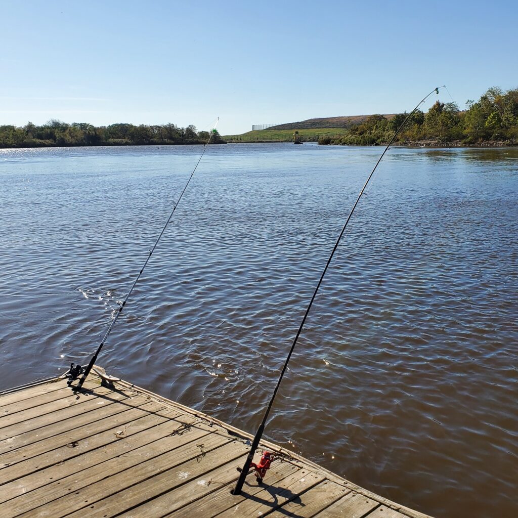
Our Thursday “regulars” fishing at the Edison Boat LaunchNot much tugging at these poles, Edison Boat Launch 10.15.2020
In February 2021, the LRWP will join the New Brunswick Community Arts Council and others for “Windows of Understanding,” in which local non-profits partner with artists to transform main street spaces into “windows of understanding” art installments. Through these art installations the community can learn about social justice issues that don’t make daily headlines.
For 2021 the LRWP is thrilled to partner with Highland Park resident Marcia Shiffman. This year Marcia will help us communicate the “hidden” social justice issue of inequitable access to nature.
Please join us for a Webex listening session on Thursday October 15 from 5:30-6:30 pm to share your concerns, observations, and thoughts related to social justice and access to nature. Your participation will help us better understand the issues, and will help us in the work of communicating these issues through art.
This listening session is free, however pre-registration is required. You will receive a Webex registration link before the event start.
While the COVID-19 quarantine has encouraged people to get a healthy dose of the out-of-doors to breathe fresh air, strengthen immune systems, exercise, and destress, we know that accessing clean, safe, green and blue spaces is much harder for our low socio economic status urban communities. Residents from these communities often don’t have transportation or resources for a visit the Jersey shore or a hike in our state or national parks.
This social justice issue motivates the work of the LRWP in monitoring pathogens at non-swimming public access beaches along the Lower Raritan. We have chosen sites where our State and County Public Health Departments do not monitor water conditions, yet where our most vulnerable residents regularly fish, swim, and otherwise recreate in the water.
We will start the listening session with a brief overview of equitable access concerns in the Lower Raritan, including data from our Summer 2020 pathogens monitoring work.
Want to learn more about Social Justice and Access to Nature? The Children & Nature Network developed a brief literature review on “Equitable Access to Nature’s Benefits“.
Photos and article by LRWP Board President Heather Fenyk
The LRWP and Rutgers Cooperative Extension of Middlesex County monitor for Fecal Coliform and Enterococcus at six non-swimming public beach access sites along the Lower Raritan during the warmer summer months. Fecal Coliform and Enterococcus are indicators of disease-causing bacteria in our waterways.
The EPA recommends that a single Enterococcus sample be less than 110 Colony Forming Units (CFU)/100mL for primary contact. Enterococci levels are used as indicators of the possible presence of disease-causing bacteria in recreational waters. Such pathogens may pose health risks to people fishing and swimming in a water body. Sources of bacteria include Combined Sewer Overflows (CSOs), improperly functioning wastewater treatment plants, stormwater runoff, leaking septic systems, animal carcasses, and runoff from manure storage areas. Enterococci levels are often high after heavy or consistent rainfall.
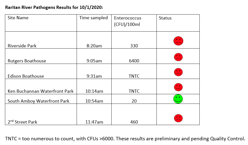
Below are our pathogens results for October 1, 2020. These are about the worst results of the season so far. Two of our sites had colony forming units (cfus) that were TNTC or “too numerous to count”.
Please note: results are preliminary and pending quality control.
Field Notes for 10.1.2020
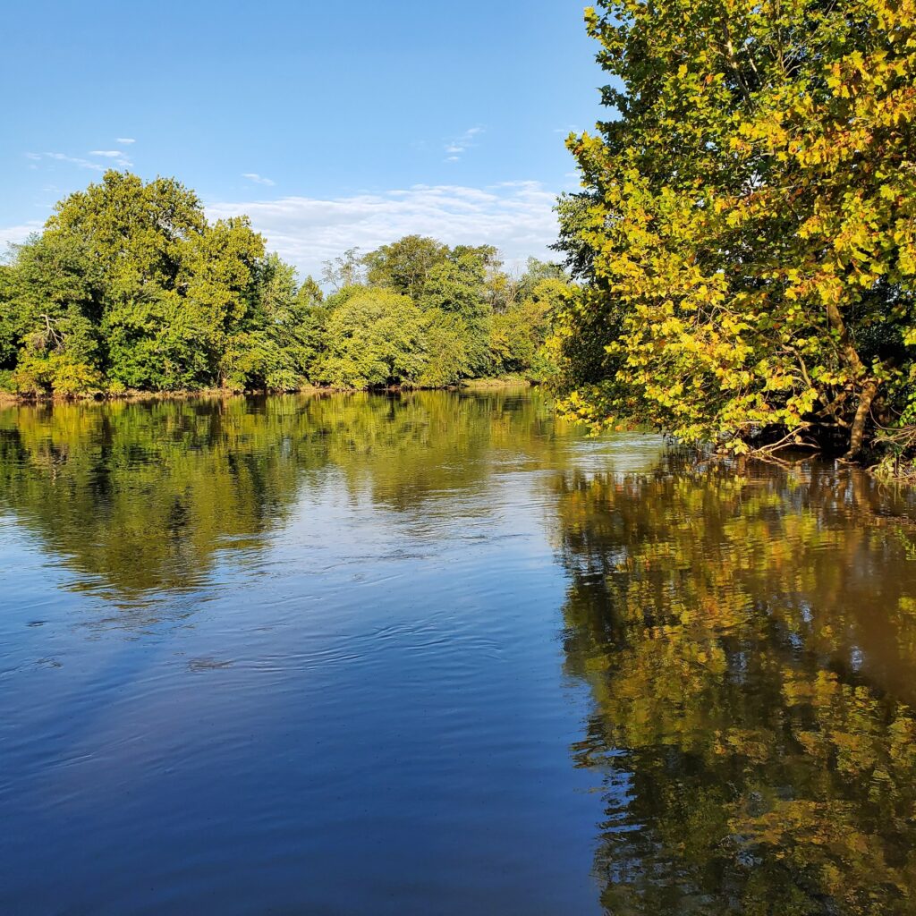
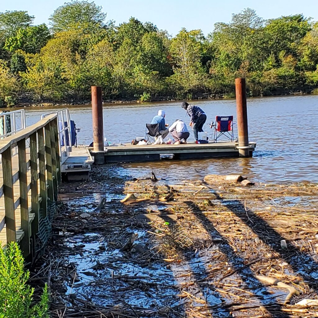
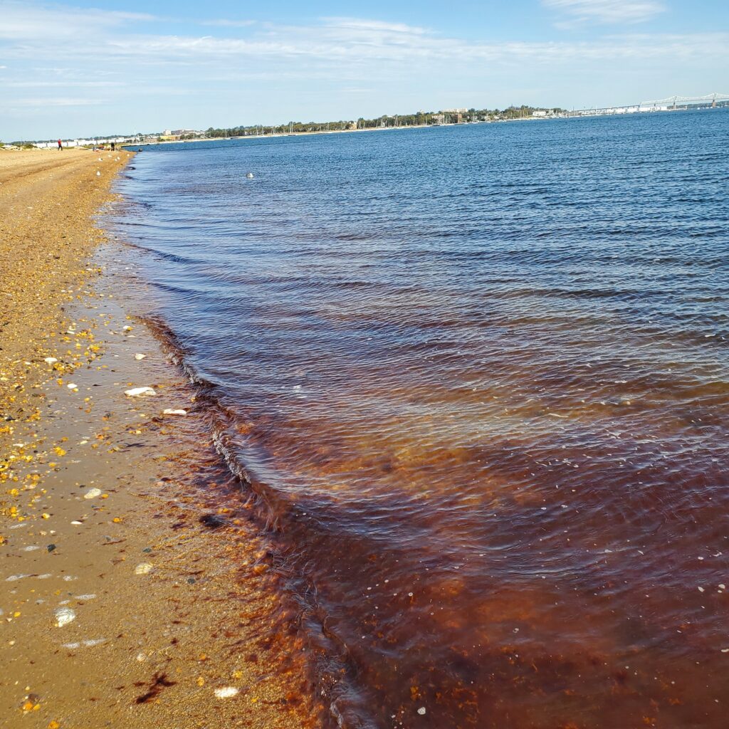
Our sites may be “dirty” but they are also beautiful, and places where many go for fishing, recreation, and to learn more about the natural and constructed world.
Gorgeous views at our Riverside Park (Piscataway) site belie what are typically our worst pathogens counts for all monitored sitesOur friends at the Edison Boat launch site told us the water was too dirty to catch anything but eels. LOTS of trash floating in the water at this site this week.This is the fifth week of red tide conditions at our monitoring site in South Amboy
Check out the video we capture of a simultaneous train crossing of the picturesque Raritan River “River Draw” in Perth Amboy!