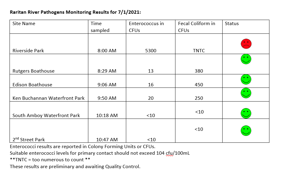
Another pretty good week of results from our pathogen monitoring. While our downstream sites are within limits, the Piscataway site continues to give us trouble with very high enterococcus and fecal coliform TNTC or “Too Numerous To Count.” Yikes! We received .7 inch of precipitation since sampling, which likely means the pathogens count will be higher at all sites.
Many thanks to our Rutgers Cooperative Extension of Middlesex County, and Interstate Environmental Commission partners, and special thanks to our wonderful volunteers!! See here for more information on our pathogens monitoring program. Have a wonderful 4th of July weekend Everyone!
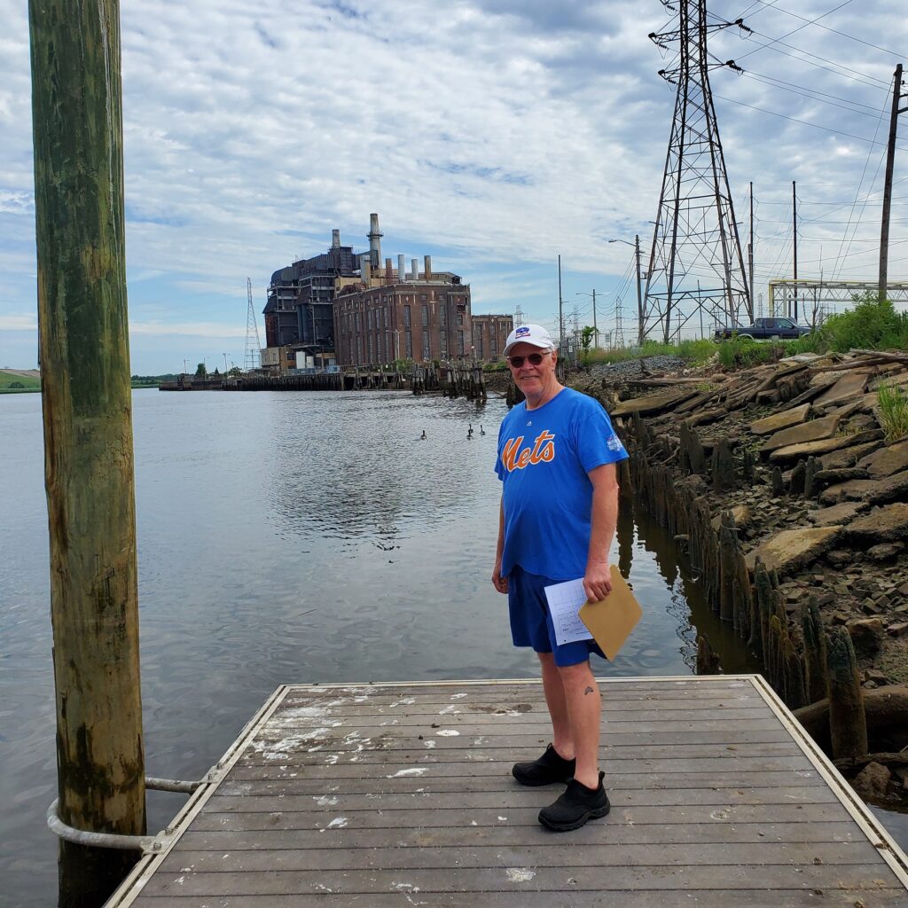
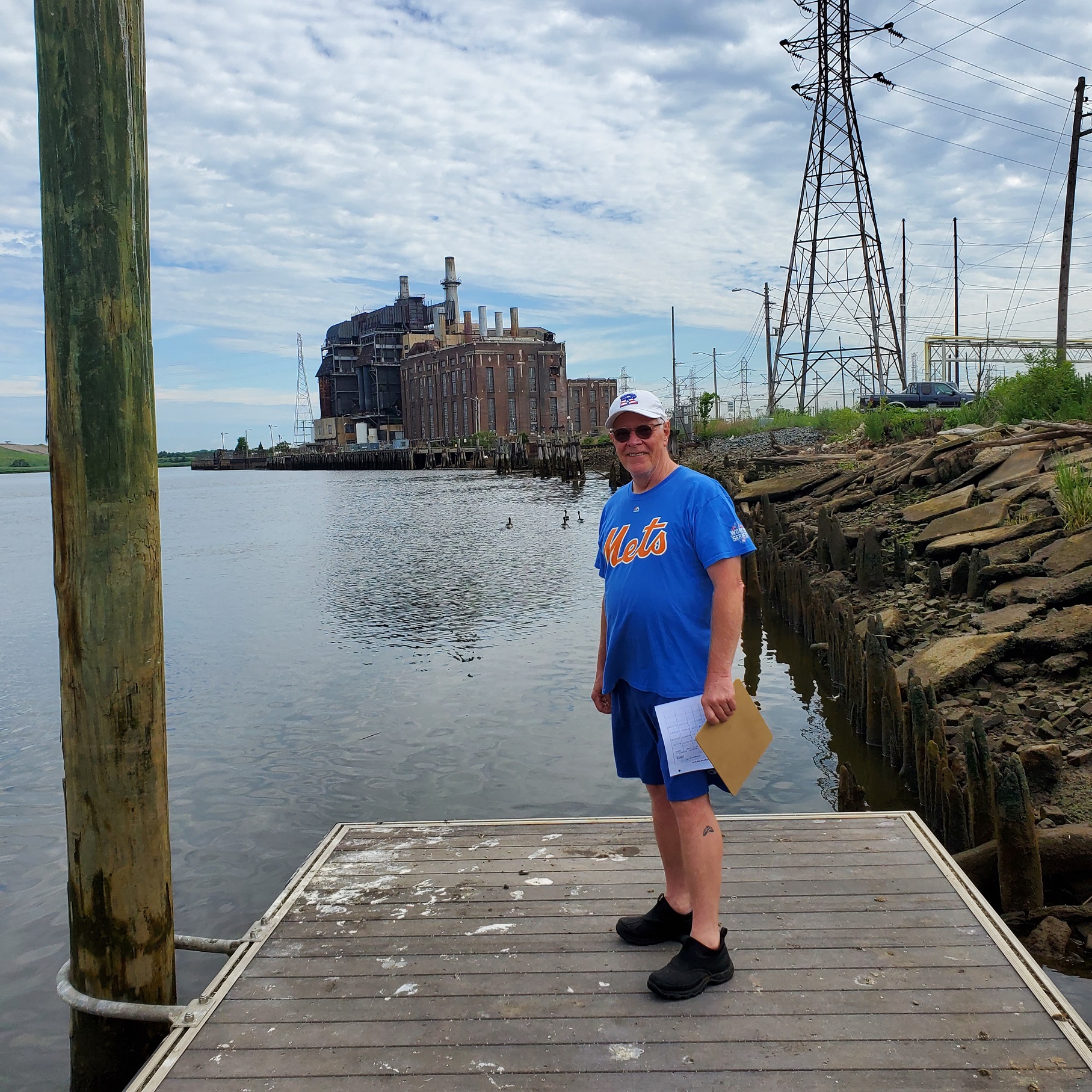
Civic science monitoring volunteer Frank Dahl at our Sayreville site – thank you, Frank!
Please join us Sunday October 3, 2-4 pm for our second “walk in the watershed” in South Bound Brook/Bound Brook with LRWP Board Member and Rutgers Professor David Tulloch! We also expect Green Brook Flood Control Commission Chair Raymond Murray to join us for part of our tour.
Plan to meet at D&R Canal Lock 11 in South Bound Brook. There is limited parking in this lot, however there is plenty of street parking.
We will start our conversation at D&R Canal Lock 11, explore a bit of the canal and talk about its function and its relationship with the health of the river. From there we will walk over to Bound Brook to see the flood control gates by the traffic circle and the levees at Billian Legion Park. We will continue our walk up the Lincoln Ave Bridge to take in views of the Raritan.
For Summer 2021 the Lower Raritan Watershed Partnership and our Rutgers Cooperative Extension of Middlesex County partners are building up our pathogens monitoring program in several new ways.
With grant support from The Watershed Institute we have engaged Jocelyn Palomino as a Project Coordinator to lead sampling and conduct outreach focused on engagement with the Spanish-speaking community. This will involve sampling demonstrations at our Perth Amboy 2nd Street Park site, boat trips, and more.
Earlier this Spring we started meeting with the US Environmental Protection Agency (EPA) regarding improving our understanding of pathogens flows into the Raritan. In addition to our six (6) non-bathing public access beach monitoring sites, for Summer 2021 the EPA will monitor an additional 22 in-channel sites for fecal/enterococcus going all the way up to Bound Brook and including the D&R Canal;
With support from the EPA, we will continue genetic source studies at our 6 sites AS WELL AS at the EPA’s 22 new sites to determine whether the fecal is human/bird/dog/horse etc.;
We are working with Interstate Environmental Commission to compare IDEXX vs. membrane filtration technology. This means that each of our samples will be analyzed by BOTH methods during this monitoring season. It will be an interesting comparison to run these numbers for the whole summer. NJDEP ONLY accepts the more stringent IDEXX method.
We are working with Rutgers Office of Analytics to develop a predictive model based on our data. That is, our goal with the model is to input precipitation, rainfall, tidal influence, etc. for those dates that we cannot go out sampling, and still get a good sense for what the likelihood of fecal/entero levels.
We are planning more water-based reconnaissance for outfalls and compromised sewage infrastructure at our sites, particularly the Piscataway site.
We are working with Brenda Allen, a doctoral candidate with the Center for Remote Sensing and Spatial Analysis, to help us understand possible land use impacts on our numbers, and help us prioritize where we start our on-the-ground sleuthing;
We are working with a start-up technology company to deploy a water-based drone that can travel the Raritan catching samples as-needed. They will deploy the drone within the next few weeks.
We continue to build a research program to better understand risks, and in this regard we are working to get Middlesex County Health involved. With EPA now very invested, we hope that with the IDEXX vs. membrane filtration comparison study we’ll be able to convince NJDEP to work with us (and our data) as well.
Running for 20 weeks through Summer 2021, the Lower Raritan Watershed Partnership and Rutgers Cooperative Extension of Middlesex County (RCE) will gather data and other information on water quality for public access sites along the tidal portions of the Raritan River at locations considered non-bathing beaches. This project is supported through grants from the Interstate Environmental Commission (IEC) and The Watershed Institute.
Summer 2021 Pathogens/Bacteria Monitoring Sites
LRWP and RCE will monitor non-bathing beach sites with active kayak/canoe launches and/or fishing and other primary contact activities that, as non-bathing beach sites, are not regularly monitored by the New Jersey Department of Environmental Protection (NJDEP) or the New Jersey Department of Health and Human Services and lack sufficient water quality data.
In addition to yielding important data about the health and safety of our waterways, the Project will also allow for development of civic science and expanded volunteer environmental monitoring programming within the Lower Raritan Watershed and Middlesex County, NJ. We are working with an approved Quality Assurance Project Plan (QAPP), provided by the IEC, which will allow for data generated from this project to inform water quality policy and regulatory decisions at all levels of government within the project area, and to educate the public about the safety of recreating on the River.
Real-time reporting of enteroccocus data will be posted every Friday on the LRWP facebook page and website, and through the New York City Water Trail Association’s citizen’s water quality testing program. Users will be able to easily interpret the data as being above or below the recommended water quality standards for primary contact recreation.
Enterococci levels are used as indicators of the possible presence of disease-causing bacteria in recreational waters. Such pathogens may pose health risks to people fishing and swimming in a water body. Sources of bacteria include Combined Sewer Overflows (CSOs), improperly functioning wastewater treatment plants, stormwater runoff, leaking septic systems, animal carcasses, and runoff from manure storage areas. Enterococci results are reported in Colony Forming Units or CFUs. Suitable levels should not exceed 104 cfu/100mL.
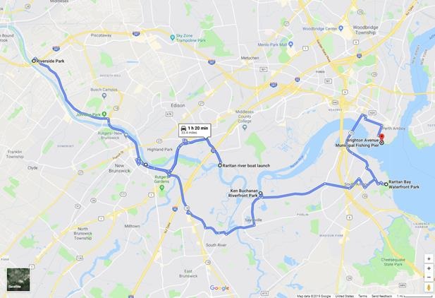
The following are details on our monitoring sites. We will share more information about each location throughout the monitoring period. For more information about the program please contact: info@lowerraritanwatershed.org
LR1
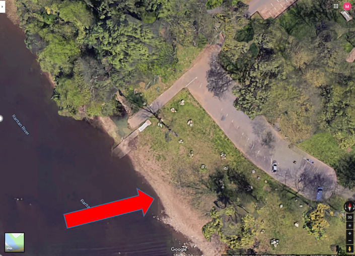
Riverside Park, 430 River Rd, Piscataway
40.54067
-74.51219
Wading site. Waders must be worn. Red arrow indicates the sampling location as this is where fishing has been observed. Access the river to the left of the boat ramp (when facing the river). Do not take the sample from the boat ramp as it is too muddy and slippery.
Bathrooms are available at this site from 10am to 2pm
LR2
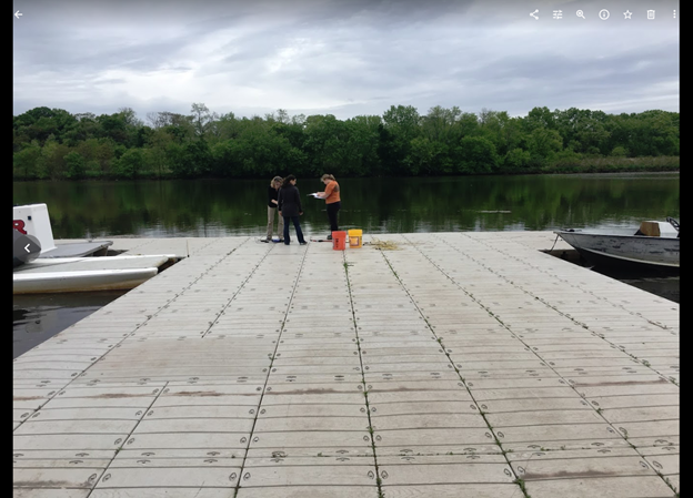
Rutgers Boathouse, 5 Memorial Pkwy, New Brunswick
40.48826
-74.43384
Sampling location is in the middle of the Rutgers boathouse dock as indicated in picture. Bathrooms may be available at the boathouse if they are open and at Boyd Park just west of the boathouse.
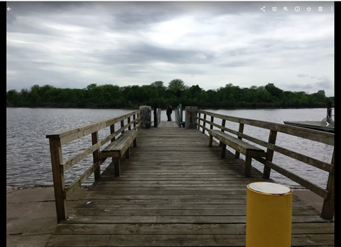
Sampling
location is at the end of the dock. No bathrooms are available at this site.
LR4
Ken Buchanan Riverfront Park River Road, Sayreville, NJ 08872
40.47483
-74.35586
LR5
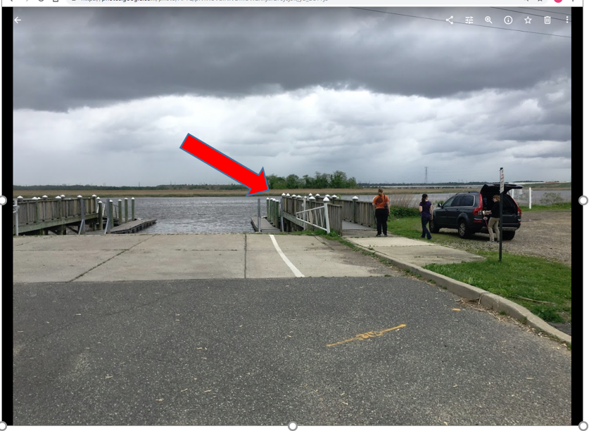
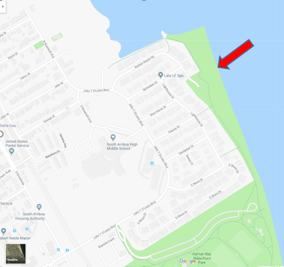
Raritan Bay Waterfront Park 201 John T O’Leary Blvd South Amboy, NJ 08879 *sample off Raritan Reach Road north of park
40.48334
-74.2698
Wading site and waders must be worn. Access the sampling location off the parking lot at the end of Raritan Reach Rd. This is northwest of the park. The site is a beach. No bathrooms available.
LR6
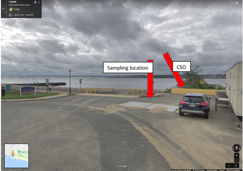
Perth Amboy Waterfront & Future 2nd Street Park 45-93 2nd St, Perth Amboy, NJ 08861
40.50007
-74.27719
This is a wading site and waders must be worn. Sampling location is at the beach next to the combined sewer outfall pipe. No bathrooms are available.
NEEDED!! Volunteer Water Quality Monitors to assist with bacteria monitoring during Summer 2021!
WHAT: In-person training Workshop for Water Quality Sampling and Bacteria Monitoring (English/Spanish)
WHEN: Wednesday May 12, 4-6 PM
WHERE: TBD (either EARTH Center of Middlesex County, 42 Riva Avenue / South Brunswick, NJ OR Riverside Park in Piscataway, registrants will be emailed location information and directions).
WHY: Every Thursday from May 27 through the end of September the Lower Raritan Watershed Partnership and Rutgers Extension / Middlesex County EARTH Center will be in the field taking water samples from five public access (non-bathing, fishing, and recreational) sites along our Raritan River. We need volunteers to help us with this important work!
Volunteers will help project coordinators with sample collection, sample preparation and delivery, and analysis.
Space is limited and registration required. With thanks to The Watershed Institute for grant support to allow for Spanish language translation for this session.
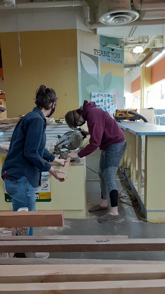
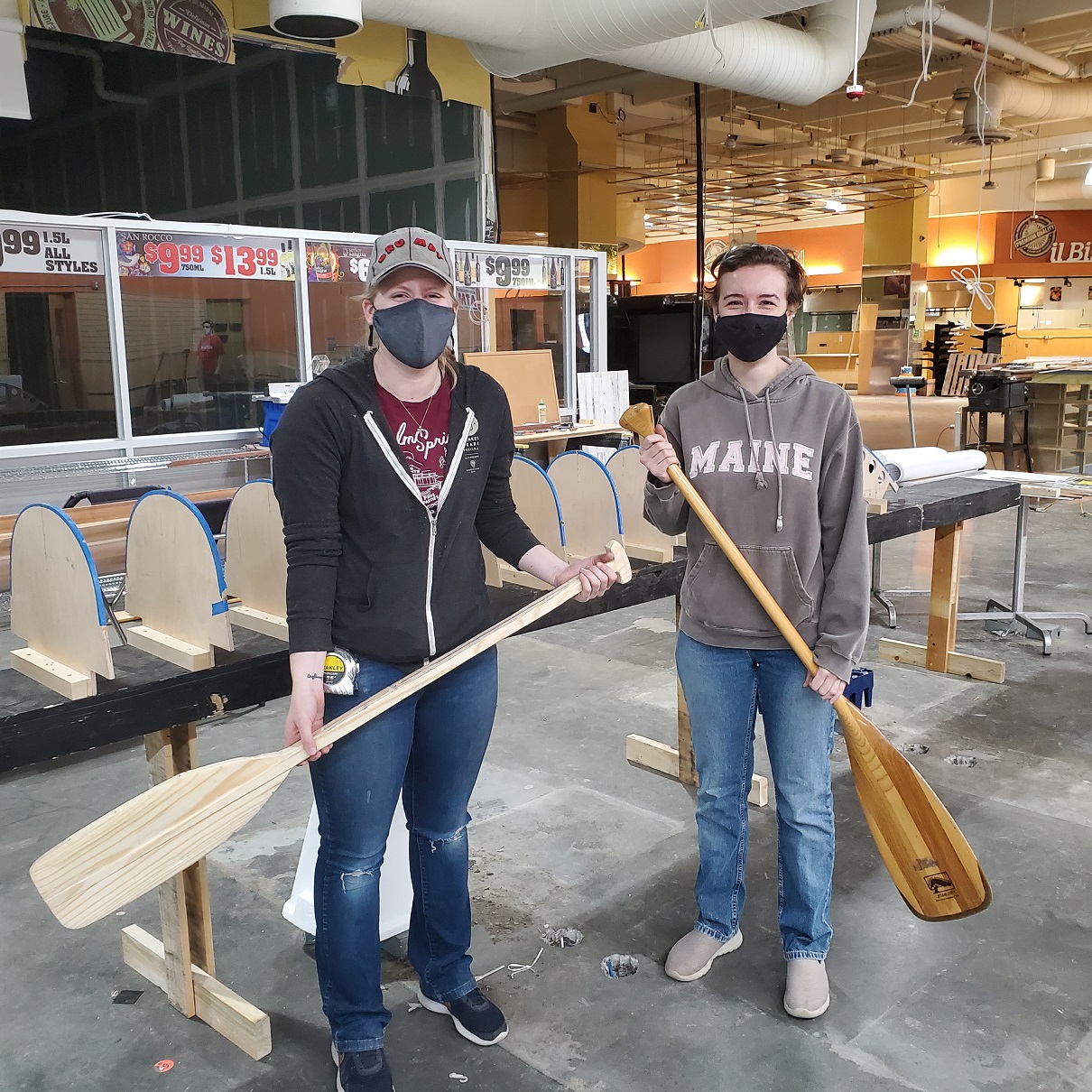
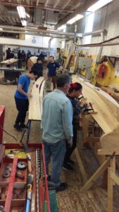
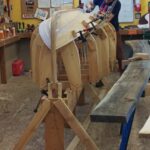
The LRWP has launched a new woodworking class for women, under the guidance of boat build volunteers-turned-instructors Amber Hennes and Sarah Tomasello. Amber gained skills in woodworking through her work in theater design and scenic fabrication across the US. Sarah has taken classes in woodworking, and has been part of our community boat shop boat build since project inception.
Participants are learning several aspects of woodworking, including: preparing and laminating wood for construction; transferring the pattern and cutting the shape; shaping the shaft, grip and blade; sanding; and applying the finish. At the end of the session, participants will have a paddle to take home!
Last Saturday, the second week of the workshop, participants finished gluing and clamping all of the pieces. Everyone’s paddles are now drying on the work benches! The next task is to cut out the basic paddle shape using a jigsaw.
This FREE six-week woodworking class for women ages 13+ will take place at the Community Boat Shop downtown New Brunswick on Saturdays from 11am-12:30pm starting Saturday April 17 and running to Saturday May 22. Participants will learn several aspects of woodworking, including: preparing and laminating wood for construction; transferring the pattern and cutting the shape; shaping the shaft, grip and blade; sanding; and applying the finish. At the end of the session, participants will have a paddle to take home! Please do not sign up if you cannot commit to attending all class sessions. Registration is limited to six (6) participants. First come, first served.
Instructors for this session are Amber Hennes and Sarah Tomasello. Amber gained skills in woodworking through her work in theater design and scenic fabrication across the US. Sarah has taken classes in woodworking, and has been part of our community boat shop boat build since project inception.
Class sessions (registration for the April 17th session will enroll you in the rest of the series):
April 17
April 24
May 1
May 8
May 15
May 22
For more on the Community Boat Build. Many thanks to US Merchant Marine Naval Academy Crew Coach Derek Hartwick for project guidance.
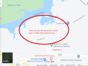
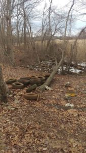
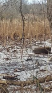
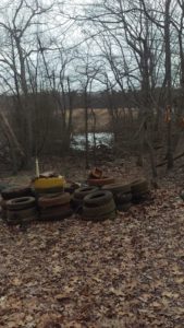
WHAT: A clean-up of the Old Bridge portion of the South River floodplain
WHEN: Sunday March 21, 9am-noon
WHERE: Park at Miller Elementary School / 2 Old Matawan Rd / Old Bridge, NJ 08857, follow signs to the clean-up staging area behind the school
WHO: The LRWP, our Central Jersey Stream Team friends, Middlesex County Division of Parks, and the Township of Old Bridge
WHY: What better way to celebrate the vernal equinox than with a clean-up?!
It is not just tires, there is plenty of other litter in the floodplain – we’ll need folks willing to pick up plastic bottles and cans as well as those who can heave, hoist and lift the larger items.
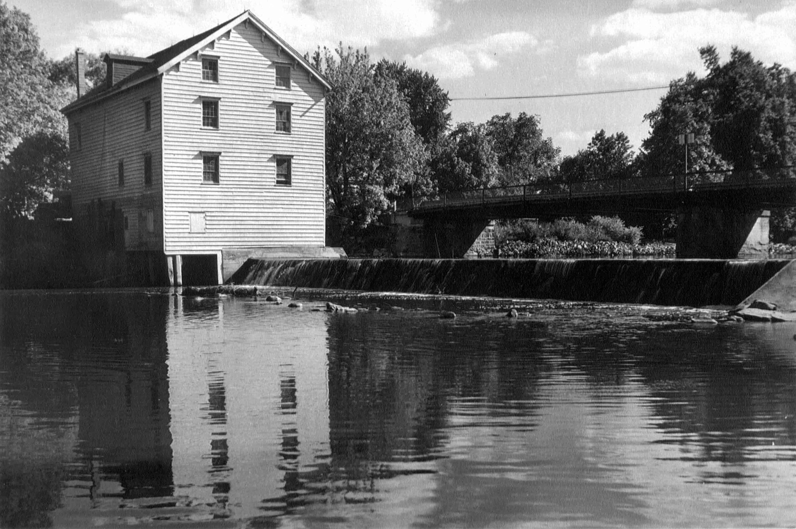
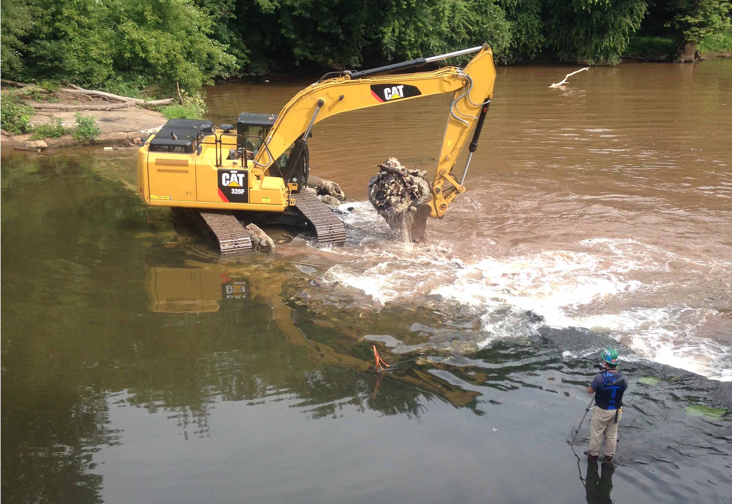
The Weston Mill Dam and the former Weston Mill gristmill and sawmill site are located approximately 1.5 miles upstream of the Millstone River’s confluence with the Raritan River, and immediately downstream of the Weston Causeway (Wilhousky Street) Bridge in the Borough of Manville and the Township of Franklin, Somerset County, New Jersey. The dam crest length was approximately 112.5 feet long and there was a concrete approach apron that ranged in thickness from 5 to 6.75-inches that extended 17.5 to 18.5 feet upriver of the dam spillway. The location of the mill was depicted on early Colonial-era and Revolutionary War military field maps, and the mill and dam were picturesque landmarks that were often photographed by local residents, including images included in the book Franklin Township [NJ] – Images of America, published in 1997.
Weston Mill Post-1948 to Early 1960s, Photographer Unknown
Through an intensive deed search, I determined that a gristmill and dam were established on the east bank of the Millstone River at the project area circa 1747, most probably built by Abraham Brokaw, and the mill was subsequently involved in a Revolutionary “Forage War” skirmish between British and American forces on January 20, 1777 while under the ownership of Abraham Van Nest. Recovery of two cornerstones during 1983 salvage operations suggest major mill building and rebuilding efforts occurred in 1803 and 1844 by John M. Bayard and Isaac R. Cornell, respectively. Though the mill remained active at this site into the early twentieth century (it was the most productive mill in the Millstone River/Stony Brook drainage), under various private owners and incorporations (Weston Mill Company, Inc.; Community Flour Mill and Grain Company; Union Mills Company, Inc.), and the dam underwent significant structural repairs between circa 1922 and circa 1948 by its last owner (Wilbur Smith), it ultimately fell into disuse and disrepair. On May 31, 1982, the mill building partially collapsed into the Millstone River. Mill artifact salvage operations were initiated on June 25, 1983 but were abandoned when arson claimed the collapsed structure on July 7, 1983.
Weston Mill Dam Initial Breach, Photo: Charles Kahler, PE
Weston Mill Initial Breach, Photo: John W. Jengo, PG
When I first began assessing this dam in 2009 as a candidate for removal, the Weston Mill site included the brownstone and concrete foundation remains of a gristmill that had enclosed a turbine room (formerly the water wheel pit) and a tailrace room, and there were associated powertrain components scattered throughout the site, including multiple bevel gears, possible mortise and pin gears, sprocket gears, drive shafts, counter shafts, flat belt pulleys, and other mill-related power-train apparatuses. A concrete coring project conducted in August 2015 at five representative locations on the dam approach apron (the same effort that determined the thickness of the apron) revealed two concrete approach aprons, which suggested that the dam was reinforced or rebuilt with concrete in two different periods in the early- to mid-twentieth century and that this run-of-the-river dam may have been built on top of a timber crib dam of unknown age.
Routine visits to the dam site over the next eight years would indicate that beginning in 2015, the eastern 78 feet of the dam crest (i.e., the top of the spillway) and spillway began to noticeably subside and detach from the concrete approach apron, placing undue stress on the riverward mill foundation wall to the east. By mid-2017, the collapsing dam crest and spillway had subsided almost to the level of the downstream pool elevation, had deflected outward some five feet downriver, and in doing so, the flow of the river was redirected toward the mill ruins on the east bank, potentially causing adverse effects to the mill foundation and complicating the dam removal.
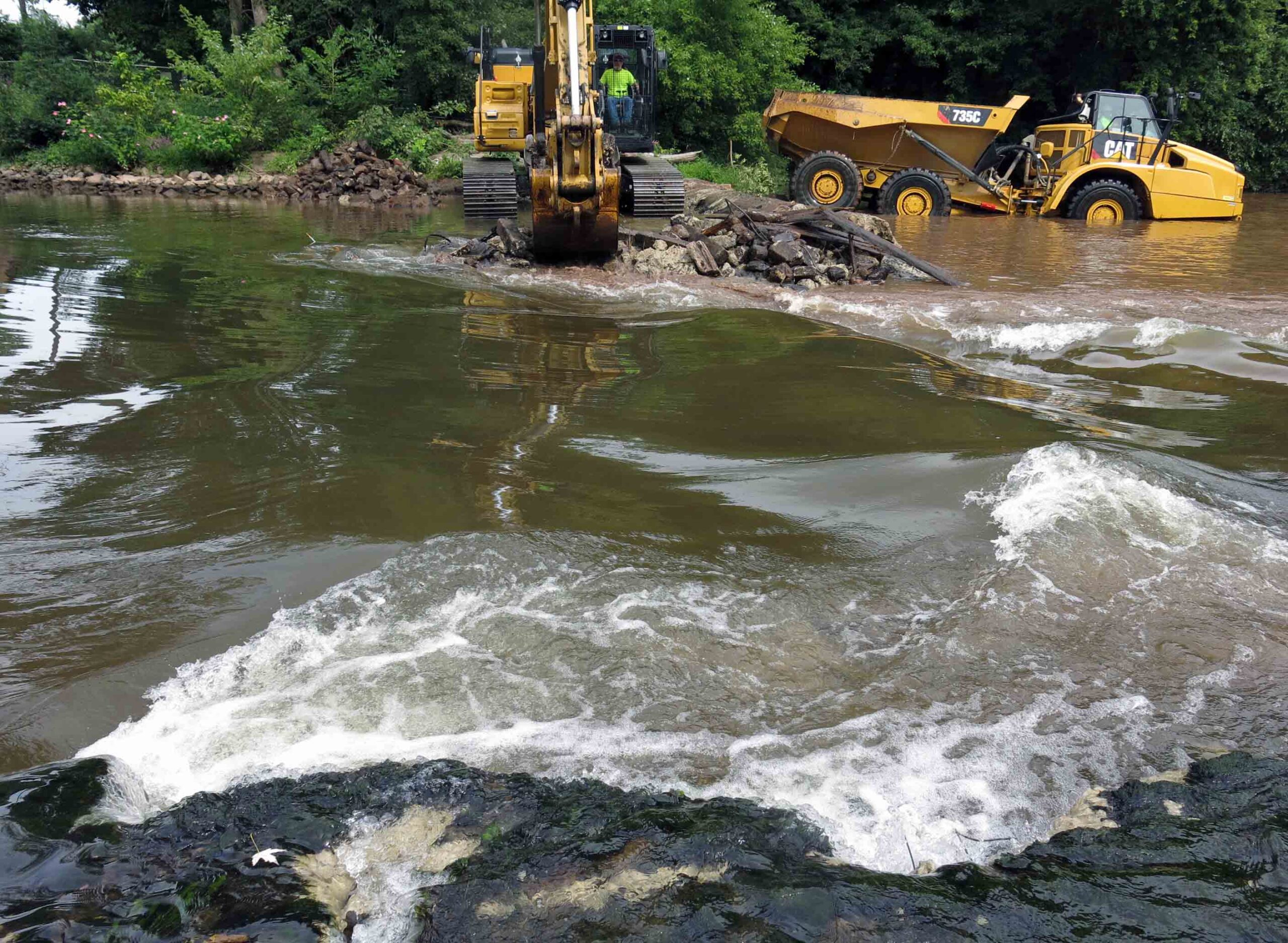
The dam removal and the engineering plans were re-designed to include emplacing scour protection around the Weston Mill foundation walls to arrest the damage to the ruins and preserve the remaining fabric of the site for future study. The first step in the dam removal process, which commenced on August 14, 2017, was to initially breach a portion of the dam to reduce the differential head between the upstream and downstream pools. The initial breach width of 35 feet, located near the center point of the dam, produced the desired upstream pool drawdown and a relatively low current velocity through the breach. Once the upstream impoundment had drained, the contact between the concrete approach apron and the riverward mill foundation wall was accessible to be saw cut to isolate the apron from the mill wall prior to further demolition. This was done to ensure that neither the weight of the demolition excavator or the vibration of the hydraulic hammer would destabilize the riverward foundation wall.
Weston Mill Dam Spillway Removal, Photo: John W. Jengo, PG
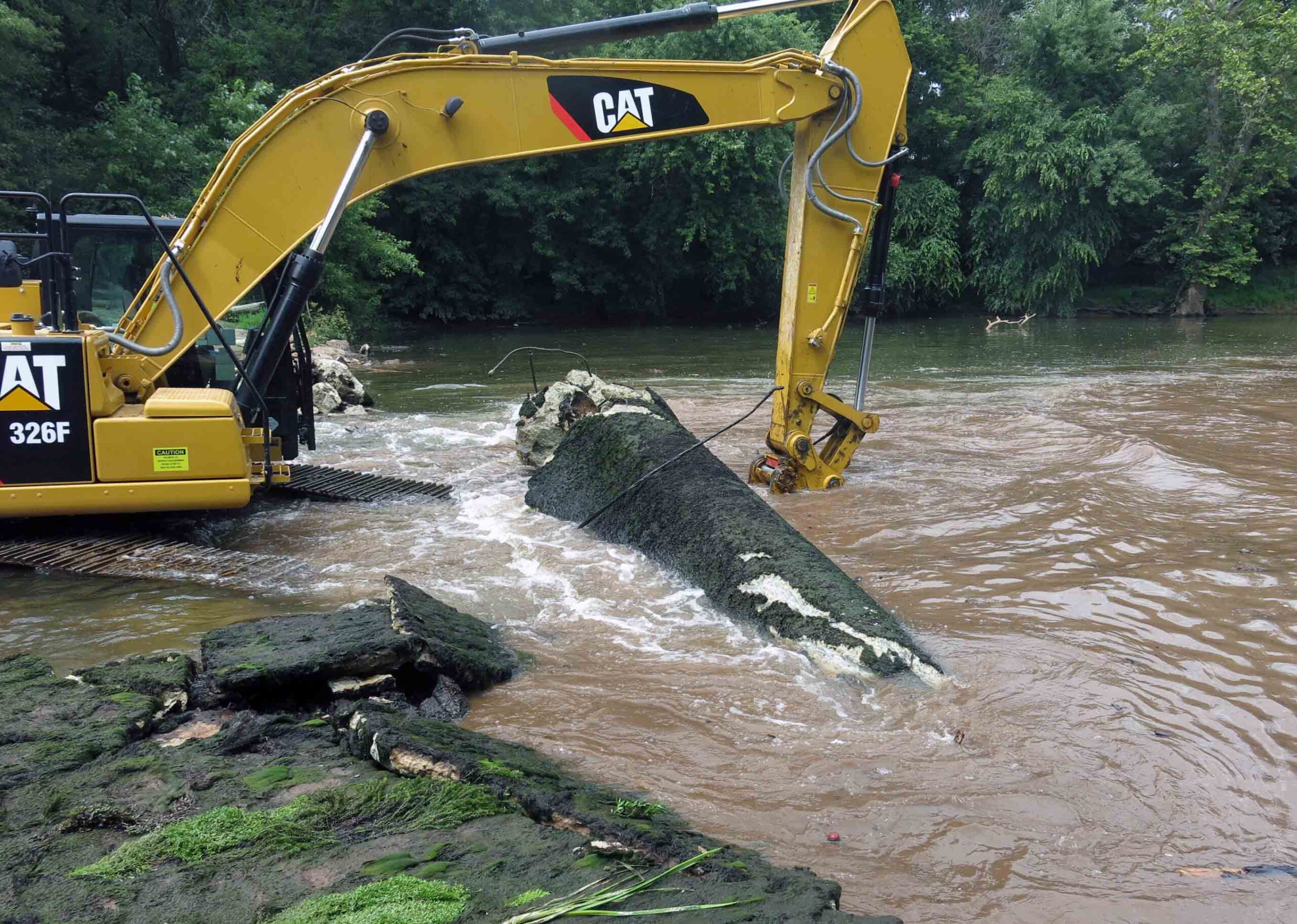
After the saw cut was completed, the concrete approach apron, an underlying concrete sub-apron, and dam spillway were carefully detached and removed. Imported rip rap was then emplaced around the mill foundation walls. My experience working on the rivers of this watershed indicated that natural sedimentation from storm events would eventually blanket and in-fill the rip rap, enhancing the stability of the scour protection armament. Finally, a restored river channel thalweg were excavated and contoured appropriately. It was during these excavations that segments of a timber crib dam, secured to the river bed by using 17.5-inch to 20.5-inch long, 1.125-inch square iron spikes, were extracted that clearly indicated that the pre-concrete dam structure was a timber crib construction. Three primary types of roughly square timbers believed to be part of the timber crib dam were identified: 13-foot long lap jointed foundation logs with iron spikes, 9.25- to 9.75-foot timbers with two mortise joints (some with intact dowels), and 3.8-foot timbers with tenons at one end. Several timbers of this historical structure were saved and donated to the Borough of Manville, Delaware and Raritan Canal State Park, and NJDEP, who had purchased the dam site in 2013 from a private owner, an acquisition that allowed the dam removal to proceed.
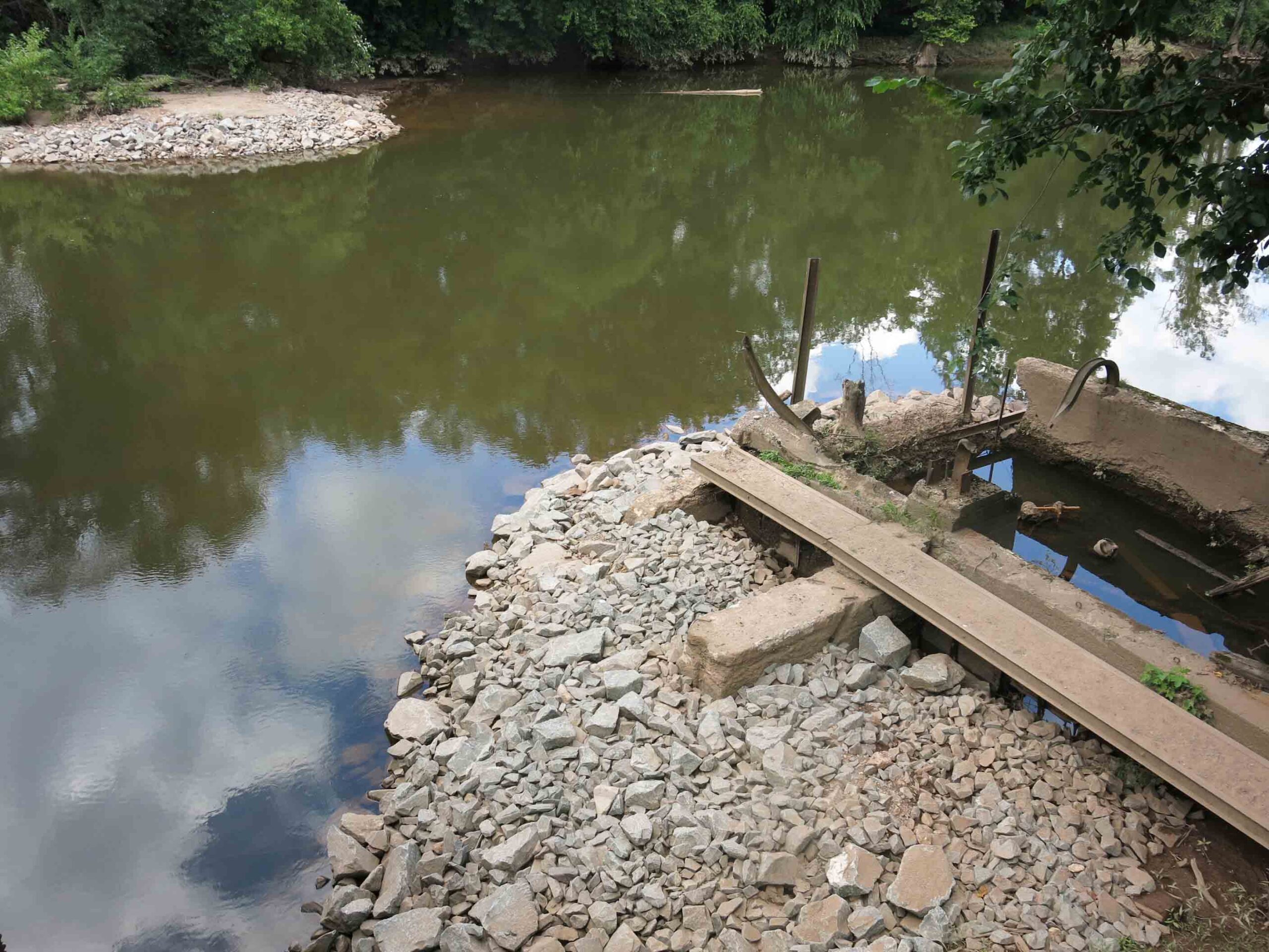
Weston Mill Dam Post Removal, Photo: John W. Jengo, PG
Monitoring of the river reach above the former Weston Mill Dam in spring 2018 following the August 2017 dam removal found definitive evidence of successful American shad spawning, an astonishing and long-awaited result given this river reach had effectively been blocked to migratory fish for over 270 years. Five juvenile shad averaging 4.3 inches in length were found 4.5 miles upstream of the dam at the base of Blackwells Mills Dam during a monitoring visit, highlighting yet again the dam removals can yield near-instantaneous positive results even after centuries of impeding fish migration and spawning.
Video of the Weston Mill Dam removal can be viewed here:
Endnote: Because of the archaeological discoveries made before and during the dam removal, and the rich cultural history of Weston Mill, a standalone video on the History of Weston Mill was developed and can be viewed here:
John W. Jengo, PG, LSRP is a licensed Professional Geologist in several Northeastern and Southeastern states and a Licensed Site Remediation Professional in New Jersey. John works as a Principal Hydrogeologist in an environmental consulting firm in southeastern Pennsylvania. He has degrees in geology from Rutgers University (1980) and the University of Delaware (1982). Over the last 30 years, he has conducted the characterization and remediation of large, complex contaminated industrial sites throughout New Jersey, Pennsylvania, and Delaware. He played a key role in Natural Resource Damage (NRD) assessments that led to groundbreaking legal settlements to remove numerous low head dams on the Raritan and Millstone Rivers to restore historically significant migratory fish spawning runs. As technical project manager, he planned, permitted, and successfully managed the removal of the Calco Dam, the Robert Street Dam, and the Nevius Street Dam between 2008-2013, and the removal of the Weston Mill Dam on the Millstone River in 2017, along with leading the archaeological investigation of the former Weston Mill in the Borough of Manville and Franklin Township.
The LRWP’s new “Rowing on the Raritan Boat Building Project” seeks volunteers to participate in boat-building to provide the inaugural fleet of a community-based rowing program on the Raritan River. The goal is to construct two cedar strip rowing boats during a 90-day building period beginning the week of January 24, 2021. No experience required. Volunteers will have the opportunity to learn through hands-on activities, as well as through live-streaming and recorded instructional sessions.
We are now taking registrations for our “soft” launch the week of January 25. Each time slot is limited to four (4) participants. Boat build activities will take place at 100 Kirkpatrick Street in New Brunswick, NJ (the former Fresh Grocer site across from the New Brunswick train station). Feel free to participate as “observer” – watch our volunteers build the boats via street-level windows.
Requirements for Participation:
Age 14+
No boat-building experience required
Free to register and participate
Participants will be screened at the beginning of each shop session and expected to follow Covid-19 Safety Protocol.
With thanks to Derek Hartwick-Head Rowing Coach- U.S. Merchant Marine Academy, and the New Brunswick Parking Authority for their partnership on this project.