Of the residents of the Lower Raritan Watershed there are many naturalists and individuals with a wealth of knowledge about the special ecosystem we call home. “Voices of the Watershed” is our community blog, a place for watershed residents to document (through photos and posts) stories and observations of the watershed. We regularly feature environmental observations and writing by Joe Mish, Joe Sapia, Margo Persin, Susan Edmunds, Maya Fenyk, Heather Fenyk and others on our site.
Starting in 2020 the LRWP is pleased to include a set of new voices to our “voices of the watershed” contributors. Our new writers are students in Dr. Mary Nucci’s Environmental Communication class at Rutgers. Effective communication about the environment is critical to raising awareness and influencing the public’s response and concern about the environment. The course Environmental Communication (11:374:325), taught by Dr. Mary Nucci of the Department of Human Ecology at Rutgers University, focuses on improving student’s writing and speaking skills while introducing students to using communication as a tool for environmental change. Students not only spend time in class being exposed to content about environmental communication, but also meet with communicators from a range of local environmental organizations to understand the issues they face in communicating about the environment. In 2019, the course applied their knowledge to creating blogs for their “client,” the Lower Raritan Watershed Partnership (LRWP). Under the guidance of LRWP Founder, Dr. Heather Fenyk, students in the course researched topics about water quality and recreation along the Raritan.
Middlesex County Extension Agent Michele Bakacs explains shoreline restoration to our group.
Many thanks to everyone who joined the LRWP and Middlesex County Water Resources Association for a picnic and tour of green infrastructure and detention basins in Middlesex County!
Rutgers County Extension Agent Michele Bakacs and Rutgers Doctoral Student and plant expert Kate Douthat provided guidance as we explored several sites in Middlesex County’s Thompson Park (Monroe Township), a retention basin retrofit site in Monmouth County, and a new rain garden at Spotswood Middle School.
I love math, as it reveals patterns of periodicity which lead to predictability and useful projection of the future and explanation of the past. Even chaos in nature follows mathematical formulas, as explained by Fibonacci’s sequence and the golden rule.
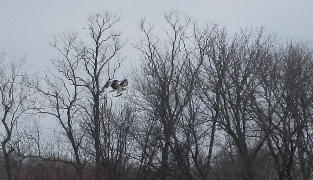
When a simple mathematical formula is applied to the pair of eagles that make their home on the South Branch of the Raritan River, an amazing picture is revealed.
Two times five plus one; Do the math and the answer is, eleven. It is this simple formula, with a single constant and two variables that summarize the efforts of one pair of eagles over a five-year period. It also theoretically predicts their future contribution to the greater eagle population.
The constant, two, is the single pair of eagles that have built and rebuilt their nest at a single riverside location on the South Branch.
Structures on the tongue to help stiffen it.
If any deserve to be called a constant, it is this dedicated pair of eagles. Though, over the years, argument between them has been has been loud and expressive. The larger female revealing her feelings in a series of threatening calls, directed at the male, beg for anthropomorphic interpretation. Dad proudly arrives with a large branch to improve the nest and mom decides its arrangement as if she was changing the furniture around. It is mom that spends the night on the nest. Food deliveries stop at dusk and by morning mom is hungry, needs to take a shower and stretch her wings. If dad is not there at first light, she becomes quite vocal, calling for him to take her place on the nest.
Every once in a while, dad would wander back a little late and get a real tongue lashing. Through the travails of their relationship, they persist as a dedicated pair. Their partnership is undeniable as they attend the needs of their offspring and each other. Both will bring food to the nest and share it with their partner. Though sometimes the fish provided has a few bites taken out.
The next variable, two, is the number of eggs this pair has laid and the number of chicks they have fledged every year for over five years.
To achieve one-hundred percent success on the number of eggs laid to eaglets fledged is quite an accomplishment. Not all eggs remain viable and not all hatched chicks survive. Some may fall out and be fatally injured or attacked by a predator. Of those that do successfully fledge, their fate is tenuous. This is one reason banding eagles can provide some data on survivability. If enough data is collected a statistical projection can be attempted by age group.
Any deviation from ‘two’ in our eagle formula is added or subtracted in the second variable. In this case it is plus one, which represents the fostering of an eaglet from a down stream nest that fell or was forced out by an attacker.
The aluminum band affixed to E82. This year both chicks were male.
Last year a female eaglet, assigned band number E68, was placed in the south branch nest during the scheduled banding session. The adult eagles and their two, six-week-old offspring, accepted the stranger. One can only imagine the endless thought bubbles appearing over each bird’s head to reveal their thoughts and words when two, magically became three. The adults had to work overtime to feed an extra hungry mouth and the established pair had to share the food provided. Consider the eagles at six weeks of age weighed almost seven pounds each.
Doing the math, our eagle pair can live thirty years or more. Subtract their immature years and in theory could produce, plus or minus, fifty offspring. Consider their first nestlings from the 2015 season are approaching maturity and the number of eagles of South Branch origin, keep growing. More impressive, today’s eagles may be seen by our grandchildren along the South Branch or several states away.
A four-year-old immature eagle captured in Quantico Virginia, March 15, 2018 as part of a study, was observed in South Jersey earlier this spring. A square solar panel on its back powers a transmitter and records a plot of its travels. Truly, the skies are the limit, to the world of an eagle and a lesson we might take to heart, literally and figuratively.
By year, this eagle pairs’ offspring have been banded with numbers…… 2015 – E14, E15, 2016 – E43, E44, 2017 – E57, E58, 2018 – E66, E67, E68 and 2019 – E82, E83.
Veterinarian with NJ fish and game endangered and non game species program, Erica Miller draws a blood sample while Kathy Clark assists in the process. Kathy is head of the endangered and non game species program.
Author Joe Mish has been running wild in New Jersey since childhood when he found ways to escape his mother’s watchful eyes. He continues to trek the swamps, rivers and thickets seeking to share, with the residents and visitors, all of the state’s natural beauty hidden within full view. To read more of his writing and view more of his gorgeous photographs visit Winter Bear Rising, his wordpress blog. Joe’s series “Nature on the Raritan, Hidden in Plain View” runs monthly as part of the LRWP “Voices of the Watershed” series. Writing and photos used with permission from the author. Contact jjmish57@msn.com. See more articles and photos at winterbearrising.wordpress.com.
Another magic moment revealed itself in a face to face encounter with a deer fawn enjoying the cool water of the South Branch. The pattern and contrast of spots on the fawn is reminiscent of the firefly spectacle and becomes a walking billboard for the upcoming bioluminescence night show.
This year mid to late June showcased a bumper crop of fireflies or lightning bugs as they are often referred. Who hasn’t seen a lightning bug flitting around their yard? Big deal! Well it is a big deal if you see the intense display of luminescence played out in a grassy pasture surrounded by tall trees on a moonless night.
Beginning just before dark, with a growing intensity, the concentrated fireflies put on a dynamic light show guaranteed to hold your attention until the curtain begins to fall at around 11 pm. Strangely enough the moving flashes of bright yellow light contrast against the black darkness to steal away any perception of depth or relative position. Stare long enough and you might lose your balance. The scale, intensity and contrast of this visual phenomenon does much to anesthetize any thoughts of logic and scientific understanding from creeping in to spoil the moment. The experience is heightened by our primal esteem of fire and light to reflect upon our souls as we surrender to the magical display of luminescence.
Fireflies are the stuff of childhood memories. Many a captive luminary flashed a desperate signal through the clear glass of a Skippy peanut butter jar. Our fascination soon ended with puberty to become an unremarkable footnote in our adult lives.
Read on and you might want to salute every time you see a lightning bug.
Fireflies belong to the family Lampyridae, so even without knowing Latin, the assignment makes sense. It was about 1948 that the luminescence was isolated but unusable until years later when sufficient quantities of the material could be produced. The firefly’s light is created by using a combination of luciferin, an enzyme named luciferase and ATP. Lucifer in Latin can be translated as ‘light giver’. Lucid is a word that means clear and derives from the Latin word for ‘light’. To the uninitiated luciferin sounds like something the devil had a hand in. Amazingly when compared to a misnamed “light bulb” almost all of the lightning bug’s light energy goes to creating light while the “light bulb” is said to produce 10% light and 90% heat.
Typically poisonous plants and animals are brightly colored to warn away potential predators. So it is with lightning bugs that they contain a substance similar to digitalis. Veterinary journals report many exotic lizards kept as pets die each year when owners try to vary the pet’s diet by feeding them lightning bugs
Worldwide there are many species of fireflies. Our local bugs display the luminescence as adults and as larvae. In fact the larvae are predatory and eat earthworms by injecting a mix of enzymes and probably anesthetic into the worm and then sucking out the blended juices. Often referred to as glow worms, firefly larvae will intensify their light when stressed not unlike you turning red in anger or embarrassment.
Female fireflies climb onto tall grasses or shrubs as they cannot fly. All the flashers cavorting in the night sky are the males. When a female finds a flash pattern she likes she signals to the male in similar fashion to ‘come on down’.
Recently with the advent of genomic research and the clinical application of gene therapy, bioluminescence has been recruited to make stunning inroads into medical research. Attaching a bioluminescent gene to a cancer cell allows researchers to follow the progression of cancer cells from the moment they are injected into animal models. Up until now, researchers would have to wait months after inoculating animals with cancer cells to see the manifestation of clinical or laboratory effects. The incubation period for tumor production was a blind spot that has now been revealed with the help of the common firefly. Immediately the distribution of cancer cells can be followed as it spreads through the body and does battle with our rather effective immune system. Immediately the effectiveness of cancer therapies can be tracked and adjusted or changed.
These light producing cells can be attached to bacteria as well in the study of anti-infective drugs. Imagine a visual image of bacteria spreading throughout an animal’s body, injecting medication and seeing immediately the effectiveness of the trial drug and dosage.
Last of all consider the myth surrounding the old favorite Beatles tune, “Lucy in the Sky with Diamonds”. Most Beatle’s fans agree the title of the song came from the Fab Four’s immersion in the psychedelic drug culture. I, however, contend the song was named after watching a mid summer’s spectacle of lightning bugs flashing in the sky like diamonds courtesy of Luci- ferin and Luci-ferase.
Author Joe Mish has been running wild in New Jersey since childhood when he found ways to escape his mother’s watchful eyes. He continues to trek the swamps, rivers and thickets seeking to share, with the residents and visitors, all of the state’s natural beauty hidden within full view. To read more of his writing and view more of his gorgeous photographs visit Winter Bear Rising, his wordpress blog. Joe’s series “Nature on the Raritan, Hidden in Plain View” runs monthly as part of the LRWP “Voices of the Watershed” series. Writing and photos used with permission from the author. Contact jjmish57@msn.com. See more articles and photos at winterbearrising.wordpress.com.
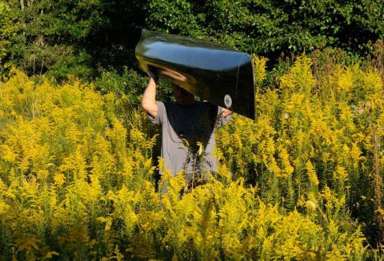
Access to some of the tributaries feeding the North and South Branch of the Raritan River is strictly a trail blazing event. The rewards are worth the effort.
Like a spectacular desert flower that only blooms after a rain, many tributaries of the Raritan river’s North and South Branch suddenly blossom into navigable waterways if only for a brief moment.
These ephemeral watery threads weave though otherwise inaccessible places of pristine beauty and undisturbed wildlife. Visitation is exclusively by invitation of the rain. The chance of appropriate water level matches the odds of winning at roulette. However, the opportunity to enjoy runnable water is increased, as it can occur at any time of the year, unlike many northeast rivers that are seasonally dependent on melting snow and large drainage areas.
One jewel of a stream went a full year before the shadow of my canoe silently passed over its sandy bottom in time with the midsummer freshet racing to the sea. The rarity of such a small stream sojourn increases the value of the experience.
The appearance of an apparition is the best way to describe the transformation of a small tributary into a navigable waterway. Water that lazily followed a convoluted path through a twisting labyrinth of exposed rocks, now flows over them with self-determination. The exposed stream bed is flushed clean of fallen leaves and broken branches while smaller rocks and stones are subtly rearranged into future sand bars and shoals.
For many years I had my eye on a tributary of the South Branch too shallow to run and whose character was totally unknown to me. On these small streams, strainers, trees that span the watercourse from bank to bank can be life threatening, especially in high water with minimal possibility for evasive action. Even on the main course of the North and South branch, strainers have claimed paddlers’ lives.
So, it was with caution that I approached what I considered to be a reasonable water level, after studying the historic stream gauge data. The possibility of another as yet undiscovered eagle nest, was also a consideration in choosing this stream.
While not situated in the wilderness, a solo trip like this, even in central New Jersey, is not to be taken lightly. I checked topo maps as well as aerial views and road maps to confirm my location at any given point.
Though I certainly wasn’t the first to paddle this stream, it sure felt that way. The initial stretch was one of several locations where the water level could be viewed from the road and rarely were the midstream rocks covered with water. Today, however, I floated easily, inches above the largest rocks. Five minutes later I was out of sight, around the first bend and on my way to explore the unknown. A very strange thought to have amid the congestion of central New Jersey; a little kid’s fantasy come to life.
The scenery did not disappoint, hardwood trees dominated the shoreline and formed a wide greenway to serve as a protective margin against runoff from cultivated land and residential properties. The intimacy of the stream’s narrow course bought both banks into view while looking straight ahead.
Bare red shale outcroppings provided a cutaway of the contours seen on the topographic map. Some more dramatic than others.
At the point of highest elevation, through which the stream cut its course, a palisade of red shale stood so high, it felt as if I were paddling through a canyon. Atop the sky scraping cliff stood a wall of giant trees which appeared to be on the same plane as the cliff face. Their combined height and singular appearance could not be taken in with just a tilt of the head and an upward glance. It was as if the trees were standing on the earth’s shoulders in a successful effort to touch the sky.
As is characteristic of these small streams, changes happen quickly and dramatically.
One moment later, the unobstructed view of the blue sky and towering prominence vanished, as a sharp bend in the again green canopied river, demanded my full attention. Here, the main current was rushing to the inside of the almost angular curve and through the branches of a fallen tree. Several forceful draw strokes were required to avoid entanglement.
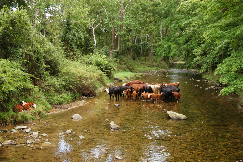
The rest of the trip was easily navigated through a few rock gardens and shoals. Deer were everywhere, while a pair of geese and a few wood ducks provided a downriver escort, warning the world of my otherwise silent approach.
No eagles were to be seen, though a close encounter with a great horned owl made up for the absence of a new eagle nest site. I eagerly await my next rain drenched invitation to another, one of many, tributary paddling options.
Each tributary has its own character, no two alike, other than they share invitation by rain only.
Author Joe Mish has been running wild in New Jersey since childhood when he found ways to escape his mother’s watchful eyes. He continues to trek the swamps, rivers and thickets seeking to share, with the residents and visitors, all of the state’s natural beauty hidden within full view. To read more of his writing and view more of his gorgeous photographs visit Winter Bear Rising, his wordpress blog. Joe’s series “Nature on the Raritan, Hidden in Plain View” runs monthly as part of the LRWP “Voices of the Watershed” series. Writing and photos used with permission from the author. Contact jjmish57@msn.com. See more articles and photos at winterbearrising.wordpress.com.
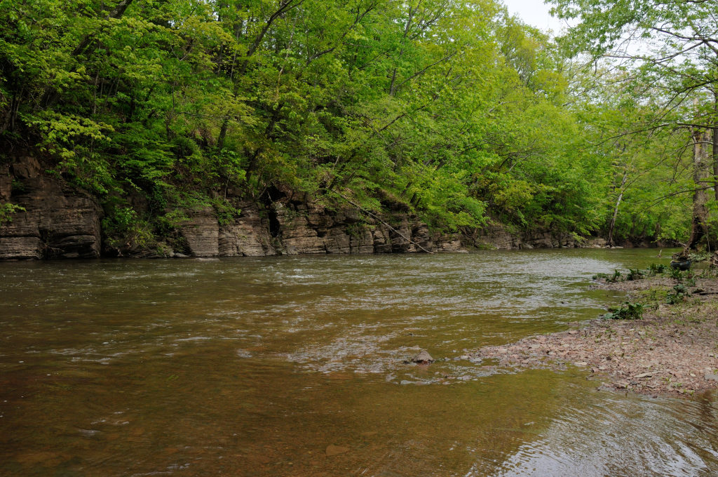
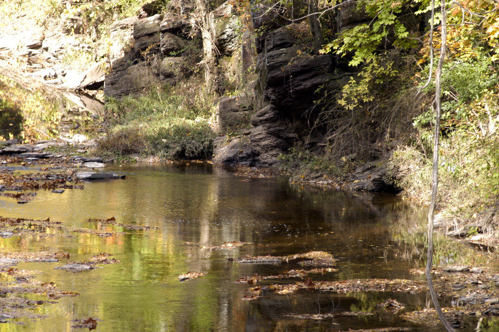
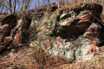
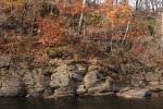
The sentinel red shale cliffs host a garden of moss, wildflowers and lichens as they stand watch over the meandering South Branch. The wandering river has its way after honoring the boundary set by this shale outcrop
The meandering South Branch has changed much of its course over the decades, restrained in its wandering, only by the presence of red shale cliffs that mark its course.
In an area of rolling hills, flood plain and the absence of field stone, the last thing you’d expect to see is a cliff. The cliffs are an exposed edge to the earth’s crust, forced above ground by never ending geologic activity along a fault line.
Growing up along the lower Raritan, there wasn’t a cliff to be seen. So when I ventured upstream in later years, the presence of a cliff was a big deal. It added drama to my paddling adventures. A genuine, bonafide cliff, like the ones you see on TV and in the movies, where heroes hung by their finger tips and from which villains fell to their death.
To top it off, these cliffs are red, well really maroon, which set them apart from any other cliffs, most of which are composed of hard gray stone.
I cannot paddle past one of these outcroppings without looking for some sign of a petroglyph. Shallow carvings made in stone by paleo inhabitants. What paleo hunter/gatherer would not leave some indelible sign on those giant billboards untouched by seasonal floods? Haven’t found any, but still keep looking.
One thing I did find is a shale slab underwater, etched with the name, “J N Stout”, followed by a roman numeral. Stout is a name common to the area of some of the earliest settlers. That inscription still remains a mystery. It would make sense to use that cliff as a boundary marker, even early 20th century deeds listed trees and rocks to mark property lines.
Surely there must be some sign from paleo travelers scratched into those cliffs. Perhaps when the light is right, a shadow of a deer or a turkey will magically appear on that red stone tablet, a testimony to a successful hunt from post glacial times.
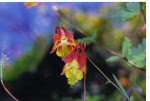
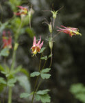
While not finding ancient artifacts of human origin, there are ancient travelers who set down roots in the cliff face. To my amazement, columbine, a native wild flower, flourishes only on the cliffs and flowers in the April/ May timeframe.
Portions of the cliffs, shaded from the sun, will be covered with a carpet of thick, dark green moss and scattered patches of the pale green lichens, to compliment the dark maroon shale.
It was beneath one high shaded cliff, notched with narrow ledges, that I silently walked, searching for photo ops. The cliff on one side and the river on the other, separated only by a few paces, my steps were confined to one narrow trail.
Suddenly, the sound of frantic scrambling in the leaf litter on a small ledge just above, got my full attention. A red fox had been sunning comfortably, protected from the wind and safe from any danger. Now, as it scrambled to escape my presence, it slipped and fell, as leaf litter rained down upon my head. Fortunately, the fox regained solid footing and headed for parts unknown.
The cliffs held another surprise for me as I paddled by on a bright sunny day in the early spring. It was a time when large flocks of geese gathered on the river. In the distance, the river made a sharp bend to the left, directly opposite a high, bare faced shale cliff.
The noise the geese made was deafening, a misrepresentation of the few geese that were visible. The greater mass of the flock was out of sight, downstream of the bend. At first glance, the overwhelming noise, out of proportion to the geese that could be seen, amounted to an auditory hallucination and set the stage for what was yet to come.
As expected, the massive flock exploded into flight as I got closer. The sound was undiminished, though the geese were out of sight, below the river bend.
I suddenly realized I was watching the endless shadows of the geese that I could not see; fly across the face of the cliff.
Because the sound the geese made echoed off the cliff and only the shadows were visible, it appeared the shadows were the source of the sound. The cliff acted as a giant movie screen complete with sound track and shadow puppets in the form of geese.
So, it is with awe and expectation that I look upon the stalwart cliffs as timeless reference points, immovable sentinels that add beauty and dimension to the scenery along the North and South Branch, their tributaries and the upper Raritan River.
Author Joe Mish has been running wild in New Jersey since childhood when he found ways to escape his mother’s watchful eyes. He continues to trek the swamps, rivers and thickets seeking to share, with the residents and visitors, all of the state’s natural beauty hidden within full view. To read more of his writing and view more of his gorgeous photographs visit Winter Bear Rising, his wordpress blog. Joe’s series “Nature on the Raritan, Hidden in Plain View” runs monthly as part of the LRWP “Voices of the Watershed” series. Writing and photos used with permission from the author. Contact jjmish57@msn.com. See more articles and photos at winterbearrising.wordpress.com.
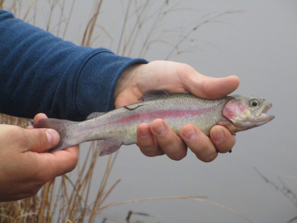
A beautiful rainbow trout at “Jamesburg Lake” in Middlesex County.
TROUT FISHING ‘OPENING DAY’: New Jersey’s trout fishing “Opening Day” was Saturday, April 6. On that day, I surveryed anglers as a state Fish and Wildlife volunteer. I was at “Jamesburg Lake,” properly “Lake Manalapan” on the boundary of Jamesburg and Monroe in Middlesex County. County Parks and Recreation lists the lake as 30 acres, created by the damming of Manalapan Brook. Prior to Opening Day, NJ Fish and Wildlife released 610 rainbow trout, “Oncorhynchus mykiss,” into the lake. I interviewed about 50 anglers, who reported catching 65 rainbow trout of which 49 were kept, 7 released, and 9 unknown if kept or released. The 65 trout ranged in size from about 9 or 10 inches to about 18 inches. Anglers were allowed to keep 6 trout as long as each was 9 or more inches. Fish and Wildlife is to release 450 rainbows during each of the next three weeks. Trout fishing at the lake, which is not traditional trout water of clarity and coolness, should extend to about June. (I also volunteer for Middlesex County Parks and Recreation, so this surveying was a two for the price of one.)
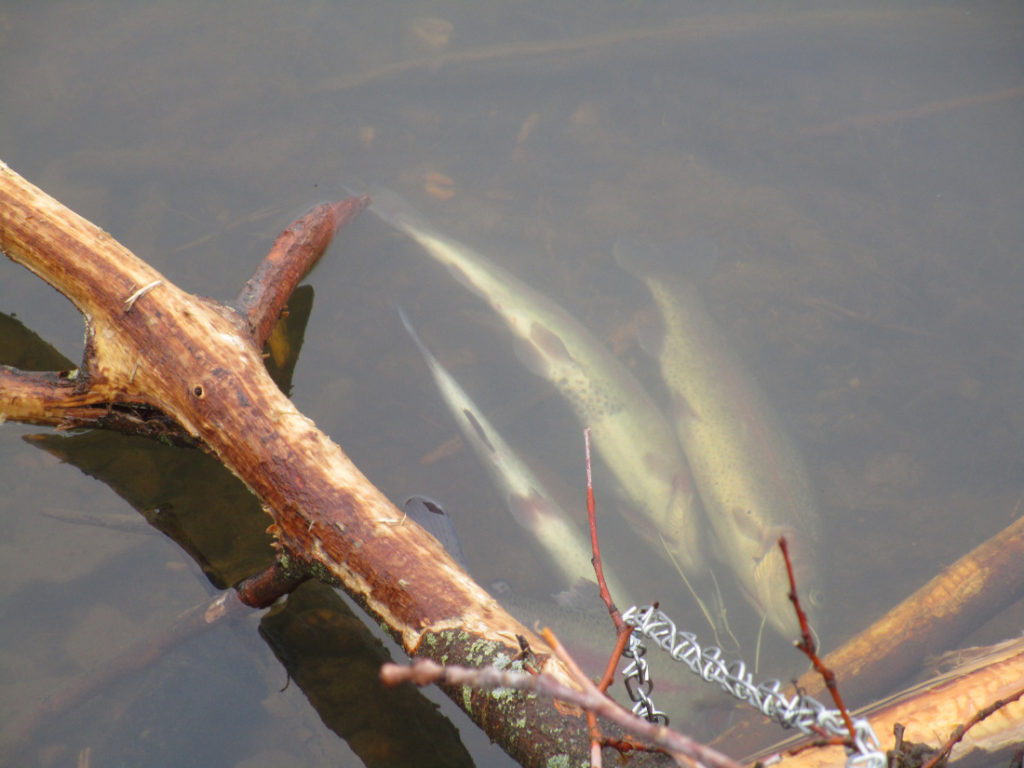
Rainbow trout on a stringer at Jamesburg Lake. Canada geese, “Branta canadensis,” fly behind a osprey, “Pandion haliaetus,” carrying a fish in its mouth.
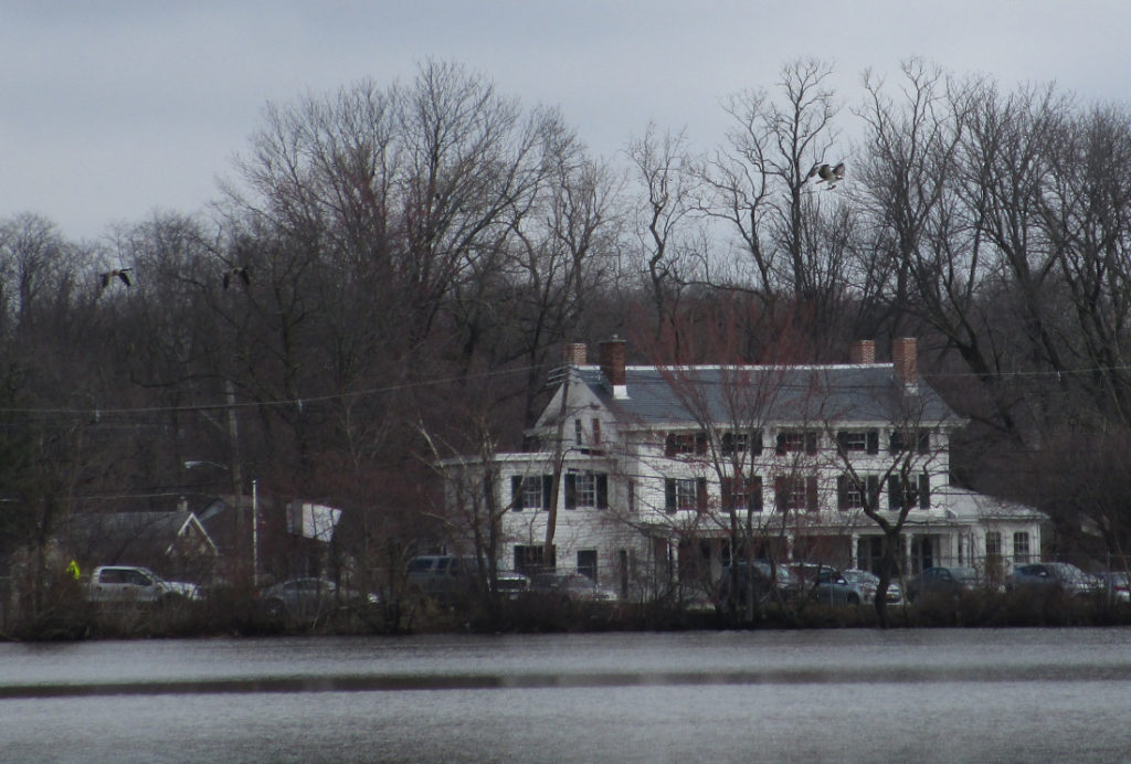
OSPREY: I watched an osprey, “Pandion haliaetus,” crash into Jamesburg Lake and grab a fish in its talons. The fish was likely one of the recently stocked rainbow trout. The osprey flew off, circling the lake, carrying the fish. “Unique among North American raptors for its diet of live fish and ability to dive into water to catch them,” according to Cornell University’s “All About Birds” website. The osprey was “seriously endangered by effects of pesticides in mid-20th century; since DDT and related pesticides were banned in 1972, ospreys have made a good comeback in many parts of North America,” according to the “Audubon, Guide to North American Birds.”
The osprey with the fish — likely a freshly stocked rainbow trout — in its talons. “When flying with prey, an osprey lines up its catch head first for less wind resistance,” according to Cornell University’s “All About Birds” website.
Joe Sapia, 61, is a lifelong resident of Monroe — in South Middlesex County, where his maternal family settled more than 100 years ago. He is a Pine Barrens naturalist and an organic gardener of vegetables and fruit, along with zinnias and roses. He loves the Delaware River north of Trenton and Piedmont, too.
He draws inspiration on the Pine Barrens around Helmetta from his mother, Sophie Onda Sapia, who lived her whole life in these Pines, and his Polish-immigrant grandmother, Annie Poznanski Onda.
He gardens the same backyard plot as did his Grandma Annie and Italian-American father, Joe Sr. Both are inspirations for his food gardening. Ma inspires his rose gardening.
Article and photos by “Voices of the Watershed” Contributor Joe Mish
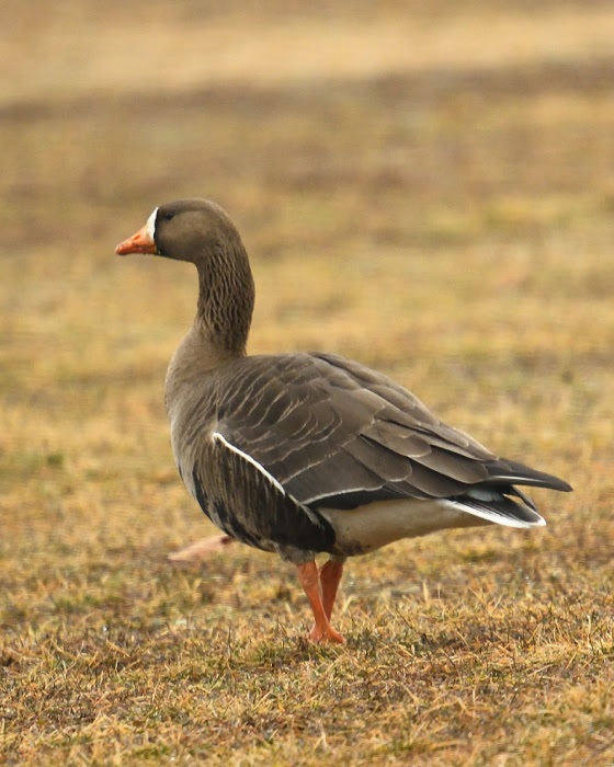
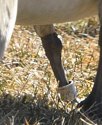
A white fronted goose, rarely seen west of the Mississippi river, enjoys grazing on central New Jersey grass.
Long before President Eisenhower signed the interstate highway bill into law in 1956, The Atlantic, Central and Pacific flyways served as major superhighways for migrating birds.
The primary exit ramps for these super flyways are the rivers which radiate out along the north-south migration routes to distribute the migrating birds far and wide.
New Jersey sits directly on the Atlantic flyway, bounded by the Delaware River and the Atlantic Ocean. Within the state’s interior flows the Raritan River, the longest inland river in the state which serves as a major migratory off ramp.
The confluence of the North and South Branches may then be considered the prime visitors center and rest area, as birds funnel down the Raritan to disperse inland.
Look at a colored distribution map in any bird book and discover that many species are specific to defined regions.
You might not expect to see a rufous hummingbird from the northern Pacific coast, sipping nectar in central New Jersey. However, in 2012, a rufous hummer showed up in our midst and stayed the winter, surviving by the kindness of human intervention. Marlene Scocco reached out to this wayward hummer providing food and shelter, causing a stir in the birding community which gratefully documented this migratory anomaly.
Checking the records for rare hummingbird visitors to New Jersey, other hummer species like the calliope and green violet eared were also documented.
How these birds end up on the east coast is pure speculation. The point is they do and they are here for you to discover.
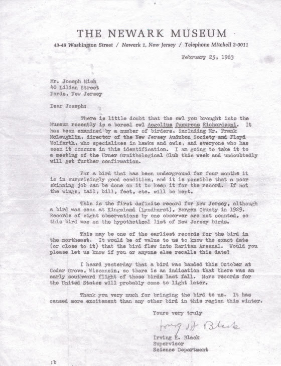
Feathered visitors from faraway places to the Raritan valley are not just limited to hummingbirds. In 1963 I was handed a small owl taken from a guard tower in the Raritan arsenal. It died shortly after. I mentioned this to a friend’s dad who was an avid bird watcher. Told him it was a boreal owl. He smiled and assured me it was probably a saw whet owl. We ended up at the Newark Museum and showed it to the curator, Irving H. Black. Confusion ensued and experts from across the country were consulted. The experts concluded the bird was indeed a boreal owl. It set a new record for the southernmost sighting in the US. The boreal owl, briefly known as the Richardson owl, is a fulltime resident of the coniferous forests of the arctic region. The owl is preserved as a study skin at the Newark museum.
The visitors keep coming. In mid March of this year I noticed an inconsistency in the color pattern of a flock of grazing geese, as I drove by. The geese blended together in one giant mosaic, painted with repetitive splashes of black, white and brown. I pulled over and focused on the colors that didn’t belong.
I was looking at a white fronted goose, another bird that was obviously unfamiliar with distribution maps found in bird books.
The white fronted goose is rarely seen east of the Mississippi river, the main artery of the central flyway. To see a white fronted goose in central NJ is therefore an unexpected surprise and evidence that nature has a tendency to violate scientific generalizations.
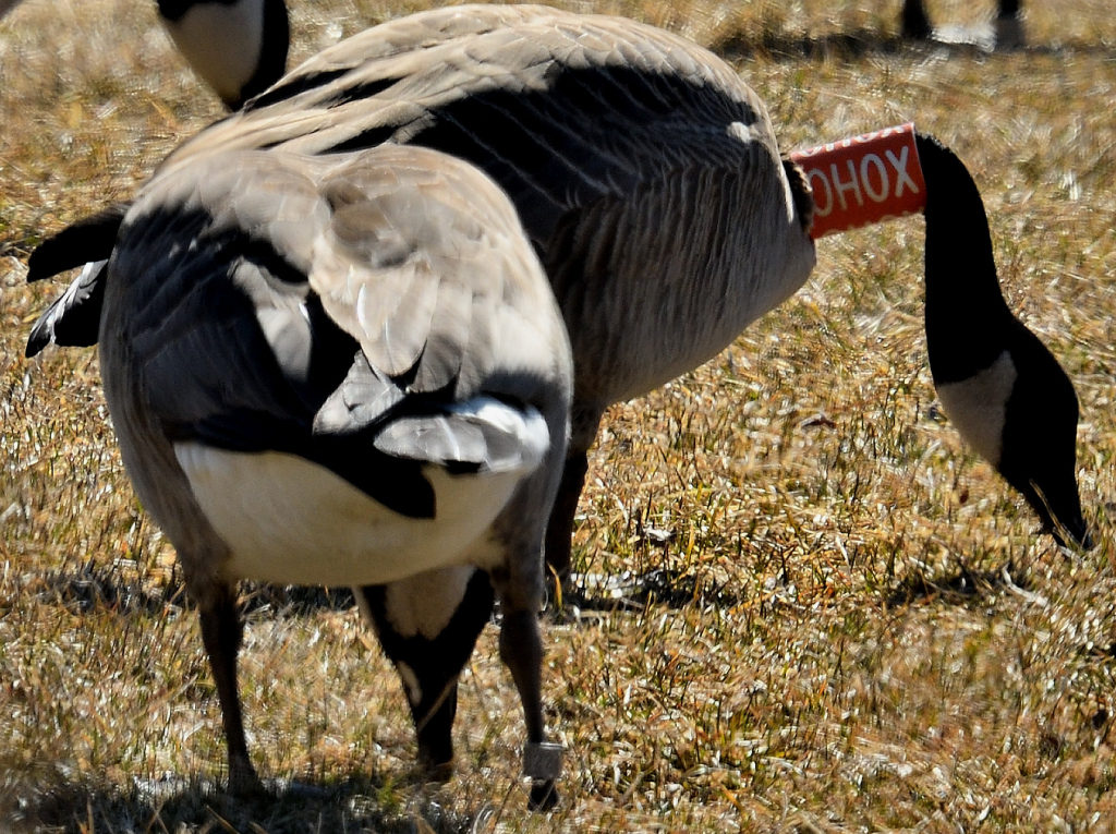
The following week, a Canada goose with an orange and white collar marked OHOX was observed along rt 22. It also had a metal band on its left leg. While editing images, I was shocked to see the goose standing next to it also wore a leg band. Reporting this goose to the USGS bird banding website I was provided with a certificate noting that the goose was a female, banded as a flightless gosling near Varennes, Quebec, Canada on the Fourth of July, 2016.
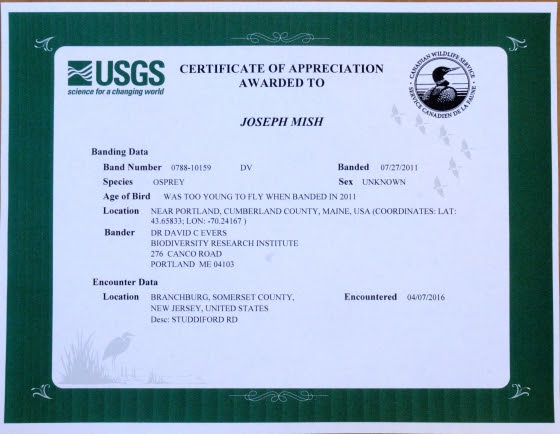
Adding to the distinguished list of local visitors was the osprey I observed April 7, 2016, just upstream of the confluence of the North and South branch. The osprey had a blue plastic band on its left leg, with stacked letters, DV, visible on one of the images taken. Again, making a report to the USGS banding website, a certificate soon arrived, stating the osprey was born on a bulkhead in Portland, Maine and banded on July 27, 2011. To report a banded bird, visit the USGS bird banding website, bandreports@usgs.gov
The spring migration is now in full swing. And along with colorful warblers, ruby throated hummingbirds, woodcock and osprey, come the errant travelers.
Diverging from their evolutionary migration patterns, these intrepid winged visitors explode the myth that, “birds of a feather stick together”.
Migrating birds that nest in our region, along with birds just passing through, are now appearing along our waterways. The confluence that forms the Raritan River is the staging area that hosts a feathered extravaganza of unimaginable variety.
Author Joe Mish has been running wild in New Jersey since childhood when he found ways to escape his mother’s watchful eyes. He continues to trek the swamps, rivers and thickets seeking to share, with the residents and visitors, all of the state’s natural beauty hidden within full view. To read more of his writing and view more of his gorgeous photographs visit Winter Bear Rising, his wordpress blog. Joe’s series “Nature on the Raritan, Hidden in Plain View” runs monthly as part of the LRWP “Voices of the Watershed” series. Writing and photos used with permission from the author. Contact jjmish57@msn.com. See more articles and photos at winterbearrising.wordpress.com.
The LRWP is often asked to identify top environmental issues facing our Central Jersey watershed communities, and every year we develop a “Top 10” list of concerns. Through 2019 we will feature one concern a month on our website, exploring that issue (and potential solutions) in more detail. This month we consider the problems caused by culverting, piping, developing over or otherwise “hiding” our streams, and provide strategies through which we can find them again.
The Lower Raritan Watershed is full of ghost streams. Entrepreneurs, town councils, industry, and home owners have long buried streams to develop their land and businesses, to expand their towns, to build their homes, and to address public health concerns. The result is centuries of piping, culverting, construction, and development that have hidden the vast majority of streams and rivers in our urban landscape.
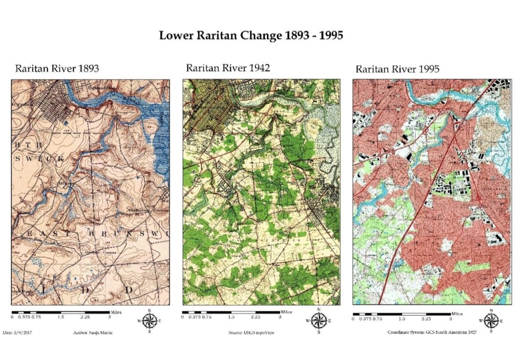
“Lower Raritan Change: 1893-1995” This graphic show gradual encroachment of development and associated disappearance of tributaries to the South River and Raritan River over a period of approximately 100 years. Sanja Martic, 2017.
The impact of “hiding” so many of our streams is devastating. Lower Raritan communities are alienated from our waterways and historic ecologies, habitats are degraded, water quality is compromised, and stormwater runoff and flooding intensify. Not only in the Lower Raritan, but throughout the United States and globally, these impacts are most acutely felt in areas with low socioeconomic status and vulnerable populations. In the face of climate change and increased precipitation and runoff, these communities bear disproportionate risk and adaptive burden.
We know that healthy, open streams play an important role in stormwater management. In a healthy stream, stormwater gets absorbed and gradually released by soil and plants. An open stream not only slows and controls stormwater surge, it also provides habitat for wildlife, and provides the aesthetic benefits of cool spaces and greenery.
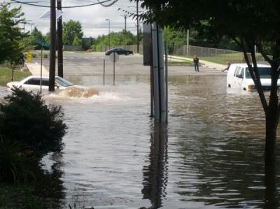
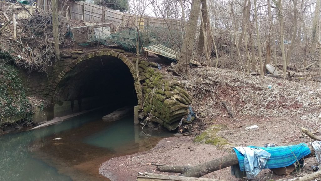
A Stream (Mile Run Brook) Runs Under It Flooding on Joyce Kilmer Avenue at the Mile Run Brook culvert strands students at New Brunswick’s Greater Brunswick Charter SchoolPhoto: Charlie Kratovil, 2016
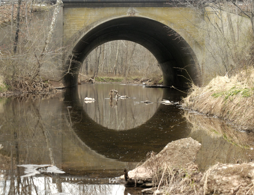
What is a culvert? A culvert is a tunnel carrying a stream or open drain under a road or railroad.Stagnant water in Mile Run Brook under New Brunswick’s Hamilton Street culvert. Photo: Heather Fenyk, 2019
Streams, especially small ones, also play an important role in improving water quality. A healthy stream ecosystem can remove excess nutrients, sediment, and other contaminants from water before it flows into our Rivers, Bays or Oceans. Recent research by the Environmental Protection Agency found that nitrates—nutrients that can become pollutants—travel on average 18 times further in buried urban streams than they do in open streams before they are taken out of the water column. This means that in areas with many buried streams like the Lower Raritan Watershed, larger water bodies including Raritan River and Raritan Bay receive more pollutants than if the waterways upstream were open and healthy and serving to filter pollutants as stormwater runoff travels its course.
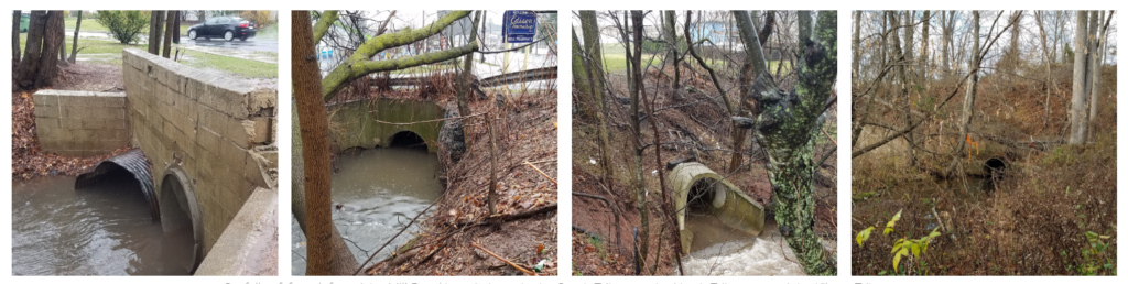
Except for the smallest tributary, all branches of Mill Brook first meet daylight at the end of concrete pipes.Outfalls of, from left to right, Mill Brook’s main branch, the South Tributary, the North Tributary, and the Kilmer Tributary (Highland Park and Edison).These photos are part of Susan Edmunds’s Storymap: “Mill Brook: A Portrait of an Urban Stream”
Of course the best first action with respect to keeping streams healthy is to avoid culverting, piping, constructing over or otherwise developing them. However, in already heavily developed areas like the Lower Raritan Watershed, much damage has already been done. In some of our Lower Raritan towns more than 50% of surfaces are paved over, including all waterways that were in evidence on maps from the 1800s.
Change in time in impervious cover in the Lower Raritan Watershed from 1995-2012
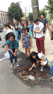
Walk down most any of our main streets and you are likely to “walk on water” without any awareness of what is beneath your feet. If you pay careful attention however, as students did during our 2018 summer camp, you can hear the streams and trace their course, even if you cannot actually see them. Learning about our landscape, and “finding” our hidden streams is the next best action to take in protecting them.
Lazos America Unida/LRWP Summer Camp looks for the buried Lyell’s Brook
Learning to decipher our landscape, and trying to “find” our hidden streams are central to the LRWP’s new #lookfortheriver campaign.
The LRWP is building the #lookfortheriver campaign to bring attention to the problems of “hiding” or disappearing our streams, and to identify ways of finding them again. In addition to teaching folks about the landscape in fun ways, this involves collecting stories by volunteers and contributors who take the time observe and document their area streams, and who highlight the great benefits of landscape connectivity. Joe Mish’s most recent February essay is a great example: Along the South Branch Connected. Margo Persin’s year of blog post’s about Ambrose Brook is another.
#lookfortheriver activities include our newly launched “Watershed Highlights and Hidden Streams: Walking Tours of the Lower Raritan Watershed,” to be led by Rutgers Professor and LRWP Board Member David Tulloch. These walks will look at landscape connections to our waterways and what this means. The series kicks off on Sunday March 16 close to the Rutgers campus, with exploration of the connections between Buell Brook and the Raritan, connecting Johnson Park and the historic Raritan Landing with the Eco Preserve.
#lookfortheriver includes working with volunteers to understand how our landscape works, where it doesn’t, and how to fix the problems we observe. Susan Edmunds’s research into the history of Mill Brook, and her careful study and documentation of the stream (see her online Storymap Mill Brook: A Portrait of an Urban Stream) lends tremendous insight into landscape functions of a relatively forgotten stream. Susan will present on this project in at the Highland Park public library on Sunday March 24. Joining Susan will be Rutgers student Jillian Dorsey, who will highlight findings from her thesis research on Mill Brook that shows how property owners can protect their urban streams. We hope these efforts will further mobilize municipal action to restore local streams, and that they will inspire homeowners in proper maintenance of waterway-adjacent homes. In fact, this work has already inspired the Highland Park Council to partner with the LRWP for a multi-site clean-up of Mill Brook, scheduled for Sunday May 12 – please save the date!
The legacy of development, culverting and piping that has hidden our streams exacerbates flooding and pollution transfer. It has disconnected us from our waterways and from our land. This is disastrous for our communities, but we are learning new ways “find” our streams again and fix these problems. Join us in online to discussions, at meetings, or for our “Hidden Streams Walking Tours”. Or simply start exploring the watershed on your own. Give close attention to landscape cues – the sound of rushing water in a storm sewer, collections of sediment and debris in low lying areas, and dense growth of trees and weeds. In this way we connect to our landscape and waterways, imagine their past, and can begin to plan for a future of “finding” and restoring them.
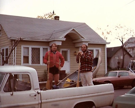
As elated as Lewis and Clark upon reaching the Colombia River, Jimmy and I proudly pose with our intrepid craft , “The Wild Turkey”, in the back of an old Ford Pickup
The eternal waters of the South Branch flow with memories and reflections, kept safe for those who have opened an account along its banks and written their story upon its waters.
I have a longstanding account, opened years ago, from which I make occasional withdrawals. The memories are recalled, polished with reflection and returned for safe keeping.
Hazy events, prompted by a scrap of paper that fell from one of my books, brought a canoe journey made decades before, into sharp focus. The lined, yellow paper, in my handwriting, was a record of time and places noted on a trip down the South Branch to the sea with my good friend Jim Serchio.
Jim worked across the hall from me in the pharmacology department at J&J. Intrigued by my stories of paddling solo to the mouth of the Raritan River; Jim recruited himself to join me on another run to the sea.
A hasty plan was hatched and a day chosen. We would launch from Main st in Clinton and paddle down to Keasbey. I would then walk to ‘Billy Vack’s Loop In’, an old iron workers bar located under the Parkway bridge, phone my brother-in-law, and get a ride in his pickup truck to my parent’s home, about three miles away.
The chosen canoe was my old canvas covered 1910 Old Town OTCA 16 named the “Wild Turkey”. Now stripped of canvas and covered with fiberglass, the hull was painted a flat, dead grass green and weighed in at about 85 pounds.
No cooler, just a couple of blue cushions and two guys in the canoe headed downstream. Jim was brilliant guy, studying biomedical engineering. I suppose it was his scientific inquisitiveness which finally prompted him, once we were underway, to ask, how long would the trip take. In my best carefully calculated estimation, I answered, “pretty much all day, we should be there before dark”.
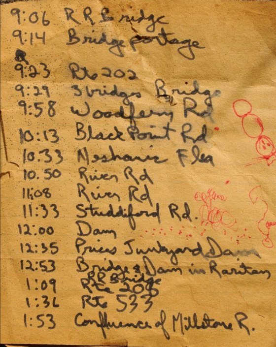
As we passed under interstate 78, just after launching, I noted the time on my scrap of paper. Every time we passed a landmark, clock time was recorded.
Route 202 was reached at 9:23 am.
Looking over the sequence of shorthand notes, I now realize we had paddled under and over landmarks that are now gone or restored differently from their original form. Many of the metal bridges have been reconstructed over the years, their fieldstone supports now replicated by fieldstone veneer. I counted five bridges between Clinton and rt 31. The old dam we portaged below Dart’s mill is now essentially washed away. One bridge downstream of Neshanic station was not yet constructed. The scenery on the same trip today would be quite different.
Route 206 was reached at 1:09 pm
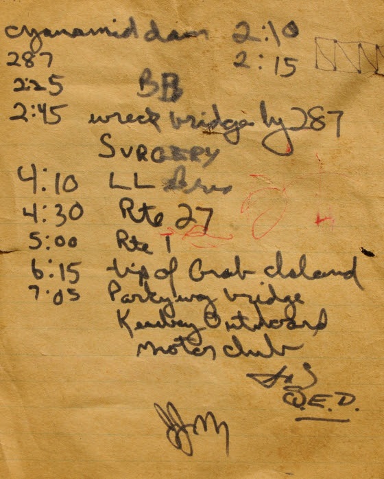
One entry made at 2:45 just before the second downstream pass under interstate 287 makes me smile; I wasn’t smiling then. I recorded the word ‘surgery’.
There was the wreckage of an old wooden bridge just before the last pass under I 287. It blocked our passage so we had to go up and over. As we set the heavy boat down on the rough planks, we did not see a huge spike that punctured the hull below the water line on the starboard side. The situation was looking grim as we were about to enter tide water on the last six hours of the trip. This meant navigating a running tide and staying clear of the main channel to avoid the large wakes churned up by tugboats and deep hulled pleasure craft.
Undaunted, we set the boat back in the water and began down river to see how bad the leak was. It was bad, real bad. How were we possibly going to finish. Pulling to shore, we looked around the debris, left by high tide, for a possible solution. Seeing a piece of yellow polypropylene rope, I had a flash of brilliance. As a kid I loved playing with fire, burning all sort of material including little plastic soldiers. The drops of melting plastic would quickly cool to form rock hard globs and even make a neat hissing sound as it dripped. On a hunch, I took the piece of rope, set it ablaze and dripped the plastic into the large hole in the hull. A perfect watertight fit and we were on our way.
At 4:30 we passed under rt 27, the low water encountered from 287 to Landing Lane Bridge road really slowed our progress. Now we had to deal with the wakes of large watercraft, which showed no mercy to two guys in a canoe. The resultant waves forced us to divert course, turn the bow into the wake and then re-correct to head downriver.
We passed the old drydock across from Crab Island at 6:15 and finally reached our destination under the New Jersey garden state parkway bridge, the former site of the Keasbey Outboard Motor Club, at 7:05pm.
While Jimmy entertained the bystanders, I headed up to Billy Vack’s to call my brother-in-law.
When I returned to the boat and Jimmy, someone asked where we put in. We were actually embarrassed to say, Clinton. We figured they wouldn’t believe us.
Our ride soon arrived and we could finally relax. We did it! Paddled from the NJ highlands to the Mouth of the Raritan river in about 12 hours in a 1910 Old Town canoe pressed into service for an epic journey to the sea.
Jimmy passed away a few years later from a medical procedure gone badly.
I still have the canoe and think fondly of the epic river journey shared with my good buddy Jim. The diary of times and places serves as a reference for memories and the ever changing river landscape.
Two of three pages from the ship’s diary, documents the journey of “The Wild Turkey” and its crew, serves to sharpen the memory of a dash to the sea by two friends in a turn of the century canoe.
Author Joe Mish has been running wild in New Jersey since childhood when he found ways to escape his mother’s watchful eyes. He continues to trek the swamps, rivers and thickets seeking to share, with the residents and visitors, all of the state’s natural beauty hidden within full view. To read more of his writing and view more of his gorgeous photographs visit Winter Bear Rising, his wordpress blog. Joe’s series “Nature on the Raritan, Hidden in Plain View” runs monthly as part of the LRWP “Voices of the Watershed” series. Writing and photos used with permission from the author.
Bear have no need to read signs, much less pronounce the names of obscure creeks, to figure out where they are going. They just put one foot in front of the other and see where it leads.
Two yearling bears curled up to sleep in a jumbled embrace, to form a single pile of pulsating fur, from which random legs protruded.
Upon waking, one bear walked downhill 500 paces to its right, the other 500 paces left, each bear seeking to satisfy its thirst in the nearby streams.
Rested and full of adventure, thirst satisfied, both bears began to follow their respective stream in the direction the water flowed.
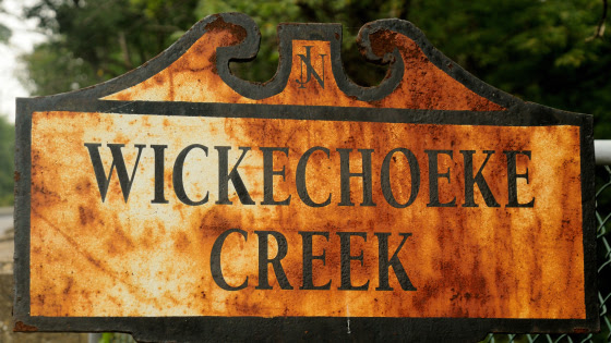
One bear followed Plum Brook to Wickecheoke Creek and ended up on the Delaware River, while its sibling rambled along the Second Neshanic River, to the First Neshanic River, to the Neshanic River, to the South Branch of the Raritan River, to the Raritan River
The two streams, arising from springs, on each side of a common ridge, a mere half mile apart, lead to the state’s opposite coasts. Together the streams form a direct pathway from coast to coast.
We live in a provincial world defined by geopolitical borders, reinforced by the scale of our self-imposed home range. When we travel US route 1 in New Brunswick, we never consider that if we go straight, instead of turning into Chipotle, we end up in Caribou, Maine or the Florida Keys. Same situation as the two bears.
Whether tracing the tracks of a rambling bear down a watery trail to the coast, or a paved highway to opposite ends of the continent, we begin to see a connectivity to distant places. Artificial borders fall away and perspective comes into focus. Taken to the highest resolution, we see that celestial events in the cosmos dictate the requirements and conditions for life on earth.
Adjust the resolution and closer to home we see the Atlantic flyway, a major bird migration route from the arctic to Mexico. Events at either end of the spectrum and along the flyway, can have a dramatic impact on population dynamics of many species.
Preserved lands like the Rachael Carson National Wildlife Refuge in Maine and the Edwin B. Forsythe National Wildlife Refuge in New Jersey are just two of many areas critical to migrating, nesting and overwintering avian activity. Private lands cannot be overlooked and must be appreciated for their valuable contribution outside established state and federal refuges and wildlife management areas.
On a smaller scale, though still expansive, is the critical need for linear greenways in an area broken into isolated segments of habitat.
Many reptiles, amphibians and furbearers are impacted. Isolated populations require a critical amount of genetic variation to remain viable into the future.
Slow moving turtles such as the bog and eastern box turtle are especially threatened. They are now exposed to predators and cars on their journey to lay eggs or migration forced by habitat loss. To celebrate the establishment of isolated patches of open space is misplaced, if a pathway is not considered.
Concerned with isolated habitat and lack of greenways connecting them, the State of NJ, Dept of Environmental Protection, Natural and Historic Resources, Div of Fish and Wildlife, has established a program to examine the impact of isolated habitat and genetic variation. Their program is CHANJ- Connecting Habitat Across New Jersey.
“The goal of this project is to collect DNA samples from a variety of native, terrestrial mammal species across NJ that represents the spectrum of movement capabilities. The genetics analysis will help us understand the impact of landscape fragmentation and road barriers on wildlife mobility.”
I have volunteered to participate and collect tissue samples from roadkill or harvested animals. Please contact me if you spot a fresh roadkill other than deer; jjmish57@msn.com
Far away places exist only in our limited imagination, programmed with a distorted sense of scale. Put one foot in front of the other and see where it leads.
Author Joe Mish has been running wild in New Jersey since childhood when he found ways to escape his mother’s watchful eyes. He continues to trek the swamps, rivers and thickets seeking to share, with the residents and visitors, all of the state’s natural beauty hidden within full view. To read more of his writing and view more of his gorgeous photographs visit Winter Bear Rising, his wordpress blog. Joe’s series “Nature on the Raritan, Hidden in Plain View” runs monthly as part of the LRWP “Voices of the Watershed” series. Writing and photos used with permission from the author.