From its headwaters in the Devil’s Brook Swamp at Monmouth Junction, to its outlet on the Raritan, Lawrence Brook once powered six mills from Deans to New Brunswick. Over the next few months local historian Richard Walling will share his research (including photos and maps) into the history of the Lawrence Brook Mills sites and their relationship to our Raritan River and Lower Raritan Watershed.
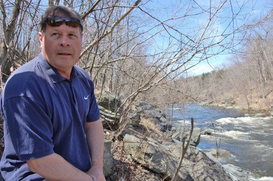
Richard is pictured here at the Farrington Lake step-dam, the site of a mill dating to the 1750s. He writes: “By the way, if the Brits had continued their 1778 withdrawal from Philly towards New Brunswick, what developed as the Battle of Monmouth could have taken place along the Lawrence Brook.“
This is the first in a series about mill sites along the Lawrence Brook.
Let us begin at the beginning: Geologically speaking, the Lawrence Brook generally separates two types of land forms in central NJ: the Piedmont & the Inner Coastal Plain. Brunswick shale is to the north of it, and loam to the south of it. The famed Middlesex County clay district extends westerly along the southern bank of the stream, at least as far west as Farrington Lake. Many of us remember digging gray clay from the shoreline near the broken dam in present-day Bicentennial Park (East Brunswick).
The Lenape called the stream, piskëpekw [-w is a whispered voiceless w], meaning “dark water”. Whether this alluded to the water’s color, to the shadowed waterway caused by steep banks, or even possibly from it’s headwaters at Devil’s Brook Swamp (did the Lenape call Devil’s Brook by the same connotation in their own language?). The land form of a neck, where Rutgers Village is located, was called ramawùnk (Ramawon in English), meaning “under the hill” or “under the bank”. Translations are provided by Lenape linguist, Ray Whritenour.
Native American artifacts are found all along the stream’s course and a path still runs along its eastern portion in the vicinity of Rte. 18 near the NJ Turnpike (Westons Mills). When a parking lot was being constructed on the Cook College campus, a cache of projectile points was found. The high ground at places like von Thun’s farm in South Brunswick, and Rutgers Gardens in New Brunswick once hosted villages. I know many folks who picked up artifacts in East Brunswick along Farrington Lake.
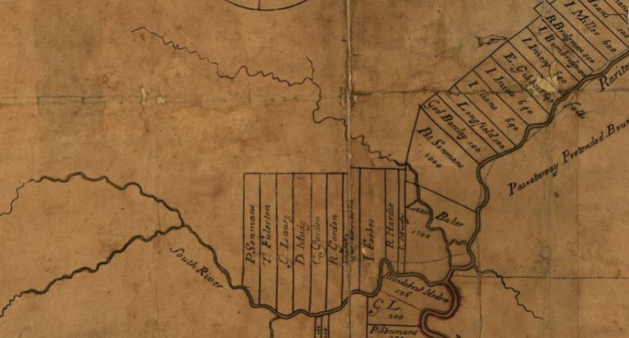
The earliest land transfer was from Native leaders to Thomas Lawrence, The Baker, a NY city merchant. As you can see from the circa 1685 map of the area, his holdings were affirmed by the East Jersey Board of Proprietors.
Map from 1685 showing the Lawrence Brook in relation to the Rariton (sic) River, South River, and land holdings of the time, source: https://www.loc.gov/item/97683564/
CONVEYANCE. Land called Ramawon on the south side of the Raritan River. [East Jersey].
Tract of land called Ramawon bounded by the Raritan and Pisscopeck Rivers.May 1, 1678
TO: Thomas Lawrence (Baker) (of New York; [Lawrence the Baker])
FROM: George Carteret (Sir) (Lord Proprietor); Philip Carteret (Esquire) (Governor of the Province)
PATENT. 1300 acres. South side Raritan River; a creek called PiscopeckIn 1693, the creek, now called Lawrence Creek (Brook), was granted to Peter Sonman, running from near Rocky Hill, all the way to Thomas Lawrence’s grant along the Raritan.
Oct. 20, 1693 TO: Peter Sonmans (Merchant) (of London; Proprietor; Son of Arent Sonmans, deceased, and Frances Sonmans; Brother of Johana Sonmans and Rachell Sonmans)
FROM: Proprietors of the Province of East New Jersey
CONVEYANCE. 38600 acres. Between Milston and Raritan Rivers; beginning at the Partition Line between East and West Jersey; opposite the foot of Rockie Hill; on both sides of Lawrence Creek; to the South River; Middlesex County.
June 7, 1677 Conveyance Record. NOTE: Isarick may have been the father of Wequeheela, who resided in present-day Spotswood.
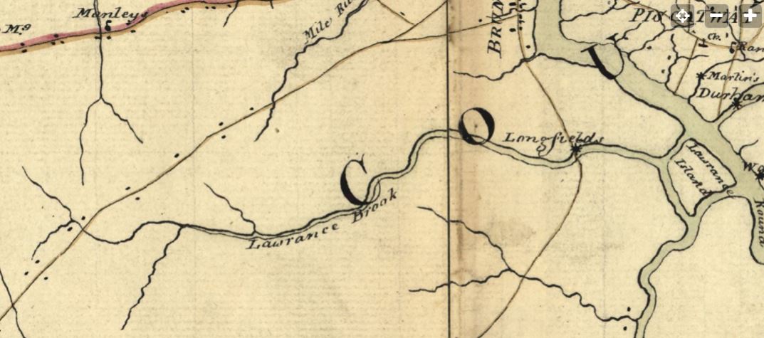
The 1781 map below, drawn by a British Army cartographer, is a general depiction of the stream, and of George’s Road (present-day Rte. 130 in part), George’s Road led from George Rescarrick’s Tavern (circa 1686) in Cranbury to New Brunswick. Below Cranbury, it led to Hightstown, Allentown, Crosswicks and points south. Longfield’s Mill is where Rte. 18 crosses the stream, a stretch known as Westons Mill.
Rich’s next installment will be on the Headwaters of the Lawrence Brook.
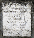
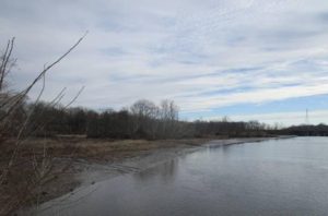
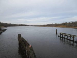
A thin blue line drawn on a map, comes to life in this photograph. A plaque, inset in a concrete bridge spanning the stream, constructed in 1923, a map showing a thin blue line depicting the stream and an image of the stream as it exists today just before it reaches the South Branch.
If all the water that ever flowed from the Raritan River drainage could be measured, its contribution to the depth of the ocean would be impressive. Think of that watershed as a collection agency for world’s oceans.
An aerial view of the Raritan River clearly shows its two main branches, the South Branch, and the North Branch. The South Branch draining more area than the North. The confluence of the North and South branch mark the beginning of the Raritan River.
A closer look reveals the larger tributaries which feed the main branches; Rockaway creek, Black River/ Lamington River and the Neshanic River, all of which are clearly noted on maps.
No less important, are the numerous smaller brooks and creeks whose contribution is significant and whose names may appear only on old maps or engraved on marble plaques set in the structures that bridge their banks; Peter’s brook, Chamber’s brook, Pleasant run, Prescott brook, Assiscong creek, Minneakoning creek, Holland brook and the First, Second and Third Neshanic rivers. Hoopstick, Prescott and Bushkill are lesser known streams, within plain view, that bear no identifying name.
There are dozens more minor streams whose names appear nowhere except on an obscure online list. Each one eventually feeds into the Raritan or its two main branches above their confluence. Knowing someone’s name is a sign of respect. Calling someone by the wrong name can be embarrassing. However, the sign that identifies the North branch of the Raritan as the Raritan River proper, has failed to embarrass those responsible for posting such signs.
Many smaller seeps and springs whose names have been lost to the ages, add to the accumulated flow. Driving along the Lamington, for instance, there are endless watery traces, arising from springs within the woods that empty into larger tributaries. Many are just moist creases worn through the soil over time, which collect rainwater and snow melt to supplement the downstream daily flow.
Maps show nameless springs, which make the cartographer’s final draft, as thin blue lines. Often, a network of converging shorter lines, each with a defined beginning, join to form larger streams like Pleasant run and Holland brook.
These obscure water sources fascinate me simply because their anonymity and remote location arouses curiosity. Their presence also represents a convergence of habitat types that attract birds and wildlife. Though they bear no labels to honor their faithful contribution to the next blue line and ultimate confluence, their importance should not be overlooked.
Many springs which appeared on old maps no longer exist, eliminated by construction of sewer lines or filled in. As maps are revised and generations fade, these streams exist only in a cartographer’s archive.
My appreciation for these disappearing blue lines was heightened when I recently discovered that as a kid, I walked over Slingtail brook every day on the way to school. At some point this little stream was diverted through a sewer line under the pavement. More amazing, even older residents had no memory of that stream whose name has been lost to the ages.
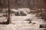
An extended winter freeze, preserving snow from a previous storm, beyond its expected stay, was interrupted by a thaw and heavy rain. The melting snow joined the torrential rain as it flowed over frozen ground to collect in every shallow crease leading to the river. The water’s velocity was enhanced by the decreasing gradient of deep well-worn pathways etched in the earth.
Where water barely trickled most of the year, a proportional biblical flood now ensued.
The banks of the successively larger streams barely contained the accumulation of water delivered from the network of anonymous thin blue lines. Acting as a single entity, the collection agency if you will, the Raritan River drainage, faithfully delivered its contribution of sweet water to the world’s salty oceans.
Cattail brook arises from the convergence of a network of bubbling springs, supplemented by runoff from rain and snow fall. It begins as hardly more than a trickle, directed by gravity, from the south facing ridge of the heavily forested Sourland mountains. The DNA extracted from a drop of water, taken from the deepest canyon in the ocean, would trace its lineage back to cattail brook through its genetic progeny. Cattail gives birth to Rock Brook, a tumultuous and moody stream that joins the more sedate Bedens brook on its way to the Millstone river. The Millstone brings its accumulated genetic material to blend with that of the Raritan to make a final contribution to the earth’s deep blue oceans.
We use our imagination as we await the technology that can trace the oceans DNA back up Cattail brook to show a single drop of morning dew that dripped from a box turtles face, was a critical contribution to the blue ocean we see via satellite images of the earth.
Rock brook derives its character from the influence of gravity which changes its mood from an idyllic mountain brook to a raging torrent.
Author Joe Mish has been running wild in New Jersey since childhood when he found ways to escape his mother’s watchful eyes. He continues to trek the swamps, rivers and thickets seeking to share, with the residents and visitors, all of the state’s natural beauty hidden within full view. To read more of his writing and view more of his gorgeous photographs visit Winter Bear Rising, his wordpress blog. Joe’s series “Nature on the Raritan, Hidden in Plain View” runs monthly as part of the LRWP “Voices of the Watershed” series. Writing and photos used with permission from the author.
Article and photos by Joe Sapia (except where noted)
The Delaware River, iced-over Tuesday, January 2, at Washington Crossing — looking from Mercer County, New Jersey, to Bucks County, Pennsylvania, just upstream of the bridge.
SUB-FREEZING DAYS: After days of sub-freezing cold, how cold was it? Cold enough for a waterway – in this case, the mighty Delaware River — to freeze over.
The frozen-over Delaware River Tuesday, January 2, at Washington Crossing, looking from Pennsylvania to New Jersey.
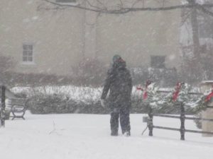
A woman maneuvers Main Street in Cranbury during the Thursday, January 4, snowfall.
SNOWFALL, JANUARY 4: This storm produced a wind-whipped, powdery snow. Snowfall totals reported by National Weather Service:
Burlington County: 3.4 inches at Cinnaminson to 7.5 inches in the Southampton area.
Hunterdon County: 1.9 inches at Readington to 5.8 inches in the Hampton area.
Mercer County: 4.0 inches in the Washington Crossing area to 6.6 inches in the Lawrence area.
Middlesex County: 4.5 inches in the South Brunswick area to 9.6 inches at Cheesequake.
Monmouth County: 9.0 inches at Keyport to 18.0 inches in the West Long Branch area.
Ocean County: 12.5 inches in the Brick area to 18.3 inches in the Berkeley area.
Somerset County: 3.0 inches in the Montgomery area to 5.8 inches in the Franklin area.
(These totals are for these specific stations and may not be complete highs and lows for the counties.)
A snowplow pushes snow on Stockton Avenue in Jamesburg, Middlesex County, in the Thursday, January 4, snowfall.
SNOWFALL FOR THE SEASON: With the January 4 snowfall, my house in Monroe, Middlesex County, has had 16 inches of snow, so far this season. The seasonal average at New Brunswick, Middlesex County, or about 7.5 miles from my house, is 25.8 inches. The January 4 snowfall produced 7 inches at my house.
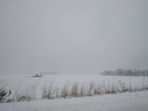
A wind-whipped, snowy field in Monroe, Middlesex County.
WALKING THE SNOWY WOODS: During the Thursday, January 4, storm, I set out from my house about 4:30 p.m., hitting the woods across the street, not wanting to pass up the pristine snowy woods. It was a brief walk, only about 45 minutes from shortly before sunset to shortly after. But I was glad I got to spend a few minutes shooting pictures of nature’s beauty and relaxing in the woods, before shoveling snow. (Weather conditions: Overcast, estimated temperature of 27 degrees, dew point of 5.5 to 6, wind sounding like a freight train.) I got thinking about this short time in the woods. Normally, I do not consider it a hike unless I do at least 3 miles. Perhaps I should re-focus and think about the mental part of the woods and try to get out there daily, even if for only a short time.
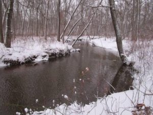
The Old Swimming Hole on Manalapan Brook in Monroe, Middlesex County.
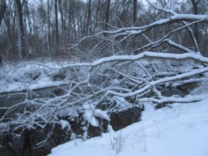
A snow-covered treefall on Manalapan Brook in Monroe, Middlesex County.
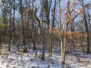
SNOW AND THE LAY OF THE LAND: Take advantage of any snow cover. Where there is no snow cover, the woods presents itself as a homogenous picture of earth tones or green leaves – or both. But add a snow-cover; or, better, snow-cover and snow clinging to vegetation; or better yet, snow-cover, snow clinging to vegetation, and foliage and the depth and roll of the land stand out.
The snow-dusted Pine Barrens around Helmetta, Middlesex County – here, specifically, an East Brunswick section of the Jamesburg Park Conservation Area. With the snow contrasting against the earth tones of the woods, it is easy to see the roll of the land.
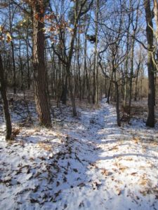
A firecut, plowed by the state Forest Fire Service before a controlled burn here in the Jamesburg Park Conservation Area, is easly seen, along with the rest of the lay of the land, thanks to snow contrasting with the woods’s earth tones.
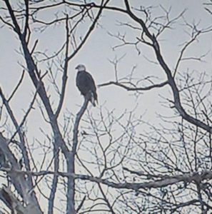
VOICES FROM AFIELD, EAGLE: Patty Byrnes Lang of Monroe, Middlesex County, checked in with photographs of a bald eagle, “Haliaeetus leucocephalus,” she saw on the boundaries of Monroe, Cranbury/Middlesex County, and East Windsor/Mercer County. In New Jersey, bald eagles are “endangered,” or in immediate jeopardy, as breeders and “threatened,” meaning if conditions persist they could become endangered,” in general. Patty described one encounter, “I caught a glimpse of him in one of the trees on the left. We got to watch as he flew off the branch he was on, circled the field, and landed on another tree.” Based on its coloring, this is an adult. It could be one of the adults that had a nest last year nearby, along the Millstone River in Monroe. This is the time of year eagles begin working on nests.
A bald eagle on the boundary of Middlesex and Mercer counties, along the border of Monroe/Middlesex, Cranbury/Middlesex, and East Windsor/Mercer. (Photo copyright 2017 by Patty Byrnes Lang)
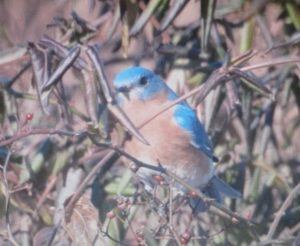
VOICES FROM AFIELD, BLUEBIRD: Bob Kane of Cranbury, Middlesex County, checked in with a photograph of an eastern bluebird, “Sialia sialis,” taken in his town. This one is easily identifiable as a male, because of the bright coloring.
A male eastern bluebird at Cranbury, Middlesex County. (Photo copyright 2018 by Bob Kane)
RANCOCAS CREEK: The Rancocas Creek watershed is 360 square miles. It is the only major waterway that flows into the Delaware River from the Pine Barrens. And, despite being freshwater, has a tidal effect; The Delaware River has a tidal effect on its freshwater as far north as Trenton.
Low tide on Rancocas Creek, looking upstream on the boundary of Mount Laurel, Willingboro, and Westampton, all in Burlington County. Although this is freshwater, there is a tidal effect on the Delaware River and its tributaries as far north as Trenton.
Rancocas Creek, looking downstream at the boundary of Mount Laurel, Willingboro, and Westampton, all Burlington County.
GARDEN WRITING COURSE: This spring, I will be teaching non-fiction writing again at the Princeton Adult School. This time, it will be “Garden Writing,” five sessions on Thursdays, 7 p.m. to 9 p.m., from March 22 to April 26. The class description: “Look at your garden and yard in a different way – through your words. Record your memories in the garden and yard through the essay and vignette. This writing-intensive course has weekly take-home assignments, with the instructor returning critiqued papers. Students will learn writing components, outlining, grammar, style, interviewing, and the importance of resources such as dictionaries and stylebooks – with all assignments focusing on our vegetables, flowers, yards – or afield, if you wish. In-class discussion will cover good examples turned in by students, common problems, and concerns. Feel free to use the class to write a chapter a week of a dream project, work on getting published, keep a journal, or just have fun.” The class costs $99. Enrollment at http://www.ssreg.com/princeton/classes/classes.asp?catID=3679.
ATLANTIC OCEAN TEMPERATURES: The Atlantic Ocean temperature at in New Jersey on the January 6-7 weekend ranged from about 29 to 30 degrees.
WEATHER: The National Weather Service forecasting office serving the Jersey Midlands is at http://www.weather.gov/phi/.
SUNRISE/SUNSET: For Sunday, January 7, to Saturday, January 13, the sun will rise about 7:20 a.m. and set about 4:45 to 4:50 p.m. For Sunday, January 14, to Saturday, January 20, the sun will rise about 7:15 to 7:20 a.m. and set about 4:55 to 5 p.m.
PENNSYLVANIA FARM SHOW: The Pennsylvania Farm Show continues through Saturday, January 13. It is a real-deal show of farming life, not faux farming. So, it has animals, tractors, food preparation, food to buy, gardening displays, and exhibitions. Visitors can get up close to it all. And check out the butter sculpture! (Unfortunately, I will miss the show this year. I had plans to go Wednesday with friends Jimmy and Kathy Krygier of Krygier’s Nursery in South Brunswick, Middlesex County, but work called. I am disappointed, because I look forward to this show.) More information at http://www.farmshow.pa.gov.
COVERING THE WEATHER: During my 31 years as a reporter at the Asbury Park Press, I never saw fellow Metro reporters whine so much about covering something than about weather stories. Me, just the opposite. I loooooooved weather stories. Still do. Was out most of Thursday, January 4, chasing the snow.
Joey on the job, here Tuesday, January 2, photographing the iced-over Delaware River at Washington Crossing, Mercer County.. (Photo copyright 2018 by Pamela B. Roes)
Joe Sapia, 61, is a lifelong resident of Monroe — in South Middlesex County, where his maternal family settled more than 100 years ago. He is a Pine Barrens naturalist and an organic gardener of vegetables and fruit, along with zinnias and roses. He draws inspiration on the Pine Barrens around Helmetta from his mother, Sophie Onda Sapia, who lived her whole life in these Pines, and his Polish-immigrant grandmother, Annie Poznanski Onda. He gardens the same backyard plot as did his Grandma Annie and Italian-American father, Joe Sr. Both are inspirations for his food gardening. Ma inspires his rose gardening. Joe is a semi-retired print journalist of almost 40 years. His work also is at @JosephSapia on Twitter.com, along with Facebook.com on the Jersey Midlands page.
Note: The yard references are to my house in the section of Monroe between Helmetta and Jamesburg in South Middlesex County. My yard is in a Pine Barrens outlier on the Inner Coastal Plain, the soil is loamy, and my neighborhood is on the boundary of Gardening Zones 6b (cooler) and 7a (warmer). Afield references are to the Pine Barrens around Helmetta, unless otherwise noted. Notes and photographs are for the period covered, unless otherwise noted.
Mountain laurel, “Kalmia latifolia,” in bloom in the Pine Barrens around Helmetta, specifically the Jamesburg Park section of East Brunswick, Middlesex County.
MORE MOUNTAIN LAUREL LORE: I have mentioned here before the Pine Barrens lore I had heard, “The snapping turtle lays its eggs when mountain laurel blooms.” Here is some woods lore I just heard, “The deer would give birth around the time mountain laurel blooms.”
If you find a fawn, “Odocoileus virginianus,” seemingly by itself, leave it. Its mother is probably nearby, waiting for you to leave. If you come across a snapper, “Chelydra serpentine,” that needs to be moved from, say, a road, move it to safety in the direction it is traveling. It probably is a female, heading to uplands to lay eggs or returning to water after laying eggs. BE CAREFUL WITH SNAPPERS. More Piney lore, “Only the setting sun or lightning makes a snapping turtle let go.” I move them with a shovel, preferably a big grain shovel. Joey lore, “If a snapping turtle bites and will not let go, shove a wire in its nostril. Or maybe a flashing light will make it let go.”
Wild mountain laurel is virtually impossible to transplant.
Mountain laurel’s scientific name is “Kalmia latifolia.” The genus name comes from Pehr Kalm, a European botanist who worked in the South Jersey area in the 1700s. He published the influential “Travels into North America.” The plant’s species name is Latin for “broad-leaved.”
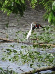
A SHORE GARDEN: On a newspaper reporting freelance story, I was at the home of artist Laura Petrovich-Cheney and her husband, educator and craftsman Peter Cheney, in Asbury Park, Monmouth County. Their property is on Deal Lake. There, a great egret, “Ardea alba”, and red-winged blackbird, “Agelaius phoeniceus,” flew along the lake. Purple martins, “Progne subis,” nest in houses on the property. In the gardens were various flowers in bloom: roses, poppies, daylilies (budding), peonies, yarrow, and trumpet vine honeysuckle. Also in gardens were Tears of Mary, tomato, eggplant, cucumbers, herbs, raspberry bushes, and a fig tree.
“Tears of Mary” plant in the Petrovich-Cheney and Cheney garden in Asbury Park, Monmouth County.
A red-winged blackbird flies past a great egret on Deal Lake at the Cheney and Petrovich-Cheney garden.
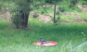
BIRD BATHS IN THE YARD: When my birdbath broke a few years ago, I took the bath part and laid it on the ground. When that had seen its days, I started using a garbage can lid, laying it on the ground. Now, I use large saucers – two in the backyard along the fruit and vegetable garden and one in the front yard. They are used by various animals: bird; squirrel; “Sciurus carolinensis”; and neighborhood cat, maybe even by skunk, “Mephitis mephitis”; chipmunk, “Tamias striatus”; raccoon, “Procyon lotor”; and ground hog, “Marmota monax.”
A blue jay, “Cyanocitta cristata,” in one of my backyard bird baths.
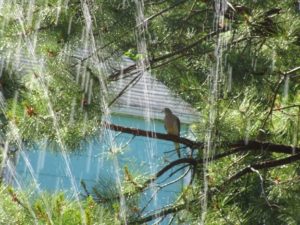
WATERING THE GARDEN: I water the garden before 10 a.m. so as not to lose water to evaporation in the heat of the day and so the garden dries by nightfall, preventing fungal growth. I use two watering methods – one, by sprinkling can if I have enough clean water accumulated (from rain, the cellar de-humidifier, and so on) and, two, by running a sprinkler. Sitting there with a cup of coffee and watching the sprinkler go back and forth is so relaxing. This week, a mourning dove, “Zenaida macroura,” joined me.
A mourning dove perches in a pitch pine – “Pinus rigida,” transplanted to my backyard from a Pine Barrens woods in Monmouth County – and hangs out with me as I watched the sprinkler water the garden.
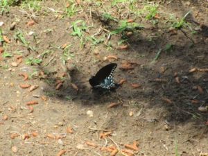
BUTTERFLIES: As I have mentioned before, I am noticing a lot of tiger swallowtails, “Papilio glaucus,” the females black and the males yellow, this year. I usually cannot shoot a good photograph because they do not sit still. This week around my garden, I had a very cooperative female, allowing me to photograph away.
A female tiger swallowtail cruises over my garden.
She rests in the garden.
DELAWARE RIVER AT FIELDSBORO: I was along the Delaware River near Fieldsboro, Burlington County. This is where the river transforms from commercial shipping (here and south) to recreational (here and north). Although the water here is fresh, there is a tidal effect as far north on the river as the area of Trenton, Mercer County.
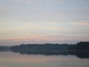
Dawn on the Delaware River, looking toward the area of Fieldsboro, Burlington County.
CLOUDS: Over the last several months, clouds have been spectacular. On the evening of May 31, Wednesday, I was along the Delaware River in the Fieldsboro area. It was clear where I was, but to the north were storm clouds with occasional streaks of lightning. The lightning was too sporadic for me to catch a photograph, but I shot pictures of the storm clouds and sunset. (Tip on photographing lightning: If the lightning is flashing near enough to one another, do not try to catch the flash. Instead, just keep on cranking pictures and hopefully there will be a usable shot of lighting in the batch – and hopefully you were not struck by lightning!)
Man in the cloud blows fire at a jet along the Delaware River.
LIGHTNING: A few years back, a Jersey Shore beachgoer at the Atlantic Ocean in clear weather was struck and killed by “out of the blue lightning” because, despite the clear weather at the beach, a thunderstorm was near enough. So, play it safe. The rule I follow, “If you hear thunder, you can be struck by lightning.” Seek cover.
NIGHT SKY: At dawn, look for the bright “star” in the East – the planet Venus. The Full Rose Moon is Friday, June 9. On Saturday, June 3, I stood on my back porch and looked at the moon, with the planet Jupiter just off it. I find it fascinating I can stand in my yard and look at the wonders of the night sky in the home I grew up in – and followed the USA-Soviet Union “Space Race” in the 1960s. Turn off the outside lights, let your eyes adjust for 20 minutes to 30 minutes, and enjoy a naked-eye view of the Night Sky.
The planet Jupiter aligned with the moon on the night of Saturday, June 3.
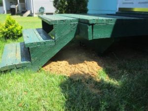
UNDER THE PORCH: After working an overnight shift, I came home to find a pile of dirt under one of my back porches, the one at the Florida room. Enough dirt in the pile to fill a wheelbarrow. I suspect a ground hog. I raked up the dirt and moved it to my garden, where I likely will rake it out in the fall. As for the animal hole, I let it be. Wildlife is welcome in my yard, but I prefer it does not mess with my vegetable-fruit garden.
The work of a ground hog, I presume.
Off to the garden with the dirt. I can always find a use for it.
SUNRISE/SUNSET: For June 4, Sunday, to June 17, Saturday, the sun will rise about 5:30 a.m. and set about 8:25 p.m.
WEATHER: The National Weather Service forecasting station for the area is at http://www.weather.gov/phi/.
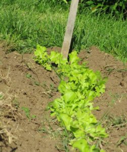
MY GARDEN: I continue with the three Ws – water, weed, and wait. The cool weather plants of lettuce and carrot are growing nicely, but the pea are lame. As for the warm weather plants, cucumber, mushmelon, and sweet corn, along with zinnia, are poking through the ground. No sign yet of tomato. (And I am thinking I may abandon planting tomato from seed. I am considering for next year buying plants and transplanting them into the garden.)
Salad Bowl Lettuce,” by Lake Valley Seed, growing in my garden.
UPCOMING “GARDEN AND AFIELDS”: After I publish a “Notes from Garden and Afield,” I panic, thinking, Will I be able to fill next week’s issue? Then, I realize there is plenty happening afield and in the garden. Alas, because of a scheduling conflict I have, “Notes from Garden and Afield” will not publish June 11. The plan is for it to return June 18. Meanwhile, check out on your own what is happening afield and in the garden.
Mountain laurel, in bloom and about to bloom fully, in Jamesburg Park.
Joe Sapia, 60, is a lifelong Monroe resident. He is a Pine Barrens naturalist and an organic vegetable-fruit gardener.
He gardens the same backyard plot as did his Italian-American father, Joe Sr., and his Polish-immigrant, maternal grandmother, Annie Poznanski Onda. Both are inspirations for his food gardening. Joe is active with the Rutgers University Master Gardeners/Middlesex County program. He draws inspiration on the Pine Barrens around Helmetta from his mother, Sophie Onda Sapia, who lived her whole life in these Pines, and his Grandma Annie. Joe’s work also is at @JosephSapia on Twitter.com, along with Facebook.com on the Jersey Midlands page.
If shadows and footprints were indelible and double exposures across time possible, you might be able to see Henry David Thoreau standing next to Joe on the shore of the Raritan River in New Jersey and the rocky streamside of the Kenduskeag in Maine. Each contemplating the wonder of nature where others might not see anything of value or beauty.
I always lived within sight of where the Raritan flows, the river being a reference point in my life. So embodied in my psyche is the river, that when at the recent 8th Sustainable Raritan River Conference at Rutgers, mention of the words, ‘Raritan River’ by one of the academic speakers felt as if it was me he was talking about. In reality the cumulative agenda was revealing the natural treasures hidden in plain view that I had discovered as a wayward youth and fondled as an adult through a newspaper column and photos.
The Raritan River basin drains about 1,100 square miles of New Jersey. The main Raritan River and bay is the summation of the North and South branches and their tributaries. I hunted ducks and trapped muskrats on the tidal creeks in season and for the rest of the year roamed the area exploring its history, geology, flora and fauna.
My interest in local nature only grew, as the gravitational pull of curiosity generated by this region’s unique natural diversity, drew me deeper into science and fostered an appreciation of its inherent beauty.
Years later I moved up river along the South Branch, fascinated by the thought of the river system as a watery highway. I paddled throughout the year and twice to Raritan Bay.
Eventually the South Branch became a training venue for the Kenduskeag Stream Canoe Race in Bangor Maine. Starting in January each year I would paddle an 11 mile stretch of river several times a week to get in shape for the 16.5 mile canoe race in Maine, which is held in mid April. I ran that race for 20 years, 18 straight years without interruption. Who knew this connection held a significant piece of a puzzle I didn’t know I was putting together.
At some point along the way, when doing research on the Raritan, I came across a history of Perth Amboy, a town located at the mouth of the Raritan River. Its list of astounding historic firsts also included a who’s who of famous visitors; Henry David Thoreau’s name was casually noted. That was very interesting, though just an isolated bit of information.
It was when I began to participate in the Maine canoe race that a coincidence hit me like a lightning bolt. Thoreau’s name came up again, this time linked to the Kenduskeag Stream and Bangor. The lights started to flash, Perth Amboy and Bangor, two river towns prominent in my life.
For those who don’t know, David Henry Thoreau, better known as Henry David Thoreau, or HDT, by his followers, is relevant today for his writings, diaries and environmental awareness. Among his best known works are ‘Walden’, ‘Civil Disobedience’, ‘Walking’ and ‘The Maine Woods’. An abolitionist and anarchist closely associated with Ralph Waldo Emerson, Louisa May Alcott and a lesser known association with Marcus Spring and Eagleswood.
Eagleswood was a utopian society established in Perth Amboy and the focus of Thoreau’s month long visit to New Jersey in October through November 1856. The visit was facilitated by Louisa May Alcott’s father, Bronson Alcott. Thoreau was hired to lecture the Eagleswood society and do a land survey.
I began to research Thoreau, Eagleswood and the Bangor Connection as I seemed to be a kindred spirit of Thoreau, as assessed by some that know me.
If footprints and shadows were indelible, HDT and I would have been physically bumping into each other. I wasn’t following in Henry’s footsteps as much as I was crossing them.
There is a great article by, Wayne Dilts, a New Jersey resident and member of the Thoreau Society who describes Thoreau’s NJ visit. Wayne’s article is found in the Thoreau Reader and titled, “Thoreau’s New Jersey Connection”; http://thoreau.eserver.org/jersey.html
Reviewing other sources for Henry’s actual diary entries for October 25th through mid November 1856 I discovered Thoreau had wandered about 2 miles west of Eagleswood, which placed him directly in the wilds I once roamed.
“Nov 2nd – Took a walk 2 miles W of Eagleswood – the quercus palustris or pin oak, very common there…”
Thoreau goes on to describe the plants, soil and topography he observed. One entry that really hits home are his words; “I see apparently the sea side goldenrod lingering still by the Raritan River”
This entry stunned me.
Here was a revered philosopher and man of nature, who transcended Walden Pond and Massachusetts to be embraced by the world and relevant for more than a century and a half to the environmental movement, said the magic word, “Raritan River”. This was the first time I experienced what I described earlier at the Sustainable River Conference, an independent discovery of our natural treasures hidden in plain view. My secret world exposed a century and half ago and still viable today.
A further look into the Thoreau, Bangor and Kenduskeag connection, bought more surprises and mingling of footsteps and shadows.
Bangor was at the edge of civilization in Maine and served at the trailhead for Thoreau’s Maine Journey to Mount Katadin via the Penobscot River with his Indian guide, Joe. Thoreau was later to say Joe was one of just a couple of people he most admired.
Thoreau also had cousins in Maine who were friends of the Pratt family. One document I read, and cannot now find as a reference, mentioned Henry and his cousin being invited to dinner at the Pratts.
As it turns out, it was the Pratt family in Bangor who hosted me each April during the Kenduskeag stream canoe race. The connection between the Pratt families in Bangor, then and now, seems to have been lost, but the parallel experiences of two out of state visitors in Bangor are wild coincidence.
“…….the impetus for Thoreau’s interest in Bangor and the northern Maine woods were his cousins Rebecca Jane Billings and Mary Ann Thoreau Billings, and aunt Nancy (Thoreau) Billings, who lived in the Queen City.”
The shore along the lower Kenduskeag, where it empties into the Penobscot River in Bangor, also marks the finish line of the canoe race. Coincidentally there are two mandatory portages around the old flour mill dam and a natural ledge which forces racers to carry their boats along the same path Henry walked.
“During his travails to Bangor, Thoreau often hiked along the Kenduskeag Stream and noted the plant and flower life along its shores.”
Henry’s last word as he died on May 6th 1862 was ‘moose’. Coincidentally my last word as I left Maine, after an unsuccessful month long archery moose hunt, was ‘moose!’, followed closely by the guttural inflection, ‘grr’. I waited more than thirty years to get drawn in the Maine moose lottery and went home with a consolation prize of 15 pounds of moose meat from a sympathetic donor, knowing full well that was my last breath of a chance at a Maine moose.
As I was finally completing this article, which had been simmering for more than two years, a hummingbird, the first one I had seen this season, flew up to the window, where I sat and stared at me for several seconds before flying off. I took that as a sign Henry was nearby and impressed by the coincidence of our footsteps and shadows.
Author Joe Mish has been running wild in New Jersey since childhood when he found ways to escape his mother’s watchful eyes. He continues to trek the swamps, rivers and thickets seeking to share, with the residents and visitors, all of the state’s natural beauty hidden within full view. To read more of his writing and view more of his gorgeous photographs visit Winter Bear Rising, his wordpress blog. Joe’s series “Nature on the Raritan, Hidden in Plain View” runs monthly as part of the LRWP “Voices of the Watershed” series. Writing and photos used with permission from the author.
As Timmy Mechkowski and I walked in back of Helmetta Pond, we came across a patch of Lycopodium.
“Look at all that ground pine,” I said. “It must like it just a little bit wet.”
The ground pine brought memories of his late mother, Catherine “Kay” Holsten Mechkowski. She used to make Christmas wreaths, using running ground pine as the foundation; common ground pine, as we were seeing on this day, to fill in the wreath.
Timmy Mechkowski and ground pine
“Every now and then, she would find holly (in the woods) and poke them in,” Timmy said.
On this day a year ago, between Christmas and the calendar changing from 2014 to 2015, Timmy and I walked afield in the Pine Barrens around Helmetta, where we grew up. As one year turns to another, we may reflect on the general past or our reflections could turn afield, here, to a time when there was less development and, in turn, more open space.
“Many years ago, I used to know these woods,” Timmy said.
Helmetta’s Timmy Mechkowski
Although Timmy, 54-years-old, lives adjacent to field, water, and woods, just as he did as a child, and works the land – in his case, gardening and cutting firewood on his property – he no longer ventures deep into the woods.
“I couldn’t even tell you,” said Timmy, speaking of the last time he explored the woods. “I was a kid, 17-, 18-years-old, had to be.”
So, on this day, Timmy and I hiked the woods.
We started about noon and walked counter-clockwise to places that locals would recognize, more so if they knew the woods, less so if they did not: the Ditch, Helmetta Pond, the Dance Pavilion, Jamesburg Park, Baron’s or Swing Hill (basically, the same place, but my mother’s generation knowing it by the former, those younger than me calling it the latter), Snuffy Hollow, the Pipeline, Cranberry Bog.
Not only do places afield have local names, but things in the woods, too, have names.
“What do they call that, a widow-maker?” Timmy said.
A massive widow-maker! An estimated 15-feet-or-longer part of a tree hung up 20 to 25 feet or so off the ground.
The typical view of Helmetta Pond is from the side of the former George W. Helme Snuff Mill, or from Helmetta looking toward the woods. Today, we had the other view, from the woods toward the Snuff Mill.
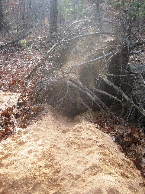
Nearby, a large oak had toppled thanks to the wind of Superstorm Sandy in October 2012. Its flipped root pan and clinging soil measured about 10-feet-tall, or well above Timmy’s approximately 5 feet, 8 inches.
Timmy Mechkowski in front of a tree uprooted, thanks to October 2012’sSuperstorm Sandy. The root pan is about 10-feet-tall
“Now, what is this, mountain laurel?” Timmy said.
“Yeah,” I replied.
“I know some things,” he joked.
Actually, Timmy knows a lot, a fine mix of his maternal and paternal farming roots and his town upbringing. By trade, a mechanic. One of my first picks if I had to choose a team to live off the grid.
A coating of ice on a small pond near Helmetta Boulevard, which slices through the woods, was evidence of the day’s temperature of about 32 degrees.
Invasive phragmites grew in the swamps on both sides of Helmetta Boulevard. Yet, not far away, one was in a classic Pine Barrens uplands ecosystem of oak and pitch pine.
“Another pristine area,” I said. “This is beautiful, right here.”
Where the Dance Pavilion stood about 100 years ago – apparently the idea being to bring people out for a good-time night in the woods to sell them lots here – we could still find remnants.
“This is pretty cool,” I said, “you could still see them, the steps,” leading to where the pavilion stood on the top of a small hill.
Here, in the Pine Barrens around Helmetta, there is a quick mix of nature and humans, some old, a lot current.
As we bushwhacked with Jamesburg Park behind us and Swing Hill ahead, swamp to our left, high ground to our right, a nearby path of white sand was hidden by the woods’s vegetation.
“You couldn’t even see the path a few feet away,” I said.
In the Swing Hill-Snuffy Hollow area, there was evidence of how this area of the woods is more accessible to the outside world: a stream washed out because of off-road vehicle riding and garbage dumped. But this walk was wrapping up, anyway.
On our walk, we passed swamp, uplands mixed with oak and pine, swamp hardwood forest and Atlantic white cedar swamp, sphagnum bog, a stand of baby pitch pines and invasive white pine, and what apparently was a coyote den, sometime the hum of the New Jersey Turnpike, only a mile or so away, in the background.
Coyote den under the roots of an uprooted tree
The woods is a funky place, a place to gather Mother Nature’s bounty. This Christmas, I did not get around to gathering materials for a wreath. Mrs. Mechkowski’s wreath is different than mine, which I make using pine boughs and inserting winterberry.
To next Christmas and, hopefully, a wreath. We are moving that way as another year has gone by.
On the way home, we saw winterberry, what I use for a wreath, and holly, what Mrs. Mechkowski used. For now, the outdoors is still here, but changing, too….
Winterberry at Cranberry Bog
Joe Sapia, 59-years-old, grew up in and lives in the Pine Barrens around Helmetta, where his family has resided for more than 100 years. He can be reached at Snufftin@aol.com or at P.O. Box 275, Helmetta, 08828.