The Lawrence Brook and its Mills: Introduction
Author: Richard Walling

From its headwaters in the Devil’s Brook Swamp at Monmouth Junction, to its outlet on the Raritan, Lawrence Brook once powered six mills from Deans to New Brunswick. Over the next few months local historian Richard Walling will share his research (including photos and maps) into the history of the Lawrence Brook Mills sites and their relationship to our Raritan River and Lower Raritan Watershed.
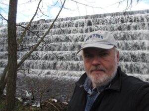
Richard is pictured here at the Farrington Lake step-dam, the site of a mill dating to the 1750s. He writes: “By the way, if the Brits had continued their 1778 withdrawal from Philly towards New Brunswick, what developed as the Battle of Monmouth could have taken place along the Lawrence Brook.“
This is the first in a series about mill sites along the Lawrence Brook.
Let us begin at the beginning: Geologically speaking, the Lawrence Brook generally separates two types of land forms in central NJ: the Piedmont & the Inner Coastal Plain. Brunswick shale is to the north of it, and loam to the south of it. The famed Middlesex County clay district extends westerly along the southern bank of the stream, at least as far west as Farrington Lake. Many of us remember digging gray clay from the shoreline near the broken dam in present-day Bicentennial Park (East Brunswick).
The Lenape called the stream, piskëpekw [-w is a whispered voiceless w], meaning “dark water”. Whether this alluded to the water’s color, to the shadowed waterway caused by steep banks, or even possibly from it’s headwaters at Devil’s Brook Swamp (did the Lenape call Devil’s Brook by the same connotation in their own language?). The land form of a neck, where Rutgers Village is located, was called ramawùnk (Ramawon in English), meaning “under the hill” or “under the bank”. Translations are provided by Lenape linguist, Ray Whritenour.
Native American artifacts are found all along the stream’s course and a path still runs along its eastern portion in the vicinity of Rte. 18 near the NJ Turnpike (Westons Mills). When a parking lot was being constructed on the Cook College campus, a cache of projectile points was found. The high ground at places like von Thun’s farm in South Brunswick, and Rutgers Gardens in New Brunswick once hosted villages. I know many folks who picked up artifacts in East Brunswick along Farrington Lake.
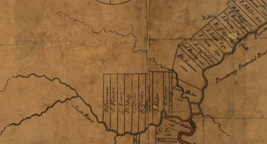
The earliest land transfer was from Native leaders to Thomas Lawrence, The Baker, a NY city merchant. As you can see from the circa 1685 map of the area, his holdings were affirmed by the East Jersey Board of Proprietors.

Early East Jersey Proprietary Period
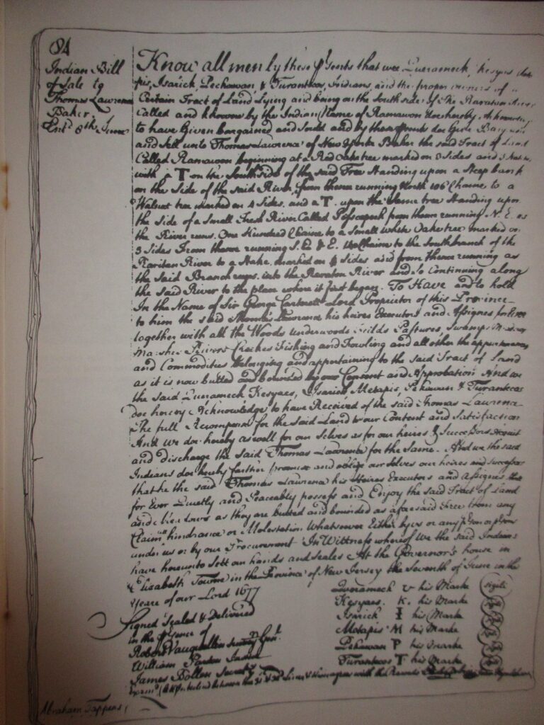
June 7, 1677 Conveyance Record (see copy below).
TO: Thomas Lawrence (Baker) (of New York)
FROM: Indians; Isarick; Kesyaes; Metapis; Pehawan; Queramacke; Turantecos
CONVEYANCE. Land called Ramawon on the south side of the Raritan River. [East Jersey].
Tract of land called Ramawon bounded by the Raritan and Pisscopeck Rivers.May 1, 1678
TO: Thomas Lawrence (Baker) (of New York; [Lawrence the Baker])
FROM: George Carteret (Sir) (Lord Proprietor); Philip Carteret (Esquire) (Governor of the Province)
PATENT. 1300 acres. South side Raritan River; a creek called PiscopeckIn 1693, the creek, now called Lawrence Creek (Brook), was granted to Peter Sonman, running from near Rocky Hill, all the way to Thomas Lawrence’s grant along the Raritan.
Oct. 20, 1693 TO: Peter Sonmans (Merchant) (of London; Proprietor; Son of Arent Sonmans, deceased, and Frances Sonmans; Brother of Johana Sonmans and Rachell Sonmans)
FROM: Proprietors of the Province of East New Jersey
CONVEYANCE. 38600 acres. Between Milston and Raritan Rivers; beginning at the Partition Line between East and West Jersey; opposite the foot of Rockie Hill; on both sides of Lawrence Creek; to the South River; Middlesex County.

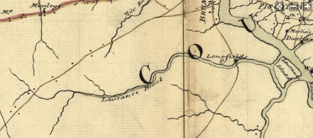
The 1781 map below, drawn by a British Army cartographer, is a general depiction of the stream, and of George’s Road (present-day Rte. 130 in part), George’s Road led from George Rescarrick’s Tavern (circa 1686) in Cranbury to New Brunswick. Below Cranbury, it led to Hightstown, Allentown, Crosswicks and points south. Longfield’s Mill is where Rte. 18 crosses the stream, a stretch known as Westons Mill.

Rich’s next installment will be on the Headwaters of the Lawrence Brook.
