Science writer Cheryl Lyn Dybas features the Raritan River and the dam removal work of Hydrogeologist John Jengo in her article “Birds Follow Flyways, Fish Navigate Swimways” published this week in the journal BioScience. Ms. Dybas also highlights research by Rutgers biologists Olaf Jensen and Anthony Vastano, who track the impact of dam removal on local fish populations in the Raritan, and cites additional research by Rutgers ecologist Julie Lockwood who is using eDNA (environmental DNA) to monitor the comeback of river herring and American shad in the Raritan. Cool stuff!
Ms. Dybas’ piece provides a fascinating global perspective on habitat connectivity, and contextualizes our local-to-the Raritan dam removal and fish passage efforts in a larger movement to save migratory fish species (World Fish Migration Day is May 21, 2022). We are so grateful for her attention and reporting on this work!
Please join us Saturday, August 14th for a three hour tour of the Headgates, Robert Street and Nevius Street dams. This tour will be led by the very wonderful and informative hydrogeologist John Jengo, PG, LRSP. The tour will include discussion of past and future dam removals, and will be a chance to see the scale of the dams so that downstream removals can be understood in context.
We will kick things off promptly at 8:30 am at Headgates Dam, followed by the Robert Street and Nevius Street dams. We estimate the trip will be approximately 3 hours. We will be walking along the river banks to see these sites, so plan on wearing appropriate footwear. For those interested, we can also visit the Weston Mill Dam site at the end of the day, which can be viewed from the Weston Causeway Bridge.
The LRWP is grateful to John Jengo for offering this opportunity. Registration is limited to 18 people. Directions and parking information will be sent to registrants in advance of the event.
ABOUT JOHN W. JENGO, PG, LSRP: John is a licensed Professional Geologist in several Northeastern and Southeastern states and a Licensed Site Remediation Professional in New Jersey. John works as a Principal Hydrogeologist in an environmental consulting firm in southeastern Pennsylvania. He has degrees in geology from Rutgers University (1980) and the University of Delaware (1982). Over the last 30 years, he has conducted the characterization and remediation of large, complex contaminated industrial sites throughout New Jersey, Pennsylvania, and Delaware. He played a key role in Natural Resource Damage (NRD) assessments that led to groundbreaking legal settlements to remove numerous low head dams on the Raritan and Millstone Rivers to restore historically significant migratory fish spawning runs. As technical project manager, he planned, permitted, and successfully managed the removal of the Calco Dam, the Robert Street Dam, and the Nevius Street Dam between 2008-2013, and the removal of the Weston Mill Dam on the Millstone River in 2017, along with leading the archaeological investigation of the former Weston Mill in the Borough of Manville and Franklin Township.
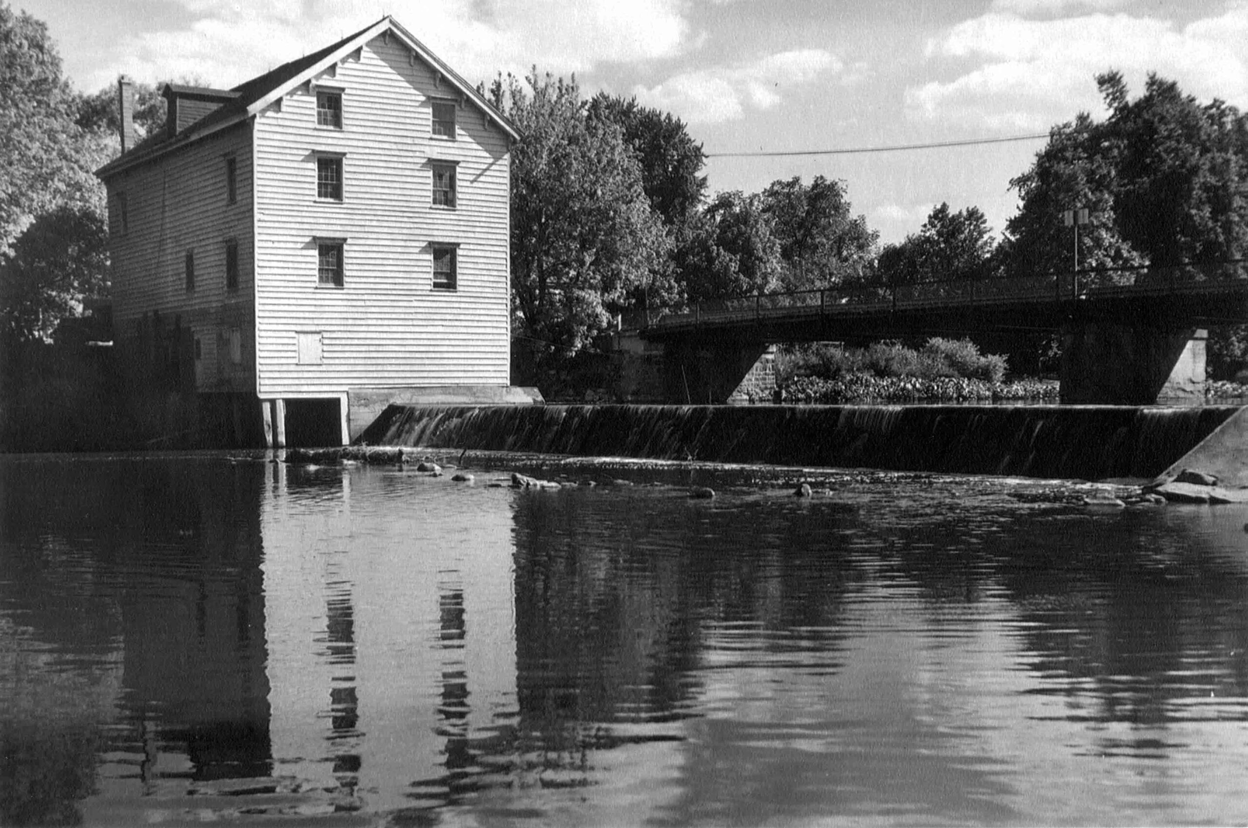
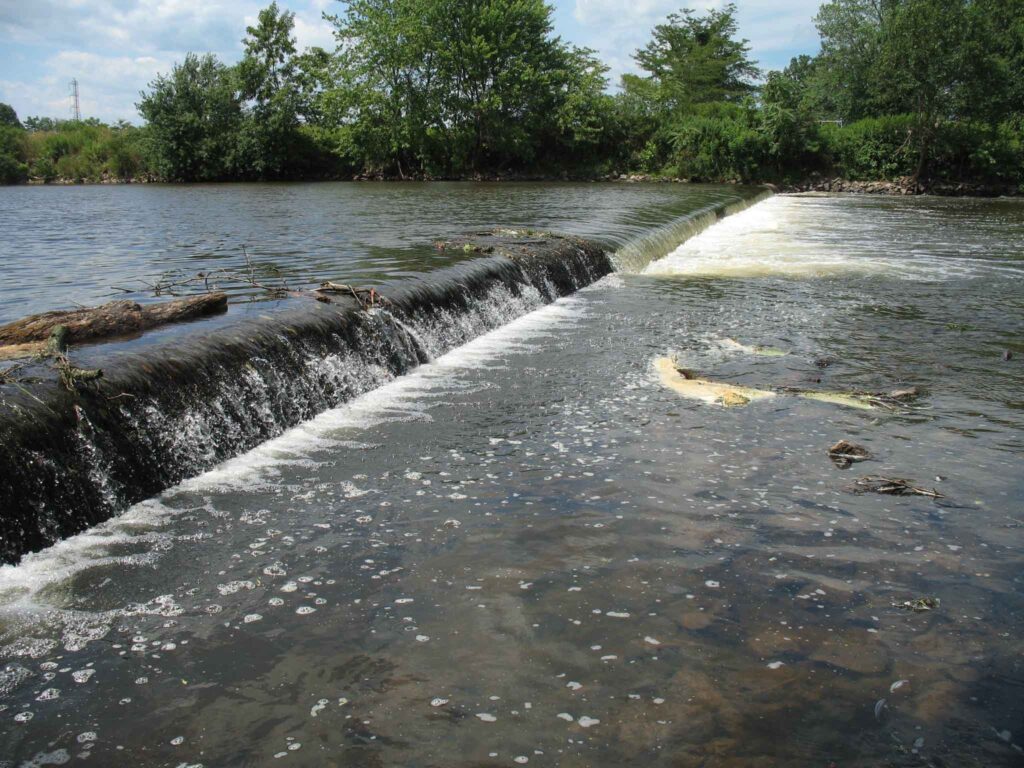
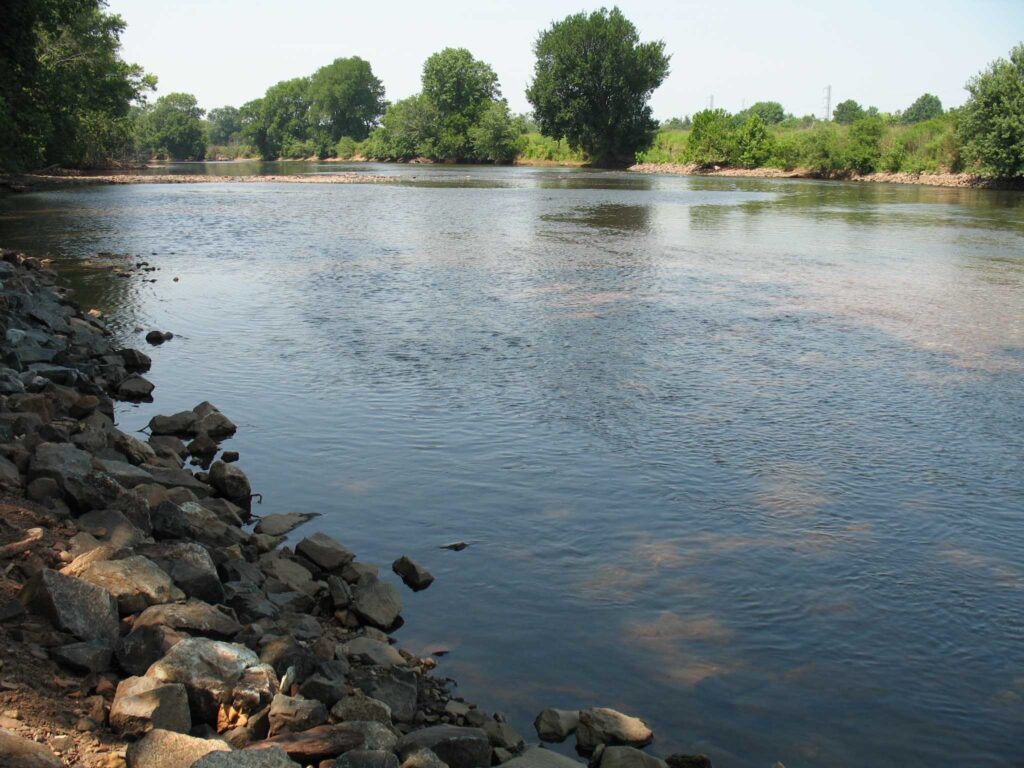
The Weston Mill Dam and the former Weston Mill gristmill and sawmill site are located approximately 1.5 miles upstream of the Millstone River’s confluence with the Raritan River, and immediately downstream of the Weston Causeway (Wilhousky Street) Bridge in the Borough of Manville and the Township of Franklin, Somerset County, New Jersey. The dam crest length was approximately 112.5 feet long and there was a concrete approach apron that ranged in thickness from 5 to 6.75-inches that extended 17.5 to 18.5 feet upriver of the dam spillway. The location of the mill was depicted on early Colonial-era and Revolutionary War military field maps, and the mill and dam were picturesque landmarks that were often photographed by local residents, including images included in the book Franklin Township [NJ] – Images of America, published in 1997.
Weston Mill Post-1948 to Early 1960s, Photographer Unknown
Through an intensive deed search, I determined that a gristmill and dam were established on the east bank of the Millstone River at the project area circa 1747, most probably built by Abraham Brokaw, and the mill was subsequently involved in a Revolutionary “Forage War” skirmish between British and American forces on January 20, 1777 while under the ownership of Abraham Van Nest. Recovery of two cornerstones during 1983 salvage operations suggest major mill building and rebuilding efforts occurred in 1803 and 1844 by John M. Bayard and Isaac R. Cornell, respectively. Though the mill remained active at this site into the early twentieth century (it was the most productive mill in the Millstone River/Stony Brook drainage), under various private owners and incorporations (Weston Mill Company, Inc.; Community Flour Mill and Grain Company; Union Mills Company, Inc.), and the dam underwent significant structural repairs between circa 1922 and circa 1948 by its last owner (Wilbur Smith), it ultimately fell into disuse and disrepair. On May 31, 1982, the mill building partially collapsed into the Millstone River. Mill artifact salvage operations were initiated on June 25, 1983 but were abandoned when arson claimed the collapsed structure on July 7, 1983.
Weston Mill Dam Initial Breach, Photo: Charles Kahler, PE
Weston Mill Initial Breach, Photo: John W. Jengo, PG
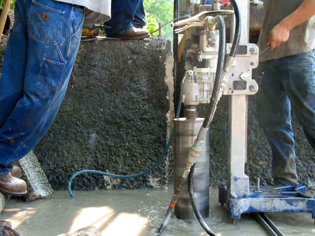
When I first began assessing this dam in 2009 as a candidate for removal, the Weston Mill site included the brownstone and concrete foundation remains of a gristmill that had enclosed a turbine room (formerly the water wheel pit) and a tailrace room, and there were associated powertrain components scattered throughout the site, including multiple bevel gears, possible mortise and pin gears, sprocket gears, drive shafts, counter shafts, flat belt pulleys, and other mill-related power-train apparatuses. A concrete coring project conducted in August 2015 at five representative locations on the dam approach apron (the same effort that determined the thickness of the apron) revealed two concrete approach aprons, which suggested that the dam was reinforced or rebuilt with concrete in two different periods in the early- to mid-twentieth century and that this run-of-the-river dam may have been built on top of a timber crib dam of unknown age.
Routine visits to the dam site over the next eight years would indicate that beginning in 2015, the eastern 78 feet of the dam crest (i.e., the top of the spillway) and spillway began to noticeably subside and detach from the concrete approach apron, placing undue stress on the riverward mill foundation wall to the east. By mid-2017, the collapsing dam crest and spillway had subsided almost to the level of the downstream pool elevation, had deflected outward some five feet downriver, and in doing so, the flow of the river was redirected toward the mill ruins on the east bank, potentially causing adverse effects to the mill foundation and complicating the dam removal.
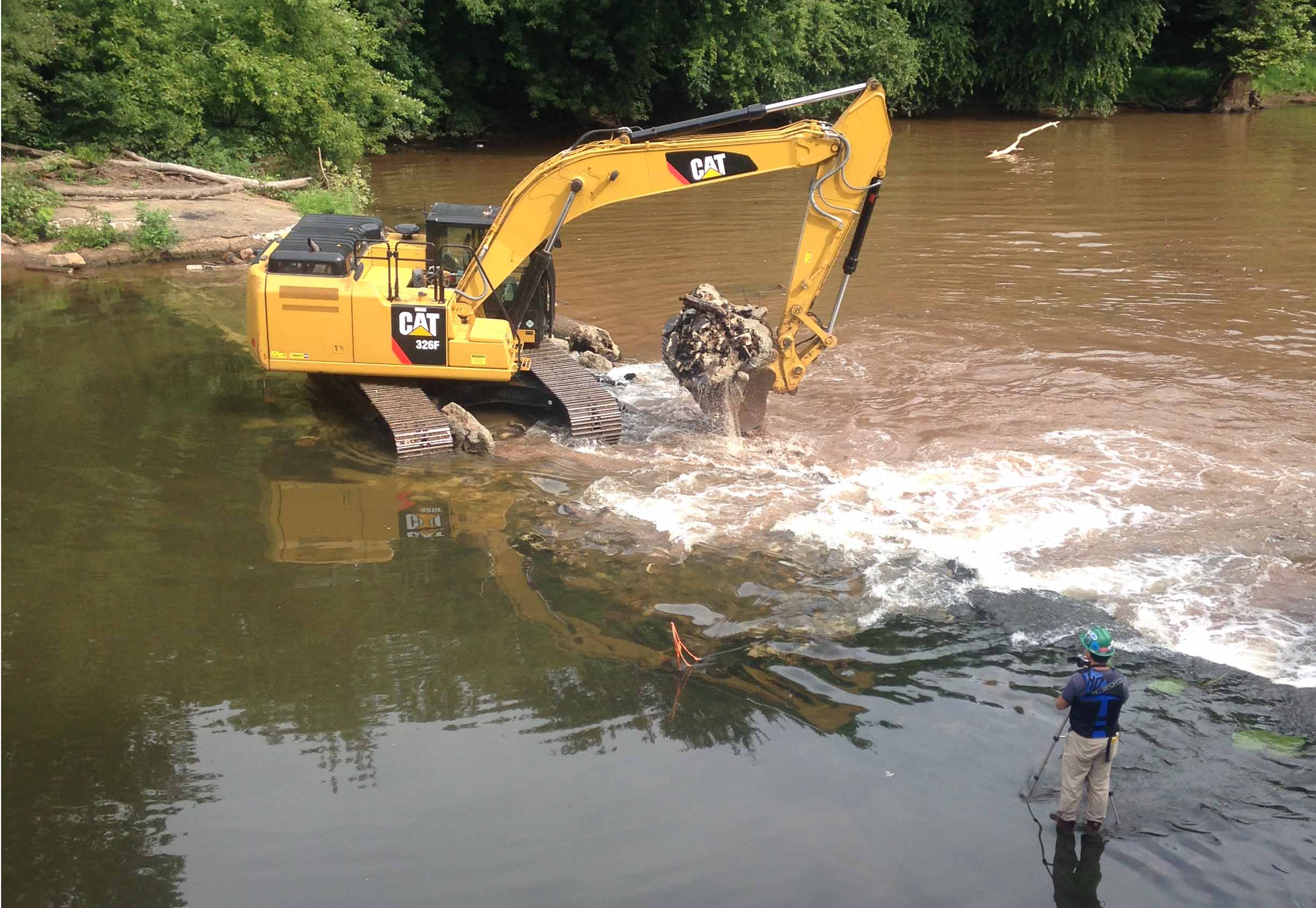
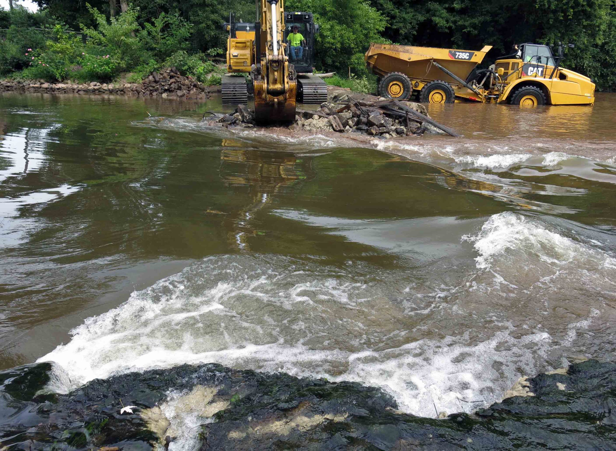
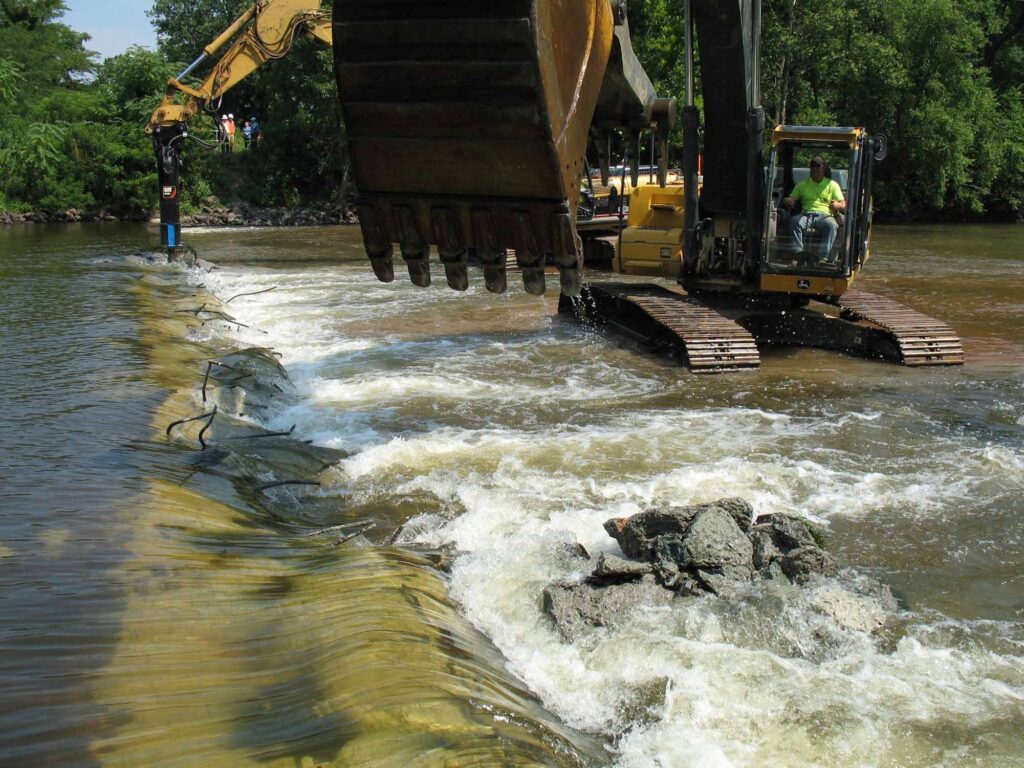
The dam removal and the engineering plans were re-designed to include emplacing scour protection around the Weston Mill foundation walls to arrest the damage to the ruins and preserve the remaining fabric of the site for future study. The first step in the dam removal process, which commenced on August 14, 2017, was to initially breach a portion of the dam to reduce the differential head between the upstream and downstream pools. The initial breach width of 35 feet, located near the center point of the dam, produced the desired upstream pool drawdown and a relatively low current velocity through the breach. Once the upstream impoundment had drained, the contact between the concrete approach apron and the riverward mill foundation wall was accessible to be saw cut to isolate the apron from the mill wall prior to further demolition. This was done to ensure that neither the weight of the demolition excavator or the vibration of the hydraulic hammer would destabilize the riverward foundation wall.
Weston Mill Dam Spillway Removal, Photo: John W. Jengo, PG
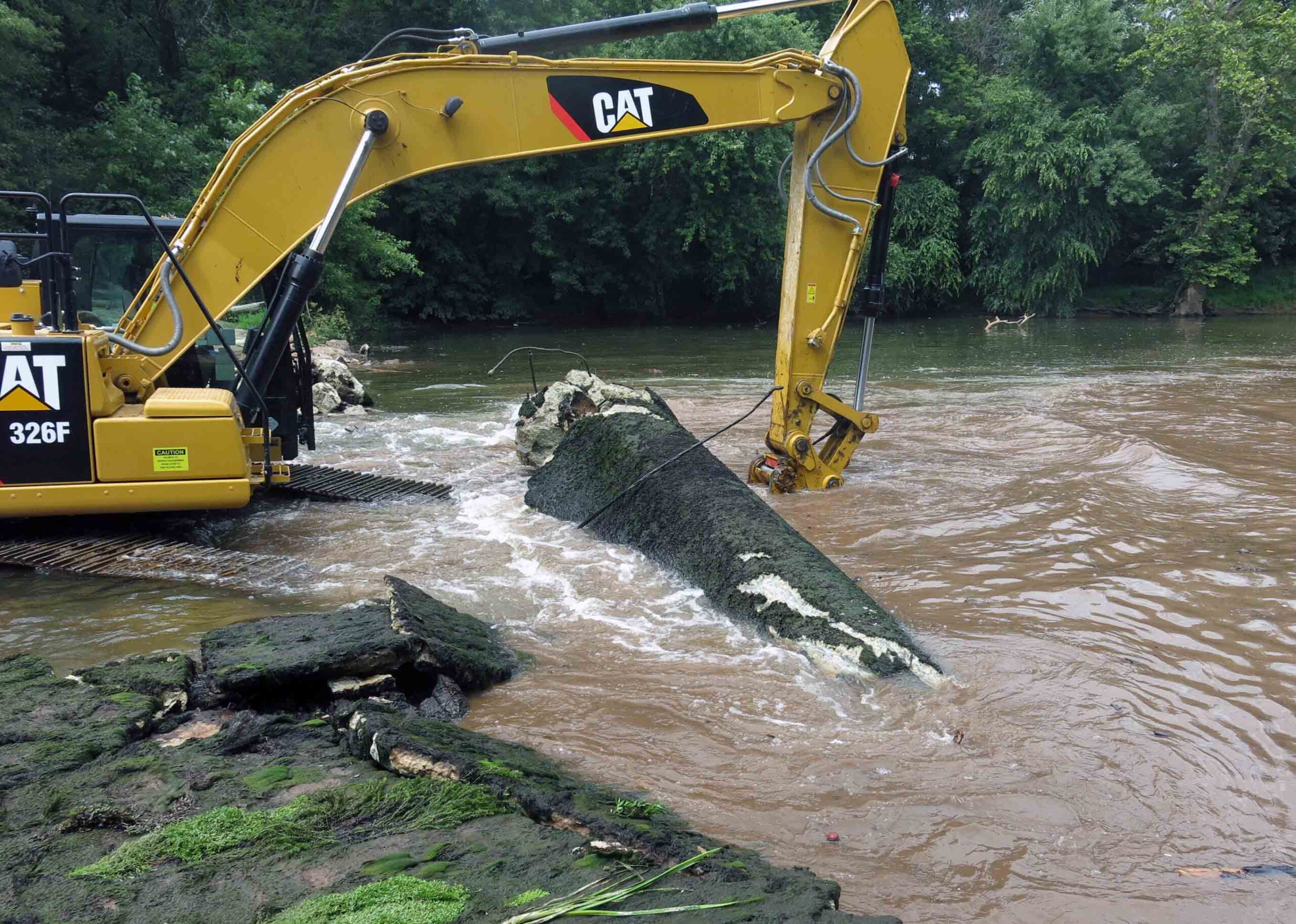
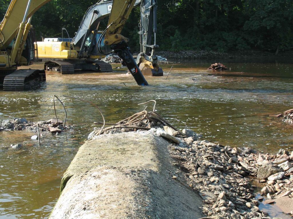
After the saw cut was completed, the concrete approach apron, an underlying concrete sub-apron, and dam spillway were carefully detached and removed. Imported rip rap was then emplaced around the mill foundation walls. My experience working on the rivers of this watershed indicated that natural sedimentation from storm events would eventually blanket and in-fill the rip rap, enhancing the stability of the scour protection armament. Finally, a restored river channel thalweg were excavated and contoured appropriately. It was during these excavations that segments of a timber crib dam, secured to the river bed by using 17.5-inch to 20.5-inch long, 1.125-inch square iron spikes, were extracted that clearly indicated that the pre-concrete dam structure was a timber crib construction. Three primary types of roughly square timbers believed to be part of the timber crib dam were identified: 13-foot long lap jointed foundation logs with iron spikes, 9.25- to 9.75-foot timbers with two mortise joints (some with intact dowels), and 3.8-foot timbers with tenons at one end. Several timbers of this historical structure were saved and donated to the Borough of Manville, Delaware and Raritan Canal State Park, and NJDEP, who had purchased the dam site in 2013 from a private owner, an acquisition that allowed the dam removal to proceed.
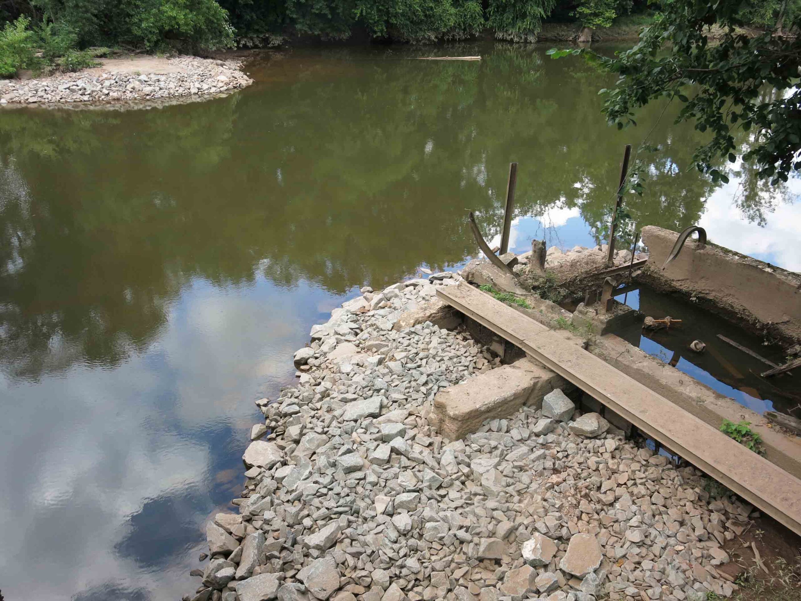
Weston Mill Dam Post Removal, Photo: John W. Jengo, PG
Monitoring of the river reach above the former Weston Mill Dam in spring 2018 following the August 2017 dam removal found definitive evidence of successful American shad spawning, an astonishing and long-awaited result given this river reach had effectively been blocked to migratory fish for over 270 years. Five juvenile shad averaging 4.3 inches in length were found 4.5 miles upstream of the dam at the base of Blackwells Mills Dam during a monitoring visit, highlighting yet again the dam removals can yield near-instantaneous positive results even after centuries of impeding fish migration and spawning.
Video of the Weston Mill Dam removal can be viewed here:
Endnote: Because of the archaeological discoveries made before and during the dam removal, and the rich cultural history of Weston Mill, a standalone video on the History of Weston Mill was developed and can be viewed here:
John W. Jengo, PG, LSRP is a licensed Professional Geologist in several Northeastern and Southeastern states and a Licensed Site Remediation Professional in New Jersey. John works as a Principal Hydrogeologist in an environmental consulting firm in southeastern Pennsylvania. He has degrees in geology from Rutgers University (1980) and the University of Delaware (1982). Over the last 30 years, he has conducted the characterization and remediation of large, complex contaminated industrial sites throughout New Jersey, Pennsylvania, and Delaware. He played a key role in Natural Resource Damage (NRD) assessments that led to groundbreaking legal settlements to remove numerous low head dams on the Raritan and Millstone Rivers to restore historically significant migratory fish spawning runs. As technical project manager, he planned, permitted, and successfully managed the removal of the Calco Dam, the Robert Street Dam, and the Nevius Street Dam between 2008-2013, and the removal of the Weston Mill Dam on the Millstone River in 2017, along with leading the archaeological investigation of the former Weston Mill in the Borough of Manville and Franklin Township.
Calco Dam, positioned at Raritan River Mile (RM) 20.9, was located in Bridgewater and Franklin Townships, Somerset County, New Jersey just upriver from the Borough of Bound Brook. Calco Dam, technically a low-head loss dispersant weir, was constructed in 1938 by the Calco Chemical Company, Inc. as part of the effluent conveyance system for a synthetic dyestuff manufacturing operation that had been established at this location in 1915. To direct effluent flow to Calco Dam, a diversion structure was built on a natural stream (Cuckels Brook) 800 feet north of the dam, and as part of the diversion construction, a canal was dug from that structure to Calco Dam; a screening structure was installed at the end of the canal to prevent debris from flowing into the dispersant pipe inside the dam. The center dispersant weir section of Calco Dam was 123 feet long and was composed of a 36-inch-diameter effluent tile pipe encased in concrete, which had on its downstream side a total of 41 8-inch-diameter outlets spaced three feet apart. The weir structure was connected to the river banks by approximately 50- to 55-foot-long solid concrete abutments, making Calco Dam a run-of-the-river structure. According to the original design drawings, Calco Dam varied in width between 21.25-23 feet and it had a structural height of approximately seven feet. There was an 18-inch-thick, 12-foot-wide concrete apron extending downstream from the dam crest, ending in an apron toe section extending 3 feet below the river bed.
Calco Dam Before Removal
When the Somerset Raritan Valley Sewerage Authority (SRVSA) purchased the manufacturing site’s wastewater treatment plant operations in 1985, ownership of Calco Dam also transferred to SRVSA because the dam was an integral part of the facility wastewater effluent discharge system. Although SRVSA was utilizing Calco Dam for discharging treated municipal effluent into the Raritan River when I approached them in 2008 about removing the dam, they were already in the process of designing and permitting an alternative effluent discharge route and outfall to the Raritan River, which would allow Calco Dam to be abandoned and removed. SRVSA immediately recognized the value of eliminating the potential liability of a dam and they became the model of a cooperative dam owner in the subsequent contractual negotiations to grant us permission to remove Calco Dam.
The Calco Dam removal was successfully accomplished between July 18 and August 1, 2011, but the removal had an unique engineering component. In planning the dam removal, I ascertained that the southernmost end of the dam had been incorporated into and under the towpath berm of the historic Delaware and Raritan (D&R) Canal, although a fair portion of this dam section had been subsequently exposed by scour eddies caused by water flowing over the dam. The effect of any further excavation on the stability of the D&R Canal towpath berm was considered too risky to implement so a decision was to made to leave that southernmost section of the dam intact and rebury the section that had become exposed from the river’s scouring action. To isolate this dam section from the remainder of the structure that was to be removed required that a methodology be devised to cut through the entire dam structure with a minimal amount of disturbance to the towpath berm (the dam was much too thick to be saw cut). Taking advantage of the same scour pool that had dangerously eroded into the base of the towpath berm, we built a temporary coffer dam around this section of the dam, dewatered it, and proceeded to drill and extract dozens of overlapping 6.5-inch diameter concrete cores across the width of the dam in the process known as “stitch coring.” Once the isolation of this section of the dam was completed, we imported tons of properly-sized rock riprap and rebuilt the base of the D&R Canal towpath berm back into its original configuration with the southernmost dam fragment now serving as a stable foundation for the reconstruction. Success of this restoration was tested just a few weeks later during back-to-back record flooding events from Hurricane Irene and Tropical Storm Lee when this section of the repaired D&R Canal towpath berm held firm while other sections along the D&R Canal route suffered washouts and breaches.
Calco Dam During Initial BreachingCalco Dam During Final BreachingCalco Dam Stitch Coring
The number of returning migratory fish in the Raritan River the following spring heralded the remarkable and rapid recovery of the Raritan River at the Calco Dam location. Based on observations at the upstream Island Farm Weir (IFW) fish ladder viewing window in the first spring migration season (March-May 2012) following the dam removal, the number of American shad migrating upstream increased 500% and the total number of fish passing through the IFW fish ladder increased by 200%. This essentially instantaneous result propelled the planning of the next two dam removals, which were accomplished in just the next two years (Robert Street Dam in 2012 and the Nevius Street Dam in 2013), and this succession of three dam removals in just three years is considered to be one of the most ambitious river restoration efforts that have implemented to date.
Calco Dam After Removal
John W. Jengo, PG, LSRP is a licensed Professional Geologist in several Northeastern and Southeastern states and a Licensed Site Remediation Professional in New Jersey. John works as a Principal Hydrogeologist in an environmental consulting firm in southeastern Pennsylvania. He has degrees in geology from Rutgers University (1980) and the University of Delaware (1982). Over the last 30 years, he has conducted the characterization and remediation of large, complex contaminated industrial sites throughout New Jersey, Pennsylvania, and Delaware. He played a key role in Natural Resource Damage (NRD) assessments that led to groundbreaking legal settlements to remove numerous low head dams on the Raritan and Millstone Rivers to restore historically significant migratory fish spawning runs. As technical project manager, he planned, permitted, and successfully managed the removal of the Calco Dam, the Robert Street Dam, and the Nevius Street Dam between 2008-2013, and the removal of the Weston Mill Dam on the Millstone River in 2017, along with leading the archaeological investigation of the former Weston Mill in the Borough of Manville and Franklin Township.
Article by John Jengo. Aerial photos by Alison M. Jones with NoWaterNoLife – photos were captured during a LightHawk, Inc. flight
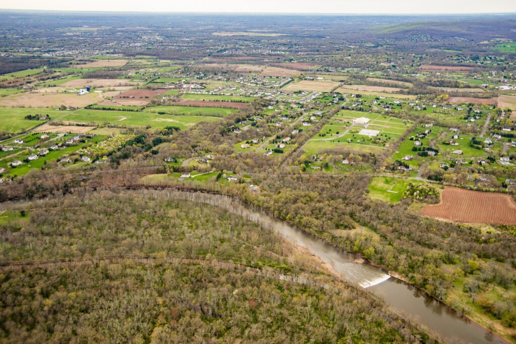
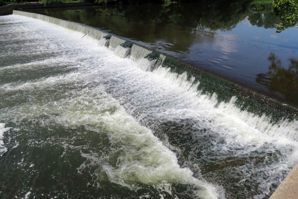
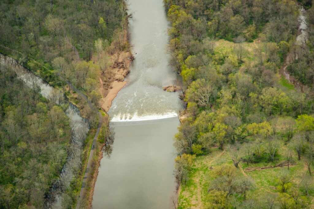
The 230-foot-wide Headgates Dam, located between Hillsborough and Duke Island Park in Bridgewater, NJ is the last dam on the Raritan River before the confluence of its North and South Branches.
Headgates Dam, Duke Island Park, Raritan Water Power Canal looking south past the Raritan River towards Princeton and Sourland Mountains Photo courtesy Alison M. Jones with NoWaterNoLife – photo taken during a LightHawk, Inc. flight
The original Headgates Dam (what you see today is a 1959 reconstruction) was built in 1842 in conjunction with the Raritan Water Power Canal as an entrepreneurial venture in order to sell commercial lots in the town of Raritan three miles east to industries requiring water power. At its height, there was a gristmill, a machine shop and foundry, a screw factory, a paint works, flour mills, the Somerville Water Company, and most famous of all, the Raritan Woolen Mills, all using water flowing down the Canal.
Headgates Dam, 8.20.2019. Courtesy John Jengo.
I believe that the term “Headgates” referred to both the dam itself and a gate structure that was formerly located at the head of the Canal where it adjoined the Raritan River. Many people have noticed the three curious bumps along the eastern half of the dam, and I postulate that these features indicate the location of a stop log guide frame that allowed a set of stop logs (rudimentary gates) to be raised or lowered to control the level of the water impounded behind the dam. Conceivably, these “gates” could be opened during the spring migration to allow migratory fish to pass upriver, and if the gates were operated in this manner, this would not be the only instance of fish passage structures being incorporated into 18th and 19th century dams. One can wonder why such multi-use, holistic thinking was forgotten when all these dams were rebuilt in the 20th century. It should be noted that the term “Headgates” also applied to large Gate House structure equipped with six timber lift gates (which was unfortunately demolished in the 1960s) that was formerly located at the head of the Canal that controlled the flow of water into the Raritan Water Power Canal.
Headgates Dam Photo courtesy Alison M. Jones with NoWaterNoLife – photo taken during a LightHawk, Inc. flight
J.B. Duke’s acquisition in 1897 of the Somerset Lighting Company/Raritan Water Power Company (the brick “powerhouse” building which survives just east of the Wrought Iron Bridge Company double intersection truss bridge, commonly referred to as the Nevius Street Bridge,) was initiated because Mr. Duke wanted both hydropower and a reliable water supply from the Canal for his expansive estate (Duke Farms), including its renowned network of lakes and fountains. To resolve the problem of the turbid Canal waters clogging the delicate fountain waterworks, Mr. Duke had a large-scale filtration facility constructed circa 1907 (the stone “castle” building just west of the Nevius Street Bridge) so that only exceptionally clear water would be discharged from the fountains. I postulate that Duke Farms ceased using Canal waters around 1974 because the flow of water had diminished, its quality had declined, and the maintenance of the filtration system became too onerous. It was at this time that Duke Farms converted the Nevius Street Dam (the dam that was located just upstream of the Nevius Street Bridge that was built for aesthetic and recreational purposes by Mr. Duke in 1901) for the estate water supply until 2013 when that dam was removed as part of the Raritan River Fish Passage Initiative and groundwater supply wells were installed to provide water for the Duke Farms lake system.
Since 2008, I have conducted research and studies to assess the feasibility of removing the Headgates Dam, but there are several complex and costly technical issues that remain to be resolved. Firstly, there is a community-essential sanitary sewer line that is located just upstream of the dam that has to be relocated before the dam is removed (part of the sewer line protrudes above the river bed so if the dam were to be removed, the sewer would be exposed to the rivers’ most turbulent flow, which is not permitted by State regulations). Secondly, the Raritan Water Power Canal is listed on the New Jersey and National Registers of Historic Places, and in the absence of the dam, it would be largely dewatered so plans are being developed to provide an alternative source of water for the Canal. Should financial resources be identified to implement these aforementioned remedies, the removal of the Headgates Dam could proceed in a manner similar to that of the Robert Street Dam (removed in 2012), which was reconstructed in 1964 using the same design specifications. The removal of the Headgates Dam would free the entire 30-mile length of the main stem of the Raritan River for migratory fish passage, in addition to opening up the lower reaches of both the South and North Branches of the Raritan.
Headgates Dam Photo courtesy Alison M. Jones with NoWaterNoLife – photo taken during a LightHawk, Inc. flight
John W. Jengo, PG, LSRP is a licensed Professional Geologist in several Northeastern and Southeastern states and a Licensed Site Remediation Professional in New Jersey. John works as a Principal Hydrogeologist in an environmental consulting firm in southeastern Pennsylvania. He has degrees in geology from Rutgers University (1980) and the University of Delaware (1982). Over the last 30 years, he has conducted the characterization and remediation of large, complex contaminated industrial sites throughout New Jersey, Pennsylvania, and Delaware. He played a key role in Natural Resource Damage (NRD) assessments that led to groundbreaking legal settlements to remove numerous low head dams on the Raritan and Millstone Rivers to restore historically significant migratory fish spawning runs. As technical project manager, he planned, permitted, and successfully managed the removal of the Calco Dam, the Robert Street Dam, and the Nevius Street Dam between 2008-2013, and the removal of the Weston Mill Dam on the Millstone River in 2017, along with leading the archaeological investigation of the former Weston Mill in the Borough of Manville and Franklin Township.