Article and photos by Joe Mish

The sea run shad, striped bass and herring that gather at the mouth of the Raritan River attract animals high on the food chain such as this harbor seal. Whales and dolphin have also been sighted over the last few years not in small part from the contribution of the Raritan River and its sweet water branches.
The spring-fed north and south branches of the Raritan River join in a marriage of sweet water at their confluence, on an endless journey to the sea. Each hidden spring and brook along the way, contributes its own genetic identity, mixed in a final blend at the mouth of the Raritan River.
Where the fresh water meets the salty sea, the ebb and flow of tides stir the brine into fresh water to create a stable buffer zone of brackish water.
These back bays and estuaries formed at the mouths of rivers are a perfect place for young of the year striped bass to gain in size before going offshore to migrate. American, hickory, gizzard shad, river herring, such as blueback herring and alewives also gather here and search for ancient breeding grounds located far upriver.
In the time before dams, sea run fish migrated far upstream into the north and south branch. Fishing was a robust industry in early colonial times where the seasonal migration of herring and shad was a profitable business.
The construction of dams to power mills along the river put a halt to upstream commercial fishing. The mills and dams were not welcomed by colonists who made a living from the seasonal fisheries. One account tells of early settlers in the mid 1700s, unhappy with a mill dam just below Bound Brook, making nightly raids to dismantle the dam and allow shad to continue their upstream migration.
Fast forward to today, the river still flows to the sea and the shad and herring gather to swim upstream.
In 1985 pregnant shad from the Delaware River were transplanted to the South Branch as part of a program to restore a shad migration along with planned dam removals.
Dams that have blocked migrating fish have recently been removed. The Calco dam near the former Calco Chemical Company built around 1938, cleared the way for migrating fish to reach the confluence of the Millstone and Raritan where a flood control dam was built. Known as the Island Farm weir, completed in 1995, it includes a viewing window and fish ladder to allow the dam to be bypassed by fish travelling upstream.
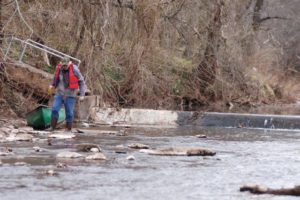
As part of the shad restoration project, volunteers working with Rutgers scientists tag shad and herring in an ongoing effort to gauge the success of the fish ladder and restoration efforts. Preliminary findings can be accessed at, http://raritan.rutgers.edu/wp-content/uploads/2015/10/NJDEP-2013-American-shad-restoration-in-the-raritan-river.pdf
A live underwater camera is placed at the dam each year after threat of ice has past. The camera is now operated by Rutgers University and may be seen online at http://raritanfishcam.weebly.com/fish-guide.html and at http://raritan.rutgers.edu/resources/fish-cam/
Aside from the Calco dam, three of five dams upstream of the Island Farm Weir, two dams on the Raritan, the Nevius street and Robert street dam and one on the Millstone have been removed. All in anticipation that the head dam at Dukes Island Park and the low dam at Rockafellows Mills on the South Branch will eventually be deconstructed.
See the above link for the video of the Nevius street dam removal. Go to MENU, open videos/multimedia to see Nevius street dam deconstructed.
See this link for a look at the Duke’s Island dam today; https://vimeo.com/259404286
The dream to restore our rivers and fisheries to their unmolested glory is well on the way to reality. Bald eagles now nest along the Raritan and its branches, soon to be joined by spawning shad and herring.
The vision of a pristine river valley, interrupted by 300 years of abuse and neglect is slowly emerging from the river mist as a magical apparition. The magic supplied by the hard work of Rutgers scientists and dedicated volunteers who echo the words of Rutgers president Thomas, who served in 1930, “Save the Raritan”.
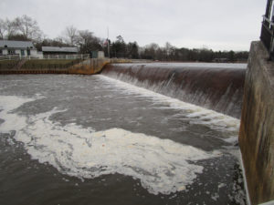
As an aside to this article, I will share a sobering and emotional experience involving the Island Weir Dam that took place in 1995. The intent is to emphasize the importance of safety while paddling in general and especially when near dams or in cold water.
See page three of this link for a description of what happened that day: http://www.wrightwater.com/assets/25-public-safety-at-low-head-dams.pdf
I was paddling on the Delaware and Raritan Canal which parallels the Millstone River about two miles from where the dam is located at the confluence of the Millstone and Raritan rivers. This was a training session for a cold water canoe race that takes place each April in Maine. I am an experienced paddler, familiar with cold water immersion and so was wearing a wet suit with a dry top and pants along with a life jacket/pfd while on the calm water in the canal.
As I neared the end of my trip at the Manville causeway, several police cars slowly drove by and turned around as if searching for something. Sirens were wailing and more police and rescue vehicles were seen and the road blocked off. First thought was the body of a woman who was reported to have ended her life in the Millstone a week before was found.
As it turned out a kayaker and two companions in a canoe decided to run the dam. According to my recollection of the news article; the canoe made it through first, while the kayaker who followed, failed to clear the dam and was stuck in the hydraulic.
According to the news article, ‘the experienced paddlers’ wore no thermal protection or pfds when they ran the dangerous dam. It was reported that the canoers paddled back to help their companion and they capsized in the hydraulic. Once you cross that line which marks the downstream flow from the water cycling upstream, you will be pulled into the hydraulic.
The kayaker and one of the men in the canoe were washed out of the turbulent water but the other was lost, his body never recovered.
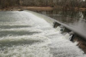
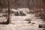
A hydraulic occurs when the weight of falling water creates a hole which is then filled by downstream water being pulled upstream in an endless re-circulating current parallel to the dam. Low head dams may be altered to prevent or mitigate a hydraulic.
There is a point of no return where you can actually see a line that separates the water flowing downstream from the water flowing back upstream to power the hydraulic.
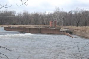
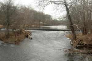
Island Weir Dam at the confluence of the millstone and Raritan River. You can see the horizontal shelves that are the fish ladder in the center and the subsequent stepped redesign to mitigate the dangerous hydraulic.
There have been several more drownings involving dams on the Raritan and its branches. I recall another at the Headgate, which is the dam created by the Duke estate below the confluence of the North and South branches. The paddler went over and was lost in the hydraulic below.
This is the headgate dam at Dukes Island Park. Created to collect river water via the Dukes canal to power the estates and supply water to the series of ponds built at decreasing elevations to allow the water to return to the river by gravity.
No warning signs are posted to alert paddlers to the danger ahead. On the downstream face of the dam is a warning to keep off.
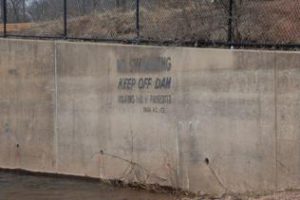
Too little too late warning.
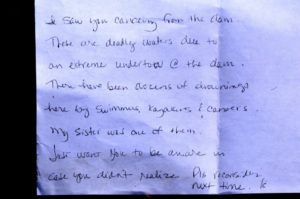
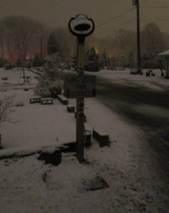
Paddling on the South Branch from Rockafellow’s mill rd, just below the low head dam that forms Red Rock Lake, this note was placed on my windshield. Though I was no where near the dam, contrary to what the note states, the message was at once heart breaking and shown here, now serves as a warning to all; beware of the dangers of low head dams.

This sign is placed about 5 football fields above the dam at red rock lake on the South Branch. It’s placement a puzzlement that mitigates its message.
Dam at Red Rock Lake.
Though rivers like the South Branch and North Branch are reputed to be no more dangerous than a swimming pool, tragedy can strike when least expected. Strainers, trees that fall into the river blocking passage, can snag and capsize a boat and entangle the paddler in its branches under pressure of a fast current. Low head dams can drown a paddler by immersion or entanglement on debris as the paddler is unable to wash out of the turbulent recycling water. Search on line to get an idea of how widespread is the danger of obscure low head dams and loss of life across the country.
Paddling when river temperatures are well below normal body temperature requires thermal protection no matter the air temperature. Wearing a pfd alone will not be enough to survive if your body temperature drops before you can be rescued or self rescue. Such was the case of a paddler on Round Valley reservoir a few years ago.
Typically water temp during the winter and early spring on the South Branch is 41 degrees. More than enough to cause a spasm to block your ability to breathe even before hypothermia sets in. See this link for a detailed explanation of the effects of cold water immersion. Remember, ‘cold water’ does not have to be that cold.
http://www.coldwatersafety.org/ColdShock.html
Overturning in fast water, a boat can instantly fill with a hundred gallons of water. Each gallon weighing 8 pounds, can pin or crush a paddler between the canoe and any obstruction. Such was the case on a locally sponsored canoe trip in shallow water on a beautiful day on the South Branch. One paddler was trapped under the canoe in a strainer. Eventually he popped out from under the boat, shaken but safe. The canoe was stuck fast in the strainer, filled with hundreds of pounds of water. Never be downstream of a capsized canoe.
Tragedy can occur on the calmest day under brilliant blue skies, always wear a pfd and be alert to potential dangers, especially dams.
Low head dam across the North Branch just above rt 202 makes a difficult passage during low water portage and a dangerous hydraulic during high water.
Author Joe Mish has been running wild in New Jersey since childhood when he found ways to escape his mother’s watchful eyes. He continues to trek the swamps, rivers and thickets seeking to share, with the residents and visitors, all of the state’s natural beauty hidden within full view. To read more of his writing and view more of his gorgeous photographs visit Winter Bear Rising, his wordpress blog. Joe’s series “Nature on the Raritan, Hidden in Plain View” runs monthly as part of the LRWP “Voices of the Watershed” series. Writing and photos used with permission from the author.
Article and photos by Joe Mish
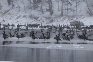 Canada Geese in a snowstorm on the South Branch appear at ease as the falling snow softens the scene.
The January blizzard raged, turning the darkness into an opaque curtain of white. Almost a foot of powdered snow covered the ground before midnight.
The broadcast news reported that NJ had declared a state of emergency shutting down roadways throughout the state. The setting was just right for the midwinter parade on the South Branch. Thousands attended and the main thoroughfare was jammed with local residents and visitors. As I stepped outside to get a head start on clearing the driveway, the sound of geese, thousands of geese, overpowered the drone of the wind driven snow. So impressive was the magnitude of the unalarmed chatter, I was compelled to investigate. Alerting my family where to search for the body, I headed into the storm.
The closer I got to the river the louder and more beckoning the sound became. Moving slowly through the trees toward the river bank, the din from the geese on the open water was deafening. The river was filled wall to wall with migrant and resident Canada geese. Some started to get up and fly. Others just drifted by. All appeared as black silhouettes against the snow and reflective water. Thousands upon thousands all in chorus, the rhythm and sound of their calls rose and fell as if one voice. Occasionally all sound would hesitate into a moment of absolute silence. The silence was as dramatic as the din.
Animals generally become fearless in extreme weather and at the height of this snowstorm the geese collectively tolerated my close approach.
As I closed in, the birds parted, momentarily leaving a void of reflective water. The surface was again soon covered with geese as the specter of an interloper was confidently dismissed.
The Geese were packed so tight; they appeared as if in a big cauldron that was being stirred. One group was drifting down with the current while the other was going back up stream in a re-circulating eddy below the island.
Aside from the geese, the river was filled with joined platelets of gray and white ice, strong enough to support several of the large birds. A display of motionless geese rode atop drifting ice flows, escorted by a cadre of even more geese floating alongside, all travelling at the same speed.
This looked all so familiar. Suddenly it struck me. I could have been watching a fourth of July parade with themed floats and accompanying marchers. Certainly the band was playing a familiar tune as spectator geese lined the banks and joined in the chorus.
How odd that here was a gathering of what seemed to be all the geese in New Jersey having their own parade. As if to celebrate some event sacred to the hearts of all geese, each bird taking comfort in knowing they owned the night and there would be no human eyes to witness their ethereal rite.
Author Joe Mish has been running wild in New Jersey since childhood when he found ways to escape his mother’s watchful eyes. He continues to trek the swamps, rivers and thickets seeking to share, with the residents and visitors, all of the state’s natural beauty hidden within full view. To read more of his writing and view more of his gorgeous photographs visit Winter Bear Rising, his wordpress blog. Joe’s series “Nature on the Raritan, Hidden in Plain View” runs monthly as part of the LRWP “Voices of the Watershed” series. Writing and photos used with permission from the author.
Article and photos by Joe Mish
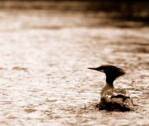
A female common merganser pauses in the fast shallow water of the South Branch where clams and crayfish abound.
“Eye of newt, and toe of frog, Wool of bat, and tongue of dog, Adder’s fork, and blind-worm’s sting, Lizard’s leg, and howlet’s wing,– For a charm of powerful trouble, Like a hell-broth boil and bubble.”
The witches brew in Shakespeare’s “Macbeth” revealed a magical recipe perhaps intended to capture a victim’s soul for evil consumption. Truth is the witches were brewing magic bait they intended to use the next morning on the opening of trout season. Shakespeare spun the story to keep the ancient fishing formula secret and so, “Macbeth”, was written to obscure the truth and ‘Shakespeare’ is now a company that makes fishing gear.
I know it’s hard to believe, but sure enough similar formulas are used today and found in books like Art Flick’s New Streamside Guide or the old classic, AJ McLanes Fishing Encyclopedia. Artificial fly recipes used to catch trout read like the midnight brew mixed during the dark of the April moon in “Macbeth”.
Pale hairs from a “red fox belly are mixed with sandy poll from a hare’s ear”; One dark ginger hackle and a quill from a Rhode Island Red rooster soaked overnight and blended with gray fox underbelly and hair of claret seal are combined with three strands of skunk tail; Peacock herl, scarlet silk, flat gold tinsel are bound with muskrat belly fur dubbing; Along with feathers from the cheek of a partridge, wing of wood duck and porcupine quills soaked in Clorox, we have a comprehensive list of standard ingredients found stocked on the shelf above any self respecting witch’s eternally boiling cauldron. The addition or deletion of the slightest ingredient is all that differentiates intended purpose. Good vs evil or brown trout vs rainbow trout, nuance makes the difference.
The use of feathers to catch fish on the fly is not exclusive to fishermen casting hooks adorned with feathers. Alternatively, the feathers are still on the birds and the hooks are in the form of beaks and talons.
Sharing the local fishery with licensed fishermen are common mergansers, great blue herons, king fishers, green herons, yellow crowned herons, egrets, osprey and bald eagles.
It is a wonder to realize the waters of the North and South Branch are rich enough to support the variety and quantity of fish required to have most of these birds as year round residents. The recent dam removals on the Raritan River will ensure an even greater supply of forage fish and a brighter future for not only fish eating birds but other game fish to improve what is already a fisherman’s paradise.
Driving along the river, I experienced a Kodak moment, where a female merganser surfaced with what looked like a decent sized bluegill in its serrated beak. Mergansers are the most commonly seen diving duck locally and are easily differentiated by gender as the males have a contrasting dark green head, black and white body while the females are white and gray with rusty red colored heads and a pronounced crest as if coiffed to resemble a wind blown hair style. Both sexes have a bright orange beak. Mergansers swim underwater to search for food that includes crayfish as well as the plentiful mollusks that populate our rivers.
Great blue herons seem to be next most common fish eater and are often seen standing tall and still as statues as they probe shallow water for small and large fish as well as frogs and salamanders.
Much shorter and less often seen is the green heron and seasonally, the pure white common egrets at summer’s end.
Our smallest fisheater is the belted kingfisher. About the size of an extra large bluejay and quite similar in color, bearing a pronounced crest and white throat patch with a blue bandana across its throat.
Osprey are often seen perched on dead tree limbs along the river eating fish, as bald eagles from two different nests are occasionally observed.
The arrival of fishing season, this April 6th at 8am, is a reminder of the flocks of feathered fishers, not bound by seasons or licenses, which share the bounty of our local waters.
Author Joe Mish has been running wild in New Jersey since childhood when he found ways to escape his mother’s watchful eyes. He continues to trek the swamps, rivers and thickets seeking to share, with the residents and visitors, all of the state’s natural beauty hidden within full view. To read more of his writing and view more of his gorgeous photographs visit Winter Bear Rising, his wordpress blog. Joe’s series “Nature on the Raritan, Hidden in Plain View” runs monthly as part of the LRWP “Voices of the Watershed” series. Writing and photos used with permission from the author.
Except as noted, article and photos by Joe Sapia.

Rain and fog over “Jamesburg Lake” (Lake Manalapan) on the Jamesburg-Monroe boundary, Middlesex County, on the morning of February 11, Sunday.
HEAVY RAIN: The National Weather Service reported these preliminary rainfall totals in Jersey Midlands counties for the February 10-11, Saturday-Sunday, rainfall. The numbers are not necessarily a comprehensive listing, so there could have been higher and lower totals: Burlington — 1.55 inches at Chesterfield to 4.02 at west northwest of Tabernacle; Hunterdon — 1.00 at northwest of Milford to 1.81 at Wertsville; Mercer — 1.44 west of Princeton to 2.21 west of East Windsor; Middlesex — 1.74 at Sayreville to 2.28 at East Brunswick; Monmouth — 1.27 at North Middletown to 2.82 at Howell; Ocean — 1.23 at Island Heights to 3.19 at Barnegat Inlet; and Somerset — 1.12 at Martinsville to 2.19 at Middlebush.
Manalapan Brook Overflows Its Banks
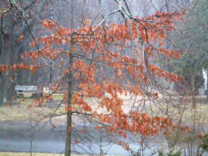
The leaves of an oak tree, genus “Quercus,” light up my front yard on a rainy day.
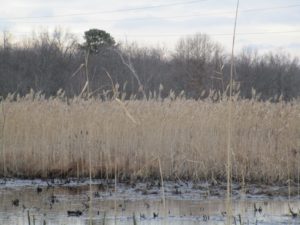
POOR DRAINAGE: A drainage issue flying under the radar is the clogging up of swamps — through filling them in purposely, by unintentionally clogging them by dumping leaves and other vegetative debris in them, and the overtaking of these wetlands by invasive species, such as phragmites reed grass. As the swamps clog and water is displaced, more flooding will happen.
In this Sunday, February 11, photograph of Helmetta Road, in the part of Monroe between Jamesburg and Helmetta, two problems are obvious: One, Helmetta Road (Middlesex County Route 615) passes through a low, swamp area and easily floods and, two, the surrounding swamps are clogged with phragmites. With phragmites, what is seen above ground is only an estimated one-fourth to one-third of the plant. Drive by wetlands and look at their changing nature — the overtaking by phragmites, easily identified by its tassel-like top.
Phragmites eradication projects are now underway or planned — for example, by Middlesex County Parks and Recreation at Helmetta Pond — but it is a complicated, labor-intensive, and costly undertaking. Combining that with the issue being ignored, by far not enough remediation is being done.
But something needs to be done, if not to protect the environment, then for practical anti-flooding reasons.
Look at this United States Geologic Survey website, https://nwis.waterdata.usgs.gov/nwis/peak…, for the highest flows per year on Manalapan Brook at the gauge on the Spotwsood-Monroe boundary. Over the last 60 years, four of the highest flows were in a recent 10-year period, from 2005 to 2014.
Keep covering up soil, keep filling in wetlands, and let these drainage issues get out of control. People will lose homes — think Tropical Storm Irene in 2011 and Superstorm Sandy in 2012, again in recent and back-to-back years — and be otherwise inconvenienced. Just wait….
The combination of this section of Helmetta Road (Route 615) in Monroe, Middlesex County, passing through a swampy area and that area clogged with common reed grass, genus “Phragmites,” equals poor drainage.
SNOWFALL UPDATE: At Helmetta-Jamesburg-Monroe in Middlesex County, the snowfall on Saturday, February 17, was 3 inches, bringing the seasonal total to 21.5 inches. (The average seasonal snowfall at New Brunswick, Middlesex County, about 7.5 miles away, is about 26 inches. We still have about seven weeks left in the snowfall season.)
These figures for Saturday’s snow are from the National Weather Service. These are reported figures, not necessarily complete figures: Burlington County — 1.2 inches in the Eastampton and Tabernacle areas to 4.0 in Wrightstown; Hunterdon County — 4.3 in Wertsville to 9.3 in the Clinton area; Mercer County: 2.0 in the Lawrence area to 4.7 in the Hopewell area; Middlesex County — 2.0 in the Old Bridge area to 3.7 in the Cheesequake area; Monmouth County — 1.3 in Rumson to 3.0 in Colts Neck; Ocean County: .5 to 1.5, both in the Brick area; Somerset County — 3.3 to 7.4, both in the Bridgewater area; and in Pennsylvania’s adjoining Bucks County — 1.0 in Penndel to 6.4 in Springtown.
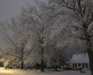
At night, as the Saturday, February 17, snow was ending, in my neighborhood in Monroe, Middlesex County.
SPRING PEEPER TREEFROGS: On the night of February 11, Sunday, I stepped outside my Monroe, Middlesex County, house and heard the nostalgic call of spring peeper treefrogs, “Pseudacris crucifer,” coming from the Manalapan Brook floodplain — kind of like sleigh bells. In February! But it was about 63 degrees on the night of a very rainy day. They are early maters — the calling likely either looking for mates or signaling territory. If you go looking for them, they will quiet as you approach and you likely will never find one. I recall seeing them only about 3 times in my 61 years. A check of my field notes going back to 1992, with only 2001 missing, shows this date as the earliest I had recorded for hearing them in a season. They likely will call and not call until we get consistently warmer weather. So, it will be interesting to see when they start calling strongly and consistently. I view peeper calls four ways: 1, these early calls; 2, regular calling; 3, late calling; and 4, an out-of-season aberration. As for their species name “crucifer,” they have a cross-like mark on their backs.
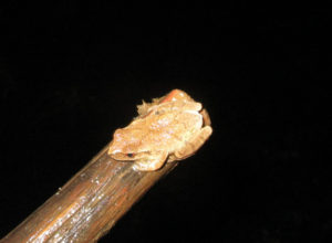
A spring peeper treefrog found in the Manalapan Brook floodplain of Monroe, Middlesex County, in 2017, March. In this photo, the X-like or cross-like mark on their upper to middle back is hard to see.
UPPER MILLSTONE RIVER EAGLE NEST: Anne Price, my fellow volunteer monitor of this nest on the boundary of Middlesex and Mercer counties, had a fabulous experience while watching the nest, where the bald eagles, “Haliaeetus leucocephalus,” are sitting on an egg or eggs. She watched a mature eagle flying with an immature. So, there is at least one immature in the immediate area of the nest. We expect the egg/s to hatch in late February or early March. We are not releasing the exact location of the nest to protect it because eagles, as breeders, are considered “endangered,” or in immediate peril, in New Jersey and, in general, are considered “threatened,” meaning if conditions deteriorate, they could become “endangered.”
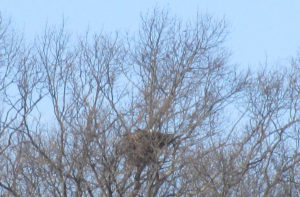
The head of a bald eagle pokes out of the Upper Millstone River nest. The eagles are sitting on an egg or eggs.
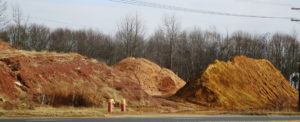
COASTAL PLAIN AND PIEDMONT: As I have noted previously, the Jersey Midlands is composed of two geologic regions: the rolling hills and rocky terrain of the Piedmont to the west and the generally flat land of the Coastal Plain to the east. (I also like to break up the Coastal Plain into the Inner and Outer.) For our purposes here, let us talk of the Piedmont with its soil of red shale and the Inner Coastal Plain with its gravelly soil. I was driving the other day in South Brunswick, Middlesex County, and noticed piles of dirt, basically displaying these two types of soil. In the following photograph, the red shale of the Piedmont is to the far left, the gravelly soil of the Inner Coastal Plain to the far right:
‘SPOTSWOOD LAKE’: On the flat-terrain Coastal Plain, there are few, if any, natural bodies of water. Instead, the water bodies are human-made, either by digging a depression or by damming a waterway. The approximately 60-acre “Spotswood Lake,” properly known as “DeVoe Lake” or “Mill Lake,” is an example — formed by the damming of Manalapan Brook shortly before it joins Matchaponix Brook on the Spotswood-Old Bridge boundary in Middlesex County to form the South River.
This dam holds back Manalapan Brook, forming Spotswood Lake.
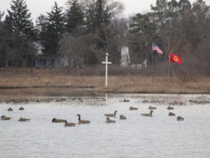
This photograph of “Spotswood Lake” takes in a lot: wildlife (Canada geese, “Branta canadensis”), religion (a cross), patriotism (the American flag), and history (in the background, an old pump house to the right of the residential house).
BROKEN PITCH PINE: A branch on the pitch pine, “Pinus rigida,” in my backyard in Monroe, Middlesex County, was leaning. When I checked it, I saw that it was damaged. So, I chopped it off. I could put it out on the road, where the township picks up vegetative waste. Instead, I put it to use on-site, adding it to my backyard wildlife brush pile — often a haven for birds and presumably other wildlife. I try to keep my yard as a quarter-acre farm, discarding something in one place and using it elsewhere on the property.
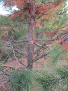
The broken branch area of the pitch pine.
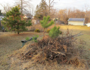
Notice the pitch pine in the background. It has a missing section. Well, there is the missing section, now in my wildlife brush pile in my backyard.
ATLANTIC OCEAN TEMPERATURES: The Atlantic Ocean temperature along the New Jersey coast was running at about 39 to 41 degrees on the February 17-18 weekend.
SUNRISE/SUNSET: From Sunday, February 18, to Saturday, February 24, the sun will rise about 6:40 to 6:45 a.m. and set 5:35 to 5:45 p.m. From Sunday, February 25, to Saturday, March 3, the sun will rise about 6:30 to 6:35 a.m. and set about 5:45 to 5:50 p.m.
FULL MOON: The next full moon is March 1, Thursday, the Full Lenten Moon.
WEATHER: The National Weather Service forecasting office serving the Jersey Midlands is at http://www.weather.gov/phi/.
MARJORY STONEMAN DOUGLAS: When I heard of the Wednesday, February 14, school shooting in Florida that took 17 lives, I thought of the school’s name: “Marjory Stoneman Douglas High School.” I hope Douglas’s name is not predominantly associated with the place where 17 murders took place; Douglas was an acclaimed environmentalist, author of the seminal 1947 “The Everglades: River of Grass.” Her name deserves better.
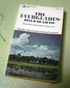
My copy of Marjory Stoneman Douglas’s classic book, “The Everglades: River of Grass.”
UPCOMING:
March 3, Saturday, 10 a.m. to 1:30 p.m., Somerset County — Deer Management Symposium at the Elks Lodge, 354 Route 518, Montgomery, free. Different stakeholders are to discuss deer management. More information is available at info@sourland.org.
March 10, Saturday, 11 a.m. to 12:30 p.m., Ocean County — Science Saturday, talk on striped bass management and fishing by Brendan Harrison, a New Jersey Division of Fish and Wildlife fishing technician,at the Long Beach Island Foundation of Arts and Sciences, 120 Long Beach Boulevard, Loveladies, 08008, $5 for non-members. More information at telephone 609-494-1241.
March 10, Saturday, 9 a.m. to 4 p.m., Atlantic County: 29th Annual Pinelands Short Course at Stockton University, 101 Vera King Farris Drive, Galloway, 08205. More information at https://stockton.edu/continuing-studies/conferences.html.
March 11, Sunday, 11 a.m. to 4 p.m., Atlantic County: 13th Annual Lines on the Pines, a Pine Barrens day of the written word, spoken word, art, and the performing arts at Stockton University, 101 Vera King Farris Drive, Galloway, 08205. More information at http://www.linesonthepines.org/linesonthepines.html.
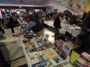
A scene from the 2016 Lines on the Pines event. This is a great event, one that I try to attend every year.
AS THIS FICKLE WEATHER WEEK ENDS: Sun, rain, and snow. Cold and warm temperatures. Soon, gardening and farming will be here. Until then….
On this snowy night of Saturday, February 17, the bell will have to await its time to be rung at Krygier’s Nursery in South Brunswick, Middlesex County.
Joe Sapia, 61, is a lifelong resident of Monroe — in South Middlesex County, where his maternal family settled more than 100 years ago. He is a Pine Barrens naturalist and an organic gardener of vegetables and fruit, along with zinnias and roses.
He draws inspiration on the Pine Barrens around Helmetta from his mother, Sophie Onda Sapia, who lived her whole life in these Pines, and his Polish-immigrant grandmother, Annie Poznanski Onda.
He gardens the same backyard plot as did his Grandma Annie and Italian-American father, Joe Sr. Both are inspirations for his food gardening. Ma inspires his rose gardening.
Joe is a semi-retired print journalist of almost 40 years. His work also is at @JosephSapia on Twitter.com, along with Facebook.com on the Jersey Midlands page.
Copyright 2018 by Joseph Sapia
Interview conducted by LRWP Raritan Scholars intern Quentin Zorn

Why did you decide to work with the LRWP?
In the past couple of years my work has been in community gardening, locally organized composting and food system development. I have focused my creative drives toward innovating and troubleshooting in these sectors via grassroots organizing and business startups.
The opportunity with coLAB and LRWP came along at the perfect time. I had just finished installing a geodesic greenhouse in an exhibition called LANDHOLDINGS at Index Art Center in Newark, NJ and was looking to invest more energy to art-making. Additionally LRWP’s mission incorporates scientific and geological considerations that at the time I was not familiar with: the focus on watershed heath and its intersection with the urban environment. I was eager to learn more.
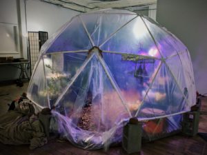
Processed with VSCO with g3 preset
How do you relate to the LRWP’s goals?
LRWP’s goals are to inspire environmental appreciation and stewardship, to inform relevant stakeholders on the watershed by building networks for sharing data about its health, and to innovate to improve watershed health responsibly with a diverse group of partners.
My role as a Resident Artist with the LRWP is to support their on-going projects and help generate new projects that align with these goals. Because my personal viewpoints also align with LRWP’s mission, my own integrity as an artist is not compromised. In fact, exposure to their programs and operations has been challenging and enlightening. The public needs organizations like LRWP to bring together science and community towards making impactful environmental efforts. Art plays a big role in this as it can help folks make the connection between the health of local environmental resources and one’s personal well-being in exciting and thought-provoking ways.
How does integrating art with science change the way you think about your own art?
Even the most traditional art forms require scientific understanding. For example, oil paint is an exceptionally difficult medium that if applied improperly can result in cracking and flaking once it sets. Research- historical, social, and technical- is always necessary for an artist and in-studio discoveries can be, in many ways, scientific in nature. I am used to shifting my medium to convey different kinds of ideas. As an interdisciplinary artist I am excited to collaborate and learn more technical languages.
How does the interpretive nature of art help or hinder conveying the messages you want people to understand?
This tension is one of my favorite parts of art making. The artist Patricia Piccinini is a huge inspiration of mine as much of her work is about the “creator’s” inability to control their “creation.” Experienced artists are able to walk the tight rope between intention and perception, directing the viewer but leaving enough space in the work open for the viewer to be able to identify and enter into it. Of course, not all art works intentionally speak to all audiences.
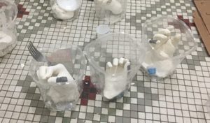
How do the sculptures from project WADES help achieve the LRWP’s goals or environmental goals in general?
Project WADES stands for Watershed, Action, Dialogue, Education and Stewardship and aims to develop Environmental Education curriculum. The sculptures are positioned at the intersection of WADES with a public sculpture project under a program called Rail Arts River, which aims to connect New Brunswick communities to the Raritan though art and green infrastructure. The sculptures from Project WADES are casts of the hands of youth clasping pieces of trash collected at clean ups along the streams of the Raritan Watershed. They serve to inspire increased connection between human behavior and watershed health within LRWP’s watershed curriculum.

When the sculptures are completed, what is the reaction you are hoping for?
To be honest I haven’t reflected on the reaction as much as the intention and the varying methods that coLAB, LRWP, and I have discussed for presentation! So far this work is still going through a collaborative gestation process. The sculptures will be brought back to the schools for semi-permanent art installations but will also be used in a larger public sculpture at Boyd Park. When the work is complete I am very much looking forward to seeing what people think.
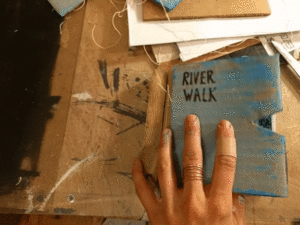
How did you create the River Walk book and what do you hope people take away from it?
River Walk is a kind of functional art work, much more sentimental and straightforward then my typical work. It is a usable notebook made primarily from recycled materials: reused paper, cardboard, old art prints and wood binding. The wood binding was fabricated from materials gathered from a FEMA buy-out home that was deconstructed and transformed into a rain garden and flood storage park, an exciting project done by landscape architect and Rutgers Professor Tobiah Horton. The signature sheets include linocut prints of humans in nature. These images were taken directly from a hike with coLAB Arts on the D&R canal in New Brunswick. The only way to acquire this work is by donating to LRWP. My hope is simply that people enjoy it and use it!
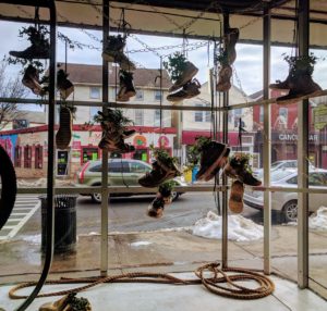
What effect do you think the Windows of Understanding project has on the community or the local environment?
Windows of Understanding is a public art project set in multiple storefront businesses. It operates like a rhizome, utilizing the brain power of local advocates and artists to filter their mission and work through a prompt. This year that prompt is ”We See Through Hate.” I see so much mutual benefit here and I’m excited about the realistic, but hopeful message. Our country is going through rapid change that seems to hark on hard times for so many of us. Americans are under incredible pressure from the media, from the antagonistic government, from the precarious state of healthcare, and from a job market threated by automation. To be truly resilient, in an environment filled with risk, disparate communities should be given opportunities to know each other face to face; to move past bigotry and ignorance and to see through hate. Windows of Understanding will address these struggles, but provide hope and positivity to the surrounding public. I believe this effort will have a positive effect on the passerby, increase the visibility of advocate organizations, and increase community cohesion.
We applaud the following Lower Raritan Watershed towns for securing Sustainable Jersey status in 2017!
East Brunswick – bronze
Edison – bronze
Monroe – bronze
New Brunswick – bronze
Plainsboro – bronze
South Plainfield – bronze
Woodbridge – silver
Hillsborough – silver
Somerville Borough – bronze
Warren Township – silver
Berkeley Heights Township – bronze
Summit City – silver
Extra kudos to New Brunswick, Perth Amboy and Woodbridge for securing 20 points in the “Climate Adaptation: Flooding Risk” action. This action is designed to help communities: 1) identify their vulnerability to flooding impacts (both coastal and inland) and 2) identify ways to improve their overall resiliency. This action focuses on the various causes of flooding that could impact a community, either now or in the future, including increased precipitation, increased frequency of heavy precipitation events, sea level rise and storm surge.
Climate change, population growth, urbanization and industrialization are all putting pressure on our communities and their access to safe and secure water supplies. Sustainable Jersey now awards points for Green Infrastructure Planning and Implementation Actions that can directly improve the water quality of our rivers and streams. Read more about these water-friendly actions on the Sustainable Jersey website.
Except as noted, article and photos by Joe Sapia
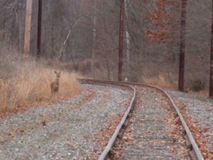
On the ConRail railroad tracks between Prospect Plains and Cranbury Station on the boundary of Cranbury and Monroe, Middlesex County.
JEEP-LESS, THE BAD: My Jeep Wrangler has been in the shop. A metal plate in the clutch area cracked. When mechanic-friend Frank Ulatowski told me the parts distributor said, I never ordered this part before, I knew this could be trouble. The part, being shipped from Detroit, finally did come in and Frank installed it, but the repair was set back by the need for a second part. The Jeep should be ready Monday. For the past week, though, my travels have been limited – generally confined to walking in my hometown of Monroe and the bordering towns of Helmetta, Spotswood, South Brunswick, Cranbury, and Jamesburg.
JEEP-LESS, THE GOOD: With no work scheduled, I decided to not rent a motor vehicle, instead hoofing it. I have thought about this for years – on my days not working, try to only walk or bicycle. So, I have been constantly walking, along with some bicycling. My longest walk was 11 miles – a trek home from the doctor’s office for a followup on my annual exam in Monroe (to which I taxied), with a detour to Teddy’s luncheonette in Cranbury and, later, supper in Helmetta. Aside from the health benefits of walking, it has taken me on routes less-traveled and slowed me to observe better. So, I have a lot of cool observations to pass along.
An old farm site in Cranbury.
SNOWFALL UPDATE: The two snowfalls on Tuesday, January 30, amounted to an estimated 1.0 inch of snowfall at my Monroe house. This brings the seasonal total to 18.0 inches. The normal season average is about 25.8 inches, recorded in New Brunswick, about 7-1/2 miles away; We still have about 2-1/2 months of snow potential to reach the average.

The view I awoke to, as seen from my bedroom window, on Tuesday, January 30, in Monroe.
‘POWDERED SUGAR’ SNOW: When I awoke Tuesday, January 30, I found a snowfall that looked as though the vegetation was covered with powdered sugar. It was a beautiful find to start the day!
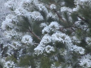
The “powdered sugar” snow on the pitch pine, “Pinus rigida,” in my backyard in Monroe.
NORTHERN HARRIERS, CONTINUED: I continue to see northern harriers, “Circus cyaneus,” more than I have ever seen. This week, I saw one at Helmetta Pond, Middlesesex County – the first time I recall seeing one there. Remember, as a nester, New Jersey lists them as “endangered,” or in imminent peril. Look for them hunting game by flying low above fields or marshes. They are sleek and have a white rump patch – females are brown, males are gray-white. As Roger Dreyling, birder extraordinaire from Monroe, noted, “I like harriers, especially males, which are sometimes called ‘gray ghosts.’”
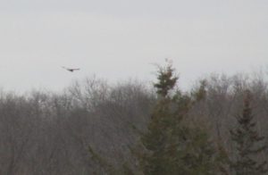
A female northern harrier at Helmetta Pond. Notice the white rump patch.
UPPER MILLSTONE RIVER EAGLES NEST: Anne Price and I, volunteers for the state Department of Environmental Protection, have been watching this nest. We agree it appears the eagles are incubating an egg or eggs. For example, I saw an eagle fly by the nest and perched nearby, while it appeared the other one was in the nest. Because bald eagles are a jeopardized species in New Jersey – “endangered,” or under imminent threat as a nester, and “threatened,” or could become “endangered” if conditions persist, in general – we are being discreet in identifying the location of the nest. (In the 2017 state eagles report, http://www.state.nj.us/dep/fgw/ensp/pdf/eglrpt17.pdf, this nest is listed as No. 184, “Upper Millstone.”)
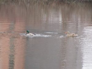
Mallard ducks, “Anas platyrhynchos,” at a fire-suppression pond at the former George W. Helme Snuff Mill in Helmetta. The more colorful male is on the left.
VOICES FROM AFIELD, EAGLE SIGHTINGS: I keep saying, if you want to see bald eagles, look up into the sky. Various reports came in during the week week. Michele Arminio of Monroe reported seeing a flying eagle at Milltown Road, between Route 18 and Ryders Lane, in East Brunswick. Janice Weinman reported seeing one at the South River and its wetlands on the boundary of Old Bridge, Sayreville, and East Brunswick: “Flying out of the marshlands area on the east side of Bordentown Avenue, flying towards east Brunswick. It was an adult as it had its white head, but not too big. I was surprised to see one there. I was not aware of any in that area.” Actually, this one could be nesting in the Old Bridge area. A pair, there, has repeatedly moved its nest and, last year, a nest could not be located. Paul Reed reported an eagle at Helmetta Pond. Roger Dreyling of Monroe reported an immature eagle at “Jamesburg Lake” (Lake Manalapan) in Monroe. Duke Farms in Hillsborough, Somerset County, has a camera on its eagle nest, http://dukefarms.org/making-an-impact/eagle-cam/.

An immature bald eagle – notice the lack of white head and tail – with a fish at “Jamesburg Lake” (Lake Manalapan) in Monroe in January. (Photograph copyright 2018 by Roger Dreyling)
MUTE SWANS: Ugh, I dislike mute swans, “Cygnus olor,” non-natives that hurt local ecosystems through their aggressive eating of aquatic vegetation and scaring off native species. But they are naturalized here…. This week, I saw a pair at Helmetta Pond.
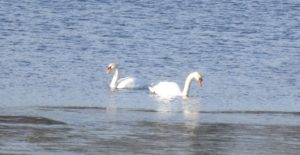
Mute swans on Helmetta Pond.
BACKYARD SHRUB PILE: I keep a pesticide- and fertilizer-free yard. It is only a quarter-acre, or about 10,000 square feet. But it is productive — a vegetable and fruit garden of more than 1,000 square feet, bird-feeders, bird baths. Roughly only 10 percent of rainwater drains off the property. One of the pro-environment bits of my property is the brush pile and tall-grass patch I keep in the backyard. The brush pile, for example, is a place for birds to retreat to and perch. This week, I photographed a few house sparrows, “Passer domesticus,” is the pile. (I was happy to see the brush pile being used, despite being used by house sparrows, a non-native species.)
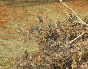
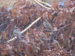
House sparrows in the backyard bush pile.
OTHER YARD BIRDS: I took random photos of various bird species in my yard: cardinal, “Cardinalis cardinalis”; dark-eyed juncos, “Junco hyemalis,” or “snowbirds”; red-bellied woodpecker, “Melanerpes carolinus”; and grackles, “Quiscalus quiscula.”
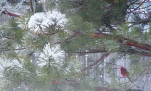
A cardinal, “Cardinalis cardinalis,” in the backyard pitch pine.
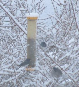
Snowbirds – one at the niger feeder, one perched nearby, one flying in.
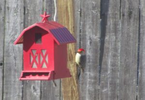
Red-bellied woodpecker at the sunflower kernel feeder.
Grackles at the feeder.
VOICES FROM AFIELD, ROBINS: “Polish Paul” Migut, a friend going back to childhood, checked in on robins, “Turdus migratorius.” He, too, had them in his South River yard. “Thursday (February 1) morning, looking into my rear yard, spotted about 10 to 12 robins,” Paul said. “Looked very healthy, plump.” Again, some may consider a robin as a sign of spring, but they are year-around.
RED-TAILED HAWKS: This week, I was able to get some pretty close-up photographs of red-tailed hawks, “Buteo jamaicensis.” Looked for them perched, soaring with a creamy underbelly look and rust-colored tail, or a big bird flying and flapping its wings about a half-dozen times.
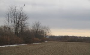
A red-tailed hawk perches in a tree and watches over farmland in South Brunswick.
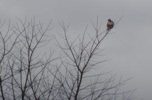
A closeup of the South Brunswick red-tailed hawk.

A red-tailed hawk perches in a tree near New Jersey Turnpike Exit 8-A in Monroe.
DEAD GREAT BLUE HERON: I was hiking in the Pine Barrens around Helmetta and at Cranberry Bog came across a dead blue heron, “Ardea Herodias.” It was lying on dry ground, inches from the water. Its eyes were in place and its body supple, so it probably was not dead all that long. I saw no obvious cause of death. Its anal area was ripped up a bit, but that likely was caused by a scavenger after death. I talked to Rick Lear, head of the Middlesex County Office of Parks and Recreation, about it and he speculated it died of starvation, because of the difficulty of finding food, such as aquatic animals and small mammals, this time of year.

A great blue heron I found dead at Cranberry Bog in Monroe.
FARMLAND, DEVELOPABLE LAND: I recall saying, “Potatoes like dry feet and so do developers.” Well, look at this gravelly, or well-drained, farmland in South Brunswick. Nice developable land, unfortunately! Even more unfortunate is it being located on the New Jersey Turnpike, near an exit, 8-A.
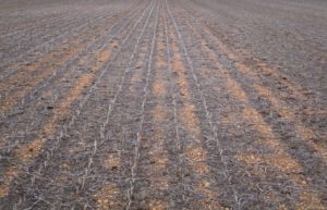
Gravelly farmland in South Brunswick.
PHRAGMITES: I am noticing a lot of invasive reed grass, genus “Phragmites.” This stuff really clogs wetlands and is difficult to control. It is not only bad for the environment, but also for drainage. Beware in heavy rain, this will contribute to flooding. And phragmites invasion is only getting worse, from what I see.
Phragmites clogging Cranberry Bog in Monroe.
BARKING FOX: One night, I stood in my yard and listened to this yip, yip, yip call from the woods or near the woods. It was a red fox, “Vulpes vulpes.” So, do not only look, but listen. Nature is all around us.
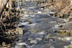
NON-POINT SOURCE POLLUTION: I was walking in the Manalapan Brook floodplain in Helmetta and there it was, non-point source pollution – garbage — that got into the water system and floated about. Ever seen those notices about garbage getting into storm drains? They really mean it. Throw a plastic bottle out of a car miles inland and, at least in theory, it could wind up in the ocean. Even if it does not wind up in the ocean, it could wind up in the freshwater system. And even if it does not do that, it is still litter.
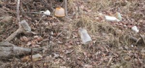
Non-point source pollution in the Manalapan Brook floodplain at Helmetta.
ATLANTIC OCEAN TEMPERATURES: The Atlantic Ocean temperature along the New Jersey coast was running at about 35 to 37 degrees on the February 3-4 weekend.
SUNRISE/SUNSET: From Sunday, February 4, to Saturday, February 10, the sun will rise about 7 a.m. and set 5:25 p.m. From Sunday, February 11, to Saturday, February 17, the sun will rise about 6:45 to 6:55 a.m. and set at about 5:30 to 5:35 p.m.
WEATHER: The National Weather Service forecasting office serving the Jersey Midlands is at http://www.weather.gov/phi/.
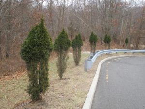
Deer damage to arbor vitae trees at the old George W. Helme Snuff Mill power plant in the Helmetta.
Joe Sapia, 61, is a lifelong resident of Monroe — in South Middlesex County, where his maternal family settled more than 100 years ago. He is a Pine Barrens naturalist and an organic gardener of vegetables and fruit, along with zinnias and roses. He draws inspiration on the Pine Barrens around Helmetta from his mother, Sophie Onda Sapia, who lived her whole life in these Pines, and his Polish-immigrant grandmother, Annie Poznanski Onda. He gardens the same backyard plot as did his Grandma Annie and Italian-American father, Joe Sr. Both are inspirations for his food gardening. Ma inspires his rose gardening. Joe is a semi-retired print journalist of almost 40 years. His work also is at @JosephSapia on Twitter.com, along with Facebook.com on the Jersey Midlands page.
Copyright 2018 by Joseph Sapia
Article and photos by Joseph Mish
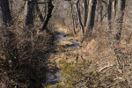
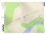
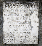
A thin blue line drawn on a map, comes to life in this photograph. A plaque, inset in a concrete bridge spanning the stream, constructed in 1923, a map showing a thin blue line depicting the stream and an image of the stream as it exists today just before it reaches the South Branch.
If all the water that ever flowed from the Raritan River drainage could be measured, its contribution to the depth of the ocean would be impressive. Think of that watershed as a collection agency for world’s oceans.
An aerial view of the Raritan River clearly shows its two main branches, the South Branch, and the North Branch. The South Branch draining more area than the North. The confluence of the North and South branch mark the beginning of the Raritan River.
A closer look reveals the larger tributaries which feed the main branches; Rockaway creek, Black River/ Lamington River and the Neshanic River, all of which are clearly noted on maps.
No less important, are the numerous smaller brooks and creeks whose contribution is significant and whose names may appear only on old maps or engraved on marble plaques set in the structures that bridge their banks; Peter’s brook, Chamber’s brook, Pleasant run, Prescott brook, Assiscong creek, Minneakoning creek, Holland brook and the First, Second and Third Neshanic rivers. Hoopstick, Prescott and Bushkill are lesser known streams, within plain view, that bear no identifying name.
There are dozens more minor streams whose names appear nowhere except on an obscure online list. Each one eventually feeds into the Raritan or its two main branches above their confluence. Knowing someone’s name is a sign of respect. Calling someone by the wrong name can be embarrassing. However, the sign that identifies the North branch of the Raritan as the Raritan River proper, has failed to embarrass those responsible for posting such signs.
Many smaller seeps and springs whose names have been lost to the ages, add to the accumulated flow. Driving along the Lamington, for instance, there are endless watery traces, arising from springs within the woods that empty into larger tributaries. Many are just moist creases worn through the soil over time, which collect rainwater and snow melt to supplement the downstream daily flow.
Maps show nameless springs, which make the cartographer’s final draft, as thin blue lines. Often, a network of converging shorter lines, each with a defined beginning, join to form larger streams like Pleasant run and Holland brook.
These obscure water sources fascinate me simply because their anonymity and remote location arouses curiosity. Their presence also represents a convergence of habitat types that attract birds and wildlife. Though they bear no labels to honor their faithful contribution to the next blue line and ultimate confluence, their importance should not be overlooked.
Many springs which appeared on old maps no longer exist, eliminated by construction of sewer lines or filled in. As maps are revised and generations fade, these streams exist only in a cartographer’s archive.
My appreciation for these disappearing blue lines was heightened when I recently discovered that as a kid, I walked over Slingtail brook every day on the way to school. At some point this little stream was diverted through a sewer line under the pavement. More amazing, even older residents had no memory of that stream whose name has been lost to the ages.
An extended winter freeze, preserving snow from a previous storm, beyond its expected stay, was interrupted by a thaw and heavy rain. The melting snow joined the torrential rain as it flowed over frozen ground to collect in every shallow crease leading to the river. The water’s velocity was enhanced by the decreasing gradient of deep well-worn pathways etched in the earth.
Where water barely trickled most of the year, a proportional biblical flood now ensued.
The banks of the successively larger streams barely contained the accumulation of water delivered from the network of anonymous thin blue lines. Acting as a single entity, the collection agency if you will, the Raritan River drainage, faithfully delivered its contribution of sweet water to the world’s salty oceans.

Cattail brook arises from the convergence of a network of bubbling springs, supplemented by runoff from rain and snow fall. It begins as hardly more than a trickle, directed by gravity, from the south facing ridge of the heavily forested Sourland mountains. The DNA extracted from a drop of water, taken from the deepest canyon in the ocean, would trace its lineage back to cattail brook through its genetic progeny. Cattail gives birth to Rock Brook, a tumultuous and moody stream that joins the more sedate Bedens brook on its way to the Millstone river. The Millstone brings its accumulated genetic material to blend with that of the Raritan to make a final contribution to the earth’s deep blue oceans.

We use our imagination as we await the technology that can trace the oceans DNA back up Cattail brook to show a single drop of morning dew that dripped from a box turtles face, was a critical contribution to the blue ocean we see via satellite images of the earth.
Rock brook derives its character from the influence of gravity which changes its mood from an idyllic mountain brook to a raging torrent.
Author Joe Mish has been running wild in New Jersey since childhood when he found ways to escape his mother’s watchful eyes. He continues to trek the swamps, rivers and thickets seeking to share, with the residents and visitors, all of the state’s natural beauty hidden within full view. To read more of his writing and view more of his gorgeous photographs visit Winter Bear Rising, his wordpress blog. Joe’s series “Nature on the Raritan, Hidden in Plain View” runs monthly as part of the LRWP “Voices of the Watershed” series. Writing and photos used with permission from the author.
Article by Quentin Zorn
My name is Quentin, and I am a junior at Rutgers studying environmental policy. Over the course of this semester, I have been interning with the Lower Raritan Watershed Partnership and have had the opportunity to work on a wide variety of projects relating to water quality issues. I participated in many stream cleanups, attended many exciting events such as the Raritan River Festival, got to contribute to several long-term art projects and learned a lot along the way. This experience has not only taught me a lot about watershed management, but also has broadened my way of thinking and strengthened my passion for combating environmental issues.
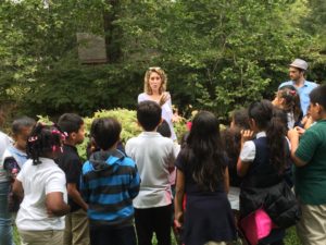
One of the more exciting projects I was able to participate in was teaching kids from the Plainfield Youth Center about water quality and watershed management, and to work on an art project with them. This was part of the Lower Raritan Watershed Partnership’s Project WADES Environmental Education curriculum. We started off by taking the kids to a nearby stream and training them in visual habitat assessments and how to notice what kinds of things can impair stream quality, such as nearby roads, maintained lawns and lack of riparian cover. We got to help build a foundation with these kids at a young age, which will help them understand and care about water quality issues as they grow up.
The art project we worked on with the kids was a lot of fun and interactive. Each kid selected a piece of trash found at a cleanup in the Lower Raritan Watershed, and then held that piece of trash in a container, which we would then fill with an algae-based mold called alginate.

The finished products were a bunch of unique sculptures of hands holding the trash.
When I was working on my own on this internship, I got to explore and contribute to several different datasets. I worked on a master database of every municipality in the Lower Raritan Watershed that contained a wide variety of information on each town’s environmental and development plans. I also worked with data from the New Jersey Department of Environmental Protection on different industries that have permits to pollute into the Raritan River, and I helped make this data more coherent and complete. This helped me understand what kind of information is important when considering water quality, and also my contributions helped make more complete and meaningful logs of data. It was really satisfying to see all this information come together and fulfilling to know that the public can access this data and learn what is going on in their watershed.

There were many cleanups of streams in the watershed throughout the duration of my internship, and I participated in as many as I could. The cleanups were far more rewarding than I anticipated them being. Arriving at any given cleanup gave me a feeling of hopelessness when I would see how much trash there was. I would think, “we can make this a little better, but it’s still going to be in a bad condition.” Every single cleanup I was surprised by how good of a job everyone did, and how great the area looked when we left. Seeing all of the trash piled up in the end was always shocking but felt good to have gotten it all out of the ecosystem.
Article and photos by Joe Sapia (except where noted)
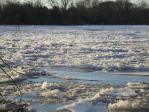
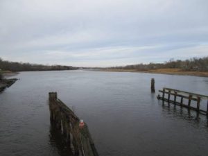
The Delaware River, iced-over Tuesday, January 2, at Washington Crossing — looking from Mercer County, New Jersey, to Bucks County, Pennsylvania, just upstream of the bridge.
SUB-FREEZING DAYS: After days of sub-freezing cold, how cold was it? Cold enough for a waterway – in this case, the mighty Delaware River — to freeze over.
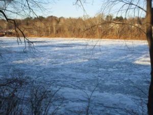
The frozen-over Delaware River Tuesday, January 2, at Washington Crossing, looking from Pennsylvania to New Jersey.
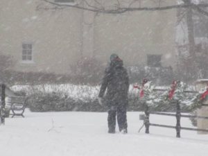
A woman maneuvers Main Street in Cranbury during the Thursday, January 4, snowfall.
SNOWFALL, JANUARY 4: This storm produced a wind-whipped, powdery snow. Snowfall totals reported by National Weather Service:
Burlington County: 3.4 inches at Cinnaminson to 7.5 inches in the Southampton area.
Hunterdon County: 1.9 inches at Readington to 5.8 inches in the Hampton area.
Mercer County: 4.0 inches in the Washington Crossing area to 6.6 inches in the Lawrence area.
Middlesex County: 4.5 inches in the South Brunswick area to 9.6 inches at Cheesequake.
Monmouth County: 9.0 inches at Keyport to 18.0 inches in the West Long Branch area.
Ocean County: 12.5 inches in the Brick area to 18.3 inches in the Berkeley area.
Somerset County: 3.0 inches in the Montgomery area to 5.8 inches in the Franklin area.
(These totals are for these specific stations and may not be complete highs and lows for the counties.)

A snowplow pushes snow on Stockton Avenue in Jamesburg, Middlesex County, in the Thursday, January 4, snowfall.
SNOWFALL FOR THE SEASON: With the January 4 snowfall, my house in Monroe, Middlesex County, has had 16 inches of snow, so far this season. The seasonal average at New Brunswick, Middlesex County, or about 7.5 miles from my house, is 25.8 inches. The January 4 snowfall produced 7 inches at my house.
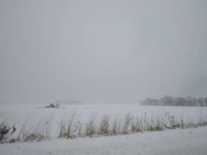
A wind-whipped, snowy field in Monroe, Middlesex County.
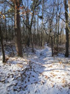
WALKING THE SNOWY WOODS: During the Thursday, January 4, storm, I set out from my house about 4:30 p.m., hitting the woods across the street, not wanting to pass up the pristine snowy woods. It was a brief walk, only about 45 minutes from shortly before sunset to shortly after. But I was glad I got to spend a few minutes shooting pictures of nature’s beauty and relaxing in the woods, before shoveling snow. (Weather conditions: Overcast, estimated temperature of 27 degrees, dew point of 5.5 to 6, wind sounding like a freight train.) I got thinking about this short time in the woods. Normally, I do not consider it a hike unless I do at least 3 miles. Perhaps I should re-focus and think about the mental part of the woods and try to get out there daily, even if for only a short time.
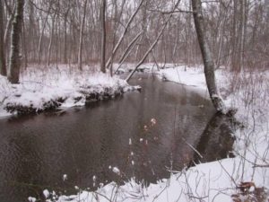
The Old Swimming Hole on Manalapan Brook in Monroe, Middlesex County.
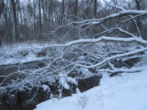
A snow-covered treefall on Manalapan Brook in Monroe, Middlesex County.
SNOW AND THE LAY OF THE LAND: Take advantage of any snow cover. Where there is no snow cover, the woods presents itself as a homogenous picture of earth tones or green leaves – or both. But add a snow-cover; or, better, snow-cover and snow clinging to vegetation; or better yet, snow-cover, snow clinging to vegetation, and foliage and the depth and roll of the land stand out.
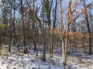
The snow-dusted Pine Barrens around Helmetta, Middlesex County – here, specifically, an East Brunswick section of the Jamesburg Park Conservation Area. With the snow contrasting against the earth tones of the woods, it is easy to see the roll of the land.
A firecut, plowed by the state Forest Fire Service before a controlled burn here in the Jamesburg Park Conservation Area, is easly seen, along with the rest of the lay of the land, thanks to snow contrasting with the woods’s earth tones.
VOICES FROM AFIELD, EAGLE: Patty Byrnes Lang of Monroe, Middlesex County, checked in with photographs of a bald eagle, “Haliaeetus leucocephalus,” she saw on the boundaries of Monroe, Cranbury/Middlesex County, and East Windsor/Mercer County. In New Jersey, bald eagles are “endangered,” or in immediate jeopardy, as breeders and “threatened,” meaning if conditions persist they could become endangered,” in general. Patty described one encounter, “I caught a glimpse of him in one of the trees on the left. We got to watch as he flew off the branch he was on, circled the field, and landed on another tree.” Based on its coloring, this is an adult. It could be one of the adults that had a nest last year nearby, along the Millstone River in Monroe. This is the time of year eagles begin working on nests.
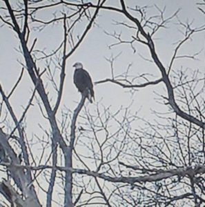
A bald eagle on the boundary of Middlesex and Mercer counties, along the border of Monroe/Middlesex, Cranbury/Middlesex, and East Windsor/Mercer. (Photo copyright 2017 by Patty Byrnes Lang)
VOICES FROM AFIELD, BLUEBIRD: Bob Kane of Cranbury, Middlesex County, checked in with a photograph of an eastern bluebird, “Sialia sialis,” taken in his town. This one is easily identifiable as a male, because of the bright coloring.
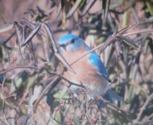
A male eastern bluebird at Cranbury, Middlesex County. (Photo copyright 2018 by Bob Kane)
RANCOCAS CREEK: The Rancocas Creek watershed is 360 square miles. It is the only major waterway that flows into the Delaware River from the Pine Barrens. And, despite being freshwater, has a tidal effect; The Delaware River has a tidal effect on its freshwater as far north as Trenton.
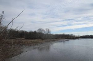
Low tide on Rancocas Creek, looking upstream on the boundary of Mount Laurel, Willingboro, and Westampton, all in Burlington County. Although this is freshwater, there is a tidal effect on the Delaware River and its tributaries as far north as Trenton.
Rancocas Creek, looking downstream at the boundary of Mount Laurel, Willingboro, and Westampton, all Burlington County.
GARDEN WRITING COURSE: This spring, I will be teaching non-fiction writing again at the Princeton Adult School. This time, it will be “Garden Writing,” five sessions on Thursdays, 7 p.m. to 9 p.m., from March 22 to April 26. The class description: “Look at your garden and yard in a different way – through your words. Record your memories in the garden and yard through the essay and vignette. This writing-intensive course has weekly take-home assignments, with the instructor returning critiqued papers. Students will learn writing components, outlining, grammar, style, interviewing, and the importance of resources such as dictionaries and stylebooks – with all assignments focusing on our vegetables, flowers, yards – or afield, if you wish. In-class discussion will cover good examples turned in by students, common problems, and concerns. Feel free to use the class to write a chapter a week of a dream project, work on getting published, keep a journal, or just have fun.” The class costs $99. Enrollment at http://www.ssreg.com/princeton/classes/classes.asp?catID=3679.
ATLANTIC OCEAN TEMPERATURES: The Atlantic Ocean temperature at in New Jersey on the January 6-7 weekend ranged from about 29 to 30 degrees.
WEATHER: The National Weather Service forecasting office serving the Jersey Midlands is at http://www.weather.gov/phi/.
SUNRISE/SUNSET: For Sunday, January 7, to Saturday, January 13, the sun will rise about 7:20 a.m. and set about 4:45 to 4:50 p.m. For Sunday, January 14, to Saturday, January 20, the sun will rise about 7:15 to 7:20 a.m. and set about 4:55 to 5 p.m.
PENNSYLVANIA FARM SHOW: The Pennsylvania Farm Show continues through Saturday, January 13. It is a real-deal show of farming life, not faux farming. So, it has animals, tractors, food preparation, food to buy, gardening displays, and exhibitions. Visitors can get up close to it all. And check out the butter sculpture! (Unfortunately, I will miss the show this year. I had plans to go Wednesday with friends Jimmy and Kathy Krygier of Krygier’s Nursery in South Brunswick, Middlesex County, but work called. I am disappointed, because I look forward to this show.) More information at http://www.farmshow.pa.gov.
COVERING THE WEATHER: During my 31 years as a reporter at the Asbury Park Press, I never saw fellow Metro reporters whine so much about covering something than about weather stories. Me, just the opposite. I loooooooved weather stories. Still do. Was out most of Thursday, January 4, chasing the snow.
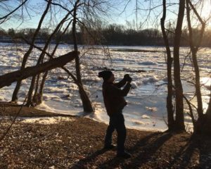
Joey on the job, here Tuesday, January 2, photographing the iced-over Delaware River at Washington Crossing, Mercer County.. (Photo copyright 2018 by Pamela B. Roes)
Joe Sapia, 61, is a lifelong resident of Monroe — in South Middlesex County, where his maternal family settled more than 100 years ago. He is a Pine Barrens naturalist and an organic gardener of vegetables and fruit, along with zinnias and roses. He draws inspiration on the Pine Barrens around Helmetta from his mother, Sophie Onda Sapia, who lived her whole life in these Pines, and his Polish-immigrant grandmother, Annie Poznanski Onda. He gardens the same backyard plot as did his Grandma Annie and Italian-American father, Joe Sr. Both are inspirations for his food gardening. Ma inspires his rose gardening. Joe is a semi-retired print journalist of almost 40 years. His work also is at @JosephSapia on Twitter.com, along with Facebook.com on the Jersey Midlands page.
Copyright 2017 by Joseph Sapia
