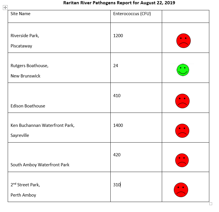
Raritan River Enterococci results for 8.22.2019, for six non-swimming beach public access sites. Enterococci results are reported in Colony Forming Units or CFUs. Suitable levels for enterococci should not exceed 104cfu/100mL.
**Please note: these results are preliminary and awaiting Quality Control.**
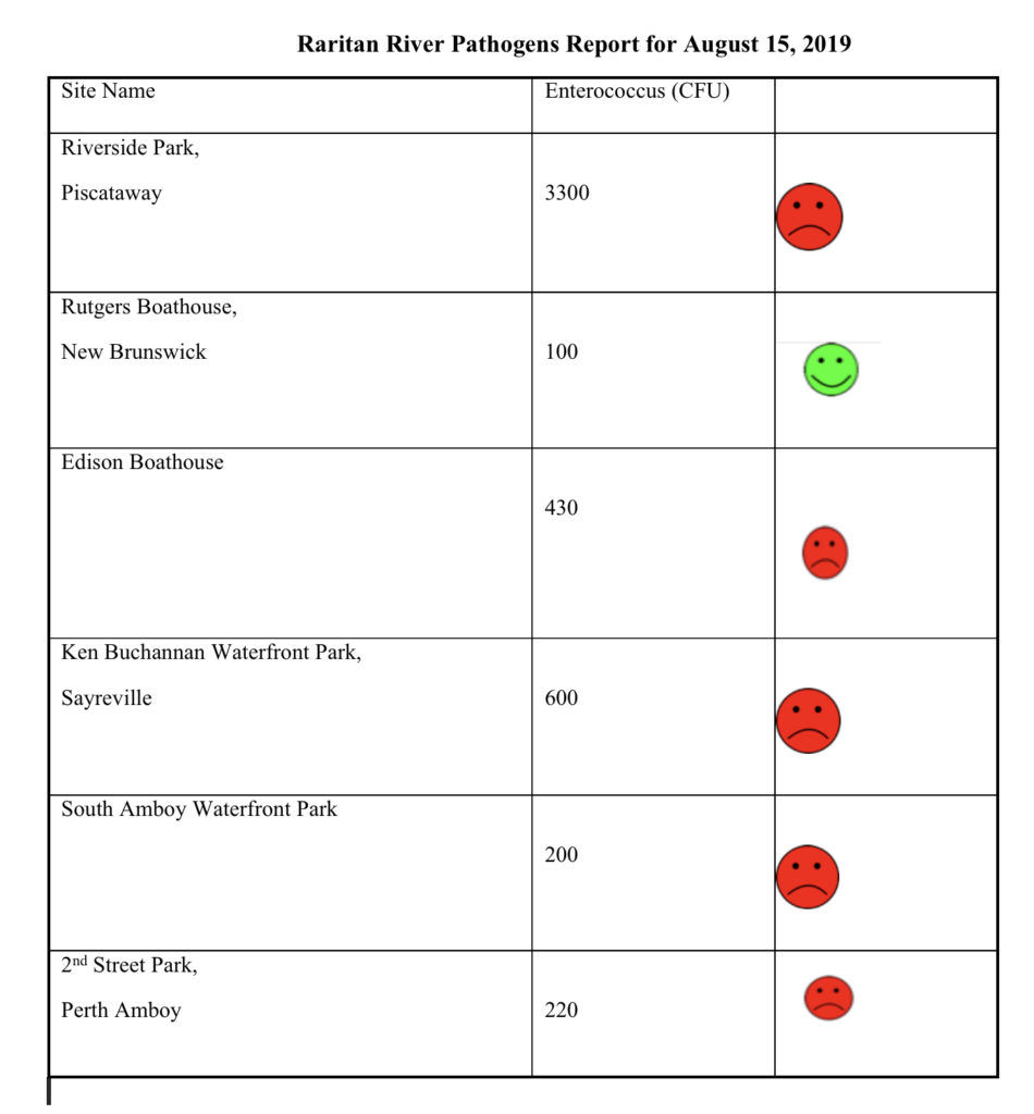
Raritan River Enterococci results for 8.15.2019, for six non-swimming beach public access sites. Enterococci results are reported in Colony Forming Units or CFUs. Suitable levels for enterococci should not exceed 104cfu/100mL.
**Please note: these results are preliminary and awaiting Quality Control.**
Our team conducted pathogens (enterococci) monitoring of six Raritan River public access sites a bit early this week so as to report out in time for the holiday weekend. We are very happy to report that with a few exceptions (Piscatway and Perth Amboy), our numbers look pretty good!
Enterococci results are reported in Colony Forming Units or CFUs. Suitable levels should not exceed 104 cfu/100mL.
The Lower Raritan Watershed Partnership is grateful to our
EARTH Center of Middlesex County partners, to the Interstate Environmental
Commission for lab analysis, to the Sustainable Raritan River Initiative for
providing grant support, to Jesse Stratowski and his team at the Rutgers
Boathouse, and of course to our wonderful volunteers!
**Please note: these results are preliminary and awaiting Quality Control**
For those of you making plans to be on the water, see below for enterococci results for our monitoring sites, reported in Colony Forming Units or CFUs. Please note that while we follow quality control measures, the real-time nature of data delivery means that EPA has not reviewed, and these are not technically quality controlled.
Enterococci levels are used as indicators of the possible presence of disease-causing bacteria in recreational waters. Such pathogens may pose health risks to people fishing and swimming in a water body. Sources of bacteria include Combined Sewer Overflows (CSOs), improperly functioning wastewater treatment plants, stormwater runoff, leaking septic systems, animal carcasses, and runoff from manure storage areas.
Enterococci results are reported in Colony Forming Units or CFUs. Suitable levels should not exceed 104 cfu/100mL.
Briefly put, the numbers look good for our New Brunswick, Sayreville and South Amboy sites. Numbers are bad for our Piscatway and Edison sites, and downright horrible for our Perth Amboy site.
Riverside Park (Piscatway, 40.54067, -74.51219): 6300 CFU Rutgers Boat House (New Brunswick, 40.48826, -74.43384): 51 CFU Edison Boat Basin (Edison, 40.48769, -74.38409): 640 CFU Ken Buchanan Waterfront Park (Sayreville, 40.47483, -74.35586): <10 CFU South Amboy Waterfront Park (South Amboy 40.48334, -74.2698): <10 CFU 2nd Street Park (Perth Amboy 49.50007, -74.27719): TNTC or Too Numerous to Count. (This number is >60,000.)
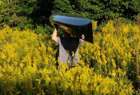
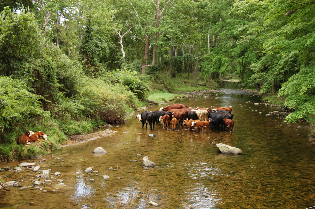
Access to some of the tributaries feeding the North and South Branch of the Raritan River is strictly a trail blazing event. The rewards are worth the effort.
Like a spectacular desert flower that only blooms after a rain, many tributaries of the Raritan river’s North and South Branch suddenly blossom into navigable waterways if only for a brief moment.
These ephemeral watery threads weave though otherwise inaccessible places of pristine beauty and undisturbed wildlife. Visitation is exclusively by invitation of the rain. The chance of appropriate water level matches the odds of winning at roulette. However, the opportunity to enjoy runnable water is increased, as it can occur at any time of the year, unlike many northeast rivers that are seasonally dependent on melting snow and large drainage areas.
One jewel of a stream went a full year before the shadow of my canoe silently passed over its sandy bottom in time with the midsummer freshet racing to the sea. The rarity of such a small stream sojourn increases the value of the experience.
The appearance of an apparition is the best way to describe the transformation of a small tributary into a navigable waterway. Water that lazily followed a convoluted path through a twisting labyrinth of exposed rocks, now flows over them with self-determination. The exposed stream bed is flushed clean of fallen leaves and broken branches while smaller rocks and stones are subtly rearranged into future sand bars and shoals.
For many years I had my eye on a tributary of the South Branch too shallow to run and whose character was totally unknown to me. On these small streams, strainers, trees that span the watercourse from bank to bank can be life threatening, especially in high water with minimal possibility for evasive action. Even on the main course of the North and South branch, strainers have claimed paddlers’ lives.
So, it was with caution that I approached what I considered to be a reasonable water level, after studying the historic stream gauge data. The possibility of another as yet undiscovered eagle nest, was also a consideration in choosing this stream.
While not situated in the wilderness, a solo trip like this, even in central New Jersey, is not to be taken lightly. I checked topo maps as well as aerial views and road maps to confirm my location at any given point.
Though I certainly wasn’t the first to paddle this stream, it sure felt that way. The initial stretch was one of several locations where the water level could be viewed from the road and rarely were the midstream rocks covered with water. Today, however, I floated easily, inches above the largest rocks. Five minutes later I was out of sight, around the first bend and on my way to explore the unknown. A very strange thought to have amid the congestion of central New Jersey; a little kid’s fantasy come to life.
The scenery did not disappoint, hardwood trees dominated the shoreline and formed a wide greenway to serve as a protective margin against runoff from cultivated land and residential properties. The intimacy of the stream’s narrow course bought both banks into view while looking straight ahead.
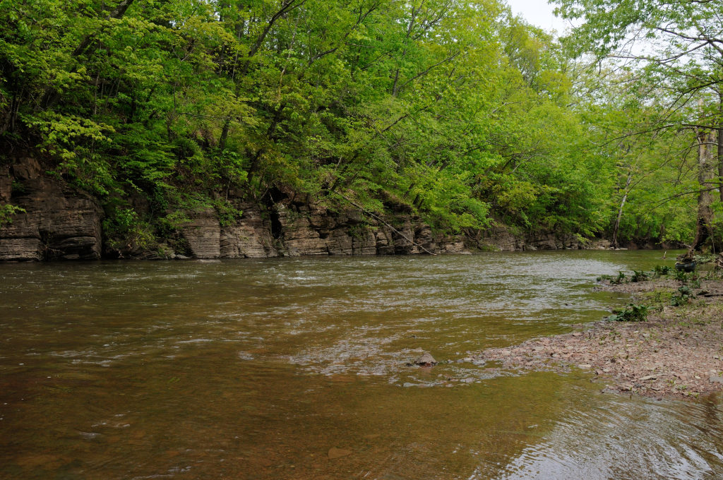
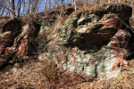
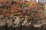
Bare red shale outcroppings provided a cutaway of the contours seen on the topographic map. Some more dramatic than others.
At the point of highest elevation, through which the stream cut its course, a palisade of red shale stood so high, it felt as if I were paddling through a canyon. Atop the sky scraping cliff stood a wall of giant trees which appeared to be on the same plane as the cliff face. Their combined height and singular appearance could not be taken in with just a tilt of the head and an upward glance. It was as if the trees were standing on the earth’s shoulders in a successful effort to touch the sky.
As is characteristic of these small streams, changes happen quickly and dramatically.
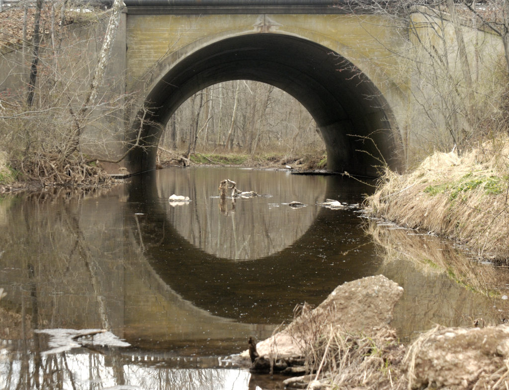
One moment later, the unobstructed view of the blue sky and towering prominence vanished, as a sharp bend in the again green canopied river, demanded my full attention. Here, the main current was rushing to the inside of the almost angular curve and through the branches of a fallen tree. Several forceful draw strokes were required to avoid entanglement.
The rest of the trip was easily navigated through a few rock gardens and shoals. Deer were everywhere, while a pair of geese and a few wood ducks provided a downriver escort, warning the world of my otherwise silent approach.
No eagles were to be seen, though a close encounter with a great horned owl made up for the absence of a new eagle nest site. I eagerly await my next rain drenched invitation to another, one of many, tributary paddling options.
Each tributary has its own character, no two alike, other than they share invitation by rain only.
Author Joe Mish has been running wild in New Jersey since childhood when he found ways to escape his mother’s watchful eyes. He continues to trek the swamps, rivers and thickets seeking to share, with the residents and visitors, all of the state’s natural beauty hidden within full view. To read more of his writing and view more of his gorgeous photographs visit Winter Bear Rising, his wordpress blog. Joe’s series “Nature on the Raritan, Hidden in Plain View” runs monthly as part of the LRWP “Voices of the Watershed” series. Writing and photos used with permission from the author. Contact jjmish57@msn.com. See more articles and photos at winterbearrising.wordpress.com.
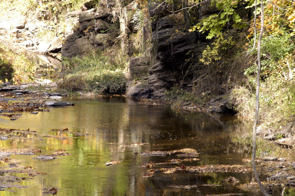
The sentinel red shale cliffs host a garden of moss, wildflowers and lichens as they stand watch over the meandering South Branch. The wandering river has its way after honoring the boundary set by this shale outcrop
The meandering South Branch has changed much of its course over the decades, restrained in its wandering, only by the presence of red shale cliffs that mark its course.
In an area of rolling hills, flood plain and the absence of field stone, the last thing you’d expect to see is a cliff. The cliffs are an exposed edge to the earth’s crust, forced above ground by never ending geologic activity along a fault line.
Growing up along the lower Raritan, there wasn’t a cliff to be seen. So when I ventured upstream in later years, the presence of a cliff was a big deal. It added drama to my paddling adventures. A genuine, bonafide cliff, like the ones you see on TV and in the movies, where heroes hung by their finger tips and from which villains fell to their death.
To top it off, these cliffs are red, well really maroon, which set them apart from any other cliffs, most of which are composed of hard gray stone.
I cannot paddle past one of these outcroppings without looking for some sign of a petroglyph. Shallow carvings made in stone by paleo inhabitants. What paleo hunter/gatherer would not leave some indelible sign on those giant billboards untouched by seasonal floods? Haven’t found any, but still keep looking.
One thing I did find is a shale slab underwater, etched with the name, “J N Stout”, followed by a roman numeral. Stout is a name common to the area of some of the earliest settlers. That inscription still remains a mystery. It would make sense to use that cliff as a boundary marker, even early 20th century deeds listed trees and rocks to mark property lines.
Surely there must be some sign from paleo travelers scratched into those cliffs. Perhaps when the light is right, a shadow of a deer or a turkey will magically appear on that red stone tablet, a testimony to a successful hunt from post glacial times.
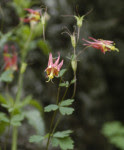
While not finding ancient artifacts of human origin, there are ancient travelers who set down roots in the cliff face. To my amazement, columbine, a native wild flower, flourishes only on the cliffs and flowers in the April/ May timeframe.
Portions of the cliffs, shaded from the sun, will be covered with a carpet of thick, dark green moss and scattered patches of the pale green lichens, to compliment the dark maroon shale.
It was beneath one high shaded cliff, notched with narrow ledges, that I silently walked, searching for photo ops. The cliff on one side and the river on the other, separated only by a few paces, my steps were confined to one narrow trail.
Suddenly, the sound of frantic scrambling in the leaf litter on a small ledge just above, got my full attention. A red fox had been sunning comfortably, protected from the wind and safe from any danger. Now, as it scrambled to escape my presence, it slipped and fell, as leaf litter rained down upon my head. Fortunately, the fox regained solid footing and headed for parts unknown.
The cliffs held another surprise for me as I paddled by on a bright sunny day in the early spring. It was a time when large flocks of geese gathered on the river. In the distance, the river made a sharp bend to the left, directly opposite a high, bare faced shale cliff.
The noise the geese made was deafening, a misrepresentation of the few geese that were visible. The greater mass of the flock was out of sight, downstream of the bend. At first glance, the overwhelming noise, out of proportion to the geese that could be seen, amounted to an auditory hallucination and set the stage for what was yet to come.
As expected, the massive flock exploded into flight as I got closer. The sound was undiminished, though the geese were out of sight, below the river bend.
I suddenly realized I was watching the endless shadows of the geese that I could not see; fly across the face of the cliff.
Because the sound the geese made echoed off the cliff and only the shadows were visible, it appeared the shadows were the source of the sound. The cliff acted as a giant movie screen complete with sound track and shadow puppets in the form of geese.
So, it is with awe and expectation that I look upon the stalwart cliffs as timeless reference points, immovable sentinels that add beauty and dimension to the scenery along the North and South Branch, their tributaries and the upper Raritan River.
Author Joe Mish has been running wild in New Jersey since childhood when he found ways to escape his mother’s watchful eyes. He continues to trek the swamps, rivers and thickets seeking to share, with the residents and visitors, all of the state’s natural beauty hidden within full view. To read more of his writing and view more of his gorgeous photographs visit Winter Bear Rising, his wordpress blog. Joe’s series “Nature on the Raritan, Hidden in Plain View” runs monthly as part of the LRWP “Voices of the Watershed” series. Writing and photos used with permission from the author. Contact jjmish57@msn.com. See more articles and photos at winterbearrising.wordpress.com.
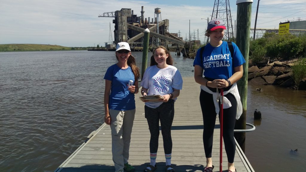
Volunteers have the chance to help gather and prepare samples and conduct analysis.
We kick things off at 9:30 AM each sampling day, and will be in the field for 5-6 hours total. The whole day includes a trip to the New England Interstate Pollution Control Commission lab in Staten Island to process samples.
Wear clothing appropriate for the weather, bring a hat and sunscreen, plenty of water and a lunch.
Our monitoring sites are as follows:
Riverside Park, Piscataway – 430 River Rd, Piscataway, NJ 08854
Rutgers Class of 1914 Boathouse, New Brunswick’s Boyd Park – 5 Memorial Pkwy, New Brunswick, NJ 08901
Volunteers will help project coordinators with sample collection, sample preparation and delivery, and analysis.
Directions to the EARTH Center-
We are located at 42 Riva Ave. in South Brunswick (note our mailing address says North Brunswick but you should use South Brunswick for your GPS). We are located in Davidson Mill Pond Park. When you come into the park follow the road around to the right and then go through the gate. Ignore the sign that says authorized vehicles only. Our building is down the road on the right with the green roof. Parking is right in front of the building. It’s a small place so you will find the room very easily. It’s right when you walk in.
South of New Jersey Turnpike Exit 8A – Cranbury/Jamesburg
Take Exit 8A towards Cranbury. Keep right, follow signs for Cranbury South Brunswick. Take Stults Road to US-130 North and make a right on US-130. In 4 miles make a right onto Old Georges Road and turn right onto Riva Ave. The EARTH Center will be on your right.
North of New Jersey Turnpike Exit 9 – New Brunswick
Turn off at Exit 9 (New Brunswick) and keep right towards Route 18 North. Use the right lane to merge onto US-1 S via the ramp to Trenton/Princeton. Use the right 2 lanes to take the US-130 S ramp to Camden. In 2 miles make a left onto Davidson Mill Rd. and turn right onto Riva Ave. The entrance to Davidson Mill Pond park and the EARTH Center will be on your left.
From Route 1, North of New Brunswick
Follow directions above from Route 1 on.
From Route 1, South of South Brunswick
Take Route 1 North. Turn Right onto Deans lane. Turn right onto Deans Lane. Turn left onto Georges Road. Continue straight onto Distribution Way for 0.4 miles. Distribution Way turns slightly right and becomes Old Georges Road. Turn right onto Riva Ave and The EARTH Center will be on your right.
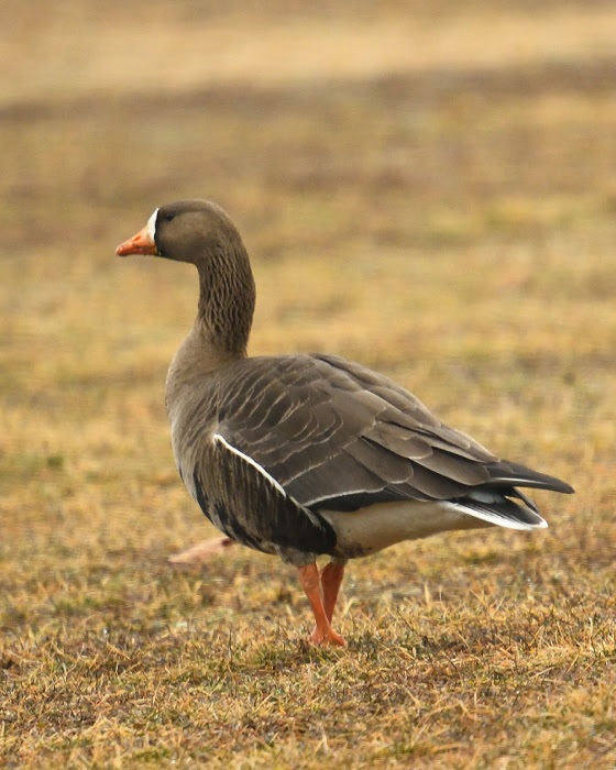
Article and photos by “Voices of the Watershed” Contributor Joe Mish
A white fronted goose, rarely seen west of the Mississippi river, enjoys grazing on central New Jersey grass.
Long before President Eisenhower signed the interstate highway bill into law in 1956, The Atlantic, Central and Pacific flyways served as major superhighways for migrating birds.
The primary exit ramps for these super flyways are the rivers which radiate out along the north-south migration routes to distribute the migrating birds far and wide.
New Jersey sits directly on the Atlantic flyway, bounded by the Delaware River and the Atlantic Ocean. Within the state’s interior flows the Raritan River, the longest inland river in the state which serves as a major migratory off ramp.
The confluence of the North and South Branches may then be considered the prime visitors center and rest area, as birds funnel down the Raritan to disperse inland.
Look at a colored distribution map in any bird book and discover that many species are specific to defined regions.
You might not expect to see a rufous hummingbird from the northern Pacific coast, sipping nectar in central New Jersey. However, in 2012, a rufous hummer showed up in our midst and stayed the winter, surviving by the kindness of human intervention. Marlene Scocco reached out to this wayward hummer providing food and shelter, causing a stir in the birding community which gratefully documented this migratory anomaly.
Checking the records for rare hummingbird visitors to New Jersey, other hummer species like the calliope and green violet eared were also documented.
How these birds end up on the east coast is pure speculation. The point is they do and they are here for you to discover.
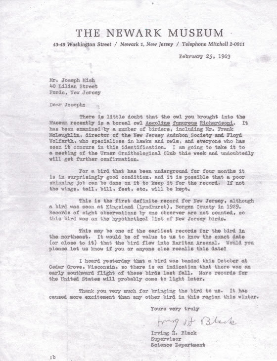
Feathered visitors from faraway places to the Raritan valley are not just limited to hummingbirds. In 1963 I was handed a small owl taken from a guard tower in the Raritan arsenal. It died shortly after. I mentioned this to a friend’s dad who was an avid bird watcher. Told him it was a boreal owl. He smiled and assured me it was probably a saw whet owl. We ended up at the Newark Museum and showed it to the curator, Irving H. Black. Confusion ensued and experts from across the country were consulted. The experts concluded the bird was indeed a boreal owl. It set a new record for the southernmost sighting in the US. The boreal owl, briefly known as the Richardson owl, is a fulltime resident of the coniferous forests of the arctic region. The owl is preserved as a study skin at the Newark museum.
The visitors keep coming. In mid March of this year I noticed an inconsistency in the color pattern of a flock of grazing geese, as I drove by. The geese blended together in one giant mosaic, painted with repetitive splashes of black, white and brown. I pulled over and focused on the colors that didn’t belong.
I was looking at a white fronted goose, another bird that was obviously unfamiliar with distribution maps found in bird books.
The white fronted goose is rarely seen east of the Mississippi river, the main artery of the central flyway. To see a white fronted goose in central NJ is therefore an unexpected surprise and evidence that nature has a tendency to violate scientific generalizations.
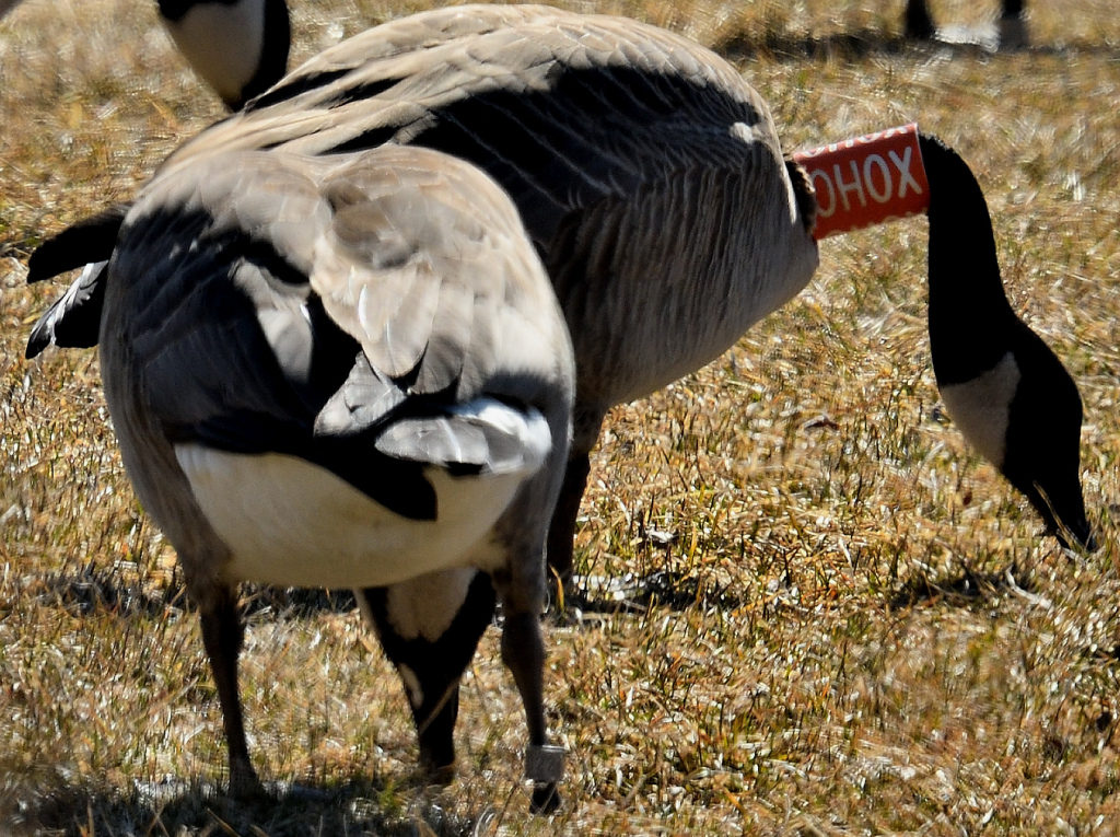
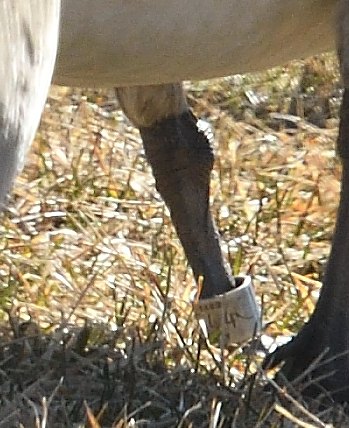
The following week, a Canada goose with an orange and white collar marked OHOX was observed along rt 22. It also had a metal band on its left leg. While editing images, I was shocked to see the goose standing next to it also wore a leg band. Reporting this goose to the USGS bird banding website I was provided with a certificate noting that the goose was a female, banded as a flightless gosling near Varennes, Quebec, Canada on the Fourth of July, 2016.
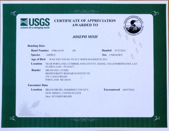
Adding to the distinguished list of local visitors was the osprey I observed April 7, 2016, just upstream of the confluence of the North and South branch. The osprey had a blue plastic band on its left leg, with stacked letters, DV, visible on one of the images taken. Again, making a report to the USGS banding website, a certificate soon arrived, stating the osprey was born on a bulkhead in Portland, Maine and banded on July 27, 2011. To report a banded bird, visit the USGS bird banding website, bandreports@usgs.gov
The spring migration is now in full swing. And along with colorful warblers, ruby throated hummingbirds, woodcock and osprey, come the errant travelers.
Diverging from their evolutionary migration patterns, these intrepid winged visitors explode the myth that, “birds of a feather stick together”.
Migrating birds that nest in our region, along with birds just passing through, are now appearing along our waterways. The confluence that forms the Raritan River is the staging area that hosts a feathered extravaganza of unimaginable variety.
Author Joe Mish has been running wild in New Jersey since childhood when he found ways to escape his mother’s watchful eyes. He continues to trek the swamps, rivers and thickets seeking to share, with the residents and visitors, all of the state’s natural beauty hidden within full view. To read more of his writing and view more of his gorgeous photographs visit Winter Bear Rising, his wordpress blog. Joe’s series “Nature on the Raritan, Hidden in Plain View” runs monthly as part of the LRWP “Voices of the Watershed” series. Writing and photos used with permission from the author. Contact jjmish57@msn.com. See more articles and photos at winterbearrising.wordpress.com.
Article and images (except as noted) by Sanja Martic, Rutgers Department of Landscape Architecture Graduate Student.
“Man wants to take the river’s natural storage reservoir and make no compensation for it. The river contends it is against Natural Law and cannot be done. The river is right.” James P. Kemper, New Orleans, 1927.
The Dutch Room for
the River Program (RfR) was conceived in 2007 as an integrated river basin
management strategy for the low-lying flood prone and densely populated areas
of the Netherlands. As part of this Program, water management is conducted via
a specialized regional “Water Board,” working in partnership with the Dutch
National Ministry and the Ministries for Transport, Public Works and Water
Management. Through RfR the Dutch Water Board takes a four-pronged approach to
water management. The four key characteristics of the RfR approach include: 1)
large scale river region landscape architectural design thinking; 2) a focus on
collaboration, with landscape architecture playing a facilitating role; 3)
considering the landscape as a system of layers; and 4) anticipating that
natural processes will change and enhance the design over time.
As in the
Netherlands, significant portions of New Jersey’s Lower Raritan River are in
low-lying densely populated areas. Flood protection is of paramount importance
and a matter of human safety and economic security. However, the Home Rule
focus of New Jersey’s local governance limits the potential for thinking in a
landscape context, no comparable “Water Board” serves as coordinating entity
for water management, flood control prioritizes human land use layers, and
engineering controls trump considerations of natural hydrological processes and
flows. There is much to learn from the Dutch RfR example. In what follows we provide
background information on RfR, and consider the Dutch Water Management approach
in the context of New Jersey’s Raritan River and Lower Raritan Watershed.
Historic Approach to River Basin Management
In riverine areas
around the world, the industrial revolution demanded capitalization of the river’s
territory and its water. As a result, many river basins were heavily
engineered: rivers streamlined, river basins minimized, and creeks and small
streams culverted or replaced by canals[1].
These practices, in combination with development over time, resulted in
floodplains that restricted the river and required repeated heightening of
flood defenses[2].
There was no appreciation for the river ecosystems, and water was seen as a
threat and as something that needed to be controlled. Over time, conflicts arose
regarding use of the floodplain and the its water. And the Industrial
Revolution and subsequent development left behind a lasting pollution legacy:
abandoned infrastructure and degraded water and soil quality. Meanwhile, the
expanding population’s need for potable water and space for a safe habitation increased,
causing a decline in the river basin surface. In recent years, rising intensity
and quantity of extreme precipitation events associated with a changing
climate, coupled with increase of the impervious surface cover, further
complicate water management issues.
Room for the River (RfR) Emergence and Approach
In the Netherlands, traditional water management methods were challenged following destructive floods in 1995, caused by record extreme precipitation events. It was clear that new flood levels required a different approach towards river management. Different approaches to water management call for different methods: many rely heavily on engineering while others emphasize a more natural approach. Room for the River Program (RfR) finds a middle ground. Instead of gradually reducing the area that rivers occupy, this approach allows the river to expand over a larger territory[3]. RfR brings together the worlds of water management and spatial planning, engineering and ecology. Tools are varied and include dredging at one extreme, and measuring spatial quality on the other, and they are put into service of two main objectives: improving safety by reducing flooding of riverine areas, and “contributing to the improvement of spatial quality of the riverine area”[4]. Although hard to quantify, this second goal is particularly interesting from the landscape architecture perspective as it considers quality of the space.
Spatial quality
within the RfR approach is defined as “a property of the resulting landscape
after a plan has been implemented.”[5]
A good design is further judged by three criteria: hydraulic effectiveness,
ecological robustness and cultural meaning and aesthetics. Cultural meaning and
aesthetics criteria call for enhancing the scenic beauty, tailored to a range
of sites that could be classified as natural, urban or countryside. Ecological
robustness endorses designs that are long lasting, self-sustained, build upon
natural processes, and are low maintenance. This is achieved through combining
natural hydrology with morphological and biotic processes to achieve stability
in riverbed and floodplain.[6]
This means that plans have to be functional in the case of floods, but at other
times must accommodate livability, wildlife habitats and areas usable as a public
good. Design is informal and natural while providing maximum access for recreation,
with spaces intended to reveal the spirit of each individual site of
intervention.
Room for the River (RfR) Implementation and Practical Measures
In the Dutch
model, spatial quality assessment requires development of a special Q-team
(quality team) composed of members from different but complimentary
disciplinary backgrounds. The Q-team’s role is to produce an independent
recommendation on enhancing spatial quality through coaching designers and planners,
peer review of the designs and plans, and regular communication to the
Ministries of Transportation, Public Works and Water Management[7].
This calls for significant transdisciplinary cooperation between planning and
design, with an equal role for the landscape architect, urban planner, river
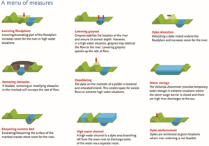
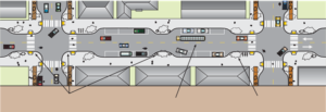
engineer, ecologist and physical geographer. Practical measures (Figure 1) are
applicable at large scale and fall into three categories ranked by complexity
of integration of flood risk measures with spatial measures. These categories
include technical measures (deepening the river bed, lowering groynes,
strengthening dikes), measures within the banks (lowering the floodplains,
removing obstacles), and measures beyond the banks (high-water channel
building, dike relocation, water storage). In addition to evaluating project’s outcome,
the team also evaluates the quality of the integrative collaborative design
process.
Figure 1: Different types of measures in the RfR program Source: Practical Measures, from Room for the River Fact Sheet
Precedent for RfR in the United States
The RfR approach
is not entirely new to the United States. An early similar effort was forwarded
in New Orleans in 1927, following devastating flooding events in the
Mississippi River delta. Like the Dutch who relied on dikes for flood
protection, the Mississippi delta community relied on constant raising and
enforcing levees, increasingly restricting the surface size of the natural
flood plain. The 1927 flood prompted a reevaluation of the Mississippi River
management approach. Official Congressional hearings were held and involved the
U.S. Army Corps of Engineers, the Mississippi River Commission and expert
witnesses such as Gifford Pinchot[8].
Discussion revolved around engineered control of the river proposed by the Army
Corps of Engineers, and an approach in which nature would be allowed more
leeway[9]
supported by Pinchot, James Kemper and others. The latter view resembles the
RfR approach as it calls for allowing more room for the river through widening the
flood plain.
RfR Methodology
1. Large-Scale Design (Entire river region)
The large scale landscape architectural design approach considers “not only detailing of small-scale elements, but also at the scale of the river system as a whole”. [10]
2. Collaboration
The landscape architect plays a central
role of coordinator between planners, architects and other partners. Fliervoet
and Den Born studied and evaluated the RfR’s collaborative process from a
stakeholders’ perspective. They concluded that the success of the approach is
highly dependent on the cooperation and collaboration of multiple entities
occupying the watershed with emphasis on the local knowledge. The biggest
obstacles to collaboration stated by the participants, were the lack of an
overarching, integrated maintenance vision and a lack of coordination between
the authorities.[11]
3. Considering the Landscape as a system of layers
o Basis of Landscape (soil, water,
ecosystems)
o Network Layer (roads, waterways energy
infrastructure)
o Occupation and Land Use (living,
working, recreation)
o Time Layer (all layers develop within their
own time scale)
4. Creating Conditions: Responding to natural
processes
Natural processes
are expected to change and enhance design over time.
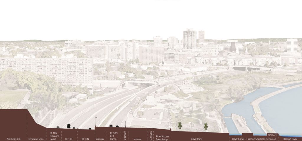
Applying the RfR Methodology to the Raritan
Large-scale Design of the Raritan River Floodplain and
Regional Network
The first characteristic,
the large scale of design as applied to the Lower Raritan, requires creating a
comprehensive masterplan with projects spanning the entire Raritan watershed. RfR
site plans would become small parts of a large Raritan Watershed Masterplan. The
masterplan would be guided by a comprehensive vision of integrated water
management, with a regional greenway connection as an integral part. Directly
connecting the City of New Brunswick to the greenway network would be a key
component of the masterplan, as New Brunswick is the largest settlement on the
banks of the Raritan River. Collaboration between many governing bodies is
essential. At the federal level the governing bodies to involve include USACE,
USCG and the Advisory Council on Historic Preservation. At a state level
governing bodies to involve include NJDOT, NJDEP and Land Use Regulations and
Ecological Services Field Office. Regionally the Delaware and Raritan Canal
Commission and counties such as Middlesex, Somerset, Hunterdon and others
should be involved. At the local level the municipalities along the Raritan
River banks including New Brunswick, Piscataway, Franklin Township etc. would
require representation.
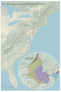
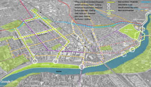
Large scale design requires examination of large-scale network connections. Analysis in the Raritan River context reveals several greenway network opportunities (Figure 2). Metropolitan areas of New York City and Washington D.C. are roughly framed by the Appalachian Trail to the North and the proposed alignment of the East Coast Greenway to the South. They are further enclosed by the major East Coast rivers that bisect the Trail and the Greenway on their way to the Atlantic Ocean. The Hudson River Valley to the East, the Delaware and Lehigh National Heritage Corridor, and the Chesapeake and Ohio Canalto the west all form a regional trail system matrix. This blue and green matrix provides unique opportunities for cross connections of the corridors and interactions with nature and culture to one of the world’s densest contiguous urban populations.
The East Coast Greenway is an aspiring walking and
biking route stretching the length of the US East Coast with southern terminus
in Key West, Florida and northern Maine. Once actualized, the East Coast
Greenway will be 3000 miles long and epitomize the bond between communities and
nature by connecting the exist green open space along its route into a unique
linear corridor. Initiated in 1991, with forming of the East Coast Greenway
Alliance, the vision of Greenway designers, “represents a commitment to public
health, environmental sustainability, economic development, and civic
engagement”[12].
The existing Appalachian National Scenic Trail, which
partially passes along New Jersey’s northern border, is currently the longest
hiking footpath in the world at 2190 miles long[13].
It was first proposed by a regional planner Benton MacKaye in a 1921 document titled “An
Appalachian Trail: A Project in Regional Planning”. MacKaye’s vision initiated the idea of land
preservation for the purposes of recreation and conservation. The idea started to materialize in 1925
and was actualized in 2014 when the last stretch of the Trail was formally
acquired and protected. Today, the trail
is visited by over 3 million visitors a year as it bisects fourteen US States
from Georgia to Maine.[14]
The East Coast Greenway’s proposed alignment crosses
the narrow waist of New Jersey using the D&R Canal Park as a major
junction. Canal Park’s Masterplan recognizes the most important quality
possessed by this linear park to be the role it can perform as a connector.
Canal Park no longer links New York City and Philadelphia, but it does join
central New Jersey communities, different land forms and different kinds of
natural areas, and connects New Jersey with its heritage[15].
Extending the Canal’s connection back into the city of New Brunswick would
align with the Canal Commission’s Masterplan and benefit New Brunswick’s future
development.
The Delaware and Lehigh National Heritage Corridor
runs along the Delaware River on the Pennsylvania side, parallel to the D&R
Canal Park. It is an indirect connection between the proposed East Coast
Greenway, through the D&R Canal Park to the Appalachian Trail. It is also an
example of a linear park run by a nonprofit organization, while Chesapeake and
Ohio Canal is a linear park that is part of the National Park system. The Chesapeake
and Ohio Canal is another significant connector between the Appalachian Trail
and the East Coast Greenway close to a major metropolitan area.
When the Delaware and Raritan Canal was built in the
1930s it permanently linked the Delaware and Raritan watersheds, creating opportunities
for connection. Since that time, construction of Route 18 through New
Brunswick, which established a several mile stretch of roadway immediately
adjacent to the Raritan, severed this historic network connection, in
particular in the area between Buccleuch Park and the Landing Lane Bridge. Today,
the City of New Brunswick’s unique geographic position could once again benefit
future development should access impediments to the D&R Canal Park be
removed, resulting in expanded access to not only Canal Park but regional
networks like the East Coast Greenway. There would be many mutual gains: the local
community would have better access to nature and everyday recreation and
day-hiking without having to drive to the trail. New Brunswick’s rich local
history would add to the richness of the trail’s experience. The local economy
would benefit from hiking and biking traffic generated by the Greenway.
Finally, being a part of the future East Coast Greenway’s shared vision could
be an invigorating driver of the nature stewardship and future community and
economic development.
Figure 2: East Coast Greenway Network Opportunities
Collaboration of Local, Regional, National and State
Partners
Collaboration and
coordination, conducted by a landscape architect, may include working with a
variety of professional partners on a local level. In addition to planners and
architects, other professions to engage include social scientists, geographers,
ecologists, river engineers, biologists, historians, archeologists and civil
engineers.
Considering the Raritan River Floodplain and Watershed
Landscape as a system of layers
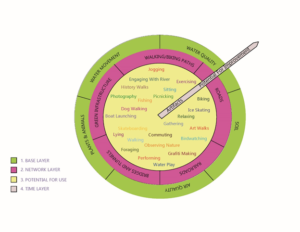
The RfR “system of
layers” approach consists of a base layer, network layer, potential for use
layer and time layer (Figure 3). Layers provide a basis for site evaluation within
the Lower Raritan. Expanding the original RfR methodology, we have conceived of
each of the four categories of layers as worth 25 points for a total of a
100-point evaluation system. The lower the score for specific site, the better
the opportunity for enhancing it.
Figure 3: Adopted Diagram of Layers of Landscape
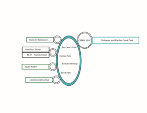
For example, considering New Brunswick in relation to the regional greenway network, the four areas identified as having the best opportunity for creating connections between the New Brunswick and regional greenways are the Key Connector Streets (Urban Core Green and Blue Corridors), Waterfront Access Points, Raritan Bike Path, and the “D&R Canal Link”(Figure 4). These] specific sites should then be evaluated for their soil, water and air quality within the base layer, and for the existing roads, railroads, bridges/tunnels, walking and biking paths and green networks within the network layer. The Network Layer evaluates the existing networks presence and connectivity. Points (0-5) are given for the presence of the networks within the site and more points for their current connectivity. All the sites have a presence of at least one network, however in some cases those networks are enhancing and in others reducing walking and biking connectivity. Increasing connectivity becomes a goal for this layer.
Figure 4: Simplified Connections Diagram
The Base Layer
evaluates the soil, water, air, plant and animal life conditions of the
landscape. 0-5 points for soil quality are allocated depending on its
permeability as well as its ability to support life. In the urban environment
soil is often covered by pervious surface or is heavily compacted resulting in
a low rating. Water movement is evaluated based on the speed of its movement
within the site. Faster movement (poor infiltration) is rated lower. Water
quality is associated with the ability of site to treat the stormwater runoff.
Water that leaves the site cleaner results in higher points. Air quality
depends on the site’s micro location. Sites near major roads with little
vegetation are rated lower. Finally, existence of plant and animal life is
rated depending on a level of presence. Based on the rating, design goals that
emerge are: increasing surface permeability, slowing down runoff by retaining
water in the landscape for longer periods, decreasing soil compaction, and creating
conditions that support more plant and animal life.
Our addition to
the methodology also includes expansion of the “potential for use layer” by
which each of these sites are evaluated for their potential to support any of 25
different activities that could take place within the area once it is
redesigned. The Potential for Use Layer allocates one point for each activity
that can currently take place within an area. The goal for this layer becomes
increasing the number of future potential use of the space.
Finally, the time
layer evaluates presence of historic and cultural artifacts on one end and a
potential for future ecosystem health improvement on the other. Sites that
contain historic and cultural artifacts are rated higher, as well as the sites
that will be able to, over time, enhance the ecosystem health. Ecosystem health
is prioritized over the existence of historic and cultural artifact. For
example, a city street has less potential for the improvement of the future
ecosystem health than the river bank.
Figure 5: Proposed Connections Diagram
The redesign of
the existing key connector streets within the City of New Brunswick enhances
the biking and walking experience, while leading to the waterfront access
points. Commercial and Joyce Kilmer Avenues are green corridors, chosen for
their proximity to the local schools, green open space, highest population
density and wide traffic lanes. These two thoroughfares have a great potential
for “road diet” interventions, such as narrowing traffic lanes and adding
bumpouts at street crossings in order to calm traffic and thus enhance safety of
pedestrian and bicyclists. They would further create opportunities for bringing
nature closer to the local communities by becoming way finders for the Raritan
River as well as the green corridors with more pervious surface and vegetation
(Figure 5).
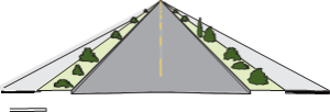
Existing Roadway Surface
Bike lanes, pervious surface
Figure 6: Green Corridor Intervention Source: Oregon Bicycle and Pedestrian Guide
Route 27 or French
Street and Hamilton Street are already main routes of access that are further
enhanced by adding new and improving existing bike lanes, and improving
pedestrian experience by adding bump outs and lowering curbs. Similar
interventions could be applied outside of the immediate study area. Franklin
Township’s Franklin Boulevard is the next such opportunity. The existing Mile
Run stream corridor, in conjunction with the key connector streets, forms a
matrix of river connections. The Mile Run stream corridor is now accessible
through this matrix, offering further opportunities for engagement with water
and nature.
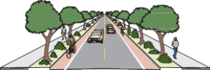
Figure 7: Bumpouts add sidewalk space, provide space for rain gardens, bike parking, etc. and shorten crossing distance. Minimum width lanes slow traffic.
Source: “Main Street: When a Highway Runs Through it”, Oregon Downtown Development Association
Access to the waterfront
is strengthened using various traffic calming techniques such as raised,
textured crossings, lowered speed limit and narrowed traffic lanes. These
approaches ensure safety and an enhanced pedestrian experience. Redesigning the
Raritan bike path by adding access points, widening its surface, and adding
small, localized interventions helps create a sense of place and wayfinding.
Materials and forms chosen for intervention help to further connect community
to the unique industrial and postindustrial history and ecology of the place.
Finally, the “Canal Link” links fragmented biking and walking paths ending
within the area of the River Road, Landing Lane, Buccleuch Park and Spillway,
through an elevated walkway bridging the impediments. This walkway becomes the
final interlocking link restoring connection to the D&R Canal Park, East
Coast Greenway and the Raritan.
A final key characteristic of the RfR program requires considering how including natural change over time can be integrated in the designed system, so that it could start functioning as a natural system. Within the landscape architecture field, time is always an important element considered in designing a landscape. The question: “How will a landscape change throughout the years?” is a core design consideration. However, change is usually considered as it relates to human use and needs. In the RfR case the emphasis is on the health of the entire ecosystem, and the ability of landscape to be “managed” by natural processes, thus making it self-sustained and supportive for all living beings. Choices of materials and forms should be made considering this final concern.[
[11] Fliervoet,
van den Born, and Meijerink, “A Stakeholder’s Evaluation of Collaborative
Processes for Maintaining Multi-Functional
Floodplains.”,p 185.