Subwatersheds
The Lower Raritan Watershed (LRW) /Watershed Management Area 9 (WMA9), is part of the larger Raritan Basin.
HUC-11s
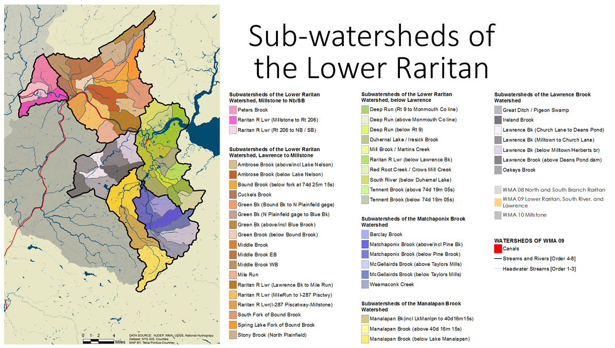
The LRW/WMA9 is comprised of six major watersheds (or “HUC 11’s,” based on their 11-digit federal hydrologic-unit code)*:
-Lawrence Brook Watershed
-Millstone to the North Branch/South Branch (Peters Brook)
-Lawrence to Millstone (Ambrose Brook, Green Brook, Mile Run)
-Below Lawrence (Deep Run, Duhernal Lake, Mill Brook, Tennent Brook)
-Matchaponix Brook
-Manalapan Brook
HUC-14s
These major HUC-11 watersheds are further divided into forty-seven sub-watersheds, called HUC-14’s (based on their 14-digit hydrologic-unit code). These HUC-14 sub-watersheds are generally 2-15 square miles and made up of the convergence of two second order streams as well as often a third order stream system. HUC-14s are the unit by which the New Jersey Department of Environmental Protection (NJDEP) evaluates stream ecosystem health based on impervious surface coverage, and the unit by which Watershed Management plans are typically developed.
In Fall 2016, Professor Karen O’Neill’s Rutgers Environmental History class developed an environmental history “report “of one HUC-14. Class activities included research into e.g. historic maps, toxics legacies, demographics, and historic ecology (flora/fauna) of the area. Here is a sample of maps found for the Lower Raritan River between Lawrence Brook and Mile Run.
Watershed Management Plans for portions of the LRW/WMA9:
The Cedar Grove Brook Watershed Restoration Plan for sub-watershed Raritan R Lwr (MileRun to I-287 Pisctwy)
Watershed Protection and Restoration Plan for Manalapan Brook
Sayreville Open Space and Floodplain Restoration Plan (2016)
*Watershed and sub-watershed boundaries are based on elevations and water courses from 1:24,000-scale (7.5-minute) USGS quadrangles.
