The sea run shad, striped bass and herring that gather at the mouth of the Raritan River attract animals high on the food chain such as this harbor seal. Whales and dolphin have also been sighted over the last few years not in small part from the contribution of the Raritan River and its sweet water branches.
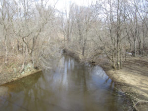
The spring-fed north and south branches of the Raritan River join in a marriage of sweet water at their confluence, on an endless journey to the sea. Each hidden spring and brook along the way, contributes its own genetic identity, mixed in a final blend at the mouth of the Raritan River.
Where the fresh water meets the salty sea, the ebb and flow of tides stir the brine into fresh water to create a stable buffer zone of brackish water.
These back bays and estuaries formed at the mouths of rivers are a perfect place for young of the year striped bass to gain in size before going offshore to migrate. American, hickory, gizzard shad, river herring, such as blueback herring and alewives also gather here and search for ancient breeding grounds located far upriver.
In the time before dams, sea run fish migrated far upstream into the north and south branch. Fishing was a robust industry in early colonial times where the seasonal migration of herring and shad was a profitable business.
The construction of dams to power mills along the river put a halt to upstream commercial fishing. The mills and dams were not welcomed by colonists who made a living from the seasonal fisheries. One account tells of early settlers in the mid 1700s, unhappy with a mill dam just below Bound Brook, making nightly raids to dismantle the dam and allow shad to continue their upstream migration.
Fast forward to today, the river still flows to the sea and the shad and herring gather to swim upstream.
In 1985 pregnant shad from the Delaware River were transplanted to the South Branch as part of a program to restore a shad migration along with planned dam removals.
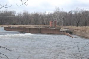
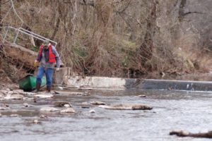
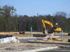
Dams that have blocked migrating fish have recently been removed. The Calco dam near the former Calco Chemical Company built around 1938, cleared the way for migrating fish to reach the confluence of the Millstone and Raritan where a flood control dam was built. Known as the Island Farm weir, completed in 1995, it includes a viewing window and fish ladder to allow the dam to be bypassed by fish travelling upstream.
Aside from the Calco dam, three of five dams upstream of the Island Farm Weir, two dams on the Raritan, the Nevius street and Robert street dam and one on the Millstone have been removed. All in anticipation that the head dam at Dukes Island Park and the low dam at Rockafellows Mills on the South Branch will eventually be deconstructed.
See the above link for the video of the Nevius street dam removal. Go to MENU, open videos/multimedia to see Nevius street dam deconstructed.
The dream to restore our rivers and fisheries to their unmolested glory is well on the way to reality. Bald eagles now nest along the Raritan and its branches, soon to be joined by spawning shad and herring.
The vision of a pristine river valley, interrupted by 300 years of abuse and neglect is slowly emerging from the river mist as a magical apparition. The magic supplied by the hard work of Rutgers scientists and dedicated volunteers who echo the words of Rutgers president Thomas, who served in 1930, “Save the Raritan”.
As an aside to this article, I will share a sobering and emotional experience involving the Island Weir Dam that took place in 1995. The intent is to emphasize the importance of safety while paddling in general and especially when near dams or in cold water.
I was paddling on the Delaware and Raritan Canal which parallels the Millstone River about two miles from where the dam is located at the confluence of the Millstone and Raritan rivers. This was a training session for a cold water canoe race that takes place each April in Maine. I am an experienced paddler, familiar with cold water immersion and so was wearing a wet suit with a dry top and pants along with a life jacket/pfd while on the calm water in the canal.
As I neared the end of my trip at the Manville causeway, several police cars slowly drove by and turned around as if searching for something. Sirens were wailing and more police and rescue vehicles were seen and the road blocked off. First thought was the body of a woman who was reported to have ended her life in the Millstone a week before was found.
As it turned out a kayaker and two companions in a canoe decided to run the dam. According to my recollection of the news article; the canoe made it through first, while the kayaker who followed, failed to clear the dam and was stuck in the hydraulic.
According to the news article, ‘the experienced paddlers’ wore no thermal protection or pfds when they ran the dangerous dam. It was reported that the canoers paddled back to help their companion and they capsized in the hydraulic. Once you cross that line which marks the downstream flow from the water cycling upstream, you will be pulled into the hydraulic.
The kayaker and one of the men in the canoe were washed out of the turbulent water but the other was lost, his body never recovered.
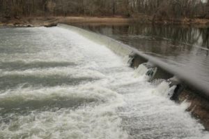
A hydraulic occurs when the weight of falling water creates a hole which is then filled by downstream water being pulled upstream in an endless re-circulating current parallel to the dam. Low head dams may be altered to prevent or mitigate a hydraulic.
There is a point of no return where you can actually see a line that separates the water flowing downstream from the water flowing back upstream to power the hydraulic.
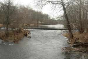
Island Weir Dam at the confluence of the millstone and Raritan River. You can see the horizontal shelves that are the fish ladder in the center and the subsequent stepped redesign to mitigate the dangerous hydraulic.
There have been several more drownings involving dams on the Raritan and its branches. I recall another at the Headgate, which is the dam created by the Duke estate below the confluence of the North and South branches. The paddler went over and was lost in the hydraulic below.
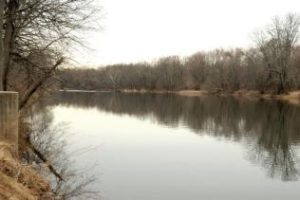
This is the headgate dam at Dukes Island Park. Created to collect river water via the Dukes canal to power the estates and supply water to the series of ponds built at decreasing elevations to allow the water to return to the river by gravity.
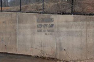
No warning signs are posted to alert paddlers to the danger ahead. On the downstream face of the dam is a warning to keep off.
Too little too late warning.
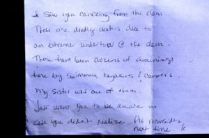
Paddling on the South Branch from Rockafellow’s mill rd, just below the low head dam that forms Red Rock Lake, this note was placed on my windshield. Though I was no where near the dam, contrary to what the note states, the message was at once heart breaking and shown here, now serves as a warning to all; beware of the dangers of low head dams.
This sign is placed about 5 football fields above the dam at red rock lake on the South Branch. It’s placement a puzzlement that mitigates its message.
Dam at Red Rock Lake.
Though rivers like the South Branch and North Branch are reputed to be no more dangerous than a swimming pool, tragedy can strike when least expected. Strainers, trees that fall into the river blocking passage, can snag and capsize a boat and entangle the paddler in its branches under pressure of a fast current. Low head dams can drown a paddler by immersion or entanglement on debris as the paddler is unable to wash out of the turbulent recycling water. Search on line to get an idea of how widespread is the danger of obscure low head dams and loss of life across the country.
Paddling when river temperatures are well below normal body temperature requires thermal protection no matter the air temperature. Wearing a pfd alone will not be enough to survive if your body temperature drops before you can be rescued or self rescue. Such was the case of a paddler on Round Valley reservoir a few years ago.
Typically water temp during the winter and early spring on the South Branch is 41 degrees. More than enough to cause a spasm to block your ability to breathe even before hypothermia sets in. See this link for a detailed explanation of the effects of cold water immersion. Remember, ‘cold water’ does not have to be that cold.
Overturning in fast water, a boat can instantly fill with a hundred gallons of water. Each gallon weighing 8 pounds, can pin or crush a paddler between the canoe and any obstruction. Such was the case on a locally sponsored canoe trip in shallow water on a beautiful day on the South Branch. One paddler was trapped under the canoe in a strainer. Eventually he popped out from under the boat, shaken but safe. The canoe was stuck fast in the strainer, filled with hundreds of pounds of water. Never be downstream of a capsized canoe.
Tragedy can occur on the calmest day under brilliant blue skies, always wear a pfd and be alert to potential dangers, especially dams.
Low head dam across the North Branch just above rt 202 makes a difficult passage during low water portage and a dangerous hydraulic during high water.
Author Joe Mish has been running wild in New Jersey since childhood when he found ways to escape his mother’s watchful eyes. He continues to trek the swamps, rivers and thickets seeking to share, with the residents and visitors, all of the state’s natural beauty hidden within full view. To read more of his writing and view more of his gorgeous photographs visit Winter Bear Rising, his wordpress blog. Joe’s series “Nature on the Raritan, Hidden in Plain View” runs monthly as part of the LRWP “Voices of the Watershed” series. Writing and photos used with permission from the author.
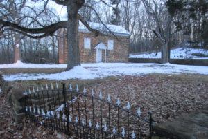
ARNEYS MOUNT: Arneys Mount stands roughly 245 feet above sea level, or about 175 feet above the surrounding lowland, in Springfield, Burlington County. It is part of the cuesta geologic formation — hills that have survived erosion and now separate New Jersey’s Outer Coastal Plain and Inner Coastal Plain. Take a map a draw a line from Sandy Hook at the Atlantic Ocean in Monmouth County to the Burlington County area of Mount Holly-Mount Laurel. That line is essentially the line of the cuesta. On a detailed map of that line, you will see names representing the hill system — Highlands, Mount Mitchell, Crawford Hill, Telegraph Hill, Beacon Hill, Knob Hill, Locust Hill, Quail Hill, Pine Hill, Backbone Hill, Disbrow Hill, Crematory Hill, Stone Hill, Arneys Mount, Mount Holly, and Mount Laurel.
The circa 1775 Arneys Mount Friends Meeting House.
VOICES FROM AFIELD NO. 1, THE CUESTA: Cousin Jerry Edvy lives on high ground just outside of Perrineville in Millstone, Monmouth County. When it snowed during the Tuesday, March 13, nor’easter, he reported “at least 5 inches.” His house is on the cuesta, or about 280 feet above sea level. When Jerry drove off the cuesta, he saw hardly any snow. “(Route) 33 was clear,” said Jerry, speaking of the road about 3 miles north of his house. “We must have got hit with a band,” he said. Or maybe it was just the height of his area. My house, about 50 feet above sea level about 10 miles to the north, got only about 1 inch of snow.I recall this cuesta-lowland dichotomy several years ago during my newspaper reporting days for the Asbury Park Press as I drove in Monmouth County from the Millstone area to the Sandy Hook area — when I was on high points of the cuesta, there was a covering of snow, maybe a few inches; when I was at lower elevations, maybe just a coating. An interesting phenomena happening in only a matter of dozens of feet.
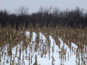
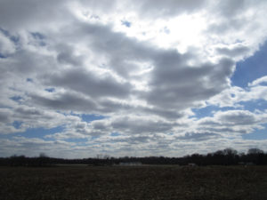
The Tuesday, March 13, nor’easter snowfall in a Monroe Township, Middlesex County, cornfield.
SNOWFALL: The seasonal snowfall tally at my house in the part of Monroe between Jamesburg and Helmetta is 29.0 inches. The average seasonal snowfall in New Brunswick, about 7.5 miles away, is about 26 inches. So, based on that, we are about 3 inches more than normal at my house, with about a month’s worth of snowfall season left.
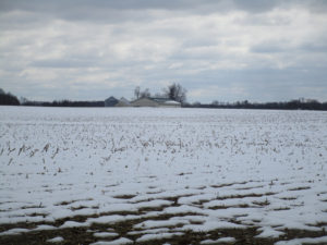
The Tuesday, March 13, nor’easter snowfall at a farm in Plainsboro, Middlesex County.
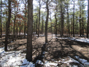
FOREST FIRE SEASON: Because of the wet weather, the Pine Barrens spring wildfire season in the Jersey Midlands is running behind this year. Normally, it runs March 15 to May 15, when winds blow, humidity decreases, temperatures rise, and sun penetrates the essentially leafless forest, warming and drying the duff. But with the wetness out there, for example, the state Forest Fire Service canceled a control-burn for the upcoming week in the Jamesburg Park Conservation Area in Middlesex County.
Snow on the ground in the Pine Barrens of Barnegat, Ocean County.
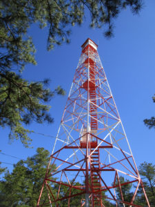
FIRE TOWERS: The idea of a fire tower is to see smoke during daylight hours, basically to dispatch firefighters before a fire really gets going. Because once flames are seen, the fire is well underway. The state Forest Fire Service has eight wildfire lookout towers in the Jersey Midlands — Apple Pie Hill, Bass River, Batsto, Lebanon, and Medford, all in Burlington County; Cedar Bridge and Lakewood, both in Ocean County; and Jamesburg, Middlesex County. When the fire towers are staffed, the public is welcome to visit. Beware, though, it can be a climb of about 60 to 100 feet, depending on the tower.
BASS RIVER STATE FOREST: Trees are to be cut around the Bass River fire-lookout tower in Bass River State Forest to improve the view for the tower observer. See https://thesandpaper.villagesoup.com/p/clear-cutting-proposed-for-bass-river-state-forest-fire-protection/1729679.
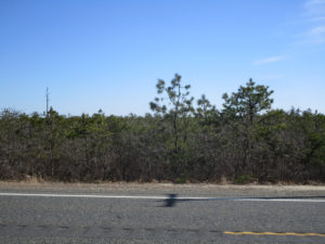
PYGMY PINES: Generally in the area of the intersection of Routes 72 and 539 in Ocean County stand hundreds of acres of Pine Barrens forest with trees perhaps only 8-feet-tall at most. This is the “Pygmy Pines” or “The Plains.” The theory is the stunted growth in this area is caused by repeated fires.
A sport utility vehicle drives on Route 539 through the Pygmy Pines, or Plains, in the Pine Barrens outside of Warren Grove, Ocean County.
The Pygmy Pines, or Plains, on Route 539 in the Pine Barrens near Warren Grove, Ocean County.
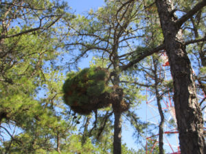
WITCH’S BROOM: If you regularly walk the Pine Barrens, you are likely to have seen a “witch’s broom,” a thick growth of needles on a pitch pine, “Pinus rigida.” While it may look haunting, it is simply caused by disease, defect, infestation, or environmental stress.
A “witch’s broom” growth on a pitch pine, “Pinus rigida,” at the Cedar Bridge fire-lookout tower in Barnegat, Ocean County.
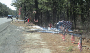
PAINTED ROCK IN THE PINE BARRENS: Going back years, a rock along Route 539, on the section between Routes 70 and 72 in Lacey, Ocean County, had been painted in different ways according to the calendar — a Halloween jack-o-lantern, a turkey for Thanksgiving, and so on. But the rock, apparently on its way by truck to the Jersey Shore for erosion control when it somehow wound up along the road, took on an American flag, patriotic theme after 9-11 — the 2001, September 11, Tuesday, terrorist attack on American soil. No matter the artwork, the rock remains a landmark in the Pine Barrens. For more information on the rock, see http://www.jamesrahn.com/pages/other/personal/rock.htm.
Since around 9-11 — the terrorist attack on American soil on 2001, September 11, Tuesday — the rock on Route 539 in the Pine Barrens of Lacey, Ocean, has taken on a patriotic theme.
PROTECTED ‘PINELANDS’: While much of the Pine Barrens is protected by state “Pinelands” regulations, it is not true the Pine Barrens are fully preserved. One, not all the Pine Barrens is regulated for environmental protection. Two, building is allowed even in the regulated area.
The (un)American way, development in the Pine Barrens, here in Whiting, Ocean County.
CROSSWICKS CREEK: Crosswicks Creek’s headwaters are in the area of New Egypt, Ocean County. It, then, flows into the Delaware River at Bordentown. The federal Geological Survey has a gauge along Crosswicks Creek at Extonville on the boundary of Burlington and Mercer counties, https://waterdata.usgs.gov/nwis/uv/?site_no=01464500. Along the waterway is Crosswicks Creek Park, part of the Monmouth County Park System, https://www.monmouthcountyparks.com/page.aspx?Id=2568.
Looking upstream on Crosswicks Creek, here on the boundary of Mercer County to the left and Burlington County to the right. Here, Crosswicks Creek separates the villages of North Crosswicks in Hamilton, Mercer County, and Crosswicks in Chesterfield, Burlington County.
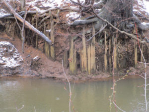
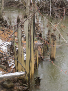
READING THE ENVIRONMENT: When walking afield, let the land talk to you. It has a historical record. For example, the other day I was telling Eric Gehring, a naturalist for the Middlesex County Office of Parks and Recreation, about the dikes in the woods across Manalapan Brook from my house. Those dikes are a record of the area’s cranberry farming that ended around World War II. Then, during the week, on a portion of Manalapan Brook about 4 miles south of my house, I noticed wood planks sticking out of the ground. Remnants of a bridge? A dam? This remains a mystery.
Remnants of a wooden structure on Manalapan Brook in southern Monroe, Middlesex County.
The wooden remnants on Manalapan Brook in southern Monroe, Middlesex County.
VOICES FROM AFIELD NO. 2, A MINK: Frank Ulatowski, an Englishtown-Manalapan outdoorsman, reported seeing a roadkilll of mink, “Mustela vison,” on Route 33 in Monroe, Middlesex County. So, mink are around.
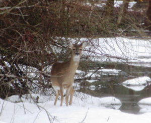
I came across this deer, “Odocoileus virginianus,” on a utility line on the boundary of Hightstown and East Windsor in Mercer County. Deer live on the edge — the edge of the woods, where they seek refuge, and fields, where they browse.
CHANJ: The state Division of Fish and Wildlife is promoting its initiative of CHANJ — Connecting Habitat Across New Jersey. CHANJ is looking to protect habitat and connect habitat through such things as land purchase, management of land, and safe wildlife passage at roadways. Roadway mitigation could include using culverts and bridges to have a safe pathway for wildlife to cross roads. The idea is have connectivity using core areas, which could be as little as 200 acres to as big as state regions such as the Highlands of North Jersey and, locally, the Pine Barrens.
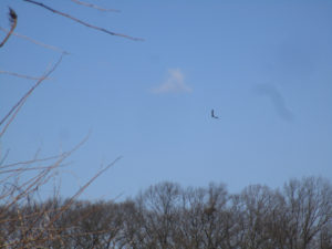
UPPER MILLSTONE RIVER EAGLES: It appears the pair of bald eagles, “Haliaeetus leucocephalus,” are feeding chicks in the Upper Millstone River nest on the boundary of Mercer and Middlesex counties, based on one adult on the nest while another flies to it. See the series of photographs:
Photo 1: An adult bald eagle circles the Upper Millstone River nest, which is below the eagle.
Photo 2: The eagle continues to circle, its white tail easily seen in this photograph. The nest is to the left.
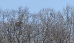
Photo 3: The eagle circles back toward the nest, which is to the left, its white head clearly seen.
Photo 4: The eagle flies toward the nest, which is to the left, where its mate awaits. The mate’s head is the speck of white above the nest.
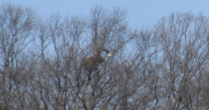
Photo 5: The eagle is landing on the nest, its mate awaiting.
VOICES FROM AFIELD NO. 3, UPPER MILLSTONE RIVER EAGLES: Frank Ulatowski, an outdoorsman from Englishtown-Manalapan, and his wife, Charlene, were visiting a business in the area of the Upper Millstone River nest of bald eagles, “Haliaeetus leucocephalus,” on the boundary of Mercer and Middlesex counties when a bald eagle flew by near the top of one of the single-story buildings. Frank wondered with all people around, how many noticed the eagle — as breeders in New Jersey, bald eagles are “endangered,” or under immediate peril, and, in general, “threatened,” or a species that can become “endangered” if conditions continue.
DUKE FARMS EAGLE CAMERA: At Duke Farms in Hillsborough, Somerset County, bald eagles, “Haliaeetus leucocephalus,” are sitting on two eggs, the first of which is scheduled to hatch about Wednesday, March 21. There is a live-stream camera on the nest that can be seen at http://dukefarms.org/making-an-impact/eagle-cam/. In New Jersey, bald eagles are “endangered,” or under immediate peril, as breeders and, in general, “threatened,” or a species that can become “endangered” if conditions continue.
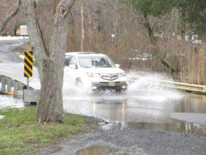
The March 13, Tuesday, nor’easter flooding on the boundary of Plainsboro and South Brunswick, Middlesex County.
BATSTO LAKE: Batsto Lake in Wharton State Forest, Burlington County, is formed by the damming of the Batsto River. The lake is 40 acres, according to the New Jersey Fish Finder website. As for the river, it drains 67.8 square miles, according to the federal Geological Survey.
Batsto River in Wharton State Forest, Burlington County.
SIGNS OF THE PINES: While traveling through the main part of the Pine Barrens, I came across a few interesting signs, both in the Bass River State Forest area of Burlington County:
A folk art sign warning drivers of deer, “Odocoileus virginianus,” crossing a road near Bass River State Forest in Burlington County.
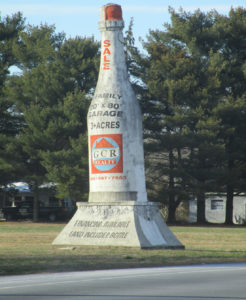
An old masonry advertising style — formerly announcing a winery, now advertising property for sale — on Route 9 near Bass River State Forest in Burlington County.
SKY VIEWS: This week’s sky views are from Hamilton, Mercer County, and Monroe, Middlesex County.
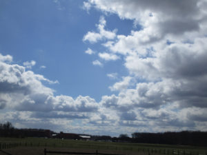
Farmland in Hamilton, Mercer County.
Mounts Mills Road in Monroe, Middlesex County.
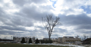
Thompson Park, looking at Monroe High School, in Monroe, Middlesex County.
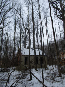
An abandoned cabin in the woods of Monroe, Middlesex County.
Joe Sapia, 61, is a lifelong resident of Monroe — in South Middlesex County, where his maternal family settled more than 100 years ago. He is a Pine Barrens naturalist and an organic gardener of vegetables and fruit, along with zinnias and roses. He loves the Delaware River north of Trenton and Piedmont, too.
He draws inspiration on the Pine Barrens around Helmetta from his mother, Sophie Onda Sapia, who lived her whole life in these Pines, and his Polish-immigrant grandmother, Annie Poznanski Onda.
He gardens the same backyard plot as did his Grandma Annie and Italian-American father, Joe Sr. Both are inspirations for his food gardening. Ma inspires his rose gardening.
Joe is a semi-retired print journalist of almost 40 years. His work also is at @JosephSapia on Twitter.com, along with Facebook.com on the Jersey Midlands page.
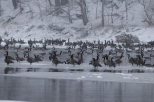
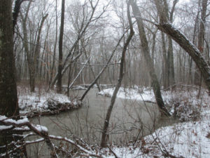
Canada Geese in a snowstorm on the South Branch appear at ease as the falling snow softens the scene.
The January blizzard raged, turning the darkness into an opaque curtain of white. Almost a foot of powdered snow covered the ground before midnight.
The broadcast news reported that NJ had declared a state of emergency shutting down roadways throughout the state. The setting was just right for the midwinter parade on the South Branch. Thousands attended and the main thoroughfare was jammed with local residents and visitors. As I stepped outside to get a head start on clearing the driveway, the sound of geese, thousands of geese, overpowered the drone of the wind driven snow. So impressive was the magnitude of the unalarmed chatter, I was compelled to investigate. Alerting my family where to search for the body, I headed into the storm.
The closer I got to the river the louder and more beckoning the sound became. Moving slowly through the trees toward the river bank, the din from the geese on the open water was deafening. The river was filled wall to wall with migrant and resident Canada geese. Some started to get up and fly. Others just drifted by. All appeared as black silhouettes against the snow and reflective water. Thousands upon thousands all in chorus, the rhythm and sound of their calls rose and fell as if one voice. Occasionally all sound would hesitate into a moment of absolute silence. The silence was as dramatic as the din.
Animals generally become fearless in extreme weather and at the height of this snowstorm the geese collectively tolerated my close approach.
As I closed in, the birds parted, momentarily leaving a void of reflective water. The surface was again soon covered with geese as the specter of an interloper was confidently dismissed.
The Geese were packed so tight; they appeared as if in a big cauldron that was being stirred. One group was drifting down with the current while the other was going back up stream in a re-circulating eddy below the island.
Aside from the geese, the river was filled with joined platelets of gray and white ice, strong enough to support several of the large birds. A display of motionless geese rode atop drifting ice flows, escorted by a cadre of even more geese floating alongside, all travelling at the same speed.
This looked all so familiar. Suddenly it struck me. I could have been watching a fourth of July parade with themed floats and accompanying marchers. Certainly the band was playing a familiar tune as spectator geese lined the banks and joined in the chorus.
How odd that here was a gathering of what seemed to be all the geese in New Jersey having their own parade. As if to celebrate some event sacred to the hearts of all geese, each bird taking comfort in knowing they owned the night and there would be no human eyes to witness their ethereal rite.
Author Joe Mish has been running wild in New Jersey since childhood when he found ways to escape his mother’s watchful eyes. He continues to trek the swamps, rivers and thickets seeking to share, with the residents and visitors, all of the state’s natural beauty hidden within full view. To read more of his writing and view more of his gorgeous photographs visit Winter Bear Rising, his wordpress blog. Joe’s series “Nature on the Raritan, Hidden in Plain View” runs monthly as part of the LRWP “Voices of the Watershed” series. Writing and photos used with permission from the author.
Sadly, after 102 issues and 29 years, the U.S. Environmental Protection Agency will cease publication of Nonpoint Source News-Notes.
The LRWP has relied on these news-notes to shape our approach to non-point source pollution reduction. For now the archived issues will remain available on EPA’s website:
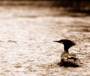
A female common merganser pauses in the fast shallow water of the South Branch where clams and crayfish abound.
“Eye of newt, and toe of frog, Wool of bat, and tongue of dog, Adder’s fork, and blind-worm’s sting, Lizard’s leg, and howlet’s wing,– For a charm of powerful trouble, Like a hell-broth boil and bubble.”
The witches brew in Shakespeare’s “Macbeth” revealed a magical recipe perhaps intended to capture a victim’s soul for evil consumption. Truth is the witches were brewing magic bait they intended to use the next morning on the opening of trout season. Shakespeare spun the story to keep the ancient fishing formula secret and so, “Macbeth”, was written to obscure the truth and ‘Shakespeare’ is now a company that makes fishing gear.
I know it’s hard to believe, but sure enough similar formulas are used today and found in books like ArtFlick’s New Streamside Guide or the old classic, AJ McLanes Fishing Encyclopedia. Artificial fly recipes used to catch trout read like the midnight brew mixed during the dark of the April moon in “Macbeth”.
Pale hairs from a “red fox belly are mixed with sandy poll from a hare’s ear”; One dark ginger hackle and a quill from a Rhode Island Red rooster soaked overnight and blended with gray fox underbelly and hair of claret seal are combined with three strands of skunk tail; Peacock herl, scarlet silk, flat gold tinsel are bound with muskrat belly fur dubbing; Along with feathers from the cheek of a partridge, wing of wood duck and porcupine quills soaked in Clorox, we have a comprehensive list of standard ingredients found stocked on the shelf above any self respecting witch’s eternally boiling cauldron. The addition or deletion of the slightest ingredient is all that differentiates intended purpose. Good vs evil or brown trout vs rainbow trout, nuance makes the difference.
The use of feathers to catch fish on the fly is not exclusive to fishermen casting hooks adorned with feathers. Alternatively, the feathers are still on the birds and the hooks are in the form of beaks and talons.
Sharing the local fishery with licensed fishermen are common mergansers, great blue herons, king fishers, green herons, yellow crowned herons, egrets, osprey and bald eagles.
It is a wonder to realize the waters of the North and South Branch are rich enough to support the variety and quantity of fish required to have most of these birds as year round residents. The recent dam removals on the Raritan River will ensure an even greater supply of forage fish and a brighter future for not only fish eating birds but other game fish to improve what is already a fisherman’s paradise.
Driving along the river, I experienced a Kodak moment, where a female merganser surfaced with what looked like a decent sized bluegill in its serrated beak. Mergansers are the most commonly seen diving duck locally and are easily differentiated by gender as the males have a contrasting dark green head, black and white body while the females are white and gray with rusty red colored heads and a pronounced crest as if coiffed to resemble a wind blown hair style. Both sexes have a bright orange beak. Mergansers swim underwater to search for food that includes crayfish as well as the plentiful mollusks that populate our rivers.
Great blue herons seem to be next most common fish eater and are often seen standing tall and still as statues as they probe shallow water for small and large fish as well as frogs and salamanders.
Much shorter and less often seen is the green heron and seasonally, the pure white common egrets at summer’s end.
Our smallest fisheater is the belted kingfisher. About the size of an extra large bluejay and quite similar in color, bearing a pronounced crest and white throat patch with a blue bandana across its throat.
Osprey are often seen perched on dead tree limbs along the river eating fish, as bald eagles from two different nests are occasionally observed.
The arrival of fishing season, this April 6th at 8am, is a reminder of the flocks of feathered fishers, not bound by seasons or licenses, which share the bounty of our local waters.
Author Joe Mish has been running wild in New Jersey since childhood when he found ways to escape his mother’s watchful eyes. He continues to trek the swamps, rivers and thickets seeking to share, with the residents and visitors, all of the state’s natural beauty hidden within full view. To read more of his writing and view more of his gorgeous photographs visit Winter Bear Rising, his wordpress blog. Joe’s series “Nature on the Raritan, Hidden in Plain View” runs monthly as part of the LRWP “Voices of the Watershed” series. Writing and photos used with permission from the author.
Even after today’s snow has melted and flowed from our streets, through our stormwater system, and out to Raritan Bay, our local streams and the Raritan River will carry the scars of our desire to drive quickly in wintry conditions.
Too often we forget that the salt we apply to our streets, parking lots, driveways and sidewalks is a pollutant that permanently stays in our water bodies and groundwater.
As we imagine warm summer days playing in the surf on the Jersey shore, basking in the sun and tasting salt spray, let’s remember that the salts we put on roadway surfaces ends up in our waterways. These salts increase the mobilization of heavy metals and other pollutants in roadside soils, causing erosion and aiding transport of pollutants into our waterways.
It is the case that in urbanized areas like the Lower Raritan Watershed, the first flush of meltwater is two-to-three times as salty as ocean water. We can float in the ocean because salty water is more dense than freshwater, and sinks to the bottom. Salts likewise sink to the sediments in our freshwater bodies, where they decrease oxygen levels, essentially strangling the animals that live in the benthic (bottom) layer.
These bottom-dwelling animals (benthic macroinvertebrates) are some of the most sensitive species in our ecosystem. They form the base of the food chain, and when they die off, the creatures higher up on the food chain, including fish, can’t find food.
Salt is toxic, but necessary for public safety. We are all part of the problem with over applying it, and all part of the solution, too. The top five things you can do now:
In winter, drive for the season. Our collective demand for perfectly-cleared roads is a major barrier to protecting our waterways
Ask your municipal and county leaders what they are doing to minimize salt usage on public roads.
Hire maintenance firms that have taken salt application training.
Minimize your personal use by removing snow quickly and distributing only about one coffee mug of salt for a typical driveway.
Be sure to clean up any leftover salt, sand, and de-icer to save and reuse as needed.
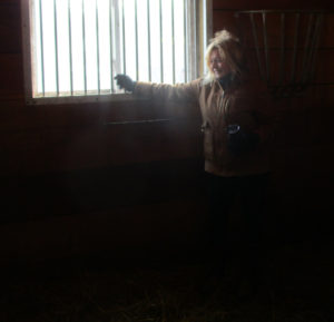
A nanny with two of her three new kids at Cranbury Brook Farm in Monroe, Middlesex County.
NEW KIDS IN TOWN: A few days ago, Laurie Ann Kozinsky Winter welcomed three “kids” to her Cranbury Brook Farm in Monroe — that is, three baby goats. On Sunday, March 4, Laurie Ann opened up her farm for a few hours so the community could visit the kids (all females) and their mom, the nanny.
The three young ladies at Cranbury Brook Farm.
As a lifelong Monroe resident of 61 years, I have watched the township of a little more than 43 square miles grow from an estimated 5,000 people to today’s estimated 50,000. So, today’s visit to the farm, which sits on Cranbury Brook, was a visit back in time — when the part of Monroe south of Jamesburg was simply “The Farms.”
A mother’s care at Cranbury Brook Farm.
My maternal Onda-Poznanski family and Laurie Ann’s maternal side have know each other for a hundred or so years. Laurie Ann’s maternal grandmother, Anna Kozinsky, and I lived in the same Helmetta Road area of Monroe. Laurie Ann and I are four days apart in age — Grrrrrr, I am the older one — and attended Holy Trinity Church in Helmetta and St. Mary School in South River — both Polish-Catholic institutions for us good Polski-Catholic children. At the farm, I got to talk to some of Laurie Ann’s children and caught up with her parents, Anna and Danny Kozinsky. So, it was a reunion of families, too.
What was supposed to be a short stay turned into about three hours — and about 120 photographs.
1967, January — Little Laurie Ann and little Joey, both 10-years-old, in the 5th grade at St. Mary School, South River, Middlesex County, where good Polish-Catholic kids went to school.
SHOUT OUT TO FARMER LAURIE ANN KOZINSKY WINTER: The GOAT (Greatest of All Time) — farm owner Laurie Ann Kozinsky Winter. Or as I call her, Princess Winter Spring Summer Fall. (Baby-boomers would understand the Princess moniker — and notice the mix-up of words.) A shout-out to Laurie Ann — A loving wife who lost her husband, Greg, over the summer after a long battle with cancer; she is very dedicated to her elderly parents; and she is a mother and grandmother. A Jersey Girl!
Laurie Ann Kozinsky Winter, owner of Cranbury Brook Farm in Monroe, Middlesex County.
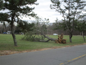
MARCH 1 to 3 NOR’EASTER: We were still cleaning up from the March 1 to 3 nor’easter…
Here in Thompson Park in Monroe, Middlesex County, this fallen tree was a victim of the March 1 to 3 nor’easter. Then, on Wednesday, March 7, we got hit with another nor’easter…
MARCH 7 NOR’EASTER: Meteorologists were having trouble forecasting snow totals for the Wednesday, March 7, nor’easter. Where would the rain/snow line be? A difference of only a few miles could mean a drastic difference in snowfall — Look at the following figures from Somerset County, a 15-inch difference! The National Weather Service reported the following snowfall totals by county. I am listing the reported highs and lows. Keep in mind this may be an incomplete report:
Burlington County: 3.3 inches at Pemberton to 9.5 inches at Moorestown and Cinnaminson.
Hunterdon County: 6.0 in East Amwell to 15.5 in the Stockton area.
Mercer County: 6.1 in the Trenton-Ewing area to 11.5 at Hamilton.
Middlesex County: 2.0 in the Old Bridge area to 9.4 at Cranbury. (I recorded an estimated 6.0 at the part of Monroe between Helmetta and Jamesburg.)
Monmouth County: 1.3 at Keyport to 7.6 in the Upper Freehold area.
Ocean County: 0.4 at Lacey to 3.2 in the Jackson area.
Somerset County: 7.1 at Somerville to 22.0 at Green Brook.
Bucks County, Pennsylvania: 6.5 in the Oakford area to 11.1 in Langhorne.
The S-curve of Manalapan Brook in Monroe, Middlesex County, known as the “Old Swimming Hole.”
SNOWFALL: With the Wednesday, March 7, nor’easter, where I live — in the Helmetta-Monroe-Jamesburg area of Middlesex county — has surpassed the seasonal snowfall average. The nor’reaster dropped 6 inches, bringing the seasonal total to 28 inches. Normal would be about 26 inches, based in New Brunswick about 7.5 miles away. And we still have about 4 weeks left in the snowfall season.
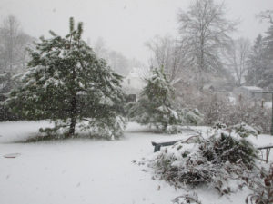
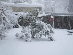
A March 7 nor’easter scene in my backyard in Monroe, Middlesex County.
OTHER SCENES FROM THE MARCH 7 NOR’EASTER:
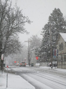
The snow begins in Hightstown, Mercer County.
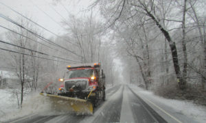
A Monmouth County Department of Public Works And Engineering plow on Route 571 in the part of Millstone, Monmouth County, between Roosevelt and ETRA.
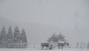
Horses in Roosevelt, Monmouth County.
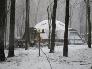
One of the famed geodisic dome houses in Roosevelt, Monmouth County.
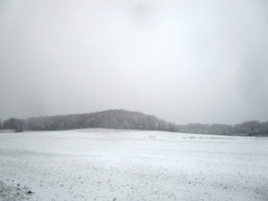
Disbrow Hill, or “Crematory Hill,” in Millstone, Monmouth County.
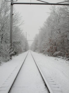
ConRail freight railroad tracks in the part of Monroe, Middlesex County, between Jamesburg and Helmetta.
HOW THESE NOR’EASTERS LIVE ON: We may not realize it, but we will see remnants of Wednesday’s nor’easter for years to come in fallen or bent trees, because of the high wind and the heavy, wet spring snow.
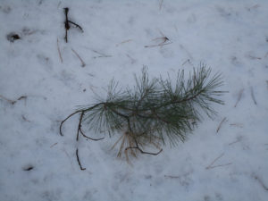
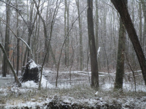
A branch of a pitch pine, “Pinus rigida,” that fell because of the March 7 nor’easter in an East Brunswick section of the Middlesex County Department of Parks and Recreation-operated Jamesburg Park Conservation Area. This is part of my beloved Pine Barrens around Helmetta.
The heavy, wet spring snow bent this American holly, “Ilex opaca,” in my backyard in Monroe, Middlesex County. In heavy snows, I knock the snow off trees and shrubs in my yard.
This swamp hardwood tree, about 60 feet in length, fell recently in the Manalapan Brook floodplan in Monroe, Middlesex County. The root pan is about 10-feet-tall. This is in woods I walk and I note trees that are lying to the west are probably remnants of 2012’s Superstorm Sandy, whose winds blew west, rather than the normal wind coming out of the west.
SIGNS OF SPRING: I have noticed male red-winged blackbirds, “Agelaius phoeniceus,” beginning to show their yellow and red epaulets, which they use to attract a female and likely signal territory. According to Cornell University’s All About Birds website, “The Red-winged Blackbird is a highly polygynous species, meaning males have many female mates – up to 15 in some cases. In some populations 90 percent of territorial males have more than one female nesting on their territories. But all is not as it seems: one-quarter to one-half of nestlings turn out to have been sired by someone other than the territorial male.”
A male red-winged blackbird is beginning to show his yellow and red epaulet, a sign of the mating season. This one was in a common position, feeding on the ground below a birdfeeder — in this case in my backyard in Monroe, Middlesex County.
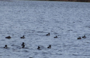
WINTERING DUCKS: During the winter season, it is fun to see what is down here from the north. At Helmetta Pond in Middlesex County, I saw ducks of the genus “Aythya.”
Ducks of the genus “Aythya” on Helmetta Pond.
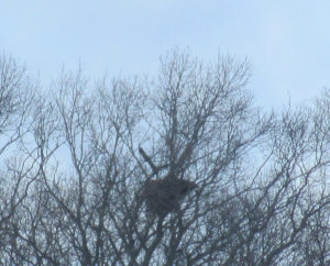
UPPER MILLSTONE RIVER EAGLES: Anne Price and I, the state Department of Environmental Protection volunteer monitors of this nest on the boundary of Middlesex and Mercer counties, believe the bald eagles, “Haliaeetus leucocephalus,” have a newly born chick or chicks in the nest. As breeders in New Jersey, bald eagles are “endangered,” or under immediate peril. For now, we just keep on watching the nest.
An adult bald eagle at the Upper Millstone River nest.
USGS GAUGES: My family through my maternal side has lived along Manalapan Brook in Helmetta or Monroe, Middlesex County, since 1900 or so. I was born, grew up, and am back living within 400 or so feet of the brook. So, I often use the brook’s United States Geological Survey stream flow gauge at Spotswood, Middlesex County, about 2 miles to the north as the crow flies, for research. For example, when the brook is running at about 50 cubic feet per second in Spotswood, I can no longer wade across the brook at my house — the velocity is too strong and maybe the brook is too high. And when the brook is running about 200 CFS in Spotswood, it is about to flow over its bank at my house. My added affinity to the Spotswood gauge is that it began operating in 1957, January, or two months after I was born — giving me almost a perfect record of brook flows of my lifetime. This week, I stumbled upon the USGS gauge on the Delaware and Raritan Canal at Kingston on the boundary of Middlesex, Mercer, and Somerset counties. See https://waterdata.usgs.gov/nj/nwis/uv/?site_no=01460500&PARAmeter_cd=00065,00060,62614 for the Kingston gauge. See https://waterdata.usgs.gov/nj/nwis/current/?type=flow for the stream flow gauges in New Jersey. There are more than 50 gauges in the Jersey Midlands.
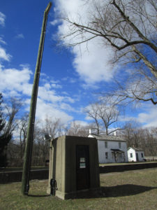
The United States Geological Survey stream flow gauge at Kingston on the boundary of Middlesex, Mercer, and Somerset counties.
Signs on the USGS stream flow gauge at Kingston.
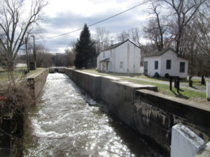
A lock of the Delaware and Raritan Canal at Kingston. The USGS gauge sits in the background, along the canal’s left bank.
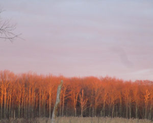
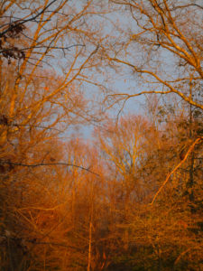
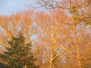
CATCHING THE RIGHT LIGHT: On two days this week, I happened to catch views of soft sunlight on trees at dusk. And both times I captured it with my camera.
This shot is across the street from my house in Monroe, Middlesex County.
Another shot from across the street from my house.
Another bit of golden sunlight at Monmouth Junction, Middlesex County.
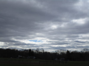
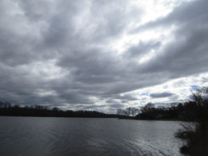
SKY VIEWS: This week’s sky views were captured in East Brunswick, Helmetta, Monmouth Junction, and Monroe, Middlesex County, along with the Kingston area on the boundary of Middlesex, Mercer, and Somerset counties.
This photograph was taken at Thompson Park in Monroe, Middlesex County.
Helmetta Pond in the Pine Barrens around Helmetta, Middlesex County.
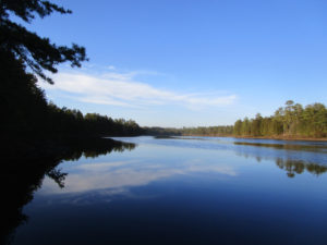
Carnegie Lake, formed by the damming of the Millstone River — this portion of the lake is on the boundary of Princeton, Mercer County; Plainsboro and South Brunswick, Middlesex County; and Franklin, Somerset County.
From my backyard in Monroe, Middlesex County, I captured this photograph of Canada geese, “Branta canadensis,” flying by.
CHRONICLING GARDEN AND AFIELD: Based on some things I have heard in recent days or months, I think people assume I spend a lot of time outdoors, finding what I write about. Actually, I do not spend enough time outdoors, either roaming the woods or in the yard! Whether I work 60 hours a week or am not working, I tend to chronicle the same way. That is, I do not pass up opportunities when I see them. I constantly have the camera with me and always have pen, pencil, and notebook with me. For example, this week’s report includes results of me having brunch in Hightstown, Mercer County; going to a doctor’s appointment in Plainsboro, Middlesex County; and dealing with the nor’easter in my neighborhood in Monroe, Middlesex County. My point, do not miss out on the outdoors world around us. It is there! Stay aware.
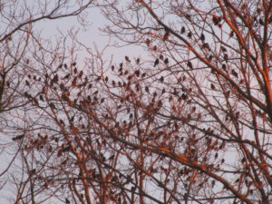
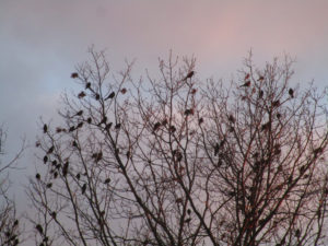
DRIVE-BY NATURALIST, STARLINGS: As I was driving through Monmouth Junction, Middlesex County, I came across a murmuration of starlings, “Sturnus vulgaris,” landing in trees.They are well-known for their flocks, or “murmurations.” “For much of the year, they wheel through the sky and mob lawns in big, noisy flocks,” according to Cornell University’s All About Birds website.
A starling murmuration in Monmouth Junction, Middlesex County.
STARLINGS, NO. 2: From reading “Garden and Afield,” you may have correctly deduced I hate non-native species, especially highly invasive ones. Not only do I find starlings, ” Sturnus vulgaris,” oily- and ugly-looking, they are non-native invasives. According to Cornell University’s All About Birds website, “All the European Starlings in North America descended from 100 birds set loose in New York’s Central Park in the early 1890s. The birds were intentionally released by a group who wanted America to have all the birds that (William) Shakespeare ever mentioned (in his writing). It took several tries, but eventually the population took off. Today, more than 200 million European Starlings range from Alaska to Mexico, and many people consider them pests.” The first thing we do, let us kill the starlings!
The Monmouth Junction starlings.
DAYLIGHT SAVINGS TIME: Daylight Savings Time begins Sunday, March 11, at 2 a.m. Spring forward with spring, so set the clocks one hour forward.
SUNRISE/SUNSET: DAYLIGHT SAVINGS TIME BEGAN SUNDAY, MARCH 11, AT 2 A.M.; SET THE CLOCKS ONE HOUR FORWARD. From Sunday, March 11, to Saturday, March 17, St. Patrick’s Day, the sun will rise about 7:15 to 7:05 a.m. and set about 7:00 to 7:05 p.m. From Sunday, March 18, to Saturday, March 24, the sun will rise about 7:05 to 6:55 a.m. and set about 7:10 to 7:15 p.m.
FULL MOON: The next full moon is March 31.
The March 4 moon, as seen through my living room window, waning from the March 1 full moon.
WEATHER: The National Weather Service forecasting office serving the Jersey Midlands is at http://www.weather.gov/phi/.
SPRING WILDFIRE SEASON: The Pine Barrens spring wildfire season generall runs from March 15 to May 15, when winds blow, humidity decreases, temperatures rise, and sun penetrates the essentially leafless forest, warming and drying the duff.
UPCOMING:
March 11, Sunday, 11 a.m. to 4 p.m., Atlantic County: 13th Annual Lines on the Pines, a Pine Barrens day of the written word, spoken word, art, and the performing arts at Stockton University, 101 Vera King Farris Drive, Galloway, 08205. More information at http://www.linesonthepines.org/linesonthepines.html.
April 9 to 15, Monday to Sunday, Mercer County: The annual Princeton Environmental Film Festival. Stand by for the specific schedule. This is a great event — not only showing environmental films, but some that are rather obscure. I try to go every year.
ME BAD OR ME GOOD? I blew off the Saturday, March 10, 29th Annual Pinelands Short Course to finish this week’s “Garden and Afield.” So, I wasted $50 and lost some knowledge. But as musician-singer-songwriter-friend Frank Pinto has noted, It is better to perform than to watch someone else perform. I am torn. In my early journalism days, I thought it was more important to write than read. Now, in my 40th year of journalism and my often tired state, I wonder….
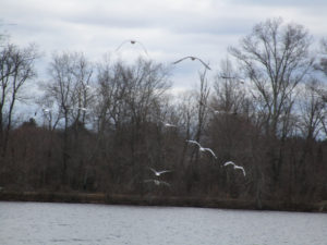
Gulls at Lake Carnegie on the boundary of Mercer, Middlesex, and Somerset counties.
Joe Sapia, 61, is a lifelong resident of Monroe — in South Middlesex County, where his maternal family settled more than 100 years ago. He is a Pine Barrens naturalist and an organic gardener of vegetables and fruit, along with zinnias and roses. He loves the Delaware River north of Trenton and Piedmont, too.
He draws inspiration on the Pine Barrens around Helmetta from his mother, Sophie Onda Sapia, who lived her whole life in these Pines, and his Polish-immigrant grandmother, Annie Poznanski Onda.
He gardens the same backyard plot as did his Grandma Annie and Italian-American father, Joe Sr. Both are inspirations for his food gardening. Ma inspires his rose gardening.
Joe is a semi-retired print journalist of almost 40 years. His work also is at @JosephSapia on Twitter.com, along with Facebook.com on the Jersey Midlands page.
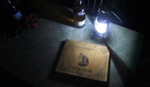
Photographic art, “The Approaching Nor’easter,” using a battery-powered lantern; a bottle of an old Jersey Midlands recipe, Laird’s Applejack; “Down Barnegat Bay, a Nor’easter Midnight Reader” by Robert Jahn; and my enamel-top kitchen table.
The nor’easter came,
rather calmly at my house.
Then, it disappeared.
NOR’EASTER: The nor’easter moved through from the Thursday-Friday, March 1-2, overnight through Saturday, March 3. It snowed, sleeted and rained. There was some minor and moderate flooding, along with power losses. Perhaps the only uniform part of the storm through the Jersey Midlands was high wind. Otherwise, the storm affected areas differently. My travels took me from my home in Monroe, Middlesex County, to the Jersey Shore at Belmar-to-Sea Girt in Monmouth County, on to Prospertown Lake in Ocean County, and back home. During those travels and at home, I witnessed snow, sleet, and high winds, but really nothing of major concern. My home had no power loss. Again, though, the nor’easter impacted the Midlands in different ways….
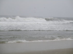
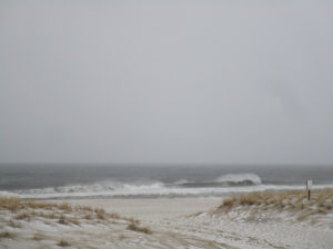
The nor’easter surf of the Atlantic Ocean at Spring Lake, Monmouth County.
The Atlantic Ocean beach at Sea Girt, Monmouth County, during the nor’easter.
NOR’EASTER SNOW: On Friday, March 2, the nor’easter brought a coating of snow, as measured at my house in the part of Monroe between Jamesburg and Helmetta, Middlesex County. This brings the season total to about 22 inches. The season’s normal snowfall is about 26 inches, as measured at New Brunswick about 7.5 miles away. With about 9 weeks of probable snow weather, we have a good chance to reach the season average.
Other preliminary snowfall totals in the Jersey Midlands, as reported by the National Weather Service. These reports are not necessarily complete, but are valid reports:
Burlington County: .2 in the Burlington area to 1.5 inches in the Medford area.
Hunterdon County: .5 at Readington to 4.5 at Byram.
Mercer County: .1 in Hamilton to .5 in the Hopewell area.
Middlesex County: .5 in the South Brunswick area.
Monmouth County: .4 in the Long Branch area to 3.3 in the Clarksburg area.
Ocean County: .2 in the Brick area to 2 in the Berkeley area.
Somerset County: .3 in the Franklin area to 4.0 in the Peapack-Gladstone.
In next-door Bucks County, Pennsylvania: .7 in the Langhorne area to 6.1 in the Perkasie area.
Other totals beyond the Jersey Midlands: Morris County, Green Pond, 11.8; Sussex County, Branchville, 16.5; and Monroe County, Pennsylvania, Coolbaugh, 23.6.
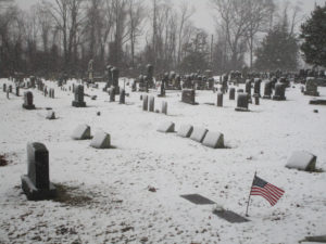
Nor’easter snowfall at Ye Olde Yellow Meeting House cemetery in Upper Freehold, Monmouth County. More information on historic Ye Olde Yellow Meeting House, http://www.oymh.org.
NOR’EASTER WIND: Despite different impacts of the nor’easter through the Jersey Midlands, the unifying factor was the high wind. The National Weather Service reported these high gusts in the Jersey Midlands. The listing may not be complete:
Burlington County: 51 miles per hour at McGuire Air Force Base.
Hunterdon County: 71 MPH at Lebanon.
Mercer County: 54 MPH at Trenton-Mercer County Airport, Ewing.
Middlesex County: 55 MPH at Perth Amboy.
Monmouth County: 54 MPH at Keyport.
Ocean County: 62 MPH at Harvey Cedars on Long Beach Island.
Somerset County: 49 MPH at Somerset Airport, Bedminster.
Bucks County, Pennsylvania: 51 MPH at Perkasie.
Other totals outside the Jersey Midlands: Brandywine Shoal on Delaware Bay, 74 MPH (the minimum speed required for a hurricane), and at the Cape May Buoy, 68 MPH.
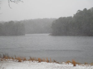
Blowing snow during the nor’easter at Prospertown Lake in Jackson, Ocean County.
USE OF ‘NOR’EASTER’: Early on in my reporting days at the Asbury Park Press, I refused to use the term “nor’easter,” finding it to be a bit pretentious to define the powerful type of storm with winds out of the northeast. Instead I would write about a “northeastern” storm. I mean, I am not a sea captain or something. As time went on, I succumbed. I mean, people do know the term “nor’easter.” But I found something this week that has got me thinking to go back to the old way — the passion of Tom Halsted. Halsted wrote, “That gimcrack word ‘nor’easter’ is a made up, fake, pseudo-Yankee neologism that came from the same plastic cracker barrel as ‘ye olde Tea Shoppe.’ It should be shunned as silly and pretentious.” Thoughts?
SIGNS OF SPRING: I am hearing birds calling — not in full swing, but calling nonetheless. Garden flowers are blooming. Herptiles are moving around.
Blooming crocuses at Heritage Park in Cranbury, Middlesex County.
MORE SPRING, THINKING ABOUT THE GARDEN: I have been thinking about the early spring vegetable garden and looking at the seed catalogs. Still deciding which varieties of beet, carrot, lettuce, pea, and spinach to plant.
My garden seed catalogs.
A NEW TICK: The Asian longhorned tick, “Haemaphysalis longicornis,” has been been found for the first time living in the United States in November — specifically, according to the Philadelphia Inquirer and Philadelphia Daily News, on an Icelandic sheep in Hunterdon County. Previously, the tick has been found in the United States only on animals at ports of entry. The tick is a threat to livestock, but there is no known threat to humans. More information is available at https://sebsnjaesnews.rutgers.edu/2017/11/rutgers-center-for-vector-biology-helps-in-identification-of-east-asian-tick-species-on-hunterdon-county-farm/.
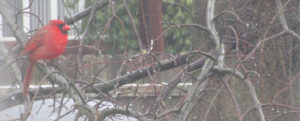
A cardinal, “Cardinalis cardinalis,” in my sideyard in Monroe, Middlesex County, during Friday’s nor’easter weather. It is easily identifiable as a male because of its bright color.
CHIGGERS ALREADY?: I think of the bite and resulting crazy itch of chiggers, genus “Trombicula,” as a late summer or fall nuisance. But this week I noticed a number of itchy red spots around my left ankle, a place one would find chigger bites. Could it be?
VOICES FROM AFIELD, JOAN GETAZ ZUMOFF ON THE ‘SMOKEY GRAY’ TURKEY: Joan Getaz Zumoff checked in from just below the Jersey Midlands in Gloucester Township, Camden County. In recent months, a wild turkey, “Meleagris gallopavo,” of thhe “smokey gray” phase has been hanging out around her yard. It is a less common coloring than the darker colors normally found on turkeys. A nice find!
A wild turkey in a less common”smokey phase” in Gloucester Township, Camden County. (Photo copyright 2018 by Joan Getaz Zumoff)
SKY VIEWS: The week’s sky view was from my backyard in Monroe, Middlesex County.
The view from my backyard in Monroe, Middlesex County.
ATLANTIC OCEAN TEMPERATURES: The Atlantic Ocean temperature along the New Jersey coast was running at about 41 to 42 degrees on the March 3-4 weekend.
DAYLIGHT SAVINGS TIME: Daylight Savings Time begins Sunday, March 11, at 2 a.m. Spring forward with spring, so set the clocks one hour forward.
SUNRISE/SUNSET: From Sunday, March 4, to Saturday, March 10, the sun will rise about 6:25 to 6:15 a.m. and set about 5:55 to 6 p.m. DAYLIGHT SAVINGS TIME BEGINS SUNDAY, MARCH 11, AT 2 A.M.; SET THE CLOCKS ONE HOUR FORWARD. From Sunday, March 11, to Saturday, March 17, St. Patrick’s Day, the sun will rise about 7:15 to 7:05 a.m. and set about 7:00 to 7:05 p.m.
WEATHER: The National Weather Service forecasting office serving the Jersey Midlands is at http://www.weather.gov/phi/.
UPCOMING:
March 10, Saturday, 11 a.m. to 12:30 p.m., Ocean County — Science Saturday, talk on striped bass management and fishing by Brendan Harrison, a New Jersey Division of Fish and Wildlife fishing technician,at the Long Beach Island Foundation of Arts and Sciences, 120 Long Beach Boulevard, Loveladies, 08008, $5 for non-members. More information at telephone 609-494-1241.
March 10, Saturday, 9 a.m. to 4 p.m., Atlantic County: 29th Annual Pinelands Short Course at Stockton University, 101 Vera King Farris Drive, Galloway, 08205. More information at https://stockton.edu/continuing-studies/conferences.html.
March 11, Sunday, 11 a.m. to 4 p.m., Atlantic County: 13th Annual Lines on the Pines, a Pine Barrens day of the written word, spoken word, art, and the performing arts at Stockton University, 101 Vera King Farris Drive, Galloway, 08205. More information at http://www.linesonthepines.org/linesonthepines.html.
April 9 to 15, Monday to Sunday, Mercer County: The annual Princeton Environmental Film Festival. Stand by for the specific schedule. This is a great event — not only showing environmental films, but some that are rather obscure. I try to go every year.
A gray squirrel, “Sciurus carolinensis,” in my backyard in Monroe, Middlesex County.
Joe Sapia, 61, is a lifelong resident of Monroe — in South Middlesex County, where his maternal family settled more than 100 years ago. He is a Pine Barrens naturalist and an organic gardener of vegetables and fruit, along with zinnias and roses.
He draws inspiration on the Pine Barrens around Helmetta from his mother, Sophie Onda Sapia, who lived her whole life in these Pines, and his Polish-immigrant grandmother, Annie Poznanski Onda.
He gardens the same backyard plot as did his Grandma Annie and Italian-American father, Joe Sr. Both are inspirations for his food gardening. Ma inspires his rose gardening.
Joe is a semi-retired print journalist of almost 40 years. His work also is at @JosephSapia on Twitter.com, along with Facebook.com on the Jersey Midlands page.