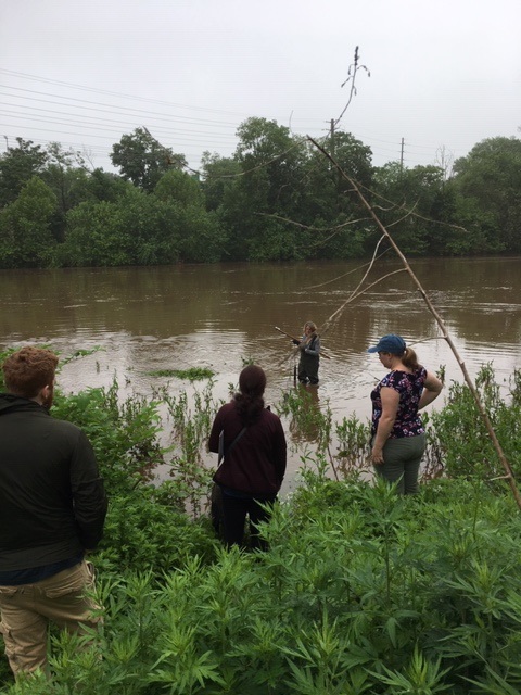
Many thanks to our great team of volunteers who dedicated their Thursday to sampling for fecal coliform and enterococci at six non-swimming beach public access sites along the Raritan River.
Enterococci levels are used as indicators of the possible presence of disease-causing bacteria in recreational waters. Such pathogens may pose health risks to people fishing and swimming in a water body. Sources of bacteria include Combined Sewer Overflows (CSOs), improperly functioning wastewater treatment plants, stormwater runoff, leaking septic systems, animal carcasses, and runoff from manure storage areas. Enterococci levels are often high after heavy or consistent rainfall.
Enterococci results are reported in Colony Forming Units or CFUs. Enterococci results are reported in Colony Forming Units or CFUs. Suitable levels should not exceed 104 cfu/100mL.
Site Name
Time
Enterococcus (CFU)
Riverside Park (40.54067, -74.51219)
9:51
TNTC
Rutgers Boathouse (40.48826, -74.43384)
10:32
TNTC
Edison Boathouse (40.48769, -74.38409)
11:09
TNTC
Ken Buchannan Waterfront Park(40.47483, -74.35586)
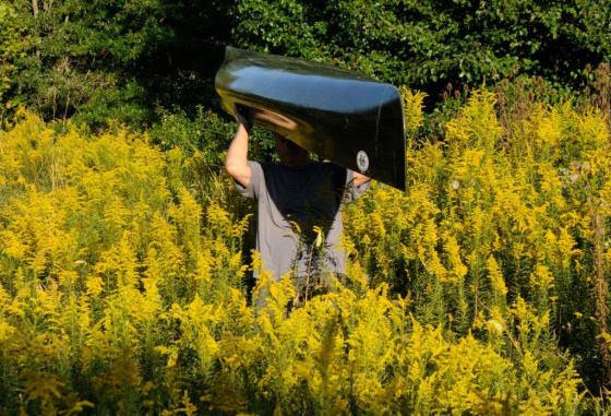
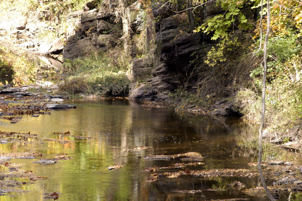
Monitoring at Riverside Park in Piscataway 5.30.2019. Photo by Jim Hearty
Please note that while we follow quality control measures, the real-time nature of data delivery means that EPA has not reviewed, and these are not technically quality controlled.
For those of you making plans to be on the water, see below for enterococci results for our monitoring sites, reported in Colony Forming Units or CFUs. Please note that while we follow quality control measures, the real-time nature of data delivery means that EPA has not reviewed, and these are not technically quality controlled.
Enterococci levels are used as indicators of the possible presence of disease-causing bacteria in recreational waters. Such pathogens may pose health risks to people fishing and swimming in a water body. Sources of bacteria include Combined Sewer Overflows (CSOs), improperly functioning wastewater treatment plants, stormwater runoff, leaking septic systems, animal carcasses, and runoff from manure storage areas.
Enterococci results are reported in Colony Forming Units or CFUs. Suitable levels should not exceed 104 cfu/100mL.
Briefly put, the numbers look good for our New Brunswick, Sayreville and South Amboy sites. Numbers are bad for our Piscatway and Edison sites, and downright horrible for our Perth Amboy site.
Riverside Park (Piscatway, 40.54067, -74.51219): 6300 CFU Rutgers Boat House (New Brunswick, 40.48826, -74.43384): 51 CFU Edison Boat Basin (Edison, 40.48769, -74.38409): 640 CFU Ken Buchanan Waterfront Park (Sayreville, 40.47483, -74.35586): <10 CFU South Amboy Waterfront Park (South Amboy 40.48334, -74.2698): <10 CFU 2nd Street Park (Perth Amboy 49.50007, -74.27719): TNTC or Too Numerous to Count. (This number is >60,000.)
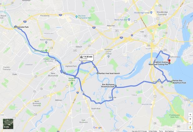
Running for 20 weeks through Summer 2019, the Lower Raritan Watershed Partnership and Rutgers Cooperative Extension of Middlesex County (RCE) will gather data and other information on water quality for public access sites along the tidal portions of the Raritan River at locations considered non-bathing beaches. This project is supported through grants from the Interstate Environmental Commission (IEC) and Rutgers’ Sustainable Raritan River Initiative (SRRI).
Summer 2019 Pathogens/Bacteria Monitoring Sites
LRWP and RCE will monitor non-bathing beach sites with active kayak/canoe launches and/or fishing and other primary contact activities that, as non-bathing beach sites, are not regularly monitored by the New Jersey Department of Environmental Protection (NJDEP) or the New Jersey Department of Health and Human Services and lack sufficient water quality data.
In addition to yielding important data about the health and safety of our waterways, the Project will also allow for development of civic science and expanded volunteer environmental monitoring programming within the Lower Raritan Watershed and Middlesex County, NJ. We are working with an approved Quality Assurance Project Plan (QAPP), provided by the IEC, which will allow for data generated from this project to inform water quality policy and regulatory decisions at all levels of government within the project area, and to educate the public about the safety of recreating on the River.
Real-time reporting of enteroccocus data will be posted every Friday on the LRWP facebook page and website, and through the New York City Water Trail Association’s citizen’s water quality testing program. Users will be able to easily interpret the data as being above or below the recommended water quality standards for primary contact recreation.
Enterococci levels are used as indicators of the possible presence of disease-causing bacteria in recreational waters. Such pathogens may pose health risks to people fishing and swimming in a water body. Sources of bacteria include Combined Sewer Overflows (CSOs), improperly functioning wastewater treatment plants, stormwater runoff, leaking septic systems, animal carcasses, and runoff from manure storage areas. Enterococci results are reported in Colony Forming Units or CFUs. Suitable levels should not exceed 104 cfu/100mL.
The following are details on our monitoring sites. We will share more information about each location throughout the monitoring period. For more information about the program please contact: info@lowerraritanwatershed.org
LR1
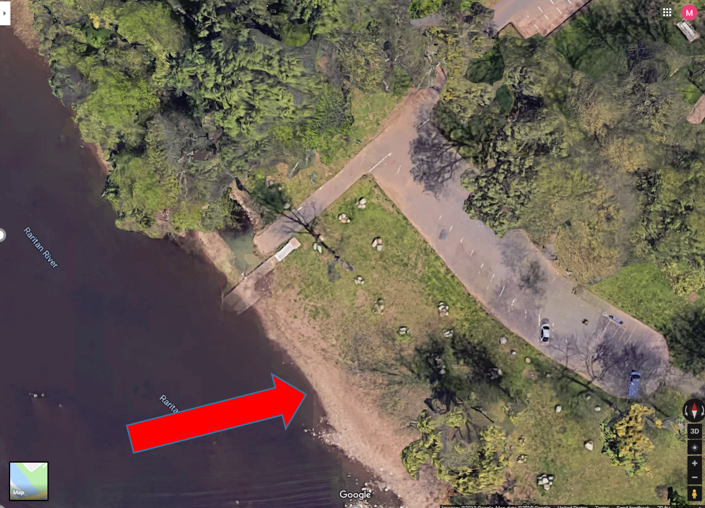
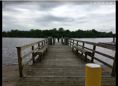
Riverside Park, 430 River Rd, Piscataway
40.54067
-74.51219
Wading site. Waders must be worn. Red arrow indicates the sampling location as this is where fishing has been observed. Access the river to the left of the boat ramp (when facing the river). Do not take the sample from the boat ramp as it is too muddy and slippery.
Bathrooms are available at this site from 10am to 2pm
LR2
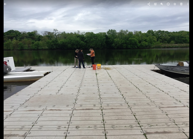
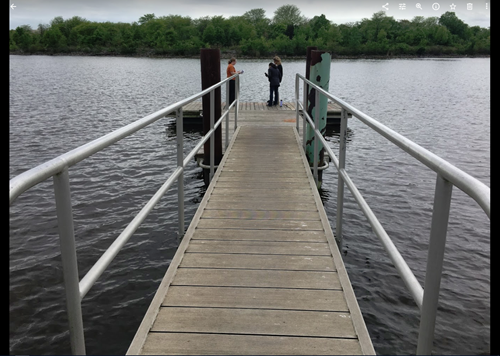
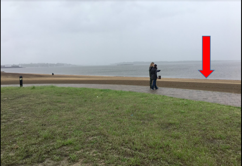
Rutgers Boathouse, 5 Memorial Pkwy, New Brunswick
40.48826
-74.43384
Sampling location is in the middle of the Rutgers boathouse dock as indicated in picture. Bathrooms may be available at the boathouse if they are open and at Boyd Park just west of the boathouse.
Sampling
location is at the end of the dock. No bathrooms are available at this site.
LR4
Ken Buchanan Riverfront Park River Road, Sayreville, NJ 08872
40.47483
-74.35586
LR5
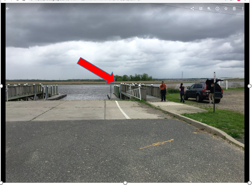
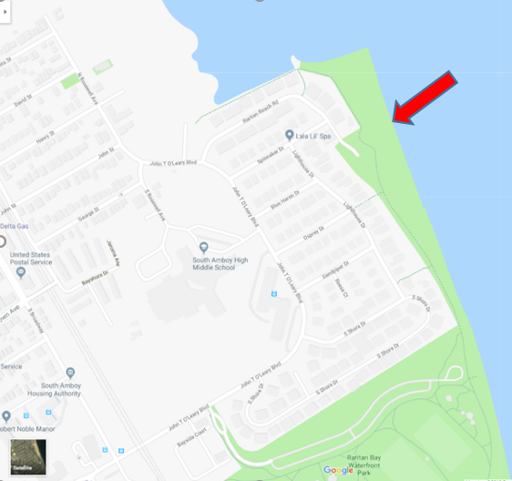
Raritan Bay Waterfront Park 201 John T O’Leary Blvd South Amboy, NJ 08879 *sample off Raritan Reach Road north of park
40.48334
-74.2698
Wading site and waders must be worn. Access the sampling location off the parking lot at the end of Raritan Reach Rd. This is northwest of the park. The site is a beach. No bathrooms available.
LR6
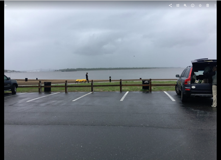
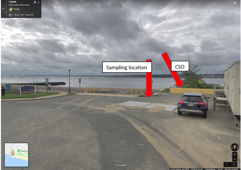
Perth Amboy Waterfront & Future 2nd Street Park 45-93 2nd St, Perth Amboy, NJ 08861
40.50007
-74.27719
This is a wading site and waders must be worn. Sampling location is at the beach next to the combined sewer outfall pipe. No bathrooms are available.
A BioBlitz is an event that focuses on finding and identifying as many species as possible in a specific area over a short period of time. At a BioBlitz, scientists, families, students, teachers, and other community members work together to get a snapshot of an area’s biodiversity.
On June
8 the Lower Raritan Watershed Partnership (LRWP) and partners including the
Americorps Watershed Ambassadors Program, New Brunswick Environmental
Commission, North Brunswick Environmental Commission, and Elmwood Cemetery will
host a day long BioBlitz of Elmwood Cemetery in North Brunswick.
Elmwood
Cemetery is a special forested habitat refuge nestled between the urban New and
North Brunswick communities. The Cemetery was established in 1868 as a “Victorian
Garden Cemetery” during the rural cemetery movement, and to this day all of
Elmwood’s lanes and paths are lined with evergreens and flowering native trees.
Cemetery managers are building on this legacy of careful planning and land
protections to secure Arboretum accreditation, which will allow them to further
advance the planting, study, and conservation of woody plants and trees in
the area.
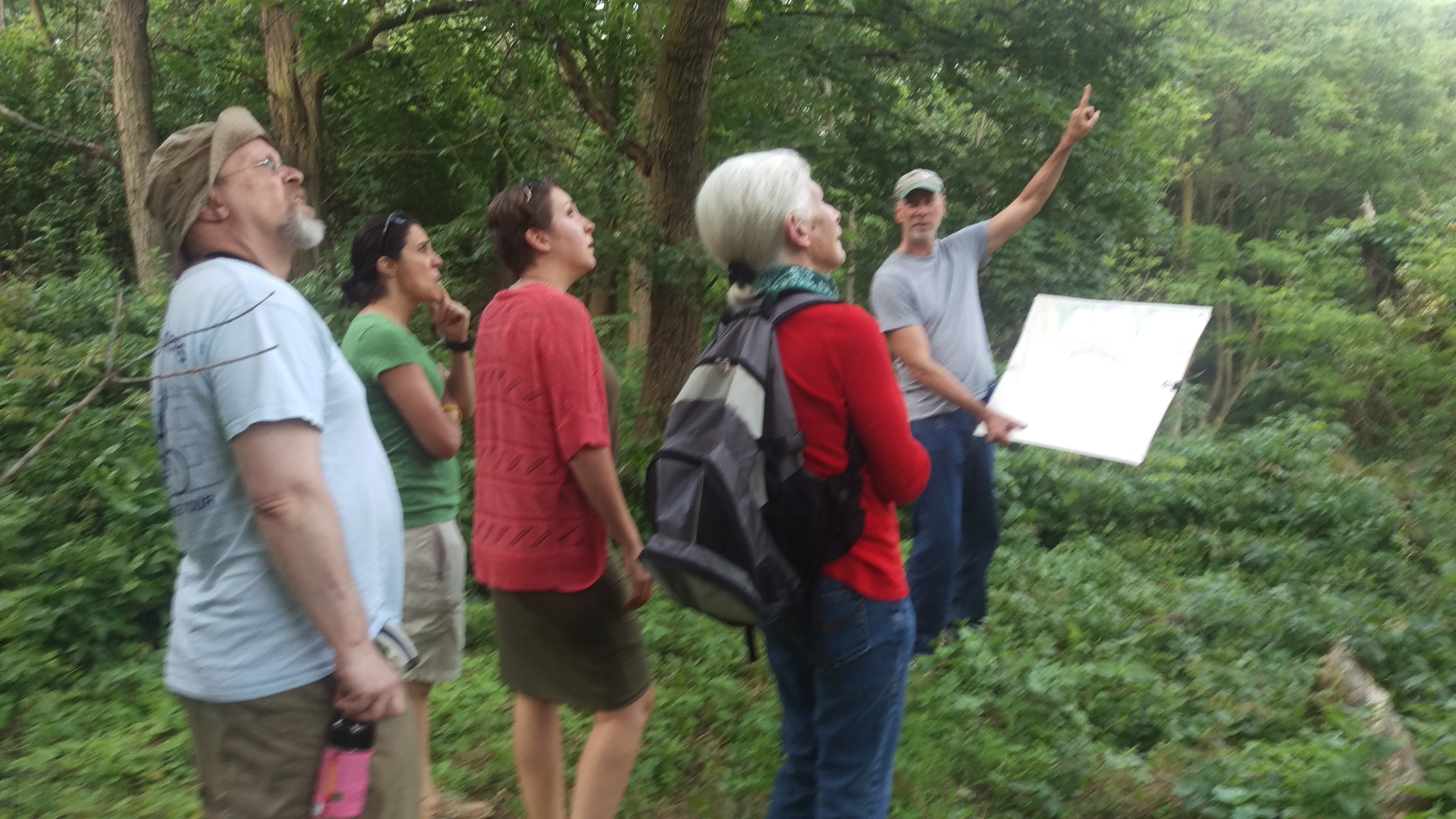
Our BioBlitz will include public talks by expert naturalists about local natural history, and a chance for the public to work with these experts in an active survey of mammals, fish, plants, insects, aquatic invertebrates, birds and fungi. Our expert scientists will be stationed at various locations at Elmwood Cemetery to help participants engage in unique research. These scientists are our “team leaders.” We use teams to help organize the science and logistics so that we get as accurate a count as possible of the biodiversity of the area.
Our Expert Scientists:
Brionna Primiani (mammals), Wildlife Specialist with New Jersey Wildlife Services
Chuck Sedor (fish), New Jersey’s Division of Fish and Wildlife in the Bureau of Freshwater Fisheries
Michele Bakacs (plants), Cooperative Extension of Middlesex County
Trisha Nichols (insects), Philadelphia Insectarium and Butterfly Pavilion
Von Scully (aquatic invertebrates) NJ Watershed Ambassadors
Laurie Gneiding (birds), NJDEP Ornithologist/Ecologist; NJ Audubon Society
Randy Hemminghaus (fungi), The New Jersey Mycological Association
Access to some of the tributaries feeding the North and South Branch of the Raritan River is strictly a trail blazing event. The rewards are worth the effort.
Like a spectacular desert flower that only blooms after a rain, many tributaries of the Raritan river’s North and South Branch suddenly blossom into navigable waterways if only for a brief moment.
These ephemeral watery threads weave though otherwise inaccessible places of pristine beauty and undisturbed wildlife. Visitation is exclusively by invitation of the rain. The chance of appropriate water level matches the odds of winning at roulette. However, the opportunity to enjoy runnable water is increased, as it can occur at any time of the year, unlike many northeast rivers that are seasonally dependent on melting snow and large drainage areas.
One jewel of a stream went a full year before the shadow of my canoe silently passed over its sandy bottom in time with the midsummer freshet racing to the sea. The rarity of such a small stream sojourn increases the value of the experience.
The appearance of an apparition is the best way to describe the transformation of a small tributary into a navigable waterway. Water that lazily followed a convoluted path through a twisting labyrinth of exposed rocks, now flows over them with self-determination. The exposed stream bed is flushed clean of fallen leaves and broken branches while smaller rocks and stones are subtly rearranged into future sand bars and shoals.
For many years I had my eye on a tributary of the South Branch too shallow to run and whose character was totally unknown to me. On these small streams, strainers, trees that span the watercourse from bank to bank can be life threatening, especially in high water with minimal possibility for evasive action. Even on the main course of the North and South branch, strainers have claimed paddlers’ lives.
So, it was with caution that I approached what I considered to be a reasonable water level, after studying the historic stream gauge data. The possibility of another as yet undiscovered eagle nest, was also a consideration in choosing this stream.
While not situated in the wilderness, a solo trip like this, even in central New Jersey, is not to be taken lightly. I checked topo maps as well as aerial views and road maps to confirm my location at any given point.
Though I certainly wasn’t the first to paddle this stream, it sure felt that way. The initial stretch was one of several locations where the water level could be viewed from the road and rarely were the midstream rocks covered with water. Today, however, I floated easily, inches above the largest rocks. Five minutes later I was out of sight, around the first bend and on my way to explore the unknown. A very strange thought to have amid the congestion of central New Jersey; a little kid’s fantasy come to life.
The scenery did not disappoint, hardwood trees dominated the shoreline and formed a wide greenway to serve as a protective margin against runoff from cultivated land and residential properties. The intimacy of the stream’s narrow course bought both banks into view while looking straight ahead.
Bare red shale outcroppings provided a cutaway of the contours seen on the topographic map. Some more dramatic than others.
At the point of highest elevation, through which the stream cut its course, a palisade of red shale stood so high, it felt as if I were paddling through a canyon. Atop the sky scraping cliff stood a wall of giant trees which appeared to be on the same plane as the cliff face. Their combined height and singular appearance could not be taken in with just a tilt of the head and an upward glance. It was as if the trees were standing on the earth’s shoulders in a successful effort to touch the sky.
As is characteristic of these small streams, changes happen quickly and dramatically.
One moment later, the unobstructed view of the blue sky and towering prominence vanished, as a sharp bend in the again green canopied river, demanded my full attention. Here, the main current was rushing to the inside of the almost angular curve and through the branches of a fallen tree. Several forceful draw strokes were required to avoid entanglement.
The rest of the trip was easily navigated through a few rock gardens and shoals. Deer were everywhere, while a pair of geese and a few wood ducks provided a downriver escort, warning the world of my otherwise silent approach.
No eagles were to be seen, though a close encounter with a great horned owl made up for the absence of a new eagle nest site. I eagerly await my next rain drenched invitation to another, one of many, tributary paddling options.
Each tributary has its own character, no two alike, other than they share invitation by rain only.
Author Joe Mish has been running wild in New Jersey since childhood when he found ways to escape his mother’s watchful eyes. He continues to trek the swamps, rivers and thickets seeking to share, with the residents and visitors, all of the state’s natural beauty hidden within full view. To read more of his writing and view more of his gorgeous photographs visit Winter Bear Rising, his wordpress blog. Joe’s series “Nature on the Raritan, Hidden in Plain View” runs monthly as part of the LRWP “Voices of the Watershed” series. Writing and photos used with permission from the author. Contact jjmish57@msn.com. See more articles and photos at winterbearrising.wordpress.com.
Infrastructure Week has finally arrived! We’ve been waiting for this all year. (No, really!)
Infrastructure Week, May 13 thru 20, is dedicated to understanding the importance of good infrastructure to our public health, quality of life, ability to cook our food, power our devices, get to work. Investment in infrastructure is an investment in our economic future.
Power companies are busy making investments in upgrading the electric grid to be ready for future growth, and developing new sources of energy to meet the challenges of climate change. Anyone who has been for a drive along New Jersey’s roads, or a ride on NJ Transit, is well aware of the need for new investment in our transportation systems. New Jersey has established ways to pay for necessary energy and transportation improvements.
There is one more important category that is often forgotten when we talk about infrastructure — our water systems. Most of us take for granted when we turn on the tap we get safe, clean water, and when we flush the toilet our wastewater is carried safely to a treatment plant. Infrastructure Week is a good opportunity for us to remind ourselves this does not happen without investment. Here are five ways to learn more about the importance of your water systems:
• Tour a sewage treatment plant. This is not as gross as it sounds! On Thursday, May 16, Jersey Water Works, the statewide coalition dedicated to upgrading our water infrastructure systems, is hosting a tour of the Asbury Park wastewater treatment plant. Meet at the plant, 1700 Kingsley St., Asbury Park, at 3:00 pm. The tour lasts about 90 minutes. It’s free and registration is required. Bonus: Networking happy hour afterwards at Anchor’s Bend Brewery, in the arcade at the Asbury Park Convention Center.
• Ask the commissioner of the state Department of Environmental Protection, Catherine McCabe, if your water is safe to drink. She will be at the Princeton Public Library for a panel discussion about the state of New Jersey’s drinking water on Tuesday, May 14, from 7 to 8:30 pm. The event is open to the public.
• Learn about green infrastructure. Green infrastructure is a more holistic way for towns to manage rainfall than just letting it run into storm sewers. The smart-growth policy nonprofit New Jersey Future is hosting a workshop in Evesham on Tuesday, May 14, from 6 to 8 pm, to introduce a toolkit they have developed to help towns make better use of this technique. The event is free and registration is required.
• Learn about the link between green infrastructure and environmental justice. Hop on a free webinar Wednesday, May 15, at 1 pm, and hear Stacey Eriksen from EPA Region 8 and Andy Kricun from the Camden County Municipal Utilities Authority discuss how green infrastructure can bring environmental, economic, and social benefits to the communities that need them the most.
• Learn how your town can pay for better water infrastructure. Jersey Water Works and New Jersey Future have developed a guide to help towns and utilities applying to the state for money to improve water systems, and especially for financing green infrastructure initiatives. They’re sponsoring a public workshop on Thursday, May 16, from 10 a.m. to noon at the offices of the North Jersey Transportation Planning Authority, 1085 Raymond Blvd., Newark, to explain the process and how to use the guide. The workshop is free and registration is required.
LRWP Board Member Missy Holzer teaches environmental science courses in Chatham High School. During my senior year of high school, I took her AP Environmental Science class. Years later, we serendipitously ran into each other at a workshop hosted by the LRWP. The reunion of this generous teacher and her former student led to this interview at the Cook Student Center with the sunset of March soaking the floor in amber.
TaeHo Lee: Where are you
from in the watershed, and how do you engage with and explore the watershed?
What is your favorite thing to do in the watershed?
Missy Holzer: I grew up in Somerset New Jersey near the Raritan River. The Raritan River was my river. One of the things that I remember distinctly about the river from my childhood is that it used to flood quite a bit. We had many storms come through such as the remnants of hurricanes that flooded the little downtown of Bound Brook. And I just lived a couple miles away. So the big routine was that, after the flood, we would walk down to Bound Brook to see what the damage was all about. We looked at the waterline underneath the underpass of the Queen’s Bridge which spans the Raritan to connect Bound Brook and South Bound Brook. We could not always access the underpass because the water was so high, so we would go over the train tracks. As a young child I really didn’t understand flooding; I really didn’t understand the power of the river and all that it had to offer, and all the damage it could do. So for me it was just a marvel and one of those things that was just part of my life.
T: Do you still live in
Somerset?
M: Yes, I live in a different part of Somerset. I have been back there for twenty years already. And I’m still in the Lower Raritan Watershed, in Franklin Township. Franklin Township is pretty big, and a part of it is a part of the Stony Brook Millstone watershed. Another small part of it is a part of the Lower Raritan Watershed.
T: Watching the
impacts of floods was a favorite activity?
M: It was one of my
biggest memories of the River. We used
to bicycle along the river. But that memory of the frequent flooding was one of
those things that was so big.
T: Did you ever do stream
or river cleanups?
M: Cleanups? Back then? No! We never did cleanups! I grew up in an era when cleanups didn’t exist. I participate in cleanups now that I’m back in the community. The early 1970’s was around the time when the whole environmental movement was just getting started. So, no, clean-ups just weren’t a thing yet, although proper disposal of trash was a thing and littering was not!
T: Wow..
M: Coming a long way!
T: (Laughter)
M: For the good.
T: As an environmental
educator, how do you want your students to engage in and with watersheds?
M: They do engage in watersheds quite a bit in two different fashions. My AP environmental science students and I explore Great Swamp Watershed in Morris County with the assistance of the Great Swamp Watershed Association. For their final course project, we visit three streams that enter the Great Swamp wetlands, and one where it drains out. The purpose of doing this is that as the water is going in, it’s picking up everything that’s running off the properties. So we have all those impervious surfaces that are contributing to the non-point source pollution going into the Great Swamp. The power of a swamp, a marsh, of wetlands and all these places is that they are great filters. You would expect the water going in would have one water chemistry and the water coming out to be another. You would expect the water going in to be pretty nasty whereas the water coming out to be a lot cleaner, if the wetlands are allowed to do what they are supposed to do. Students gathered the data that showed the swamp does purify water.
T: How did your students
react to this project?
A: They loved being outside! They loved collecting the data. The whole point of the project was Watershed-friendly living. The students were tasked with coming up with ways that the community can protect their watershed. There are so many different aspects and ways that can do that, like making recommendations for taking care of your lawn, making recommendations for taking care of dog waste, etc. So with all those different types of recommendations they developed, the students did a presentation for community members.
T: That’s brilliant!
What, in your view, are the primary issues that need to be addressed in the
watershed?
M: For the Lower Raritan there are two things. One is the amount of impervious surfaces, and understanding how that is related to the water quality. This issue is directly related to population and land use within the confines of the Lower Raritan Watershed. The other thing is engagement. People should have relationships with the Raritan River. People might cross it on a daily basis, but only look down once in a while. But if more people understand that it’s their river then they would take a little bit more ownership of it; they would understand it as a community resource that we all should take care of. So I think if there’s a way that we can promote social aspects of the river, that would be a great way to ensure better water quality in the future.
T: I agree with you. I
also think that people need to understand the concept of a watershed, because during
outreach tabling for the LRWP, many people do not even know what a watershed
is.
M: I hundred percent
agree with you. Even starting with that little nugget — having a model of what
a watershed is and showing them where their house is relative to the river, anything
that’s on their driveway. All the things that are allowed to be put on the
ground is going to change the chemistry of our watershed.
T: What is your vision
for the LRWP?
M: My vision for the
LRWP is to include as many people as possible as resources to further the betterment
of the river and its watershed.
T: You are an
environmental science teacher at Chatham High School. What is your role there?
Can you provide insights into how we can best interact and communicate with
young adults to address the needs of the LRW?
M: I teach environmental
science in high school and other courses as well. When there’s a group of
students who are interested in an environmental club then I serve as their
advisor. The way to best communicate and interact with young adults is to get
them involved, to get them outside. We hide our face too much with technology,
and we don’t experience what it is like to be outside away from technology. If
we can get as many students as possible outside to do water testing, or go for
a hike and nature walk within the watershed with someone who is knowledgeable
to point out few things, and have students actually explore and ask questions
and have those questions answered, and also point out things that are
challenges, I guarantee you that students will develop passion and want to
address and fix those challenges!
T: What is your
environmental teaching philosophy? In other words, when do you think that students
learn best?
M: That would be
engaging them with real problems to solve. Students also learn best when they
are involved in the process of learning. For instance, getting them involved in
collecting data on their own – whether it’s looking at home energy audit so
that they can look at their own energy usage. So connecting it back to their
lives is I think going to allow the students digest the information a lot
better than just learning from a textbook.
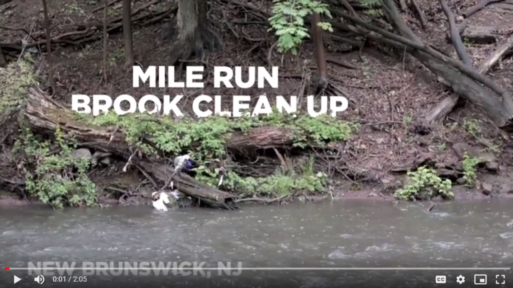
On May 12, 2018 more than 150 people joined the Lower Raritan Watershed Partnership, Greater Brunswick Charter School, Esperanza Neighborhood Partnership, Friends of Mile Run Brook and Elmwood Cemetery for a multi-site community clean-up and celebration of New Brunswick’s Mile Run Brook. The clean-up was enlivened by our roving “Trash Troubadour” – Dave Seamon – who engaged our volunteers with song and stories as they cleaned-up the stream.
Our Trash Troubadour traveled with a large sculptural bread-and-puppets style bottle (made from trash found during prior clean-ups) that clean-up volunteers covered with messages of environmental hope. With thanks to all the volunteers for a great day of stewardship and celebration. And huge thanks to filmmaker Jessica Dotson for capturing this story of our wonderful New Brunswick, NJ community.