Research Tools
See below for an annotated list of sources for primary documents related to the Lower Raritan Watershed. Materials may include maps, postcards, letters, diaries, sermons, literary manuscripts, organizational records, financial and legal records, and more! (See notes and advice regarding use restrictions).
1. Rutgers Special Collections and University Archives
Rutgers Special Collections and University Archives at Rutgers University Library are located at Alexander Library on College Avenue. It is divided into Sinclair New Jersey Collection, Manuscript Collection, Rare Book Collection, and University Archives.
a) Special Collections and University Archives contain and provide primary sources of a rare, unique, or specialized nature. Very knowledgeable staff makes this the best starting point of any research.
b) The Sinclair New Jersey Collection documents New Jersey history and culture and is one of the finest and largest collections of state and local history in the country. It contains letters, diaries, sermons, literary manuscripts, organizational records, financial and legal records, and other documents,18th century to the present. Check out this research guide for navigating the Sinclair Collection holdings: Rutgers University Sinclair Collection Research Guide
c) Special Collections contains primary sources, many but not all of which are digitized. Navigating library websites can be confusing as there are 4 different portals that lead to the good digital map archives:
-New Jersey Historical Maps Portal is a single point of access to the multiple digital map collections residing within: Rutgers University Libraries’ Special Collections and University Archives, the New Jersey Environmental Digital Library and New Jersey Digital Highway.
http://njmaps.libraries.rutgers.edu/
-Cartography is Rutgers Department of Geography webpage that allows for viewing, but not for the use of the maps on the website.
http://mapmaker.rutgers.edu/MAPS.html
-Part of this map collection is Rutgers University John Brush Collection. Named after a Professor Emeritus of Geography at Rutgers University, John Brush Cartography is a collection of the Rutgers Department of Geography. Many maps and aerial photographs are local, and created by professor Brush himself.
http://mapmaker.rutgers.edu/BrushCartography/
-Institutional repository – RU Core Rutgers Community Repository represents the original research of the faculty in electronic form created and used by the University community and its strategic collaborators. RU Core’s collection includes theses and dissertations, in collaboration with the Rutgers University graduate schools as well as faculty and departmental publications: pre-prints, post prints, presentations, technical reports as well as primary source materials-manuscripts, photographs, maps, and multimedia, from the libraries’ special collections.
https://rucore.libraries.rutgers.edu/portals/njmaps/
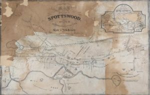
Figure 9: Spotswood, New Jersey – 1870
Source: Rutgers University Libraries Special Collections
https://rucore.libraries.rutgers.edu/portals/njmaps/
Example of use restriction: “This object has been provided by Rutgers University Libraries Special Collections after a copyright, permissions, and usage rights evaluation. You may make use of the information under a Creative Commons Attribution-NonCommercial 2.5 license (see creativecommons.org/licenses/by-nc/2.5/). If undeclared, you may need to contact the rights holder for permission for further use.” – Rutgers Libraries
Rutgers University Library Findings Guide
With thanks to Rutgers University Librarians Al King and Christine Lutz, here is a wonderful resource, a findings guide to Raritan River-related Rutgers University holdings with a focus on special collections and historic holdings:
RU Libraries Special Collections Finding Guide for Lower Raritan Watershed_Spring 2017
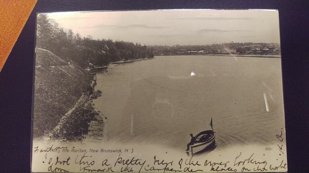
The featured image is a postcard of the Raritan River from the Rutgers Libraries Special Collections Postcard Collections.
Here are sample additional holdings:

1863 Map of the Raritan River at New Brunswick

1963 Environmental Impact Statement for Wastewater Facilities in the Lower Raritan River and Raritan Bay
2. Library of Princeton University
The Library of Princeton University contains much of the local cultural history information as well as the special collections that include Government Documents collection (US Federal Government from 1884 on, the State of New Jersey 1950 on) and Historic Maps collection (prior to 1919, many in digitized form).
http://library.princeton.edu/collections
3. USGS “topoView”
USGS “topoView” is a USGS online application that allows for the search of USGS maps covering the entire US, and the time span from 1880 till today. Maps made in the late 90s were not ground truthed anymore and there is some criticism of their accuracy post 90s. Maps are georeferenced and downloadable in formats that are friendly for any application.
https://ngmdb.usgs.gov/maps/topoview/viewer
4. Boston Public Library: Norman B. Leventhal Map Center
The Boston Library Leventhal Map Center encourages innovative uses of maps and geographic materials. There are no restrictions on the use of their maps, but there is a fee for purchasing of high resolution images. Collection contains some very good and detailed local revolutionary war maps.
5. Library of Congress
The Library of Congress website contains a lot of relevant data, and most interesting are the Sanborn Maps.
6. Sanborn Maps
Sanborn Maps were originally created for assessing the fire insurance liability in urbanized areas of the United States. The maps include detailed information about buildings in approximately 12,000 US towns and cities.
https://www.loc.gov/collections/sanborn-maps
7. Raritan River Rail Road Historical Society, Inc.
The RRRR Historical Society website includes Raritan River Rail Road data, cultural history, and technical information. Webpage contains some rare maps of the area between 1937 and 1980 and a lot of video, audio, and textual material.
http://www.raritanriver-rr.com
8. Army Core of Engineers, USACE Digital Library
The USACE Digital library contains booklets, manuals and guides, history of the agency as well as the fish and wild life reports, maps, aerial photographs and water reports.
http://cdm16021.contentdm.oclc.org/cdm/
9. NOAA Office of Coast Survey, Historical Map, and Chart Collection
NOAA’s map and chart collection contains nautical Charts of Raritan River starting from 1874 and up to 2013.
https://historicalcharts.noaa.gov/historicals/search#searchInput
10. Office of New Jersey State Climatologist
The NJ State Climatologist’s holdings include a bibliography list of books and articles that deal specifically with the climate of New Jersey.
http://climate.rutgers.edu/stateclim/?section=njcp&target=publications
11. British Library
The British Library’s collection of maps, plans and views is one of the largest in the world, numbering some 4.5 million. Access and usage are somewhat limiting.
http://www.bl.uk/collection-guides/cartographical-collections
12. Hathi Trust
Hathi Trust is a partnership of academic & research institutions, offering a collection of millions of titles digitized from libraries around the world. Access and usage is allowed through the Rutgers Libraries System.
13. New Jersey Environmental Digital Library.
The New Jersey Environmental Digital Library is a partnership between New Jersey Department of Environmental Protection and the Rutgers University Libraries.
http://njedl.rutgers.edu/search
14. Middlesex County Libraries, Museums and Archives.
http://www.linkpendium.com/middlesex-nj-genealogy/lib/
