Article and photos by Joe Mish
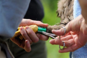
Rose gets a green aluminum band affixed to her left leg and a silver band to her right leg. Green is the band color used by NJ and silver is a federal band. Each state uses a specific color to quickly identify a banded eagle’s origin.
Over last century as the northeast bald eagle population dwindled, their image flourished as a marketing tool to brand high end merchandise. Gilded eagles sat upon flag poles in parades and auditoriums. Dollar bills and quarters bore engraved, lone eagles, wings spread and talons flared, about to attack at the least provocation.
Never did any image show more than one eagle, even though they mate for life and are dedicated parents. As a generation, we came to know eagles as powerful solitary creatures frozen in iconic poses. There was nothing to challenge that image, the skies were empty and no shadows could be seen speeding across the land. Least of all in central NJ, a land reputed to be sanitized of nature.
Awareness of man’s place in the natural world and his impact on the environment began to be studied in universities like Rutgers College of Agriculture and Environmental Science in the late 1960s, which opened the door to a new era of enlightenment and activism. Books like Silent Spring and Sand County Almanac were the seeds sown to nourish the idea humans were not apart from the cascade of life that flowed, uninterrupted, from the soil and water to apex predators, like the eagle and peregrine falcon.
Eagle restoration in NJ began in earnest in the 1980s accompanied by an ever-growing accumulation of study data gleaned by observation and scientific research. Still the view of intimate eagle relationships and social interaction remained at a sky-high level and not well published for public consumption.
Eagles kept their privacy and legacy reputation as solitary creatures intact until the advent of live cameras, genetic mapping, banding and miniature transmitters.
As far as the public is concerned, it is the live cams, set above some nests and broadcast on the internet, that provide non-stop coverage of eagle antics in the aerie to feed an insatiable voyeuristic human appetite.
The forums that accompany these spy cams generate lively conversation and together, have created a whole new audience beyond those immersed in all things nature. People who can’t tell a snow goose from a snow bunting, are now addicted a wildlife reality show.
And addictive it is, as viewers and scientists both learn what goes on behind nest walls. As voyeurs watch, they see behaviors that mimic human responses. The eagle screaming at its partner could very well be a replay of last night’s argument with their spouse, “who never listens to a word I say”.
Cumulatively, what we see are personality differences among pairs of eagles, where before we had only anecdotal observations and generalized conclusions. We knew the eagle as a solitary warrior and now we see a great raptor dedicated to its mate and offspring. When we look closely into the world of an eagle we see a glimpse of ourselves.
Locally the intrigue has been riveting, with a ringside seat to a female ingénue coming between a mated pair, a harassing hawk obliterated by an annoyed eagle and tender moments of dedicated parents doting on their precious offspring.
We watch as courting behavior evolves into mating, egg laying and alternate job sharing, as pairs relieve each other from brooding duty. We see and hear the wailing of one parent when their mate fails to return, either through injury or death. You cannot be unaffected by that sight and sound as what you experience is automatically translated into human terms.
A live cam from another state showed a female eagle covering her three, day old chicks, as a late spring snowstorm raged. That moment was tender enough but then the male positioned himself alongside the female, resting his head on her shoulder and spread his wings to shield his mate and their chicks from the heavy snowfall; our collective tears flowed.
Recently an eagle that prematurely fell from a local nest was rescued, examined and found to be in good health. Given that one parent went missing in the weeks prior to the fall and it was impossible to return the bird to the nest, a decision was made to place that eagle in another nearby nest.
Armed with the knowledge of intimate eagle behavior and demonstrated dedication to their young, fostering that young eagle was done with full confidence it would be accepted and thrive.
Only time will tell but so far, so good. Years hence, if you see a bald eagle bearing a green leg band, engraved with E68, you now know the rest of the story. Consider an eagle that was killed, June 2015, in upstate NY by a car, was banded 38 years prior! So, eagle E68, affectionately named, Rose, and her foster siblings, E66 and E67 have a good chance to be seen by your grandchildren!
Author Joe Mish has been running wild in New Jersey since childhood when he found ways to escape his mother’s watchful eyes. He continues to trek the swamps, rivers and thickets seeking to share, with the residents and visitors, all of the state’s natural beauty hidden within full view. To read more of his writing and view more of his gorgeous photographs visit Winter Bear Rising, his wordpress blog. Joe’s series “Nature on the Raritan, Hidden in Plain View” runs monthly as part of the LRWP “Voices of the Watershed” series. Writing and photos used with permission from the author.
Article and photos by Joe Mish
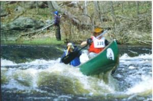
The powerful watery hand of the river reaches up in a wild mood to toss its dance partner skyward.
A canoeist might think of the river as a dance partner whose energy flow and mood sets the tone for the style of dance to be performed. A waltz, a tango or lambada are all on the river’s dance card to be enjoyed or sat out. Any paddler who wishes to partner with the river and enjoy the wide variety of watery tunes must have practiced moves, familiarity with boat and paddle and an ability to read the subtle nuance of wave patterns reflecting the structure of the hidden riverbed.
While high water and low water dances may be thoroughly enjoyed, I originally coined the term ‘river dance’ to describe the convoluted navigation required to follow the low water flow typically occurring on the South Branch during the summer.
Each year, winter ice and downed trees reshape the river bed to form new shoals, islands and channels which leave the scars and wrinkles that figure so prominently when water levels drop in the summer.
Low water and limited paddler skill do not preclude a float trip down the river as a grounded boat may be dragged across exposed shoals and shallows to deeper water.
Plodding along does not equate to river dancing but it gets the job done.
The joy of river dancing comes into play when the paddler, perhaps in a solo canoe, seeks out cuts and channels that hold just enough water to support the boat. Following the deepest water when the riverbed becomes a player in the band may mean tracing a convoluted course from one side of the river to the other. This shallow water navigation strategy is directly applicable to high, fast water flowing through boulder strewn stretches of river. Both situations require reading the wave patterns to determine the best path beyond the next immediate move.
One fast water section where I launch always has sufficient water from bank to bank for about a hundred yards. During lower water levels the left side and most of the middle of the riverbed is almost exposed and not navigable except for a narrow cut quite close to river right. As is often the case, a direct downstream approach to the deep water cut is not possible because the water directly above the cut is too shallow or has a downed tree blocking that approach. As the situation and solution is obvious from a long distance upstream there is time to gradually approach the passage at a forty-five degree angle and then straighten the boat with a quick draw to follow perfectly in the strong deep current.
Further downstream near a bend in the river, a long treeless island appears, the right side of which is navigable in a channel that runs along the opposite bank. As the channel nears the end of the island, it flattens out and disappears. The water then seeks to run at an angle across the raised center section of the riverbed. The riverbed here appears to have a profile of a typical crowned roadway and the main channel reappears to run just along the tip of the island. Crossing the riverbed from one channel to the other requires a good look at the wave patterns. If you know nothing, then just observe the differences in the wave patterns. In very shallow water they are almost indistinguishable but with practice differences will become apparent. Generally, flatter waves reflect deeper water. Or simply put, the less busy the surface of the water appears, the further above the riverbed it is. Don’t be surprised sometimes to find the water too shallow despite choosing the most favorable pathway. Crossing an ultra shallow channel as described, may require the paddler to shift their weight forward to create an absolute neutral balance in the boat to avoid a fore or aft drag. Shifting paddler weight to one side in a typical shallow V-shaped hull will often decrease the depth the hull protrudes into the water and might make the difference between stepping out and dragging the boat or barely floating by with some slight scraping.
One of the most useful skills a paddler can acquire is the ability to ferry. A ferry is a method which allows cross stream travel in swift water with minimal paddler effort.
I usually stop to do a ferry whenever fast water presents itself just because it is so much fun and feels like magic. A ferry is based on the premise that a canoe becomes invisible to the current when perfectly aligned with the water flow. A canoe can be paddled upstream and held in position without any downstream travel when the hull is parallel to the water flow. Eventually when the hull begins to angle across the current the boat will be washed downstream. The speed with which the boat is carried downstream depends on the angle of the boat to the water flow. The greater the hull angle, the greater the surface area the current has to push against. A ferry is possible when the boat is angled into the current and that angle held steady by the paddler. Very fast water requires a shallow angle to be held, the slower the water speed the greater the angle needed to perform a ferry.
Often the current speed changes as you cross the river and the boat’s position must be adjusted appropriately. The magic occurs when you realize the boat, held at the proper angle, begins to cross the current from one side to the other without any downstream travel!
A ferry can be accomplished with the bow upstream or downstream. Simply angle the upstream end of the boat in the direction of the shore you wish to reach. In very fast water you might suddenly find yourself at the precipice of a ledge with no chance of safe passage. Not to worry. Straighten the hull with any and all paddle strokes that might be applicable, hold the boat steady. Choose your angle and be amazed as your boat becomes a magic carpet to drift you above the ledge, perpendicular to the current, and on to a safe passage or convenient eddy.
Do not despair when summer water levels fall and most folks abandon the thought of paddling the local rivers. Armed with patience and agility you might try to dance with the river on her terms.
Author Joe Mish has been running wild in New Jersey since childhood when he found ways to escape his mother’s watchful eyes. He continues to trek the swamps, rivers and thickets seeking to share, with the residents and visitors, all of the state’s natural beauty hidden within full view. To read more of his writing and view more of his gorgeous photographs visit Winter Bear Rising, his wordpress blog. Joe’s series “Nature on the Raritan, Hidden in Plain View” runs monthly as part of the LRWP “Voices of the Watershed” series. Writing and photos used with permission from the author.
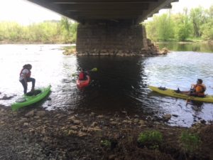
On Saturday May 5 several partners helped the Borough of Bound Brook inaugurate its first kayak/canoe launch site. A partnership between the Borough and New Jersey American Water (NJAW) resulted in an access agreement to allow recreational use of private land, giving paddlers a new access point to the Raritan River. The agreement between the Borough and NJAW allows the public to put their watercraft into the Raritan in an area owned by NJAW under the Queens Bridge in the Borough.

Bound Brook Borough Administrator Hector Herrera and Council President Abel Gomez were joined by representatives of South Bound Brook; Somerset County; New Jersey American Water; Pfizer on behalf of Wyeth Holdings; the Raritan Riverkeeper; National Park Service Rivers, Trails & Conservation Assistance; and members of the public for the ribbon cutting and launch ceremony on a beautiful spring day. Signs explaining how to use the access site with a map of downtown Bound Brook greeted launch users in English and Spanish.
Council President Abel Gomez noted: “This launch site for kayaks and canoes is part of a bigger plan to restore public access to the Raritan River. In 2015, the Borough’s Economic Development Advisory Committee published Riverfront Access Plan for Pedestrians and Bicyclists. This plan puts forth strategy and initiatives for a comprehensive bicycle and pedestrian network to connect downtown commercial areas with the riverfront. The launch site is another element that makes Bound Brook a destination area.”
In addition to the access to the River for paddlers, the Plan calls for the creation of a park along the waterfront from Queens Bridge to Middle Brook, including the development of a riverfront trail system for pedestrians and bicyclists using inactive rail corridor and a levee system. Raritan Riverkeeper Bill Schultz explained that the “launch site will mean that paddlers can now travel all the way from Bound Brook downstream to Perth Amboy and the Raritan Bay, about 18 miles. Raritan River recreation complements the land-based recreation currently available on the south side of the river, as part of the Delaware & Raritan Canal State Park.”
The Borough is receiving technical assistance from the National Park Service’s Rivers, Trails & Conservation Assistance Program. The NPS helped form a steering committee made of local stakeholders, including New Jersey American Water, Somerset County Planning Division, Rutgers University Edward J. Bloustein School of Planning and Public Policy, Pfizer on behalf of Wyeth Holdings, and members of the Bough’s Economic Development Advisory Committee.
The Riverfront Access Plan is available at: http://boundbrooknj.org/MasterPlan/RiverAccessPlan
For more information about the project, contact Bound Brook Borough Administrator
Hector Herrera at 732-893-8520 or hherrera@boundbrook-nj.org
Article and photos by Joe Mish
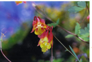
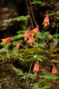
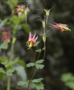
Looking up into the columbine flower’s mouth, I see a dove with wings spread or an angel. This diminutive wild flower is found in isolated patches among the red shale cliffs that line the South Branch. Who knew, other than hummingbirds, that such a treasured crown jewel was hidden along our river.
The red shale cliffs interrupt pasture and field along the South Branch to stand as an unchanging reference point, immune to progress and raging spring floods that swirl around them.
The exposed cliff face is characterized by a jagged appearance, with sections of smooth rock face the exception. Ancient floods have scoured rounded contours into the soft shale, to form shallow caves, nooks, crannies and alcoves. Like a human face with striking character, the cliffs beg more than a casual glance.
I cannot paddle by without desperately searching the high cliff face for ancient etchings or a petroglyph. Travelers from earliest times could not have passed up an opportunity to scribe their name or draw their hunting or fishing trophies into the smoother areas of these red shale sketchpads. It would be against human nature to leave no sign.
Unexpectedly, what I have found among the craggy shale cliffs is a species of native wildflower that begins to bloom in late April through May. Wild columbine is not found anywhere else, except in the crevices of the prominent shale outcroppings along the river.
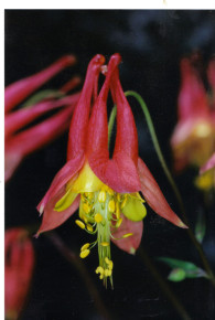
Columbine is a finely structured red and yellow flower, in the shape of a crown with five distinct tubular projections. The openings of the five separate passages are shrouded in a common vestibule. Several stalks arise from one clump, one flower to a stem, opening faces downward. The plant is not found in profusion, just in scattered, isolated patches.
There are many commercial cultivars and species of columbine, so to be clear, the wild native columbine is Aquilegia columbine. The derivative of the name is interesting as, ‘Aquila’, is Latin for eagle, and columbine references the family designation of doves. Early taxonomists saw characteristics of both in the flower. It is said the ‘spurs’ resemble the open talons of a raptor and the face of the flower, a nest of doves. To me the spurs that project to form the crown remind me of the reversed leg joint of a grasshopper when viewed from a certain angle and looking up into the mouth of the flower, I see the form of a single dove with wings spread.
The columbine flower produces tiny round black seeds in late May that are indistinguishable from poppy seeds. Though the columbine blooms about the time the first migrating hummingbirds show up, I have yet to catch a hummer dining on the flowers but surely some returning hummers have the plants marked on their GPS.
How and when columbine first found anchorage in these cliffs is a mystery. In the absence of its known origins, I prefer to think of these flowers as inheritance from an ancient legacy of primitive plants. The first of which relied on wind for propagation and then, as if by the hand of an engineer, designed shape, color and form to take advantage of insect pollinators and local soil conditions. Could it be that flowers intelligently made use of the cliffs to mark their presence through the centuries where humans left no trace?
Wild columbine are the crown jewels hidden among the cliffs, that appear in the spring for a brief moment to enrich both pollinators and humans who stumble upon them.
Author Joe Mish has been running wild in New Jersey since childhood when he found ways to escape his mother’s watchful eyes. He continues to trek the swamps, rivers and thickets seeking to share, with the residents and visitors, all of the state’s natural beauty hidden within full view. To read more of his writing and view more of his gorgeous photographs visit Winter Bear Rising, his wordpress blog. Joe’s series “Nature on the Raritan, Hidden in Plain View” runs monthly as part of the LRWP “Voices of the Watershed” series. Writing and photos used with permission from the author.
Article and photos by Joe Mish
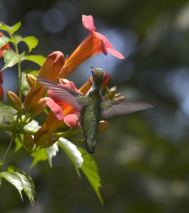
A hummingbird and orange trumpet flower engage in an evolutionary dance of equal partnership that has lasted for eons. The flower not only took advantage of an array of pollinators but also stole the heart of man who would seek to propagate flowers far beyond their natural range and ability to survive.
A name logically follows the existence of an idea, a person, place or a thing and forever provides an instant reference, complete with assigned identifiable characteristics. So before there was a month named May, a segment of time existed in nature where birth and bloom dominated the season.
The mythology from which the name of May arose was based on the same natural observations seen today. Stories of the stars and the gods became the reference points displayed on the night sky overhead projector to help explain observed phenomenon. The poetic phrase, “April showers bring May flowers” provides information sufficient enough for most people to understand the season. Instead of placing flowers at the altar of the goddess Maia we now send flowers to our mothers on a day designated to show her our appreciation, same story, different day.
Going back to the time before May, can you imagine discovering the first flower ever to bloom? In retrospect it would have meant that some plant had evolved to take advantage of a new method of pollination that relied on insects rather than wind. At the time of discovery, however, the moment had to be absolutely magical. Here was something so different in structure, color, scent and profusion that it instantly intensified a fledgling human emotion that speaks to the appreciation of beauty. The flower not only took advantage of insect pollinators but at that moment stole the heart of man who would later seek to propagate flowers far beyond their natural range and ability to survive.
Watching a rambunctious fox pup at a distance, I saw what appeared to be orange pollen on its solid black nose. As the pup was playing around the daylilies I imagined he stuck his nose inside a funnel shaped orange flower, designed for bees and hummingbirds, to come away with the telltale signs of brightly colored pollen grains. If he sniffed a few more flowers he actually became the “bee” and a willing, if not random, participant in asexual reproduction. The part that serendipity plays in nature and science can never be underestimated and its potential never unappreciated when unprecedented success results.
Fox pups are not the only pollinators unknowingly pressed into service by the ingenious evolutionary design of flowers. It is a laugh riot, for some reason, to see a dusting of yellow or orange pollen on the nose of a child or adult who sniffs a flower in pursuit of its scent. Eyes closed, as if about to plant a kiss, the human pollinator presses forward until nose touches stamen.
The entire event, so instinctive and innocently conducted, that the “bee” comes away unaware of its role in the evolutionary drama of species reproduction and survival. A kind friend will of course bring attention to the dusting of pollen left by such an intimate encounter and be trusted to address it discreetly.
Bees of all kind have ‘pollen baskets’ on their back legs which hold an accumulation of pollen grains that appear as large colorful round beads on opposite back legs. Watch one of those big furry yellow and black bees and you can easily see the lumps of colorful pollen that varies from flower to flower.
Paddling along the south branch, wild columbine can now be seen in select places on north and west facing red shale cliffs. These delicate plants grow from roots wedged between the layered red shale well above the surface of the water. The reddish pink tubular flowers with a common yellow center resemble a group of ice cream cones joined to form a common opening which leads to several individual tails. This structure encourages contact with the centrally located pollen that has to be brushed against in order to reach several sources of nectar located in each tail. This flower must have had a hummingbird sitting on the design team who decided not only the flowers structure but the time the flower was set to bloom. Hummers arriving in early spring from Mexico and Central America have a ready source of food to replenish the energy spent in their annual migration north.
Consider the greatest mayflower of all and the part it played in another notable migration. The “Mayflower”, was a ship that sailed to our shores bearing its human pollen to establish new life on the North American continent The ship, so named by unknown whimsy and intended as a supply barge, grew to evolve much as early flowers did into an effective delivery system directed by nothing more than chance. Like a flower it bloomed, spread its pollen and ‘died back’ soon after returning to England.
May apples, Virginia bluebells, trout lilies, trillium, jack-in-the pulpits and spring beauties are a small sample of local May flowers that represent the spectrum of a floral legacy whose genealogy traces back to the earliest flowers. Consider that flowers are living things that in some magical way recruited man to further their propagation in exchange for a glimpse of eternal beauty, dreams and imagination to expand the universe of human potential with unbounded creativity and expression.
Author Joe Mish has been running wild in New Jersey since childhood when he found ways to escape his mother’s watchful eyes. He continues to trek the swamps, rivers and thickets seeking to share, with the residents and visitors, all of the state’s natural beauty hidden within full view. To read more of his writing and view more of his gorgeous photographs visit Winter Bear Rising, his wordpress blog. Joe’s series “Nature on the Raritan, Hidden in Plain View” runs monthly as part of the LRWP “Voices of the Watershed” series. Writing and photos used with permission from the author.
Article and photos by Joe Mish
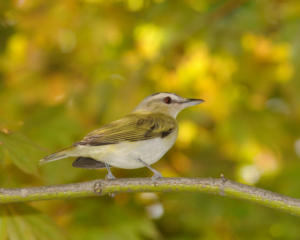
A red eyed vireo briefly descends from the treetops to provide a fleeting glimpse of one of the most common, yet rarely seen birds, east of the Mississippi.
March is the last piece of evidence needed to prove winter has gone by. No matter the weather March brings, her legacy of cold and snow, as the step child of winter, is invalidated by “the first day of spring” conspicuously stamped twenty-one days into the month on just about every calendar printed.
Further visual proof needed to allay the fear that winter is here to stay, are the strands of migratory birds that precede peak migration in the next couple of months. Perfectly positioned between two rivers that lead to the sea and link to the main Atlantic flyway, Branchburg comes alive with colorful winged migrants. Some birds are just passing through while others stay to establish breeding territories.
You don’t really need to be a graduate ornithologist with the ability to differentiate a magnolia warbler from a black throated warbler to enjoy all the feathered gems that pass our way in spring.
During a recent snowfall the view of several brilliant red, resident cardinals, dodging among the tight branches of a nearby holly tree resplendent in dark green leaves and an overabundance of red berries was a sight to behold. The gently falling snow turned the scene into a living Christmas card.
Bird seed scattered on the ground immediately near the back glass sliding door was being appreciated by a flock of brave juncos. The scene was calm and predictable with an occasional song sparrow darting across the stage. Suddenly, standing on the ground next to the glass was what appeared to be a Parula warbler. I ran for the camera to no avail as the little bird disappeared quicker than a shooting star. It didn’t seem plausible that a warbler would be in this area so early but there it was. Looking through the, ‘guide to field identification, Birds of North America’, I reviewed the dazzling array of warblers each differentiated by plumage unique to adult and juvenile, male and female with a cautionary note on hybrid warblers and seasonal plumage. I guess it was a male Parula warbler.
The conflict of identification versus the excitement at seeing a strange colorful bird lingered for a moment until I realized it was the sight of the bird that provided the magic.
Knowledge of the scientific classification was irrelevant to the enjoyment of simply noticing something that appeared to be different and gave pause to a moment of thoughtfulness or beauty.
As an example, you might gaze upon a stunning portrait of another person or a dreamy sunset and immediately be drawn in even though you have no idea of the person’s name or the location of the sunset.
Beauty is its own reward and needs no further qualification.
Birds are creatures which reflect the colors that dripped from God’s palette of infinite hues used to paint the portrait of life. One could argue ‘colors’ have wings to spread nature’s beauty far and wide and taken together they are called, ‘birds’.
Soon the area will be crowded with migrating birds, the most colorful of which are the warblers. A walk along the river flyways while scanning the treetops will reveal small flocks of birds that look like no other you have ever seen. The bright plumed breeding males will be the first to arrive as they travel in the safety of numbers. It is hard to imagine that these diminutive delicate appearing birds migrate yearly to Central America, Mexico and the West Indies from New Jersey and points north. After arriving in breeding areas, the males separate to set up mating territories defended by trilling songs sung loud and often.
The colorful and numerous male warblers representing several species are spectacular to observe in their diversity of color swatches, masks, vests, necklaces and caps. Each color pattern represents a different species despite similar size and intermingling of flocks.
Even the most ‘nature oblivious’ and ‘nature neutral’ observers may have their heads compulsively turned by the accidental appearance of a flash of tropical color among the local treetops.
Perhaps a seed of curiosity may be sown, nurtured and cultivated from a brief encounter with a spring warbler. That dangling thread of gangly curiosity left by a Magnolia warbler or Yellowthroat can easily draw the observer into the world of nature to wander and wonder at the infinite complexities that bind all living things. To believe beauty is only skin deep and fleeting is to ignore the power, depth and satisfaction the beauty of nature has to offer. Asking nothing in return, not even requiring that you can differentiate a Rufous sided towhee from a Cape May warbler, beauty exists only to be appreciated.
Author Joe Mish has been running wild in New Jersey since childhood when he found ways to escape his mother’s watchful eyes. He continues to trek the swamps, rivers and thickets seeking to share, with the residents and visitors, all of the state’s natural beauty hidden within full view. To read more of his writing and view more of his gorgeous photographs visit Winter Bear Rising, his wordpress blog. Joe’s series “Nature on the Raritan, Hidden in Plain View” runs monthly as part of the LRWP “Voices of the Watershed” series. Writing and photos used with permission from the author.
Article and photos by Joe Sapia
Arneys Mount in Springfield, Burlington County.
ARNEYS MOUNT: Arneys Mount stands roughly 245 feet above sea level, or about 175 feet above the surrounding lowland, in Springfield, Burlington County. It is part of the cuesta geologic formation — hills that have survived erosion and now separate New Jersey’s Outer Coastal Plain and Inner Coastal Plain. Take a map a draw a line from Sandy Hook at the Atlantic Ocean in Monmouth County to the Burlington County area of Mount Holly-Mount Laurel. That line is essentially the line of the cuesta. On a detailed map of that line, you will see names representing the hill system — Highlands, Mount Mitchell, Crawford Hill, Telegraph Hill, Beacon Hill, Knob Hill, Locust Hill, Quail Hill, Pine Hill, Backbone Hill, Disbrow Hill, Crematory Hill, Stone Hill, Arneys Mount, Mount Holly, and Mount Laurel.
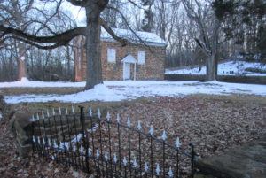
The circa 1775 Arneys Mount Friends Meeting House.
VOICES FROM AFIELD NO. 1, THE CUESTA: Cousin Jerry Edvy lives on high ground just outside of Perrineville in Millstone, Monmouth County. When it snowed during the Tuesday, March 13, nor’easter, he reported “at least 5 inches.” His house is on the cuesta, or about 280 feet above sea level. When Jerry drove off the cuesta, he saw hardly any snow. “(Route) 33 was clear,” said Jerry, speaking of the road about 3 miles north of his house. “We must have got hit with a band,” he said. Or maybe it was just the height of his area. My house, about 50 feet above sea level about 10 miles to the north, got only about 1 inch of snow. I recall this cuesta-lowland dichotomy several years ago during my newspaper reporting days for the Asbury Park Press as I drove in Monmouth County from the Millstone area to the Sandy Hook area — when I was on high points of the cuesta, there was a covering of snow, maybe a few inches; when I was at lower elevations, maybe just a coating. An interesting phenomena happening in only a matter of dozens of feet.
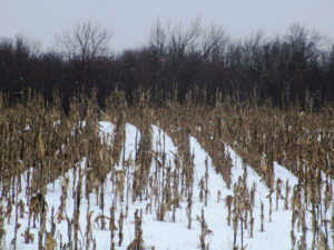
The Tuesday, March 13, nor’easter snowfall in a Monroe Township, Middlesex County, cornfield.
SNOWFALL: The seasonal snowfall tally at my house in the part of Monroe between Jamesburg and Helmetta is 29.0 inches. The average seasonal snowfall in New Brunswick, about 7.5 miles away, is about 26 inches. So, based on that, we are about 3 inches more than normal at my house, with about a month’s worth of snowfall season left.
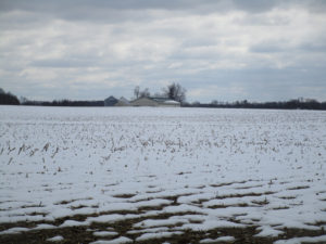
The Tuesday, March 13, nor’easter snowfall at a farm in Plainsboro, Middlesex County.
FOREST FIRE SEASON: Because of the wet weather, the Pine Barrens spring wildfire season in the Jersey Midlands is running behind this year. Normally, it runs March 15 to May 15, when winds blow, humidity decreases, temperatures rise, and sun penetrates the essentially leafless forest, warming and drying the duff. But with the wetness out there, for example, the state Forest Fire Service canceled a control-burn for the upcoming week in the Jamesburg Park Conservation Area in Middlesex County.
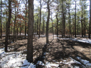
Snow on the ground in the Pine Barrens of Barnegat, Ocean County.
FIRE TOWERS: The idea of a fire tower is to see smoke during daylight hours, basically to dispatch firefighters before a fire really gets going. Because once flames are seen, the fire is well underway. The state Forest Fire Service has eight wildfire lookout towers in the Jersey Midlands — Apple Pie Hill, Bass River, Batsto, Lebanon, and Medford, all in Burlington County; Cedar Bridge and Lakewood, both in Ocean County; and Jamesburg, Middlesex County. When the fire towers are staffed, the public is welcome to visit. Beware, though, it can be a climb of about 60 to 100 feet, depending on the tower.
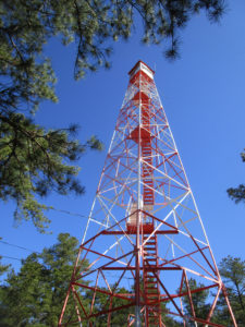
BASS RIVER STATE FOREST: Trees are to be cut around the Bass River fire-lookout tower in Bass River State Forest to improve the view for the tower observer. See https://thesandpaper.villagesoup.com/p/clear-cutting-proposed-for-bass-river-state-forest-fire-protection/1729679.
PYGMY PINES: Generally in the area of the intersection of Routes 72 and 539 in Ocean County stand hundreds of acres of Pine Barrens forest with trees perhaps only 8-feet-tall at most. This is the “Pygmy Pines” or “The Plains.” The theory is the stunted growth in this area is caused by repeated fires.

A sport utility vehicle drives on Route 539 through the Pygmy Pines, or Plains, in the Pine Barrens outside of Warren Grove, Ocean County.
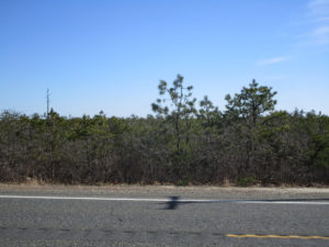
The Pygmy Pines, or Plains, on Route 539 in the Pine Barrens near Warren Grove, Ocean County.
WITCH’S BROOM: If you regularly walk the Pine Barrens, you are likely to have seen a “witch’s broom,” a thick growth of needles on a pitch pine, “Pinus rigida.” While it may look haunting, it is simply caused by disease, defect, infestation, or environmental stress.
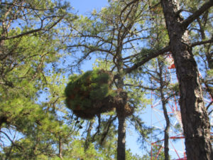
A “witch’s broom” growth on a pitch pine, “Pinus rigida,” at the Cedar Bridge fire-lookout tower in Barnegat, Ocean County.
PAINTED ROCK IN THE PINE BARRENS: Going back years, a rock along Route 539, on the section between Routes 70 and 72 in Lacey, Ocean County, had been painted in different ways according to the calendar — a Halloween jack-o-lantern, a turkey for Thanksgiving, and so on. But the rock, apparently on its way by truck to the Jersey Shore for erosion control when it somehow wound up along the road, took on an American flag, patriotic theme after 9-11 — the 2001, September 11, Tuesday, terrorist attack on American soil. No matter the artwork, the rock remains a landmark in the Pine Barrens. For more information on the rock, see http://www.jamesrahn.com/pages/other/personal/rock.htm.
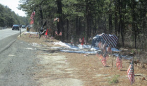
Since around 9-11 — the terrorist attack on American soil on 2001, September 11, Tuesday — the rock on Route 539 in the Pine Barrens of Lacey, Ocean, has taken on a patriotic theme.
PROTECTED ‘PINELANDS’: While much of the Pine Barrens is protected by state “Pinelands” regulations, it is not true the Pine Barrens are fully preserved. One, not all the Pine Barrens is regulated for environmental protection. Two, building is allowed even in the regulated area.

The (un)American way, development in the Pine Barrens, here in Whiting, Ocean County.
CROSSWICKS CREEK: Crosswicks Creek’s headwaters are in the area of New Egypt, Ocean County. It, then, flows into the Delaware River at Bordentown. The federal Geological Survey has a gauge along Crosswicks Creek at Extonville on the boundary of Burlington and Mercer counties, https://waterdata.usgs.gov/nwis/uv/?site_no=01464500. Along the waterway is Crosswicks Creek Park, part of the Monmouth County Park System, https://www.monmouthcountyparks.com/page.aspx?Id=2568.
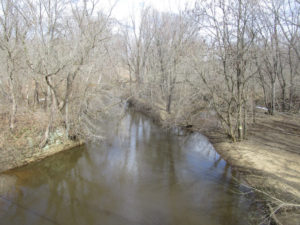
Looking upstream on Crosswicks Creek, here on the boundary of Mercer County to the left and Burlington County to the right. Here, Crosswicks Creek separates the villages of North Crosswicks in Hamilton, Mercer County, and Crosswicks in Chesterfield, Burlington County.
READING THE ENVIRONMENT: When walking afield, let the land talk to you. It has a historical record. For example, the other day I was telling Eric Gehring, a naturalist for the Middlesex County Office of Parks and Recreation, about the dikes in the woods across Manalapan Brook from my house. Those dikes are a record of the area’s cranberry farming that ended around World War II. Then, during the week, on a portion of Manalapan Brook about 4 miles south of my house, I noticed wood planks sticking out of the ground. Remnants of a bridge? A dam? This remains a mystery.
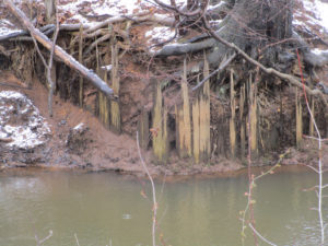
Remnants of a wooden structure on Manalapan Brook in southern Monroe, Middlesex County.
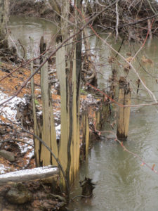
The wooden remnants on Manalapan Brook in southern Monroe, Middlesex County.
VOICES FROM AFIELD NO. 2, A MINK: Frank Ulatowski, an Englishtown-Manalapan outdoorsman, reported seeing a roadkilll of mink, “Mustela vison,” on Route 33 in Monroe, Middlesex County. So, mink are around.
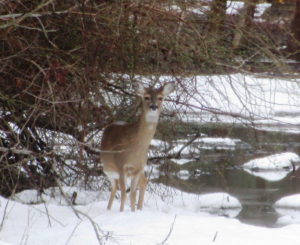
I came across this deer, “Odocoileus virginianus,” on a utility line on the boundary of Hightstown and East Windsor in Mercer County. Deer live on the edge — the edge of the woods, where they seek refuge, and fields, where they browse.
CHANJ: The state Division of Fish and Wildlife is promoting its initiative of CHANJ — Connecting Habitat Across New Jersey. CHANJ is looking to protect habitat and connect habitat through such things as land purchase, management of land, and safe wildlife passage at roadways. Roadway mitigation could include using culverts and bridges to have a safe pathway for wildlife to cross roads. The idea is have connectivity using core areas, which could be as little as 200 acres to as big as state regions such as the Highlands of North Jersey and, locally, the Pine Barrens.
UPPER MILLSTONE RIVER EAGLES: It appears the pair of bald eagles, “Haliaeetus leucocephalus,” are feeding chicks in the Upper Millstone River nest on the boundary of Mercer and Middlesex counties, based on one adult on the nest while another flies to it. See the series of photographs:
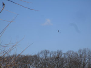
Photo 1: An adult bald eagle circles the Upper Millstone River nest, which is below the eagle.
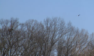 Photo 2: The eagle continues to circle, its white tail easily seen in this photograph. The nest is to the left.
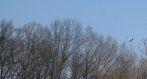
Photo 3: The eagle circles back toward the nest, which is to the left, its white head clearly seen.
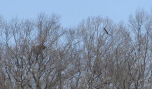
Photo 4: The eagle flies toward the nest, which is to the left, where its mate awaits. The mate’s head is the speck of white above the nest.
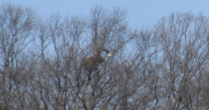
Photo 5: The eagle is landing on the nest, its mate awaiting.
VOICES FROM AFIELD NO. 3, UPPER MILLSTONE RIVER EAGLES: Frank Ulatowski, an outdoorsman from Englishtown-Manalapan, and his wife, Charlene, were visiting a business in the area of the Upper Millstone River nest of bald eagles, “Haliaeetus leucocephalus,” on the boundary of Mercer and Middlesex counties when a bald eagle flew by near the top of one of the single-story buildings. Frank wondered with all people around, how many noticed the eagle — as breeders in New Jersey, bald eagles are “endangered,” or under immediate peril, and, in general, “threatened,” or a species that can become “endangered” if conditions continue.
DUKE FARMS EAGLE CAMERA: At Duke Farms in Hillsborough, Somerset County, bald eagles, “Haliaeetus leucocephalus,” are sitting on two eggs, the first of which is scheduled to hatch about Wednesday, March 21. There is a live-stream camera on the nest that can be seen at http://dukefarms.org/making-an-impact/eagle-cam/. In New Jersey, bald eagles are “endangered,” or under immediate peril, as breeders and, in general, “threatened,” or a species that can become “endangered” if conditions continue.
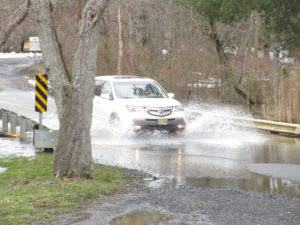
The March 13, Tuesday, nor’easter flooding on the boundary of Plainsboro and South Brunswick, Middlesex County.
BATSTO LAKE: Batsto Lake in Wharton State Forest, Burlington County, is formed by the damming of the Batsto River. The lake is 40 acres, according to the New Jersey Fish Finder website. As for the river, it drains 67.8 square miles, according to the federal Geological Survey.
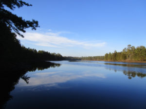
Batsto River in Wharton State Forest, Burlington County.
SIGNS OF THE PINES: While traveling through the main part of the Pine Barrens, I came across a few interesting signs, both in the Bass River State Forest area of Burlington County:

A folk art sign warning drivers of deer, “Odocoileus virginianus,” crossing a road near Bass River State Forest in Burlington County.
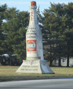
An old masonry advertising style — formerly announcing a winery, now advertising property for sale — on Route 9 near Bass River State Forest in Burlington County.
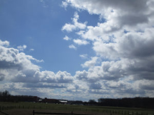
SKY VIEWS: This week’s sky views are from Hamilton, Mercer County, and Monroe, Middlesex County.
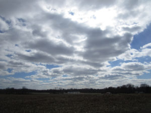
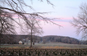
Farmland in Hamilton, Mercer County.
Mounts Mills Road in Monroe, Middlesex County.
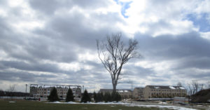
Thompson Park, looking at Monroe High School, in Monroe, Middlesex County.
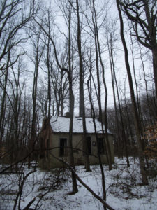
An abandoned cabin in the woods of Monroe, Middlesex County.
Joe Sapia, 61, is a lifelong resident of Monroe — in South Middlesex County, where his maternal family settled more than 100 years ago. He is a Pine Barrens naturalist and an organic gardener of vegetables and fruit, along with zinnias and roses. He loves the Delaware River north of Trenton and Piedmont, too.
He draws inspiration on the Pine Barrens around Helmetta from his mother, Sophie Onda Sapia, who lived her whole life in these Pines, and his Polish-immigrant grandmother, Annie Poznanski Onda.
He gardens the same backyard plot as did his Grandma Annie and Italian-American father, Joe Sr. Both are inspirations for his food gardening. Ma inspires his rose gardening.
Joe is a semi-retired print journalist of almost 40 years. His work also is at @JosephSapia on Twitter.com, along with Facebook.com on the Jersey Midlands page.
Copyright 2018 by Joseph Sapia
Except as noted, article and photos by Joe Sapia
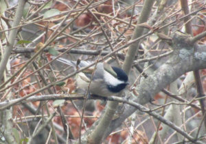
A Carolina chickadee in the front yard shrubbery of my house in Monroe, Middlesex County. Here, looking at the bird through the living room window.
BIRDING THROUGH THE WINDOW: One of my favorite places to watch birds is through my living room window. The love seat, my favorite resting spot, is across from the window, providing the lazy person’s way to birding. Birds perch in the shrubs and, if lucky enough, I take a good photo of them. Recents include the Carolina chickadee, “Poecile carolinensis“; cardinal, “Cardinalis cardinalis”; house sparrow, “Passer domesticus,”; and junco, or “snowbird,” or “Junco hyemalis.
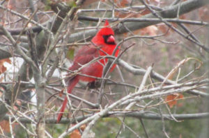
A cardinal outside my living room window, easily identifiable as a male because of its bright red color.
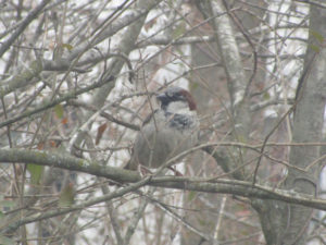
A house sparrow outside the living room window.
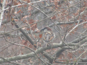
Another view of a house sparrow, showing off its colorful pattern.
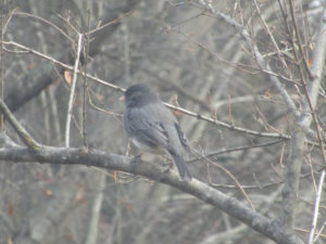
A junco, or “snowbird,” outside the window.
SNOWFALL: Flurries on Sunday, February 4, did not accumulate at my home in Monroe, Middlesex County. But on Wednesday, we had a dusting. So far, the season’s total is 18.5 inches (at my house). The normal seasonal total at New Brunswick, Middlesex County, about 7-1/2 miles away is about 26 inches. We still have about two months left of realistic snow weather.

The dusting of snow Wednesday, February 7, in my front yard in Monroe, Middlesex County.
ALONG MANALAPAN BROOK: I live across the street from Manalapan Brook in the house I was “born” in — actually taken to this Monroe, Middlesex County, home from the hospital of my birth. I often escape to a few minutes of woods time by walking the few hundred feet to the Brook. This week, I shot photos there on the snowy Wednesday, February 7, and the rainy-foggy Saturday, February 10. Manalapan Brook’s headwaters are in the area between downtown Freehold, Monmouth County, and the Great Adventure amusement park in Jackson, Ocean County. From its headwaters to where it meets Matchaponix Brook and the two form the South River at Spotswood and Old Bridge in Middlesex County is a straight line of about 15 miles in a direction heading north. It drains 43 square miles in Middlesex and Monmouth counties. The Brook, its floodplain, and surrounding woods are no longer as mysterious and no longer as big (literally and in in my mind) as when I was a kid, but they still provide an adventure. My family has lived along Manalapan Brook since about 1900.
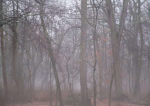
A foggy Saturday, February 10, in the swamp hardwood forest of the Manalapan Brook floodplain.
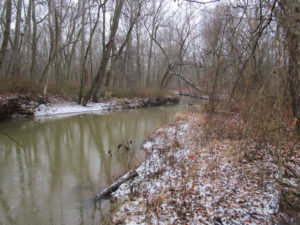
A dusting of snow along Manalapan Brook on Wednesday, February 7.
VOICES FROM AFIELD, RED-SHOULDERED HAWK: Mike Deitche of Monroe checked in with a great photograph of a red-shouldered hawk, “Buteo lineatus,” he took Tuesday, February 6, in Hamilton, Mercer County. “The hawk was on a path as I was walking,” Mike said. “It must have been finishing up its meal when I noticed it. I took three photos (of it) on the ground. Then, it flew up to the top of the tree. It was a lucky shot. I circled around, but it had taken off. I took some photos of the remnants of its meal — looked like breast feathers and tail feathers.”
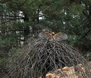
A red-shouldered hawk in Hamilton, Mercer County. “It’s one of our most distinctively marked common hawks, with barred reddish-peachy underparts and a strongly banded tail,” according to Cornell University’s All About Birds website. (Photograph copyright 2018 by Mike Deitche)
LIGHTED CANDLES IN THE WOODS: Pass a forest and you might see leaves of gold on small trees, “lighting” up the woods. These are beech trees, genus “Fagus.” Snow certainly paints a beautiful picture in a winter woods, but when there is no snow, look for these beeches to add some sparkle to the otherwise earthy tones.
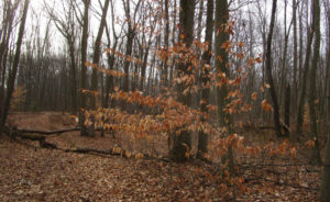
Beech trees “sparkle” at a hardwood forest at Pigeon Swamp in South Brunswick, Middlesex County.
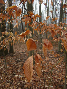
A closeup of a beech tree at Pigeon Swamp in South Brunswick, Middlesex County.
DEBBIE MANS, FROM BAYKEEPER TO DEP: Debbie Mans has watched over the New Jersey-New York Harbor Estuarty for 10 years as director of the New York-New Jersey Baykeeper group, based in Keyport, Monmouth County. Now, Debbie is moving on to be deputy commissioner of the New Jersey Department of Environmental Protection. Debbie is the type of person we need in government — smart, passionate but low key, a leader. As a Jersey boy who went to college in Wisconsin, I appreciate Debbie’s Upper Midwest sensibility — in her case, growing up in Michigan — and, as she put it, now “with a splash of New Jersey.” Congrats, Deb! (A profile I did on Debbie in 2016, September, http://tworivertimes.com/debbie-mans-midwesterner-with-jersey-sand-in-her-shoes/.)
IF YOU THINK YOU HEAR A WOMAN SCREAMING IN THE WOODS…: …I am not saying you should not call the police, but it could just be a red fox, “Vulpes vulpes.” One, perhaps more than one, was really making a racket this week in the woods along Manalapan Brook across the street from my house in Monroe, Middlesex County. A year or so ago, my neighbor called the police after he and his wife heard what sounded like a woman being dragged through the woods, screaming. An example of a fox scream, https://www.youtube.com/watch?v=zk1mAd77Hr4.
VERNAL PONDS: A New Jersey Division of Fish and Wildlife website defines vernal ponds as “confined depressions, either natural or man-made, that hold water for at least two consecutive months out of the year, and are devoid of breeding fish populations.” Vernal ponds, or “vernal pools, pools provide habitat to many species of amphibians, insects, reptiles, plants, and other wildlife,” according to Fish and Wildlife. “The absence of fish is the essence of these ecosystems. Fish are highly predatory on amphibian eggs and larvae. Over the course of evolution, several species of salamanders and frogs exploited these fish-less water bodies. Today, these species exhibit ‘hardwired’ instincts and behaviors that are geared exclusively towards fish-free aquatic habitats.” As warmer weather approaches, keep an eye on vernal pools and the wildlife they produce.
vernal pond at Pigeon Swamp in South Brunswick, Middlesex County.
ATLANTIC OCEAN TEMPERATURES: The Atlantic Ocean temperature along the New Jersey coast was running at about 35 to 37 degrees over the February 10-11 weekend.
SUNRISE/SUNSET: From Sunday, February 11, to Saturday, February 17, the sun will rise about 6:45 to 6:55 a.m. and set at about 5:30 to 5:35 p.m. From Sunday, February 18, to Saturday, February 24, the sun will rise about 6:40 to 6:45 a.m. and set 5:35 to 5:45 p.m.
WEATHER: The National Weather Service forecasting office serving the Jersey Midlands is at http://www.weather.gov/phi/.
UPCOMING:
March 3, Saturday, 10 a.m. to 1:30 p.m., Somerset County — Deer Management Symposium at the Elks Lodge, 354 Route 518, Montgomery, free. Different stakeholders are to discuss deer management. More information is available at info@sourland.org.
March 10, Saturday, 11 a.m. to 12:30 p.m., Ocean County — Science Saturday, talk on striped bass management and fishing by Brendan Harrison, a New Jersey Division of Fish and Wildlife fishing technician,at the Long Beach Island Foundation of Arts and Sciences, 120 Long Beach Boulevard, Loveladies, 08008, $5 for non-members. More information at telephone 609-494-1241.
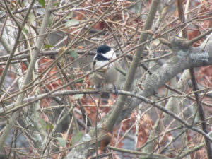
The Carolina chickadee in front of my living room window.
— Joseph Sapia
2018, February 11, Sunday,
In the Pine Barrens around Helmetta, Middlesex County,
Joe Sapia, 61, is a lifelong resident of Monroe — in South Middlesex County, where his maternal family settled more than 100 years ago. He is a Pine Barrens naturalist and an organic gardener of vegetables and fruit, along with zinnias and roses.
He draws inspiration on the Pine Barrens around Helmetta from his mother, Sophie Onda Sapia, who lived her whole life in these Pines, and his Polish-immigrant grandmother, Annie Poznanski Onda.
He gardens the same backyard plot as did his Grandma Annie and Italian-American father, Joe Sr. Both are inspirations for his food gardening. Ma inspires his rose gardening.
Joe is a semi-retired print journalist of almost 40 years. His work also is at @JosephSapia on Twitter.com, along with Facebook.com on the Jersey Midlands page.
Copyright 2018 by Joseph Sapia
~VOLUNTEERS NEEDED~ Please join the LRWP, our Americorps Watershed Ambassador and community partners including Friends of Mile Run Brook, Greater Brunswick Charter School, Esperanza Neighborhood Project, the New Brunswick Environmental Commission, Elmwood Cemetery and the New Brunswick Department of Public Works for a multi-site clean-up of Mile Run Brook, culminating in a community celebration in Boyd Park!
WHAT: a clean-up of Mile Run Brook, followed by a community picnic and celebration
WHEN: Saturday May 12
9:00 AM to noon – clean-up of multiple sites.
12-1:30 pm community gathering / picnic in Boyd Park.
WHERE: Multiple sites in New Brunswick
Site 1: Friends of Mile Run Brook / Corner of Hamilton Street and Woodbridge Street

Site 2: Esperanza Neighborhood Project / Corner of French Street and Sandford Street

Site 3: Greater Brunswick Charter School (closed group)

Site 4: Elmwood Cemetery / Entrance at Commercial Avenue
Please wear closed toe shoes and clothes you are willing to get wet and dirty. Gloves and bags will be provided!
WAIVERS
5.12.2018 MRB clean-up waiver, English
Permission and rights granted to LRWP to record and use image and voice, English
For more information
Heather: hfenyk AT lowerraritanwatershed DOT org
or Americorps Watershed Ambassador Rob Hughes: wsamb AT raritanbasin DOT org
Article and photos by Joseph Mish
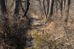
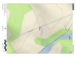
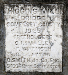
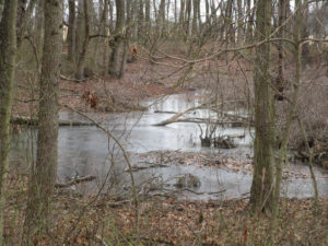
A thin blue line drawn on a map, comes to life in this photograph. A plaque, inset in a concrete bridge spanning the stream, constructed in 1923, a map showing a thin blue line depicting the stream and an image of the stream as it exists today just before it reaches the South Branch.
If all the water that ever flowed from the Raritan River drainage could be measured, its contribution to the depth of the ocean would be impressive. Think of that watershed as a collection agency for world’s oceans.
An aerial view of the Raritan River clearly shows its two main branches, the South Branch, and the North Branch. The South Branch draining more area than the North. The confluence of the North and South branch mark the beginning of the Raritan River.
A closer look reveals the larger tributaries which feed the main branches; Rockaway creek, Black River/ Lamington River and the Neshanic River, all of which are clearly noted on maps.
No less important, are the numerous smaller brooks and creeks whose contribution is significant and whose names may appear only on old maps or engraved on marble plaques set in the structures that bridge their banks; Peter’s brook, Chamber’s brook, Pleasant run, Prescott brook, Assiscong creek, Minneakoning creek, Holland brook and the First, Second and Third Neshanic rivers. Hoopstick, Prescott and Bushkill are lesser known streams, within plain view, that bear no identifying name.
There are dozens more minor streams whose names appear nowhere except on an obscure online list. Each one eventually feeds into the Raritan or its two main branches above their confluence. Knowing someone’s name is a sign of respect. Calling someone by the wrong name can be embarrassing. However, the sign that identifies the North branch of the Raritan as the Raritan River proper, has failed to embarrass those responsible for posting such signs.
Many smaller seeps and springs whose names have been lost to the ages, add to the accumulated flow. Driving along the Lamington, for instance, there are endless watery traces, arising from springs within the woods that empty into larger tributaries. Many are just moist creases worn through the soil over time, which collect rainwater and snow melt to supplement the downstream daily flow.
Maps show nameless springs, which make the cartographer’s final draft, as thin blue lines. Often, a network of converging shorter lines, each with a defined beginning, join to form larger streams like Pleasant run and Holland brook.
These obscure water sources fascinate me simply because their anonymity and remote location arouses curiosity. Their presence also represents a convergence of habitat types that attract birds and wildlife. Though they bear no labels to honor their faithful contribution to the next blue line and ultimate confluence, their importance should not be overlooked.
Many springs which appeared on old maps no longer exist, eliminated by construction of sewer lines or filled in. As maps are revised and generations fade, these streams exist only in a cartographer’s archive.
My appreciation for these disappearing blue lines was heightened when I recently discovered that as a kid, I walked over Slingtail brook every day on the way to school. At some point this little stream was diverted through a sewer line under the pavement. More amazing, even older residents had no memory of that stream whose name has been lost to the ages.
An extended winter freeze, preserving snow from a previous storm, beyond its expected stay, was interrupted by a thaw and heavy rain. The melting snow joined the torrential rain as it flowed over frozen ground to collect in every shallow crease leading to the river. The water’s velocity was enhanced by the decreasing gradient of deep well-worn pathways etched in the earth.
Where water barely trickled most of the year, a proportional biblical flood now ensued.
The banks of the successively larger streams barely contained the accumulation of water delivered from the network of anonymous thin blue lines. Acting as a single entity, the collection agency if you will, the Raritan River drainage, faithfully delivered its contribution of sweet water to the world’s salty oceans.

Cattail brook arises from the convergence of a network of bubbling springs, supplemented by runoff from rain and snow fall. It begins as hardly more than a trickle, directed by gravity, from the south facing ridge of the heavily forested Sourland mountains. The DNA extracted from a drop of water, taken from the deepest canyon in the ocean, would trace its lineage back to cattail brook through its genetic progeny. Cattail gives birth to Rock Brook, a tumultuous and moody stream that joins the more sedate Bedens brook on its way to the Millstone river. The Millstone brings its accumulated genetic material to blend with that of the Raritan to make a final contribution to the earth’s deep blue oceans.

We use our imagination as we await the technology that can trace the oceans DNA back up Cattail brook to show a single drop of morning dew that dripped from a box turtles face, was a critical contribution to the blue ocean we see via satellite images of the earth.
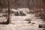
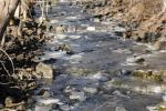
Rock brook derives its character from the influence of gravity which changes its mood from an idyllic mountain brook to a raging torrent.
Author Joe Mish has been running wild in New Jersey since childhood when he found ways to escape his mother’s watchful eyes. He continues to trek the swamps, rivers and thickets seeking to share, with the residents and visitors, all of the state’s natural beauty hidden within full view. To read more of his writing and view more of his gorgeous photographs visit Winter Bear Rising, his wordpress blog. Joe’s series “Nature on the Raritan, Hidden in Plain View” runs monthly as part of the LRWP “Voices of the Watershed” series. Writing and photos used with permission from the author.