Be Prepared: March is Flood Safety Month
Although abundant snow fell in New Jersey’s Lower Raritan Watershed in January and February, March is still the wettest month. Good preparation and knowing what to do in a flood will increase your safety and chances of survival if it happens in your area. It can also help minimize potential flood damage and accelerate recovery efforts.
Flood Preparedness: Before, During, After a Flood
- Turn around, don’t drown!
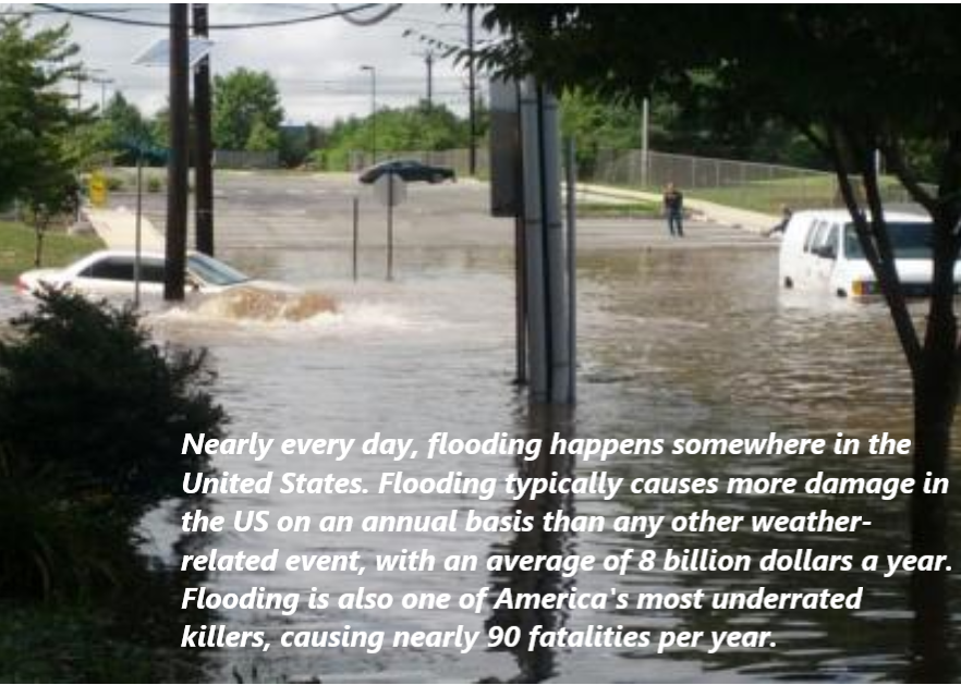
As little as six inches of moving water can sweep an adult off their feet, and just 12 inches of it can carry a small car. A foot of swiftly moving water can also carry away an SUV or truck. Even if you think you know how deep a particular part of the road is, it is better to avoid driving or walking through it altogether. It’s not just the depth alone, either — there’s also the potential for hazardous debris or downed active power lines in or nearby the water. Especially at night after a significant rainfall or flooding event when your vision is not as strong, play it safe and find an alternate route until the water recedes.
2. Sign up for local news and community alerts
The Weather Channel provides free forecasts, radar, and severe weather alerts on their desktop site. The Emergency Email & Wireless Network and Weather Underground offer free email subscriptions of weather and other alerts. By signing up for push alerts to your cellphone, home phone, or email, you can get up-to-the-minute information about flooding. NOAA Radio also broadcasts weather alerts around the nation, and local meteorologists send out alerts when heavy rains or coastal flooding is possible.
3. Know the risks where you live
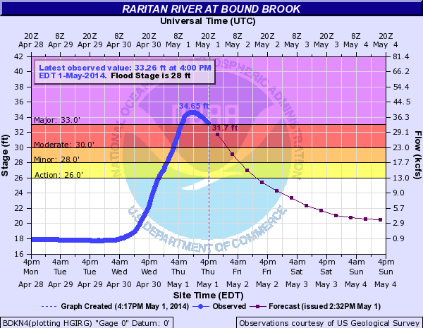
Ask neighbors about flooding risks. Visit your local library to find hyper-local topographical maps of your community, or use the USGS TopoView Viewer tool to get an idea of where nearby water bodies are so you can estimate your chance of being directly affected by flooding. Check your flood insurance policy to ensure appropriate coverage. The LRWP relies on the USGS flood gauge at Bound Brook to give us a sense for local conditions.
You can also take a page from the LRWP’s book of landscape decoding and #lookfortheriver by observing water flows, tracing land contours, and re-discover our buried streams using historic maps.
4. Prepare a “go kit” for flood season and other emergencies
Do you have an evacuation plan in place for your family and pets in cases of fire or other threats? Does it include a “go kit”? A “go kit” is a great way to always stay prepared. Some items you can keep in this waterproof kit are:
- Non-perishable food
- Water bottles
- Sleeping bag and blankets for each person
- A full change of clothes for each person, and an extra set of masks
- Important documents sealed in a waterproof case
- Cash or traveler’s checks
- Pet food
- Baby formula
- A 30-day supply of any necessary medications
You can find a full list of items that are good to have at the ready year-round here.
The actions listed above are just some of many actions each of us can take to prevent loss of lives, jobs and homes in the face of flooding. We also must start “thinking regionally” about preparedness, which will help us all be more resilient in a climate uncertain future.
COVID-19 showed what can happen when our states and nation is under-prepared for a pandemic. The recent storms in Texas give us insights into how we can prepare for future weather related crises. Regions that are not prepared for climate change will suffer lost lives, jobs, and homes. This is especially a concern for coastal communities, including many in our Lower Raritan Watershed.
For example, we do not yet have a true flood risk assessment for the Lower Raritan. FEMA flood maps are incomplete, and often inaccurate. And many homes in Lower Raritan communities like South River, Sayreville and Woodbridge are excluded from flood plains for political reasons. Not surprisingly, the maps and processes that communicate risks associated with flooding are often highly politicized. The risk maps often reflect the politics of property developers in flood plains, pressures to keep property values high, and fears of the overwhelming cost of adapting at-risk homes to rising seas and flooding, more than the actual risk.
As part of #ResilientNJ, the LRWP and regional partners are working to conduct an accurate regional risk assessment to understand the magnitude of flood risks and threats for our area. From there we aim to make plans to protect lives, homes and employment that may be vulnerable to flooding, and likewise seek to identify ways to adapt to and mitigate climate change impacts. In coming months the LRWP and County and municipal partners will launch a website, outreach campaign, app and more to engage the larger Middlesex/Lower Raritan community in regional resilience planning. We look forward to working with you!
