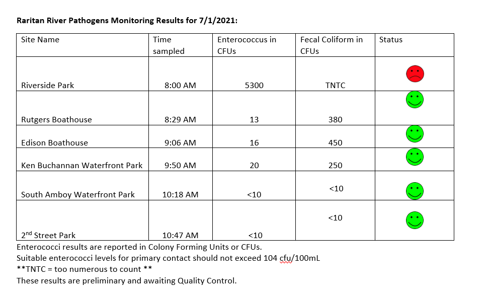
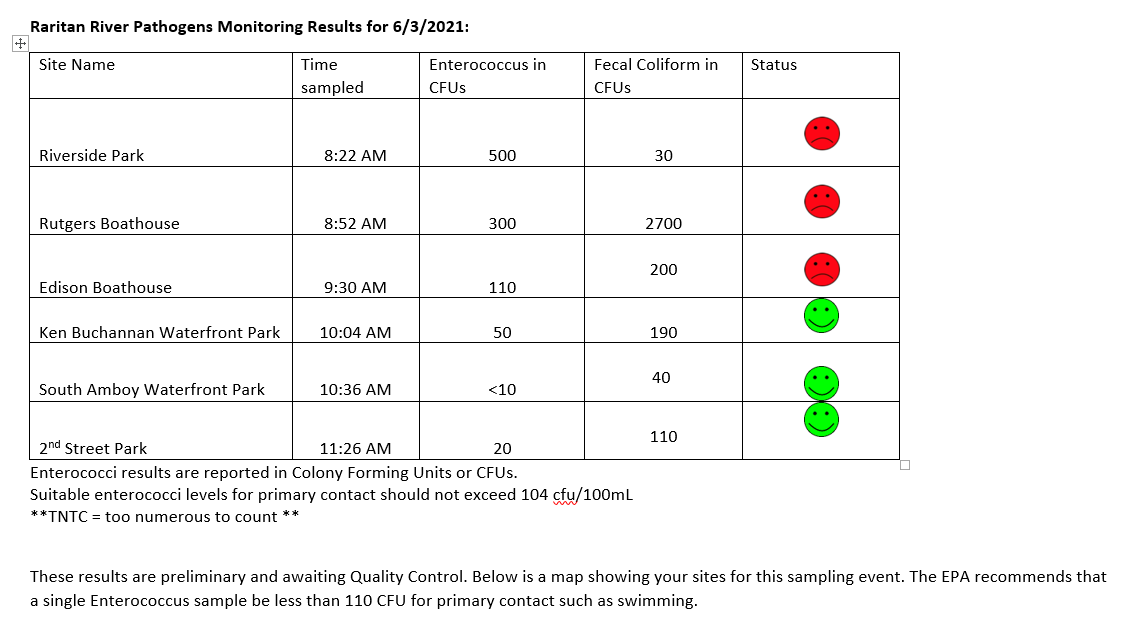
Another pretty good week of results from our pathogen monitoring. While our downstream sites are within limits, the Piscataway site continues to give us trouble with very high enterococcus and fecal coliform TNTC or “Too Numerous To Count.” Yikes! We received .7 inch of precipitation since sampling, which likely means the pathogens count will be higher at all sites.
Many thanks to our Rutgers Cooperative Extension of Middlesex County, and Interstate Environmental Commission partners, and special thanks to our wonderful volunteers!! See here for more information on our pathogens monitoring program. Have a wonderful 4th of July weekend Everyone!
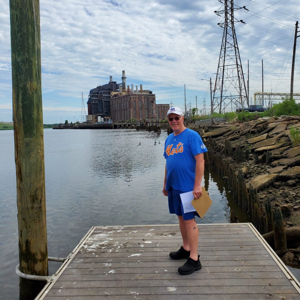
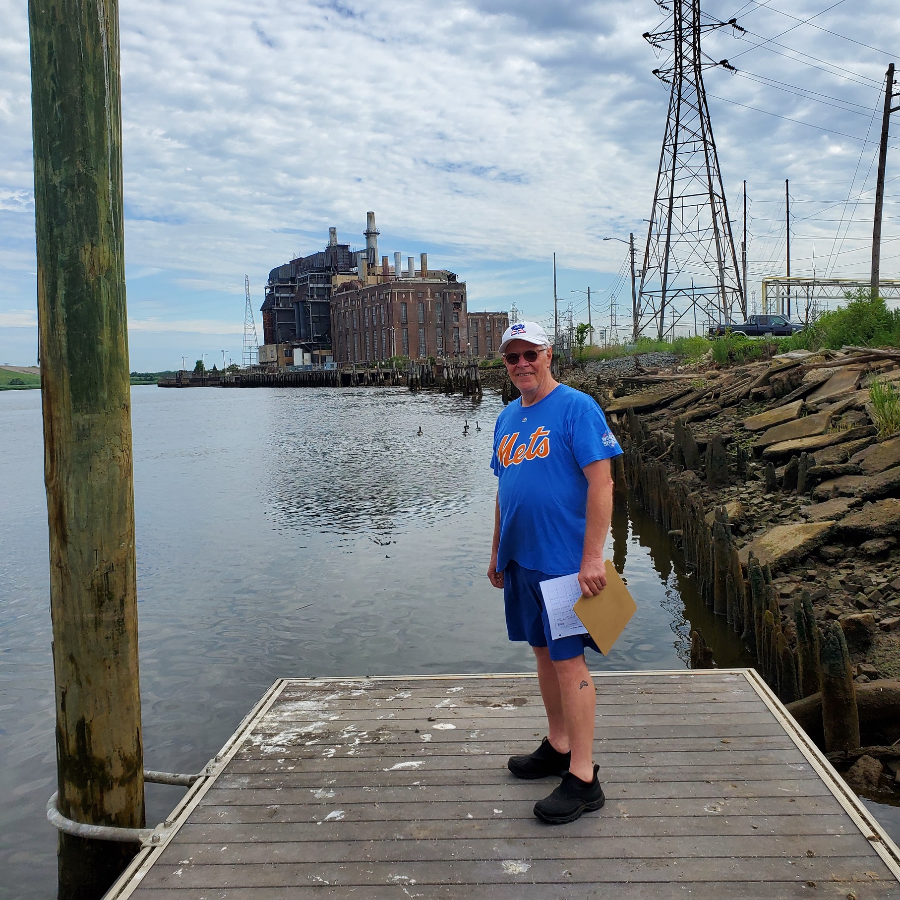
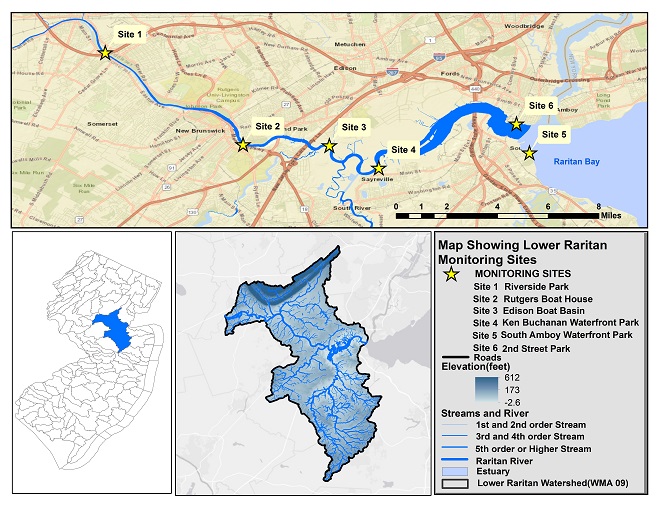
Civic science monitoring volunteer Frank Dahl at our Sayreville site – thank you, Frank!
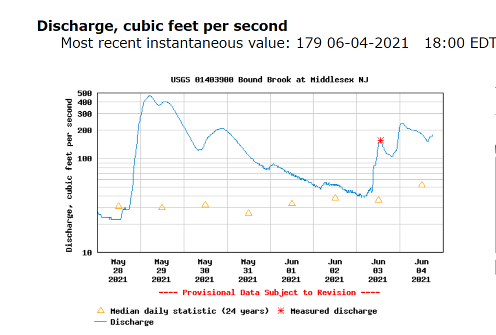
What a soggy week in the Lower Raritan, with 1.56 inches accumulated in our rain gauge in the 24 hours since our water quality monitoring activities yesterday morning June 3. The USGS flood gage shows discharge significantly above the 24 year median daily statistic.
With such significant precipitation please know that our pathogens sampling numbers for six non-bathing public access beach sites captured during June 3, 2021 monitoring are not reflective of the current situation. (See here for more on our pathogens monitoring program):
Enterococci results are reported in Colony Forming Units or CFUs. Suitable levels for primary contact should not exceed 110 cfu/100mL. Pathogens/Enterococci levels are used as indicators of the possible presence of disease-causing bacteria in recreational waters. Such pathogens may pose health risks to people fishing and swimming in a water body. Sources of bacteria include Combined Sewer Overflows (CSOs), improperly functioning wastewater treatment plants, stormwater runoff, leaking septic systems, animal carcasses, and runoff from manure storage areas.
Huge thanks to our partners: Rutgers Cooperative Extension of Middlesex County and the New England Interstate Water Pollution Control Commission.
Field Notes:
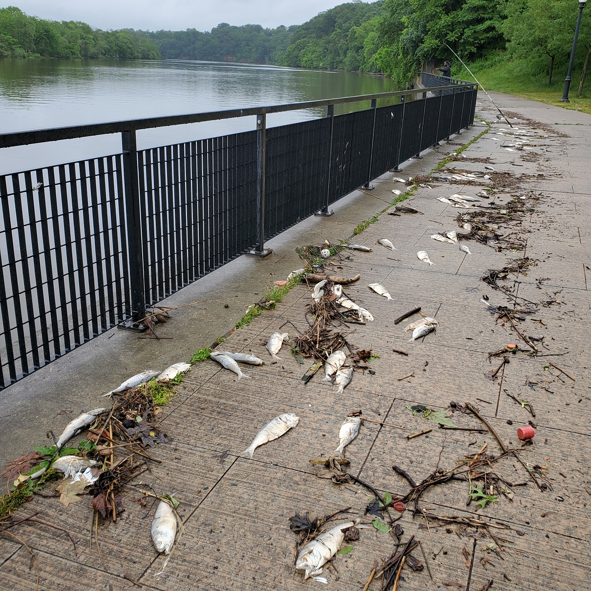
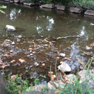
We were concerned we would observe a repeat of the fish kill from the week prior. This photo shows the Boyd Park site on 5.31.2021 after the first wave of heavy rains. Thankfully the numbers of dead fish were far fewer this week.
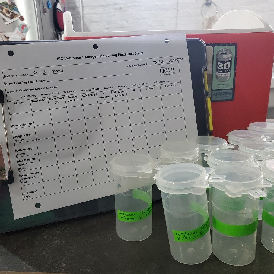
Data sheet, sample bottles and cooler
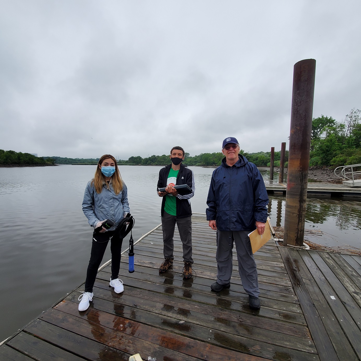
Jocelyn Palomino, Jason Acevdo and volunteer Frank Dahl at the Edison Boat Basin
In our efforts to diagnose stream, river and watershed health, we regularly assess conditions in only a small portion of our waters. Even in those, we typically measure only a few things once a summer, or once every few years. What’s more, we may realize later we measured the wrong things, or used the wrong tool, at the wrong time, perhaps in the wrong way. We know that the quantity and quality of the data we obtain today is not adequate to diagnose our watersheds’ health and to prescribe the right actions to protect or restore them. So why then do we continue to monitor?
Sites of freshwater monitoring conducted by Lower Raritan Watershed Partnership “civic science” volunteers
Why monitor?
Critics of monitoring programs correctly point out that getting obsessed with gathering more data can blind us to clear lessons already learned and divert our attention and resources from actions clearly needed. It may be the case that not every stream needs on-going monitoring. But good monitoring activities should be underway in most of our streams and sub-watersheds.
The LRWP sees five major categories of benefits of long-term watershed-based monitoring programs:
1. Enhancing environmental education. People learn best from hands-on experience. One good day in the field studying a river provides more longlasting environmental lessons than ten lectures endured, a hundred news stories read, or a thousand one-line environmental slogans overheard. Monitoring inevitably promotes greater understanding and awareness in a community. When understanding and awareness grow, greater protection and stewardship almost always follow.
2. Clearly defining problems. Monitoring may help confirm fears about watershed problems and trends. It may also help dispel them. By helping us get a firm grip on the nature and magnitude of watershed problems, monitoring helps us focus our efforts and resources on the most important problems to address. When monitoring confirms that a water body is clean and healthy, it helps us define the desirable conditions we need to maintain over time.
3. Pinpointing sources of problems. Understanding what a watershed’s biggest problems are is only half the battle. The other is determining the real sources of those problems. A single problem may be the result of multiple sources, and multiple problems may stem from a single source. Thoughtful, comprehensive, adaptive, long-term monitoring helps us be sure we are addressing all the major sources of problems, not just some of their collective symptoms.
4. Setting standards and goals. Voluntary and regulatory watershed programs both work best when they are based on solid standards and clear goals. The best standards and goals grow from a well grounded understanding of historic and current conditions and trends. Without this type of understanding, standards and goals may be set inappropriately. If they are too low, protection and restoration efforts will not be aggressive enough, and opportunities may be delayed or missed. If they are too high, expectations may be unrealistic and the enthusiasm of involved parties may wane over time. Monitoring helps us set the bar at the right level for each watershed.
5. Providing benchmarks for measuring progress. Restoration and protection efforts cost money and take time—usually, years. Involved parties need clear evidence that their efforts are making a difference if they are to continue to justify their time, effort and expense. Consequently, monitoring before, during and after intensive protection and restoration efforts helps us explain the importance of current efforts and make the case for new ones.
Next steps
Of course the state and federal entities that have mandates to bring about fishable, swimmable waters can and should do more. However, government has not proven its capacity to do everything necessary for healthy waters. In addition to building and securing support for our monitoring programs we need to coordinate governmental and non-governmental monitoring efforts. We need to target those efforts toward better fundamental understanding of our watersheds and their problems. And we need to involve legions of interested and concerned citizens in the ongoing business of assessing watershed conditions and trends.
Brackish water sites monitored for presence of pathogens/bacteria by the Lower Raritan Watershed Partnership
The Lower Raritan Watershed Partnership and Rutgers Cooperative Extension of Middlesex County seek civic science volunteers to assist with the Summer 2019 “Citizen Science Monitoring for Pathogens Indicators on the Raritan River.” This program will run every Thursday from mid-May to the end of September. Volunteers will travel with a monitoring team to capture water quality samples at sites along the Raritan River, followed by a trip to the IEC lab in Staten Island to assist with preparation of samples for analysis. A 2 hour training is required, after which the Project Team would like volunteers to commit to assisting with at least five (5) sampling events throughout Summer 2020.
Please join us for a virtual training on Monday April 20, 4:30-6:30 PM. Registration required.
This project will allow us to gather data and other information on water quality for six public access sites along the tidal portions of the Raritan River at locations considered non-bathing beaches. In addition to capturing water samples at each of the six public access sites, volunteers will have the opportunity to go to the IEC lab on Staten Island to learn how samples are processed for monitoring.
We will monitor non-bathing beach sites with active kayak/canoe launches and/or fishing and other primary contact activities that are not regularly monitored by the New Jersey Department of Environmental Protection or the New Jersey Department of Health and Human Services and lack sufficient water quality data.
Bacteria data will be reported in “real-time” on Friday afternoons to allow Lower Raritan residents and others to make informed decisions about their on-water recreation activities for the weekend.
The Project will also allow for development of civic science and expanded volunteer environmental monitoring programming within the Lower Raritan Watershed and Middlesex County, NJ. Working with an approved Quality Assurance Project Plan (QAPP) will allow for data generated from this project to inform water quality policy and regulatory decisions at all levels of government (state, federal, local) within the project area, and to educate the public.
Water quality monitoring sampling will directly inform public access decision-making for six (6) diverse Lower Raritan Watershed municipalities (see site map below). These sites include:
Riverside Park (Piscataway)
Rutgers Boathouse at Boyd Park (New Brunswick)
Edison Basin Boat Launch (Edison Township)
Ken Buchanan Riverfront Park (Sayreville)
Raritan Bay Waterfront Park (South Amboy)
2nd Street / Brighton Avenue Beach (Perth Amboy)
Sites were chosen to inform decision-making about access and use, to aid understanding of municipal stormwater and sewage flows, and to inform current and future landuse planning and restoration efforts. Sites include the following known activities: 1) launch sites for personal non-motorized watercraft (sites 1-5); 2) fishing (sites 2-6); 3) birding hotspots (site 5); 4) crabbing (sites 2,4,5,6); 5) proximate to Combined Sewer Overflow (site 6); 6) unofficial bathing activity (sites 2,5,6); 7) collegiate watersport competition (site 2).
Generous support for equipment and data analysis is provided by the Interstate Environmental Commission.
Volunteers will help project coordinators with sample collection, sample preparation and delivery, and analysis. See here for more info on our monitoring program.
Want to know how citizen scientists take action to monitor the health of our waterways? Want to learn about the Raritan River and the tools and techniques used to gauge bacteria levels at sites along the Raritan River? Please join the Lower Raritan Watershed Partnership and Rutgers Cooperative Extension of Middlesex County (RCE) for a “Facebook Live” event when we will demonstrate how we gather data and other information on water quality for public access sites along the tidal portions of the Raritan River.
We are designing the event for classroom engagement, and welcome student questions! We anticipate the program to run 45 minutes – 1 hour.
We will build the event schedule around registrant demand. Once you have registered, project coordinators will reach out to you with more details.
Article and Photos by Margo Persin, Rutgers Environmental Steward
Editor’s Note: In 2018 Margo Persin joined the Rutgers Environmental Steward program for training in the important environmental issues affecting New Jersey. Program participants are trained to tackle local environmental problems through a service project. As part of Margo’s service project she chose to conduct assessments of a local stream for a year, and to provide the data she gathered to the Lower Raritan Watershed Partnership (LRWP). Margo keeps a journal of her experiences, excerpts of which are included in the LRWP’s “Voices of the Watershed” column.
Internship Diary / August, 2018
For this visit to my assigned assessment site, I had new members of my ‘team’. It so happens that two of my godsons were visiting from London, UK, where they reside and go to school. Alex, 14 years old, and Mathieu, 12 years old, were presented with the option of participating as full team members to do a stream assessment at the Ambrose Brook. They readily agreed, and we set off for the stream site.
The day was partly cloudy upon arrival and proceeded to get more clouded over as our time at the stream advanced. I appreciated very much the extra eyes and hands, given that it would take a group effort to undertake and finish all the measurements required of the assessment. It was so nice to have the company and the opportunity to share this activity with them. They asked some pertinent questions in regard to the site, as well as concerning the focus of the project. We were armed with marker flags, tape measure and ruler, thermometer, stop watch, and the required forms to fill out. In addition, as a nod to my own childhood, I had dug out of storage the red plastic duckie that I had used so (too) many years ago when I was a child. After having sealed the seams with glue, it proved to be water ready and floatable, and was thrown into our equipment bag.
Upon arrival, we did a quick survey of the site. I gave the boys an overview of the project as we walked the required distance to mark off where we would take our measurements and set our marker flags. We were not particularly surprised to note that summer was on the wane, and the stream site showed the effects of the copious summer rain fall of this year and the subtle yet visible march of time on the greenery. There were a few trees already beginning to drop some leaves, apparent at their base as well as at the edges of the stream. Some windfallen branches had made their way into the stream on both sides, evidence of the frequent storms that had buffeted our area during the preceding summer months. In addition, the water level had risen, as marked by mud splashes on bushes, trunks and the mud banks. There were a few ducks and Canadian geese, who had vacated the surrounding lawns and walkways; that day, they were floating lazily on the water’s surface between the far bank and the island, oblivious to our presence.
Ambrose Brook, August 2018 – Margo Persin
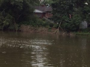
High water at Ambrose Brook, August 2018 – Margo Persin
At that point, the boys and I got to work. Alex and I did the physical measuring, including wading to the middle of the stream to measure depth and velocity, while Mathieu took on the role of scribe and stop watch handler. The first order of business was to observe, consult and come to a shared decision in regard to water conditions. My team mates took their jobs seriously and we were able to arrive at mutually acceptable readings of turbidity and stream flow. The next order of business was to measure width, depth and velocity. Armed with the rubber duck and ruler, Alex waded to the starting point while I headed in the opposite direction. Mathieu had been instructed in the subtleties of the stop watch, and as the two of us with wet feet called out the various measurements and Mathieu proceeded to fill out the form. All of us – Alex, Mathieu, me, and the rubber duck – showed ourselves up to the task and we were able to finish that part of the assessment in due time.
After exiting the stream, it began to rain, so the three of us made a mad dash back to my vehicle, where we took refuge and worked through the rest of the form. The boys were more than willing to express their views in regard to stream characteristics as well as all the elements of high gradient monitoring. We reviewed the results in order to make sure that we were of one accord in regard to our observations and conclusions. They did a wonderful job of giving themselves over to the project, with determination, seriousness, intellectual curiosity, good humor, and dedication. After approximately one and half hours, we took our leave and headed to a nearby ice cream parlor for a well-deserved reward. Their company and participation were most welcome and I hope that this experience will inspire in them the desire to become involved with environmental projects of their own, whether on their own or in conjunction with their school curriculum.
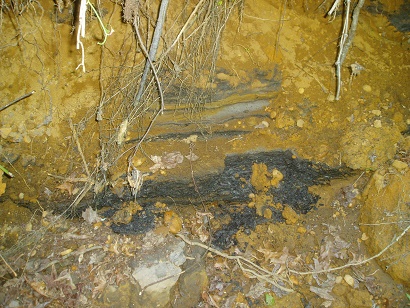
Check out these pics from June 16, 2016 water quality monitoring in the Englishtown area of the LRW. Waters were bright orange in color with very low pH (3.8):
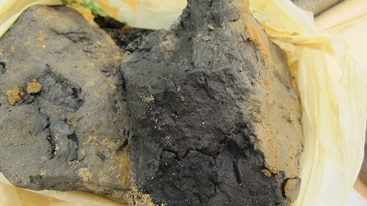
Upstream was an eroding bank with charcoaled, black wood:
What’s going on here? This is an acid-producing deposit from the Englishtown Geologic Formation. According to Stephanie Murphy, Director of Rutgers Soil Testing lab: “When deposits are buried (not exposed) the mineral is iron sulfide and pH is not “unusual”. It can have black color. When exposed, the extreme acidity results from certain microbes oxidizing the sulfide to sulfate with H+ produced. Same process with acid coal-mining spoils. Acidity makes iron soluble, and when it re-deposits/precipitates, you get the orange hues.”
Also see the NJ Geological Survey’s Figure 1-1. NJ sedimentary units with potential to produce acid: