THANK YOU FOR YOUR INTEREST IN OUR APRIL 13th EVENT – WE ARE AT CAPACITY FOR VOLUNTEERS! PLEASE JOIN US MAY 19 for our MULTI-SITE CLEAN-UP IN GREEN BROOK
Since its inception in 1970, Earth Day has brought millions of people together to celebrate our world’s environment. The day has also focused our attention on environmental problems such as pollution, flooding and littering.
Join the Lower Raritan Watershed Partnership, Franklin Township Environmental Commission, our Watershed Area 9 Watershed Ambassador Brianna Casario, and others for an Earth Day clean-up of Seeleys Run!
WHAT: a clean-up of Seeleys Run on Saturday April 13
WHEN: 9:30 am – noon
WHERE: Back corner of the Somerset Village parking lot, 900 Easton Avenue, Franklin Township (enter by the IHOP)
SPECIAL NOTE: Please wear closed toe shoes and clothes you are willing to get dirty and wet. Bring a reusable water bottle. Gloves, bags and light refreshments will be provided!
REGISTRATION IS CLOSED
***For general information contact Brianna Casario: wma9.njwap@gmail.com
***For press inquiries please contact Franklin Township Environmental Commissioner Stan Jaracz: jaraczs@yahoo.com
You may wonder why it is so important to keep our waterways clean. Streams, rivers and other waterbodies make up the watershed where we all live. Watersheds are areas of land where runoff from rain and snow drains into a lake, stream, river or wetland. These watersheds are full of life. They provide habitat for fish, birds and wildlife. They are also a source of drinking water for homes and businesses. The Lower Raritan Watershed Partnership and Franklin Township share a joint mission to keep water clean, safe and healthy through conservation, advocacy, science and education.
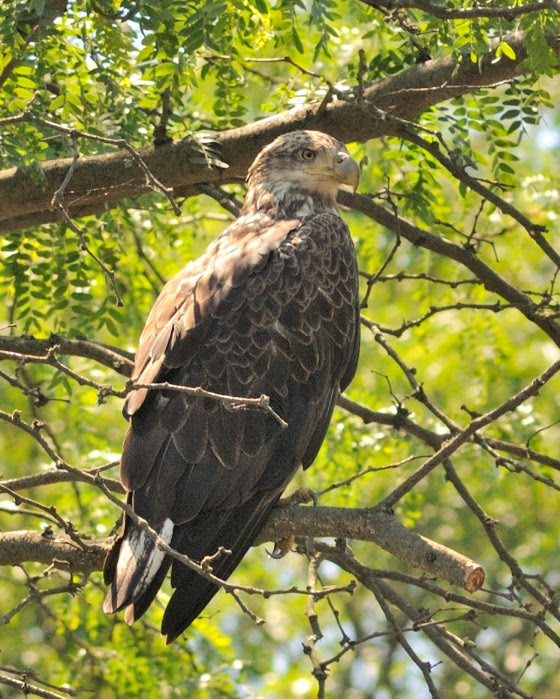
No mistaking this eagle for a hawk. Given that the bald eagles’ characteristic pure white head and tail do not emerge until they are three and a half years old, juvenile eagles are easily mistaken for hawks.
A two year old eagle with traces of white beginning to emerge on the head and tail.
It was a fine day on the river, blue sky, light breeze, air temperature in the 60s, and a perfect water level.
Having paddled several times a week throughout the winter in preparation for a canoe race in Maine, this mid spring post-race trip down the South Branch was a soothing balm to mind and body.
After the trout season opener, the South Branch was closed to fishing on Tuesdays during in-season trout stocking. So, Tuesdays were my choice to paddle and be assured no human company would spoil the sense of wilderness the river trip provided.
Though not in race mode, the smooth rhythm of my paddle stroke and resultant speed was mesmerizing as well as a distraction. I would zone out as if each stroke was a repetitive chant in a litany. So, for short periods, my attention would drift away from observing the world around me. Who knows how many deer or mink watched from the woody bank as I passed within yards of their position?
On a long straightaway, as I transitioned from hypnotic state to consciousness, I was shocked to see a very large raptor sunning on an overhanging dead branch under which I would pass. The sun silhouetted the bird as I traded paddle for camera and a chance at a very close photo op. I set the course with one hand on the paddle and the other holding the camera. Keeping movement to a minimum was critical as the canoe drifted perfectly into position. The bird seemed huge as the distance closed. I figured the ‘hawk’ would soon fly off, but to my surprise it tolerated my presence. I turned the canoe to face upstream and take more images. The ‘hawk’ spread its wings to sun itself but gave no intention of flying away.
For the rest of the trip, I kept wondering about the size of the bird and extra large beak, never thinking it was an eagle. Eagles were not a possibility, at least on the course of the river from Clinton to South Branch. Eagles frequented the upper Delaware and weren’t that commonly seen and never on the South Branch. Aside from no known local eagle sightings, this bird was primarily brown, and everyone knows bald eagles have white heads and tail feathers.
The closer I looked at the images later that day; it became clear the ‘hawk’ was a year-old bald eagle!
Even the celebrated nest at Duke Farms, discovered in 2004, was thought at first to be an osprey nest.
Bald eagle fledglings start out covered with brown feathers. Each year more mottled white appears on their body and not until their third year does the head and tail begin to turn white, though still marked with brown streaks. To see an illustration of plumage changes by year, check out avianreport.com.
My eagle 2011 encounter was a prelude to the construction of a nest on the lower South Branch of the Raritan in 2014. That nest has fledged eleven more eagles to cast a shadow over the wilds of New Jersey and states far beyond. Last year an eagle banded in 2017 on the South Branch, was seen paired with another eagle in Connecticut on the Connecticut River
Today eagles are a common sight along many of our major waterways. Given that the bald eagles’ characteristic pure white head and tail do not emerge until they are three and a half years old, juvenile eagles are easily mistaken for hawks.
Consider, you may have been given the privilege to see an eagle and not known it. If able to get a close look, see that its beak in comparison to any other hawk is huge. Keep an open mind to unexpected possibilities and know, for that reason, many self professed birders have missed the thrill of seeing their first eagle.
Author Joe Mish has been running wild in New Jersey since childhood when he found ways to escape his mother’s watchful eyes. He continues to trek the swamps, rivers and thickets seeking to share, with the residents and visitors, all of the state’s natural beauty hidden within full view. To read more of his writing and view more of his gorgeous photographs visit Winter Bear Rising, his wordpress blog. Joe’s series “Nature on the Raritan, Hidden in Plain View” runs monthly as part of the LRWP “Voices of the Watershed” series. Writing and photos used with permission from the author. Contact jjmish57@msn.com. See more articles and photos at winterbearrising.wordpress.com.
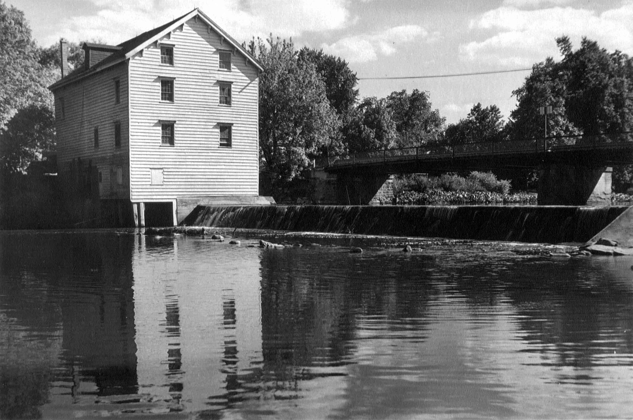
The Weston Mill Dam and the former Weston Mill gristmill and sawmill site are located approximately 1.5 miles upstream of the Millstone River’s confluence with the Raritan River, and immediately downstream of the Weston Causeway (Wilhousky Street) Bridge in the Borough of Manville and the Township of Franklin, Somerset County, New Jersey. The dam crest length was approximately 112.5 feet long and there was a concrete approach apron that ranged in thickness from 5 to 6.75-inches that extended 17.5 to 18.5 feet upriver of the dam spillway. The location of the mill was depicted on early Colonial-era and Revolutionary War military field maps, and the mill and dam were picturesque landmarks that were often photographed by local residents, including images included in the book Franklin Township [NJ] – Images of America, published in 1997.
Weston Mill Post-1948 to Early 1960s, Photographer Unknown
Through an intensive deed search, I determined that a gristmill and dam were established on the east bank of the Millstone River at the project area circa 1747, most probably built by Abraham Brokaw, and the mill was subsequently involved in a Revolutionary “Forage War” skirmish between British and American forces on January 20, 1777 while under the ownership of Abraham Van Nest. Recovery of two cornerstones during 1983 salvage operations suggest major mill building and rebuilding efforts occurred in 1803 and 1844 by John M. Bayard and Isaac R. Cornell, respectively. Though the mill remained active at this site into the early twentieth century (it was the most productive mill in the Millstone River/Stony Brook drainage), under various private owners and incorporations (Weston Mill Company, Inc.; Community Flour Mill and Grain Company; Union Mills Company, Inc.), and the dam underwent significant structural repairs between circa 1922 and circa 1948 by its last owner (Wilbur Smith), it ultimately fell into disuse and disrepair. On May 31, 1982, the mill building partially collapsed into the Millstone River. Mill artifact salvage operations were initiated on June 25, 1983 but were abandoned when arson claimed the collapsed structure on July 7, 1983.
Weston Mill Dam Initial Breach, Photo: Charles Kahler, PE
Weston Mill Initial Breach, Photo: John W. Jengo, PG
When I first began assessing this dam in 2009 as a candidate for removal, the Weston Mill site included the brownstone and concrete foundation remains of a gristmill that had enclosed a turbine room (formerly the water wheel pit) and a tailrace room, and there were associated powertrain components scattered throughout the site, including multiple bevel gears, possible mortise and pin gears, sprocket gears, drive shafts, counter shafts, flat belt pulleys, and other mill-related power-train apparatuses. A concrete coring project conducted in August 2015 at five representative locations on the dam approach apron (the same effort that determined the thickness of the apron) revealed two concrete approach aprons, which suggested that the dam was reinforced or rebuilt with concrete in two different periods in the early- to mid-twentieth century and that this run-of-the-river dam may have been built on top of a timber crib dam of unknown age.
Routine visits to the dam site over the next eight years would indicate that beginning in 2015, the eastern 78 feet of the dam crest (i.e., the top of the spillway) and spillway began to noticeably subside and detach from the concrete approach apron, placing undue stress on the riverward mill foundation wall to the east. By mid-2017, the collapsing dam crest and spillway had subsided almost to the level of the downstream pool elevation, had deflected outward some five feet downriver, and in doing so, the flow of the river was redirected toward the mill ruins on the east bank, potentially causing adverse effects to the mill foundation and complicating the dam removal.
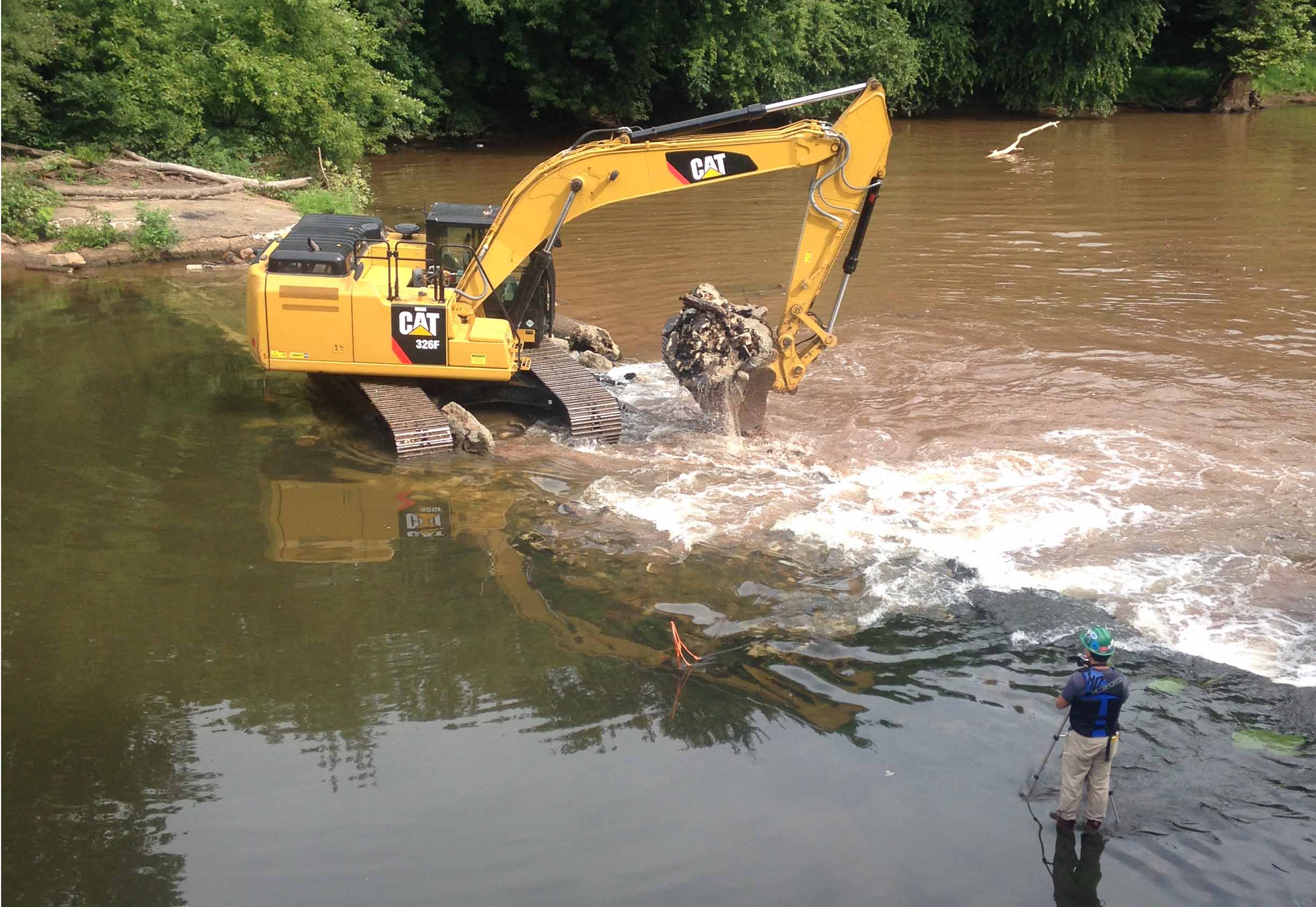
The dam removal and the engineering plans were re-designed to include emplacing scour protection around the Weston Mill foundation walls to arrest the damage to the ruins and preserve the remaining fabric of the site for future study. The first step in the dam removal process, which commenced on August 14, 2017, was to initially breach a portion of the dam to reduce the differential head between the upstream and downstream pools. The initial breach width of 35 feet, located near the center point of the dam, produced the desired upstream pool drawdown and a relatively low current velocity through the breach. Once the upstream impoundment had drained, the contact between the concrete approach apron and the riverward mill foundation wall was accessible to be saw cut to isolate the apron from the mill wall prior to further demolition. This was done to ensure that neither the weight of the demolition excavator or the vibration of the hydraulic hammer would destabilize the riverward foundation wall.
Weston Mill Dam Spillway Removal, Photo: John W. Jengo, PG
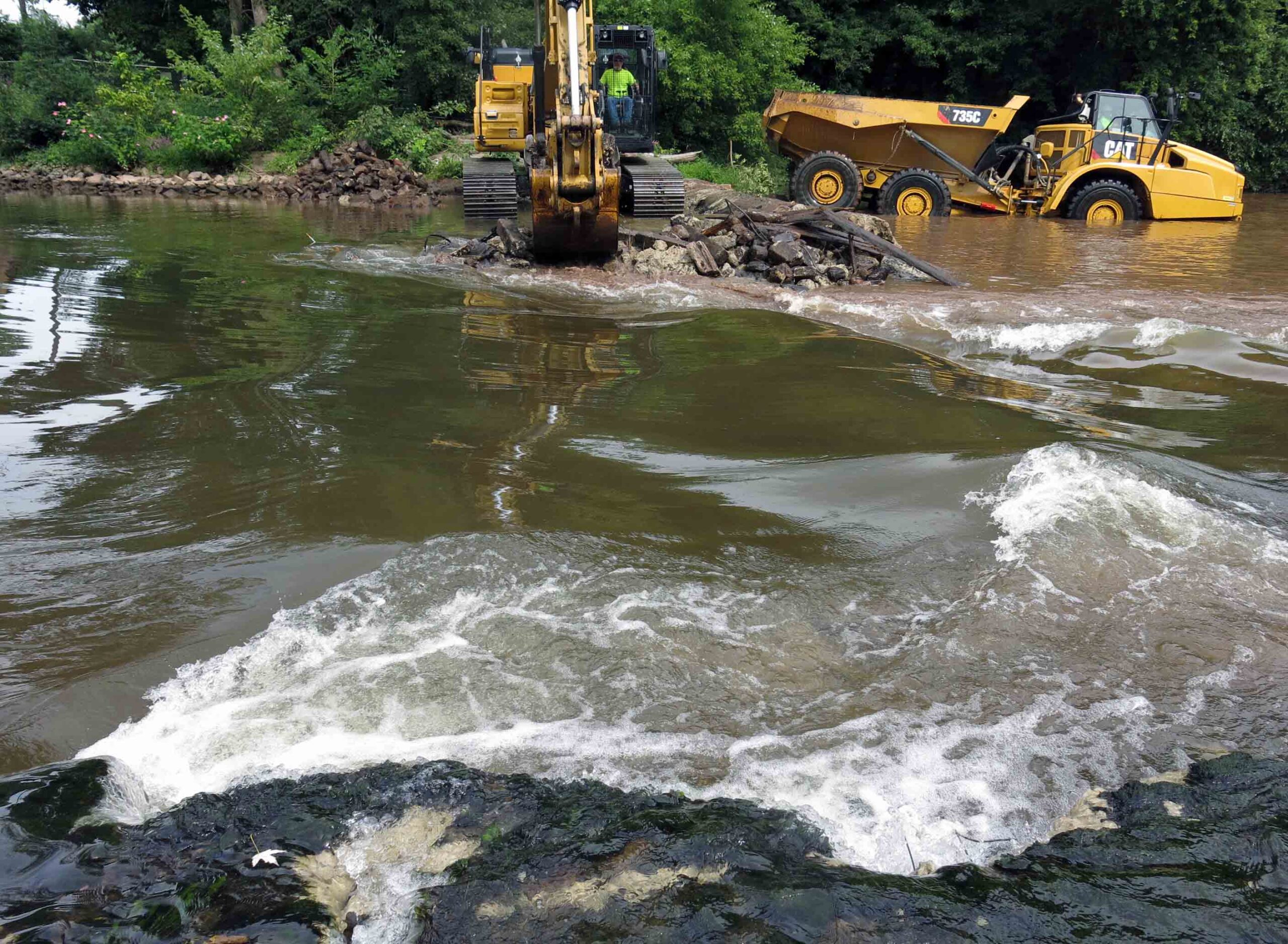
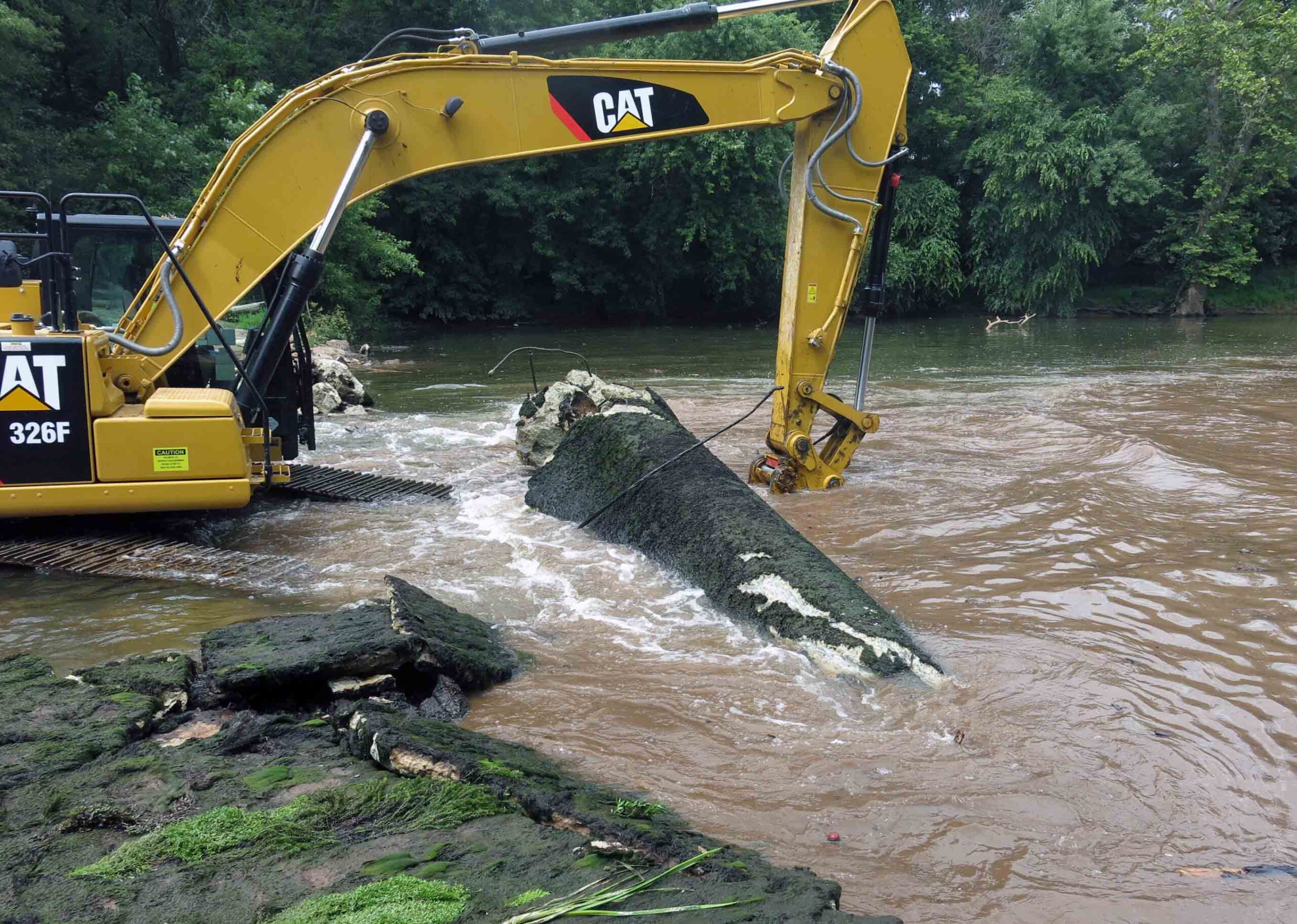
After the saw cut was completed, the concrete approach apron, an underlying concrete sub-apron, and dam spillway were carefully detached and removed. Imported rip rap was then emplaced around the mill foundation walls. My experience working on the rivers of this watershed indicated that natural sedimentation from storm events would eventually blanket and in-fill the rip rap, enhancing the stability of the scour protection armament. Finally, a restored river channel thalweg were excavated and contoured appropriately. It was during these excavations that segments of a timber crib dam, secured to the river bed by using 17.5-inch to 20.5-inch long, 1.125-inch square iron spikes, were extracted that clearly indicated that the pre-concrete dam structure was a timber crib construction. Three primary types of roughly square timbers believed to be part of the timber crib dam were identified: 13-foot long lap jointed foundation logs with iron spikes, 9.25- to 9.75-foot timbers with two mortise joints (some with intact dowels), and 3.8-foot timbers with tenons at one end. Several timbers of this historical structure were saved and donated to the Borough of Manville, Delaware and Raritan Canal State Park, and NJDEP, who had purchased the dam site in 2013 from a private owner, an acquisition that allowed the dam removal to proceed.
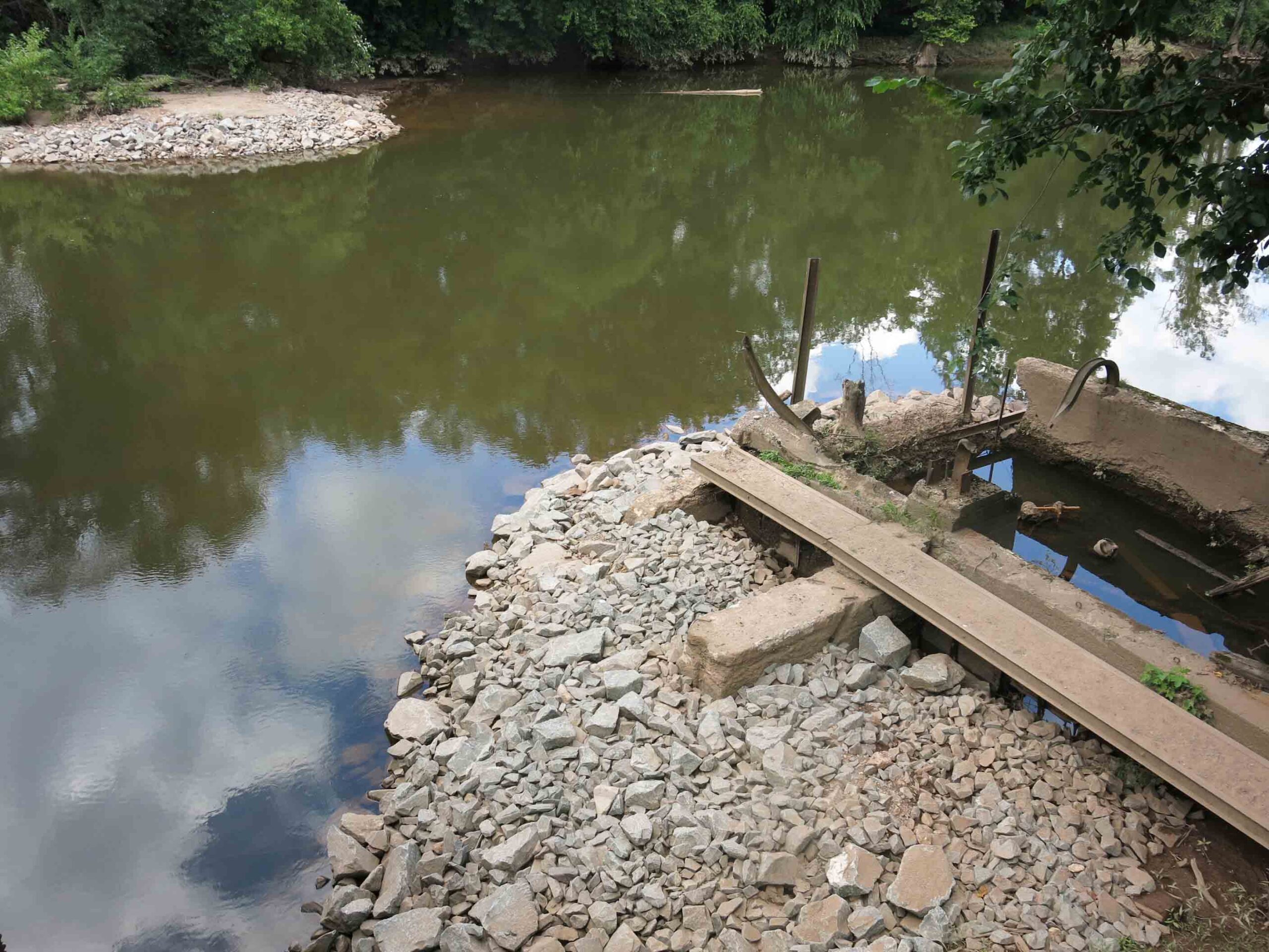
Weston Mill Dam Post Removal, Photo: John W. Jengo, PG
Monitoring of the river reach above the former Weston Mill Dam in spring 2018 following the August 2017 dam removal found definitive evidence of successful American shad spawning, an astonishing and long-awaited result given this river reach had effectively been blocked to migratory fish for over 270 years. Five juvenile shad averaging 4.3 inches in length were found 4.5 miles upstream of the dam at the base of Blackwells Mills Dam during a monitoring visit, highlighting yet again the dam removals can yield near-instantaneous positive results even after centuries of impeding fish migration and spawning.
Video of the Weston Mill Dam removal can be viewed here:
Endnote: Because of the archaeological discoveries made before and during the dam removal, and the rich cultural history of Weston Mill, a standalone video on the History of Weston Mill was developed and can be viewed here:
John W. Jengo, PG, LSRP is a licensed Professional Geologist in several Northeastern and Southeastern states and a Licensed Site Remediation Professional in New Jersey. John works as a Principal Hydrogeologist in an environmental consulting firm in southeastern Pennsylvania. He has degrees in geology from Rutgers University (1980) and the University of Delaware (1982). Over the last 30 years, he has conducted the characterization and remediation of large, complex contaminated industrial sites throughout New Jersey, Pennsylvania, and Delaware. He played a key role in Natural Resource Damage (NRD) assessments that led to groundbreaking legal settlements to remove numerous low head dams on the Raritan and Millstone Rivers to restore historically significant migratory fish spawning runs. As technical project manager, he planned, permitted, and successfully managed the removal of the Calco Dam, the Robert Street Dam, and the Nevius Street Dam between 2008-2013, and the removal of the Weston Mill Dam on the Millstone River in 2017, along with leading the archaeological investigation of the former Weston Mill in the Borough of Manville and Franklin Township.
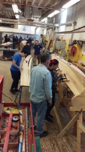
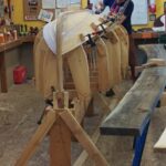
The LRWP’s new “Rowing on the Raritan Boat Building Project” seeks volunteers to participate in boat-building to provide the inaugural fleet of a community-based rowing program on the Raritan River. The goal is to construct two cedar strip rowing boats during a 90-day building period beginning the week of January 24, 2021. No experience required. Volunteers will have the opportunity to learn through hands-on activities, as well as through live-streaming and recorded instructional sessions.
We are now taking registrations for our “soft” launch the week of January 25. Each time slot is limited to four (4) participants. Boat build activities will take place at 100 Kirkpatrick Street in New Brunswick, NJ (the former Fresh Grocer site across from the New Brunswick train station). Feel free to participate as “observer” – watch our volunteers build the boats via street-level windows.
Requirements for Participation:
Age 14+
No boat-building experience required
Free to register and participate
Participants will be screened at the beginning of each shop session and expected to follow Covid-19 Safety Protocol.
With thanks to Derek Hartwick-Head Rowing Coach- U.S. Merchant Marine Academy, and the New Brunswick Parking Authority for their partnership on this project.
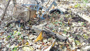
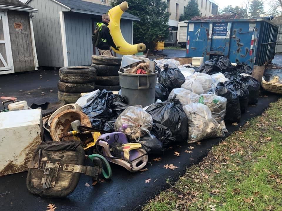
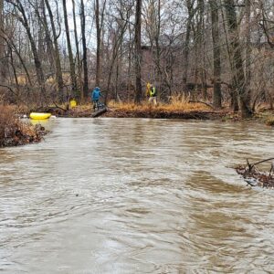
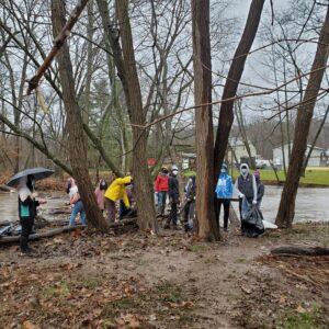
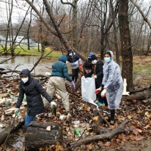
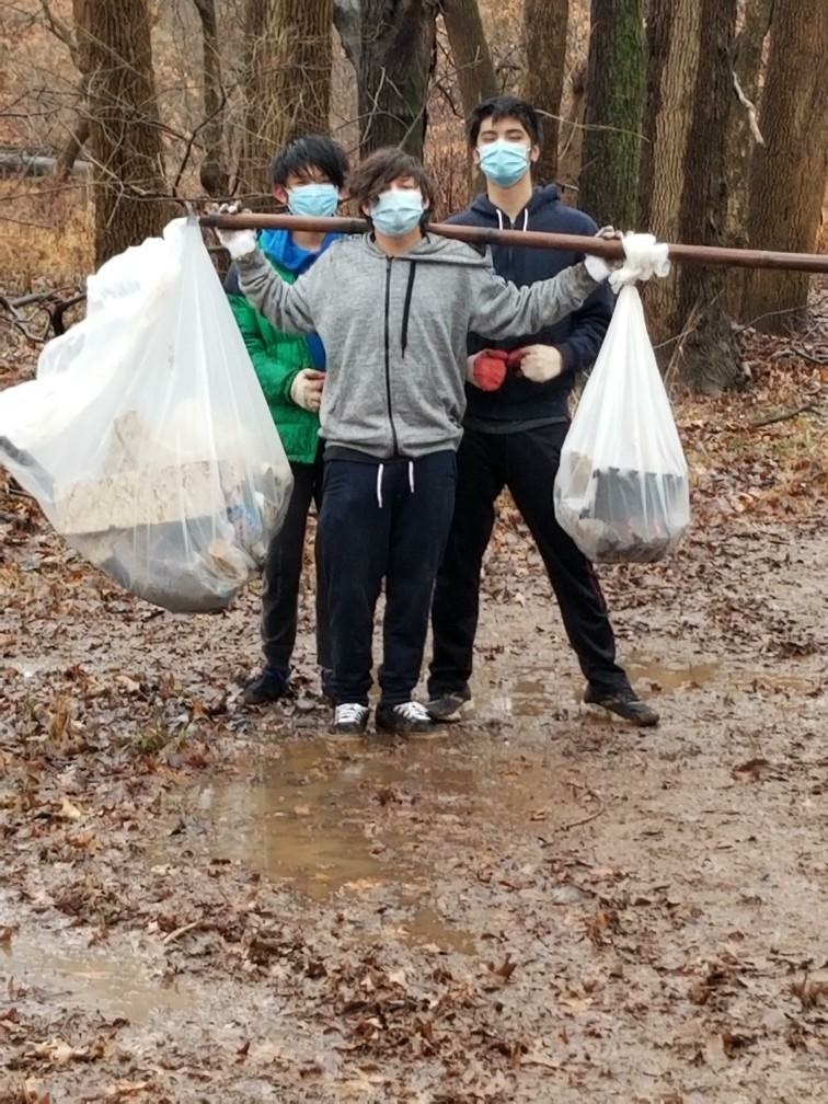
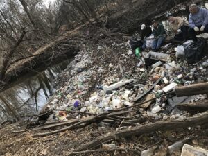
HUGE THANKS to the 60+ intrepid souls who joined the Lower Raritan Watershed Partnership and Central Jersey Stream Team out on the Green Brook floodplain for our last clean-up of the year. It was a cold, windy, rainy, mucky start to the day – really only the cold abated by the time we wrapped up.
With appreciation to Green Brook Township, Green Brook Regional Centre, GreenBrook Lions, Sewa Central Jersey, Mr. Kevin Ellis’ Middle School Science class, our Hackensack Riverkeeper friends and all the wonderful volunteers for giving of their time to clean up our watershed!
A crazy amount of trash was collected including a mini fridge, large screen TV, a big inflatable banana and so much more. See below for a few photos from the day. See you in 2021!!
LRWP board member Anton Getz and CJST board member Jens Riedel spot an inflatable banana on the Green Brook
Green Brook Middle School science teacher Kevin Ellis and his students
Central Jersey Sewa volunteer fill dozens of bags with plastic bottles
A healthy stream is a complex place. Vegetation grows along its banks, shading the stream and filtering pollutants before they enter the waters. Wildlife find shelter and food near and in its waters. And within the stream itself are fish, insects, and other organisms with specific needs for oxygen, food, and shelter. Certain land uses affect habitat quality and stream health. A stream corridor functions holistically, and any changes to a part may affect the entire habitat.
A habitat assessment is a summary of different characteristics of a stream segment that help us better understand the health of our area streams. When we understand issues that affect our streams, we can do a better job of protecting them.
Please join the LRWP and Americorps Watershed Ambassador Caitlin DiCara on Monday November 30 for a two-hour FREE virtual Stream Habitat Assessment training.
This training will detail the “how-tos” of assessing the health of our local streams in preparation for Spring 2021 monitoring.
We will also provide general overview of our adopt-a-stream and stream monitoring program, and answer participant questions about these program and program requirements.
This FREE training will run from 5:30-7:30 PM from the comfort of your own home. Registration required.
We look forward to seeing you on November 30!
Heather Fenyk
Jon Dugan
Caitlin DiCara, NJ Watershed Ambassador Program
For more information, contact Heather Fenyk: hfenyk@lowerraritanwatershed.org OR #908.349.0281
A healthy stream is a complex place. Vegetation grows along its banks, shading the stream and filtering pollutants before they enter the waters. Wildlife find shelter and food near and in its waters. And within the stream itself are fish, insects, and other organisms with specific needs for oxygen, food, and shelter. Certain land uses affect habitat quality and stream health. A stream corridor functions holistically, and any changes to a part may affect the entire habitat.
A habitat assessment is a summary of different characteristics of a stream segment that help us better understand the health of our area streams. When we understand issues that affect our streams, we can do a better job of protecting them.
Please join the LRWP and Americorps Watershed Ambassador Caitlin DiCara on Monday November 30 for a two-hour FREE virtual Stream Habitat Assessment training.
This training will detail the “how-tos” of assessing the health of our local streams in preparation for Spring 2021 monitoring.
We will also provide general overview of our adopt-a-stream and stream monitoring program, and answer participant questions about these program and program requirements.
This FREE training will run from 9–11 AM from the comfort of your own home. Registration required.
We look forward to seeing you on November 30!
Heather Fenyk
Jon Dugan
Caitlin DiCara, NJ Watershed Ambassador Program
For more information, contact Heather Fenyk: hfenyk@lowerraritanwatershed.org OR #908.349.0281
~SAVE THE DATE~ Join the Lower Raritan Watershed Partnership, Central Jersey Stream Team and friends for a clean-up of the Green Brook!
WHAT: a clean-up of the Green Brook on Saturday December 5 from 10AM to 1PM
WHERE: Green Brook Regional Center, 275 Greenbrook Rd, Green Brook Township, NJ 08812
This Event is Co-coordinated by the Lower Raritan Watershed Partnership and Central Jersey Stream Team. With special thanks to the Green Brook Department of Public Works for cartage and supplies.
Please wear closed toe shoes and clothes you are willing to get dirty and wet. Gloves and bags will be provided.
*** For more information contact Heather hfenyk@lowerraritanwatershed.org or Jens jens.riedel@cjstreamteam.org ***
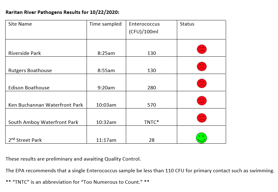
The LRWP and Rutgers Cooperative Extension of Middlesex County monitor for Fecal Coliform and Enterococcus at six non-swimming public beach access sites along the Lower Raritan during the warmer summer months. Fecal Coliform and Enterococcus are indicators of disease-causing bacteria in our waterways.
The EPA recommends that a single Enterococcus sample be less than 110 Colony Forming Units (CFU)/100mL for primary contact. Enterococci levels are used as indicators of the possible presence of disease-causing bacteria in recreational waters. Such pathogens may pose health risks to people fishing and swimming in a water body. Sources of bacteria include Combined Sewer Overflows (CSOs), improperly functioning wastewater treatment plants, stormwater runoff, leaking septic systems, animal carcasses, and runoff from manure storage areas. Enterococci levels are often high after heavy or consistent rainfall.
Below are our pathogens results for October 22, 2020.
Field notes for October 22, 2020
Fog blanketed much of the East Coast through the morning, and hung heavy over the Raritan until burning off around noon. Called “advection fog,” the mist forms when warm, moist air passes over a cool surface. Advection describes the movement of fluid, in this case the fluid is wind. When the moist, warm air made contact with the cooler surface air, water vapor condensed to create fog.
A blanket of fog hovered over our monitoring sites, including Riverside Park in Piscataway
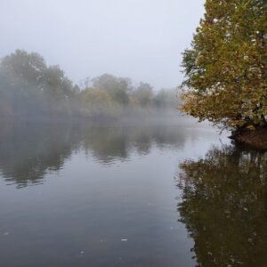
Ever wonder how all the rain that falls onto a highway is “disappears” for a safe driving experience? It is transferred via stormwater infrastructure — that is, pipes or channels — to and “outfall” at which the stormwater enters receiving waters (rivers, streams, or creeks). This outfall at New Brunswick’s Boyd Park conveys rainwater from Route 18 (above the arches) into the Raritan River at the Rutgers Class of 1918 Boathouse.
A stormwater outfall conveying water off of Route 18 into the Raritan River at Rutgers Boathouse.
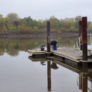
Our fisher friends in Edison didn’t seem to mind the fog. They told us they had just caught and released a 26-inch striper the night before.
The LRWP and Rutgers Cooperative Extension of Middlesex County monitor for Fecal Coliform and Enterococcus at six non-swimming public beach access sites along the Lower Raritan during the warmer summer months. Fecal Coliform and Enterococcus are indicators of disease-causing bacteria in our waterways.
The EPA recommends that a single Enterococcus sample be less than 110 Colony Forming Units (CFU)/100mL for primary contact. Enterococci levels are used as indicators of the possible presence of disease-causing bacteria in recreational waters. Such pathogens may pose health risks to people fishing and swimming in a water body. Sources of bacteria include Combined Sewer Overflows (CSOs), improperly functioning wastewater treatment plants, stormwater runoff, leaking septic systems, animal carcasses, and runoff from manure storage areas. Enterococci levels are often high after heavy or consistent rainfall.
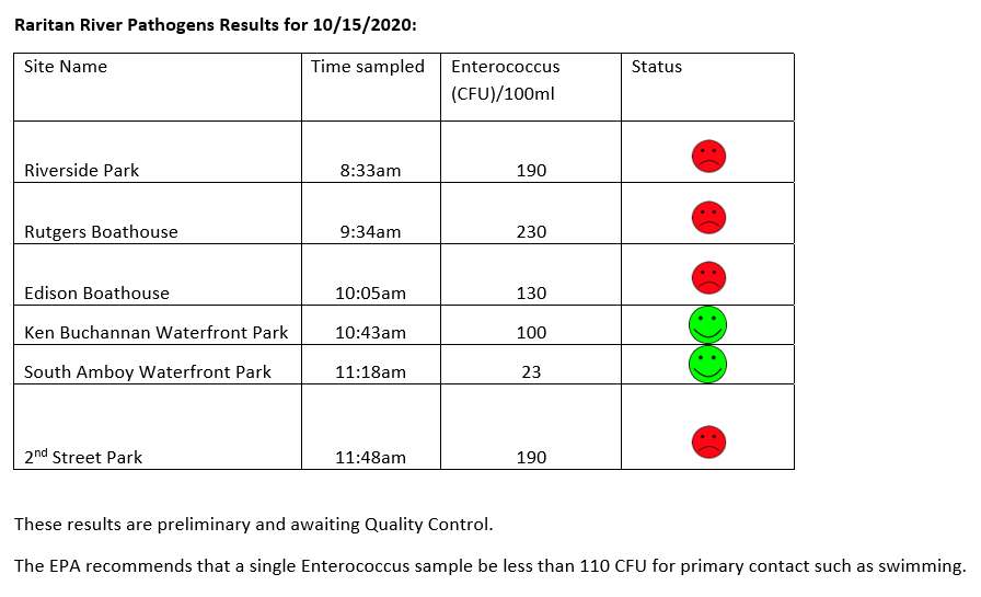
Below are our pathogens results for October 15, 2020.
Field notes for 10.15.2020
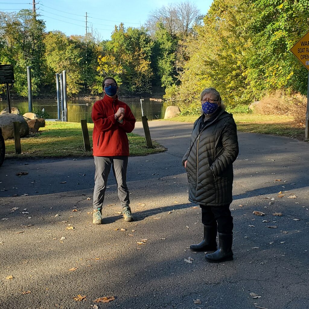
What a beautiful day for monitoring! Americorps Watershed Ambassador Caitlin DiCara helped us out with monitoring. We were also joined at our Piscataway and New Brunswick sites by our Windows of Understanding 2021 artist Marcia Shiffman. Marcia’s work for 2021 will focus on communicating the “hidden” social justice issue of inequitable access to nature.
Caitlin DiCara and Marcia Shiffman at our Riverside Park (Piscataway) site
We talked with Marcia and Caitlin about social barriers and physical obstacles to enjoyment of blue or green spaces or parks. In preparation for our listening session on Social Justice and Access to Nature, we identified a number of barriers to accessing nature. All of the below we observe as issues at non-bathing public access beach pathogens monitoring sites. These include:
-Difficulty in accessing green/blue or park space because of landscape design
-Difficulty in accessing green/blue or park space because of cost
-Not feeling welcome in a natural blue/green space or park because of economic status, or ethnic or cultural difference
-Cultural and/or language restriction present other barriers to enjoyment of time in natural spaces
-Bullying behaviors or material obstacles limit enjoyment of time in natural spaces for persons with disabilities
-Fear, anxiety, or feelings of helplessness in the face of crime limits time in natural spaces
What obstacles or barriers have we missed?
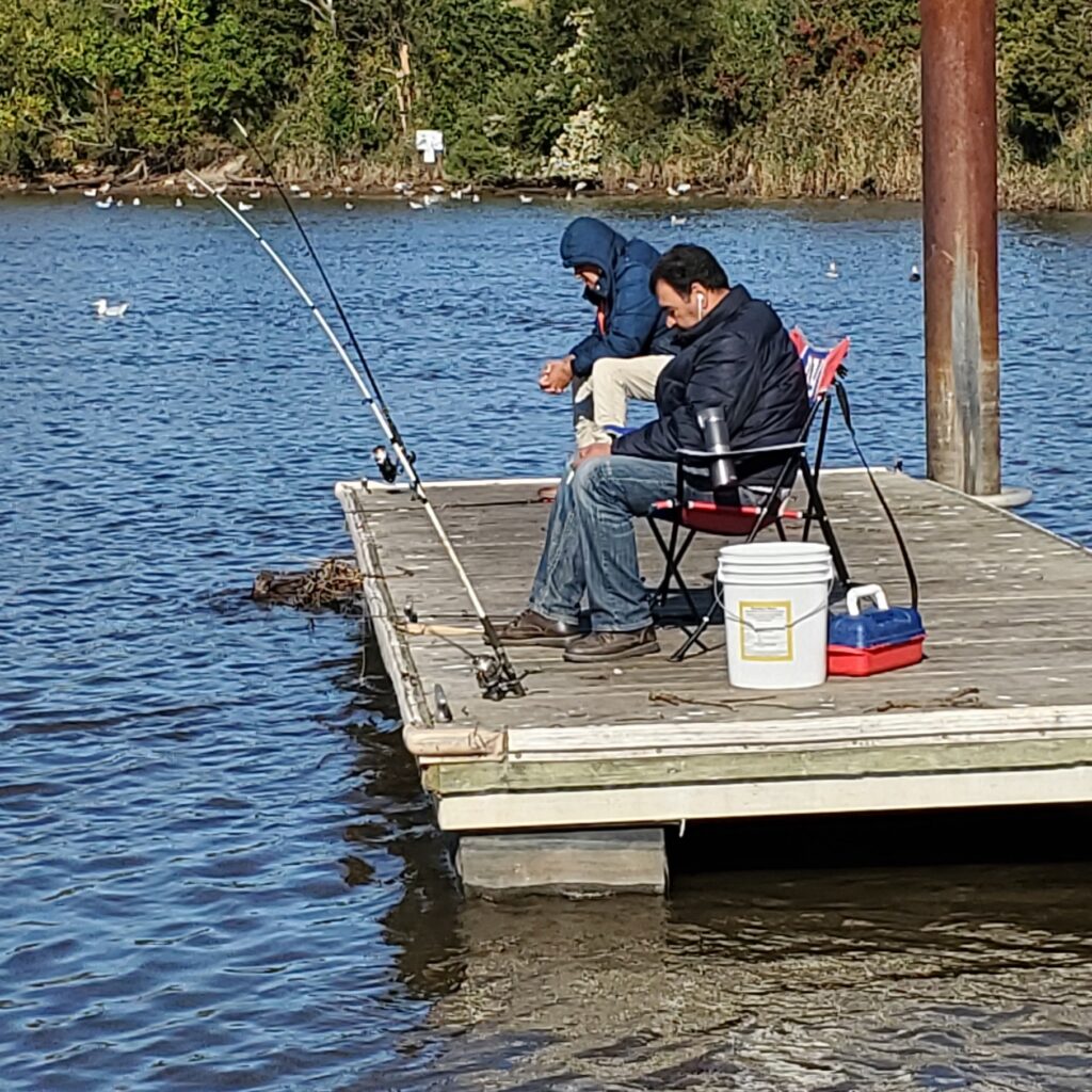
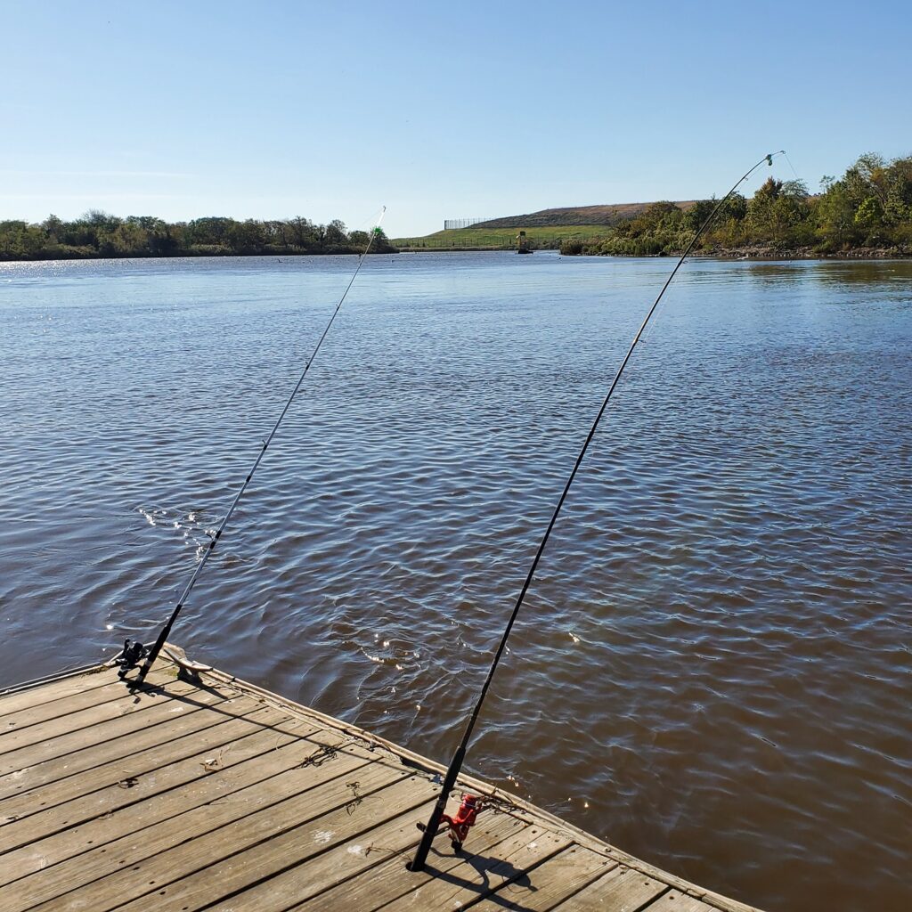
Our Thursday “regulars” fishing at the Edison Boat LaunchNot much tugging at these poles, Edison Boat Launch 10.15.2020