Did you all get caught in the snow squall yesterday? Leaving Rutgers campus at 3:15 PM I traveled a good half mile in near white out conditions on Route 1 North. Skies cleared at about 3:40 PM, just as I started on the Goodkind Bridge across the Raritan River. There was no precipitation at all as I traced the path of a salt spreader for the length of the span. In fact, the squall was the result of a very narrow band of precipitation and lasted a mere 25 minutes. It left just .02 of melted snow in our gauge.
Salt trucks are loaded with 12-15 tons of salt, and spread rates are about 400 pounds per lane mile of roadway. In the time I was behind that truck – the quarter mile or so across the bridge – approximately 100 pounds of salt was spread on one roadway lane. This was after the snow had stopped.
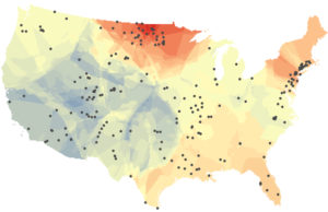
A new study released January 23, 2018 by University of Maryland researchers is the first to assess long-term changes in freshwater salinity and pH at the continental scale. Drawn from data recorded at 232 U.S. Geological Survey monitoring sites across the country over the past 50 years, the analysis shows significant increases in both salinization and alkalinization. The study results also suggest a close link between the two properties, with different salt compounds combining to do more damage than any one salt on its own.
This map shows changes in the salt content of fresh water in rivers and streams across the United States over the past half century. Warmer colors indicate increasing salinity while cooler colors indicate decreasing salinity. The black dots represent the 232 US Geological Survey monitoring sites that provided data for the University of Maryland study. Image credit: Ryan Utz/Chatham University.
The results of this “freshwater salinization syndrome”? Infrastructure corrosion, contaminant mobilization, variations in coastal ocean acidification caused by increasingly alkaline river inputs, and significant impacts on ecosystem services such as safe drinking water, contaminant retention, and biodiversity.
Simply put, fish and bugs that live in the Raritan River and our freshwater streams can’t survive in extra salty water. And while almost all of us in the Lower Raritan depend on local streams for drinking water, water treatment plants are not equipped to filter out the extra salt, so it ends up in tap water and corrodes pipes.
Road salt is everywhere during winter months. It keeps us safe on roads and sidewalks, but it can also pose a threat to fish and wildlife as well as human health. Of course we want to keep our roadways safe. We also must ensure that any salt spreading be conducted utilizing best practices for sustainable use, which includes calibrating salt spreading in accordance with weather forecasts and minimizing the amount of salt spread over sensitive habitats.
There are things you can do to help us better understand the impacts of road salt on our local environments. The Cary Institute of Ecosystem Studies presents several best management practices in their new report: “Road Salt: The Problem, The Solution, and How to Get There.” One key recommendation is identifying areas for low or no salt application. That is, basically creating a buffer of “no salt zones” around any water body. This report also identifies substitutes for road salt, and their relative impact on our waterways.
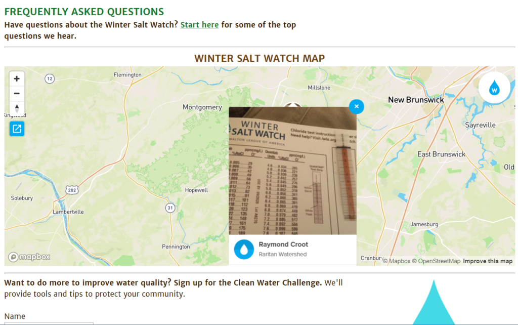
And the Izaak Walton League is recruiting volunteers to help measure salt levels in area streams to gauge the extent of salt spreading impact. With the information they gather they will be able to develop a targeted and prioritized approach to reduction of salts in local and national waters. The Izaak Walton League requires a simple registration process, after which participants receive a free chloride test kit. The kit includes test strips and instructions to measure the chloride level in local streams, then report out findings in a national database.
Dedicated Lower Raritan Watershed volunteer Raymond Croot is the first to submit “winter salt watch” data for a Lower Raritan stream.
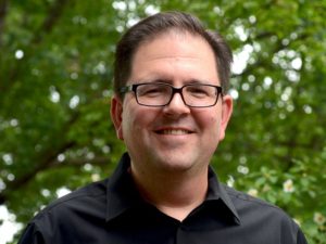
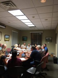
On the second Monday of 2019, LRWP Board Member and Rutgers Professor David Tulloch welcomed me to his office at the Center for Remote Sensing and Spatial Analysis lab (CRSSA). Giant maps on the lab walls hint at what Professor Tulloch does at Rutgers. His research focuses on a mixture of landscape architecture and Geographic Information Systems (GIS). Professor Tulloch received a Bachelor’s degree in Landscape Architecture at the University of Kentucky, his Master’s in Landscape Architecture at Louisiana State University, and PhD in Land Resources at the University of Wisconsin, Madison. He has now lived and worked in the Lower Raritan Watershed for two decades. He enjoys exploring our area on foot, urban hikes, and trying to connect pieces of landscapes that a lot of people overlook. These interests led him to create an interactive google map that explores various features of the Lower Raritan Watershed. The map will soon be a supplement for Professor Tulloch’s “Watershed Highlights and Hidden Streams: Walking Tours of the Lower Raritan Watershed,” which kicks off on Sunday March 16.
LRWP Board Member, Professor David Tulloch
TaeHo Lee: Where are you from in the LRW, and in your time in the watershed, how have you engaged in/explored the watershed?
David Tulloch: I live in Highland Park near the Mill Brook, and I have lived there for nearly 20 years. I am within an easy walk to the Raritan making it hard to ignore the connection of the landscape and its watershed to the river. I’ve gotten to know the watershed as I explored it not only as a person who is curious about the large landscape. But also, as a benefit of my job, I have what amounts to two decades of mapping and design projects in different parts of the LRW and the larger Raritan River basin. Student research projects and studios have helped me get to know the watershed in ways that now are quite helpful in ways that, at the time, I didn’t always appreciate. My favorite thing to do in the Watershed is just to get out and walk it. I will look through historic maps or various air photos and look for hidden connections to explore. But there are also plenty of marked trails within the Watershed that I have yet to walk.
TL: As a parent, how do you want your kids to engage in/with the watershed?
DT: Well, I want my kids, like so many people who have grown up here, to really treasure this as a special landscape and see that it is both a special landscape and a singular, very large landscape. It has a fascinating history that we don’t talk enough about: American history, Revolutionary War, World War II, and an industrial history which is really significant as it impacted people around the world but also has impacted the river and our communities pretty dramatically. There are interesting educational and cultural histories for example, a colonial college right on the banks of the river in New Brunswick, the old proprietary house in Perth Amboy, the Monmouth Battlefield. So many things have marked this landscape. Additionally, its nature is incredible: Bald eagles, peregrine falcons, sandhill cranes, all within a few miles of us. And the landscapes that make up the Watershed are amazing: Mountains to marshes with really special spots within the Watershed like Duke Farms, Watchung Reservation, and the Rutgers Ecological Preserve. I really hope that my sons are coming to see the place not just as memorable but as incredibly special and something to treasure, even if they end up in another part of the world in the coming years.
TL. What, in your view, are the primary issues that need to be addressed in the watershed?
DT: The first for me is clearly the need to improve resident’s awareness of the Watershed and its issues, and their understanding of how both natural and policy processes within the Watershed work. I think one of the real challenges for us, an issue that affects ultimately the quality of water of the river, is encouraging our population of something like 800,000 residents to understand that the watershed is so much more than the river, and more than just the river valley. Most people associate the watershed with Donaldson Park, Johnson Park, Duke Island, or Duke Farms, and they can see those as areas that are associated with Raritan River. But we need to help them understand that in a 350 square mile watershed places like Freehold, Scotch Plains, and Bridgewater are all contributing to the water quality and the experiential quality of the watershed. And with a growing awareness and understanding, comes an appreciation of how much we still don’t know and how we need to enlarge our understanding of the river.
The other issue that
really stands out to me is the land use of the watershed. It covers 350 square
miles and includes 50 municipalities, each making their own independent decisions
about land use with very little coordination, and we share collectively in the good
and bad outcomes of these decisions. I live in one of those municipalities and
work in another, but in between projects for work or taking my kids to
different events I spend lots of time in other watershed towns experiencing the
results of those independent decisions made in 50 different borough halls, city
halls, and township halls. A really important step is to begin to monitor land
use choices, and to examine them in terms of how they impact the watershed. We
need to help the different people involved with the LRWP connect with those
processes and see them in a more serious way.
TL. What is your vision for the LRWP?
DT: One important thing as a young organization, part of the shared vision we all have, is that as a growing organization it needs to be nimble enough to adjust to not only the changing needs of the Watershed but also the changing understanding of what the organization can become. Through listening and learning and reshaping itself, we all come to a new understanding of what the Lower Raritan Watershed as a community, as a physical landscape, and as a place with changing pressures on it, is.
Having said that, three
areas are really important for us. One is appreciation. I don’t just mean that
in the broadest sense, not just appreciating the place, but appreciation based
on increased understanding. That’s getting more residents out on cleanups so
they can see the problems themselves; getting as much as we can out of the
research at Rutgers and the NJ DEP and from others working along the river so
that our appreciation of those problems are also based on something serious.
Second is advocacy. My
vision for LRWP sees it as a voice for the river and the Watershed that can
really advocate for needs that often don’t have a strong voice.
Third is action. Turning
the appreciation and advocacy into action. This includes small steps like
cleanups, but some of the actions we take overtime can become more dramatic. Appreciation,
advocacy and action, I think, together really represent a forward looking
vision for the Watershed and the Partnership that could engage a very large
number of residents and not just the usual suspects.
TL. You are a Professor at Rutgers. What is your role there? Can you provide insights into how we can best bring the resources and attention of the University to address the needs of the LRW?
DT: As a faculty member of Rutgers, I have formal roles. I am Associate Professor of Landscape Architecture, Associate Director at CRSSA, and lead the GeoHealth lab. A lot of the things that I do at Rutgers are as an integrator, as someone crossing over between different kinds of activities. So I work as an educator, and in landscape architecture I teach design, I teach planning, I teach what we call geomatics. But I’m also a researcher here at the center. We are looking a lot at the ways that the landscape is shaped and affects human health and our lives.
In my role as an
integrator, I bring research into the classroom, and draw students back into
the research. In the same way, I am now really interested in integrating the
experiences with the watershed into the different activities that I have in
Rutgers, as well. As part of my research 20 years ago or so, I visited and
interviewed NGOs all over New Jersey, looking at their use of GIS and mapping. The
groups that most caught my attention at the time were primarily watersheds.
Many of them were brand new and in that way, for me, it was the first chance to
learn and explore New Jersey’s landscapes. This forced me begin to confront the
potential that Watershed organizations have as advocates for pieces of the
landscape across municipal boundaries. I also began to see a role for
integrating science and education and policy.
One of the other roles
that I have at Rutgers is interacting with students. I get to know a lot of
students as they first come to Rutgers. A role for me with students who are not
from the area is helping them appreciate what a special place this is, getting
them hooked on the River, and sharing Rutgers’ long relationship with the river.
After all, it’s mentioned in the school song. In the broadest sense, to answer your
question, we are so fortunate as a watershed organization to have a University
like Rutgers in such an integral relationship with the river and the Watershed.
But, with the many research and outreach programs that Rutgers has, one of my
ongoing roles is going to be bridging the two and helping make connections with
those activities and helping be a voice for the Watershed as well.
TL. I understand you are planning a series of “Walks in the Watershed.” Can you tell me more about this opportunity? What is your goal with the walks?
DT: Part of this goes back to simply trying to help all of us improve our appreciation and understanding of the watershed in little and big ways. But the walks are a very special way to connect the abstract places that we’ve all seen on maps with very real experiences on the ground. The goal with the “Watershed Highlights and Hidden Streams: Walking Tours of the Lower Raritan Watershed” is to help reveal connections across landscapes of the Watershed that are often hidden in plain sight, but also to help us explore some connections, like hidden streams, that are truly invisible.
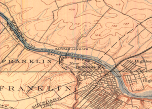
Johnson Park/Raritan Landing – 1890s
Over time we will try some walks that explore the outer edges of the Watershed – Beyond the banks of the old Raritan – but at the start, we’re going to take walks that explore connections of important pieces of land to the river and, where possible, look into the streams that make those connections. So, one of the first walks, on March 17, is going to be close to the Rutgers campus here where we’ll be looking at the connections between Buell Brook and the Raritan by taking a walk that connects Johnson Park and some of its history and Raritan Landing with the Eco Preserve. Many people visit Rutgers’ Eco Preserve and don’t think, even when they are only hundreds of yards away from the river, don’t think of its connection to the river. The walks will look more at the connection and what it means. Walking also just reveals some other patterns and some hidden features along the way. I hope to be as surprised as the other participants. A second walk this Spring, scheduled for May 18, connects the old constructed landscapes of the canal at Duke Island County Park through a new greenway that has been developed along the Raritan and crosses over into the Duke Farms properties. I think a lot of the residents in that area are familiar with individual pieces. Fewer have made the walk to connect them all. We hope to make the walks a regular experience.
TL. Is there anything else you want to add?
DT: When you asked about what I do at Rutgers and how this helps make connections for the watershed, let me mention one more example. I think that as I teach planning students and geomatics students and design students who make some connection with the place, that the Watershed as a whole also is benefiting from those who stay here. An interesting example of that is Daryl Krasnuk, who I taught as an undergraduate student. Daryl has continued to volunteer and make maps both for the LRWP’s general education efforts and specifically for the State of the Lower Raritan Watershed report. It’s exciting to see the students that I taught now sharing their passion for this special place and finding ways to help up us to improve that landscape over time.
Martin Luther King Day was established as a National Holiday in 1983. Eleven years later in 1994, Congress added a service component to the holiday. Monday January 21 marks the 25th anniversary of our federally designated National Day of Service, also called the “King Day of Service” or “A Day On, Not a Day Off.”
Through his leadership of the civil rights movement, Dr. Martin Luther King provided tremendous service to our nation. Despite this, media coverage of the service aspect of Martin Luther King Day celebrations is sparse. Especially rare are stories that highlight impacts of volunteering that go beyond economic valuation and personal benefits.
How can we build on Dr. King’s legacy and celebrate volunteering in ways that strengthen our neighborhoods and nation? We can conceive of service as an expression of citizenship, service as an expression of generosity, and service as the opportunity to experience a felt sense of community.
Citizenship. The pressures of our day-to-day political and economic engagement tend to reduce us to “voters” or “consumers.” Through this process we lose sense of ourselves as citizens, and lose connection to our communities. Volunteering allows us to connect deeply with one another as citizens in the craft of working together for the common good.
Generosity. Non-profits, schools and nursing homes do not need “free labor” or “spare time” as much as they need the generosity of spirit that prompts us to engage as volunteers. In sharing our generosity, we are held to a higher standard: the intention to enhance the true well-being of those to whom our generosity is given.
Community. Volunteering is about a felt sense of community. It is about making connections and building resilience. Connections, resilience – these are especially critical assets in these more trying times.
As we recognize 25 years of celebrating service as a national value, let’s reflect on and commit to grow through the broad benefits of volunteerism. Evolving through service in this way can help strengthen our diverse communities and further protect civil rights and civil liberties.
Heather Fenyk, Ph.D. serves as Board President of the 100% volunteer-run Lower Raritan Watershed Partnership based in New Brunswick, NJ.
The Lower Raritan Watershed Partnership is often asked to talk about the most pressing environmental issues facing our Central Jersey watershed communities. Here is our “Top 10” list of cross-cutting concerns for 2019. Starting in February we will feature one concern a month on our website, exploring that issue (and potential solutions) in more detail. We invite you to join in the conversation.
Poorly coordinated stormwater management, conducted at municipal (not watershed) scales, means that one community’s flood control efforts can lead to another community’s flooding problems.
Perceptions of safety (poor lighting, litter) around riverfront spaces, and poor signage and access to these spaces, deters use and enjoyment of our waterways. If we don’t know our rivers and streams we won’t grow to love them and act to protect them.
Failure of aging water infrastructure (culverts, pipes, inlets and outfalls), an urgent safety issue for all our communities, is exacerbated by an increase in precipitation due to climate change.
Poor control of non-point pollution sources (fertilizers and pesticides from lawns, sediments from development and erosion, oil and grease and road salt from roadways, animal and human waste, dumping of detergents and paints and other chemicals into stormdrains, and litter) results in high chemical levels, bacteria loads and algal blooms in our rivers and streams.
State and regional authorities do not have a clear plan to improve knowledge of the health of the Raritan and its tributaries, and do not model pollutant loads for our watershed.
Recent federal rollbacks of requirements for oil and gas reporting may result in increased methane emissions and open the door to more pipelines that fragment and threaten habitat.
Federal policies that extend the offshore fishing season and increase allowances in catch rates for commercial fishing reduce numbers of anadromous migratory fish in the Raritan, affecting the food chain.
Check with your local Environmental Commission or Green Team for information about specific source impacts and development pressures in your community.
Article and Photos by Margo Persin, Rutgers Environmental Steward
Editor’s Note: In 2018 Margo Persin joined the Rutgers Environmental Steward program for training in the important environmental issues affecting New Jersey. Program participants are trained to tackle local environmental problems through a service project. As part of Margo’s service project she chose to conduct assessments of a local stream for a year, and to provide the data she gathered to the Lower Raritan Watershed Partnership (LRWP). Margo keeps a journal of her experiences, excerpts of which are included in the LRWP’s “Voices of the Watershed” column.
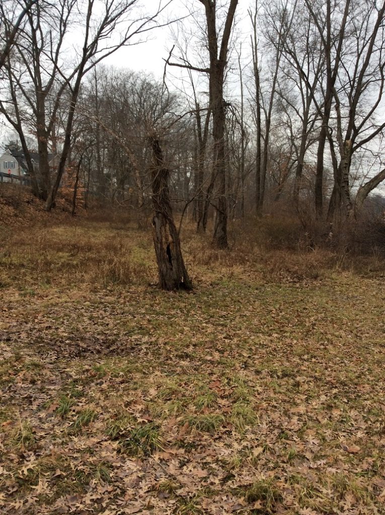
As my year-long project entailing the assessment of the Ambrose Brook is now drawing to a close, I wanted to make one last observational visit to the site, which I completed on 31 December 2018. As I was driving over, in my mind I reviewed the year and wondered, at this point in the process, if there would anything more or new that I could possibly say about the Ambrose Brook. Well, was I in for a surprise, and a most captivating one at that! I arrived at just about 10:30 am, I was the only human around, and as I traversed the eastern side of the stream, I spied just one pair of mallards afloat on the lazy, meandering brook. The male’s plumage was blatantly obvious against the muddy, slow-moving current, whereas the female’s was camouflaged just about perfectly with the background: muddy water, brown earth, fallen leaves. The sky was overcast and the air was calm with a moderate 40 degree temperature that provided a welcome and silent capsule for my period of observation. My goal was to walk the bank, if possible on both sides, from a bit past the small waterfall all the way back to the footbridge and back again. And with this trajectory, nature provided me with a series of surprises.
As
I made my way south on the eastern side of the brook, a veritable flock of
mallard pairs came into view, comfortably resting on the water’s surface, the
first that I have seen in the entire year.
They gave me a slight if sneering glance, then turned away from me to
glide closer to the western bank. Secondly, as I walked along the bank farther
and farther from the street noise, I noticed that several trees had a
distinctive series of marks along the base up to about one foot, all around the
circumference of the trunk. I am not a
naturalist, but I wondered if by any chance it could be a family of beavers at
work. “Nah”, I said to myself, this
place has too many people around, “no way”.
Well, I suspect that I was proved wrong!
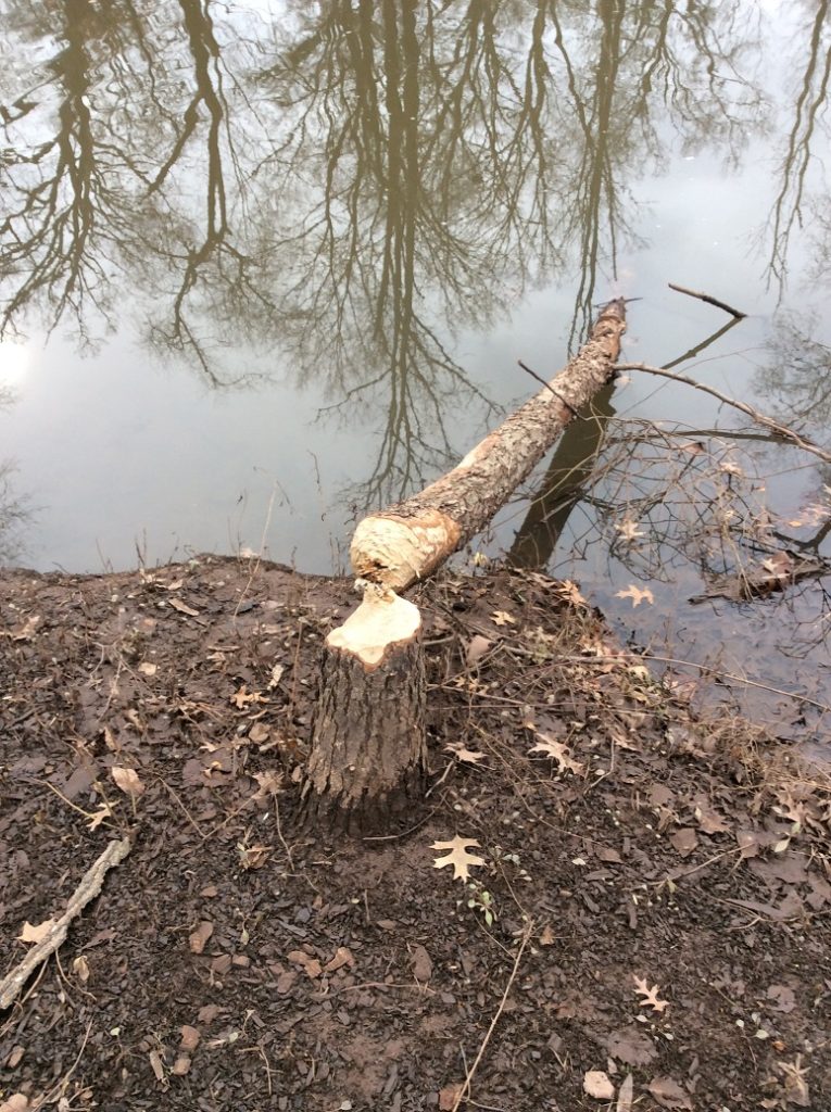
At another spot, a neatly chewed tree, gnawed to what looked like a
precise pencil point, had been felled and now was lying in the water, the
severed trunk just inches from the sad looking stump. “Aha!” I exclaimed, “nature wins again,
beavers’ resourcefulness as effective or more so as a mini-chainsaw”. I never did see any beavers but their handiwork
was a very good indicator of their presence.
At the farthest point away from the street, still on the eastern side of
the brook, felled trees were piled up very close to the water’s edge, and I
wondered whether that might be an indication of a lovely and cozy den. Hmmmm…..
Beaver handiwork. Very impressive!
After
crossing the footbridge to the western side of the brook, I was presented with
another of nature’s surprises. Now that
winter is officially upon us and foliage has died back both above my head and
below my feet, I was able to make my way about three quarters of the distance
to the small waterfall. As I walked
among the brown brush, fallen branches, and dormant grasses, it dawned on me
that the brook had on this western bank a lovely and wide flood plain well
below street level that I had never noticed before, given the presence of a
daunting array of vegetation, including some very fierce brambles that had
heartily discouraged my passage in previous visits. Wow!
Talk about hiding in plain sight!
I presume that this flood plain accepts the surplus of storm water that
occasionally overflows the banks of the brook, which is then absorbed into the
ecosystem, but in turn does not flood area streets … or basements. Nifty!
West Bank flood plain, Brook is to the right, street to the left.
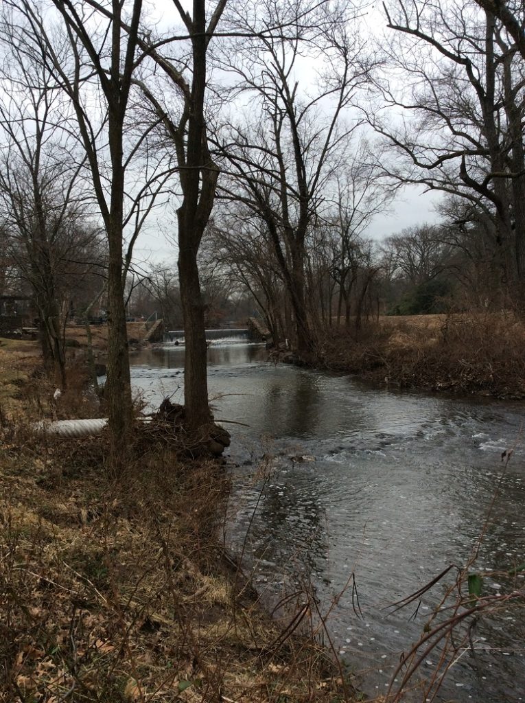
And two last affirmative surprises. Having crossed over once again to the eastern side, I noticed yet another storm water outlet that fed into the brook, close to the small waterfall. I had never noticed it before because of the verdant camouflage offered by the grasses that were presumably fed by its generous flow and overflow. It was right there all the time, but I had never seen it. It humbled me and made me smile – in this visit, I suspect that nature, anthropomorphized to be sure, was having a good chuckle at my expense because of my naiveté. To think that there would be ‘nothing more to see’ was pure hubris and I was given my comeuppance. In addition, the waterfall also had a surprise. Even though the water continues to flow, it was evident that it was starting to freeze at the base! The clumps of white ice shone unmistakably through the tumbling current, a solemn reminder that winter is upon us. I would have missed it if I had not walked closer to the waterfall than I had ever done on previous visits.
Waterfall view in winter. Great for a contemplative moment.
The
last surprise was not a very happy one.
As I made my way on both sides of the brook, I took note of several
places where the water was almost completely stagnant, where the current did
not have the opportunity to lend an active, cleansing presence. And in those small culverts at the water’s edge,
I noted that the water kept a glaze of oil slick of who knows what
composition. At first glance I had
guessed that the water might be beginning to freeze, but upon closer
inspection, the real reason for the discoloration was obvious: water pollution
of a chemical nature. Ugh.
So this was my visit, a combination
of wonder and despair. I plan to offer
in the coming weeks one last report, an estimation of the year’s trajectory as
applied to my original proposal for this project. Happy New Year, everyone! May nature be your guide and live in your
heart.
Editor’s note: The LRWP is regularly amazed by the behind-the-scenes work of municipal Green Teams, Environmental Commissions and other groups to advance environmental protections and restoration throughout the watershed. The South River Green Team shared their New Year’s Resolutions with us (see Mark Barry’s article below), and we think these goals are pretty inspiring. Are you part of a Green Team, Environmental Commission or other group with plans to tackle big (and small) environmental issues in your community? Share them with us, and we will post them on our blog as a way to encourage others to likewise prepare and act for a healthier watershed.
By Mark Barry, South River Green Team
Community Garden — creation of pollinator garden, bee keeping, bat houses, nursery for street tree replacement, flower nursery for community beautification projects, Adopt-a-Spot (or street) for clean-ups and beautification.
River Advocacy — flood plain restoration and tree planting, recommending creation of a local river advocacy community group and/or permanent inter-municipal advisory board, study riparian land use zoning, Blue Acres property reactivation, Brownfields inventory and landuse, flood resiliency.
Natural Resources — green infrastructure planning and implementation, assist in ERI/NRI research, review processes in Community Forestry Plan and tree planting/inventory.
Transparency and Open Government Taskforce — study and issue report of recommendations on improving access to government and records, produce a guide to preparing public body minutes, review public information and publicity efforts of the borough and school district.
Creative South River — encourage creative arts respecting inclusiveness and diversity, pursue arts funding and grants, mural installations to combat graffiti.
The main Green Team Committee will also continue to advocate for the environment and sustainability by pursuing Sustainable Jersey certification, make recommendations to the South River governing body and undertake public education efforts on all matters green.
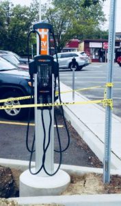
See below for photos from a successful 2018 in South River
Charging station installed in July 2018 – Photo by Mark Barry
South River GT youth contingent outnumbers GT members – Photo by Mark Barry
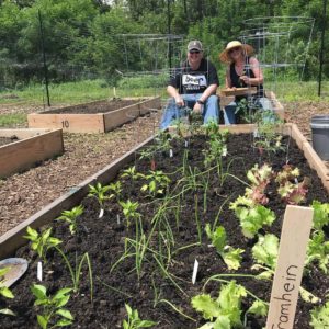
Initiation of the South River community garden – Photo by Mark Barry
Interview by TaeHo Lee, LRWP Fall 2018 Raritan Scholar
Olga Bautista’s “Tree: Bonding with Plastic“
On Boxing Day 2018, Olga Mercedes Bautisa and I met at the Zimmerli Art Museum in New Brunswick to talk about her art installation that will be featured in Windows of Understanding, a city-wide public art project, on behalf of the Lower Raritan Watershed Partnership. Windows of Understanding is a project of The New Brunswick Community Arts Council, Mason Gross School of the Arts at Rutgers University and the Highland Park Arts Commission that unites local artists, organizations and businesses to promote compassion and awareness around social justice issues in our community. Olga was paired with the Lower Raritan Watershed Partnership, and has developed sculptural pieces that address pollutant and littering concerns at the heart of the LRWP’s community outreach. Her work will be displayed in Kim’s Bike Shop (111 French Street, New Brunswick, NJ) from January 21- February 28, 2019.
Olga was born and raised in Colombia and moved to New Jersey when she was 24. She graduated from Kean University and New Jersey City University with Sculpture and Studio degrees, respectively. Living in Perth Amoby, Olga now travels between the town’s high school where she teaches photography, and her studio. She has also founded and served as director for Perth Amboy’s public art gallery. Check out her website to learn more about her art, and read below to learn about what she found inspiring in her “Windows of Understanding” partnership with the Lower Raritan Watershed Partnership.
TaeHo: What was the environmental ah-ha moment that prompted you
to address environmental issues through art?
Olga: Superstorm
Sandy. The roof of my studio was damaged. Since then, I noticed that I was
looking for something more… real, something that is representing what is going
on. For a long time, I had been working with clay, ceramics, mass media, a
bunch of installations. I wanted something more real. The roof incident
happened six years ago. That personal moment, partially caused by climate
change, motivated me to reflect environmental issues to my art.
T: What materials do you use for your art, and what are your
processes?
O: Right now I use leaves, tree branches and
bark that I found after Sandy, and any trash or litter that gets washed into
the Raritan River. After collecting this debris, I used the real bark and make
a mold out of it by pouring silicon on top of it. This process allows me to make
a copy of the original bark. I then add leaves, trash and other plastic pieces
before the silicon dries up to enhance color and texture. When the silicon
dries, the material is opaquely visible, and through my assembly I work to
highlight interesting words and colors of plastic. These are essentially sheets
of a duplicated bark, and I can connect and hang them, shaping them like trees.
While on first glance these pieces look like trees, a closer look reveals the
bits of plastic and trash.
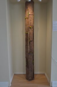
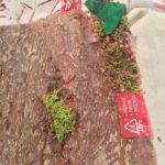
A sheet of faux bark. Several sheets will be crafted into “hanging trees” and installed in the windows of Kim’s Bike.
T: What is your goal with the sculptural pieces that you are
creating?
O: The goal of this piece is to portray the
plasticity of the world in our impacts on the environment. I hope that the
piece creates conversation between people about their plastic use and make
people question their own habits and change their behavior to be more
environmentally-friendly. I hope they will see the words and logos of big
corporations and brands dissolved into what looks like a real tree made of
plastic. Many of these companies are responsible environmental harm. Just like
this fake plastic tree, if we do not change our patterns of plastics
consumption, plastic will take over everything, no? (laughter). And I want to
see how people react to the piece. Let’s just see how they react.
T: How do your pieces reflect the work of the LRWP?
O: Trees are such an important part of the
watershed. Appropriating and connecting the benefits of trees to my art, I
think, resonates with the work of the LRWP. Trees create oxygen, provide
habitats for innumerable kinds of species, and hold the soil and water for the
health of the watershed. I see these traits of trees as symbolic in its relation
to what the LRWP does to restore the environment.
Additionally,
plastic litter and trash is a huge issue for the Raritan River and tributaries.
The LRWP regularly conducts clean-ups of the Raritan and area streams, and
gathers hundreds of bags of plastic litter a year. The action of collecting and integrating plastic
into my work is important. These materials highlight the littering problem in
the watershed. As I explained, my approach is to appropriate real tree bark by
introducing leaves with plastics debris to mold a new plastic tree bark. I want
to show how the plastic which is used to make shopping bags, plastic bottles,
or other items found in abundance as litter and debris during clean-ups is
impacting the health of area streams and the watershed.
T: Can you tell me more about creating the Resin Piece?
O: The process of creating the plastic tree bark involves handling chemicals for a long time, like three hours per day at least. So, creating the piece takes quite a time, especially when I dry the mold in the barks. And being exposed to these chemicals gives me headaches sometimes. Also, during the winter time, it is difficult to work in studio and collect debris from the waterways because of the cold weather.
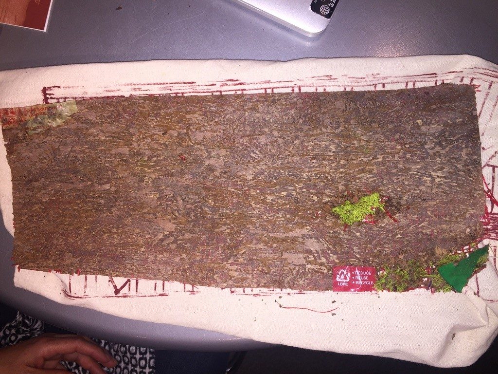
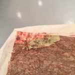
Close up of tree “bark” with onion bag peeping through the silicon
Close up of tree “bark” with plastic bag debris.
T: What effect do you think the Windows of Understanding project
has on you and the community?
O: People will be able to communicate something
artistic and unique at commercial places as they see and pass through the area
with the projects. I hope they will be curious about how the tree piece is
done. Taking a look at the piece inside these commercial places is where the
curiosity starts. And they will reflect their lives on this piece and create
more conversations with their friends or family. This chain effect will, I
hope, create a strong connection between people and the environment. I see the
Windows of Understanding Project as a great platform to raise local
environmental awareness through art.
T: As an artist, what do you stand for?
O: The difficult part of being an artist is
communicating a message that is going to transcend the beauty of the piece. For
example, some might think seeing a ceramic container is nice and pretty and
useable or practical, but how the container makes people think beyond that is
difficult. That is what I stand for as an artist. Additionally, not only is the
transcendental communication part of art important for me, but especially
considering the urgency of the issue these days, addressing environmental crises
is extremely important. My
project, Bonding with Plastic,
addresses the daily stress of individuals facing global crises of
overconsumption and climate change. Through my sculptures, I want to contribute
to a greater awareness of these issues before we reach a point of no return.
The opening reception for Windows of Understanding is at the
Zimmerli Art Museum on January 22nd. Olga’s art installation will be
exhibited at Kim’s Bike Shop, 111 French St., starting on January 21st.
From 10-noon on January 21 the Olga and the LRWP will participate in walking
tours of the art installations and seed plantings at 10am and 2pm.
Seed Planting with the Lower Raritan Watershed Partnership & Kim’s Bike Shop
Location: Kim’s Bike Shop / 111 French St, New Brunswick, NJ 08901
Time: Monday January 21, 10-11:30 AM
Description: Join the LRWP and Kim’s Bike Shop as we plant trees and pollinator plants – seeds of hope – in honor of Martin Luther King Day and the kick-off to Windows of Understanding 2019. Participants will be able to take their seedlings home with them.
During this semester, as part of my internship, I am conducting interviews with members of organizations which work in partnership with the LRWP. The common goal of the LRWP and its partners is to improve the natural environment of the region. I recently met with Nicole Wines who resides in Highland Park in order to discuss the Raíces Cultural Center and the Raíces Eco-Culture program. Nicole, a co-founder of Raíces, has been with the organization since it was established 10 years ago. The mission of Raíces is “to preserve cultural roots through the arts, history and ecology.” One of its goals is to utilize the performing, visual, and media arts in order to promote environmental awareness.
According to Nicole, one’s cultural values should be in harmony with a lifestyle which respects and restores the natural environment. Raíces understands that in every culture there must be a focus which sustains the earth’s ecosystems. It is through an appreciation of the arts that this fundamental bond between humans and their natural world is to be celebrated and encouraged. This “eco-culture” approach is what motivates those who work and volunteer for Raíces.
Raíces Cultural Center and the LRWP collaborate on various projects on the path to their common objective: an eco-friendly Central New Jersey. Both groups are committed to sustainable regional ecology, however the groups have not worked together on stream clean-ups. Raíces believes that participating in occasional environmentally friendly acts such as voluntary clean-ups of watershed sites, while helpful to some extent, are insufficient. Instead, Raíces advocates that attention be given to studying and learning from the indigenous peoples of the Caribbean and other regions whose lifestyles are based on an inherent respect for the natural world. The group has determined that it is through understanding environmentalism and the arts that the wisdom of indigenous societies can be combined along with the technological advances of the so-called “developed world.” Through arts programs, all individuals, youngsters as well as adults, can appreciate the importance of environmental sustainability. According to Nicole, excessive consumerism which encourages waste and pollution, should be replaced by the values of those indigenous peoples who respect the environment.
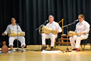
Nicole Wines, far left, performing on traditional drums
As an example of the group’s commitment, volunteers from Raíces, including Nicole, traveled to Puerto Rico to assist those who endured the catastrophic effects of Hurricane Maria. In Aguada and San Sebastian, Raíces repaired roofs. The group also replaced the Agrabond cover for a tunnel at Finca Mi Casa in Camuy. Volunteers provided packets of organic and non-GMO seeds to community gardeners, homeowners, farmers, schools, as well as to organizations which promote sustainable agriculture. Raíces distributed herbal medicines, organic teas, solar lights, and water filters. In Phase 1 of the group’s Disaster Relief Support Initiative, Raíces raised over $10,000 to support recovery efforts.
Nicole believes that in future years, inhabitants of regions beyond the Caribbean, including those living in coastal areas of the United States, must become proactive regarding extreme meteorological events. Nicole is aware of the environmental challenges which confront the Lower Raritan Basin. Run-off from nearby lawns and industrial sites pollute the watershed with chemical fertilizers and industrial waste. The proliferation of trash is an ongoing problem. Invasive fauna and flora must be replaced by species which are native to the area. Rain gardens should be established in buffer zones adjacent to the Raritan River which can address excessive run-off. Residents of Central New Jersey as a result of Raíces and the group’s environmental arts programs better understand the need to restore our treasured watershed. For more information on Raíces and their work and programs: https://www.raicesculturalcenter.org/.
Article and Photos by Margo Persin, Rutgers Environmental Steward
Editor’s Note: In 2018 Margo Persin joined the Rutgers Environmental Steward program for training in the important environmental issues affecting New Jersey. Program participants are trained to tackle local environmental problems through a service project. As part of Margo’s service project she chose to conduct assessments of a local stream for a year, and to provide the data she gathered to the Lower Raritan Watershed Partnership (LRWP). Margo keeps a journal of her experiences, excerpts of which are included in the LRWP’s “Voices of the Watershed” column.
Fall has arrived in all of its glory to Ambrose Brook. This visit entailed yet another habitat assessment, one of several that have taken place throughout 2018 under the aegis of my Environmental Stewards program project, and most probably the last for this year-long commitment. For this round of measurements, I was very fortunate to have for company, support and assistance Susan E., another Environmental Steward whose project has been an inspiration and role model of sorts for my own. We arrived at the designated spot on the Ambrose Brook at around 10:30 in the morning. The weather was co-operative: high overcast skies, temperature in the high 40’s, variable light wind. It was so helpful to have Susan to aid in the assessment from logistical and safety points of view as well as the advantage of the team work that it provided.
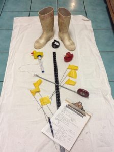
We immediately set to work by measuring out the required inspection distance, placing our flag markers along the designated route, and deciding who would undertake what task for the actual stream assessment of width, depth and velocity, in addition to visually based water conditions, stream and land use characteristic, and high gradient monitoring. To begin, my stream buddy waited at the bank pen and paper in hand while I lurched into the stream for width measurement, equipped with a handy retractable tape measure. I called out the measurement numbers and she jotted them down on the assessment sheets. So far, so good. The next task was depth measurement, to be taken with a rigid metal ruler at various spots along the flag marked course of the brook. I waded mid-stream along our designated route and quickly discovered to my chagrin that my waterproof boots were approximately two inches too low for the water’s depth …. so aside from our official water temperature of 49 degrees taken with a floating thermometer, my feet measured the water temp and gave out a silent primordial scream as the water rushed into said boots and soaked boots, socks, feet, and pant legs. Arrr-r-r-g-g-g-h-h-hhhhh! But I had thought about such an eventuality and had brought along dry socks, shoes and a towel, which were put to excellent use once our foray was concluded.
Stream monitoring equipment, including boots too short for the water’s depth midstream
The measurement of velocity proved to be the most interesting to us. At the start of the designated course, Susan dropped in the red plastic duck mid-stream, which began to wend its way downstream toward me according to the force of the flowing water’s current. I used a stopwatch, timed each passage, and called out the numbers. Per the directive on the assessment sheet, we took four readings that varied between less than a minute to slightly over two minutes. However, with the fifth and last release of the duck, we got a surprise. It stopped mid-journey, irrevocably caught in a small whirlpool that was just about invisible at the water’s surface. We were only made aware of this singular current by the round-and-round dance of the red duck mid-stream, and midway between the starting point and presumed ending point. Thus our final measurement for velocity called for a bit of not-so-subtle human intervention in the form of ‘making waves’, in order to encourage the red duck to continue on its journey. The elapsed time for this final reading was four and one half minutes, double the greatest of the previous four. Not only was this a singular event for this round of assessments, but for all the previous ones earlier in the year. No doubt that stream bed conditions created this unexpected duck dance.
As a final contribution to the assessment, we took a seat on one of the park benches and worked our way through the rest of the paperwork. We consulted on each of the necessary readings and were able to arrive at mutually acceptable descriptive categories in regard to water conditions, stream and land use characteristics, and high gradient monitoring. A contribution that enriched our observation was that my stream assessment buddy pointed out an additional pipe outlet, presumably for rain runoff, that I had missed completely in my previous observations. Two heads are better than one.
So this yearly cycle will soon be drawing to a close, given that I began in December of 2017. I plan to offer some reflections on this journey and offer for contemplation the lesson that have presented themselves to me with the turning of the seasons. Happy Holidays, everyone.