Margo Persin, Rutgers Environmental Steward
Editor’s Note: In 2018 Margo Persin joined the Rutgers Environmental Steward program for training in the important environmental issues affecting New Jersey. Program participants are trained to tackle local environmental problems through a service project. As part of Margo’s service project she chose to conduct assessments of a local stream for a year, and to provide the data she gathered to the Lower Raritan Watershed Partnership (LRWP). Margo keeps a journal of her experiences, excerpts of which are included in the LRWP’s “Voices of the Watershed” column.
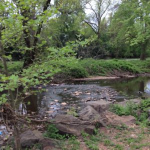
Location: Willow Dr. Middlesex, NJ 08846, USA
Latitude: 40:566552
Longitude: -74.510890
Prologue
In working on my project, I plan to provide a detailed chronological report of the specified site over a period of one complete annual cycle. Secondly, I will take photos to document any changes – or lack of changes – with the passing of seasons, and to bear witness to human intervention, whether it be positive or negative. For example, has any work been done previously to prevent erosion of the stream? Or, what are the effects of littering/ dumping in regard to stream health? I am looking forward to being an active observer of the ‘big picture’ as well as the minutiae of this specific site. Because I am a life-long gardener, it is patently obvious that my garden ‘talks to me’ – I learned that from my Mom. One needs to learn to observe and interpret the sometimes subtle and sometimes obvious messages that nature sends out. For example, a plant may not be partial to a planting site and thus sends out runners or shoots to a more appropriate placement and then a new plant pops up in the more favored location. Needs more sun? Wants higher or direr ground? Example: day lilies don’t like to be in the vicinity of lilies-of-the-valley and they also don’t tolerate any mulch…. With this in mind, I want to to enter into that active ‘observing/listening’ relationship with a stream habitat, which will be slightly different from one with a suburban garden. But I suspect that some (many?) of the same or similar skills will apply.
And third, I want to create a written narrative of my relationship with the site, which I hope will be a meditation on the ‘how’ and ‘why’ of a more intimate connection with the wild part of nature that surrounds us. How can we become more active and aware observers and listeners, in order to be able to honor the wildness in nature? And how can we utilize that in order to attain a closer, more authentic and honorable connection between earth and human, to acknowledge that wild part that connects rather than separates us?
A bit of a delayed and bumpy start ….
Given that I wanted to do a stream assessment, the first order of business was to get some training in that field of endeavor. To that end, I participated in a Visual Habitat Assessment training program offered by the Lower Raritan Watershed Partnership that took place on 21 May 2017 at the Lawrence Brook. It was led by Heather Fenyk and those of us in the group learned how to assess stream quality utilizing a very helpful and specific set of guidelines that include water conditions, stream measurements, and stream characteristics. In addition, we also were introduced to ‘high gradient monitoring’ that has as its focus such parameters as embeddedness, sediment deposition, channel flow, velocity/depth, channel alteration, bank stability, etc. My mind’s eye was awakened to the plethora of detail that could so easily be passed over, if one’s full attention to detail is not called into service. It was a wonderful learning opportunity and I was so glad that the opportunity had been afforded to me to learn in this very supportive and educational context. It is my opinion that we learned from the group leader, from the assistants and from nature itself. It was an experience that has stayed with me – I was so impressed by how the gifts of science and observation we who inhabit that green planet that we call home can both inhabit and commune with earth, water, sun, and sky. We need to be silent, to look, to listen, to be, and to be at ease so that the earth’s signals can fill us with wonder.
My next step was to find out exactly where the stream was located, obviously. But this task proved much, much harder to achieve than would be expected. After contacting several people over a period of several months, the site coordinates were eventually sent to me by Mr. Robert Hughes, the Watershed Ambassador WMA 9, on 30 October 2017. Progress!
The third step was to do a reconnoitering mission to the site – more about that in a moment – and finally, to arrange for an ‘official first visit’, in the company of another environmental enthusiast, so that the first official set of measurements could be taken. It was strongly suggested by both Michele Bakacs and Heather, with an eye toward safety, to develop and utilize a team approach for site visits. Two people had been recommended to me who might be willing to visit the site with me; I contacted these two people and because of timing, only one was able to co-ordinate with me for the site visit. That first official visit took place on 2 December 2017, with Carolyn F as the second member of the site visit team. So begins the project – it will continue over the course of an entire year, from December to December, so as to be able to capture the feel of the site and to develop a relationship with nature’s rhythm at this particular site. Wish me luck.
Preliminary visit
Prior to the official start of my project, I wanted to locate the site on my own and to reconnoiter it from a very practical perspective: aside from the spatial co-ordinates, what was the easiest, safest, most direct route to the site? Is parking available? How safe/reachable is the site from a public safety perspective? Is the site easily accessible via vehicle? On foot? Are there walking trails? Are they cleared / easy to negotiate? Are there other accommodations? Is the site under the care of any public entity? Are there man-made structures in the vicinity? If so, what purpose do they serve?
25 November 2017
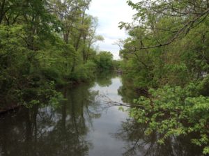
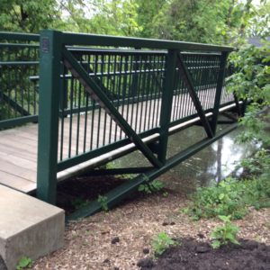
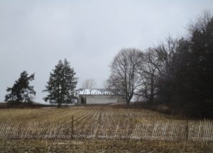
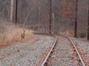
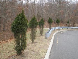
My first unaccompanied visit to the site was purely for reconnoitering. The part that I visited is easily accessible from Rte. 28 in Middlesex and there is a small parking lot available that fronts the Ambrose Brook. (It turns out that I was not quite at the coordinate site, but within walking distance of the GPS coordinates. More about that later.) While seated in my vehicle I waited for a few moments to get my bearings: there are paths that lead in both directions, one that parallels Rte. 28 and another that cuts back into a residential area. Part of the path is paved, then gives way to some well-trodden dirt walkways that follows the contours of the stream as it meanders its way through the suburban area. There is a small park with a pavilion, a suspended observation / fishing deck that is handicapped accessible, and a portable potty adjacent to the parking lot. Farther down, barely visible from the road, is a lovely foot bridge that crosses the stream from the small park area to a rather dense suburban area. The bridge is made of metal, quite sturdy, and provides a beautiful vista in both directions of the stream.
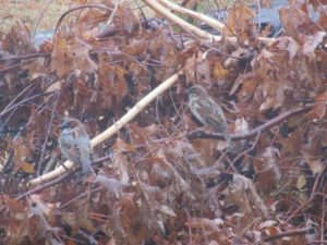
Exiting my vehicle, I walked farther down along the part parallel to Rte. 28 and observed a small but lovely waterfall that allows for the swelling of the brook during times of heavy rain. There are two drains, presumably for rain run-off, that deposit water into the brook. One is a cement structure with a grate that protrudes from under Rte. 28 and the other is a slightly battered metal pipe that extends from underground over the brook. During that first visit, neither drain had any appreciable amount of water to contribute to the brook water capacity. In regard to vegetation, being that it is winter, the ground is frozen hard but the water from the brook is not frozen. The grass is brown and dormant, fallen leaves are all around and the trees are bare, sleeping as they should on this cold winter day. Few birds made their presence known and the only sounds were those of the quietly gurgling brook versus the distant hum of the traffic less than one block away.
A lovely memory and observation came to me from the past. One of my acquaintances from years past is a lovely Native American woman; if I remember correctly, she is of the Cree tribe. In speaking of the turning of the seasons, she noted that within Native American culture, in her tribe in particular, winter is of great value because it gives members of the tribe both the time and the space for storytelling, for being with family and tribe members in close proximity, for listening and learning, for observing, for working on and teaching traditional crafts to the younger generation, for making music and singing, for the passing down of valued and cherished information such as family and tribal history, tribal traditions, myths and legends, for sharing the lessons that are needed to pass from one stage of life to another, for maintaining a way of life. She also emphasized that winter is so important to nature because it is a time of somnolent rest, a time to retreat inward, to focus on the completion of one cycle before embarking on the renewal of spring and the start of yet another growing season. As I wandered the bank of the Ambrose Brook on that cold and quiet winter day, I pondered the lessons that await me in this project. The air was cold and I felt a quiet sense of contentment and anticipation, a turning inward that my friend had indicated that is one of the gifts of the winter season. What other gifts would nature bestow upon me if I could just be still, wait, observe, and listen?
2 December 2017
Ready, set, go! This was a cold and brisk, partly cloudy, not unpleasant day for the very first ‘official visit’ to the site; I was accompanied by Carolyn F, a valued member of the assessment workshop whose name had been suggested to me by Heather of the LRWP. We communicated several times via e-mail and then met on this Saturday in order to put into practice the skills and formula that we had learned back in May. It turns out that this environmental buddy had a bit more on the ball than I did, for she pointed out to me that the actual site of the GPS coordinates was a bit farther removed from the one that I had scoped out on Rte. 28. After texting back and forth, we finally met at the appointed date and time at the GPS location; both of us came prepared, she more than I. Her waders served her very well, given that we did a practice run of habitat assessment using the study sheets provided at the workshop. We did a quick reconnaissance of the site via the latitude and longitude numbers, which is located in a residential neighborhood a bit farther removed – about two blocks or so – from Rte. 28, close to a modest children’s playground. We walked the site, she took some photos, then we decided to head for the other section closer to Rte. 28 in order to try our hand at working through the assessment sheets as a practice run.
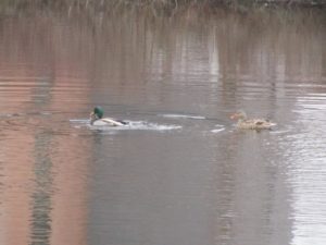
Using all the equipment and measurement tools provided by the Lower Raritan Watershed Partnership – metal ruler, flag markers, floating rubber duck, thermostat – we happily set to work on the task, starting with the ‘general sheet’, then working through ‘water conditions’, and ‘stream measurements’ (width, depth, velocity). Sounds fairly straightforward, right? Well, what slowed the process at this point was that the measurements are required to be taken using the metric system and not the standard American system of inches, feet and yards, including centigrade versus Fahrenheit readings. Arghhhhhhhh…… Needless to say, the conversions slowed us down just a bit but Carolyn’s phone (with calculator) turned out to be a most vital component of our visit. We did some of the calculations on the spot and then later at home I checked our numbers and completed the conversions. Our tasks included wading into the stream – her waders and my duck boots came in very handy considering the distance and depth – and I appreciated very much having a buddy to ‘compare notes’ to take all the measurements and come to a shared decision in regard to stream characteristics and visual assessment of gradient factors such as epifaunal substrate, embeddedness, sediment deposition, channel flow, frequency of ripples, and the rest of the categories. We measured out our required distance – 50 meters in either direction – placed the flag markers, then got to work.
The task was engrossing and the suburban context faded into the background as we assiduously worked our way through the assessment. Even though the natural habitat was in full winter mode, I became aware of the subtle shadings of sound, color, texture, movement and stillness. For example, the floating rubber duck signaled the literal ebb and flow of the stream with its bobbing and stalling as it responded to the currents and cross-currents of the slowly moving water. At times it got caught in a pocket of calm, and then with a bit of encouragement from us, rejoined the water’s energy to make it to the final point of our measures. In observing the little rubber duck’s movement, its vibrant yellow color so visible to our human eyes, it became for me a bit of a metaphor, in that it was floating on the surface of the all-encompassing stream, seemingly unaware of its insignificance vis-à-vis the natural world. We humans ‘float on the surface’, unaware of our insignificance over time in regard to the pulsing of the planet beneath our feet. Alas, our interventions often are negative, considering how overpopulation, pollution, and other forms of contamination interfere with this pulsing, as our lovely green planet hurls itself through the universe, the planet itself insignificant in the greatness of space.
Carolyn and I utilized our time well: we were at the site for approximately two and a half hours, taking measurements, comparing our individual observations, appreciating the subtleties of the winter landscape. And just one more observation. We both noted that the area was relatively clean of human garbage, trash, and other forms of detritus, which was a pleasant surprise for me. Given the site’s proximity to the road, the parking lot and rather dense housing, I honestly had expected there to be a stronger and more visible human footprint in the form of various forms of waste – trash, paper, cans, bottles, old tires. But the area is fairly clean! At the end, my environmental buddy suggested that a visit for the purpose of kayaking might be a doable undertaking at some future time in the warmer months, in order to explore the area upstream of the given site. That idea will be placed on the list of possibilities for another day. With that we each went our separate ways. It was good to be heading home, with the heat flowing in the cab of my vehicle.
30 December 2017
“The best laid plans….” Now that this project had finally launched, I was anxious to establish a steady rhythm in regard to my site visits. And in addition, there was contact with another environmental enthusiast, who signaled a sincere willingness to serve as my exploration buddy. Susan E. had volunteered to accompany me on further adventures; she is perfectly qualified and suited for the task, having developed an environmental project of her own, which in truth, was the inspiration for my own. We decided that an end-of-the-year visit would be an appropriate means to both close out one cycle and look forward to another, Janus like, in anticipation of a yet another change of season. Alas, the plans fell through because I came down with a virus and was out of commission for the good part of a month. So… on to the New Year and the start of another cycle.
21 January 2018
In the company of Susan E., we headed to the site on a cold, clear and sunny day. We parked at the lot in close proximity to the brook, then on foot wandered back to where the GPS coordinates are located. Our meandering took us farther upstream than I had previously visited. The footing was firm in places and quite soggy in others, and we noted the dormant vegetation, including a healthy crop of brambles that very effectively caught at our clothing. Ugh. We noted the places where the waters had left a mark on the land within an overflow plain, evident in the swirling, matted down grass and the markings on the shrubs and trees that line the banks of the brook. Susan pointed out several places of evident erosion in the banks of the opposite side of the stream and noted the layering of sediment – different colors and textures — that gave evidence of the changing composition of the earth’s layering. Many are the varieties of trees that line the banks, whose root systems benefit from the generous supply of water. [ Note to self: try to identify the flora on the banks of the stream. Are these specimens native to the area? Or have they been added to enhance the landscape from a human perspective?]
We made our way to the lovely footbridge, a steel structure that provides an excellent vantage point to look in both directions, both up and down stream. Some fauna were present, a few ducks and geese on the surface of the water as well as a some fish that lazily lolled in the current below. I was struck by the sense of solitude and peace of this beautiful place, in spite of the proximity of suburban life so close. We continued on the bridge to the other side, then made our way carefully along the opposite bank. The footing became quite muddy and unstable but the view from this far side of the stream offered the opportunity to reclaim a perspective based on a more unenhanced version of the site, one not as manufactured by human intervention. Nice!
Our visit included stopping for Susan to take some photos, then we crossed back to the parking lot and took our leave.
21 March 2018
As predicted by the US Weather Service, it has been a cold and long winter, followed by a cold and wet spring. I stopped by the Ambrose Brook today in the hopes of spying a bit of change, whether in the early budding of trees, the minute sprouting of grass, a return of more birds with their flutters and chirping. Any harbingers of spring? No such luck, not yet. However, this visit provided me with another opportunity. It was a cold and mostly cloudy day that served for me to stand in quiet solitary contemplation on the observation platform. Not to be deterred, I chose to focus attention on a small island that is at the center of the brook and attempt to take note of the visual minutiae that delineate the island’s subtle shadings. The colors are primarily brown and green, with varying shades of tan and grey. Black lurks in the shadows and slivers of flickering sunlight shoot arrow-like through the trees, shrubs and brambles. Wind ruffles some fallen leaves that cling to roots and branches, decaying evidence of a season long past. Some ducks paddle quietly along the perimeter of the island and barely take note of my presence. Perhaps they have become inured to human presence in general or through experience have learned that the imposing, vertical mammals do not have the habit of crossing the water barrier between solid ground and the little island to their backs. They occasionally glanced in my direction and then continued on with their creek cruising. Not a bad life, given that their feathers and a layer of winter fat provide ample protection from the water and wind.
My observation also took in the water level, higher than in previous visits, presumably from early spring melting and run-off. The brook water was a muddy brown and lapped at the edges of the island; there was some bank vegetation that was partially submerged and partially above water level. As with the previous visit a bit upstream, trees on the island threw off roots, some as thick as the fists of a prize fighter, to sustain their height. There was no indication as yet of buds forming on the trees, none that I could see from the distance, standing on the observation platform. The quiet of this visit on this end-of-winter day comforted me, offered a soothing message of tranquility, endurance and the abiding wisdom of nature’s continuing cycles.
10 May 2018
Spring has finally arrived at Ambrose Brook, there are many indications that the season has turned in alignment with the earth’s rotation and tilt. I visited the site at around 10:30 am and stayed for about one and a half hours. My time was spent in observation and contemplation of the natural environment as well as the effects of human intervention. For starters, the leaves are starting to appear on all the trees – finally – the grass is starting to appear less stubbly. As a result of the burgeoning leaf cover, the ability to see across the brook will be quickly diminishing in the coming weeks, I surmise. The water in the creek seems to be moving at a bit faster pace, probably because of the amount of rain that has been falling in the last week or so. I walked for approximately a quarter of a mile in each direction from the parking area off of Rt. 28 in order to determine what changes, if any, had occurred because of the winter weather.
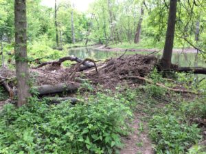
What I observed in the area closest to the segment identification by latitude and longitude was some washing up and / or tree fall from winter storms. Some of the fallen timber had been ‘cut down to size’ by someone wielding a chain saw, most probably a worker from the local DPW; the logs and branches were piled up on the left bank to a height of approximately three and one half feet. This pile of wood and leafy debris may prove enticing to some small furry creatures in the future for a lovely, cool, and protected nesting or burrowing place, if it is left as it is. I was able to get around the pile and continue my observation but the brambles have started to fill in and the slog got a bit more difficult. It was evident from where I was walking on the bank that there is a type of flood plain for the creek; the flow exceeds the bank where the creek takes a meandering turn toward the left. The footing became quite muddy and the brown grass left over from the fall manifested the effects of flowing water – lovely swirls and whorls that give the impression of a lazy aquatic ballet performed upon the welcoming earth with the literal ebb and flow of the creek’s capricious visits during the winter months.
The brook’s water has now receded from the flood plain and is within a channel that has definitive banks, although the height of the banks varies at different points on my observation path. Taking a turn in the opposite direction from the parking area, parallel to Rt. 28, the view is idyllic – a meandering brook with a few surface ripples that give off a low and pleasing hum, an overhang of greening trees, grass appealing to the eye and calling for the tread of bare feet, a small waterfall, and some waterfowl – Canadian geese and a few mallard ducks who were more than willing to share the space and beauty of the moment, either the ones who were on the banks of the creek or those who were enjoying the cool embrace of the creek’s sultry flow. In spite of the minimal traffic noise emanating from Rt. 28, this was place and moment that could be described as a feast for the senses. The gift of sight that captures the nuance of color and form, that of hearing, the sound of birds and brook, that of touch, that encourages physical discourse with so many material forms as well as the ephemeral contact of wind on my face. And the olfactory experience is not to be denied, in the sweet reminder of flowering trees and bushes that contrasts with the musty and not-to-be-denied odor of the languorous creek within its uneven banks. And the experience of taste? I was not expecting to add that to the list, but a bug unceremoniously entered my mouth and with an unanticipated crunch, the bitterness of the insect’s demise forged its way into my consciousness. Ugh. So much for poetic contemplation of this idyllic scenario.
In regard to human intervention, in addition to the chainsawed fallen timber, there was evidence of tidying up in the recently mowed grass along the banks, mulch piled and spread along the public walkways, and a cheerful DPW worker raking some leaves. There was some human traffic; two men were fishing off of two different piers with hand rails – handy for resting their fishing poles –, and a young mother ambled briskly with her toddler son who had no interest in staying in the stroller but rather preferred to trot along beside her.
The visit was enjoyable, refreshing, renewing. Some ideas for further exploration are to identify the trees and shrubs in the area, to focus on bird species that are present, and perform another official habitat assessment of the creek utilizing the format provided by the Lower Raritan Watershed Partnership. And the possibility of a kayaking expedition offers yet another challenge. Onward!
About Margo Persin: I am a retired Rutgers professor who needed a project. I took the Environmental Stewards course offered through Rutgers and was inspired to get back in touch with this beautiful green planet that we all call home via a focus on water. I grew up on the Lake Erie shore, the northeast Ohio coastline, so the pull to return to a partnership with water was a logical and autobiographical one for me. Also, during my years as a professor, I spent several years in Mexico and was able to observe firsthand the devastating and catastrophic effects of no access to potable water. Water means healthy communities, healthy crops, healthy kids. Water is life.
By Arianna Illa, Coordinator, Civic Engagement and Experiential Learning, Middlesex County College
The Watershed Sculpture Project: Middlesex County College
On Tuesday, November 21st of last year, students enrolled in Integrated Reading and Writing (ENG 096) at Middlesex County College (MCC) did something unusual for a typical college course. Rather than meeting in their classroom, they boarded a college van to travel to the Fox Road underpass, a stretch of road off the highway in Edison, NJ. This class excursion was the culminating event following a semester focused on reading, writing, discussing, and learning about environmental issues faced by local communities. In collaboration with the Lower Raritan Watershed Partnership (LRWP) and the Edison Environmental Commission, students planned and executed a community cleanup service project as part of the greater service learning initiative happening at the College.
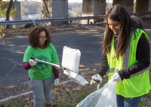
Students Jessica Colon or Rahway (left) places trash in the bag held by Carolyn Muncibay of Old Bridge.
The cleanup involved spending 3 hours of class time bagging trash and recyclables along the underpass. The location of the cleanup was especially significant as it is uphill from the Raritan River. When it rains, trash and other contaminants travel downhill, further polluting the already vulnerable river. By the end of the cleanup, 17 bags of trash and recyclables, nine tires, a suitcase, car seats, as well as other large trash items were collected.
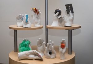
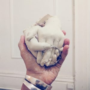
John Keller, Director of Education and Outreach of CoLAB Arts, assists students during the hand sculpture creation process.
During the cleanup, students selected one small trash item to bring back to campus. In collaboration with local arts advocacy organization CoLAB Arts, students created cement hand sculptures which are now on display in the MCC College Center in an exhibition titled The Watershed Sculpture Project: Middlesex County College. Each sculpture is of a student’s hand holding the trash item they saved from the cleanup.
The display demonstrates the large impact seemingly “small” amounts of littering can have on the environment as a whole, and likewise demonstrates the power of simple acts of stewardship (including stream clean-ups and socially engaged art) to effect positive environmental change. This work seeks to raise awareness of issues of environmental damage happening in the local community, and to prompts viewers to examine and reflect on their own relationship and interactions with the environment.
If your non-profit organization is interested in getting involved with service learning at MCC, please contact Arianna Illa, Coordinator of Civic Engagement and Experiential Learning, at ailla@middlesexcc.edu.
Article and photos by Joe Mish
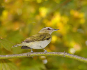
A red eyed vireo briefly descends from the treetops to provide a fleeting glimpse of one of the most common, yet rarely seen birds, east of the Mississippi.
March is the last piece of evidence needed to prove winter has gone by. No matter the weather March brings, her legacy of cold and snow, as the step child of winter, is invalidated by “the first day of spring” conspicuously stamped twenty-one days into the month on just about every calendar printed.
Further visual proof needed to allay the fear that winter is here to stay, are the strands of migratory birds that precede peak migration in the next couple of months. Perfectly positioned between two rivers that lead to the sea and link to the main Atlantic flyway, Branchburg comes alive with colorful winged migrants. Some birds are just passing through while others stay to establish breeding territories.
You don’t really need to be a graduate ornithologist with the ability to differentiate a magnolia warbler from a black throated warbler to enjoy all the feathered gems that pass our way in spring.
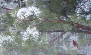
During a recent snowfall the view of several brilliant red, resident cardinals, dodging among the tight branches of a nearby holly tree resplendent in dark green leaves and an overabundance of red berries was a sight to behold. The gently falling snow turned the scene into a living Christmas card.
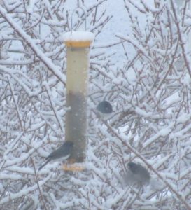
Bird seed scattered on the ground immediately near the back glass sliding door was being appreciated by a flock of brave juncos. The scene was calm and predictable with an occasional song sparrow darting across the stage. Suddenly, standing on the ground next to the glass was what appeared to be a Parula warbler. I ran for the camera to no avail as the little bird disappeared quicker than a shooting star. It didn’t seem plausible that a warbler would be in this area so early but there it was. Looking through the, ‘guide to field identification, Birds of North America’, I reviewed the dazzling array of warblers each differentiated by plumage unique to adult and juvenile, male and female with a cautionary note on hybrid warblers and seasonal plumage. I guess it was a male Parula warbler.
The conflict of identification versus the excitement at seeing a strange colorful bird lingered for a moment until I realized it was the sight of the bird that provided the magic.
Knowledge of the scientific classification was irrelevant to the enjoyment of simply noticing something that appeared to be different and gave pause to a moment of thoughtfulness or beauty.
As an example, you might gaze upon a stunning portrait of another person or a dreamy sunset and immediately be drawn in even though you have no idea of the person’s name or the location of the sunset.
Beauty is its own reward and needs no further qualification.
Birds are creatures which reflect the colors that dripped from God’s palette of infinite hues used to paint the portrait of life. One could argue ‘colors’ have wings to spread nature’s beauty far and wide and taken together they are called, ‘birds’.
Soon the area will be crowded with migrating birds, the most colorful of which are the warblers. A walk along the river flyways while scanning the treetops will reveal small flocks of birds that look like no other you have ever seen. The bright plumed breeding males will be the first to arrive as they travel in the safety of numbers. It is hard to imagine that these diminutive delicate appearing birds migrate yearly to Central America, Mexico and the West Indies from New Jersey and points north. After arriving in breeding areas, the males separate to set up mating territories defended by trilling songs sung loud and often.
The colorful and numerous male warblers representing several species are spectacular to observe in their diversity of color swatches, masks, vests, necklaces and caps. Each color pattern represents a different species despite similar size and intermingling of flocks.
Even the most ‘nature oblivious’ and ‘nature neutral’ observers may have their heads compulsively turned by the accidental appearance of a flash of tropical color among the local treetops.
Perhaps a seed of curiosity may be sown, nurtured and cultivated from a brief encounter with a spring warbler. That dangling thread of gangly curiosity left by a Magnolia warbler or Yellowthroat can easily draw the observer into the world of nature to wander and wonder at the infinite complexities that bind all living things. To believe beauty is only skin deep and fleeting is to ignore the power, depth and satisfaction the beauty of nature has to offer. Asking nothing in return, not even requiring that you can differentiate a Rufous sided towhee from a Cape May warbler, beauty exists only to be appreciated.
Author Joe Mish has been running wild in New Jersey since childhood when he found ways to escape his mother’s watchful eyes. He continues to trek the swamps, rivers and thickets seeking to share, with the residents and visitors, all of the state’s natural beauty hidden within full view. To read more of his writing and view more of his gorgeous photographs visit Winter Bear Rising, his wordpress blog. Joe’s series “Nature on the Raritan, Hidden in Plain View” runs monthly as part of the LRWP “Voices of the Watershed” series. Writing and photos used with permission from the author.
Article and photos by Joe Mish
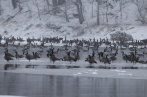 Canada Geese in a snowstorm on the South Branch appear at ease as the falling snow softens the scene.
The January blizzard raged, turning the darkness into an opaque curtain of white. Almost a foot of powdered snow covered the ground before midnight.
The broadcast news reported that NJ had declared a state of emergency shutting down roadways throughout the state. The setting was just right for the midwinter parade on the South Branch. Thousands attended and the main thoroughfare was jammed with local residents and visitors. As I stepped outside to get a head start on clearing the driveway, the sound of geese, thousands of geese, overpowered the drone of the wind driven snow. So impressive was the magnitude of the unalarmed chatter, I was compelled to investigate. Alerting my family where to search for the body, I headed into the storm.
The closer I got to the river the louder and more beckoning the sound became. Moving slowly through the trees toward the river bank, the din from the geese on the open water was deafening. The river was filled wall to wall with migrant and resident Canada geese. Some started to get up and fly. Others just drifted by. All appeared as black silhouettes against the snow and reflective water. Thousands upon thousands all in chorus, the rhythm and sound of their calls rose and fell as if one voice. Occasionally all sound would hesitate into a moment of absolute silence. The silence was as dramatic as the din.
Animals generally become fearless in extreme weather and at the height of this snowstorm the geese collectively tolerated my close approach.
As I closed in, the birds parted, momentarily leaving a void of reflective water. The surface was again soon covered with geese as the specter of an interloper was confidently dismissed.
The Geese were packed so tight; they appeared as if in a big cauldron that was being stirred. One group was drifting down with the current while the other was going back up stream in a re-circulating eddy below the island.
Aside from the geese, the river was filled with joined platelets of gray and white ice, strong enough to support several of the large birds. A display of motionless geese rode atop drifting ice flows, escorted by a cadre of even more geese floating alongside, all travelling at the same speed.
This looked all so familiar. Suddenly it struck me. I could have been watching a fourth of July parade with themed floats and accompanying marchers. Certainly the band was playing a familiar tune as spectator geese lined the banks and joined in the chorus.
How odd that here was a gathering of what seemed to be all the geese in New Jersey having their own parade. As if to celebrate some event sacred to the hearts of all geese, each bird taking comfort in knowing they owned the night and there would be no human eyes to witness their ethereal rite.
Author Joe Mish has been running wild in New Jersey since childhood when he found ways to escape his mother’s watchful eyes. He continues to trek the swamps, rivers and thickets seeking to share, with the residents and visitors, all of the state’s natural beauty hidden within full view. To read more of his writing and view more of his gorgeous photographs visit Winter Bear Rising, his wordpress blog. Joe’s series “Nature on the Raritan, Hidden in Plain View” runs monthly as part of the LRWP “Voices of the Watershed” series. Writing and photos used with permission from the author.
At our April 16 meeting we will catch up on partner activities and provide status updates for on-going projects. We will also dedicate time on the agenda to discuss ways to link Raritan River activities to energies around the East Coast Greenway. Mike Kruimer with the East Coast Greenway Alliance, and other ECGW advocates have been invited to join in the discussion.
The meeting will be held from 10-noon in the Middlesex County Planning Offices at 75 Bayard Street, New Brunswick, NJ – 5th floor mid-size conference room.
Parking is validated for those parking on floors 5 and higher in the RWJ Wellness Parking Deck located at 95 Paterson Street, New Brunswick, NJ 08901. Be sure to bring your ticket to the meeting for validation.
With grant support from the Middlesex County Office of Arts History, the Lower Raritan Watershed Partnership and coLAB Arts will implement the first component of the #lookfortheriver Public Art Program in New Brunswick’s Boyd Park in Summer 2018. The grant will allow for engineering and construction of a footing (the base) for a new public art piece for New Brunswick’s Boyd Park. The creative work to be installed at that site will serve both environmental/watershed awareness and cultural/community engagement purposes for the Raritan River waterfront at that site. Grant funding has been provided by the Middlesex County Board of Chosen Freeholders through a grant provided by New Jersey State Council on the Arts / Department of State.
The #lookfortheriver Public Art Program is a component of the LRWP’s #lookfortheriver watershed restoration campaign, which is designed to encourage community members to “look” for buried streams using landscape cues and historical research. #lookfortheriver is a package of actions communities can engage in around flood resilience and environmental restoration. The LRWP will be rolling out aspects of the #lookfortheriver campaign through 2018 and 2019.


Interview conducted by LRWP Raritan Scholars intern Quentin Zorn

Why did you decide to work with the LRWP?
In the past couple of years my work has been in community gardening, locally organized composting and food system development. I have focused my creative drives toward innovating and troubleshooting in these sectors via grassroots organizing and business startups.
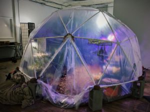
The opportunity with coLAB and LRWP came along at the perfect time. I had just finished installing a geodesic greenhouse in an exhibition called LANDHOLDINGS at Index Art Center in Newark, NJ and was looking to invest more energy to art-making. Additionally LRWP’s mission incorporates scientific and geological considerations that at the time I was not familiar with: the focus on watershed heath and its intersection with the urban environment. I was eager to learn more.
Processed with VSCO with g3 preset
How do you relate to the LRWP’s goals?
LRWP’s goals are to inspire environmental appreciation and stewardship, to inform relevant stakeholders on the watershed by building networks for sharing data about its health, and to innovate to improve watershed health responsibly with a diverse group of partners.
My role as a Resident Artist with the LRWP is to support their on-going projects and help generate new projects that align with these goals. Because my personal viewpoints also align with LRWP’s mission, my own integrity as an artist is not compromised. In fact, exposure to their programs and operations has been challenging and enlightening. The public needs organizations like LRWP to bring together science and community towards making impactful environmental efforts. Art plays a big role in this as it can help folks make the connection between the health of local environmental resources and one’s personal well-being in exciting and thought-provoking ways.
How does integrating art with science change the way you think about your own art?
Even the most traditional art forms require scientific understanding. For example, oil paint is an exceptionally difficult medium that if applied improperly can result in cracking and flaking once it sets. Research- historical, social, and technical- is always necessary for an artist and in-studio discoveries can be, in many ways, scientific in nature. I am used to shifting my medium to convey different kinds of ideas. As an interdisciplinary artist I am excited to collaborate and learn more technical languages.
How does the interpretive nature of art help or hinder conveying the messages you want people to understand?
This tension is one of my favorite parts of art making. The artist Patricia Piccinini is a huge inspiration of mine as much of her work is about the “creator’s” inability to control their “creation.” Experienced artists are able to walk the tight rope between intention and perception, directing the viewer but leaving enough space in the work open for the viewer to be able to identify and enter into it. Of course, not all art works intentionally speak to all audiences.
How do the sculptures from project WADES help achieve the LRWP’s goals or environmental goals in general?
Project WADES stands for Watershed, Action, Dialogue, Education and Stewardship and aims to develop Environmental Education curriculum. The sculptures are positioned at the intersection of WADES with a public sculpture project under a program called Rail Arts River, which aims to connect New Brunswick communities to the Raritan though art and green infrastructure. The sculptures from Project WADES are casts of the hands of youth clasping pieces of trash collected at clean ups along the streams of the Raritan Watershed. They serve to inspire increased connection between human behavior and watershed health within LRWP’s watershed curriculum.
When the sculptures are completed, what is the reaction you are hoping for?
To be honest I haven’t reflected on the reaction as much as the intention and the varying methods that coLAB, LRWP, and I have discussed for presentation! So far this work is still going through a collaborative gestation process. The sculptures will be brought back to the schools for semi-permanent art installations but will also be used in a larger public sculpture at Boyd Park. When the work is complete I am very much looking forward to seeing what people think.
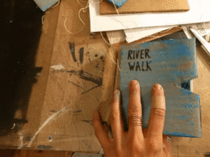
How did you create the River Walk book and what do you hope people take away from it?
River Walk is a kind of functional art work, much more sentimental and straightforward then my typical work. It is a usable notebook made primarily from recycled materials: reused paper, cardboard, old art prints and wood binding. The wood binding was fabricated from materials gathered from a FEMA buy-out home that was deconstructed and transformed into a rain garden and flood storage park, an exciting project done by landscape architect and Rutgers Professor Tobiah Horton. The signature sheets include linocut prints of humans in nature. These images were taken directly from a hike with coLAB Arts on the D&R canal in New Brunswick. The only way to acquire this work is by donating to LRWP. My hope is simply that people enjoy it and use it!
What effect do you think the Windows of Understanding project has on the community or the local environment?
Windows of Understanding is a public art project set in multiple storefront businesses. It operates like a rhizome, utilizing the brain power of local advocates and artists to filter their mission and work through a prompt. This year that prompt is ”We See Through Hate.” I see so much mutual benefit here and I’m excited about the realistic, but hopeful message. Our country is going through rapid change that seems to hark on hard times for so many of us. Americans are under incredible pressure from the media, from the antagonistic government, from the precarious state of healthcare, and from a job market threated by automation. To be truly resilient, in an environment filled with risk, disparate communities should be given opportunities to know each other face to face; to move past bigotry and ignorance and to see through hate. Windows of Understanding will address these struggles, but provide hope and positivity to the surrounding public. I believe this effort will have a positive effect on the passerby, increase the visibility of advocate organizations, and increase community cohesion.
Except as noted, article and photos by Joe Sapia
On the ConRail railroad tracks between Prospect Plains and Cranbury Station on the boundary of Cranbury and Monroe, Middlesex County.
JEEP-LESS, THE BAD: My Jeep Wrangler has been in the shop. A metal plate in the clutch area cracked. When mechanic-friend Frank Ulatowski told me the parts distributor said, I never ordered this part before, I knew this could be trouble. The part, being shipped from Detroit, finally did come in and Frank installed it, but the repair was set back by the need for a second part. The Jeep should be ready Monday. For the past week, though, my travels have been limited – generally confined to walking in my hometown of Monroe and the bordering towns of Helmetta, Spotswood, South Brunswick, Cranbury, and Jamesburg.
JEEP-LESS, THE GOOD: With no work scheduled, I decided to not rent a motor vehicle, instead hoofing it. I have thought about this for years – on my days not working, try to only walk or bicycle. So, I have been constantly walking, along with some bicycling. My longest walk was 11 miles – a trek home from the doctor’s office for a followup on my annual exam in Monroe (to which I taxied), with a detour to Teddy’s luncheonette in Cranbury and, later, supper in Helmetta. Aside from the health benefits of walking, it has taken me on routes less-traveled and slowed me to observe better. So, I have a lot of cool observations to pass along.
An old farm site in Cranbury.
SNOWFALL UPDATE: The two snowfalls on Tuesday, January 30, amounted to an estimated 1.0 inch of snowfall at my Monroe house. This brings the seasonal total to 18.0 inches. The normal season average is about 25.8 inches, recorded in New Brunswick, about 7-1/2 miles away; We still have about 2-1/2 months of snow potential to reach the average.
The view I awoke to, as seen from my bedroom window, on Tuesday, January 30, in Monroe.
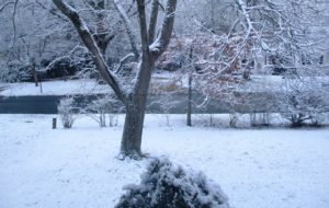
‘POWDERED SUGAR’ SNOW: When I awoke Tuesday, January 30, I found a snowfall that looked as though the vegetation was covered with powdered sugar. It was a beautiful find to start the day!
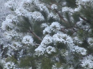
The “powdered sugar” snow on the pitch pine, “Pinus rigida,” in my backyard in Monroe.
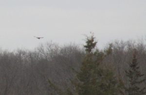
NORTHERN HARRIERS, CONTINUED: I continue to see northern harriers, “Circus cyaneus,” more than I have ever seen. This week, I saw one at Helmetta Pond, Middlesesex County – the first time I recall seeing one there. Remember, as a nester, New Jersey lists them as “endangered,” or in imminent peril. Look for them hunting game by flying low above fields or marshes. They are sleek and have a white rump patch – females are brown, males are gray-white. As Roger Dreyling, birder extraordinaire from Monroe, noted, “I like harriers, especially males, which are sometimes called ‘gray ghosts.’”
A female northern harrier at Helmetta Pond. Notice the white rump patch.
UPPER MILLSTONE RIVER EAGLES NEST: Anne Price and I, volunteers for the state Department of Environmental Protection, have been watching this nest. We agree it appears the eagles are incubating an egg or eggs. For example, I saw an eagle fly by the nest and perched nearby, while it appeared the other one was in the nest. Because bald eagles are a jeopardized species in New Jersey – “endangered,” or under imminent threat as a nester, and “threatened,” or could become “endangered” if conditions persist, in general – we are being discreet in identifying the location of the nest. (In the 2017 state eagles report, http://www.state.nj.us/dep/fgw/ensp/pdf/eglrpt17.pdf, this nest is listed as No. 184, “Upper Millstone.”)
Mallard ducks, “Anas platyrhynchos,” at a fire-suppression pond at the former George W. Helme Snuff Mill in Helmetta. The more colorful male is on the left.
VOICES FROM AFIELD, EAGLE SIGHTINGS: I keep saying, if you want to see bald eagles, look up into the sky. Various reports came in during the week week. Michele Arminio of Monroe reported seeing a flying eagle at Milltown Road, between Route 18 and Ryders Lane, in East Brunswick. Janice Weinman reported seeing one at the South River and its wetlands on the boundary of Old Bridge, Sayreville, and East Brunswick: “Flying out of the marshlands area on the east side of Bordentown Avenue, flying towards east Brunswick. It was an adult as it had its white head, but not too big. I was surprised to see one there. I was not aware of any in that area.” Actually, this one could be nesting in the Old Bridge area. A pair, there, has repeatedly moved its nest and, last year, a nest could not be located. Paul Reed reported an eagle at Helmetta Pond. Roger Dreyling of Monroe reported an immature eagle at “Jamesburg Lake” (Lake Manalapan) in Monroe. Duke Farms in Hillsborough, Somerset County, has a camera on its eagle nest, http://dukefarms.org/making-an-impact/eagle-cam/.
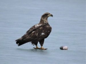
An immature bald eagle – notice the lack of white head and tail – with a fish at “Jamesburg Lake” (Lake Manalapan) in Monroe in January. (Photograph copyright 2018 by Roger Dreyling)
MUTE SWANS: Ugh, I dislike mute swans, “Cygnus olor,” non-natives that hurt local ecosystems through their aggressive eating of aquatic vegetation and scaring off native species. But they are naturalized here…. This week, I saw a pair at Helmetta Pond.
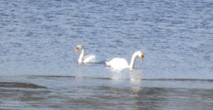
Mute swans on Helmetta Pond.
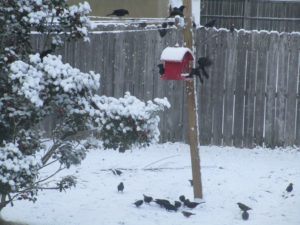
BACKYARD SHRUB PILE: I keep a pesticide- and fertilizer-free yard. It is only a quarter-acre, or about 10,000 square feet. But it is productive — a vegetable and fruit garden of more than 1,000 square feet, bird-feeders, bird baths. Roughly only 10 percent of rainwater drains off the property. One of the pro-environment bits of my property is the brush pile and tall-grass patch I keep in the backyard. The brush pile, for example, is a place for birds to retreat to and perch. This week, I photographed a few house sparrows, “Passer domesticus,” is the pile. (I was happy to see the brush pile being used, despite being used by house sparrows, a non-native species.)
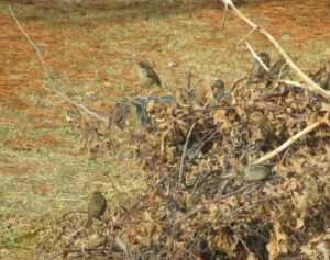
House sparrows in the backyard bush pile.
OTHER YARD BIRDS: I took random photos of various bird species in my yard: cardinal, “Cardinalis cardinalis”; dark-eyed juncos, “Junco hyemalis,” or “snowbirds”; red-bellied woodpecker, “Melanerpes carolinus”; and grackles, “Quiscalus quiscula.”
A cardinal, “Cardinalis cardinalis,” in the backyard pitch pine.
Snowbirds – one at the niger feeder, one perched nearby, one flying in.
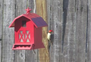
Red-bellied woodpecker at the sunflower kernel feeder.
Grackles at the feeder.
VOICES FROM AFIELD, ROBINS: “Polish Paul” Migut, a friend going back to childhood, checked in on robins, “Turdus migratorius.” He, too, had them in his South River yard. “Thursday (February 1) morning, looking into my rear yard, spotted about 10 to 12 robins,” Paul said. “Looked very healthy, plump.” Again, some may consider a robin as a sign of spring, but they are year-around.
RED-TAILED HAWKS: This week, I was able to get some pretty close-up photographs of red-tailed hawks, “Buteo jamaicensis.” Looked for them perched, soaring with a creamy underbelly look and rust-colored tail, or a big bird flying and flapping its wings about a half-dozen times.
A red-tailed hawk perches in a tree and watches over farmland in South Brunswick.
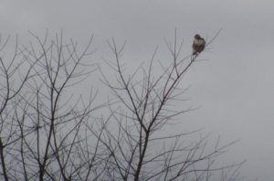
A closeup of the South Brunswick red-tailed hawk.
A red-tailed hawk perches in a tree near New Jersey Turnpike Exit 8-A in Monroe.
DEAD GREAT BLUE HERON: I was hiking in the Pine Barrens around Helmetta and at Cranberry Bog came across a dead blue heron, “Ardea Herodias.” It was lying on dry ground, inches from the water. Its eyes were in place and its body supple, so it probably was not dead all that long. I saw no obvious cause of death. Its anal area was ripped up a bit, but that likely was caused by a scavenger after death. I talked to Rick Lear, head of the Middlesex County Office of Parks and Recreation, about it and he speculated it died of starvation, because of the difficulty of finding food, such as aquatic animals and small mammals, this time of year.
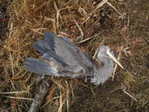
A great blue heron I found dead at Cranberry Bog in Monroe.
FARMLAND, DEVELOPABLE LAND: I recall saying, “Potatoes like dry feet and so do developers.” Well, look at this gravelly, or well-drained, farmland in South Brunswick. Nice developable land, unfortunately! Even more unfortunate is it being located on the New Jersey Turnpike, near an exit, 8-A.
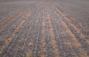
Gravelly farmland in South Brunswick.
PHRAGMITES: I am noticing a lot of invasive reed grass, genus “Phragmites.” This stuff really clogs wetlands and is difficult to control. It is not only bad for the environment, but also for drainage. Beware in heavy rain, this will contribute to flooding. And phragmites invasion is only getting worse, from what I see.
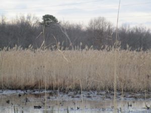
Phragmites clogging Cranberry Bog in Monroe.
BARKING FOX: One night, I stood in my yard and listened to this yip, yip, yip call from the woods or near the woods. It was a red fox, “Vulpes vulpes.” So, do not only look, but listen. Nature is all around us.
NON-POINT SOURCE POLLUTION: I was walking in the Manalapan Brook floodplain in Helmetta and there it was, non-point source pollution – garbage — that got into the water system and floated about. Ever seen those notices about garbage getting into storm drains? They really mean it. Throw a plastic bottle out of a car miles inland and, at least in theory, it could wind up in the ocean. Even if it does not wind up in the ocean, it could wind up in the freshwater system. And even if it does not do that, it is still litter.
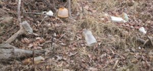
Non-point source pollution in the Manalapan Brook floodplain at Helmetta.
ATLANTIC OCEAN TEMPERATURES: The Atlantic Ocean temperature along the New Jersey coast was running at about 35 to 37 degrees on the February 3-4 weekend.
SUNRISE/SUNSET: From Sunday, February 4, to Saturday, February 10, the sun will rise about 7 a.m. and set 5:25 p.m. From Sunday, February 11, to Saturday, February 17, the sun will rise about 6:45 to 6:55 a.m. and set at about 5:30 to 5:35 p.m.
WEATHER: The National Weather Service forecasting office serving the Jersey Midlands is at http://www.weather.gov/phi/.
Deer damage to arbor vitae trees at the old George W. Helme Snuff Mill power plant in the Helmetta.
Joe Sapia, 61, is a lifelong resident of Monroe — in South Middlesex County, where his maternal family settled more than 100 years ago. He is a Pine Barrens naturalist and an organic gardener of vegetables and fruit, along with zinnias and roses. He draws inspiration on the Pine Barrens around Helmetta from his mother, Sophie Onda Sapia, who lived her whole life in these Pines, and his Polish-immigrant grandmother, Annie Poznanski Onda. He gardens the same backyard plot as did his Grandma Annie and Italian-American father, Joe Sr. Both are inspirations for his food gardening. Ma inspires his rose gardening. Joe is a semi-retired print journalist of almost 40 years. His work also is at @JosephSapia on Twitter.com, along with Facebook.com on the Jersey Midlands page.
Copyright 2018 by Joseph Sapia
**Please note date change**
For our March 12 general meeting, in recognition of the 2018 World Water Day theme of “Nature for Water,” we have asked Rutgers Professor JeanMarie Hartman to present on “The Role of Forests as Green Infrastructure.” As part of this presentation, Professor Hartman will provide an overview of a proposal to reforest vacant lots in Perth Amboy as a way to manage combined sewer overflow events.
The design suggestions will be compared to current best management standards and practices. Discussion will also elucidate several points regarding the relationships between human and natural systems such as resource conservation, habitat restoration and creation, and urban ecology.
The meeting will be held from 10-noon in the Middlesex County Planning Offices at 75 Bayard Street, New Brunswick, NJ – 5th floor mid-size conference room.
Parking is validated for those parking on floors 5 and higher in the RWJ Wellness Parking Deck located at 95 Paterson Street, New Brunswick, NJ 08901. Be sure to bring your ticket to the meeting for validation.
For more information contact Heather: hfenyk AT lowerraritanwatershed DOT org
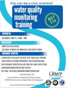
Please join us for our May visual habitat assessment training with the LRWP and WMA9 Americorps Watershed Ambassador Rob Hughes! (Here’s more on the LRWP’s water quality monitoring programs).
This FREE training on Saturday May 5 will run from 9 AM – 1 PM at the Middlesex High School, located at 300 John F Kennedy Dr, Middlesex, NJ 08846
We will start the morning with a lecture indoors, and then get out in the field to test our knowledge of streams and stream habitat.
Please wear clothing and footwear that you don’t mind getting wet and dirty.
RSVP required, E-mail Rob Hughes: wsamb@raritanbasin.org