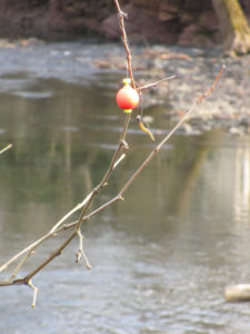
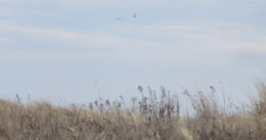
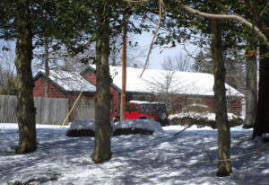
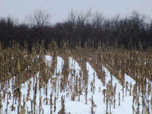
Eager and hungry fox pups survived the mercurial spring floods to feed voraciously on mom in the bright sunlight of a late April morning.
April is the quintessential month of spring, the first month to start with a vowel after a bleak winter of hard consonant constructed months. The name April is probably derived from the Latin infinitive, aperere, ‘to open’, but that consideration is at the risk of offending the claims of the goddess of love, Aphrodite, and Apollo the son of Zeus, their namesake month.
I see April as a grand series of ever changing dance steps performed in tune to the great celestial choreography of the planets and stars. One planetary misstep and the world comes crashing down. It is, however, a play without flaw that brings the predictability of the seasons and the impish April to improvise her set of daily surprises that precede the full bloom of May.
April is a charming minx with dancing green eyes whose mercurial ways give false hope to early gardeners as she whirls in the white robes of a sudden snow squall. Days of bright sunshine are mixed with bone chilling moist air, frosts and gentle rain or hailstorms of biblical proportion. These are the veils April sheds as she improvises dance steps to tease and mislead, all the while faithfully delivering the solemn promise of May.
Edwin Way Teale, a noted author and naturalist claims that, “spring approaches from the south at fifteen miles a day”. If you were to drive from New Jersey to Maine in mid April, you could actually see spring approach.
Travelling north, you go back in time to see spring begin.
As you drive through New Jersey, forsythia planted along road medians would be in full yellow bloom as tree buds give birth to pale green leaves.
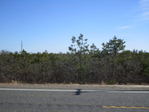
The crowns of naturalized red maple dominated hardwoods would have shed their maroon veil to now wear a haze of light green unfurling leaves that will continue to darken as they mature
Oak dominated hillsides and lowlands scattered with black gum, hard maple, beech, ash and sycamore appear as colorful as autumn with interlacing crowns covered in non reflective red, yellow, pink and salmon hued emerging leaves.
The color and blooms slowly fade as you travel north. The further you travel in one day, the more the landscape appears as if drawn on individual sheets of paper flicked by hand to appear as if moving. The individual frames of the ‘movie’ become alive and reveal the living, leading edge of the manifestations of spring.
The return journey south allows you to enjoy the second coming of spring and the insight that comes with a second chance.
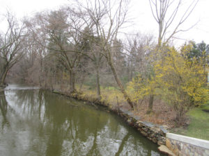
Along the South Branch, a Great Horned Owl has been nurturing a clutch of eggs that will produce at least one full sized, flightless owlet to stand constantly alert for parental food deliveries in mid April.
During two trips down the South Branch in February and March, a female red fox ran along the river bank to expose herself as if to draw me away from her riverside den. She would run along the bare vertical bank then walk out onto a gravel bar, sit down and watch me approach. When I got too close she would run off and wait further downstream. At one point she ran across a sand bar that was flanked by a pair of mallards standing on the bare ground and a great blue heron posed in foot deep water. All three birds stood perfectly still as the fox ran between them. Neither the ducks nor the heron made any move to escape as if they knew the fox was not a threat that day.
I can only hope the fox waited until April to have her pups in light of the flood that came in late March. Perhaps April will reveal a gentle rain that favors the survival of not only the fox pups, but the bank swallows, flycatchers, muskrat and turkeys that might have dens or nests close to the riverbank and flood plain.
It is amazing how migration, breeding, births and nurturing coincide with seasonal events as if truly participating in a dance whose every step is critical to survival.
We have evolved physiologically to fit into a small, ‘temporary’ niche circling in an eddy on the river of change. If the changes take place faster than we can evolve, we go away.
Despite the vagaries of April’s whim, she shows the world an emergence of life that has learned her fickle ways and dances in step to lovingly embrace such a wild partner.
Author Joe Mish has been running wild in New Jersey since childhood when he found ways to escape his mother’s watchful eyes. He continues to trek the swamps, rivers and thickets seeking to share, with the residents and visitors, all of the state’s natural beauty hidden within full view. To read more of his writing and view more of his gorgeous photographs visit Winter Bear Rising, his wordpress blog. Joe’s series “Nature on the Raritan, Hidden in Plain View” runs monthly as part of the LRWP “Voices of the Watershed” series. Writing and photos used with permission from the author.
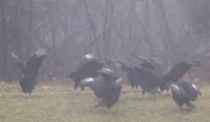
The dance of the black vultures, “Coragyps atratus,” in a professional park in Plainsboro, Middlesex County. These vultures were near a deer carcass, so they could have been spreading their wings to rid them of any bacteria picked up while feeding on the dead body. Or it could be a simple drying of the wings, although the day was foggy.
BLACK VULTURES, UP FROM THE SOUTH: As I have mentioned in the past, I do not recall seeing a black vulture, “Coragyps atratus,” until about the middle 1990s. They are more of a southeastern United States species. Now, I see them frequently in the Jersey Midlands. The species “has expanded range northward in the northeast, but has declined in parts of southeast,” according to the National Audubon Society’s website. “Loss of good nest sites in large tree hollows may be one cause.”
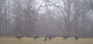
Black vultures on a foggy day in a professional park in Plainsboro, Middlesex County.
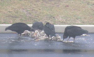
BLACK VULTURES ON A CARCASS: In a professional park in Plainsboro, Middlesex County, lie a well-picked-over carcass of a deer, “Odocoileus virginianus,” presumably the victim of motor vehicle accident. It was not picked-over enough for black vultures, “Coragyps atratus,” to be uninterested. There were about 10 on or near the carcass. Black vultures feed on “mostly carrion,” according to the National Audubon Society website. The species “feeds on carcasses of dead animals of all sizes.” And from Cornell University’s All About Birds website, “Turkey vultures (“Cathartes aura”) have an excellent sense of smell, but black vultures aren’t nearly as accomplished sniffers. To find food they soar high in the sky and keep an eye on the lower-soaring turkey vultures. When a turkey vulture’s nose detects the delicious aroma of decaying flesh and descends on a carcass, the black vulture follows close behind. One on one at a carcass, black vultures lose out to the slightly larger turkey vulture. But flocks of black vultures can quickly take over a carcass and drive the more solitary turkey vultures away.” I saw no turkey vultures at the carcass.
Black vultures on a deer carcass in a professional park in Plainsboro, Middlesex County.
DEER DAMAGE: Damage from browsing deer, “”Odocoileus virginianus,” is quite apparent, if you know what to look for. Look where ornamentals are planted. If you see arbor vitae with a thin bottom and a tipped top, kind of like an arrow pointed upward, you are probably looking at deer damage — the bottom being what is easily reachable to the deer, the top being harder to reach or out of reach.
Deer damage on these evergreen ornamental trees on a foggy day in a professional park in Plainsboro, Middlesex County.
MULCHING TREES: The concept of mulching a tree is to retain water to the root area while the tree is getting established. Well, if you are going to mulch, please do it correctly. That is, think “doughnut,” not “volcano.” Regarding the proper way, build a “doughnut” outside of the trunk — the hole around the trunk, the ring not touching any trunk or roots. Run the rim out to the end of the root ball or to the end of the tree canopy. The mulch should be only 2- to 3-inches deep. (Regarding a volcano, its massive depth could introduce and hold contaminants, while its touching the tree could introduce contaminants to the tree itself. Also, why mulch an established tree? Aesthetics — and property owners love aesthetics. Sorry, but I view that as image over substance.
Volcanoes, the wrong way to mulch a tree. Here in a professional park in Plainsboro, Middlesex County.
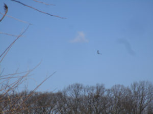
THE DRIVE-BY NATURALIST: A doctor’s appointment in this Plainsboro, Middlesex County, professional park got me a lot of material for this writing. So, as I keep reminding, be prepared. There is a lot of nature around us. As much as I preach about keeping an eye out for things happening in the natural world, I missed a rare photograph — a flying adult bald eagle, “Haliaeetus leucocephalus,” and an Air Force jet circling Joint Base McGuire-Dix-Lakehurst. Per my duties as a state Division of Fish and Wildlife volunteer, I was observing the Upper Millstone River eagle nest on the boundary of Mercer and Middlesex counties, including shooting photographs. An adult eagle left the nest and was circling the area, flying farther and farther south from the nest — in the direction of the military base. At the same time, the Air Force cargo plane was circling the base. There they were, two flying symbols of American freedom in one frame. Well, nowadays, I have only a point-and-shoot camera. Instead of focusing on the eagle and plane in the background, the camera focused on the tree branches in the foreground. So, the eagle and plane are a blur. My fault. Despite the capture-the-moment shot, I should have made sure the camera was properly focused.
A missed photograph opportunity of two flying symbols of American freedom — a bald eagle circling in front of the Upper Millstone River nest and a plane circling Joint Base McGuire-Dix-Lakehurst.
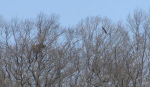
UPPER MILLSTONE RIVER EAGLES: The bald eagles, “Haliaeetus leucocephalus,” on the Upper Millstone River nest on the boundary of Mercer and Middlesex counties seem to have been attending to their young for weeks. So, the baby or babies — it is unknown if there is one baby or more in the nest — should fledge in early to mid-May on the early end to early June on the far end. Then, the family should stay together in the area. After fledging, the young eagle or eagles should stay in the area until about early September to early December. (The bald eagle remains in New Jersey an “endangered” breeder – that is, in immediate jeopardy as a breeder – and “threatened” in general – that is, in danger of becoming “endangered” if conditions deteriorate.)
An adult bald eagle flies into the Upper Millstone River nest, left, on the boundary of Mercer and Middlesex counties.
SNOWFALL THIS WEEK: This week at my house in Monroe, Middlesex County, snow fell Monday, April 2 — and estimated 2 inches. Also on April 2, I noticed the first forsythia blooming this season in Mercer County (Hightstown and East Windsor) and Middlesex County (Cranbury and South Brunswick).
Forsythia blooming along Cranbury Brook in Cranbury, Middlesex County.
SNOWFALL TO DATE: With the Monday, April 2, snowfall of about 2 inches at my house in Monroe, Middlesex County, the seasonal snowfall total is 42.5 inches. What a late snow period — prior to March 2, 21.5 inches fell; from March 2 to April 2, 21 inches fell. (The seasonal average at New Brunswick, about 7.5 miles away, is about 26 inches.)
A tranquil Brainerd Lake (informally “Cranbury Lake”) in Cranbury, Middlesex County, on the day it last snowed, Monday, April 2. It was a wet snow of about 2 inches and melted very quickly — before this photograph was taken in the afternoon.
SNOWFALL, I TOLD YOU SO: I keep noting we can get snowfall until about April 15. This year, it is proving true. Based on my record-keeping, since the winter of 1995-1995, the latest snowfall accumulation in Monroe, Middlesex County, was 3.5 inches in 1996, April 9-10, and the latest snowfall without accumulation was in 2007, April 16.
From the Joey Archives: 1996, April 9, Tuesday — Snow on blooming forsythia in Hamilton Square, Mercer County.
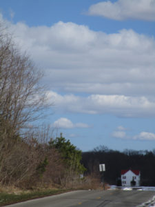
SUNRISE AND SUNSET: For the week of Sunday, April 8, Sunday, to Saturday, April 14, the sun will rise from about 6:30 to 6:20 a.m. and set about 7:30 to 7:35 p.m. For the week of Sunday, April 15, to Saturday, April 21, the sun will rise about 6:20 to 6:10 a.m. and set about 7:35 to 7:45 p.m.
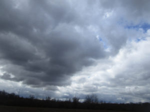
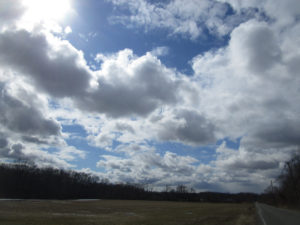
Sky photo, No. 1: My backyard in Monroe, Middlesex County.
ATLANTIC OCEAN TEMPERATURE: The Atlantic Ocean temperature off New Jersey was about 45 degrees.
Sky photo, No. 2: “Jamesburg Lake” (properly “Lake Manalapan”) in Thompson Park on the Jamesburg-Monroe boundary of Middlesex County.
WEATHER: The National Weather Service office serving the Jersey Midlands is at https://www.weather.gov/phi/.
Forsythia blooming in a front yard of a house in East Windsor, Mercer County.
April 11, Wednesday, 9 a.m. to 3:30 p.m., Somerset County, Hillsborough: The 10th Annual New Jersey Invasive Species Strike Team Conference, Duke Farms, Route 206. More information is available from the Friends of Hopewell Valley Open Space, email info@fohvos.org.
April 14, Saturday, 9:30 a.m. signup, 10 a.m. to 1 p.m., Middlesex County, East Brunswick: The 15th Annual Farrington Lake Cleanup, Bicentennial Park, Riva Avenue and Hardenburg Lane. (Rain date, April 15, Sunday, 1 to 4 p.m.). More information is available from Michael Shakarjian at telephone 732-828-3275, Alan Godber at 732-846-4476, website http://www.lbwp.org, or email contact@lbwp.org.
April 21, Saturday, 11 a.m. to 2 p.m., Burlington County, Southampton: The Pinelands Preservation Alliance’s 13th Annual Native Plant Sale, Alliance headquarters, 17 Pemberton Road (Route 616). More information is available from the alliance, telephone 609-859-8860 or website http://www.pinelandsalliance.org.
April 28, Saturday, 10 a.m. to 4 p.m., Middlesex County, New Brunswick: Rutgers University Ag Field Day, Cook Campus, Route 1 and Ryders Lane. More information is available at website http://agfieldday.rutgers.edu.
April 28 and 29, Saturday and Sunday, Hunterdon County, Lambertville: Shad Fest event of environmentalism, entertainment, food, crafts. More information is available at http://www.shadfest.com.
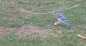
Now, this is a Jersey blue jay, a blue jay, “Cyanocitta cristata,” that eats pizza. In my backyard in Monroe, Middlesex County.
Joe Sapia, 61, is a lifelong resident of Monroe — in South Middlesex County, where his maternal family settled more than 100 years ago. He is a Pine Barrens naturalist and an organic gardener of vegetables and fruit, along with zinnias and roses. He loves the Delaware River north of Trenton and Piedmont, too.
He draws inspiration on the Pine Barrens around Helmetta from his mother, Sophie Onda Sapia, who lived her whole life in these Pines, and his Polish-immigrant grandmother, Annie Poznanski Onda.
He gardens the same backyard plot as did his Grandma Annie and Italian-American father, Joe Sr. Both are inspirations for his food gardening. Ma inspires his rose gardening.
Joe is a semi-retired print journalist of almost 40 years. His work also is at @JosephSapia on Twitter.com, along with The Jersey Midlands page on Facebook.com on the Jersey Midlands page.
Here at Rock Brook on Sourland Mountain in Montgomery, Somerset County, and in other New Jersey locales, trout fishing formally opens Saturday, April 7, at 8 a.m.
ROCK BROOK: Rock Brook has its headwaters on Sourland Mountain, from which it drains about 3.2 square miles into Beden Brook below the mountain to the east in the area of Skillman Park. Beden Brook, then, crosses Route 206 and flows into the Millstone River between Rocky Hill and Griggstown. These few miles of flow are all in Montgomery, Somerset County. Rock Brook is filled with traprock, one of the characteristics of the Piedmont geologic area.
A rite of passage of fishing, getting snagged in a tree. Here, a bobber and lure snagged along Rock Brook at Bessie Grover Memorial Park on Sourland Mountain in Montgomery, Somerset County. Bessie Grover was a local resident. Her history is at http://www.stoutsburgcemetery.org/stories/bessie-grover/.
Sky photo 1: East Windsor, Mercer County.
HARRY’S ARMY/NAVY: Harry’s Army/Navy, a military surplus and outdoors retail institution on Route 130, is closing. In the summer of 1974, as I headed to my freshman year at Marquette University’s College of Journalism in Wisconsin, I bought my pea coat at Harry’s for $45. Since, I have bought many a thing: shoes, shirts, denim jacket, neckerchief, belts, T-shirts, knapsack, bright orange safety vest, pocket knife, flashlight…. I am so sad to see Harry’s go. What will I do, now? See http://www.nj.com/mercer/index.ssf/2018/03/post_180.htmland http://www.nj.com/mercer/index.ssf/2018/03/17_things_harrys.html#incart_river_index. Harry’s website, http://harrysan.com.
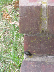
I believe this is an oil beetle, genus “Meloe,” on my back porch in Monroe, Middlesex County. Why “oil”? Because they have a defense of secreting an oily substance.
THE SOUNDS OF SPRING: As I was leaving my house in Monroe, Middlesex County, I heard the cooing of a mourning dove, “Zenaida macroura,” sounding as though it was coming from the Manalapan Brook floodplain’s swamp hardwood forest. Earlier by a day or two, I heard another bird, although I do not know the species, colorfully singing. Then, another bird singing away. Oh, and the spring peeper treefrogs, “Pseudacris crucifer,” are really calling away. This is the sound of spring.
The emergence of this oil beetle on my back porch is another sign of spring.
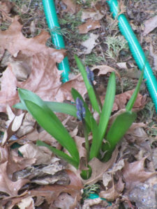
‘ONION SNOW’: I learned a new term, “onion snow.” It means a snow that comes after onions have been planted and are sprouting or when they should be planted. In other words, a late snow that melts quickly. In New Jersey, the Rutgers University Cooperative Extension advises planting onions in April. So, here we are, with an “onion snow” forecast for the Sunday-Monday, April 1-2, overnight. As for wild onions, they have been sprouting for weeks.
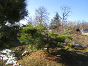
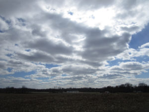
Sky photo 2: Farmland in Monroe, Middlesex County.
SPRING SNOW: A spring snow tends to be wet and heavy. In a recent snow, a pitch pine, “Pinus rigida,” in my backyard in Monroe, Middlesex County, broke. It already was weakened — I noticed what I believe were woodpecker peck marks in it — for whatever reason. The pitch pine is the common pine of the Pine Barrens and I dug up this one in my local woods and transplanted it in my yard. So, it is not normally used as an ornamental. Because it is more forest tree, I am leaving it in place, broken — as it would sit in the woods. I did remove the broken limbs and added them to my brush pile, a favorite place of house sparrows, “Passer domesticus.”
The snow-broken pitch pine in my backyard.
Another view of the snow-broken pitch pine in my backyard.
I added the broken branches from the damaged pitch pine to the wildlife bush pile in my backyard.
NO EAGLETS AT DUKE FARMS: I have been watching the live camera on the Duke Farms nest of bald eagles, “Haliaeetus leucocephalus,” pre-nor’easter snow, during a nor’easter, and after a nor-easter. During a nor’easter, an eagle covered in snow sat on an egg or eggs. Sadly the nest at Duke Farms in Hillsborough, Somerset County, is done for the season, with no successful hatching of the two eggs. See the story at http://www.nj.com/somerset/index.ssf/2018/03/duke_farm_devastated_after_eagle_cam_nest_fails.html. This means the Duke Farms nest is done for the season.
Sky Photo 3: Farmland in Monroe, Middlesex County.
UPPER MILLSTONE RIVER EAGLES: For a few weeks now, the bald eagles, “Haliaeetus leucocephalus,” at the Upper Millstone River nest on the boundary of Middlesex and Mercer counties have been feeding a chick or chicks. This was based on watching the adults, either standing high on the nest or flying in or out frequently — as if they were taking care of, feeding, an eaglet or more than one. This week, Ann Price, my fellow volunteer nest monitor, “saw the adult feeding the chick/s. I did catch a glimpse of an eaglet. No idea how many are there. But I can confirm one.”
Sky photo 4: Farmland in Monroe, Middlesex County.
MYSTERY OF THE BIG CATS: Recently, there have been reports of a mystery big cat in Ewing, Mercer County, and Helmetta, Middlesex County. Mountain lion? Doubtful. Bobcat? Maybe. Domestic cat? Probably. These mystery big cat sightings happen every so often. During my newspaper reporting days, I kept a file on them. Normally, they never amount to anything conclusive.
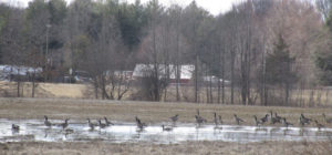
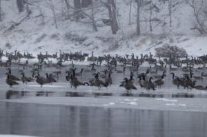
Canada geese, “Branta canadensis,” at a puddle on farmland in Monroe, Middlesex County.
SUNRISE AND SUNSET: For the week of Sunday, April 1, to Saturday, April 7, the sun will rise about 6:40 to 6:30 a.m. and set about 7:20 to 7:30 p.m. For the week of Sunday, April 8, Sunday, to Saturday, April 14, the sun will rise from about 6:30 to 6:20 a.m. and set about 7:30 to 7:35 p.m.
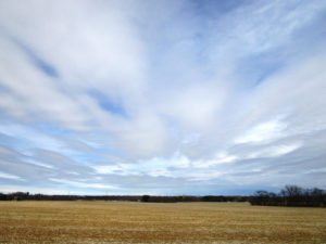
A field of Indian grass in Montgomery, Somerset County.
ATLANTIC OCEAN TEMPERATURE: The Atlantic Ocean temperature off New Jersey is about 45 degrees.
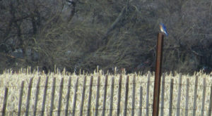
An eastern bluebird, “Sialia sialis,” sits on a snowfence post in Montgomery, Somerset County. It is a male, identifiable because of its bright colors.
WEATHER: The National Weather Service office serving the Jersey Midlands is at https://www.weather.gov/phi/.
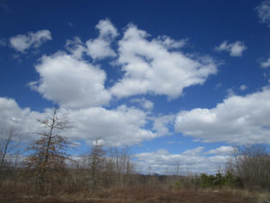
Sky photo 5: Farmland in Monroe, Middlesex County.
UPCOMING:
April 9 to 15, Monday to Sunday, Mercer County: The annual Princeton Environmental Film Festival, https://www.princetonlibrary.org/peff/.
HEARINGS ON GAS PIPELINE EXPANSION: The Federal Energy Regulatory Commission (FERC) has schedule hearings on the “draft environmental impact statement” for the Northeast Supply Enhancement project’s natural gas pipeline expansion through the Jersey Midlands. Hearings are scheduled for:
April 25, Wednesday, 5 to 9 p.m., in Middlesex County, Old Bridge, at the George Bush Senior Center.
April 26, Thursday, 5 to 9 p.m., in Brooklyn, New York, at the Best Western Gregory Hotel.
May 2, Wednesday, 5 to 9 p.m., in Somerset County, Franklin, at the Franklin Township Community Center.
May 3, Thursday, 5 to 9 p.m., in Quarryville, Pennsylvania, at Solanco High School.
Sunset in my backyard in Monroe, Middlesex County.
Joe Sapia, 61, is a lifelong resident of Monroe — in South Middlesex County, where his maternal family settled more than 100 years ago. He is a Pine Barrens naturalist and an organic gardener of vegetables and fruit, along with zinnias and roses. He loves the Delaware River north of Trenton and Piedmont, too.
He draws inspiration on the Pine Barrens around Helmetta from his mother, Sophie Onda Sapia, who lived her whole life in these Pines, and his Polish-immigrant grandmother, Annie Poznanski Onda.
He gardens the same backyard plot as did his Grandma Annie and Italian-American father, Joe Sr. Both are inspirations for his food gardening. Ma inspires his rose gardening.
Joe is a semi-retired print journalist of almost 40 years. His work also is at @JosephSapia on Twitter.com, along with Facebook.com on the Jersey Midlands page.
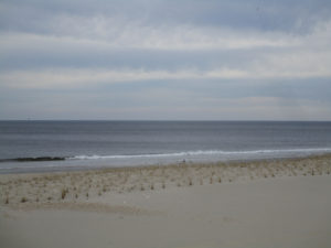
Gulls flying above a dune along the Atlantic Ocean at Spring Lake, Monmouth County.
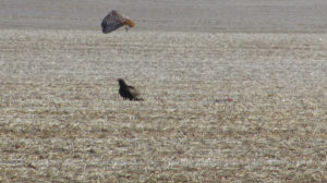
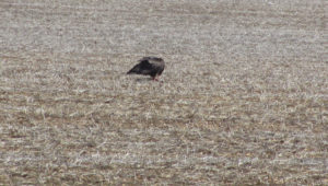
DRIVE-BY NATURALIST: As I was driving along a road in Monroe, Middlesex County, I looked at farmland and saw two birds — a red-tailed hawk, “Buteo jamaicensis,”on a dead animal, the other, a turkey vulture, “Cathartes aura,” standing aside. When the red-tail left, the turkey vulture began feasting on the dead animal, while another turkey vulture flew in. It appears the turkey vultures were not messing with a red-tail.
Photo 1: A turkey vulture, bottom, awaits its turn on a dead animal, to the right of the vulture, as a red-tail hawk got done eating and flies away. Moral of this story: Do not mess with a red-tail.
Photo 2: The red-tail flies off.
Photo 3: The turkey vulture gets its turn on the dead animal.
Photo 4: Another turkey vulture flies in.
HOLLYWOOD AND THE RED-TAILED HAWK: “The Red-tailed Hawk has a thrilling, raspy scream that sounds exactly like a raptor should sound,” according to Cornell University’s All About Birds website. “At least, that’s what Hollywood directors seem to think. Whenever a hawk or eagle appears onscreen, no matter what species, the shrill cry on the soundtrack is almost always a Red-tailed Hawk.” The site adds, “This is probably the most common hawk in North America. If you’ve got sharp eyes, you’ll see several individuals on almost any long car ride, anywhere.”
A red-tailed hawk flies over field and farmland on the boundary of Monroe and Cranbury in Middlesex County.
SNOW: From the snowfall of Tuesday to Thursday, March 20 to 22, the National Weather Service is reporting the following totals by county. They are broken down, here, by the low number of inches to the high number, but they may not reflect complete totals from around each county:
Burlington County: 7.3 inches in Cinnaminson to 11.9 inches in Mount Holly.
Hunterdon County: 6.7 in Wertsville to 14 in the Byram area.
Mercer County: 6 in the Princeton area to 9.1 in the Hightstown area.
Middlesex County: 5 in south Old Bridge to 12.5 at Cheesequake. (I recorded about 11 inches in the part of Monroe between Helmetta and Jamesburg.)
Monmouth County: 8.5 in Keyport to 13 in Lincroft.
Ocean County: 5.8 in the Lakehurst area to 15 in Lacey.
Somerset County: 5.6 in Watchung to 8.5 in the Bedminster area.
Turtle Creek on the Helmetta-Monroe boundary in Middlesex County after the Tuesday to Thursday, March 20 to 22, snowfall.
SNOWFALL TO DATE: At my house in Monroe, Middlesex County, the season’s snowfall to date has been 40.5 inches. Normal at New Brunswick, Middlesex County, or about 7.5 miles away, is about 26 inches. We are well past normal, with about three weeks of snow season to go. Interestingly, nearly half the snowfall, or 19 inches, has been in the last three weeks — of March!
Joey’s house in Monroe, Middlesex County, in the snow.
CLIMATE CHANGE AND THE WEATHER: Jennifer Francis, a research professor at Rutgers Univeristy, talks about climate change’s impact on weather, http://www.philly.com/philly/opinion/commentary/climate-change-noreaster-spring-snow-opinion-20180322.html.
The Wednesday, March 21, nor’easter party at the Hightstown Diner, Mercer County.
GARDEN WRITING: The “Garden Writing” course I am teaching in the Princeton Adult School began this week. So, I have spent some time reading student papers, covering such topics as farm life in Delaware, Hunterdon County; orchids; Grandma’s pansies; and a lemon tree. All the papers have been enjoyable reads by area writers.
A farm scene in the Applegarth section of Monroe, Middlesex County.
MY GARDEN, NO. 1, PLANTING: The back portion of my backyard has as far back as I can remember in my 61 years been called “The Garden,” where my father, Joe Sr., and Grandma Annie Poznanski Onda grew vegetables and fruit. I still garden it, that patch being about 15 feet in depth and 75 feet in width, or a little more than 1,100 square feet. Before this week’s snow, I plowed up The Garden. Some look to St. Patrick’s Day, March 17, to plant peas and I had my Burpee Sugar Snap Peas in hand, but I viewed St. Paddy’s Day as too early. Instead, I was looking to plant the peas in early April. Finally, on Saturday, March 24, I broke down and planted two rows, or about 30 feet, of the Burpee Sugar Snap Peas. I also planted a row, or about 15 feet, of Burpee heirloom Touchon Carrot, because I had some old seeds around.
“The Garden” plowed up in my backyard in Monroe, Middlesex County.
MY GARDEN, NO. 2, ORDERING SEEDS: I ordered the rest of my early garden seeds, along with the summer garden stuff, all from Burpee. The early stuff: heirloom Touchon Carrot, Kaleidoscope Blend Carrot, Salad Bowl Lettuce, Early Wonder Beet, and heirloom Bloomsdale Long Standing Spinach. The summer seeds: Red Currant cherry tomatoes, heirloom Rutgers Tomato, Silver Queen Hybrid Corn, Straight Eight Organic Cucumber, heirloom Big Mama Lima Bean, and heirloom Hales Best Jumbo Cantaloupe. Also for the summer season, I bought various varieties of Burpee zinnia for fresh cuts and to attract pollinators — Envy, Candy Cane Mix, Old Mexico, Forecast, and Raspberry Lemonade Mix.
MY GARDEN, NO. 3, ZINNIA: Last year was the first year I grew zinnia. I bought them to attract pollinators, which they did — especially various species of butterfly. And I always had fresh cuts. Zinnia, too, are easy to grow. Also nice about zinnia is it being an annual, so I am not introducing an invasive non-native plant. I fell in love with zinnia. This year, I plan on putting the seeds of various varieties in a jar, shaking the jar, and planting the seeds in a big mix. So far, I plan these Burpee varieties — Envy, Candy Cane Mix, Old Mexico, Forecast, Raspberry Lemonade Mix, Cut and Come Again, Giant Flowered, and Big Tetra. If I need more, I will buy more. If I have too much seed, I will save the extra or take the view, “You cannot have too much zinnia seed.”
ELSEWHERE IN THE YARD: Ma (Sophie Onda Sapia) died at 81-years-old in 1995. But her flowers still grow in the front yard.
Ma’s flowers in the front yard of my home in Monroe, Middlesex County.
FULL MOON: The next full moon is Saturday, March 31, the second full moon of March. The first one was March 1.
A half-moon with clouds passing in front of it, as viewed from my backyard in Monroe, Middlesex County.
SUNRISE AND SUNSET: For the week of Sunday, March 25, to Saturday, March 31, the sun will rise from about 6:55 to 6:45 a.m. and set about 7:15 to 7:20 p.m. For the week of Sunday, April 1, to Saturday, April 7, the sun will rise about 6:40 to 6:30 a.m. and set 7:20 to 7:30 p.m.
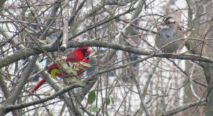
A cardinal, “Cardinalis cardinalis,” and a white-throated sparrow, “Zonotrichia albicollis,” in my sideyard in Monroe, Middlesex County.
ATLANTIC OCEAN TEMPERATURE: The Atlantic Ocean temperature off New Jersey is about 40 degrees.
A calm, flat Atlantic Ocean at Sea Girt, Monmouth County.
WEATHER: The National Weather Service office serving the Jersey Midlands is at https://www.weather.gov/phi/.
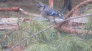
A HAWK?: Have you ever heard a blue jay cry like a hawk? “The blue jay frequently mimics the calls of hawks, especially the red-shouldered hawk” according to Cornell University’s All About Birds website. “These calls may provide information to other jays that a hawk is around, or may be used to deceive other species into believing a hawk is present.”
A blue jay, “Cyanocitta cristata,” helping itself to sunflower seeds in the backyard of my Monroe, Middlesex County, home.
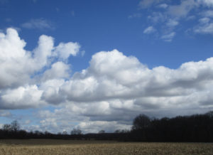
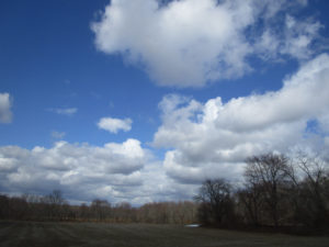
SKY PHOTOS: This week’s sky photographs are from Monroe and Cranbury in Middlesex County.
The Wyckoff’s Mills section of Monroe, Middlesex County.
The Wyckoff’s Mills section of Monroe, Middlesex County.
The sky over farmland in Cranbury, Middlesex County.
A dusk view from my backyard in Monroe, Middlesex County.
HEARINGS ON GAS PIPELINE EXPANSION: The Federal Energy Regulatory Commission (FERC) has schedule hearings on the “draft environmental impact statement” for the Northeast Supply Enhancement project’s natural gas pipeline expansion through the Jersey Midlands. Hearings are scheduled for:
April 25, Wednesday, 5 to 9 p.m., in Middlesex County, Old Bridge, at the George Bush Senior Center.
April 26, Thursday, 5 to 9 p.m., in Brooklyn, New York, at the Best Western Gregory Hotel.
May 2, Wednesday, 5 to 9 p.m., in Somerset County, Franklin, at the Franklin Township Community Center.
May 3, Thursday, 5 to 9 p.m., in Quarryville, Pennsylvania, at Solanco High School.
UPCOMING:
April 7, Saturday, 8 a.m.: New Jersey’s trout fishing season formally opens.
April 9 to 15, Monday to Sunday, Mercer County: The annual Princeton Environmental Film Festival, https://www.princetonlibrary.org/peff/.
In my front yard in Monroe, Middlesex County, the Wednesday-Thursday, March 21-22, nor’easter ends. This photograph reminds me of “Scout Vespers,” a song we sang at Boy Scout Troop 81 meetings, “Softly falls the light of day as our campfire fades away….”
Joe Sapia, 61, is a lifelong resident of Monroe — in South Middlesex County, where his maternal family settled more than 100 years ago. He is a Pine Barrens naturalist and an organic gardener of vegetables and fruit, along with zinnias and roses. He loves the Delaware River north of Trenton and Piedmont, too.
He draws inspiration on the Pine Barrens around Helmetta from his mother, Sophie Onda Sapia, who lived her whole life in these Pines, and his Polish-immigrant grandmother, Annie Poznanski Onda.
He gardens the same backyard plot as did his Grandma Annie and Italian-American father, Joe Sr. Both are inspirations for his food gardening. Ma inspires his rose gardening.
Joe is a semi-retired print journalist of almost 40 years. His work also is at @JosephSapia on Twitter.com, along with Facebook.com on the Jersey Midlands page.
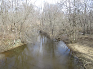
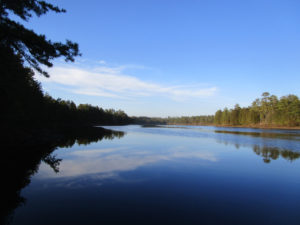
The sea run shad, striped bass and herring that gather at the mouth of the Raritan River attract animals high on the food chain such as this harbor seal. Whales and dolphin have also been sighted over the last few years not in small part from the contribution of the Raritan River and its sweet water branches.
The spring-fed north and south branches of the Raritan River join in a marriage of sweet water at their confluence, on an endless journey to the sea. Each hidden spring and brook along the way, contributes its own genetic identity, mixed in a final blend at the mouth of the Raritan River.
Where the fresh water meets the salty sea, the ebb and flow of tides stir the brine into fresh water to create a stable buffer zone of brackish water.
These back bays and estuaries formed at the mouths of rivers are a perfect place for young of the year striped bass to gain in size before going offshore to migrate. American, hickory, gizzard shad, river herring, such as blueback herring and alewives also gather here and search for ancient breeding grounds located far upriver.
In the time before dams, sea run fish migrated far upstream into the north and south branch. Fishing was a robust industry in early colonial times where the seasonal migration of herring and shad was a profitable business.
The construction of dams to power mills along the river put a halt to upstream commercial fishing. The mills and dams were not welcomed by colonists who made a living from the seasonal fisheries. One account tells of early settlers in the mid 1700s, unhappy with a mill dam just below Bound Brook, making nightly raids to dismantle the dam and allow shad to continue their upstream migration.
Fast forward to today, the river still flows to the sea and the shad and herring gather to swim upstream.
In 1985 pregnant shad from the Delaware River were transplanted to the South Branch as part of a program to restore a shad migration along with planned dam removals.
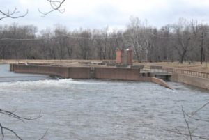
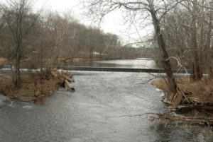
Dams that have blocked migrating fish have recently been removed. The Calco dam near the former Calco Chemical Company built around 1938, cleared the way for migrating fish to reach the confluence of the Millstone and Raritan where a flood control dam was built. Known as the Island Farm weir, completed in 1995, it includes a viewing window and fish ladder to allow the dam to be bypassed by fish travelling upstream.
Aside from the Calco dam, three of five dams upstream of the Island Farm Weir, two dams on the Raritan, the Nevius street and Robert street dam and one on the Millstone have been removed. All in anticipation that the head dam at Dukes Island Park and the low dam at Rockafellows Mills on the South Branch will eventually be deconstructed.
See the above link for the video of the Nevius street dam removal. Go to MENU, open videos/multimedia to see Nevius street dam deconstructed.
The dream to restore our rivers and fisheries to their unmolested glory is well on the way to reality. Bald eagles now nest along the Raritan and its branches, soon to be joined by spawning shad and herring.
The vision of a pristine river valley, interrupted by 300 years of abuse and neglect is slowly emerging from the river mist as a magical apparition. The magic supplied by the hard work of Rutgers scientists and dedicated volunteers who echo the words of Rutgers president Thomas, who served in 1930, “Save the Raritan”.
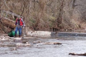
As an aside to this article, I will share a sobering and emotional experience involving the Island Weir Dam that took place in 1995. The intent is to emphasize the importance of safety while paddling in general and especially when near dams or in cold water.
I was paddling on the Delaware and Raritan Canal which parallels the Millstone River about two miles from where the dam is located at the confluence of the Millstone and Raritan rivers. This was a training session for a cold water canoe race that takes place each April in Maine. I am an experienced paddler, familiar with cold water immersion and so was wearing a wet suit with a dry top and pants along with a life jacket/pfd while on the calm water in the canal.
As I neared the end of my trip at the Manville causeway, several police cars slowly drove by and turned around as if searching for something. Sirens were wailing and more police and rescue vehicles were seen and the road blocked off. First thought was the body of a woman who was reported to have ended her life in the Millstone a week before was found.
As it turned out a kayaker and two companions in a canoe decided to run the dam. According to my recollection of the news article; the canoe made it through first, while the kayaker who followed, failed to clear the dam and was stuck in the hydraulic.
According to the news article, ‘the experienced paddlers’ wore no thermal protection or pfds when they ran the dangerous dam. It was reported that the canoers paddled back to help their companion and they capsized in the hydraulic. Once you cross that line which marks the downstream flow from the water cycling upstream, you will be pulled into the hydraulic.
The kayaker and one of the men in the canoe were washed out of the turbulent water but the other was lost, his body never recovered.
A hydraulic occurs when the weight of falling water creates a hole which is then filled by downstream water being pulled upstream in an endless re-circulating current parallel to the dam. Low head dams may be altered to prevent or mitigate a hydraulic.
There is a point of no return where you can actually see a line that separates the water flowing downstream from the water flowing back upstream to power the hydraulic.
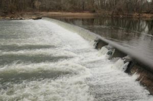
Island Weir Dam at the confluence of the millstone and Raritan River. You can see the horizontal shelves that are the fish ladder in the center and the subsequent stepped redesign to mitigate the dangerous hydraulic.
There have been several more drownings involving dams on the Raritan and its branches. I recall another at the Headgate, which is the dam created by the Duke estate below the confluence of the North and South branches. The paddler went over and was lost in the hydraulic below.
This is the headgate dam at Dukes Island Park. Created to collect river water via the Dukes canal to power the estates and supply water to the series of ponds built at decreasing elevations to allow the water to return to the river by gravity.
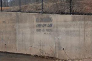
No warning signs are posted to alert paddlers to the danger ahead. On the downstream face of the dam is a warning to keep off.
Too little too late warning.
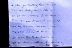
Paddling on the South Branch from Rockafellow’s mill rd, just below the low head dam that forms Red Rock Lake, this note was placed on my windshield. Though I was no where near the dam, contrary to what the note states, the message was at once heart breaking and shown here, now serves as a warning to all; beware of the dangers of low head dams.
This sign is placed about 5 football fields above the dam at red rock lake on the South Branch. It’s placement a puzzlement that mitigates its message.
Dam at Red Rock Lake.
Though rivers like the South Branch and North Branch are reputed to be no more dangerous than a swimming pool, tragedy can strike when least expected. Strainers, trees that fall into the river blocking passage, can snag and capsize a boat and entangle the paddler in its branches under pressure of a fast current. Low head dams can drown a paddler by immersion or entanglement on debris as the paddler is unable to wash out of the turbulent recycling water. Search on line to get an idea of how widespread is the danger of obscure low head dams and loss of life across the country.
Paddling when river temperatures are well below normal body temperature requires thermal protection no matter the air temperature. Wearing a pfd alone will not be enough to survive if your body temperature drops before you can be rescued or self rescue. Such was the case of a paddler on Round Valley reservoir a few years ago.
Typically water temp during the winter and early spring on the South Branch is 41 degrees. More than enough to cause a spasm to block your ability to breathe even before hypothermia sets in. See this link for a detailed explanation of the effects of cold water immersion. Remember, ‘cold water’ does not have to be that cold.
Overturning in fast water, a boat can instantly fill with a hundred gallons of water. Each gallon weighing 8 pounds, can pin or crush a paddler between the canoe and any obstruction. Such was the case on a locally sponsored canoe trip in shallow water on a beautiful day on the South Branch. One paddler was trapped under the canoe in a strainer. Eventually he popped out from under the boat, shaken but safe. The canoe was stuck fast in the strainer, filled with hundreds of pounds of water. Never be downstream of a capsized canoe.
Tragedy can occur on the calmest day under brilliant blue skies, always wear a pfd and be alert to potential dangers, especially dams.
Low head dam across the North Branch just above rt 202 makes a difficult passage during low water portage and a dangerous hydraulic during high water.
Author Joe Mish has been running wild in New Jersey since childhood when he found ways to escape his mother’s watchful eyes. He continues to trek the swamps, rivers and thickets seeking to share, with the residents and visitors, all of the state’s natural beauty hidden within full view. To read more of his writing and view more of his gorgeous photographs visit Winter Bear Rising, his wordpress blog. Joe’s series “Nature on the Raritan, Hidden in Plain View” runs monthly as part of the LRWP “Voices of the Watershed” series. Writing and photos used with permission from the author.
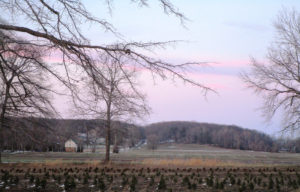
ARNEYS MOUNT: Arneys Mount stands roughly 245 feet above sea level, or about 175 feet above the surrounding lowland, in Springfield, Burlington County. It is part of the cuesta geologic formation — hills that have survived erosion and now separate New Jersey’s Outer Coastal Plain and Inner Coastal Plain. Take a map a draw a line from Sandy Hook at the Atlantic Ocean in Monmouth County to the Burlington County area of Mount Holly-Mount Laurel. That line is essentially the line of the cuesta. On a detailed map of that line, you will see names representing the hill system — Highlands, Mount Mitchell, Crawford Hill, Telegraph Hill, Beacon Hill, Knob Hill, Locust Hill, Quail Hill, Pine Hill, Backbone Hill, Disbrow Hill, Crematory Hill, Stone Hill, Arneys Mount, Mount Holly, and Mount Laurel.
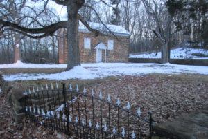
The circa 1775 Arneys Mount Friends Meeting House.
VOICES FROM AFIELD NO. 1, THE CUESTA: Cousin Jerry Edvy lives on high ground just outside of Perrineville in Millstone, Monmouth County. When it snowed during the Tuesday, March 13, nor’easter, he reported “at least 5 inches.” His house is on the cuesta, or about 280 feet above sea level. When Jerry drove off the cuesta, he saw hardly any snow. “(Route) 33 was clear,” said Jerry, speaking of the road about 3 miles north of his house. “We must have got hit with a band,” he said. Or maybe it was just the height of his area. My house, about 50 feet above sea level about 10 miles to the north, got only about 1 inch of snow.I recall this cuesta-lowland dichotomy several years ago during my newspaper reporting days for the Asbury Park Press as I drove in Monmouth County from the Millstone area to the Sandy Hook area — when I was on high points of the cuesta, there was a covering of snow, maybe a few inches; when I was at lower elevations, maybe just a coating. An interesting phenomena happening in only a matter of dozens of feet.
The Tuesday, March 13, nor’easter snowfall in a Monroe Township, Middlesex County, cornfield.
SNOWFALL: The seasonal snowfall tally at my house in the part of Monroe between Jamesburg and Helmetta is 29.0 inches. The average seasonal snowfall in New Brunswick, about 7.5 miles away, is about 26 inches. So, based on that, we are about 3 inches more than normal at my house, with about a month’s worth of snowfall season left.
The Tuesday, March 13, nor’easter snowfall at a farm in Plainsboro, Middlesex County.
FOREST FIRE SEASON: Because of the wet weather, the Pine Barrens spring wildfire season in the Jersey Midlands is running behind this year. Normally, it runs March 15 to May 15, when winds blow, humidity decreases, temperatures rise, and sun penetrates the essentially leafless forest, warming and drying the duff. But with the wetness out there, for example, the state Forest Fire Service canceled a control-burn for the upcoming week in the Jamesburg Park Conservation Area in Middlesex County.
Snow on the ground in the Pine Barrens of Barnegat, Ocean County.
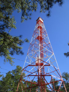
FIRE TOWERS: The idea of a fire tower is to see smoke during daylight hours, basically to dispatch firefighters before a fire really gets going. Because once flames are seen, the fire is well underway. The state Forest Fire Service has eight wildfire lookout towers in the Jersey Midlands — Apple Pie Hill, Bass River, Batsto, Lebanon, and Medford, all in Burlington County; Cedar Bridge and Lakewood, both in Ocean County; and Jamesburg, Middlesex County. When the fire towers are staffed, the public is welcome to visit. Beware, though, it can be a climb of about 60 to 100 feet, depending on the tower.
BASS RIVER STATE FOREST: Trees are to be cut around the Bass River fire-lookout tower in Bass River State Forest to improve the view for the tower observer. See https://thesandpaper.villagesoup.com/p/clear-cutting-proposed-for-bass-river-state-forest-fire-protection/1729679.
PYGMY PINES: Generally in the area of the intersection of Routes 72 and 539 in Ocean County stand hundreds of acres of Pine Barrens forest with trees perhaps only 8-feet-tall at most. This is the “Pygmy Pines” or “The Plains.” The theory is the stunted growth in this area is caused by repeated fires.
A sport utility vehicle drives on Route 539 through the Pygmy Pines, or Plains, in the Pine Barrens outside of Warren Grove, Ocean County.
The Pygmy Pines, or Plains, on Route 539 in the Pine Barrens near Warren Grove, Ocean County.
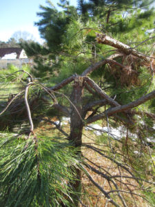
WITCH’S BROOM: If you regularly walk the Pine Barrens, you are likely to have seen a “witch’s broom,” a thick growth of needles on a pitch pine, “Pinus rigida.” While it may look haunting, it is simply caused by disease, defect, infestation, or environmental stress.
A “witch’s broom” growth on a pitch pine, “Pinus rigida,” at the Cedar Bridge fire-lookout tower in Barnegat, Ocean County.
PAINTED ROCK IN THE PINE BARRENS: Going back years, a rock along Route 539, on the section between Routes 70 and 72 in Lacey, Ocean County, had been painted in different ways according to the calendar — a Halloween jack-o-lantern, a turkey for Thanksgiving, and so on. But the rock, apparently on its way by truck to the Jersey Shore for erosion control when it somehow wound up along the road, took on an American flag, patriotic theme after 9-11 — the 2001, September 11, Tuesday, terrorist attack on American soil. No matter the artwork, the rock remains a landmark in the Pine Barrens. For more information on the rock, see http://www.jamesrahn.com/pages/other/personal/rock.htm.
Since around 9-11 — the terrorist attack on American soil on 2001, September 11, Tuesday — the rock on Route 539 in the Pine Barrens of Lacey, Ocean, has taken on a patriotic theme.
PROTECTED ‘PINELANDS’: While much of the Pine Barrens is protected by state “Pinelands” regulations, it is not true the Pine Barrens are fully preserved. One, not all the Pine Barrens is regulated for environmental protection. Two, building is allowed even in the regulated area.
The (un)American way, development in the Pine Barrens, here in Whiting, Ocean County.
CROSSWICKS CREEK: Crosswicks Creek’s headwaters are in the area of New Egypt, Ocean County. It, then, flows into the Delaware River at Bordentown. The federal Geological Survey has a gauge along Crosswicks Creek at Extonville on the boundary of Burlington and Mercer counties, https://waterdata.usgs.gov/nwis/uv/?site_no=01464500. Along the waterway is Crosswicks Creek Park, part of the Monmouth County Park System, https://www.monmouthcountyparks.com/page.aspx?Id=2568.
Looking upstream on Crosswicks Creek, here on the boundary of Mercer County to the left and Burlington County to the right. Here, Crosswicks Creek separates the villages of North Crosswicks in Hamilton, Mercer County, and Crosswicks in Chesterfield, Burlington County.
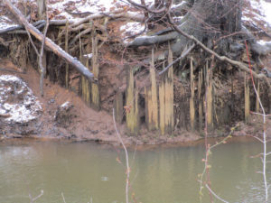
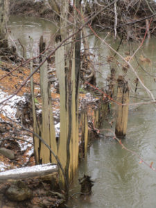
READING THE ENVIRONMENT: When walking afield, let the land talk to you. It has a historical record. For example, the other day I was telling Eric Gehring, a naturalist for the Middlesex County Office of Parks and Recreation, about the dikes in the woods across Manalapan Brook from my house. Those dikes are a record of the area’s cranberry farming that ended around World War II. Then, during the week, on a portion of Manalapan Brook about 4 miles south of my house, I noticed wood planks sticking out of the ground. Remnants of a bridge? A dam? This remains a mystery.
Remnants of a wooden structure on Manalapan Brook in southern Monroe, Middlesex County.
The wooden remnants on Manalapan Brook in southern Monroe, Middlesex County.
VOICES FROM AFIELD NO. 2, A MINK: Frank Ulatowski, an Englishtown-Manalapan outdoorsman, reported seeing a roadkilll of mink, “Mustela vison,” on Route 33 in Monroe, Middlesex County. So, mink are around.
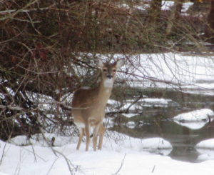
I came across this deer, “Odocoileus virginianus,” on a utility line on the boundary of Hightstown and East Windsor in Mercer County. Deer live on the edge — the edge of the woods, where they seek refuge, and fields, where they browse.
CHANJ: The state Division of Fish and Wildlife is promoting its initiative of CHANJ — Connecting Habitat Across New Jersey. CHANJ is looking to protect habitat and connect habitat through such things as land purchase, management of land, and safe wildlife passage at roadways. Roadway mitigation could include using culverts and bridges to have a safe pathway for wildlife to cross roads. The idea is have connectivity using core areas, which could be as little as 200 acres to as big as state regions such as the Highlands of North Jersey and, locally, the Pine Barrens.
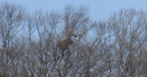
UPPER MILLSTONE RIVER EAGLES: It appears the pair of bald eagles, “Haliaeetus leucocephalus,” are feeding chicks in the Upper Millstone River nest on the boundary of Mercer and Middlesex counties, based on one adult on the nest while another flies to it. See the series of photographs:
Photo 1: An adult bald eagle circles the Upper Millstone River nest, which is below the eagle.
Photo 2: The eagle continues to circle, its white tail easily seen in this photograph. The nest is to the left.
Photo 3: The eagle circles back toward the nest, which is to the left, its white head clearly seen.
Photo 4: The eagle flies toward the nest, which is to the left, where its mate awaits. The mate’s head is the speck of white above the nest.
Photo 5: The eagle is landing on the nest, its mate awaiting.
VOICES FROM AFIELD NO. 3, UPPER MILLSTONE RIVER EAGLES: Frank Ulatowski, an outdoorsman from Englishtown-Manalapan, and his wife, Charlene, were visiting a business in the area of the Upper Millstone River nest of bald eagles, “Haliaeetus leucocephalus,” on the boundary of Mercer and Middlesex counties when a bald eagle flew by near the top of one of the single-story buildings. Frank wondered with all people around, how many noticed the eagle — as breeders in New Jersey, bald eagles are “endangered,” or under immediate peril, and, in general, “threatened,” or a species that can become “endangered” if conditions continue.
DUKE FARMS EAGLE CAMERA: At Duke Farms in Hillsborough, Somerset County, bald eagles, “Haliaeetus leucocephalus,” are sitting on two eggs, the first of which is scheduled to hatch about Wednesday, March 21. There is a live-stream camera on the nest that can be seen at http://dukefarms.org/making-an-impact/eagle-cam/. In New Jersey, bald eagles are “endangered,” or under immediate peril, as breeders and, in general, “threatened,” or a species that can become “endangered” if conditions continue.
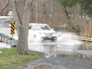
The March 13, Tuesday, nor’easter flooding on the boundary of Plainsboro and South Brunswick, Middlesex County.
BATSTO LAKE: Batsto Lake in Wharton State Forest, Burlington County, is formed by the damming of the Batsto River. The lake is 40 acres, according to the New Jersey Fish Finder website. As for the river, it drains 67.8 square miles, according to the federal Geological Survey.
Batsto River in Wharton State Forest, Burlington County.
SIGNS OF THE PINES: While traveling through the main part of the Pine Barrens, I came across a few interesting signs, both in the Bass River State Forest area of Burlington County:
A folk art sign warning drivers of deer, “Odocoileus virginianus,” crossing a road near Bass River State Forest in Burlington County.
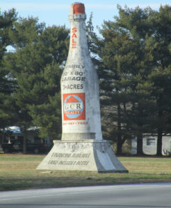
An old masonry advertising style — formerly announcing a winery, now advertising property for sale — on Route 9 near Bass River State Forest in Burlington County.
SKY VIEWS: This week’s sky views are from Hamilton, Mercer County, and Monroe, Middlesex County.
Farmland in Hamilton, Mercer County.
Mounts Mills Road in Monroe, Middlesex County.
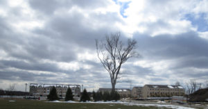
Thompson Park, looking at Monroe High School, in Monroe, Middlesex County.
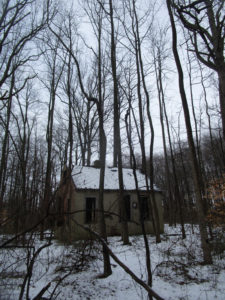
An abandoned cabin in the woods of Monroe, Middlesex County.
Joe Sapia, 61, is a lifelong resident of Monroe — in South Middlesex County, where his maternal family settled more than 100 years ago. He is a Pine Barrens naturalist and an organic gardener of vegetables and fruit, along with zinnias and roses. He loves the Delaware River north of Trenton and Piedmont, too.
He draws inspiration on the Pine Barrens around Helmetta from his mother, Sophie Onda Sapia, who lived her whole life in these Pines, and his Polish-immigrant grandmother, Annie Poznanski Onda.
He gardens the same backyard plot as did his Grandma Annie and Italian-American father, Joe Sr. Both are inspirations for his food gardening. Ma inspires his rose gardening.
Joe is a semi-retired print journalist of almost 40 years. His work also is at @JosephSapia on Twitter.com, along with Facebook.com on the Jersey Midlands page.
Canada Geese in a snowstorm on the South Branch appear at ease as the falling snow softens the scene.
The January blizzard raged, turning the darkness into an opaque curtain of white. Almost a foot of powdered snow covered the ground before midnight.
The broadcast news reported that NJ had declared a state of emergency shutting down roadways throughout the state. The setting was just right for the midwinter parade on the South Branch. Thousands attended and the main thoroughfare was jammed with local residents and visitors. As I stepped outside to get a head start on clearing the driveway, the sound of geese, thousands of geese, overpowered the drone of the wind driven snow. So impressive was the magnitude of the unalarmed chatter, I was compelled to investigate. Alerting my family where to search for the body, I headed into the storm.
The closer I got to the river the louder and more beckoning the sound became. Moving slowly through the trees toward the river bank, the din from the geese on the open water was deafening. The river was filled wall to wall with migrant and resident Canada geese. Some started to get up and fly. Others just drifted by. All appeared as black silhouettes against the snow and reflective water. Thousands upon thousands all in chorus, the rhythm and sound of their calls rose and fell as if one voice. Occasionally all sound would hesitate into a moment of absolute silence. The silence was as dramatic as the din.
Animals generally become fearless in extreme weather and at the height of this snowstorm the geese collectively tolerated my close approach.
As I closed in, the birds parted, momentarily leaving a void of reflective water. The surface was again soon covered with geese as the specter of an interloper was confidently dismissed.
The Geese were packed so tight; they appeared as if in a big cauldron that was being stirred. One group was drifting down with the current while the other was going back up stream in a re-circulating eddy below the island.
Aside from the geese, the river was filled with joined platelets of gray and white ice, strong enough to support several of the large birds. A display of motionless geese rode atop drifting ice flows, escorted by a cadre of even more geese floating alongside, all travelling at the same speed.
This looked all so familiar. Suddenly it struck me. I could have been watching a fourth of July parade with themed floats and accompanying marchers. Certainly the band was playing a familiar tune as spectator geese lined the banks and joined in the chorus.
How odd that here was a gathering of what seemed to be all the geese in New Jersey having their own parade. As if to celebrate some event sacred to the hearts of all geese, each bird taking comfort in knowing they owned the night and there would be no human eyes to witness their ethereal rite.
Author Joe Mish has been running wild in New Jersey since childhood when he found ways to escape his mother’s watchful eyes. He continues to trek the swamps, rivers and thickets seeking to share, with the residents and visitors, all of the state’s natural beauty hidden within full view. To read more of his writing and view more of his gorgeous photographs visit Winter Bear Rising, his wordpress blog. Joe’s series “Nature on the Raritan, Hidden in Plain View” runs monthly as part of the LRWP “Voices of the Watershed” series. Writing and photos used with permission from the author.
Sadly, after 102 issues and 29 years, the U.S. Environmental Protection Agency will cease publication of Nonpoint Source News-Notes.
The LRWP has relied on these news-notes to shape our approach to non-point source pollution reduction. For now the archived issues will remain available on EPA’s website:
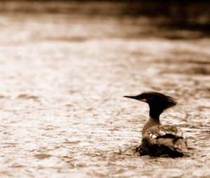
A female common merganser pauses in the fast shallow water of the South Branch where clams and crayfish abound.
“Eye of newt, and toe of frog, Wool of bat, and tongue of dog, Adder’s fork, and blind-worm’s sting, Lizard’s leg, and howlet’s wing,– For a charm of powerful trouble, Like a hell-broth boil and bubble.”
The witches brew in Shakespeare’s “Macbeth” revealed a magical recipe perhaps intended to capture a victim’s soul for evil consumption. Truth is the witches were brewing magic bait they intended to use the next morning on the opening of trout season. Shakespeare spun the story to keep the ancient fishing formula secret and so, “Macbeth”, was written to obscure the truth and ‘Shakespeare’ is now a company that makes fishing gear.
I know it’s hard to believe, but sure enough similar formulas are used today and found in books like ArtFlick’s New Streamside Guide or the old classic, AJ McLanes Fishing Encyclopedia. Artificial fly recipes used to catch trout read like the midnight brew mixed during the dark of the April moon in “Macbeth”.
Pale hairs from a “red fox belly are mixed with sandy poll from a hare’s ear”; One dark ginger hackle and a quill from a Rhode Island Red rooster soaked overnight and blended with gray fox underbelly and hair of claret seal are combined with three strands of skunk tail; Peacock herl, scarlet silk, flat gold tinsel are bound with muskrat belly fur dubbing; Along with feathers from the cheek of a partridge, wing of wood duck and porcupine quills soaked in Clorox, we have a comprehensive list of standard ingredients found stocked on the shelf above any self respecting witch’s eternally boiling cauldron. The addition or deletion of the slightest ingredient is all that differentiates intended purpose. Good vs evil or brown trout vs rainbow trout, nuance makes the difference.
The use of feathers to catch fish on the fly is not exclusive to fishermen casting hooks adorned with feathers. Alternatively, the feathers are still on the birds and the hooks are in the form of beaks and talons.
Sharing the local fishery with licensed fishermen are common mergansers, great blue herons, king fishers, green herons, yellow crowned herons, egrets, osprey and bald eagles.
It is a wonder to realize the waters of the North and South Branch are rich enough to support the variety and quantity of fish required to have most of these birds as year round residents. The recent dam removals on the Raritan River will ensure an even greater supply of forage fish and a brighter future for not only fish eating birds but other game fish to improve what is already a fisherman’s paradise.
Driving along the river, I experienced a Kodak moment, where a female merganser surfaced with what looked like a decent sized bluegill in its serrated beak. Mergansers are the most commonly seen diving duck locally and are easily differentiated by gender as the males have a contrasting dark green head, black and white body while the females are white and gray with rusty red colored heads and a pronounced crest as if coiffed to resemble a wind blown hair style. Both sexes have a bright orange beak. Mergansers swim underwater to search for food that includes crayfish as well as the plentiful mollusks that populate our rivers.
Great blue herons seem to be next most common fish eater and are often seen standing tall and still as statues as they probe shallow water for small and large fish as well as frogs and salamanders.
Much shorter and less often seen is the green heron and seasonally, the pure white common egrets at summer’s end.
Our smallest fisheater is the belted kingfisher. About the size of an extra large bluejay and quite similar in color, bearing a pronounced crest and white throat patch with a blue bandana across its throat.
Osprey are often seen perched on dead tree limbs along the river eating fish, as bald eagles from two different nests are occasionally observed.
The arrival of fishing season, this April 6th at 8am, is a reminder of the flocks of feathered fishers, not bound by seasons or licenses, which share the bounty of our local waters.
Author Joe Mish has been running wild in New Jersey since childhood when he found ways to escape his mother’s watchful eyes. He continues to trek the swamps, rivers and thickets seeking to share, with the residents and visitors, all of the state’s natural beauty hidden within full view. To read more of his writing and view more of his gorgeous photographs visit Winter Bear Rising, his wordpress blog. Joe’s series “Nature on the Raritan, Hidden in Plain View” runs monthly as part of the LRWP “Voices of the Watershed” series. Writing and photos used with permission from the author.
Even after today’s snow has melted and flowed from our streets, through our stormwater system, and out to Raritan Bay, our local streams and the Raritan River will carry the scars of our desire to drive quickly in wintry conditions.
Too often we forget that the salt we apply to our streets, parking lots, driveways and sidewalks is a pollutant that permanently stays in our water bodies and groundwater.
As we imagine warm summer days playing in the surf on the Jersey shore, basking in the sun and tasting salt spray, let’s remember that the salts we put on roadway surfaces ends up in our waterways. These salts increase the mobilization of heavy metals and other pollutants in roadside soils, causing erosion and aiding transport of pollutants into our waterways.
It is the case that in urbanized areas like the Lower Raritan Watershed, the first flush of meltwater is two-to-three times as salty as ocean water. We can float in the ocean because salty water is more dense than freshwater, and sinks to the bottom. Salts likewise sink to the sediments in our freshwater bodies, where they decrease oxygen levels, essentially strangling the animals that live in the benthic (bottom) layer.
These bottom-dwelling animals (benthic macroinvertebrates) are some of the most sensitive species in our ecosystem. They form the base of the food chain, and when they die off, the creatures higher up on the food chain, including fish, can’t find food.
Salt is toxic, but necessary for public safety. We are all part of the problem with over applying it, and all part of the solution, too. The top five things you can do now:
In winter, drive for the season. Our collective demand for perfectly-cleared roads is a major barrier to protecting our waterways
Ask your municipal and county leaders what they are doing to minimize salt usage on public roads.
Hire maintenance firms that have taken salt application training.
Minimize your personal use by removing snow quickly and distributing only about one coffee mug of salt for a typical driveway.
Be sure to clean up any leftover salt, sand, and de-icer to save and reuse as needed.