Water quality results are in for Thursday June 27, and with the recent dry spell we’ve had the news looks pretty good for a change! Hooray!
Enterococci results are reported in Colony Forming Units or CFUs. Enterococci results are reported in Colony Forming Units or CFUs. Suitable levels should not exceed 104 cfu/100mL. We are reporting on enterococci at six non-swimming beach public access sites along the Raritan River. See here for more information on our Summer 2019 monitoring program.
Enterococci levels are used as indicators of the possible presence of disease-causing bacteria in recreational waters. Such pathogens may pose health risks to people fishing and swimming in a water body. Sources of bacteria include Combined Sewer Overflows (CSOs), improperly functioning wastewater treatment plants, stormwater runoff, leaking septic systems, animal carcasses, and runoff from manure storage areas. Enterococci levels are often high after heavy or consistent rainfall.
Huge thanks to our the EARTH Center of Middlesex County, to Jesse Stratowski and his team at the Rutgers Boathouse, and to our wonderful volunteers.
**Please note: these results are preliminary and awaiting Quality Control.** Next week we will report monitoring results on Wednesday July 3 to help you make plans for water sports and activities.
Enterococci levels are used as indicators of the possible presence of disease-causing bacteria in recreational waters. Such pathogens may pose health risks to people fishing and swimming in a water body. Sources of bacteria include Combined Sewer Overflows (CSOs), improperly functioning wastewater treatment plants, stormwater runoff, leaking septic systems, animal carcasses, and runoff from manure storage areas. Enterococci levels are often high after heavy or consistent rainfall.
Enterococci results are reported in Colony Forming Units or CFUs. Enterococci results are reported in Colony Forming Units or CFUs. Suitable levels should not exceed 104 cfu/100mL. Enterococcus results, times and coordinates for June 20, 2019:
For those of you making plans to be on the water, see below for Enterococcus results for monitoring conducted on June 13, 2019. Results are reported in Colony Forming Units or CFUs. Please note that while we follow quality control measures, the real-time nature of data delivery means that EPA has not reviewed, and these are not technically quality controlled.
Enterococci levels are used as indicators of the possible presence of disease-causing bacteria in recreational waters. Such pathogens may pose health risks to people fishing and swimming in a water body. Sources of bacteria include Combined Sewer Overflows (CSOs), improperly functioning wastewater treatment plants, stormwater runoff, leaking septic systems, animal carcasses, and runoff from manure storage areas.
Enterococci results are reported in Colony Forming Units or CFUs. Suitable levels should not exceed 104 cfu/100mL.
Site Name
Time sampled
Enterococcus (CFU)
Riverside Park, Piscataway
8:45
TNTC
Rutgers Boathouse, New Brunswick
9:45
2,600
Edison Boathouse
10:22
150
Ken Buchannan Waterfront Park, Sayreville
11:03
250
South Amboy Waterfront Park
11:44
51
2nd Street Park, Perth Amboy
12:12
TNTC
TNTC stands for Too Numerous To Count, or >60,000. Please note that these results are in colony forming units (CFU). These results are preliminary and pending Quality Control.
Article by Howard Swerdloff, New Brunswick Environmental Commission
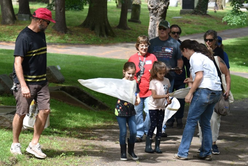
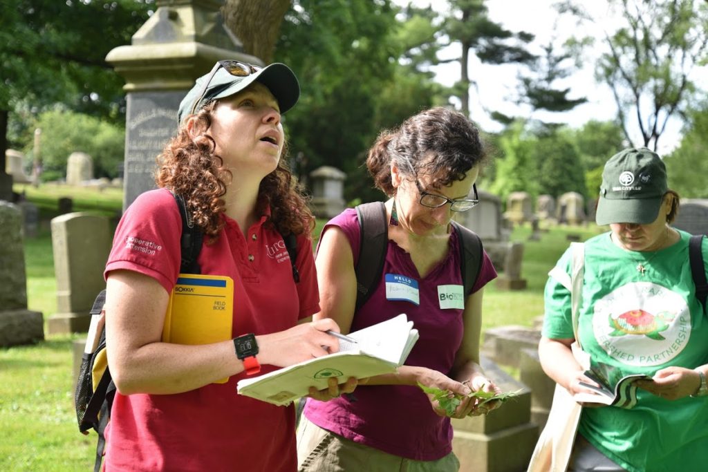
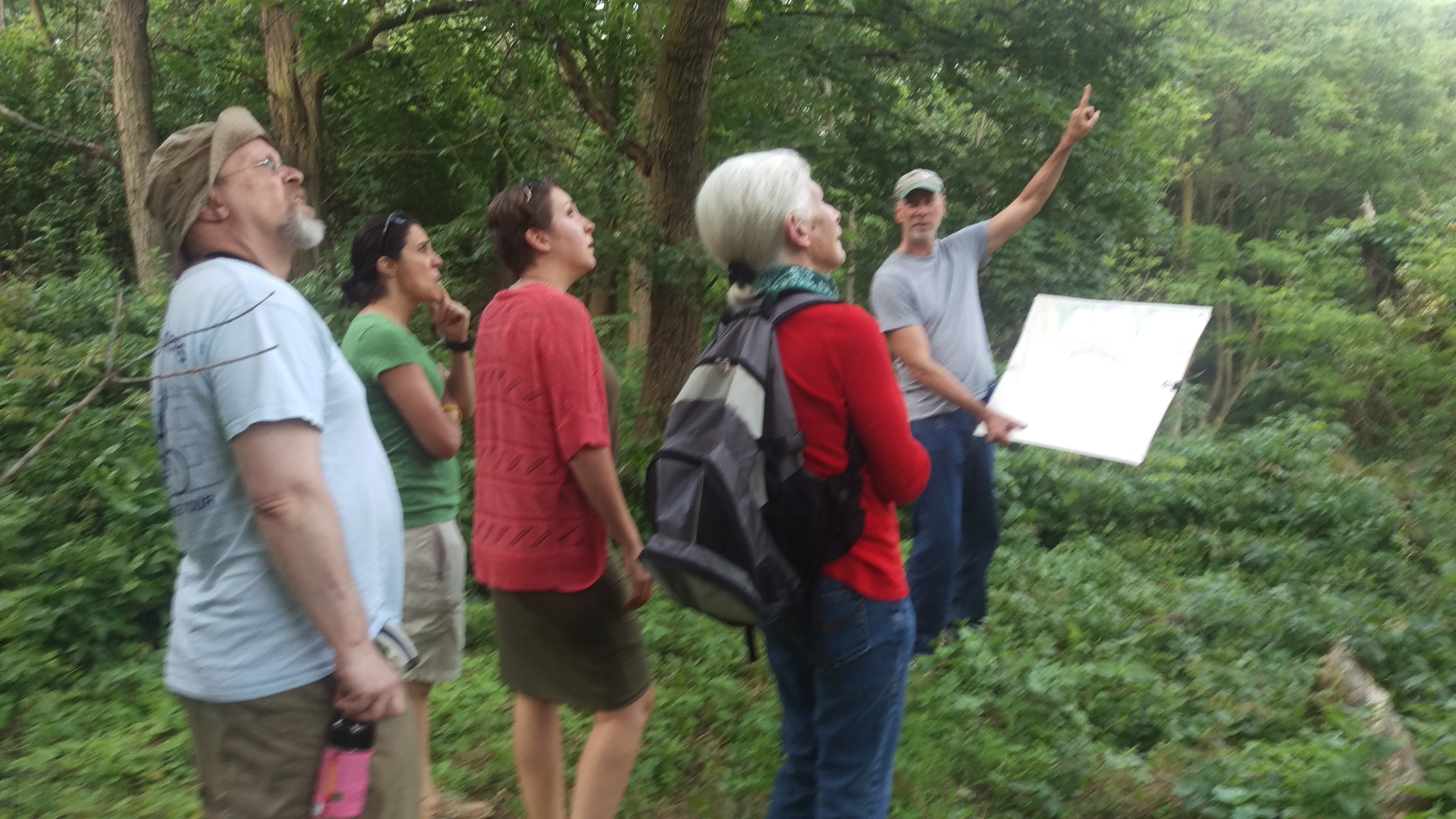
On Saturday June 8, 2019, the Elmwood Cemetery hosted their first annual “BioBlitz.” (A“BioBlitz” is an event that focuses on finding and identifying as many species as possible in a specific area over a short period of time.) The event was sponsored by the Lower Raritan Watershed Partnership (LRWP), the Americorps Watershed Ambassadors Program, New Brunswick Environmental Commission, North Brunswick Environmental Commission, and the Elmwood Cemetery.
Photo credit: Roger Dreyling
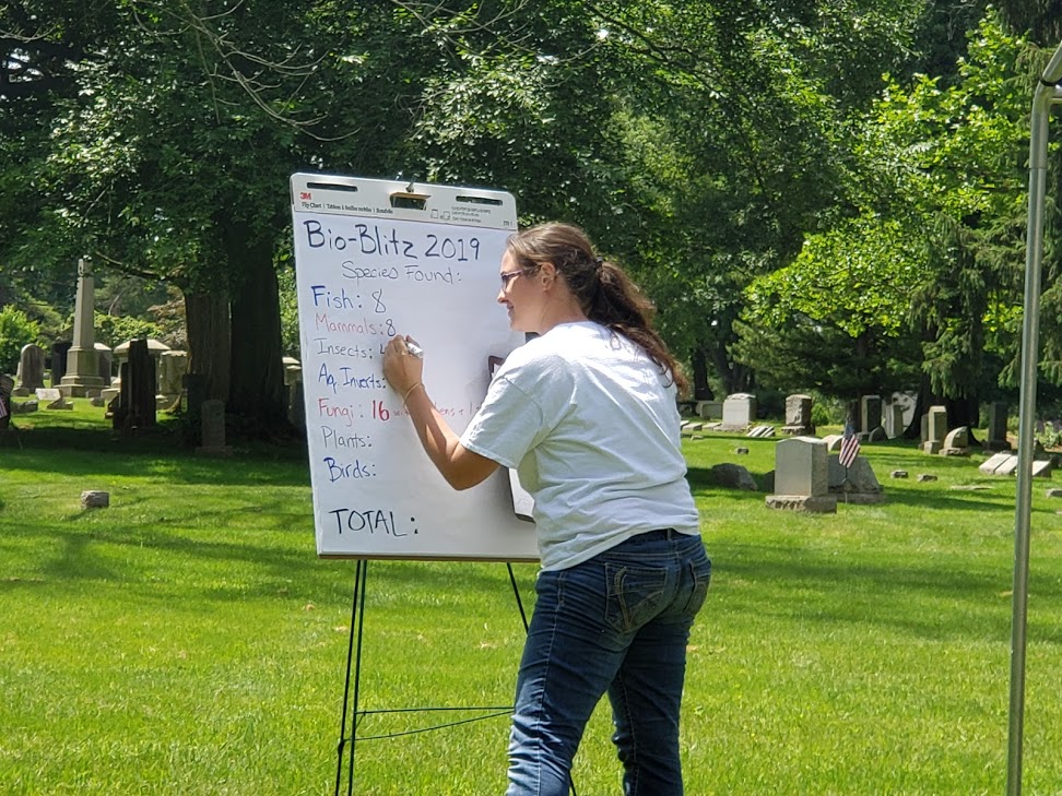
Over 4 dozen area “citizen scientists” and experts scoured the 50 acre site identifying and cataloging the fish, mammals, insects, aquatic invertebrates, fungi, plants, and birds. They identified 8 species of fish; 8 species of mammals; 47 species of insects; 15 species of aquatic invertebrates; 20 species of fungi; 37 species of plants; and 42 species of birds (the latter are catalogued on E-bird: https://ebird.org/nj/view/checklist/S57201308 ) — a total of 177 different species.
Photo credit: Johnny MalpicaPhoto Credit: Johnny Malpica Photo credit: Johnny Malpica
The event inspired many two-way conversations between our community participants and the volunteer scientists. Instead of a didactic “top down” learning experience, both groups shared their knowledge and understanding of the local environment in a way that enhanced the specialized knowledge of the expert scientists, and, in turn, the expert scientists helped community volunteers develop a deeper knowledge and appreciation for the natural world and local environment. The experts’ final reports will be ready in a month; their findings will be shared with the volunteers. Elmwood Cemetery plans to make a Bioblitz an annual event.
Elmwood Cemetery, a Special Forested Habitat Refuge The cemetery is nestled between the New and North Brunswick communities. It was established in 1868 as a “Victorian Garden Cemetery” during the rural cemetery movement, and to this day all of Elmwood’s lanes and paths are lined with evergreens and flowering native trees. Cemetery managers are building on this legacy of careful planning and land protections to secure Arboretum accreditation, which will allow them to further advance the planting, study, and conservation of woody plants and trees in the area.
Enterococci levels are used as indicators of the possible presence of disease-causing bacteria in recreational waters. Such pathogens may pose health risks to people fishing and swimming in a water body. Sources of bacteria include Combined Sewer Overflows (CSOs), improperly functioning wastewater treatment plants, stormwater runoff, leaking septic systems, animal carcasses, and runoff from manure storage areas. Enterococci levels are often high after heavy or consistent rainfall.
Enterococci results are reported in Colony Forming Units or CFUs. Enterococci results are reported in Colony Forming Units or CFUs. Suitable levels should not exceed 104 cfu/100mL.
Enterococcus results, times and coordinates:
Site Name
Time sampled
Enterococcus (CFU)
Riverside Park (40.54067, -74.51219)
10:01
800
Rutgers Boathouse (40.48826, -74.43384)
10:37
520
Edison Boathouse (40.48769, -74.38409)
11:05
250
Ken Buchannan Waterfront Park(40.47483, -74.35586)
11:43
46
South Amboy Waterfront Park(40.48334, -74.2698)
12:13
15
2nd Street Park (49.50007, -74.27719)
12:41
150
TNTC stands for Too Numerous To Count , or >60,000. Please note that these results are in colony forming units (CFU), not MPN. These results are preliminary and pending Quality Control.
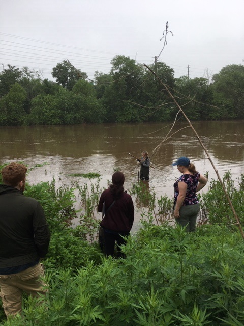
Many thanks to our great team of volunteers who dedicated their Thursday to sampling for fecal coliform and enterococci at six non-swimming beach public access sites along the Raritan River.
Enterococci levels are used as indicators of the possible presence of disease-causing bacteria in recreational waters. Such pathogens may pose health risks to people fishing and swimming in a water body. Sources of bacteria include Combined Sewer Overflows (CSOs), improperly functioning wastewater treatment plants, stormwater runoff, leaking septic systems, animal carcasses, and runoff from manure storage areas. Enterococci levels are often high after heavy or consistent rainfall.
Enterococci results are reported in Colony Forming Units or CFUs. Enterococci results are reported in Colony Forming Units or CFUs. Suitable levels should not exceed 104 cfu/100mL.
Site Name
Time
Enterococcus (CFU)
Riverside Park (40.54067, -74.51219)
9:51
TNTC
Rutgers Boathouse (40.48826, -74.43384)
10:32
TNTC
Edison Boathouse (40.48769, -74.38409)
11:09
TNTC
Ken Buchannan Waterfront Park(40.47483, -74.35586)
Monitoring at Riverside Park in Piscataway 5.30.2019. Photo by Jim Hearty
Please note that while we follow quality control measures, the real-time nature of data delivery means that EPA has not reviewed, and these are not technically quality controlled.
For those of you making plans to be on the water, see below for enterococci results for our monitoring sites, reported in Colony Forming Units or CFUs. Please note that while we follow quality control measures, the real-time nature of data delivery means that EPA has not reviewed, and these are not technically quality controlled.
Enterococci levels are used as indicators of the possible presence of disease-causing bacteria in recreational waters. Such pathogens may pose health risks to people fishing and swimming in a water body. Sources of bacteria include Combined Sewer Overflows (CSOs), improperly functioning wastewater treatment plants, stormwater runoff, leaking septic systems, animal carcasses, and runoff from manure storage areas.
Enterococci results are reported in Colony Forming Units or CFUs. Suitable levels should not exceed 104 cfu/100mL.
Briefly put, the numbers look good for our New Brunswick, Sayreville and South Amboy sites. Numbers are bad for our Piscatway and Edison sites, and downright horrible for our Perth Amboy site.
Riverside Park (Piscatway, 40.54067, -74.51219): 6300 CFU Rutgers Boat House (New Brunswick, 40.48826, -74.43384): 51 CFU Edison Boat Basin (Edison, 40.48769, -74.38409): 640 CFU Ken Buchanan Waterfront Park (Sayreville, 40.47483, -74.35586): <10 CFU South Amboy Waterfront Park (South Amboy 40.48334, -74.2698): <10 CFU 2nd Street Park (Perth Amboy 49.50007, -74.27719): TNTC or Too Numerous to Count. (This number is >60,000.)
Running for 20 weeks through Summer 2019, the Lower Raritan Watershed Partnership and Rutgers Cooperative Extension of Middlesex County (RCE) will gather data and other information on water quality for public access sites along the tidal portions of the Raritan River at locations considered non-bathing beaches. This project is supported through grants from the Interstate Environmental Commission (IEC) and Rutgers’ Sustainable Raritan River Initiative (SRRI).
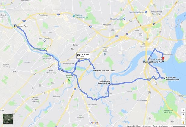
Summer 2019 Pathogens/Bacteria Monitoring Sites
LRWP and RCE will monitor non-bathing beach sites with active kayak/canoe launches and/or fishing and other primary contact activities that, as non-bathing beach sites, are not regularly monitored by the New Jersey Department of Environmental Protection (NJDEP) or the New Jersey Department of Health and Human Services and lack sufficient water quality data.
In addition to yielding important data about the health and safety of our waterways, the Project will also allow for development of civic science and expanded volunteer environmental monitoring programming within the Lower Raritan Watershed and Middlesex County, NJ. We are working with an approved Quality Assurance Project Plan (QAPP), provided by the IEC, which will allow for data generated from this project to inform water quality policy and regulatory decisions at all levels of government within the project area, and to educate the public about the safety of recreating on the River.
Real-time reporting of enteroccocus data will be posted every Friday on the LRWP facebook page and website, and through the New York City Water Trail Association’s citizen’s water quality testing program. Users will be able to easily interpret the data as being above or below the recommended water quality standards for primary contact recreation.
Enterococci levels are used as indicators of the possible presence of disease-causing bacteria in recreational waters. Such pathogens may pose health risks to people fishing and swimming in a water body. Sources of bacteria include Combined Sewer Overflows (CSOs), improperly functioning wastewater treatment plants, stormwater runoff, leaking septic systems, animal carcasses, and runoff from manure storage areas. Enterococci results are reported in Colony Forming Units or CFUs. Suitable levels should not exceed 104 cfu/100mL.
The following are details on our monitoring sites. We will share more information about each location throughout the monitoring period. For more information about the program please contact: info@lowerraritanwatershed.org
LR1
Riverside Park, 430 River Rd, Piscataway
40.54067
-74.51219
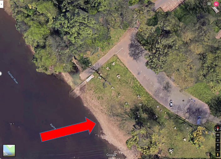
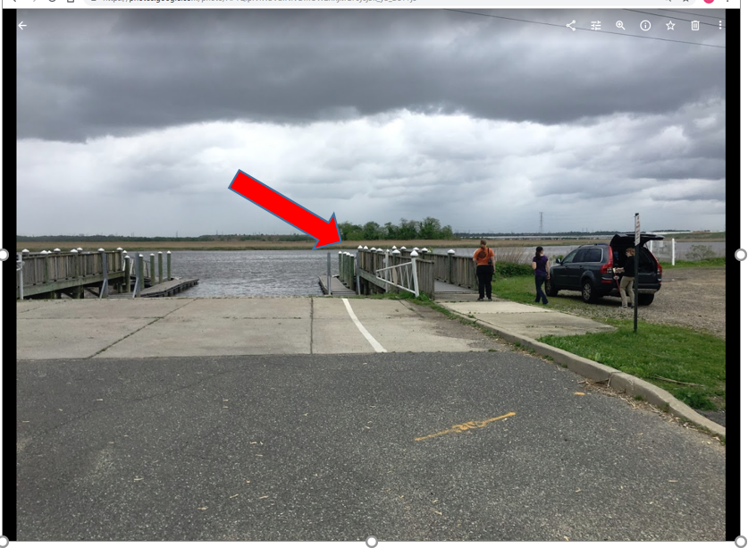
Wading site. Waders must be worn. Red arrow indicates the sampling location as this is where fishing has been observed. Access the river to the left of the boat ramp (when facing the river). Do not take the sample from the boat ramp as it is too muddy and slippery.
Bathrooms are available at this site from 10am to 2pm
LR2
Rutgers Boathouse, 5 Memorial Pkwy, New Brunswick
40.48826
-74.43384
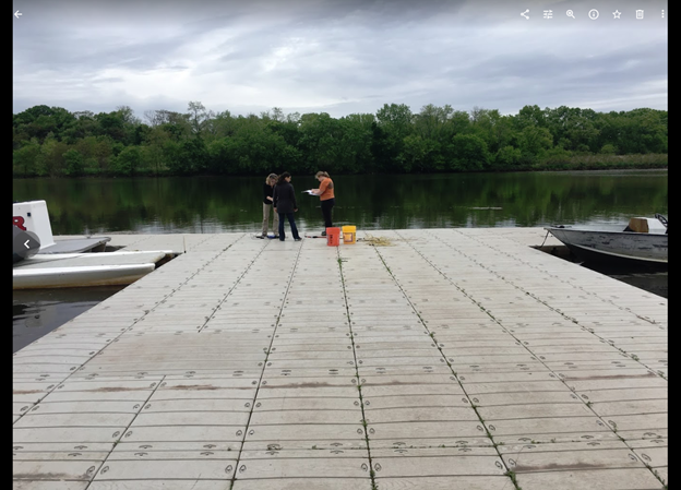
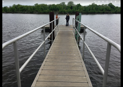
Sampling location is in the middle of the Rutgers boathouse dock as indicated in picture. Bathrooms may be available at the boathouse if they are open and at Boyd Park just west of the boathouse.
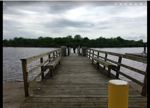
Sampling
location is at the end of the dock. No bathrooms are available at this site.
LR4
Ken Buchanan Riverfront Park River Road, Sayreville, NJ 08872
40.47483
-74.35586
LR5
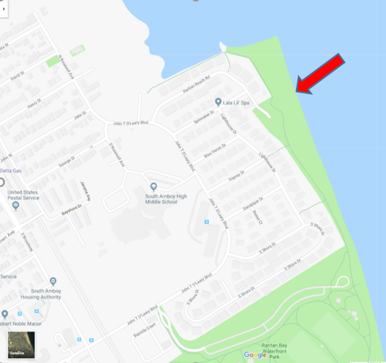
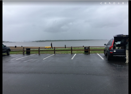
Raritan Bay Waterfront Park 201 John T O’Leary Blvd South Amboy, NJ 08879 *sample off Raritan Reach Road north of park
40.48334
-74.2698
Wading site and waders must be worn. Access the sampling location off the parking lot at the end of Raritan Reach Rd. This is northwest of the park. The site is a beach. No bathrooms available.
LR6
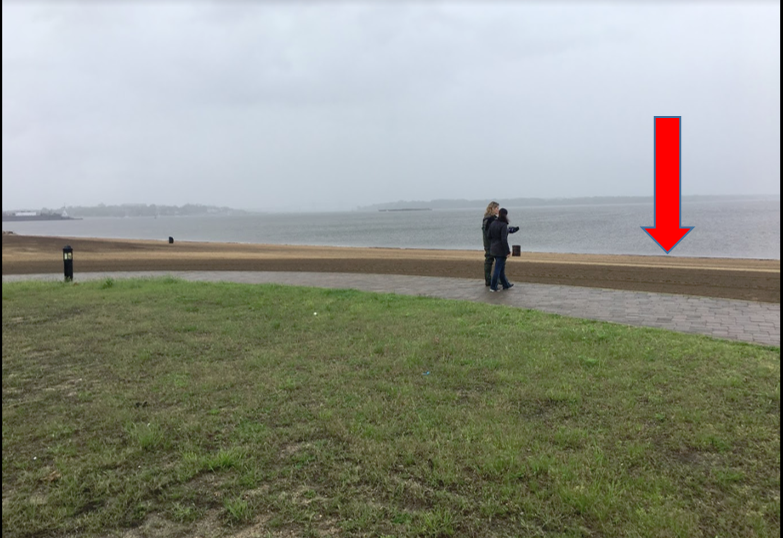
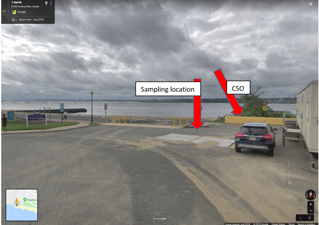
Perth Amboy Waterfront & Future 2nd Street Park 45-93 2nd St, Perth Amboy, NJ 08861
40.50007
-74.27719
This is a wading site and waders must be worn. Sampling location is at the beach next to the combined sewer outfall pipe. No bathrooms are available.
A BioBlitz is an event that focuses on finding and identifying as many species as possible in a specific area over a short period of time. At a BioBlitz, scientists, families, students, teachers, and other community members work together to get a snapshot of an area’s biodiversity.
On June
8 the Lower Raritan Watershed Partnership (LRWP) and partners including the
Americorps Watershed Ambassadors Program, New Brunswick Environmental
Commission, North Brunswick Environmental Commission, and Elmwood Cemetery will
host a day long BioBlitz of Elmwood Cemetery in North Brunswick.
Elmwood
Cemetery is a special forested habitat refuge nestled between the urban New and
North Brunswick communities. The Cemetery was established in 1868 as a “Victorian
Garden Cemetery” during the rural cemetery movement, and to this day all of
Elmwood’s lanes and paths are lined with evergreens and flowering native trees.
Cemetery managers are building on this legacy of careful planning and land
protections to secure Arboretum accreditation, which will allow them to further
advance the planting, study, and conservation of woody plants and trees in
the area.
Our BioBlitz will include public talks by expert naturalists about local natural history, and a chance for the public to work with these experts in an active survey of mammals, fish, plants, insects, aquatic invertebrates, birds and fungi. Our expert scientists will be stationed at various locations at Elmwood Cemetery to help participants engage in unique research. These scientists are our “team leaders.” We use teams to help organize the science and logistics so that we get as accurate a count as possible of the biodiversity of the area.
Our Expert Scientists:
Brionna Primiani (mammals), Wildlife Specialist with New Jersey Wildlife Services
Chuck Sedor (fish), New Jersey’s Division of Fish and Wildlife in the Bureau of Freshwater Fisheries
Michele Bakacs (plants), Cooperative Extension of Middlesex County
Trisha Nichols (insects), Philadelphia Insectarium and Butterfly Pavilion
Von Scully (aquatic invertebrates) NJ Watershed Ambassadors
Laurie Gneiding (birds), NJDEP Ornithologist/Ecologist; NJ Audubon Society
Randy Hemminghaus (fungi), The New Jersey Mycological Association
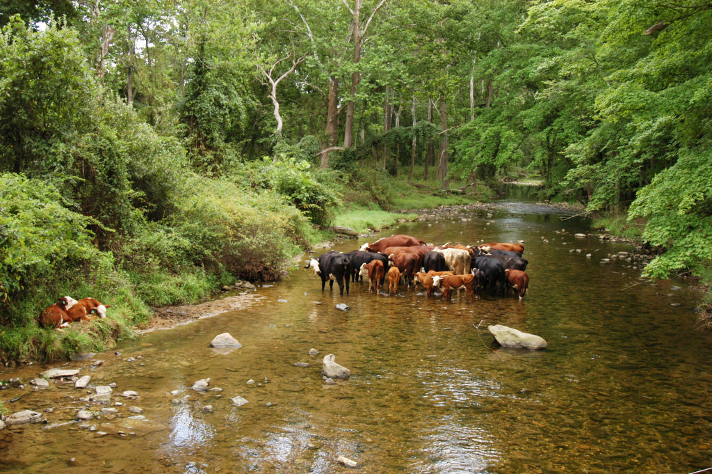
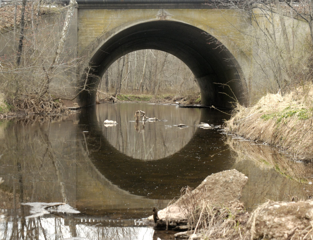
Access to some of the tributaries feeding the North and South Branch of the Raritan River is strictly a trail blazing event. The rewards are worth the effort.
Like a spectacular desert flower that only blooms after a rain, many tributaries of the Raritan river’s North and South Branch suddenly blossom into navigable waterways if only for a brief moment.
These ephemeral watery threads weave though otherwise inaccessible places of pristine beauty and undisturbed wildlife. Visitation is exclusively by invitation of the rain. The chance of appropriate water level matches the odds of winning at roulette. However, the opportunity to enjoy runnable water is increased, as it can occur at any time of the year, unlike many northeast rivers that are seasonally dependent on melting snow and large drainage areas.
One jewel of a stream went a full year before the shadow of my canoe silently passed over its sandy bottom in time with the midsummer freshet racing to the sea. The rarity of such a small stream sojourn increases the value of the experience.
The appearance of an apparition is the best way to describe the transformation of a small tributary into a navigable waterway. Water that lazily followed a convoluted path through a twisting labyrinth of exposed rocks, now flows over them with self-determination. The exposed stream bed is flushed clean of fallen leaves and broken branches while smaller rocks and stones are subtly rearranged into future sand bars and shoals.
For many years I had my eye on a tributary of the South Branch too shallow to run and whose character was totally unknown to me. On these small streams, strainers, trees that span the watercourse from bank to bank can be life threatening, especially in high water with minimal possibility for evasive action. Even on the main course of the North and South branch, strainers have claimed paddlers’ lives.
So, it was with caution that I approached what I considered to be a reasonable water level, after studying the historic stream gauge data. The possibility of another as yet undiscovered eagle nest, was also a consideration in choosing this stream.
While not situated in the wilderness, a solo trip like this, even in central New Jersey, is not to be taken lightly. I checked topo maps as well as aerial views and road maps to confirm my location at any given point.
Though I certainly wasn’t the first to paddle this stream, it sure felt that way. The initial stretch was one of several locations where the water level could be viewed from the road and rarely were the midstream rocks covered with water. Today, however, I floated easily, inches above the largest rocks. Five minutes later I was out of sight, around the first bend and on my way to explore the unknown. A very strange thought to have amid the congestion of central New Jersey; a little kid’s fantasy come to life.
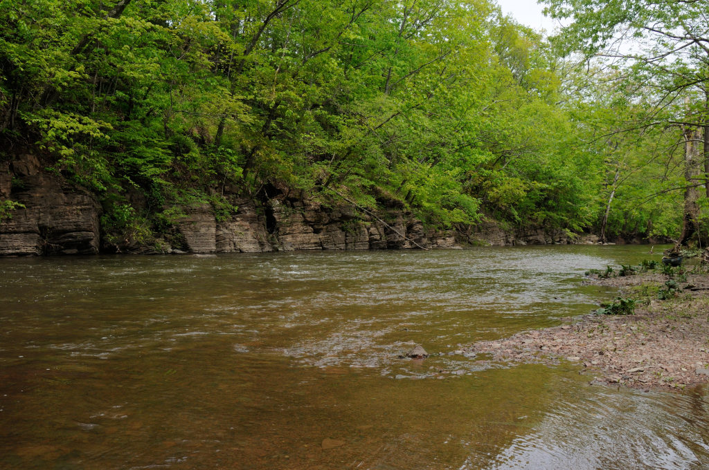
The scenery did not disappoint, hardwood trees dominated the shoreline and formed a wide greenway to serve as a protective margin against runoff from cultivated land and residential properties. The intimacy of the stream’s narrow course bought both banks into view while looking straight ahead.
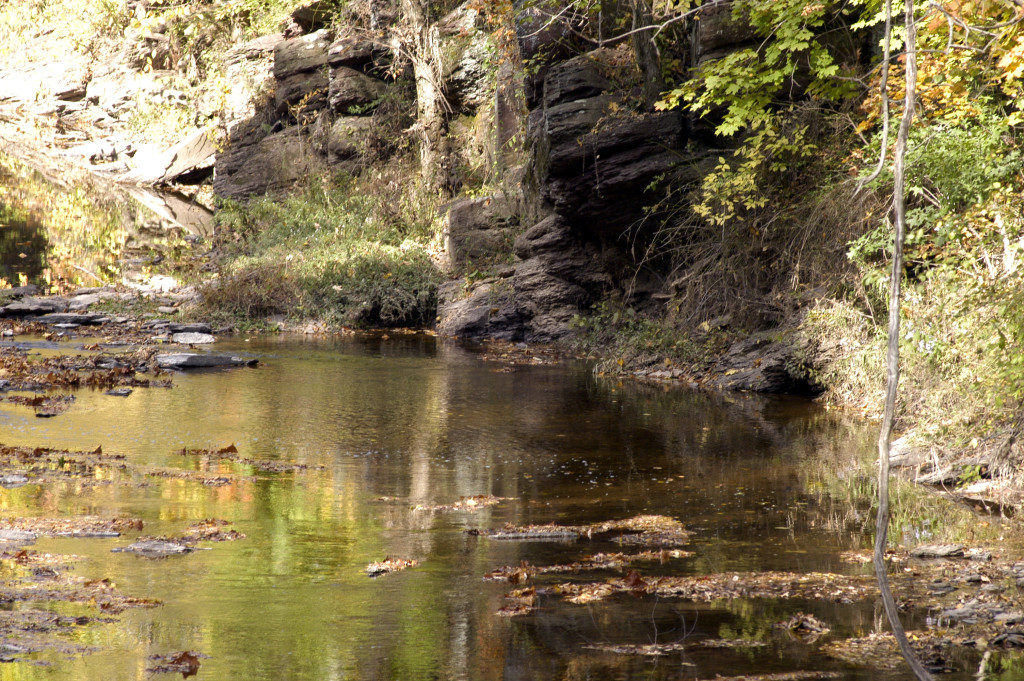
Bare red shale outcroppings provided a cutaway of the contours seen on the topographic map. Some more dramatic than others.
At the point of highest elevation, through which the stream cut its course, a palisade of red shale stood so high, it felt as if I were paddling through a canyon. Atop the sky scraping cliff stood a wall of giant trees which appeared to be on the same plane as the cliff face. Their combined height and singular appearance could not be taken in with just a tilt of the head and an upward glance. It was as if the trees were standing on the earth’s shoulders in a successful effort to touch the sky.
As is characteristic of these small streams, changes happen quickly and dramatically.
One moment later, the unobstructed view of the blue sky and towering prominence vanished, as a sharp bend in the again green canopied river, demanded my full attention. Here, the main current was rushing to the inside of the almost angular curve and through the branches of a fallen tree. Several forceful draw strokes were required to avoid entanglement.
The rest of the trip was easily navigated through a few rock gardens and shoals. Deer were everywhere, while a pair of geese and a few wood ducks provided a downriver escort, warning the world of my otherwise silent approach.
No eagles were to be seen, though a close encounter with a great horned owl made up for the absence of a new eagle nest site. I eagerly await my next rain drenched invitation to another, one of many, tributary paddling options.
Each tributary has its own character, no two alike, other than they share invitation by rain only.
Author Joe Mish has been running wild in New Jersey since childhood when he found ways to escape his mother’s watchful eyes. He continues to trek the swamps, rivers and thickets seeking to share, with the residents and visitors, all of the state’s natural beauty hidden within full view. To read more of his writing and view more of his gorgeous photographs visit Winter Bear Rising, his wordpress blog. Joe’s series “Nature on the Raritan, Hidden in Plain View” runs monthly as part of the LRWP “Voices of the Watershed” series. Writing and photos used with permission from the author. Contact jjmish57@msn.com. See more articles and photos at winterbearrising.wordpress.com.