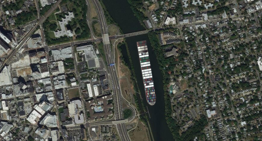
With volunteers having removed hundreds of tires from the riverbed over the years, perhaps there is now room for the “Ever Given” to displace some of the Lower Raritan? The Ever Given’s WNA (Winter North Atlantic mark) indicates she draws 48′ of water below her plimsoll (a plimsoll is the waterline reference mark located on a ship’s hull that indicates the maximum depth to which the vessel may be safely immersed). There’s just about enough flow in the deeper spots at high tide to accommodate this massive ship.
Here we see how nicely the ship’s 1/4 mile frame nestles in between the Raritan Avenue Bridge (Route 27) and the New Street exit off Route 18 in New Brunswick.
On Saturday September 12, the Lower Raritan Watershed Partnership will join groups throughout the New York New Jersey Harbor Estuary in bringing attention to climate change and the resilient nature of our waterfront neighborhoods.
This year we focus on our New Brunswick, NJ community and landscape and will offer programming in New Brunswick’s waterfront Boyd Park from 9 am to 3 pm. Please join us!
In addition to appropriately social-distanced in-person activities, a portion of our programming for the day (from 11am – noon) will be shared virtually via Facebook live. Log-in details will be sent to those who preregister.
City of Water Day events in New Brunswick will include:
#lookfortheriver: FRAMES sculpture installation – ENGLISH AND SPANISH (9am – 3pm)
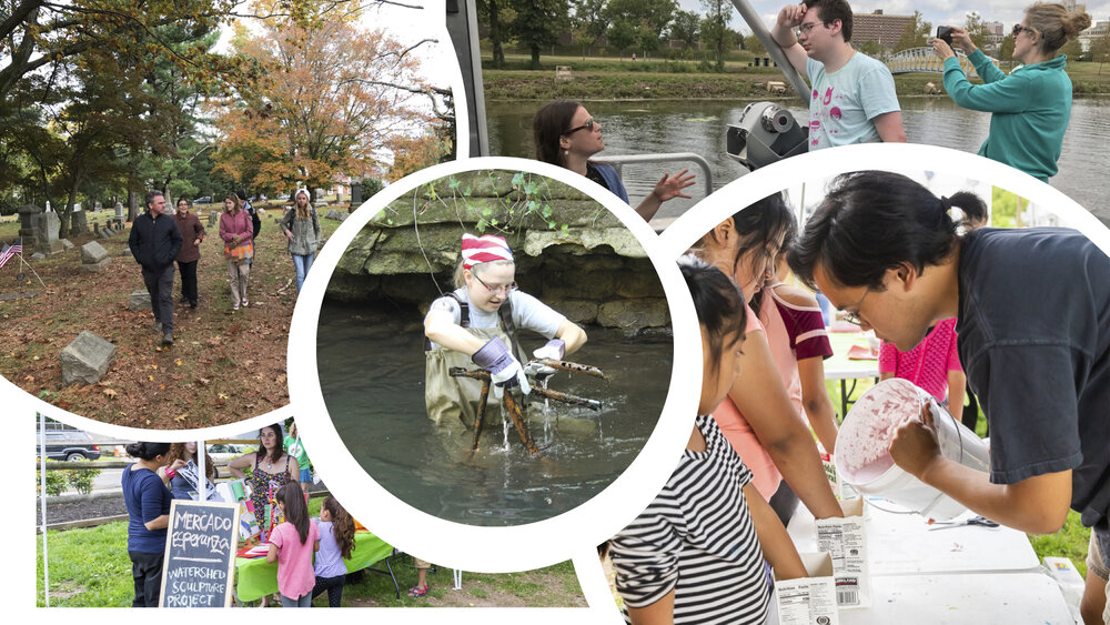
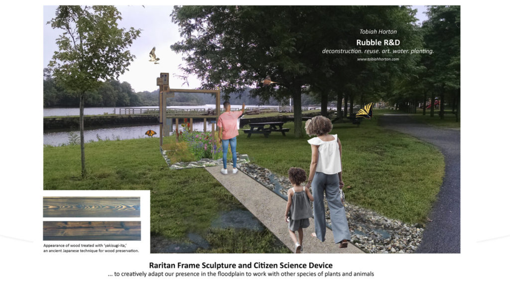
Event participants will observe sculpture artist Tobiah Horton (Rubble R & D) during a “work day” as he installs a new sculpture #lookfortheriver: FRAME in New Brunswick’s Boyd Park Raritan River riverfront.
Participants will have a chance to speak with Toby and members of the LRWP board about flooding and resilience along the Raritan River, and about the #lookfortheriver: FRAMES project. New Brunswick’s Boyd Park floodplain suffers repeat flood inundation, and serves as a protective “sponge” for other parts of New Brunswick. The #lookfortheriver: FRAME sculpture tells the story of infrastructure that is at-risk of flood inundation due to climate change and sea level rise. The sculpture is a living symbol of how removal of structures (in this case a house) from our floodplains allows for ecological restoration and regeneration, and fosters resilience.
Participants will also learn how the FRAMES sculpture functions as a data gathering tool. Through repeat digital photography uploaded to social media, passersby participate in civic science data collection about sea level rise, land use change, and resilience. Data gathered will allow for prioritization of resilience and restoration planning.
2. Water quality monitoring demonstrations – ENGLISH AND SPANISH (9:30-10 am and 11-11:30 am)
The LRWP and EARTH Center of Middlesex County collect weekly samples of Raritan River water for analysis of disease-causing bacteria. We will provide demonstrations of these activities and information about our findings thus far. Learn how and why we do this work and how you can get involved!
3. Raritan River Resilience info sharing – ENGLISH AND SPANISH (9am – 3pm)
This will include discussion of the regional BlueLine Initiative, flood hazard mapping, New Brunswick’s Municipal Public Access Plan, South River Ecosystem restoration proposals, and discussion of the LRWP’s NJ DEP-funded regional resilience planning grant
DUE TO COVID CONCERNS PREREGISTRATION IS APPRECIATED. ONLY THOSE WHO PREREGISTER WILL RECEIVE ADVANCE INFORMATION TO LINK TO THE FACEBOOK LIVE EVENT.
In this Public Scholars Program session at the Old Dutch Parsonage and Wallace House in Somerville, to be held on Sunday June 14, at 3pm, LRWP Board President Heather Fenyk will discuss the changes made to our urban streams over time; how to read a topographic map, identify watersheds, and #lookfortheriver – to empower community members to explore their own local landscapes.
As we travel through our communities, few of us think about the hidden world of streams and rivers that once flowed across the landscape. In the face of climate change and increased precipitation, real life has shown us that stormwater runoff and flooding have intensified. Centuries of piping, culverting and development have hidden the vast majority of waterways in urban areas. The impact of these factors can be devastating: communities are alienated from their streams and historic ecologies, habitats are degraded, and water quality is compromised.
Please contact Paul Soltis to register and for more information: Paul.Soltis@dep.nj.gov
This program is funded by the New Jersey Council for the Humanities.
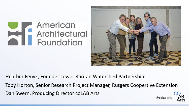
On December 13, 2019 LRWP collaborator and coLAB Arts co-producer and Director of Education John Keller delivered the opening plenary to the 2019 Jersey Water Works annual statewide summit at the Hyatt Regency Hotel in New Brunswick, NJ. John talked about the intersection of art, and our work in the watershed. He gave lots of examples of our collaborative effort these past 5 years. With thanks to John for allowing the LRWP to share his words.
Good Morning Everyone,
Uh, oh. I have to be that first person who annoyingly chastises you for being lack luster in your morning greeting. Think of it this way. It is Friday! You are coming to have a great time at this symposium, learn lots of stuff, have some good conversations, have la meal and still be out by 2:30! And as long as you don’t have a boss who is a party pooper it’s highly unlikely that any of us are going to go back to the office for just a few measly afternoon hours so that means found time! Maybe you’ll stop by your favorite independent coffee shop and have a nice afternoon latte in your favorite reusable cup. Then go over to the local day-spa maybe get a message or a nice facial (as long as it doesn’t have any microplastics in it), then meet up with some friends or family for a movie afterwards, but you will bring your own refillable BPA free water bottle because you are a little dehydrated from the latte, message, and facial and don’t want to pay $12 for a bottle of water at the theater. Then you will get out of the movie and think to yourself… wow that was a pretty good day.
So, let’s start this over.
Good morning everyone!
My name is John Keller and I have titled this presentation. 5 years of art in 9 minutes.
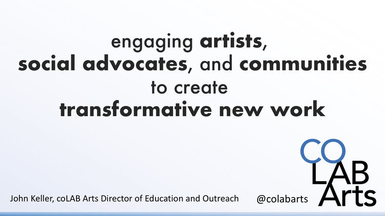
I am the director of education and outreach for a non-profit arts organization called coLAB Arts. You can find us on all the social media stuff as @colabarts.
I am here to tell you a story. The story is how an arts organization found itself motivated and inspired to facilitate conversations around our watersheds, and our relationship to water.
First, a little background. What is coLAB Arts and how does our mission drive us to collaborate with non-arts based social advocacy organizations, government institutions, and community groups?
Our mission is quite simply an equation. We engaged artists, advocates, and communities to created transformative new art-work. For us transformation must be three things. It must be sustainable, positive, and community focused. We work in areas as diverse as juvenile justice reform, transgender rights, domestic violence prevention, and dignity for our immigrant neighbors.
But this one is about water. So here we go.
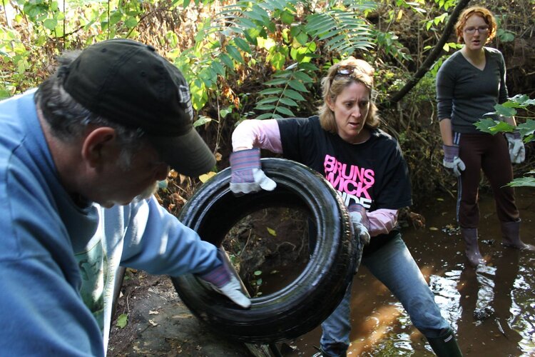
In 2015, myself and two coLAB Arts’ board members attended a watershed education workshop with the then recently formed Lower Raritan Watershed Partnership (LRWP). After the workshop we adopted a local stream and found what so many find in our urban areas: a stream in need of some love. We asked ourselves what we ask ourselves whenever engaging with a new advocacy concern:
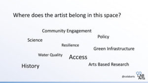
How does the artist engage in this space?
What are the core issues that the advocacy partners are wrestling with? What are the historic contexts? What are the socio-political barriers to equity, diversity, inclusion, Justice and Access that the arts might help dismantle? Who are the communities not yet at the table? What are the questions not being asked? What are the ways artists can influence and augment research? – quantitative and qualitative data gathering. What are the complex ideas that artists can infuse into the conversation to make advocacy and even infrastructure better?
When LRWP heard these questions. And challenged us with some of their own for us to ponder. It was kismet. We began working together. Two organizations, arts and science. We formed a working group of artists, landscape architects, community organizers, and civic scientists, to wrestle with arts-based interventions to our natural and built environments. Early recognition from the American Architectural Foundation and their Sustainable Cities Design Academy gave us the opportunity generate bold ideas around on how the arts can drive sustainable changes to complex structural challenges.
We centered on a seemingly simple idea to drive the story of the work. It is the idea that the river is both a physical entity in our landscape, but it is also a powerful metaphor in our daily lives. It is all around us. It does not just exist in the physical limitations of the banks of a body of water, but it exists in our storm water systems, in the run-off from our homes, in our sprinklers, our faucets, in our dreams for quality of life, in our stories of migration, and our desperation in times of crisis. We began asking ourselves as well as the artists and communities brought into the work to #LookForTheRiver in all things.
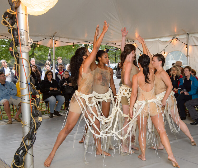
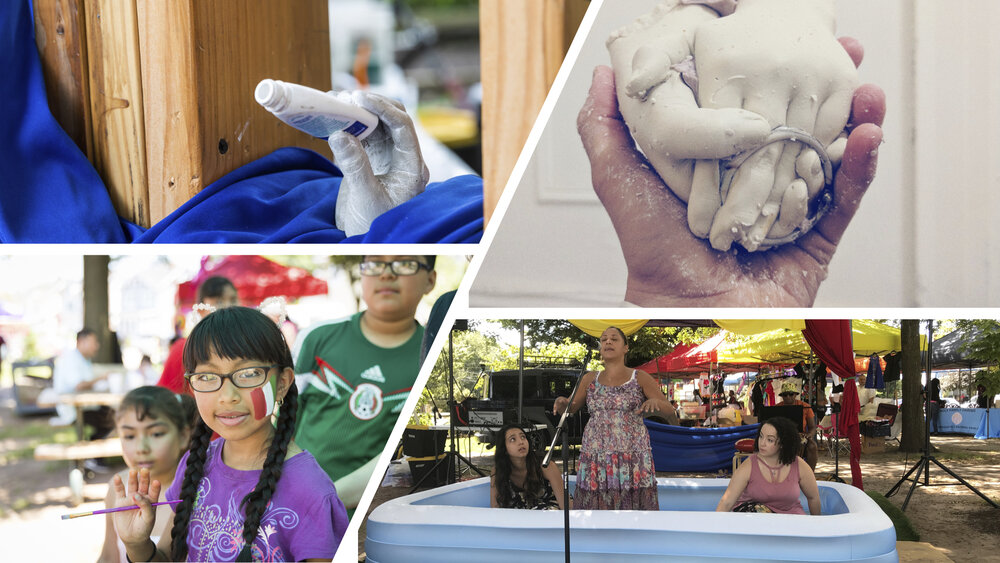
We began work in earnest. Going alongside the LRWP on stream clean ups. Participating in macro invertebrate trainings, touring spaces and landscapes that maybe weren’t the most obvious places of water stewardship. We began engaging professional artists through programs like our National Endowment for the Arts funded residencies where we partner an artist with a non-arts based organization and task each with creating an engaged arts project that facilitates a conversation with community that generates new works of art inspired by some big problem or question that advocacy org is wrestling with. The model of that residency which now has multiple artists with a diverse group of organizations is successful in no small part to LRWP piloting that program our first year. Our Watershed Helping Hands Sculpture Project on display in the lobby is one such example of one of the community based art engagement programs that resulted from that artist residency.
Once the communities have been engaged and you have built a critical mass of participation. You have to think next steps.
At the end of the day we are an arts organization and the greatest way to partner with artists is to provide opportunities for them to create bold artistic gestures.
Our work has been both conceptual and literal.
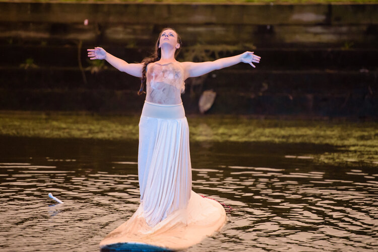
We have used the process of cleanups, data collection and public access as our points of inspiration to create works that both reuse found materials as well as engage with artists from diverse backgrounds and disciplines such as sculptural work, dance, theater, and mixed media.
To integrate both professional arts creation with community arts creation. Recognizing that while not everything can be called great art, great art can come from anywhere. We balance the ethereal of the performative with the substance of created artifacts; both a natural growth from a new communal education on watershed health and quality and the provocation of a call to action.
When this happens a new kind of reality might be possible. Where if we truly look for the river in all of the aspects of our lives. We begin to question why is it absent? And we see our spaces built in essence to do whatever they can to keep the river out. To blot it out from our landscape…
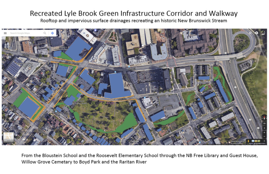
But when you create the potential for new vision we can inspire ourselves, our planners, and political leaders to reintegrate the river into our lives; into our built cities, and our story telling. Accepting the river back becomes our way of solving infrastructure problems. Like a new art and history based greenway connecting public spaces through the heart of an urban area, or an art and green infrastructure concept project which includes a two-story sculpture work that becomes a wayfinding landmark, urban beautification, and a five thousand gallon cistern to keep water run-off from reaching the storm water system in times of flooding.
When empowering communities to create art that allows them to connect with both their environmental and social justice history we can make space to dream about ways in which we can work with our built communities to remember the landscape of our past. And find new ways to interact with it.
The arts are in incredible communicative tool. But the first act of social justice is to listen. Our creations cannot come before we first strive to listen with the intention of learning. Artists and water experts need to engage in this process together. When the artist is involved in the process – not just brought in at the end to slap some paint on a wall, not just asked to develop the PR or marketing strategy, rather allowing the artist to be in response to this listening process.
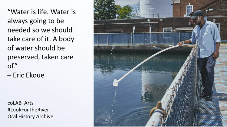
In 2019 we began an oral history archive which is about capturing those stories. Balancing the narratives. We research and collect the stories perhaps lost, perhaps suppressed, perhaps forgotten, around one very simple idea: Water is everywhere, and water is important to everyone. And then doing what we do… make are that is in response and helps us all frame a greener future.
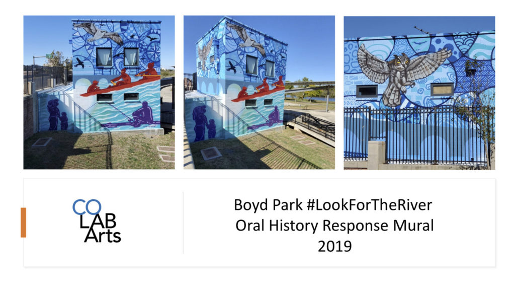
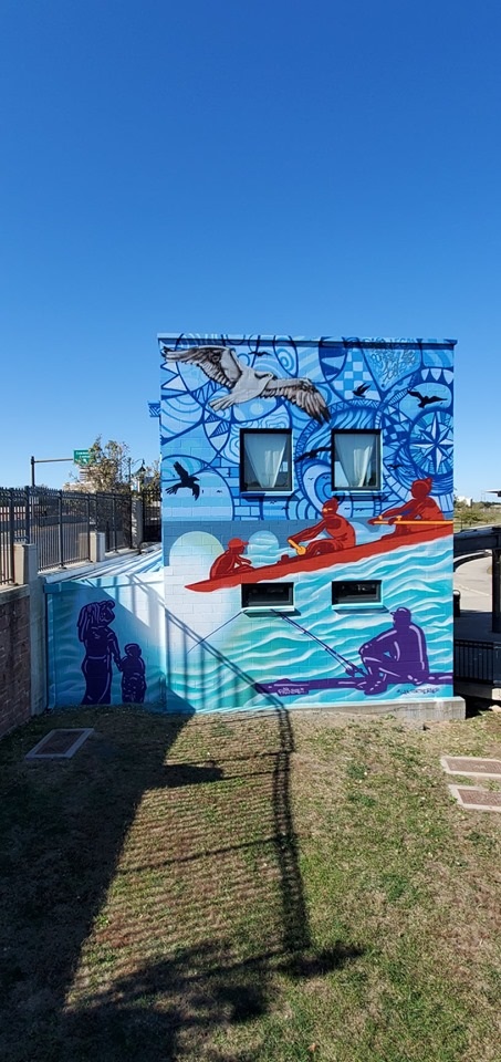
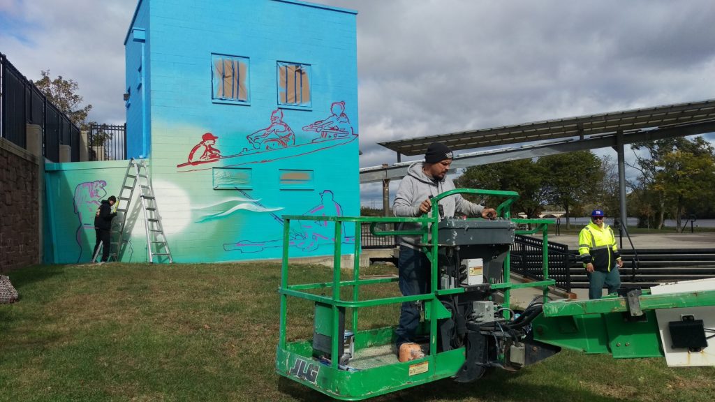
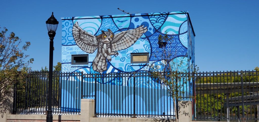
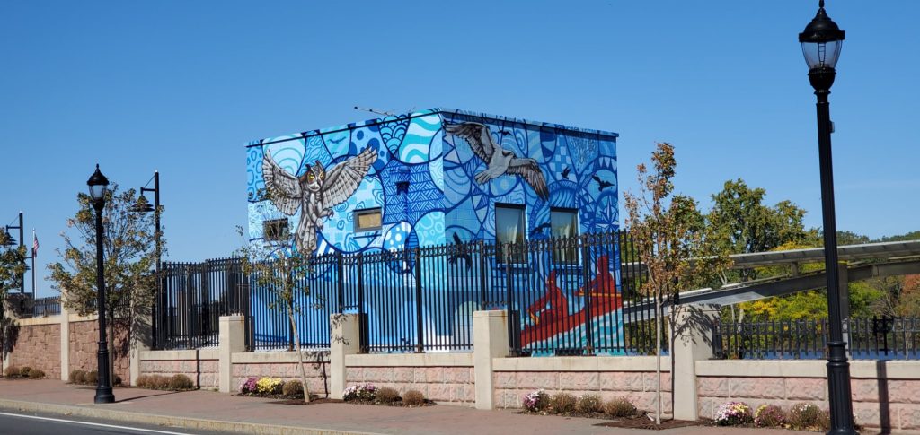
“Raritan River Ways” was created by Leon Rainbow in New Brunswick, in Elmer B. Boyd Park overlooking the amphitheater entrance and Route 18. The mural was created as a commission from the New Brunswick City Government’s response to coLAB Arts’ oral histories collected from individuals who have been boating, fishing, and stewarding the Raritan River for decades.
Route 18 has disconnected New Brunswick from its waterway since the 1950s. Given the high visibility of this mural, we view #RaritanRiverWays is a form of wayfinding for the New Brunswick community and others to reconnect with the Raritan River. We see it as a reminder that we should all #lookfortheriver
Special Thanks to Leon, and to his assistants Radek and John Everyman for this beautiful gift for the City.
Thanks also to Michael Tublin, Keith Jones II, Daniel Swern and John P Keller for all your hard work to make this project possible!
As we travel through our communities, few of us think about the hidden world of streams and rivers that once flowed across the landscape. In the face of climate change and increased precipitation, real life has shown us that stormwater runoff and flooding have intensified. #lookfortheriver is an outreach campaign to engage New Jersey residents in examining changes made to our urban streams and hydrology over time.
Seven years ago my family was without power and heat following Superstorm Sandy. We spent days off from school and work, charging phones in a local fire station, shopping at A&P in the dark, and mopping up our flooded basement apartment. We mourned with our next door neighbor who lost a brother to generator-related carbon monoxide poisoning, and with a colleague who lost a neighbor when the storm’s vicious winds downed a tree.
Today we stop to remember. As we do, we think about those for whom Hurricane-related devastation is fresh. The Bahamas is still assessing damage from Hurricane Dorian. Puerto Rico is still recovering from Hurricane Maria. And just last month Tropical Storm Imelda dumped 43 inches on the Houston, Texas region, causing wide scale flooding, a near repeat of the intense rainfall seen during Hurricane Harvey in 2017.
Imelda and Harvey in particular have brought attention to the likelihood that global climate change will increase the frequency of powerful hurricanes and other storms, and not just in Texas. The northeast has already experienced a 71% increase between 1958 and 2012 in rainfall from intense storms. If the amount of rain that saturated Houston during Harvey or Imelda hit Raritan Bay, our Lower Raritan Watershed riverine communities, including Perth Amboy, South Amboy, Sayreville and South River, would be completely inundated through a combination of storm surge and overland stormwater flow. Although rainfall amounts akin to Harvey are unlikely in our region, we know we must adapt to a wetter, stormier reality.
Intense rainfall is especially devastating in heavily urbanized areas that are characterized by impervious cover, and by streams that are completely culverted, buried, or otherwise covered up. The impact of “hiding” so many of streams causes serious problems. Communities are alienated from their waterways and historic ecologies, habitats are degraded, water quality is compromised, and stormwater runoff and flooding intensify. In the context of intensified precipitation, healthy, open streams play an important role in stormwater management. Open streams slow and control stormwater surge, and stormwater gets absorbed and gradually released by soil and plants.
On this seventh anniversary of Hurricane Sandy the Lower Raritan Watershed Partnership (LRWP) is rolling out #lookfortheriver, a new campaign designed to inspire care for neglected waterways – our lost or forgotten streams – in the context of climate change, intensified urban flooding and sea level rise. We see #lookfortheriver as a way to build social resilience, and to empower communities, particularly folks in harms way with respect to flooding, to value and restore freshwater ecosystems and the environment as community care and resilience.
#lookfortheriver is a way for ordinary citizens to learn how to adapt and prepare for a wetter, stormier future. It involves training in how to read a topographic map, identify watersheds, and understand basic hydrology. It is designed to support residents and communities as they explore their own local landscapes, and to open up discussion about historic patterns of land management and how we might do better.
The LRWP will be gradually building a portfolio of #lookfortheriver offerings. To start, in 2020 eligible entities like libraries, historical societies, museums, civic associations, public agencies, senior centers, and other community groups throughout the state of New Jersey can host a #lookfortheriver outreach session through the New Jersey Council for the Humanities (NJCH) Public Scholars Project.
We are excited about this new initiative, and hope you will join us as we look to the future and #lookfortheriver.
The LRWP is often asked to identify top environmental issues facing our Central Jersey watershed communities, and every year we develop a “Top 10” list of concerns. Through 2019 we will feature one concern a month on our website, exploring that issue (and potential solutions) in more detail. This month we consider the problems caused by culverting, piping, developing over or otherwise “hiding” our streams, and provide strategies through which we can find them again.
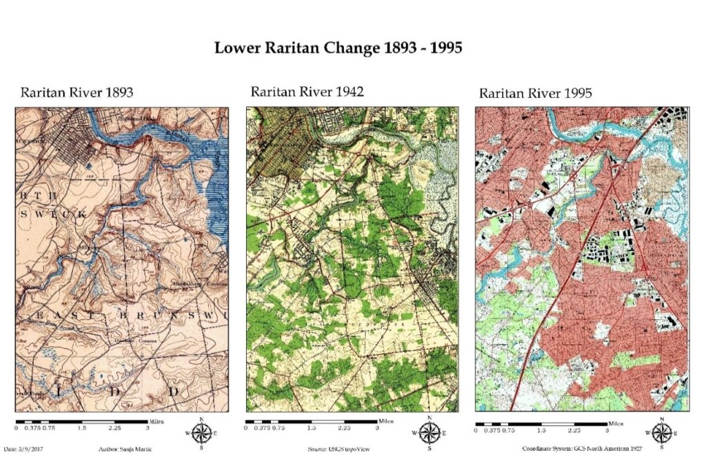
The Lower Raritan Watershed is full of ghost streams. Entrepreneurs, town councils, industry, and home owners have long buried streams to develop their land and businesses, to expand their towns, to build their homes, and to address public health concerns. The result is centuries of piping, culverting, construction, and development that have hidden the vast majority of streams and rivers in our urban landscape.
“Lower Raritan Change: 1893-1995” This graphic show gradual encroachment of development and associated disappearance of tributaries to the South River and Raritan River over a period of approximately 100 years. Sanja Martic, 2017.
The impact of “hiding” so many of our streams is devastating. Lower Raritan communities are alienated from our waterways and historic ecologies, habitats are degraded, water quality is compromised, and stormwater runoff and flooding intensify. Not only in the Lower Raritan, but throughout the United States and globally, these impacts are most acutely felt in areas with low socioeconomic status and vulnerable populations. In the face of climate change and increased precipitation and runoff, these communities bear disproportionate risk and adaptive burden.
We know that healthy, open streams play an important role in stormwater management. In a healthy stream, stormwater gets absorbed and gradually released by soil and plants. An open stream not only slows and controls stormwater surge, it also provides habitat for wildlife, and provides the aesthetic benefits of cool spaces and greenery.
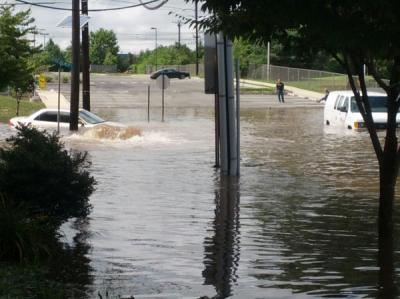
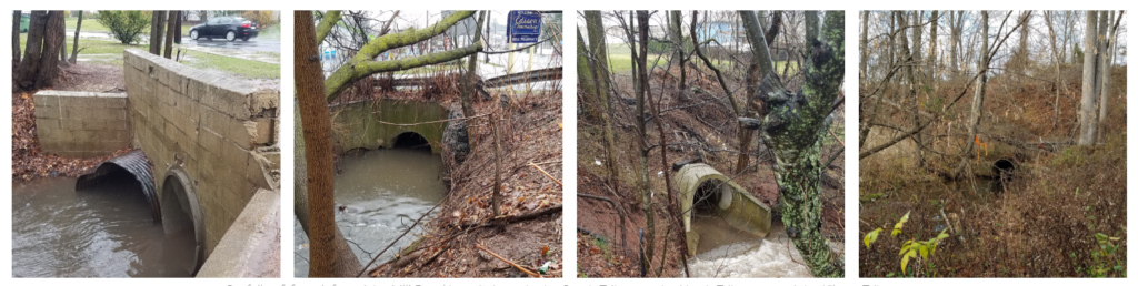
A Stream (Mile Run Brook) Runs Under It Flooding on Joyce Kilmer Avenue at the Mile Run Brook culvert strands students at New Brunswick’s Greater Brunswick Charter SchoolPhoto: Charlie Kratovil, 2016
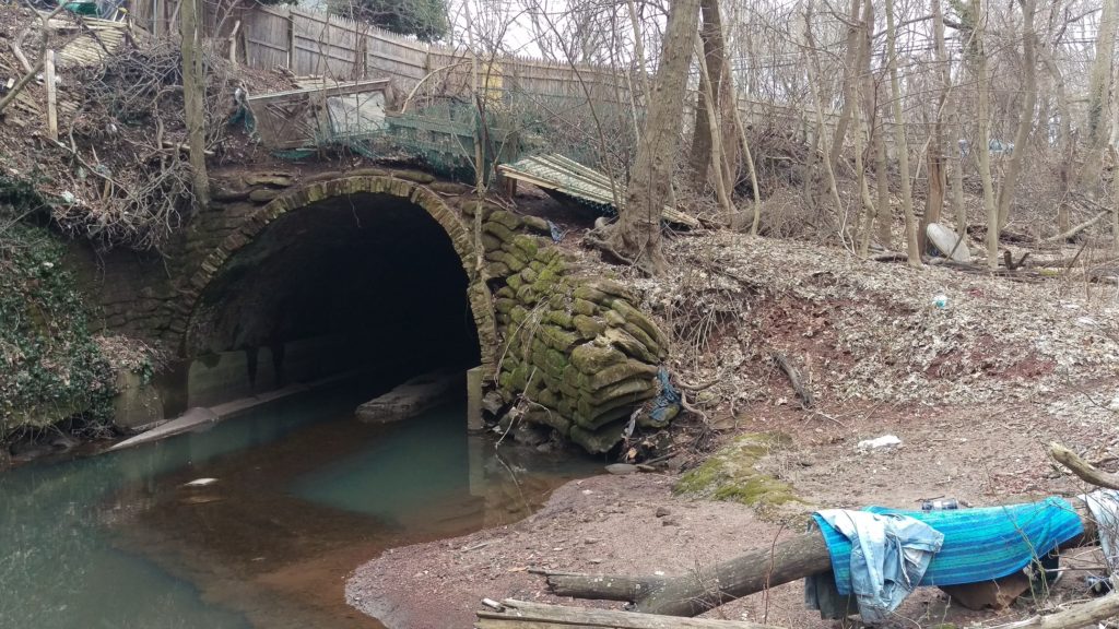
What is a culvert? A culvert is a tunnel carrying a stream or open drain under a road or railroad.Stagnant water in Mile Run Brook under New Brunswick’s Hamilton Street culvert. Photo: Heather Fenyk, 2019
Streams, especially small ones, also play an important role in improving water quality. A healthy stream ecosystem can remove excess nutrients, sediment, and other contaminants from water before it flows into our Rivers, Bays or Oceans. Recent research by the Environmental Protection Agency found that nitrates—nutrients that can become pollutants—travel on average 18 times further in buried urban streams than they do in open streams before they are taken out of the water column. This means that in areas with many buried streams like the Lower Raritan Watershed, larger water bodies including Raritan River and Raritan Bay receive more pollutants than if the waterways upstream were open and healthy and serving to filter pollutants as stormwater runoff travels its course.
Except for the smallest tributary, all branches of Mill Brook first meet daylight at the end of concrete pipes.Outfalls of, from left to right, Mill Brook’s main branch, the South Tributary, the North Tributary, and the Kilmer Tributary (Highland Park and Edison).These photos are part of Susan Edmunds’s Storymap: “Mill Brook: A Portrait of an Urban Stream”
Of course the best first action with respect to keeping streams healthy is to avoid culverting, piping, constructing over or otherwise developing them. However, in already heavily developed areas like the Lower Raritan Watershed, much damage has already been done. In some of our Lower Raritan towns more than 50% of surfaces are paved over, including all waterways that were in evidence on maps from the 1800s.
Change in time in impervious cover in the Lower Raritan Watershed from 1995-2012
Walk down most any of our main streets and you are likely to “walk on water” without any awareness of what is beneath your feet. If you pay careful attention however, as students did during our 2018 summer camp, you can hear the streams and trace their course, even if you cannot actually see them. Learning about our landscape, and “finding” our hidden streams is the next best action to take in protecting them.
Lazos America Unida/LRWP Summer Camp looks for the buried Lyell’s Brook
Learning to decipher our landscape, and trying to “find” our hidden streams are central to the LRWP’s new #lookfortheriver campaign.
The LRWP is building the #lookfortheriver campaign to bring attention to the problems of “hiding” or disappearing our streams, and to identify ways of finding them again. In addition to teaching folks about the landscape in fun ways, this involves collecting stories by volunteers and contributors who take the time observe and document their area streams, and who highlight the great benefits of landscape connectivity. Joe Mish’s most recent February essay is a great example: Along the South Branch Connected. Margo Persin’s year of blog post’s about Ambrose Brook is another.
#lookfortheriver activities include our newly launched “Watershed Highlights and Hidden Streams: Walking Tours of the Lower Raritan Watershed,” to be led by Rutgers Professor and LRWP Board Member David Tulloch. These walks will look at landscape connections to our waterways and what this means. The series kicks off on Sunday March 16 close to the Rutgers campus, with exploration of the connections between Buell Brook and the Raritan, connecting Johnson Park and the historic Raritan Landing with the Eco Preserve.
#lookfortheriver includes working with volunteers to understand how our landscape works, where it doesn’t, and how to fix the problems we observe. Susan Edmunds’s research into the history of Mill Brook, and her careful study and documentation of the stream (see her online Storymap Mill Brook: A Portrait of an Urban Stream) lends tremendous insight into landscape functions of a relatively forgotten stream. Susan will present on this project in at the Highland Park public library on Sunday March 24. Joining Susan will be Rutgers student Jillian Dorsey, who will highlight findings from her thesis research on Mill Brook that shows how property owners can protect their urban streams. We hope these efforts will further mobilize municipal action to restore local streams, and that they will inspire homeowners in proper maintenance of waterway-adjacent homes. In fact, this work has already inspired the Highland Park Council to partner with the LRWP for a multi-site clean-up of Mill Brook, scheduled for Sunday May 12 – please save the date!
The legacy of development, culverting and piping that has hidden our streams exacerbates flooding and pollution transfer. It has disconnected us from our waterways and from our land. This is disastrous for our communities, but we are learning new ways “find” our streams again and fix these problems. Join us in online to discussions, at meetings, or for our “Hidden Streams Walking Tours”. Or simply start exploring the watershed on your own. Give close attention to landscape cues – the sound of rushing water in a storm sewer, collections of sediment and debris in low lying areas, and dense growth of trees and weeds. In this way we connect to our landscape and waterways, imagine their past, and can begin to plan for a future of “finding” and restoring them.
Join LRWP Board Member Professor David Tulloch as he leads our second “Watershed Highlights and Hidden Streams” walking tour of 2019!
Professor Tulloch will help us connect the old constructed landscapes of the canal at Duke Island County Park through a new greenway / bikeway that has been developed along the Raritan and crosses over into the Duke Farms properties. Many area residents are likely familiar with individual pieces of these recreation spaces. Fewer have made the walk to connect them all.
We expect to traverse 3 municipalities (and a named community that locals assume is a 4th municipality), and learn about the role that James Buchanan Duke played in shaping the hydrology of the area including creating multiple dams on the Raritan River to channel water to man-made lakes on the Duke Farms grounds.
Professor Tulloch says: “With the pump house and former dam, I think this will really be more about history than the hidden streams. But there are some interesting spots along the river where small streams contort themselves to cross the greenway.”
Join us from 9-11 AM on Saturday May 18.
Please park at the lot marked as the Raritan River Greenway on Old York Road between Woodmere St and Chestnut St, just barely inside Raritan Borough.
Registration required.
As we will not enter into Duke Park lands, dogs are allowed on this walking tour.
Article by Rutgers Raritan Scholar Intern Allie Oross
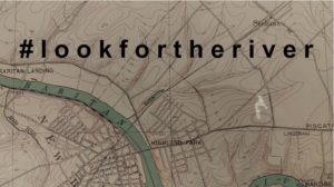
#lookfortheriver
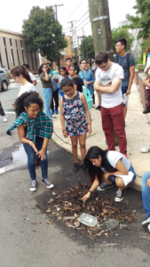
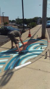
On Saturday, July 7th, the LRWP led the New Brunswick Environmental Commission and other members of the New Brunswick community in a project on the Redmond Street side of Lord Stirling Elementary School. The final product of their hard work is manifested in a whimsical sidewalk mural that not only serves as a form of neighborhood beautification, but also a semi-permanent reminder of the intricate roles human’s play in the environment.
New Brunswick Environmental Commissioners, residents and LRWP friends paint flowers
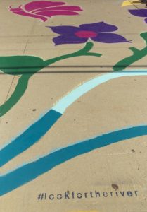
Funded through an Americorps alumni grant secured by Thalya Reyes, and designed by former Americorps alum Johnny Malpica, interwoven swirls paint a picture of natural necessities that are integral aspects in every single person’s day to day life. In the mural, clouds create rain drops that collect to form a pulsing river. That river then flows into a set of flowers being pollinated by a bee and a butterfly with the next section displaying a fish in the river. Though the images are depicted in a delightfully playful and abstract manner, each can also be interpreted as a representation for a much more crucial concept:
We, as a community and as a species, must never forget how inextricable we are from the environment. You cannot have one without the other, and though we may seem separated from nature, the gap is almost always smaller than we may think.
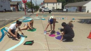
New Brunswick Environmental Commissioner Howie Swerdloff paints a river
A few blocks down from the sidewalk mural is the Raritan River. A core purpose for the mural is to act as an expression of the course stormwater runoff takes through the New Brunswick streets every time it rains. After rain events our streets often serve as veins pumping litter and pollution into the heart of our waterways. Out of sight should never mean out of mind when discussing the environment, and the mural engages citizens to remember there is nature all around us if we only make the effort to search for it.
With grant support from the Middlesex County Office of Arts History, the Lower Raritan Watershed Partnership and coLAB Arts will implement the first component of the #lookfortheriver Public Art Program in New Brunswick’s Boyd Park in Summer 2018. The grant will allow for engineering and construction of a footing (the base) for a new public art piece for New Brunswick’s Boyd Park. The creative work to be installed at that site will serve both environmental/watershed awareness and cultural/community engagement purposes for the Raritan River waterfront at that site. Grant funding has been provided by the Middlesex County Board of Chosen Freeholders through a grant provided by New Jersey State Council on the Arts / Department of State.
The #lookfortheriver Public Art Program is a component of the LRWP’s #lookfortheriver watershed restoration campaign, which is designed to encourage community members to “look” for buried streams using landscape cues and historical research. #lookfortheriver is a package of actions communities can engage in around flood resilience and environmental restoration. The LRWP will be rolling out aspects of the #lookfortheriver campaign through 2018 and 2019.