Interview by Emily Koai, LRWP Spring 2020 Raritan Scholar
Nandini Checko was born in India and moved to the United States at a young age. She earned her bachelors and masters degrees at Rutgers and Columbia Universities respectively. When her children started school, she began her journey in local volunteering in schools and townships within Somerset County. She has helped with a multitude of initiatives in an effort to improve local sustainability. Through her work with LRWP and ANJEC, she hopes for improved civic engagement in communities and a more profound understanding of our interconnectedness with nature.
EK: Could you tell us a little about yourself and your background?
NC: Unlike many of my colleagues, I don’t have an environmental science background. I have a bachelor’s degree from Rutgers School of Business, and a master’s degree from Columbia in Organizational Development. My degree in organizational development has helped frame the work that I do because it takes a holistic approach to managing change — the people, systems, process and technology. It’s a highly collaborative approach to help move a project along and to help folks really co-create their future.
EK: What led you to your focus in plastics then?
NC: It started with my organization that I work for right now, which is the Association of New Jersey Environmental Commissions (ANJEC)— a statewide, non-profit environmental group that helps New Jersey environmental commissions, individuals, local and state agencies preserve natural resources and promote sustainable communities. We just celebrated 50 years of environmental excellence. We are a small but mighty group! My boss came to me maybe about 4 years ago and said EPA Region 2 is doing a roll out of a program called Trash Free Waters – zero waste loading of trash into our waterways, and at that time, Region 2 (NJ, NY, PR, US Virgin Islands, & eight Indian Nations) was led by Judith Enck. She’s an absolute visionary, a total leader, similar to Heather—very inspiring and amazing woman.
ANJEC started dipping their toes in and asked “What would that really look like in New Jersey?” When we dug into that question, we found our way to the problem of people pollution. The nine million of us that live in New Jersey—we’re all polluting in our own little way. So much waste entering our natural eco-systems. And when you dig down into that waste (especially litter), then you’re looking at plastics, and when you go a little further into plastics, you realize the majority of it is single-use, once and done.
That really motivated us to take this and move this agenda item forward. It aligns very well with our mission of supporting the local environment and I had a lot of support to advance reducing single-use plastics from my boss, Jennifer Coffey (ANJEC Executive Director) – an inspirational leader that gives the staff a lot of leeway.
EK: Did you have any passion projects in your career that led you to where you are today?
NC: I lived in India during my formative years and was always really connected to the environment. I’m very sensitive about waste– whether it’s litter or food waste, just waste in general, it bothers me deeply because it’s such a pull on the Earth’s resources.
We recycle at home, and when my son started elementary school, I figured the school was doing the same. And then he came home a few weeks in and said that they don’t recycle in school. I looked into it and, sure enough, they weren’t recycling. That started me on the path of local volunteering. I started the Green Design Group and we created sustainable efforts within the community and put forth a lot of the initiatives in schools and the township. And through that effort, I also started the Green Classroom Committee. As a parent volunteer, I worked with the superintendent, the facilities manager, business administrator, students and teachers to help educate and implement a variety of programs from anti-idling, removing Styrofoam lunch trays, and energy efficiency programs.
When you think about what gets people activated, it’s about what they can see, touch and feel in their own lives. When you see the woods in your town on fire, you’re going to get involved and ask: Why is that on fire? How can I help? For me, it was my kids. I was recycling at home and they come back from school and say they’re not recycling there. That’s when I got curious. Children are key to helping adults get involved in civic engagement.
EK: On a wider scale, what roles do you think municipalities have in progressing the work we are doing as an organization?
NC: I think they play a massive role. Municipalities are key players in advancing LRWP’s mission of improving water quality and the health of the ecosystem of the Raritan River. Given NJ’s home rule structure, local governance is essential to making water stewardship and advocacy a priority.
EK: What kind of opportunities do you think there are for partnership between the LRWP and the ANJEC?
NC: “Water is life, and we have a moral obligation to protect it for all its inhabitants now and in the future.” This quote from Candy Ashmun, ANJEC Co-founder, highlights the synergy between our two groups. Environmental commissions play a pretty unique role in municipalities. Most local planning happens within the boundaries of the town and in site development, it’s just by block and lot numbers. You’re not looking to see how it’s all connected. Water, land, animals have no boundaries. And environmental commissioners, when they take that bigger regional look, they’re looking at the watershed. Through my role at ANJEC, I would like to introduce more municipal officials to LRWP and help advance our mutual goals.
EK: What would you like to communicate to today’s society about watersheds and the environment?
Watersheds play a really key role in all our lives. We have to support reducing the amount of pollution that enters the watersheds and people need to better understand where their water comes from and where it goes.
Article by John Jengo. Aerial photos by Alison M. Jones with NoWaterNoLife – photos were captured during a LightHawk, Inc. flight
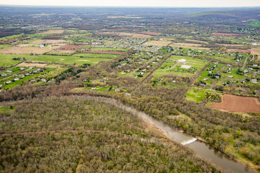
The 230-foot-wide Headgates Dam, located between Hillsborough and Duke Island Park in Bridgewater, NJ is the last dam on the Raritan River before the confluence of its North and South Branches.
Headgates Dam, Duke Island Park, Raritan Water Power Canal looking south past the Raritan River towards Princeton and Sourland Mountains Photo courtesy Alison M. Jones with NoWaterNoLife – photo taken during a LightHawk, Inc. flight
The original Headgates Dam (what you see today is a 1959 reconstruction) was built in 1842 in conjunction with the Raritan Water Power Canal as an entrepreneurial venture in order to sell commercial lots in the town of Raritan three miles east to industries requiring water power. At its height, there was a gristmill, a machine shop and foundry, a screw factory, a paint works, flour mills, the Somerville Water Company, and most famous of all, the Raritan Woolen Mills, all using water flowing down the Canal.
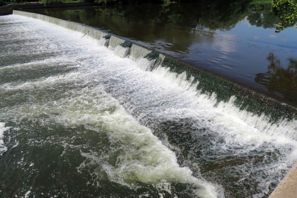
Headgates Dam, 8.20.2019. Courtesy John Jengo.
I believe that the term “Headgates” referred to both the dam itself and a gate structure that was formerly located at the head of the Canal where it adjoined the Raritan River. Many people have noticed the three curious bumps along the eastern half of the dam, and I postulate that these features indicate the location of a stop log guide frame that allowed a set of stop logs (rudimentary gates) to be raised or lowered to control the level of the water impounded behind the dam. Conceivably, these “gates” could be opened during the spring migration to allow migratory fish to pass upriver, and if the gates were operated in this manner, this would not be the only instance of fish passage structures being incorporated into 18th and 19th century dams. One can wonder why such multi-use, holistic thinking was forgotten when all these dams were rebuilt in the 20th century. It should be noted that the term “Headgates” also applied to large Gate House structure equipped with six timber lift gates (which was unfortunately demolished in the 1960s) that was formerly located at the head of the Canal that controlled the flow of water into the Raritan Water Power Canal.
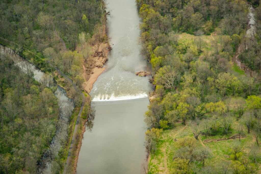
Headgates Dam Photo courtesy Alison M. Jones with NoWaterNoLife – photo taken during a LightHawk, Inc. flight
J.B. Duke’s acquisition in 1897 of the Somerset Lighting Company/Raritan Water Power Company (the brick “powerhouse” building which survives just east of the Wrought Iron Bridge Company double intersection truss bridge, commonly referred to as the Nevius Street Bridge,) was initiated because Mr. Duke wanted both hydropower and a reliable water supply from the Canal for his expansive estate (Duke Farms), including its renowned network of lakes and fountains. To resolve the problem of the turbid Canal waters clogging the delicate fountain waterworks, Mr. Duke had a large-scale filtration facility constructed circa 1907 (the stone “castle” building just west of the Nevius Street Bridge) so that only exceptionally clear water would be discharged from the fountains. I postulate that Duke Farms ceased using Canal waters around 1974 because the flow of water had diminished, its quality had declined, and the maintenance of the filtration system became too onerous. It was at this time that Duke Farms converted the Nevius Street Dam (the dam that was located just upstream of the Nevius Street Bridge that was built for aesthetic and recreational purposes by Mr. Duke in 1901) for the estate water supply until 2013 when that dam was removed as part of the Raritan River Fish Passage Initiative and groundwater supply wells were installed to provide water for the Duke Farms lake system.
Since 2008, I have conducted research and studies to assess the feasibility of removing the Headgates Dam, but there are several complex and costly technical issues that remain to be resolved. Firstly, there is a community-essential sanitary sewer line that is located just upstream of the dam that has to be relocated before the dam is removed (part of the sewer line protrudes above the river bed so if the dam were to be removed, the sewer would be exposed to the rivers’ most turbulent flow, which is not permitted by State regulations). Secondly, the Raritan Water Power Canal is listed on the New Jersey and National Registers of Historic Places, and in the absence of the dam, it would be largely dewatered so plans are being developed to provide an alternative source of water for the Canal. Should financial resources be identified to implement these aforementioned remedies, the removal of the Headgates Dam could proceed in a manner similar to that of the Robert Street Dam (removed in 2012), which was reconstructed in 1964 using the same design specifications. The removal of the Headgates Dam would free the entire 30-mile length of the main stem of the Raritan River for migratory fish passage, in addition to opening up the lower reaches of both the South and North Branches of the Raritan.
Headgates Dam Photo courtesy Alison M. Jones with NoWaterNoLife – photo taken during a LightHawk, Inc. flight
John W. Jengo, PG, LSRP is a licensed Professional Geologist in several Northeastern and Southeastern states and a Licensed Site Remediation Professional in New Jersey. John works as a Principal Hydrogeologist in an environmental consulting firm in southeastern Pennsylvania. He has degrees in geology from Rutgers University (1980) and the University of Delaware (1982). Over the last 30 years, he has conducted the characterization and remediation of large, complex contaminated industrial sites throughout New Jersey, Pennsylvania, and Delaware. He played a key role in Natural Resource Damage (NRD) assessments that led to groundbreaking legal settlements to remove numerous low head dams on the Raritan and Millstone Rivers to restore historically significant migratory fish spawning runs. As technical project manager, he planned, permitted, and successfully managed the removal of the Calco Dam, the Robert Street Dam, and the Nevius Street Dam between 2008-2013, and the removal of the Weston Mill Dam on the Millstone River in 2017, along with leading the archaeological investigation of the former Weston Mill in the Borough of Manville and Franklin Township.
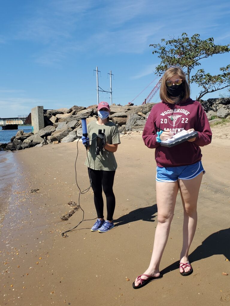
Photos and article by LRWP Board President Heather Fenyk
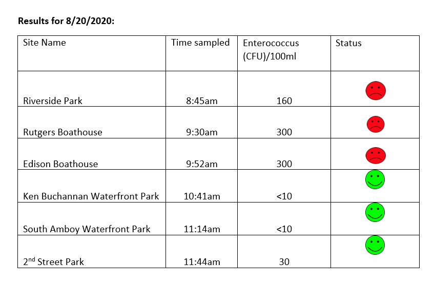
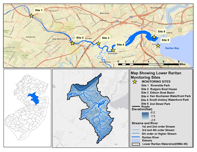
The LRWP and EARTH Center of Middlesex County monitors for Fecal Coliform and Enterococcus at six non-swimming public beach access sites along the Lower Raritan during the warmer summer months. Fecal Coliform and Enterococcus are indicators of disease-causing bacteria in our waterways.
The EPA recommends that a single Enterococcus sample be less than 110 Colony Forming Units (CFU)/100mL for primary contact. Enterococci levels are used as indicators of the possible presence of disease-causing bacteria in recreational waters. Such pathogens may pose health risks to people fishing and swimming in a water body. Sources of bacteria include Combined Sewer Overflows (CSOs), improperly functioning wastewater treatment plants, stormwater runoff, leaking septic systems, animal carcasses, and runoff from manure storage areas. Enterococci levels are often high after heavy or consistent rainfall.
Briefly, our Sayreville, South Amboy and Perth Amboy sites are looking good this week! Please note that these results for August 20, 2020 are preliminary and awaiting Quality Control.
Field Notes
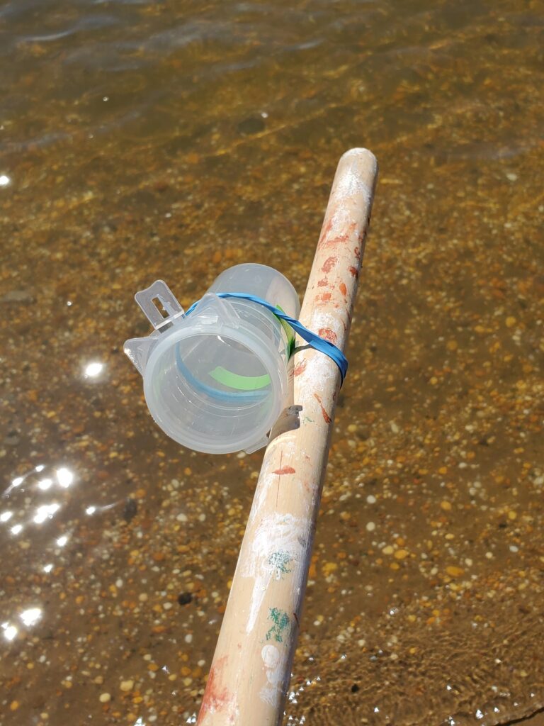
Yesterday was an exquisite day for sampling the Raritan!
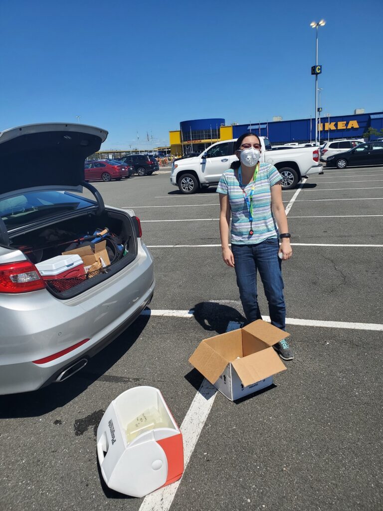
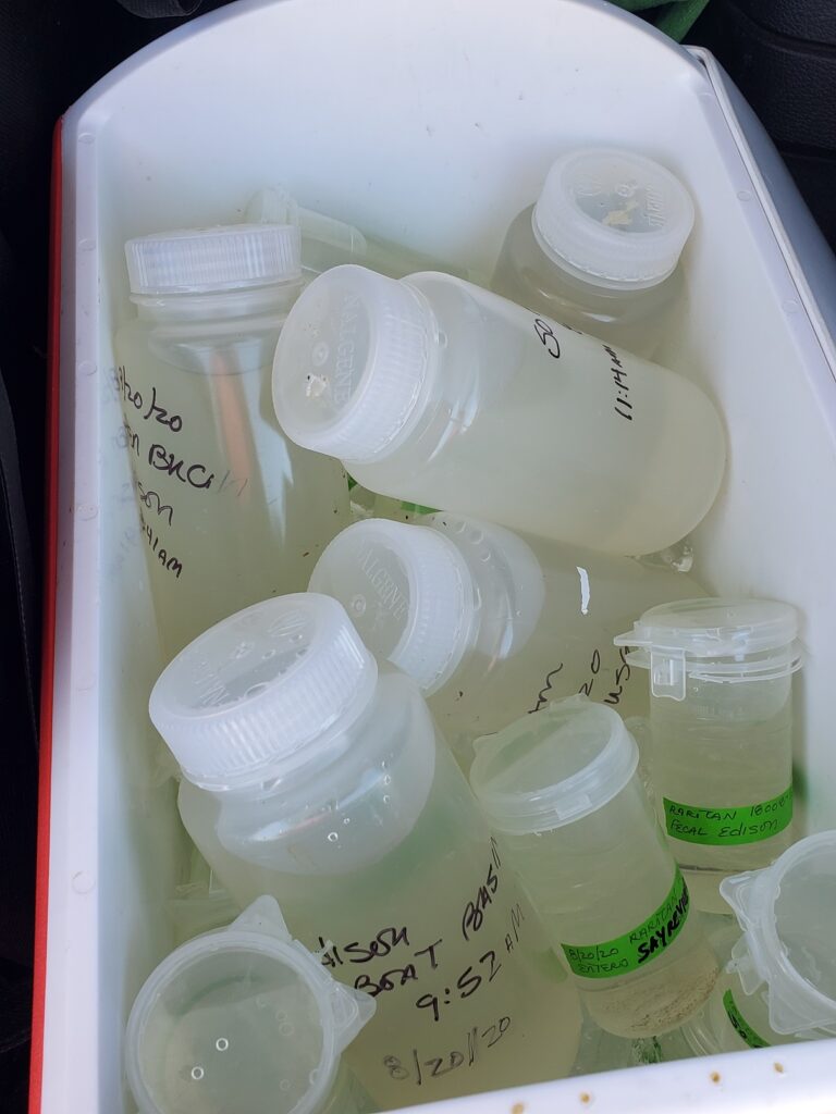
Clear and gorgeous waters, and the re-purposing of a broom handle into our snazzy new sampling stick.Thanks to Maya and NJ Watershed Ambassador Heather Miara for lending a hand in the field.Thanks also to IEC’s wonderful Jessica Bonamusa for meeting us in the Elizabeth IKEA parking lot for the sample handoff.This week we kick off our genetic source trackdown analysis – the larger sample bottle in the mix of pathogens sample bottles will go to a Rutgers lab for filtering and analysis. We’re looking forward to more definitively pinning our pathogens problems on human, beast or fowl.
Summer 2020 Lower Raritan Monitoring Sites
The New Jersey state Department of Environmental Protection and Middlesex County Health Departments typically monitor at sanctioned public swimming beach sites. They do not monitor the water quality for pathogens at public access non-swimming beach sites along the Raritan, despite regular use of these areas for primary contact (fishing and swimming) by members of our urban communities.
The LRWP works with in partnership with the Interstate Environmental Commission for lab analysis of our samples. We have a Quality Assurance Protocol Plan (QAPP) approved by the federal Environmental Protection Agency. We work to report our results as soon as lab analysis is completed.
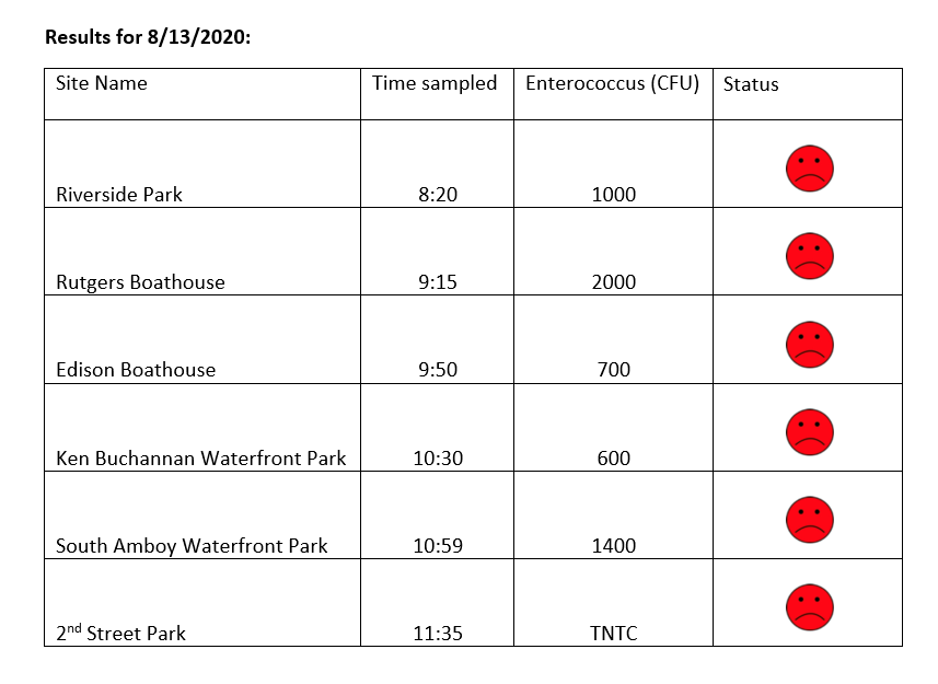
The LRWP and EARTH Center of Middlesex County monitors for Fecal Coliform and Enterococcus at six non-swimming public beach access sites along the Lower Raritan during the warmer summer months. Fecal Coliform and Enterococcus are indicators of disease-causing bacteria in our waterways.
The EPA recommends that a single Enterococcus sample be less than 110 Colony Forming Units (CFU)/100mL for primary contact. Enterococci levels are used as indicators of the possible presence of disease-causing bacteria in recreational waters. Such pathogens may pose health risks to people fishing and swimming in a water body. Sources of bacteria include Combined Sewer Overflows (CSOs), improperly functioning wastewater treatment plants, stormwater runoff, leaking septic systems, animal carcasses, and runoff from manure storage areas. Enterococci levels are often high after heavy or consistent rainfall.
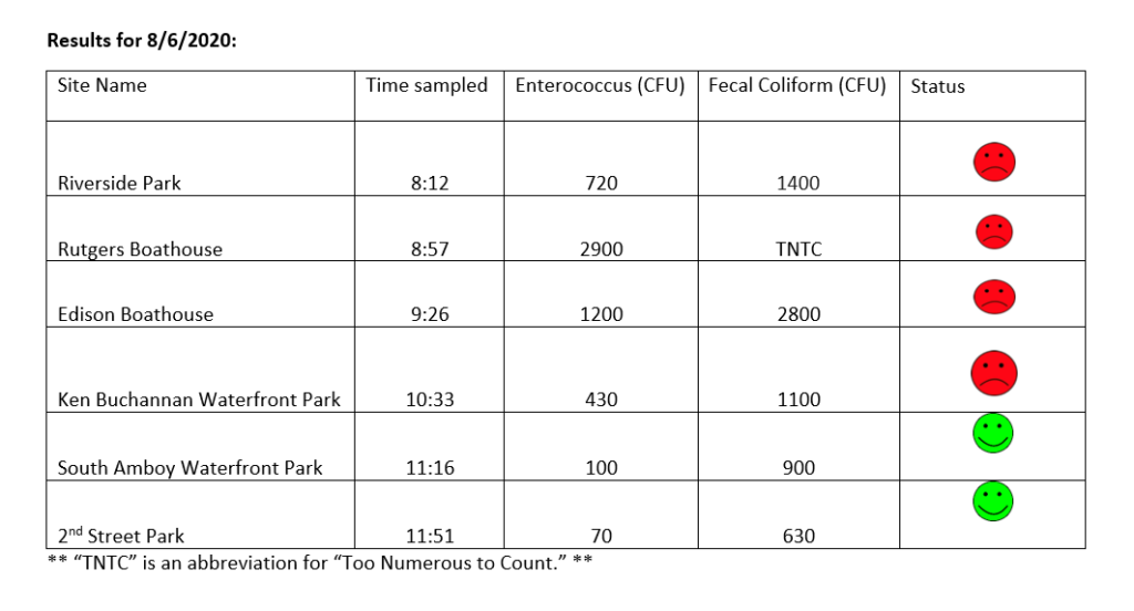
“TNTC” is an abbreviation for “Too Numerous To Count.”
Please note that these results for August 13, 2020 are preliminary and awaiting Quality Control:
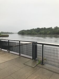
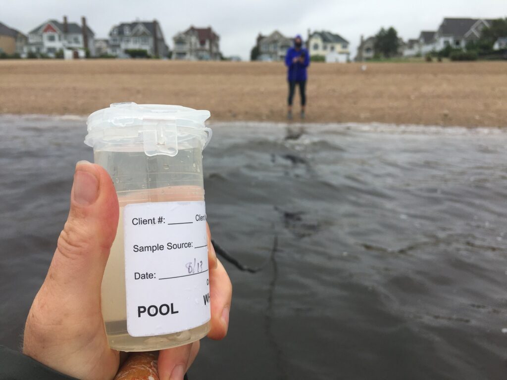
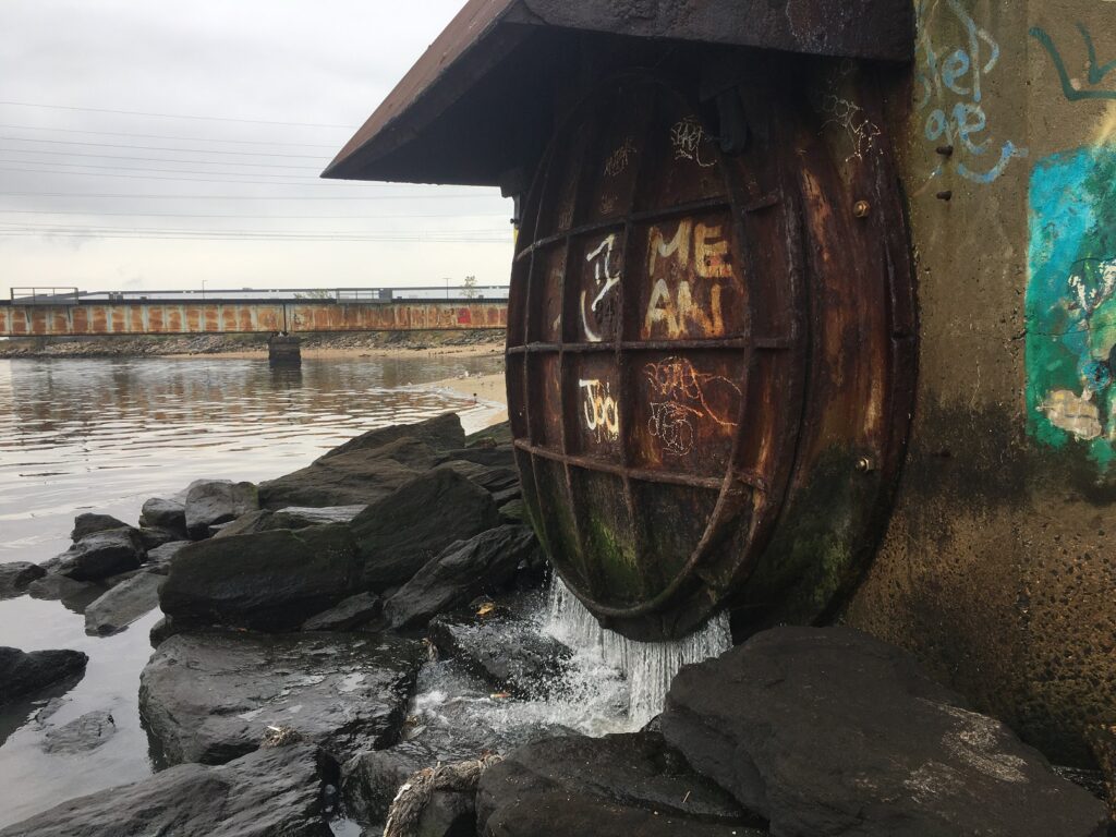
Photos and notes from 8.13.2020 Monitoring
Lots of rainfall this week meant high pathogens counts at our sites. This week we monitored in the rain! Thanks to Michele Bakacs for the photos.
View of Raritan River from Rutgers Class of 1914 Boathouse
Sample catching at South AmboyActive CSO discharge, Perth Amboy
The New Jersey state Department of Environmental Protection and Middlesex County Health Departments typically monitor at sanctioned public swimming beach sites. They do not monitor the water quality for pathogens at public access non-swimming beach sites along the Raritan, despite regular use of these areas for primary contact (fishing and swimming) by members of our urban communities.
The LRWP works with in partnership with the Interstate Environmental Commission for lab analysis of our samples. We have a Quality Assurance Protocol Plan (QAPP) approved by the federal Environmental Protection Agency. We work to report our results as soon as lab analysis is completed.
The LRWP and EARTH Center of Middlesex County monitors for Fecal Coliform and Enterococcus at six non-swimming public beach access sites along the Lower Raritan during the warmer summer months. Fecal Coliform and Enterococcus are indicators of disease-causing bacteria in our waterways.
The EPA recommends that a single Enterococcus sample be less than 110 Colony Forming Units (CFU)/100mL for primary contact. Enterococci levels are used as indicators of the possible presence of disease-causing bacteria in recreational waters. Such pathogens may pose health risks to people fishing and swimming in a water body. Sources of bacteria include Combined Sewer Overflows (CSOs), improperly functioning wastewater treatment plants, stormwater runoff, leaking septic systems, animal carcasses, and runoff from manure storage areas. Enterococci levels are often high after heavy or consistent rainfall.
Please note that these results for August 6, 2020 are preliminary and awaiting Quality Control:
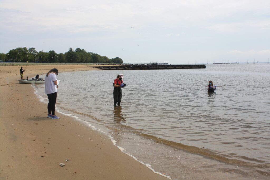
Field observations for 8.6.2020
Waters were running high and fast during monitoring, due in part to remnant stormwater flow from Tropical Storm Isiasis which started its destruction in New Jersey on August 4, knocking out power for 1.4 million state residents. Isiais pummeled the Lower Raritan as well, and the River looked like chocolate milk at our Piscataway, New Brunswick and Edison sites. We observed a fair amount of flotsam in the water, and a few islands of accumulating logs and trash.
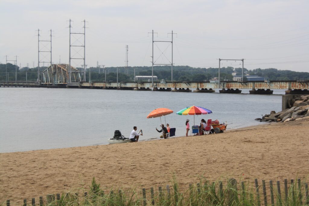
Our monitoring crew, with fisherfolk in the background (photo: Renee Skelton)In Perth Amboy, folks were out on the beach picnicking and fishing, despite active discharge from the Combined Sewer Overflow just 20 feet away. (photo: Renee Skelton)
The New Jersey state Department of Environmental Protection and Middlesex County Health Departments typically monitor at sanctioned public swimming beach sites. They do not monitor the water quality for pathogens at public access non-swimming beach sites along the Raritan, despite regular use of these areas for primary contact (fishing and swimming) by members of our urban communities.
The LRWP works with in partnership with the Interstate Environmental Commission for lab analysis of our samples. We have a Quality Assurance Protocol Plan (QAPP) approved by the federal Environmental Protection Agency. We work to report our results as soon as lab analysis is completed.
The LRWP and EARTH Center of Middlesex County monitors for Fecal Coliform and Enterococcus at six non-swimming public beach access sites along the Lower Raritan during the warmer summer months. Fecal Coliform and Enterococcus are indicators of disease-causing bacteria in our waterways.
The EPA recommends that a single Enterococcus sample be less than 110 Colony Forming Units (CFU)/100mL for primary contact. Enterococci levels are used as indicators of the possible presence of disease-causing bacteria in recreational waters. Such pathogens may pose health risks to people fishing and swimming in a water body. Sources of bacteria include Combined Sewer Overflows (CSOs), improperly functioning wastewater treatment plants, stormwater runoff, leaking septic systems, animal carcasses, and runoff from manure storage areas. Enterococci levels are often high after heavy or consistent rainfall.
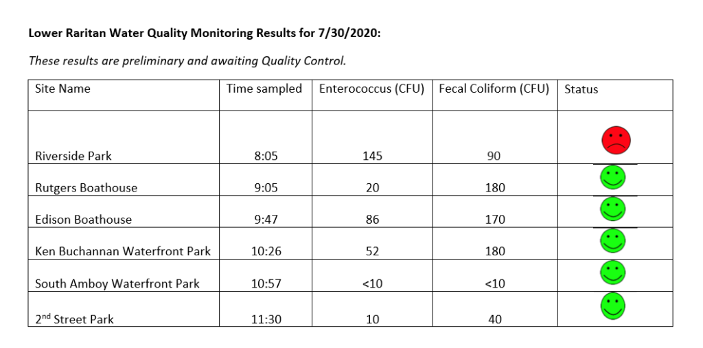
Please note that these results for July 30, 2020 are preliminary and awaiting Quality Control:
The New Jersey state Department of Environmental Protection and Middlesex County Health Departments typically monitor at sanctioned public swimming beach sites. They do not monitor the water quality for pathogens at public access non-swimming beach sites along the Raritan, despite regular use of these areas for primary contact (fishing and swimming) by members of our urban communities.
The LRWP works with in partnership with the Interstate Environmental Commission for lab analysis of our samples. We have a Quality Assurance Protocol Plan (QAPP) approved by the federal Environmental Protection Agency. We work to report our results as soon as lab analysis is completed.
The LRWP monitors for Fecal Coliform and Enterococcus at six non-swimming public beach access sites along the Lower Raritan during the warmer summer months. Fecal Coliform and Enterococcus are indicators of disease-causing bacteria in our waterways.
The EPA recommends that a single Enterococcus sample be less than 110 Colony Forming Units (CFU)/100mL for primary contact. Enterococci levels are used as indicators of the possible presence of disease-causing bacteria in recreational waters. Such pathogens may pose health risks to people fishing and swimming in a water body. Sources of bacteria include Combined Sewer Overflows (CSOs), improperly functioning wastewater treatment plants, stormwater runoff, leaking septic systems, animal carcasses, and runoff from manure storage areas. Enterococci levels are often high after heavy or consistent rainfall.
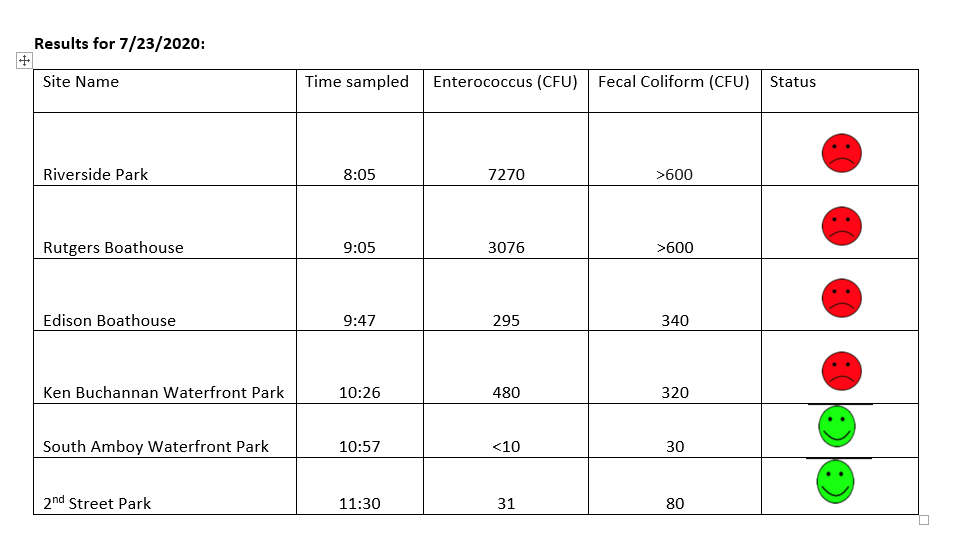
Please note that these results for July 23, 2020 are preliminary and awaiting Quality Control:
The New Jersey state Department of Environmental Protection and Middlesex County Health Departments typically monitor at sanctioned public swimming beach sites. They do not monitor the water quality for pathogens at public access non-swimming beach sites along the Raritan, despite regular use of these areas for primary contact (fishing and swimming) by members of our urban communities.
The LRWP works with in partnership with the Interstate Environmental Commission for lab analysis of our samples. We have a Quality Assurance Protocol Plan (QAPP) approved by the federal Environmental Protection Agency. We work to report our results as soon as lab analysis is completed.
Field observations for July 23, 2020:
Water was mucky and running fast from Wednesday’s storms. There was 1.11 inches in the rain gauge Thursday morning before we left for monitoring. We got soaked through while we were in the field, with rains continuing through the day. There was especially hard rainfall early this morning (Friday July 24) with a total accumulation in the rain gauge today of 2.07.
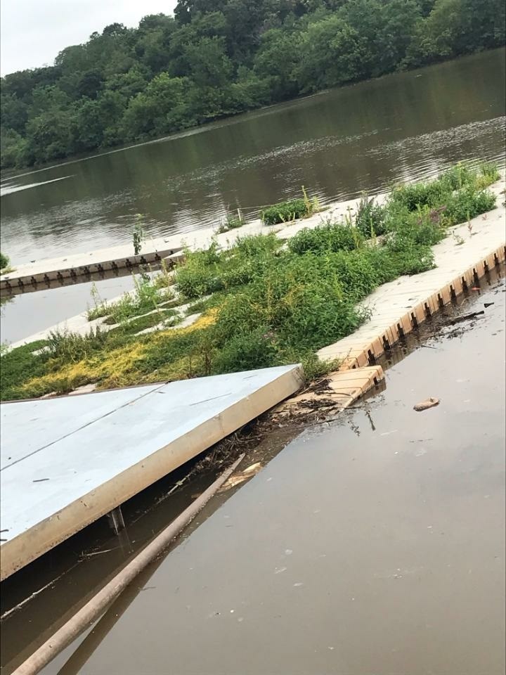
This was our first time out monitoring since October 2019. Some of our sites are neglected, and all bathrooms are closed. The Rutgers Class of 1914 Boathouse launch, home to RU crew, is hard to distinguish from a floating wetland. Geese, gulls and ducks have the run of the Piscataway, Edison and Ken Buchanan sites.
Rutgers Class of 1914 Boathouse launch – 7.23.2020
The South Amboy and Perth Amboy sites were active with fisher folk. There are tons of menhaden in the water at South Amboy! We hear there are sharks going after them so please be careful in the water.
Many thanks to Jessica Bonamusa and our Interstate Environmental Commission friends for helping us out with lab analysis. And special thanks to Julie Blum for helping develop a new app for data entry!
Emily Koai, LRWP Raritan Scholar Intern Spring 2020
New Jersey’s habitat faces significant barriers due to an expanding urban landscape. Ecosystems of interdependent flora and fauna are interrupted by the hustle and bustle of high-volume traffic and concrete, man-made passages of culverts. This juxtaposition gives us pause to reflect on what can be done to help wildlife connect to their habitats across our built environment. We are prompted consider our urban landscape and promote connectivity between our natural spaces and to improve and enhance the relationship between our natural environment and our urban communities.
Originally scheduled for March 16th, the LRWP’s much anticipated habitat connectivity workshop was held virtually on May 4. Many thanks to our partners – Middlesex County Office of Planning, NJDEP, and NY/NJ Harbor Estuary – for persevering and helping us bring these tools and knowledge to participants via a virtual platform! A video of Mr. Zarate’s presentation is now on youtube.
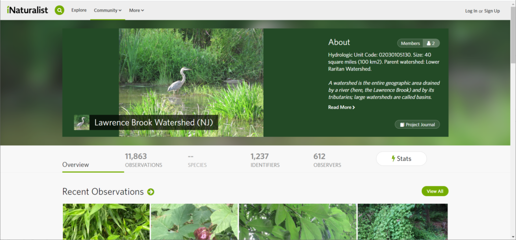
Working with tools shared during the workshop, our friend Herve Barrier created an inaturalist project for the Lawrence Brook subwatershed. Herve explains: “I copied the borders, street by street, using the CHANJ map, after selecting only the ‘watershed’ layer. I am working to make it more and more precise.” Feel free to add your own observations to the growing tally of almost 12,000 observations in the Lawrence Brook sub-watershed! Interested in starting an inaturalist page for another sub-watershed of our Lower Raritan? Let us know!
Webinar Recap
To kick things off, Isabelle Stinnette explained how she and her team from the NY/NJ Harbor Estuary Program set out to explore potential passages for our diadromous and potadromous fish friends through their Aquatic Connectivity Through Climate-Ready Infrastructure Project. What they found were tens of culverts and barriers in the Lower Raritan that obstruct the passability for aquatic wildlife. Blocked up by debris and soil, many of these sites have the potential to be opened up or mitigated into effective passages, a sentiment that excited volunteers. This project uses the North Atlantic Connectivity Collaborative protocols (www.naacc.org) in concert with a hydraulic model to make recommendations for connectivity restoration in New Jersey watersheds.
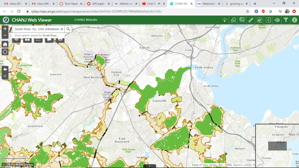
To help illustrate the potential for these obstructed passageways, Brian Zarate, along with Gretchen Fowles, the originator of CHANJ (Connecting Habitat Across New Jersey), helped bring habitat connectivity to our screens. Launched in 2019, CHANJ provides innovative tools that map out natural land cover in relation to our urban environments and further guidance “to help prioritize land protection, inform habitat restoration and management, and guide mitigation of road barrier effects on wildlife and their habitats”. Layer by layer, the mapping tool reveals the islands of greenery our wildlife seek refuge in and, connecting them, corridors or stepping stones, pit stops for our terrestrial friends. With ease of access to information about each core, recommendations, and even NAACC protocols utilized by Isabelle and her team, the tools of CHANJ bring us closer to our goal of habitat connectivity.
Partial view of Middlesex County. Cores (green), large areas of contiguous lands suitable for larger, more mobile terrestrial life. Stepping Stones (light green), smaller areas of contiguous land. Corridors (beige + gradient), ease of passability.
We are now presented with an opportunity to consider fish ladders, debris removal, and underpasses to help aid wildlife carry out their natural life cycles. The branch now extends to our municipal partners, counties, and DoTs to consider this opening to administer changes that will help build bridges across built environments for our wildlife
Indicative of urban sprawl, the visible islands for wildlife now have evolving needs for preservation. Whittled down to beige and green corridors and stepping stones on our screens, CHANJ and the work of the HEP gives us the means to see opportunities for connections between our natural and built environments. Wildlife have had to adapt to their altered environments as development slowly engulfed their living quarters. With green islands surrounded by the liveliness that is our urban environment, our role as stewards now extends to the advocation of habitat connectivity to help enhance our relationship between our natural environments and urban communities.
Whether on the statewide, local, or backyard scale, CHANJ can help us to visualize our place in New Jersey’s habitat connectivity puzzle and to take steps to preserve and restore important linkages for wildlife across the landscape.
Not sure where to begin? Don’t sweat, the CHANJ Mapping Tutorial will walk you through it! This step-by-step video shows you how to use our online interactive CHANJ Web Viewer (mapping tool), so you’ll be up to cruising speed in about 10 minutes.
Want to learn more about habitat connectivity in New Jersey? See PBS’s Eco Sense for Living’s “Wild Crossings” special feature highlighting local habitat connectivity work.
Artículo por Magdalena Mysliwiec, estudiante de posgrado de Rutgers y participante en el estudio
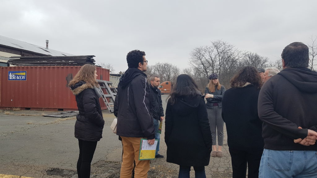
Frente a Pacers Field en South River (NJ) – área propensa a las inundaciones, junto a lugareños lo suficientemente amables como para darnos un recorrido por la ciudad; el equipo del Estudio de Planificación Ambiental de la Universidad Rutgers de Primavera 2020, compuesto por siete estudiantes de posgrado y en asociación con la organización sin fines de lucro Lower Raritan Watershed Partnership, tuvo la oportunidad de tener un primer acercamiento al agua que fluye por esta comunidad. Ver y escuchar las historias y preocupaciones de los guías turísticos locales sobre South River sirvió como introducción del equipo para aprender sobre la relación de la comunidad con sus sistemas de agua y como estos afectan al barrio, desde las personas que lo habitan y su salud hasta los edificios en los que se vive y trabaja. Una relación con la que todas las ciudades de Nueva Jersey están familiarizadas y de la que todas se benefician.
Estudiantes de Rutgers en el tour de South River (NJ), South River Green Team
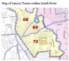
El equipo del estudio dedicó el semestre a estudiar South River, sus habitantes, sus viviendas y el agua, incluyendo el que se origina en otras partes de Nueva Jersey y que luego fluye hacia South River. Los participantes centraron su atención en el Censo 69 (reflejado en el mapa a continuación), la zona con la esperanza de vida más baja en el condado de Middlesex. La investigación del equipo también tuvo como objetivo preparar a la comunidad de South River para participar en un proyecto del Departamento de Protección Ambiental de Nueva Jersey (NJDEP). Este proyecto busca desarrollar una mayor resiliencia (o capacidad de recuperación) de la ciudad ante futuros eventos climáticos extremos como son las inundaciones.
Mapa de censos incluidos en South River
Como resultado de los problemas de esperanza de vida en el Censo 69, el equipo del estudio estableció el objetivo de lograr resultados de salud equitativos para todos los residentes de esta multicultural comunidad. El equipo identificó tres categorías de problemáticas que South River debe abordar: la planificación regional, el diseño y el desarrollo comunitario. Estas tres dimensiones se describen en el documento adjunto de una página y que está disponible en inglés y en español. Es importante destacar que las soluciones a dichas problemáticas requieren de asociaciones entre diferentes actores, incluso entre los propios residentes de South River. Por ejemplo, el gobierno y las agencias locales deben avanzar en los pasos necesarios para lograr involucrar a habitantes de todos los orígenes culturales en las decisiones orientadas a conseguir una ciudad resiliente. Esto significa ser creativo y llegar a la comunidad, por ejemplo, organizando eventos culturales donde los locales puedan compartir cómodamente sus opiniones sobre las decisiones de la ciudad o boletines informativos como este en inglés y español. En el informe final del equipo de estudio, disponible en el listado de recursos que se muestra a continuación, se pueden encontrar más propuestas y recomendaciones.
El equipo del estudio también grabó la “Water Story” de South River utilizando la herramienta Water Story de la organización sin ánimo de lucro Sustainable Jersey. Esta herramienta guía a los municipios, a través de la recopilación de los datos necesarios, a crear una narrativa del agua específica para cada caso particular. El agua es un derecho humano al que toda persona debería de poder acceder. Las personas usamos el agua para diferentes tareas básicas diarias como beber, cocinar y limpiar. Los sistemas de almacenamiento, tratamiento, y distribución del agua son importantes para una vida saludable. Comprender la historia del agua de un municipio es incluso cada vez más importante en contextos de eventos climáticos extremos que amenazan a las empresas de servicios públicos y a otras instalaciones encargadas de producir agua potable y del tratamiento de aguas residuales (o, agua usada y contaminada), tanto para South River como para otras ciudades de Nueva Jersey.
La herramienta “Water Story” desarrolla la comprensión de la infraestructura y los recursos hídricos de South River, además de destacar las problemáticas y acciones locales dirigidas a convertir el agua en un activo para todos los residentes de la ciudad. Los problemas identificados se basan en datos de recursos locales, condales y estatales sobre el suministro de agua, aguas residuales y pluviales, así como datos procedentes de conversaciones con los miembros de South River Green Team y el alcalde de la ciudad. Estas problemáticas se enumeran en la página 84 del informe final.
Los próximos pasos a corto plazo del proyecto de estudio de South River son lograr un mayor alcance y participación de la comunidad para así garantizar que cada persona pueda involucrarse activamente en las decisiones en torno a la consecución de un municipio resiliente. Estas acciones serán lideradas por la Lower Raritan Watershed Partnership, South River Green Team y la Oficina de Planificación del Condado de Middlesex. A continuación se enumeran recursos adicionales para los residentes que buscan participar en la “ciencia ciudadana“, explorar las vías fluviales por su cuenta y tomar la iniciativa para conseguir que el agua de Nueva Jersey sea un activo para todas las personas.
Article by Magdalena Mysliwiec, Rutgers graduate studio participant
Standing at Pacers Field in flood-prone South River, NJ, alongside locals kind enough to give a tour of the town, the Spring 2020 Rutgers University Environmental Planning Studio team, made up of seven graduate students and partnered with the nonprofit Lower Raritan Watershed Partnership, got their first peek of the water which flows through this community. Seeing and hearing the stories and concerns of the hometown tour guides about the South River was the team’s introduction to learning how a community’s relationship with its water systems affects the neighborhood, from the people who live there and their health, to the buildings they live and work in. It is a relationship all towns in New Jersey are familiar with and all towns benefit from.
Rutgers students on a tour of South River, NJ, from the local Green Team
The studio team spent their semester studying South River, the people who live there, its housing, and water, including the water that begins outside South River in other parts of New Jersey and then flows into the town. They focused their attention on South River’s Census Tract 69 area (seen in the map below) where life expectancy is the lowest in Middlesex County. The team’s research also prepares South River for participation in a New Jersey Department of Environmental Protection (NJDEP) project to build up the town’s resilience (or, ability to recover) from future extreme weather events like flooding.
As a result of the life expectancy issues in Census Tract 69, the studio team identified a goal of achieving equal health outcomes for all residents of the multi-cultural South River. Three categories of issues South River must tackle were identified by the team: regional planning, design, and community development and are described in the attached one-page document, found below in both English and in Spanish. Importantly, solutions to the issues require partnerships, including with South River residents themselves. For example, the town government and agencies will need to take the next steps of involving locals of all cultural backgrounds in the town’s resilience decisions. This means being creative with outreach to the community, such as by hosting cultural events where locals can comfortably share their opinions on town decisions, or by sharing newsletters like this one in both English and Spanish. More proposals and recommendations can be found in the studio team’s final report, which is linked to in the list of resources below.
The studio team also recorded South River’s “Water Story” using the Water Story tool from the non-profit Sustainable Jersey. This tool guides municipalities through the collection of data needed to create a borough-specific narrative of water. Water is a human right every person should be able to access. People use water for different daily tasks like drinking, cooking, and cleaning. Where water is stored and treated, and the management of water, are important for a healthy life. Understanding a municipality’s Water Story is also increasingly important in the context of extreme weather events, which threaten utilities and other facilities that produce drinking water and treat wastewater (or, used and contaminated water) for South River and other New Jersey towns.
The Water Story tool builds understanding of South River’s water infrastructure and resources, in addition to highlighting local water issues and actions to turn water into an asset for all residents of the town. The identified issues are based on data from local, county, and state resources on water supply, wastewater, and stormwater as well as from speaking with South River Green Team members and the Mayor. The issues are listed on page 84 of the final report.
Short-term next steps of the South River studio project are more community outreach and engagement to ensure that every townsperson can be involved with the Borough’s resilience decisions. These actions will be led by the Lower Raritan Watershed Partnership, the South River Green Team, and the Middlesex County Office of Planning. More resources are listed below for residents looking to take part in “citizen science” and explore their waterways on their own, and take the initiative to make New Jersey’s water an asset for everyone.